Second Temple Period >> The Period of Rule by the Herodian Dynasty and the Roman Procurators, 37 BCE - 70 CE
|

|
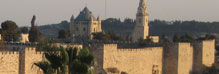
The city flourished and expanded during this period. Herod bestowed upon it a clearly Hellenistic character and built palaces, strongholds, mansions and water systems in it. He reinforced the Temple Mount, renewed the Temple and built the Antonia fortress on top of the Birah from the time of Nehemiah. The building projects continued until the destruction of the city in 70 CE. Many remains of buildings from this period still exist. We know of three city walls from this period:
The First Wall (the Old Wall) – was built based on a wall that dates to the time of the Hasmoneans.
The Second Wall (the New Wall) – was built in order to delimit the expansion of the city northward beyond the Upper City.
The Third Wall – was built in order to defend the northern regions of the city and a number of presumed routes are ascribed to it.
Finds:
- Remains of fortifications of the First Wall were revealed in the excavations of the Citadel's courtyard and along the city's western wall. Remains of the southern sections were already discovered by Bliss and Dickie in 1894-1897.
- Remains of a tower and a gate (the place where the Third Wall branches off from the First Wall) 'Hippicus Tower'.
- Remains of the Second Wall in the vicinity of Damascus Gate; however, most of the route that this wall followed is only presumed.
- Remains of the Third Wall in the north of the city.
Historical Sources:
Descriptions of the city walls appear in Josephus.
Remarks:
Reconstruction of the building projects in the city are done based on archaeological research and Josephus' descriptions.
Josephus' description of Jerusalem's city walls
Jerusalem was defended by three walls except where it was shut in by impassable ravines; so that a single rampart was enough. It was built on two hills….. The Jewish War (Book 5 4:1)
Josephus' writings present a detailed description of Jerusalem's city walls as they were during the first century CE. This description is an important source when it comes to studying the route of the walls and their components, as well as other sites in Jerusalem
The First Wall - 'The Old Wall'
Of the three walls the Old, thanks to the ravines and the hill above them on which it was built, was almost impregnable; and apart from the advantage of the situation it was also strongly constructed, David and Solomon, and later kinds too, having tackled the work with enthusiasm. Starting in the north at the Hippicus tower it stretched to… The Jewish War (Book 5 4:2)
This wall was used during Herod's time but its foundations were laid already in the First Temple period. The wall was rehabilitated at the time of Nehemiah and large parts of it were built and reinforced during the Hasmonean period. The City of David and Mount Zion are included within the precincts of this wall. The route that most of this wall follows is located outside the Ottoman city wall.
The route of the wall: It begins in the region of today's Citadel where one can discern the remains of a city wall. Herod reinforced the wall, the Tower of Phasael, the Tower of Miriamne and built the Tower of Hippicus (David's Citadel) in this region. The section that is south of the citadel, where the wall was built on bedrock in order to defend the western part of the Upper City, was also fortified and the palace was built next to it. Here the city wall functioned as retaining wall to support the building and another wall, 3.5 meters thick, was added to the front of it, which later served as a base for the Ottoman wall (remains of it still exist).
From there the wall descended along the southern ridge line of Mount Zion, on a hewn bedrock cliff toward the Shiloah Pool. The Essene Gate that led to the desert was fixed in the southern part of the wall. From there the wall turned east and north on the eastern side of the City of David along a line parallel to Nahal Kidron and was built above the ravines "and was almost impregnable ..." The wall passed through the Ophel and joined the Temple Mount wall slightly north of the southwestern corner in order to facilitate entry into the Temple Mount from the east.
The point where the First Wall is connected to the Temple Mount wall is called the "seam" due to the two different building styles that meet there. The northern part of the wall began from the Tower of Hippicus and ran east to the Temple Mount, parallel to David Street and the Street of the Chains. A number of gates were situated in the northern wall, among them the Hidden Gate and Gennath Gate.
The Second Wall
The Second Wall started at Gennath, a gate in the first wall. It enclosed the northern quarter only and went up as far as Antonia… The Jewish War (Book 5 4:2)
The Second Wall was built in the Second Temple period, probably during Herod's reign. This wall enclosed the part of the city that extended north of the ancient First Wall and part of it passed in the vicinity of the Ottoman wall (next to Damascus Gate).
The route of the wall: The route the wall follows is only presumed owing to the lack of finds and descriptions. It began in the vicinity of Gennath Gate (the Garden Gate), the place where the Second Wall was connected to the First Wall and the passageway between the southern and the northern part of the city (today these areas are in the Christian and Moslem quarters). From there it turned north, east and north again, along the moat until the vicinity of Damascus Gate, and northeast along the route of the Ottoman wall until the region of Herod's Gate, and from there by way of the slope in Beit Zita Valley to the Antonia fortress.
The Third Wall
The Third started at the Hippicus Tower from which it ran as far north as the Psephinus Tower, then going down opposite Helena's Tower. And from there going down opposite Helena's Monuments and continuing a long way past the Caves of the Kings bent at a corner tower near the Fuller's Tomb, and joining the Old Wall came to an end at the Kidron Valley. This wall was built by Agrippa to protect the newest parts of the City, hitherto defenseless; for as the population overflowed the City gradually crept beyond its limits, and uniting the area north of the Temple to the hill the people pushed out so far the houses covered a fourth hill, Bezetha. Situated opposite Antonia this was cut out from it by a deep trench, dug purposely so that the foundations of Antonia should not be in contact with the hill and be approachable and too low: the relative height of the towers was greatly increased by the depth of the ditch. The new housing estate was known locally as Bezetha, which might be translated New Town… The Jewish War (Book 5 4:3-4)
The Third Wall is the northernmost and longest of Jerusalem's walls in the Second Temple period. Josephus describes the walls and its components in great detail. This wall was built at the end of the Second Temple period; it was begun during the reign of King Agrippa I who halted its construction, was continued by the Kannaim (41-44 CE) and was hastily completed (67-69 CE) on the eve of siege of Jerusalem. The New City, which is called in Aramaic Bazatha (Baza=plot) and in Josephus' writings Bezetha, was situated between the Second and Third Walls. Running the length of the wall were fortifications that were built to reinforce and defend the city from the northern side, which was also its weakest side, and indeed in the month of Nisan in 70 CE, the Roman brigades approached the Third Wall from the direction of Mount Scopus, breached it and entered Jerusalem. When the city was destroyed the wall was also demolished; the foundations were covered and a few of its stones remained visible.
During the 1920's remains of the Third Wall were accidentally discovered, which led to the beginning of the first scientific excavations of it (between 1925-1927), headed by E. L. Sukenik and L.A. Mayer, on behalf of the Jewish Palestine Exploration Society and the Hebrew University.
The route of the wall: Most of the Third Wall passed through the area of what is today the New City, in the Mussrara and Mea Shearim neighborhoods. It ran from Hippicus Tower north to the Psephinus Tower, which is in the west of the city. From there it continues east opposite Helena's monument and the Tomb of the Kings in East Jerusalem, and south, parallel to Nahal Kidron until it connects to the Old Wall of the Temple Mount.
|
|

|
| The city walls at the time of the Herodian Dynasty and the Roman procurators |

|
| Remains of the Third Wall ("Agrippa's Wall"), photographed circa 1900-1920 |
Matson Photograph Collection
|
|