Welcome to Israel Antiquities Authority
Survey WebSite.
The sites documented in the Archaeological Survey of Israel are published on the website where they are displayed in survey squares of 100 sq km (10 × 10 km). The list of maps is presented below in alphabetic order, according to their names and numbers as recorded in Yalquṭ Ha-Pirsumim. The survey maps can be seen on the right side of the screen against the background of an aerial photograph. The sites (marked with yellow dots) can be accessed by zooming in on the screen and a description of them will appear by clicking on the dots. The introduction to each map and search options are also displayed.
-
 Afula
Afula
(
33)
Avner Raban and Noy Shemesh (introduction)
978-965-406-535-1
-
Ahihud
(
20)
Gunnar Lehmann and Martin Peilstöcker
978-965-406-259-6
-
Akhziv
(
1)
Rafael Frankel and Nimrod Gerzov
965-406-024-8
-
akko
(
19)
978-965-406-647-1
-
Amatzia
(
109)
Yehuda Dagan
965-406-195-3
-
'Amqa
(
5)
Rafael Frankel and Nimrod Getzov
978-965-406-263-3
-
Ashdod
(
84)
Ariel Berman, Leticia Barda and Harley Stark
965-406-174-0
-
Ashkelon
(
92)
Alen Mitchell
978-965-406-657-0
-
Ashmura
(
15)
Moshe Hartal and Yigal Ben Ephraim.
978-965-406-468-2
-
'Atlit
(
26)
Avraham Ronen, Ya'acov Olami
978-965-406-361-6
Welcome to the Archaeological Survey of Israel Website of the Israel Antiquities Authority
Following the establishment of the State of Israel, Dr. Shmuel Yeivin, first director of the Antiquities Department, suggested to Prime Minister David Ben-Gurion that “an archaeological survey of Israel be conducted for future generations to know what is concealed within the borders of the new state”. In July 1964, the “Archaeological Survey of Israel” was established as an association. The association’s teams of archaeologists surveyed thousands of sites throughout the State of Israel, many which were new. The results of the surveys are published here in the website, in addition to the many surveys that were carried out as part of the development processes in the State of Israel.
Since 2007 the Archaeological Survey of Israel website has been the publication platform of the surveys performed by the Israel Antiquities Authority. The survey maps that were published as books appear in the site together with the dozens of survey maps added in recent years. The maps include geographic and archaeological introductions, descriptions of ancient and historical sites, illustrations, plans, periodic maps and bibliography. The sites are displayed in survey squares of 100 sq km (10 × 10 km).
The list of maps is presented below in alphabetic order, according to their names and numbers as they appear on the general map on the right side of the screen. The sites (marked with orange dots) can be accessed by zooming in on the screen and their description will appear by clicking on the dots.
Loading Survey Point Data ....
Introduction to the Golan Survey
Moshe Hartal
Preface
Sixteen surveys have been or will be published that cover the Golan and Mount Hermon within the area of the State of Israel. They are: Ḥammat Gader, ‘Ein Gev, Nov, Ma‘ale Gamla, Rujem el-Hiri, Giv‘at Orḥa, Qaṣrin, Qeshet and Har Peres. The following surveys are in preparation: Ashmora, Har Shifon, Shamir, Merom Golan, Dan, Birket Ram and Har Dov.
As is customary, each survey comprises an independent unit, in each of which the sites and findings are described. Each individual survey includes a geological introduction and a description of the history of settlement in the various periods. The information is accompanied by detailed maps of the periods.
However, the nature of the publication is such that it presents a fragmented picture due to the arbitrary division of the maps, a picture that does not correspond to landscape units or settlement distribution. That is the reason for this general introduction, which provides a full picture of the entire region in the various periods. The maps of the periods appended to the introduction, highlight and emphasize the dynamics of settlement over the generations in the entire region.
Because the historical background of each area is presented in the individual surveys, to avoid repetition, I have made do with a brief description of the events there, and refer readers to this introduction, which expands on the historical and archaeological sources for the history of the Golan.
The bibliography contains the main research sources on the Golan, where interested readers can find additional information and details that go beyond the scope of this publication.
Editor: Ofer Sion
Text Editing: Ruti Erez Edelson
Table of Contents
Preface
1. The History of the Research
The Golan was first surveyed between 1884 and 1886 by Gottlieb Schumacher, who created the region’s first detailed map (Schumacher 1888). Schumacher carried out his survey at a time when the archaeology of the Land of Israel was still in its infancy and the use of pottery for dating sites was still unknown. Thus, the information that can be gleaned from this survey is fairly limited. The importance of Schumacher’s survey is that it was the first, and particularly because of the description of the Golan at the end of the 19th century, a period in which the Bedouin tribes had begun to settle down.
At the time of Schumacher’s survey, in 1885, Sir Lawrence Oliphant also surveyed a number of sites in the Beteiḥa (Bethsaida) Valley in the southern Golan. Among these sites are Khisfin, the synagogues at Umm el-Qanaṭir, Khirbet ed-Dikke and el-Ḥuseniyye (Oliphant 1884, 1886).
A large cemetery, dated to the Roman and Byzantine periods, was excavated in 1936 at Khisfin by "a team of excavators headed by Prince Mijem
el-Shalan of the ‘Annezzeh bedouin tribe”; which seemed more like grave robbery. Six years later, additional tombs were uncovered with the assistance of antiquities merchants, the Dahdah brothers.
The Syrian Department of Antiquities worked to save the findings from the tombs. Findings from 54 tombs are documented in the National Museum in Damascus, each apparently a single burial. Unfortunately, because of the nature of the excavations, there is no information about the precise location of the tombs, their structure, the find-spots of the artifacts and of the human remains (Weber 2006:64).
Four figurines from Khisfin on display at the National Museum in Damascus were published by T.R. Weber (2006:64–68). In 1942 and 1962, excavations were carried out at Fiq and el-‘Āl, but none of the findings were published (Dentzer 1997:89).
In 1968, the Golan was surveyed by two teams headed by Claire Epstein and Shmariya Guttman (Epstein and Guttman 1972). Epstein and Guttman continued their surveys in 1969, discovering additional sites; however, these surveys were not published. These surveys were undertaken during the first period of re-acquaintance with the Golan, at a time when some of the characteristics of the region were unknown. They focused on villages and ruins and did not cover the entire area. The publication of the first stage of the survey does not deal with the environmental conditions, while, as noted, the second stage was not published at all.
From 1968 to 1970, dozens of sites were examined in the survey of abandoned Syrian villages under the direction of Dan Urman. Emphasis in Urman’s survey was on architectural findings and locating reliefs and inscriptions. Almost no pottery was collected. The survey was never published, but it served as raw material for Urman’s book (1985).
Meanwhile, Yitzhaki Gal conducted a site and landscape survey, in which he described many sites (Axelrod 1970). From 1983 to 1987 Moshe Hartal conducted an extensive survey of the northern Golan, where numerous sites were discovered and a fuller picture emerged of the development of settlement in the region from prehistoric times to the present (Hartal 1989).
The Mount Hermon sites were surveyed from 1983 to 1989 by Shimon Dar (1978; 1993). Some of the surveyors focused on a certain subject or number of subjects in this area. C. Epstein surveyed and excavated dolmen fields (Epstein 1985) and sites from the Chalcolithic period (Epstein 1998). The synagogues were surveyed by Z.U. Ma‘oz (1981, 1995) and Zvi Ilan (1991: 61–113). Chaim Ben David (1998) surveyed the Golan’s oil presses, excavated ‘Ein Nashôt and Giv‘at HaYe‘ur and also surveyed the Jewish settlements in the lower Golan (Ben David 2005). A survey of the Byzantine villages was conducted by C. Dauphin and S. Gibson (1992–1993). Partial surveys were conducted by A. Golani (1990) and L. Vinitzky (1995). O. Zingboim (2001) surveyed ancient cemeteries in the southern and central Golan. He also conducted development surveys in various places in the Golan. S. Friedman surveyed settlement sites in the southern Golan (still unpublished).
Hundreds of inscriptions were revealed by the various surveys; most were on tombstones. Others included dedicatory inscriptions – on buildings, milestones and boundary stones. Urman published the Hebrew and the Aramaic inscriptions (1984, 1996) and a selection of the Greek inscriptions were published by Gregg and Urman (1996), C. Dauphin (Dauphin, Brock, Gregg and Beeston 1996) and L. Di Segni (1997).
In 1993, then-director of the IAA, Amir Drori, initiated a survey in the central and southern Golan in order to complete the methodical survey of the Golan. The Survey was headed by M. Hartal, district archaeologist of the Golan at the time. The southern Golan was surveyed by a team headed by H. Bron and E. Kelmachter (1997). The team surveying the southeastern Golan was headed by D. Goren and Y. Ben-Ephraim headed the team that surveyed the central Golan (1997). Participants in the field survey were R. Bar-Nur, A. Elrom, Y. Sheffer, I. Abu-Awad and V. Bar-Lev, with C. Epstein, O. Marder and M. Hartal acting as advisers. The field survey took place from 1993 to 1998 and was completed in 2001 by M. Hartal and R. Bar-Nur. Y. Ben-Ephraim coordinated the findings of his surveys with those of the southern teams, but the material did not reach the publication stage.
In 2010, I was given the task of publishing the survey. Since much time had passed since the conclusion of the work, and there were previous surveys that had not been published, I decided to publish most of the information that had been collected about each site in surveys conducted in the Golan over the past decades.
In preparation for publication, more than 20,000 pictures taken during the surveys were scanned, from the first surveys by Epstein and Guttman and to the present. Some sites were re-photographed. The manuscripts of the unpublished surveys were also gathered, including phase 2 of the Epstein-Guttman survey, the village survey directed by Urman and Golani’s survey. I once again went over all the pottery that had been collected in the various surveys and I prepared the pottery tables for each site whose findings justified this. The publication is based on the notes of Y. Ben-Ephraim, which were completed according to other surveys. The prehistoric sites were described by O. Marder.
2. Geography of the Region
2.1 Northern Transjordan
Northern Transjordan is covered with basalt flows, some of which rise as cones of volcanic ash; however, they are not uniform; a number of different areas can be seen, each with its own characteristics.
2.1.1 The Golan Heights – a plateau extending from the foot of Mount Hermon in the north to the Yarmuk River in the south and between the Jordan River in the west to the Ruqqad River in the east. In the northeast, the plateau reaches a height of 1,000 m above sea level, and the ash cones rise to a height of 1,200 m and more. It slopes gradually southward to a height of c. 300 m. On the west it is bounded by the steep slopes descending to the Hula Valley, the Jordan and the Sea of Galilee, which are approximately 200 m below sea level (see below, 2.2)
2.1.2 Naqura – East of the Golan a broad plateau, 500–700 m above sea level, extending as far as Jebel el-Druze. The basalt covering of the plateau has eroded and created large areas of fertile agricultural, soil, low in stones, especially suited for the cultivation of cereals. Wadi a-Zidi is the southern boundary of this area. It passes north of Boṣra and enters the Yarmuk northwest of Dar‘a. The northern border is Wadi a-Dahab, which emerges from the southern edges of the Leja (see below 2.1.4). Jebel el-Druze (see below 2.1.5) and the Leja are the boundaries of Naqura on the east and the north. West of Leja the Naqura Plateau extends northward to al Sanamayn. To the south, it gradually merges with the Jordanian desert. Due to the relatively low precipitation (200–350 mm per year), water is the main problem for settlement in large parts of this region.
2.1.3 Jadur – northwest of el-Sanamayn Jadur is the name of the land that rises gradually to a small lava field at the foot of Mount Hermon. It differs from Naqura in its rocky ground and its altitude – 600–900 m above sea level. Volcanic ash cones, such as Tell el-Mal and Tell el-Ḥara, rise as much as 1,000 m above sea level. This area is largely an extension of the landscape unit of volcanoes and valleys of the northern Golan (see below 2.2.8).
2.1.4 Leja – an area of approximately 1,000 sq km between Shahaba, Buraq and Izra‘a, covered with fissured basalt almost without soil; the basalt creates alternating scatterings of large boulders and irregular basalt mazes. The area looks like a desert, but it served as pastureland and a hideout for highway robbers. In the southern part of the Leja are a number of basins of fertile agricultural soil without rocks. The settlements in this area are divided between those on the perimeter of the Leja, which enjoy protection and the fertile soil (el-Mismyah, Buraq, Dakir, Khalkhala, Shahaba, Najran, Azra‘, Khabab, and others) and those within the Leja, mainly in the south near the fertile basins (Damiat el-‘Alyam, ‘Arieka, Jarin, Lubin, Ṣuar and others).
2.1.4 Jebel el-Druze (Jebel el-‘Arab, Mount Ḥawran) – created from an accumulation of basalt flows rising about 1,000 m above sea level, and a peak of 1,860 m. The level area on the peak extends over an area of 30 x 60 km. The almost flattened peak, at a height of 1,500 m, is located in the northern half, and is surrounded by many ash cones. The steeper slopes of the mountain are located on the eastern and western sides, with fertile, arable soil. Because of its height, the mountain is forested and has abundant water at the top. Its slopes are the eastern extent of permanent settlement in the lava country and they create the boundary between the “desert and the sown.” South of the peak plain the slopes are more moderate and they descend to the plains of Tzalhad and Boṣra and south to Umm el-Jimal. This area is sometimes called “southern Ḥawran” and it is suitable both for grazing and winter crops. The western part of Jebel el-Druze is rainy and utilized for agriculture. The western slopes, at 1,000-1,300 m above sea level, feature a band of oak forests. Grapes and fruit trees can be cultivated from 950 m to the peak, while cereals and legumes are cultivated on the slopes. South and east of the mountain the area is suitable for sustaining nomads only.
2.1.5 eṣ-Ṣafa and Ḥara – East of Jebel el-Druze is a broad region, covered with basalt flows. It is arid, with an annual rainfall of only 200 mm, which declines as one moves east. In most periods nomadic or semi-nomadic tribes made their homes there. Seasonal agriculture is possible in the streambeds and in the portions nearer to Jebel el-Druze (Ard el-Bataniya).
2.2 Landscape Units of the Golan Heights and Mt. Hermon
The survey was conducted in two different geographical regions: the Hermon and the Golan. The character of the Hermon greatly differs from that of the Golan. The Hermon is mountainous, and consists mainly of sedimentary rock, while the Golan is a plateau covered with volcanic rock. Because only a small part of Mount Hermon is within the boundaries of the State of Israel, and because it was surveyed at the same time as part of the Golan Heights survey and revealed evidence of cultures similar to those of the northern Golan, both of these regions were included in the survey. The following aspects will be described below: landscape units, geological and climatological characteristics and their impact on human settlement in the various periods (see map 1).
2.2.1 The Hermon – the southern part of the Anti-Lebanon range. The ridge is c. 50 km long and c. 25 km wide and its highest point is 2,814 m above sea level. The Hermon, which is built mainly of limestone and dolomite, is largely a broken anticline, both on its edges and within it. The limestone and dolomite of the Hermon date from the Jurassic period (170 million years before present). Two parts of the Hermon ridge are included within the State of Israel the Shiryon spur in the east, whose peak is snow-covered, at a height of 2,121 above sea level; and the Sion spur in the west, whose highest point is 1,548 m above sea levels. Naḥal Sion separates these two areas.
The stream pattern in the region (the Naḥal Sion and Naḥal Govta, among others) was determined mainly by the geological faults. Lacking springs with regular flows, the streams are seasonal, their flow dependent on the extent of melting snow. The higher area – above 2,000 m above sea level, is snow-covered for most of the winter. Rainfall is greater here than anywhere else in the country, reaching an annual average of 1,600 mm in part of the highest area of the mountain. Karstic activity is prominent in the landscape, appearing in two main phenomena – dolinas and numerous rills and gullies.
The thin vegetation is apparently the result of human intervention, by deforestation and over-grazing. In the high zone (above 1,800 m above sea level) the dominant vegetation is alpine.
Settlements developed on the Hermon only in the area under the snow line. Small villages and farms were built in this area, whose inhabitants cultivated small plots in the valleys or on top of the spurs. Due to the forested nature of the area, the soil potential and the severe climate, the Hermon was inhabited only during periods of intense settlement.
Settlements in the area were first established at the beginning of the Roman period and were abandoned at the beginning of the Byzantine period. After hundreds of years of abandonment, a number of ruins were re-inhabited at the end of the 19th century or the 20th century, mainly by seasonal settlements of the neighboring villages.
2.2.2
Baniyas Plateau – A plateau 300–450 m above sea level, constituting an intermediate step between the Golan and the northern Hula Valley. The plateau is cut by the Naḥal Sa‘ar. This area is covered with basalt, on which shallow, lithosol basalt soil was created.
The surface declines toward the Hula Valley in two natural terraces, whose western slopes are particularly steep. This phenomenon is particularly prominent at Mitṣpe Golani and Giv‘at ‘Azaz. The main water channel in this area is the Naḥal Pera‘, to which a number of large springs drain, the largest of which are ‘Ein Abu Suda and ‘Ein ‘Azaz. A forest-park of Mt. Tabor oak, which in the past covered the whole area, was largely decimated and replaced with Ziziphus lotus and herbaceous species. Due to the relative low elevation of the Baniyas Plateau, the climate is moderate.
2.2.3
‘Ein Quniyye Hills – A hilly region 400–880 m above sea level covering c. 6 sq. km. Spurs consisting of sedimentary rock are typical of the area. These spurs constitute intermediate terraces between the Baniyas Plateau on the west and Har Qeṭa‘ in the east.
The northern part of the region consists of hard limestone of the Hermon Formation. These rocks create the Nimrod Fortress Spur. This spur, which bounded on the north by the Naḥal Govta and on the south by the Naḥal Naqib, descends gradually to ‘Ein Pamias. The spur is very rocky and is uncultivated in the main. Over time, brown-red terra rosa soil developed on it. Olive groves are now planted on the southern, moderate slope of the spur, while thick natural woodlands grow on the northern, steep part. Dwarf-shrub steppe grows in areas were the natural woodlands have been decimated. The Nimrod Fortress was built atop the spur and a fortified encampment was established to its east.
The area south and east of the Nimrod Fortress spur is built of soft marl rocks and limestone. The soil created on top of them is light rendzina – undeveloped and relative poor. The areas covered with this soil were once utilized to raise winter cereals.
In other parts of the area light-brown rendzina soil was created. This soil is developed and rich in organic material. It is cultivated, particularly on the slopes below the village of ‘Ein Quniyye, where orchards of deciduous species, olives, figs, pomegranates and prickly pear have been planted. Small plots are used to grow vegetables and in the past, they were also used to raise tobacco. A good many of these areas are irrigated with spring water, which emerges at relatively high altitudes and therefore is easy to use for irrigation.
The layers of marl created many large and small springs, which emerge at the eastern edges of the region. There are 18 springs in the village of ‘Ein Quniyye, some in the ‘Ein Quniyye Hills. The largest of these are ‘Ein a-Shalala (1.1 million cu m of water per year) and ‘Ein Ḥammam (23,000 cu m of water per year).
The entire area is drained by two streams – Wadi Naqib and Masil ‘Eisha. Wadi Naqib creates a deep, steep channel south of the Nimrod Fortress. The wadi passes through very porous karstic limestone, and therefore, other than a number of instances of flooding, hardly any water flows through it on the surface.
Masil ‘Eisha with descends from ‘Ein Quniyye in the southern part of the area and passes through marl rocks and therefore the valley created here is broader. The stream flows throughout most of the winter and spring, and when the water of ‘Ein Ḥammam, which feeds the stream, is not diverted for agriculture, it flows in summer as well. This was apparently the situation during the Roman period, when the stream provided water for an aqueduct that led it to the nearby city of Paneas.
There were once a number of small settlements in the area. Today the Druze village of ‘Ein Quniyye is located there.
2.2.4 Har Qeṭa‘ – Built of a band consisting of a series of broad, flat terraces, created between layers of sedimentary rock. The area is located between ‘Ein Quniyye on the west and Ya‘afuri Valley on the east. In this band, which is 2 km wide and has an area of c. 10 sq km, dolomite rocks were found, along with sandstone, marl and shale from the Cenomanian Phase and the Lower Cretaceous and Jurassic periods. Among the sedimentary rocks remnants of ancient volcanic eruptions can be seen, from the Lower Cretaceous period.
The varied geological structure can also be observed on the surface. The alternating hard and soft rock and the incline of the strata create an elongated ridge on a northeast–southwest axis. Its peak, at 1,173 m, is located southwest of the town of Majdal Shams. The ridge descends in a series of terraces via Har Qeṭa‘ (1,115 m above sea level). On the peak of Har Qeṭa‘ is the community of Nimrod and the site of Khirbet el-Ḥawarit (1,020 m above sea level).
This ridge is surrounded on all sides by steep slopes: to the south above the Naḥal Sa‘ar, to the west above ‘Ein Quniyye, on the northwest above the Naḥal Ḥazur and to the northeast above the Ya‘afuri Valley. Small streams emerge on these slopes due to the layers of marl. Atop the sandstone is ḥamra soil that has eroded down. This soil is quite poor and therefore until recently most of the ridge was not cultivated and was covered with dwarf-shrub steppe and annual vegetation. There is also much less pasturage on the ridge than in the basalt areas to the south. In recent years, plots have been created for cultivation by the Druze by adding soil brought from other areas, which has made possible the cultivation of cherry and apple trees in large areas.
This area, which, as noted, was soil-poor, was almost unsettled throughout history. The main settlement here was Khirbet el-Ḥawarit, which is located near springs and a valley that could be easily cultivated. The inhabitants of this area utilized the marl and sandstone, creating manufacturing center for pottery. The workshop from the Roman period found here is a link in the chain of pottery production that began in the Early Bronze Age and continues at Rashia el-Fuḥar to this day.
2.2.5 Ya‘afuri Valley – triangular in shape, with its base at Birket Ram and its apex at at ‘Ein Sa‘ar. It is c. 2 sq km in area. The upper portion of the perennial Naḥal Sa‘ar passes through the center of the valley. The average annual flow volume of ‘Ein Sa‘ar is 6.47 cu m. ‘Ein Mushreifa (annual flow volume 1.6 million cu m) emerges on the eastern edges of the valley. Smaller springs – Neba‘ Sa‘ar – also emerge on the western edges of the valley.
The valley is covered with a thick layer of brown Mediterranean accumulative soil – young soil that eroded and collected in the valley and is suitable for field crops and orchards. Today the valley and its slopes are planted with deciduous species. There are currently no settlements in the valley but in the past there were three. The largest of these – Khirbet Sa‘ar – was located in the middle of the valley. The two smaller sites are on the eastern edge of the valley – Khirbet el-Baqi and an unnamed ruin found recently on the border with Syria. The tomb of Nebi Ya‘afuri, who is a sacred figure to the Druze, is located in the valley, hence, its name.
2.2.6 Har Ram – A mountainous area of c. 6 sq km, which rises east of the Ya‘afuri Valley, where sedimentary rocks are exposed from the Cenomanian to the Eocene. A good deal of the area consists of dolomite rock; but on the southeastern and northeastern edges limestone, chalk, marl and flint were also exposed. The upper part of Har Ram is built of cover basalt, much older than the basalt of the northern Golan.
Three mountains rise in this area: Sḥyta (1,127 m above sea level), Ram (1,202 m above sea level) and Tell el-Manpukha – the highest of them all (1,210 m above sea level), and the highest peak in the region in general. Between the mountains are small, arable valleys. The region is drained mainly to the west, by seasonal streambeds that pass through the valleys and drain into Wadi el-Shar‘ani and the Naḥal Sa‘ar.
Terra rosa and rendzina soils were created on the sedimentary rock, while on the basalt slope, lithosols were created – young, poor soils, which are typically very stony and suitable only for grazing.
Brown Mediterranean soils accumulated in the valleys, which are suitable for field crops, and in places where the soil is deep, for orchards as well. This area has been prepared for cultivation by the Druze and numerous deciduous orchards have been planted there. The only community in the area was the Druze village of Sḥyta, which was built on an ancient site. This village was abandoned after the Six-Day War and its inhabitants moved to nearby Mas‘adeh.
2.2.7 Odem Flow – A very dominant landscape component in the northern Golan. This extensive area is covered with basalt flows from the foot of Mount Odem and flowed west to the Hula Valley, north to the Naḥal Sa‘ar, east to the Buq‘ata Valley and south to the Quneṭra Valley.
The area is completely covered with flows of ‘Ein Zivan-type basalt. These flows create rocky, stepped plains covered with poor soil and large quantities of rocks. A number of ash cones protrude from it, the largest of which is Mount Odem. In the western part of the flow are a number of large craters (“jubas”), which were created by volcanic eruptions.
There are hardly any water sources in the area of the flow. Except for two small springs, most of the springs emerge along its edges. The combination of poor soil and lack of water turned the Odem Flow into the one with the low settlement potential of the entire Golan (see below, Chapter 3). Indeed, throughout most periods there were no settlements here at all. Only in the Late Roman and the Byzantine period were the first settlements built here, as part of the extensive work of preparing land for cultivation and the digging of wells and cisterns. During this period the Odem Flow saw only two settlements: Sukeik and Ra‘abne. Other settlements, including Bab el-Hawa, were built on the edges of the flow, taking advantage of the springs in that area and the nearby soil.
Most of the area of the Odem Flow is above 700 m above sea level and consequently the climate is cold, the winds are strong, and snow falls almost every year.
2.2.8 The Volcanos and the Valleys – These extinct volcanoes, with fertile valleys in between them, are located on the basalt plateau. The ash cones of the volcanos consist of scoria and tuff. They are arranged in two parallel lines on a northwest–southeast axis. On the slopes of the ash cones the soil is of the tuff regosol type – shallow and suitable only for grazing; and Mediterranean tuff soil – intermediate soil; usually deep and suitable for all crops, including orchard species. The slopes are covered with herbaceous species and shrubs and in a number of places, patches of woodland species. Vineyards and fruit orchards are planted on the lower part of the slopes.
The ‘Ein Zivan lava flows emerged from the ash cones (see above, 2.2.7). The flows are densely covered with woodland species – oak and terebinth, which survive to this day; because the area was mainly used for grazing and was little farmed. In the areas between the ash cones, which were not covered with young ‘Ein Zivan basalt, valleys were created where Muweisse basalt was exposed, on which brown, basaltic Mediterranean soil was created with few rocks. Soil of this type is good for agriculture and suitable for most crops. In contrast, on the slopes of the hills surrounding the valley the soil eroded away and the remaining poor soil is found in fissures and pockets between the rocks and is not arable.
As noted above, the valleys are arable and the settlements were usually concentrated on their edges. The most important of these valleys are: Wadi Abu Sa‘id; the Buq‘ata Valley; Marj el-Qatarna and the Quneṭra Valley. The latter is the largest of these valleys. It is 6 km long and 1–2 km wide, with an area of c. 10 sq km. Most of the Quneṭra Valley is covered with tuff, on which tuff regosol developed and red Mediterranean tuff soil – fertile and arable soils. Due to drainage problems a swamp developed in the northwestern part of the valley, which was flooded in winter.
In the southeastern part of the volcanos and the valleys is the Bashanit Ridge. This ridge consists of ‘Ein Zivan basalt on which is a line of ash cones, the central of which is Mount Ḥazak. The ‘Ein Zivan flows emerged from the ridge and covered the areas west and north of it. The soil created on the slopes eroded away leaving behind basaltic lithosol. On the moderate slopes of Bashanit Ridge brown Mediterranean soil accumulated, very stony and difficult to cultivate. For this reason most of the ridge is not cultivated and there are large areas covered with Mediterranean woodland species – Kermes oak and Bossier oak.
At the southern end of the landscape unit are the volcanos of Har Peres and Giv‘at Orḥa. The northern end of the unit consists of relatively young volcanic rock – Kramim basalt and Birket Ram tuff. Sedimentary rock is also exposed there, mainly limestone and chalk. Wadi Abu Sa‘id drains this area, running through its eastern part in a broad valley surrounded by rounded hills with moderate slopes. On the western side, the stream deepens and creates a valley with steep slopes, which flows into the Naḥal Sa‘ar north of Mas‘adeh.
The volcano landscape unit is located in the higher part of the Golan, in the area 700–1200 m above sea level. Most of which is more than 800 m above sea level. Due to the height, temperatures are relatively low, winds are strong and there is a large amount of precipitation (700–900 mm per year), with snowfalls almost every year.
However, despite the great precipitation, water sources in the area are few. Birket Ram is the largest such source, containing 1–5 million cu m of water. However, its geographical location at the bottom of an enclosed crater made it difficult to utilize in the past.
The springs in this unit are few, and most run dry in the summer. Only in the southern part of the unit are springs more plentiful and their flow volume greater. The water table in the northern part of the unit is high and can be relatively easily accessed by digging wells.
2.2.9 The Northern Plateau – descends from a height of 800 m above sea level in the east, at the foot of Mount Avital, to 500 m above sea level in the west. In the west it is bounded by a system of faults that create the slope of the Hula Valley and the landscape unit of the Hula Valley streams. In the north, the plateau is bounded by the Odem Flow (see above, 2.2.7) and in the south it is incorporated into the central plateau, with no clear boundary dividing them.
The northern plateau is covered by Muweisse basalt flows on which good arable soil developed, as well as by Dalawa basalt flows, on which rocky, poor soil developed. Above the basalt plains a number of ash cones rose, the most important of which is Tel Shiban.
On the edges of the Odem Flow, near Wasit and Summqa, springs flow that provided water to the area year-round. Another group of springs is found near ‘Aliyqah and additional springs emerge in the streambeds.
This area has the smallest amount of trees anywhere in the northern Golan. It seems that the area was once covered with a forest-park of Mount Tabor oaks that was decimated long ago.
The climate varies according to height above sea level. The upper part of the plateau is in the snow zone, while most of the area has a more moderate climate.
2.2.10 The Hula Stream Basins – are located at the foot of a steep slope descending from the northern plateau, from 500 m above sea level to the Hula Valley, 70 m above sea level. The streams, which descend from east to west are relatively short (3–7 km) and parallel to each other. In the eastern, higher parts, they flow through shallow valleys; but when they reach the steep slope in the Hula Valley they create deep valleys and sometimes even canyons. These valleys impede north–south movement.
2.2.11 Naḥal Meshoshim and Naḥal Yahûdiyye Basins – located on a flat plateau descending moderately from 500 m above sea level, northeast of Qaṣrin; to the southwest, to a height of c. 130 m below sea level, in the Beteiḥa (Bethsaida) Valley on the shore of the Sea of Galilee.
The area is drained by Naḥal Meshoshim and its tributaries, the largest of which is Naḥal Zavitan. The streams dig deeply and create deep valleys, and in certain portions even canyons. Because of the area’s topographical structure, Naḥal Meshoshim is relatively long – c. 15 km, and flows parallel to the Jordan River, unlike most of the other streams in the Golan.
Naḥal Yahûdiyye flows parallel to Naḥal Zawitan, the former beginning at the foot of the Bashanit Ridge. Upper Naḥal Yahûdiyye and its tributaries flow through shallow valleys; but the lower part of the stream creates a high canyon. The stream channel is narrow and surrounded by cliffs and steep slopes. The streams in the area flow year-round. Precipitation ranges from 600 mm per year in the Qaṣrin area to c. 450 mm in the Beteiḥa (Bethsaida) Valley.
This unit is bounded on the south by a long geological fault – the Sheikh ‘Ali Fault – which caused a drop in the surface to the north. The area is covered mainly with rocky Dalawa basalt, with large quantities of stones and shallow soil. The stones atop the Dalawa basalt were used as building material in the villages, many of which were built on the edges of the region, as well as for dolmens. Stones had to be removed so the land could be worked. These stones were gathered into heaps and also served for the construction of walls around agricultural plots. The land that developed on the Dalawa basalt is suitable for raising olives, and most of the olive orchards in the region were planted here. The areas that were not cultivates in this unit are covered with forest-park, in which the space between the trees – Mt. Tabor oak and terebinth – is relatively great. In the upper part of the region are remnants of a forest and of extensive pasturelands.
2.2.12 The Central Plateau – This area declines from 750 m above sea level in the east to c. 400 m above sea level in the west. It ends in the west at the top of a steep cliff. The streams here flow year-round in shallow channels. In the western part of the plateau they descend in waterfalls into steep canyons, which impede movement from north to south.
The area is mainly covered with rocky Dalawa basalt but there are also a few narrow flows of Muweisse basalt, on which arable soil developed. The ancient cover basalt was exposed in the western part of the central plateau.
Precipitation ranges from 700 mm a year in the east to 500 mm in the west. There are remnants of a forest in the area as well as pasturelands.
2.2.13 The Beteiḥa Streams – West of the central plateau a steep slope descends from 500 m above sea level to the Beteiḥa (Bethsaida) valley, at 130 m below sea level, north of the Sea of Galilee. The slope consists mostly of cover basalt.
In addition to Naḥal Meshoshim and Naḥal Yahûdiyye, the Daliyyot and Sfamnun streams also flow through the Beteiḥa Valley. Naḥal Batra, which flows into Naḥal Daliyyot, this unit’s main stream, flows along the Sheikh ‘Ali Fault and divides the Beteiḥa streams from the Meshoshim and Yahûdiyye drainage basin.
Naḥal Daliyyot dug itself beneath the basalt layers and exposed limestone of the Gesher Formation; continental sedimentary rock of the Herod Formation and chalk of the Maresha Formation. As opposed to the basalt, the sedimentary rocks eroded rapidly, creating a valley about 2 km wide. The stream dug deeply, in a series of waterfalls. In the eastern part its slopes are steep and almost unsuitable for habitation except for the Gamla spur and Ḥorbat Daliya. In the western part of the stream moderate terraces were created on which settlements were built.
Naḥal Sfamnun flows parallel to and south of Naḥal Daliyyot. All the streams drain into the Beteiḥa (Bethsaida) Valley. The areas between the streams and the moderate terraces are covered with forest-park consisting of Mount Tabor oak and terebinth.
2.2.14 the Beteiḥa (Bethsaida) Valley – six streams drain into this valley: the Jordan, Meshoshim, Yahûdiyye, Batra, Daliyyot and Sfamnun. The large quantity of alluvium brought by the streams has gradually filled the northeastern Sea of Galilee and created a valley approximately 12 sq km in area.
The valley is 130–200 m below sea level and its climate is hot. In addition to herbaceous and riparian vegetation, mainly Christ’s thorn jujube grows there. The steams cross the valley and near the Sea of Galilee beach are a number of lagoons and swamps.
2.2.15 Naḥal Samak and Naḥal Qanaf – Two streams that descend from the east, from 360 m above sea level, flowing into the Sea of Galilee at 200 m below sea level. Naḥal Samak creates a valley 4 km wide and 9 km long into which Naḥal Samak flows from the north and Naḥal el-‘Āl from the south. This fertile valley was settled in all periods.
The two streams dug deeply into the basalt layers and exposed thick layers of Maresha chalk and continental sedimentary rock of the Herod Formation. The rock is soft and erodes easily; consequently creating broad, deep valleys surrounded by slopes whose northern parts are cliff-like and covered with basalt and whose southern parts, covered with sedimentary rock, are more moderate. There is good, arable land at the bottom of these valleys. Small streams emerge on the seam between the basalt and the sedimentary rock, which provided water to settlements.
The climate is moderate in the upper part of the landscape unit and hot in the lower part. Roads ascending to the plateau pass through this unit.
2.2.16 The Sea of Galilee Cliffs – This series of cliffs and steep slopes, 300–400 m high, were created as a result of the Jordan Valley fault. Under the cover basalt, layers of a variety of sedimentary rock are exposed, of the Herod, Fiq and Sussita formations. These created steep slopes and the settlements in this unit are usually concentrated on the lower part of the slopes.
The streams along the slopes are short and have small drainage basins. An exception to this is Naḥal Sussita, which begins under the community of Afiq. The eastern part of the stream cuts into the continental sedimentary rock of the Herod Formation and creates a fertile valley. In the center is crosses a fault like between Maresha chalk and limestone of the Sussita Formation, where a short portion of the stream is a narrow, steep channel. Farther on, parallel to Sussita’s northern slope, the stream widens and has areas suitable for settlement and agriculture.
In the northern part of the unit, north of Kursi, and in the southern part, in the southwestern corner of the Golan, the slopes descend in a series of terraces that made settlement possible and a road to be built up to the Golan.
2.2.17 – The Southern Plateau – a flat area that descends from 450 m above sea level in the north to 330 m above sea level in the south. The plateau is bounded on the east by the deep valleys of Naḥal Ruqqad and Naḥal Meyṣar; and in the west, by Naḥal Samak and Naḥal ‘Ein Gev and by the slopes descending to the Sea of Galilee. On the south the plateau ends with the steep slope descending toward the Yarmuk River.
2.2.18 Naḥal Ruqqad – This stream begins at the foot of Mount Hermon in the north, where it flows through a shallow, almost imperceptible channel, while its southern portion flows through a valley 200 m deep and 2–3 km wide. Continental sedimentary rock of the Herod Formation is exposed on the slopes; Susita limestone and chalk from the ‘Adulam Group. The stream bed bears remnants of the Ruqqad basalt flow, created from lava that flowed through the steam bed.
The slopes of the valley are quite steep but it has moderately sloped terraces and areas suitable for agriculture.
2.2.19 – Naḥal Meyṣar ¬– this stream descends from the southern plateau to the Yarmuk in a southeasterly direction. The stream digs its way under layers of cover basalt and exposes rocks of the Herod Formation and chalk of the Maresha Formation and the ‘Adulam Group. The rock is soft and erodes easily, consequently creating a valley 6 km long and 4 km wide, with moderate areas that lend themselves agriculture. Small springs emerge from the seam between the basalt and the sedimentary rock. The climate is moderate in the upper part and hotter in the lower part. The combination of agricultural soil, water and a comfortable climate is suitable for settlement and the valley was settlement throughout almost all periods.
The chalk rock is suitable for quarrying and therefore this landscape unit contains many winepresses, caves and rock-cut tombs.
2.2.20 The Yarmuk River – A long stream that cuts into the border between Syria and Jordan. Only the lower part of the stream is within the boundaries of the State of israel, after the Ruqqad flows into it. In this portion of the stream it creates a deep, wide valley, which, like the Ruqqad, cuts into the cover basalt and the rocks of the Herod, Sussita and Maresha formations and chalk of the ‘Adulam Group. In the streambed are remnants of two basalt flows. The more ancient one is Yarmuk basalt; above it is Ruqqad basalt. As it flows, the Yarmuk creates a small valley in which the hot springs of Ḥammat Gader and el-Mukheiba emerge. Opposite Ḥammat Gader the stream flows through a deep canyon until it emerges in the Jordan Valley.
3. Settlement Potential in the Golan
“According to the nature of the soil, the Jaulan may be divided into two districts: (1) stony in the northern and middle part, (2) smooth in the south and more cultivated part” (Schumacher 1888:11). In this single sentence, Gottleib Schumacher expressed the great difference in settlement potential between the two parts of the Golan.
3.1 The Northern and Central Golan
This settlement potential of this area is relatively low, mainly limited by a lack of soil and water. The lack of good soil for agriculture is common to most of the landscape units in this area; most of it is suitable for grazing only. Areas with soil are limited and a major investment is required to rid the land of rocks and upgrade it.
The lack of water is also a limiting factor. The area in general gets a great deal of precipitation, and in the northeastern part precipitation is very great, and is therefore suitable for rain-fed agriculture. However, in fact, the amount of water available to farmers is much smaller. The great fluctuation in precipitation from one year to the next and its fluctuations over the season often cause major damage to farmers. A few drought years in a row can lead to the abandonment of the region.
Despite the major precipitation, the area lacks major water sources. This is because the basalt flows create shallow water tables where the emerging springs are small and usually run dry in the summer. The basalt rocks are also hard and difficult to quarry and are therefore unsuitable for digging cisterns. That is the reason that cisterns and wells are rare in this area. Most of them are located in the villages of the Circassians, who came to the Golan in the 1870s from an entirely different type of region.
A good deal of the area once bore thick forests, which had to be cut down and to take advantage of the soil. This was only worthwhile in areas where the forest covered good, arable soil. The marginal areas remained forested or were deforested in times when a population boom required additional agricultural areas.
The major advantage of this area, however, is its excellent pasturelands. The northern and central Golan are considered the richest grazing area in all of southern Syria. As noted above, most of the area is not suitable for agriculture and therefore extensive portions remained uncultivated. Moreover, the area’s large quantities of precipitation assured good pasturage year-round.
The height differences between the western and eastern parts of this region were also advantageous to herders. Vegetation grew at different rates, which allowed for a longer grazing season. When pasture ran out in the lower part of the region – in late spring or early summer, the shepherds could lead the flocks up to the higher parts, where extensive pasturage remained. The small springs, while not abundant enough for farmers, were useful to shepherds for watering their cattle, sheep and goats.
It is therefore not surprising that the region attracted nomadic tribes from the Bashan and the Hauran. Nomads in such numbers constituted a continual threat to farmers and during periods when the central government was weak, this state of affairs could lead to the abandonment of permanent settlement in the area.
3.2 The Southern Golan
The plateau in this area is narrow and bears ancient eroded cover basalt that created deep soil with few rocks. This area is suitable for field crops and was cultivated extensively for long periods. Most of the settlements were built along the edges of the plateau, freeing much of the area for cultivation. The plateau is bounded on the east and the west by broad, arable stream valleys and small springs that made irrigated farming possible.
The climate in the southern Golan is more moderate than in the north. Since this area is lower than the northern Golan, it suffers less from frost. The amount of precipitation is smaller than in the north but it is sufficient to ensure the growth of winter wheat each year. The combination of good soil and a moderate climate led to continuous settlement throughout almost all periods. The stream valleys became preferred areas of settlement. They were very densely settled for much of their history and in a number of periods, settlement concentrated only there. The settlements in the southern plateau, which were fewer but larger, were farming settlements whose inhabitants lived permanently on their land.
Pastureland on the southern plateau is meager compared to the center and north and so throughout all periods it was less attractive to nomadic tribes, although they were present to some extent.
4. History of Settlement according to Archaeological Findings
A detailed description of the types of settlements in the different periods, in the context of geographical location, is presented in the introduction to each individual survey. This chapter will present the general picture of settlement in the Golan and the Hermon. Discussion is based on the analysis of the surveys of the central and southern Golan that have been published on this website. The description of settlement in the northern Golan is based on publication of the Northern Golan Survey (Hartal 1989).
For the reader’s convenience I have minimized notes directing to earlier studies. All the documents and publications, including references to additional sources, are included in the Bibliography.
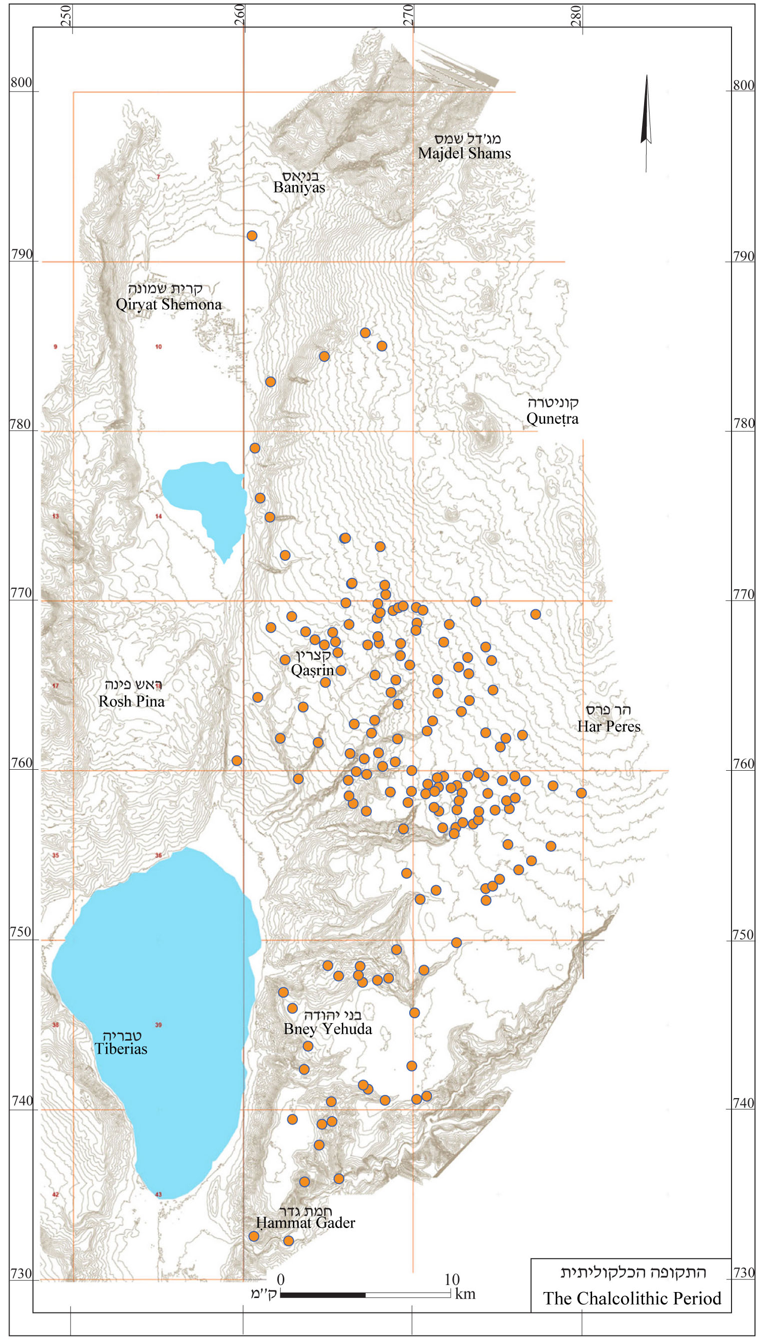
4.1 The Chalcolithic Period
4.1.1 Central Golan – This region saw a major wave of settlement in this period (see map 2). One hundred and eighty sites were surveyed, 135 of them in the central Golan, where a Chalcolithic culture was revealed that had been previously unknown to research. There were small, unwalled settlements in this area, most of which were built in streambeds, which in this area were shallow. Such a streambed is known locally as a masil. The Chalcolithic culture of the Golan has been extensively studied by C. Epstein, who surveyed dozens of site and excavated many of them (Epstein 1998).
The dwellings in these settlements are uniform. They are of the broadroom type and include two rooms, one larger than the other; the latter, usually in the west, apparently served for storage. Most are built as chains of houses, parallel to each other. In a number of cases walls were found that connected the chains of houses and created a sort of courtyard.
In many houses small basalt pillars were found, the top of which was convex, and bore a relief of a nose, eyes and sometimes a male goat’s horns and beard. These reliefs have been interpreted as house gods.
The uniformity of the houses attests to an egalitarian society with no wealthier class. It seems that the inhabitants were farmers who worked small plots of land in the masils (see above), which have water even in the summer months. Epstein believed that this was the period in which the olive was domesticated. The inhabitants also raised sheep and goats and possibly cattle as well. The settlements were mainly established on virgin ground. Their inhabitants came from outside the area and just as they arrived, they disappeared. Most of the settlements from this period were abandoned and never rebuilt. Their remnants remained exposed on the surface. There was practically no cultural continuity between the Chalcolithic period and the Early Bronze Age.
4.1.2 In the Northern Golan – Thirteen sites were found in the northern Golan from the Chalcolithic period. Findings from this period are very meager and were discovered during earthworks that revealed potsherds that could not be seen on the surface. Other sites may have been covered up and disappeared. The sherds found in the northern Golan are similar to those in the center; they apparently belong to the same period. However, the paucity of finds makes it difficult to determine this with certainty.
4.1.3 In the Southern Golan – Here, the Chalcolithic culture was different. There are fewer sites in this area than in the central Golan – only 32 – and they were widely spaced. The pottery resembles that of the Jordan Valley, although pottery was also found that is typical to the central Golan. As opposed to the central Golan, the sites in the southern Golan were not extensively researched and information about them is limited.
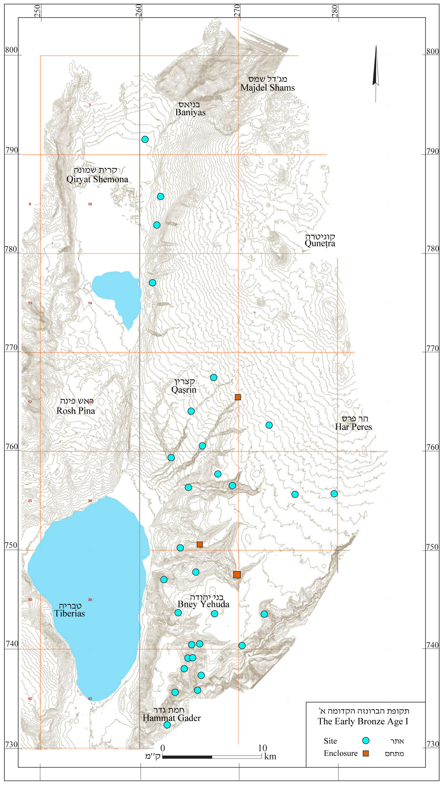
4.2 The Early Bronze Age
4.2.1 In the Early Bronze Age I – Settlement in the Golan was renewed at this time (see map 3) and site distribution is completely different than during the Chalcolithic period. This is testimony to the lack of settlement continuity between the two periods.
In the southern Golan 17 sites were found from the EB I, apparently all villages built in streambeds. In the central Golan, 15 widely spaced sites were found. Only three of these were found on the central plateau; the rest were in the streambeds. In the northern Golan, four sites from this period were found, all on the slopes facing the Hula Valley.
4.2.2 In the Early Bronze Age II–III – The distribution of settlements changed at this time (see map 4). Only 12 settlements from the EB I continued in existence.
There were 24 settlements in the southern Golan, 43 in the center and 41 in the north. Most of the settlements were apparently unwalled villages built on level areas and in the stream valleys. The EB II–III is the only period in the history of the Golan in which there was an apparently uniform culture throughout the Golan.
4.2.3 The enclosures – Among the dozens of sties from the Early Bronze Age discovered in the Golan, a number of sites are prominent that were not previously known. These sites have been dubbed “enclosures” (enclosure = Mitḥam in Hebrew)
Three of the sites, Mitḥam Iṣḥaqi (Qaṣrin Survey, site no. 60), el-Bardawil (‘Ein Gev Survey, site no. 43) and Leviah (Ma‘ale Gamla Survey, site no. 94). They are located on spurs surrounded on three sides by cliffs and steep slopes, whereas the fourth side, which could be easily accessed, was enclosed with a broad wall, built of large fieldstones. At Gamla (Ma‘ale Gamla Survey, site no. 42), which is situated on a steep spur, excavations revealed remains of structures from the Early Bronze Age. This site may also have been a “mitḥam”; however, no remains of a wall enclosing the spur have yet been found. Three sites – esh-Sha‘abaniyye (Rujem el-Hiri Survey, site no. 44), ‘Ayit Enclosure (Qeshet Survey, site no. 62) and Mitḥam ‘Ani‘am (Qaṣrin Survey, site no. 81) were surrounded by similarly built walls. In two sites, Ḥorvat Zawitan (Ma‘ale Gamla Survey, site no. 2), and ed-Dura (Qaṣrin Survey, site no. 41) a moat was dug across the spur as an alternative to a protective wall.
All these enclosures were found in the central Golan, east of the Sea of Galilee, at an altitude of 220–550 m above sea level. In the first surveys, no remains of structures were found and so these remains were called, as noted, “enclosures.” Initially it was proposed that they had been built as protection for nomads and their flocks in wartime. Later surveys uncovered wall traces revealing the presence of a settlement at these sites.
In excavations at Mitḥam Leviah, the largest of these sites, remains of structures were found within the walls from all periods of the Early Bronze Age (Paz 2003), Based on these findings, all the enclosures are now identified as fortified cities; however, this identification raises a number of questions.
The economic potential of the central Golan is quite limited. The land in the area is rocky and unsuitable for agriculture. The main livelihood was the raising of cattle and sheep and goats, which enjoyed the rich pastureland. This area could not economically support cities and indeed, until Second Temple times when olive cultivation expanded there were no cities in this area.
If all of these enclosures contained cities, it is unclear what their economic basis was. Moreover, four of the sites (Gamla, ‘Ayiṭ, Ani‘am and Mitḥam Iṣḥaqi) are only 1.5–2 km apart, which limits their economic options even more.
It is also important to note that these enclosures differed in their plan and location from the known Early Bronze Age cities in this country. Such enclosures were found in marginal areas of the Lower Galilee and Samaria and in all of them there seemed to be no proportion between the walls surrounding the enclosure and the meager, if any, remains within them.
4.2.4 Pottery Industry – At the foot of Mount Hermon, particularly around ‘Ein Quniyye, evidence was found of pottery manufacture typical of this period – metallic pottery. These vessels made of well-fired clay and were used in the northern and central parts of the country. At the site of ‘Ein el-Raḥman (Dan Survey) an accumulation of jar sherds was discovered, some of which were decorated by cylinder stamps. The sherds were found in a trench created during road building. Basalt potters’ wheels were found on the surface.
At the end of this period all the settlements in the Golan were abandoned.
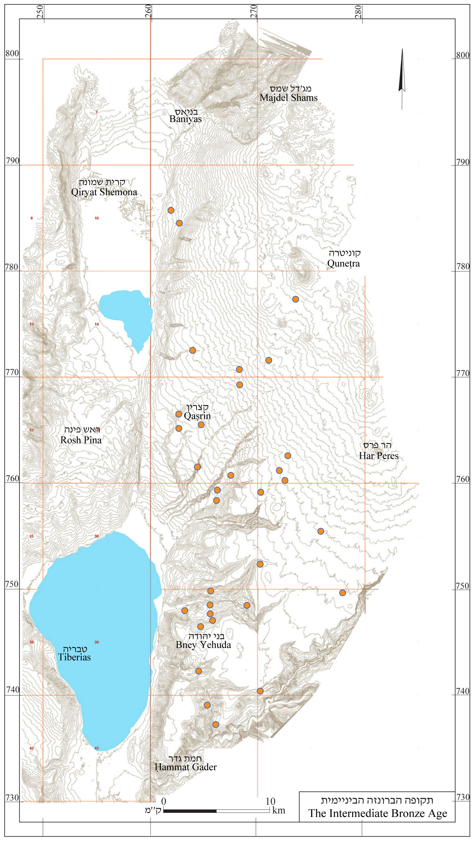
4.3 The Intermediate Bronze Age
Some 30 sites were found from the Intermediate Bronze Age (see map 5). Most of these revealed sherds only. The density of settlement in this period was very low. Twelve sites each were found in the central and the southern Golan. In the north, six sites were found.
As in other periods, the area filled with nomads or semi-nomads, who took advantage of the abundant pasturelands. Their presence was signaled by the thousands of dolmens scattered across the Golan (see below, Chapter 5).
Numerous shaft tombs were found at 14 sites, in the limestone areas of the southeastern Golan – nine in the Ḥammat Gader Survey area and four in the ‘Ein Gev Survey area. These tombs were not excavated and therefore their dating is uncertain.
Shaft tombs were in extensive use during the Intermediate Bronze Age. The Intermediate Bronze Age is typified by a large variety of tombs, usually individual tombs. These characteristics are typical both to dolmens and shaft tombs, although these two types of burials are very different in their form and construction techniques.
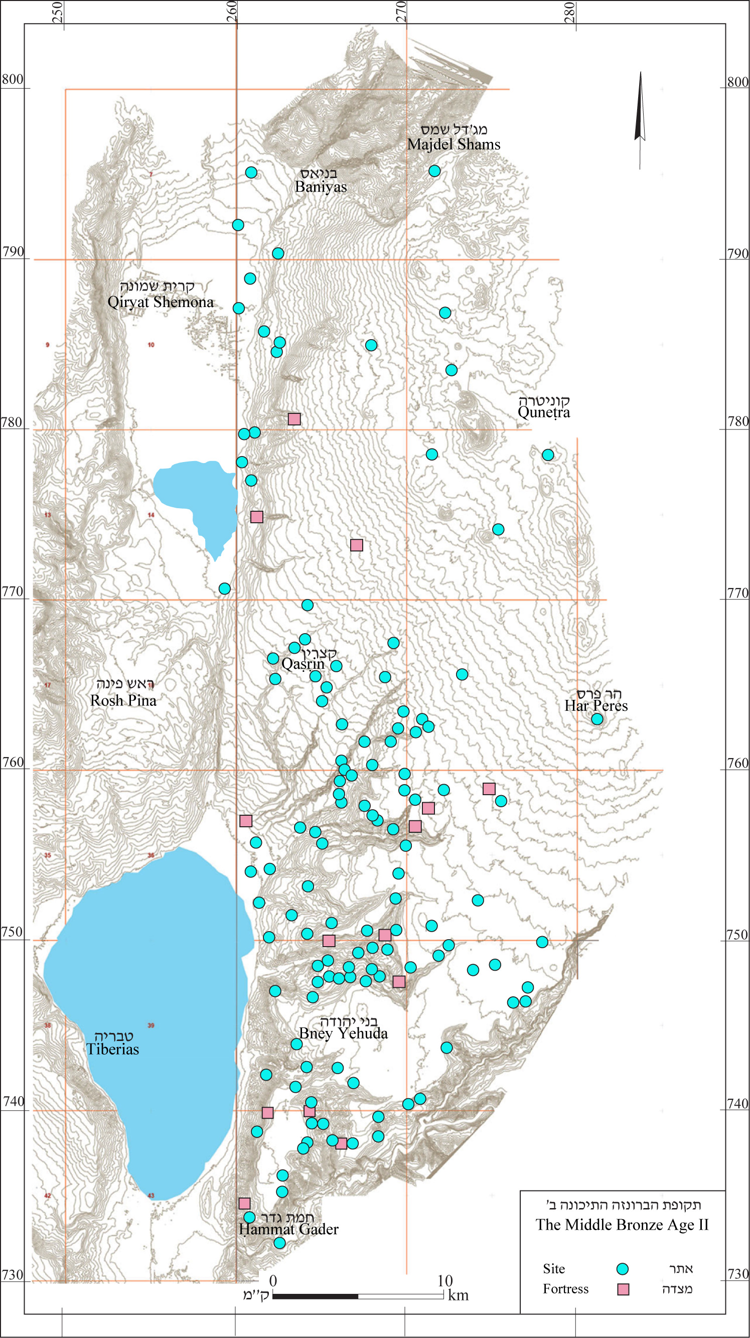
4.4 The Middle Bronze Age II
4.4.1 Before discussing the finds from the period, its name must be clarified. The Middle Bronze Age was once divided into two sub-periods – “Middle Bronze Age I” and “Middle Bronze Age II.” Since the Middle Bronze Age I was very different in its characteristics from the Early Bronze Age that preceded it and the Middle Bronze Age that came after it, its name was changed to the “Intermediate Bronze Age.”
Following this name change, the next period was called the Middle Bronze Age II without there being a Middle Bronze Age I (see the table of chronological periods in the The New Encyclopedia of Archaeological Excavations in the Holy Land, Stern 1993). To correct this situation, in recent years the name of the first part of the Middle Bronze Age II was changed to the Middle Bronze Age I, and the name “Middle Bronze Age II” was taken as the name of the second part of that period. The name change is logical; however, it can cause confusion in terms of earlier publications and therefore we continue to use the former terminology.
4.4.2 During the Middle Bronze Age II, settlement was renewed in the Golan. Remains from this period were found in 138 sites (see map 6). Sixty-four sites were found in the southern Golan, 58 in the central Golan and 16 in the northern Golan.
Most of the settlements are concentrated in three dense settlement clusters in the stream valleys. In the Yarmuk and Naḥal Meẓar that flows into it, 22 sites from this period were identified. On the terrace below Mevo Ḥamma a concentration of five sites were found in an area of 1 sq km. In the Naḥal Samak basin, 25 sites were found and in the Beteiḥa basin, 37 sites were found from this period. Additional sites are scattered across the plateaus.
The finds from this period have still not been thoroughly studied, but it seems that these sites represent cities, villages and fortresses. The distribution of the sites in dense clusters may perhaps attest to different political unites in the southern Golan at this time.
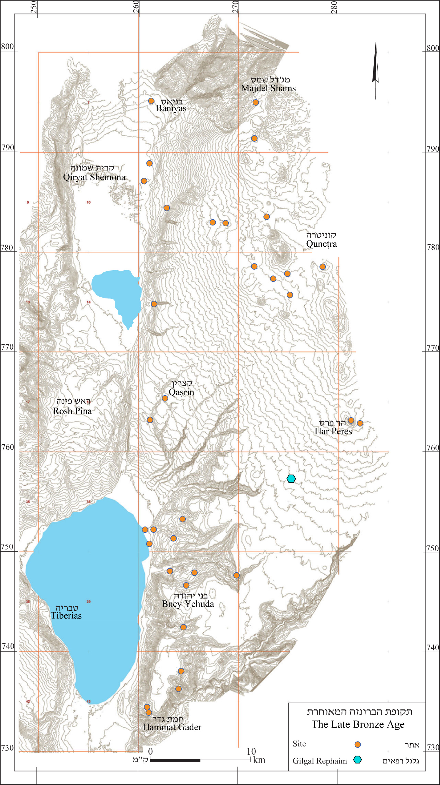
4.5 The Late Bronze Age
4.5.1 Settlement continued during the Late Bronze Age in the stream valleys, but the numbers dwindled greatly. Only 14 sites were found in the southern Golan, all in the valleys of Naḥal ‘Ein Gev, Naḥal Samak and Naḥal Kanaf (see map 7). At Tel Hadar (Ma‘ale Gamla Survey, site no. 89) on the shore of the Sea of Galilee, an administrative center was founded. The site was surrounded by a wall or two walls. In excavations at the site, two floors were found, bearing tools and abutting the wall. On the northeastern side part of a well-preserved round tower was found. The settlement was destroyed around 1500 BCE (Kochavi 1996:190). Remains of four sites were found in the Naḥal Samak basin, one of which was on the Kinnar Beach (Ma‘ale Gamla Survey, site no. 73), on the shore of the Sea of Galilee, and three sites were found at a point with a controlling view of the stream valley. Few sites were found on the southern and central plateau. Two were found in the Har Peres Survey area, and one site each in the Rujem el-Hiri and Qaṣrin Survey areas. No sites were found from this period in the Nov or Qeshet survey areas. In the northern Golan, 15 sites were found from the Late Bronze Age, some of which featured only dolmens. Among the settlements of the southern and northern Golan was an area in the central Golan that had practically no settlements. It is possible that the settlements in the southern Golan belonged to the kingdom of Geshur and those of the northern Golan to the kingdom of Ma‘acah (see below, 9.2).
4.5.2 The steep decline in the number of settlements left large areas without settlements. As in other periods, these areas seem to have been in the hands of nomads or semi-monads. While these people left no remains of buildings, they did leave their imprint on the area.
Between Rujem el-Hiri in the south and ‘Ein Zivan in the north are large stone heaps covering dolmens. These dolmens are built of relatively small stones arranged in rows slanting inward and forming a kind of false dome, at the top of which a large stone slab was placed. In two of these heaps, sherds were found from the Late Bronze Age. These heaps are usually surrounded by smaller dolmens built in the usual manner. It seems that these were dolmen fields, built in the Late Bronze Age, and that they served as burials for nomads (see below, 5.1).
4.5.3 The tomb in the middle of Rujem el-Hiri (Hebrew: Galgal Refaim) is built in a fashion similar to the heaps described above, and excavations revealed finds from the Late Bronze Age. There is no doubt that this site was in use at that time and therefore it is presented here. However, scholars are divided on the question of whether this was secondary use of an ancient structure or whether the structure was first built in the Late Bronze Age.
Although no finds were discovered that dated it to a period other than the Late Bronze Age, a number of dates have been proposed. Michael Freikman (pers. comm.) suggested that it be dated to the Chalcolithic period. Mataniya Zohar, Moshe Kochavi and Yonatan Mizrachi dated (below) the construction of the curving walls to the Early Bronze Age. Zohar (1992) also believed that there was a monument of some kind in the center of the structure. Kochavi posited that the central heap was built in the Early Bronze Age and that the finds within it attest to secondary use in the Late Bronze Age (Kochavi 1993). Mizrachi proposed that the heap was built in the Late Bronze Age in the center of the circles, which themselves were built in the Early Bronze Age (Mizrachi 1992). Moshe Hartal (1991) suggested that the entire complex was built in the Late Bronze Age (See below, 5.1.1).
The function of the structure is also unclear. Yehoshua Yitzhaki (1993) suggested that it served as an astronomical observatory. According to Aveni and Mizrachi its purpose was to forecast the first rain (Aveni and Mizrachi 1998). Hartal (1999) proposed that the site served as a cult center for a pastoral population.
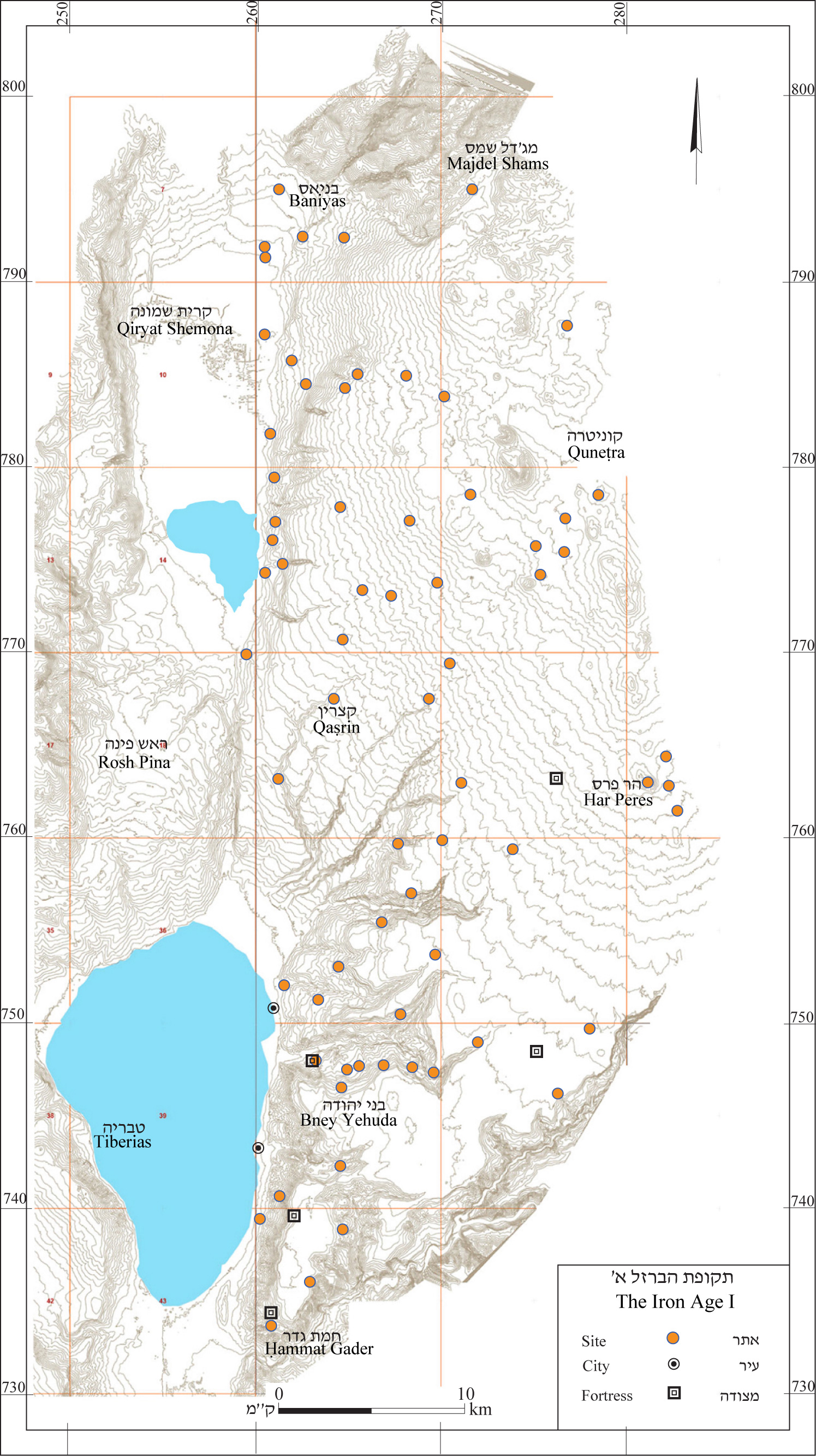
4.6 Iron Age I
During the Iron Age I the number of settlements increased in the Golan (see map 8). In the southern Golan, 20 sites from this period were found, in the center, 24 and in the north, 31 sites. Most of the sites were found in areas not settled in the Late Bronze Age and most were situated in stream valleys.
Near the shore of the Sea of Galilee were two administrative centers, Tel Hadar (Ma‘ale Gamla Survey, site no. 89). At Tel Hadar settlement was renewed in the twelfth century BCE. In the eleventh century, the settlement expanded and served as a walled administrative center. It contained large storehouses in which taxes were collected from surrounding settlements. It seems that this was one of the administrative centers of the Land of Geshur (see below, 9.2.1). The settlement with its storehouses was destroyed in the eleventh century BCE by a major conflagration (Kochavi 1996: 190–192). In the early tenth century BCE, the fortified city at Tel ‘Ein Gev was founded (‘Ein Gev Survey, site no. 68).
The densest cluster of settlements was in Naḥal Samak. Six sites were found there, which were apparently villages. A fortified settlement, at el-Khashash (‘Ein Gev Survey, site no. 15) protected the entrance to the stream valley from the direction of the Sea of Galilee. This period was the height of the development of this settlement.
There were only a few sites on the plateau at this time, some of which were apparently fortresses. Remains of fortresses from this time were found at Tel Abu Zeitun (Nov Survey, site no. 24) on the southern plateau while Meẓad Yonatan (Qeshet Survey, site no. 62) was on the central plateau. Sites were also few in the Meshoshim-Yahûdiyye basins as well as the central plateau. It seems that these areas were still under the control of nomads or semi-nomads and the fortresses were apparently intended to control them.
During this period on the northern Golan, small sites were established, apparently of nomadic settlements, perhaps of the Ma‘acah tribes (see below, 9.2.1). In Wadi Balua‘ (Shamir Survey) remains were found of a fortress. There may also have been fortresses at other sites on hills controlling the roads and near water sources. The sites – Ṣurman (Har Shifon Survey), Somaka (Shamir Survey) and Miṣpe Golani (Dan Survey) – suggest the possibility that there too, there were fortresses.
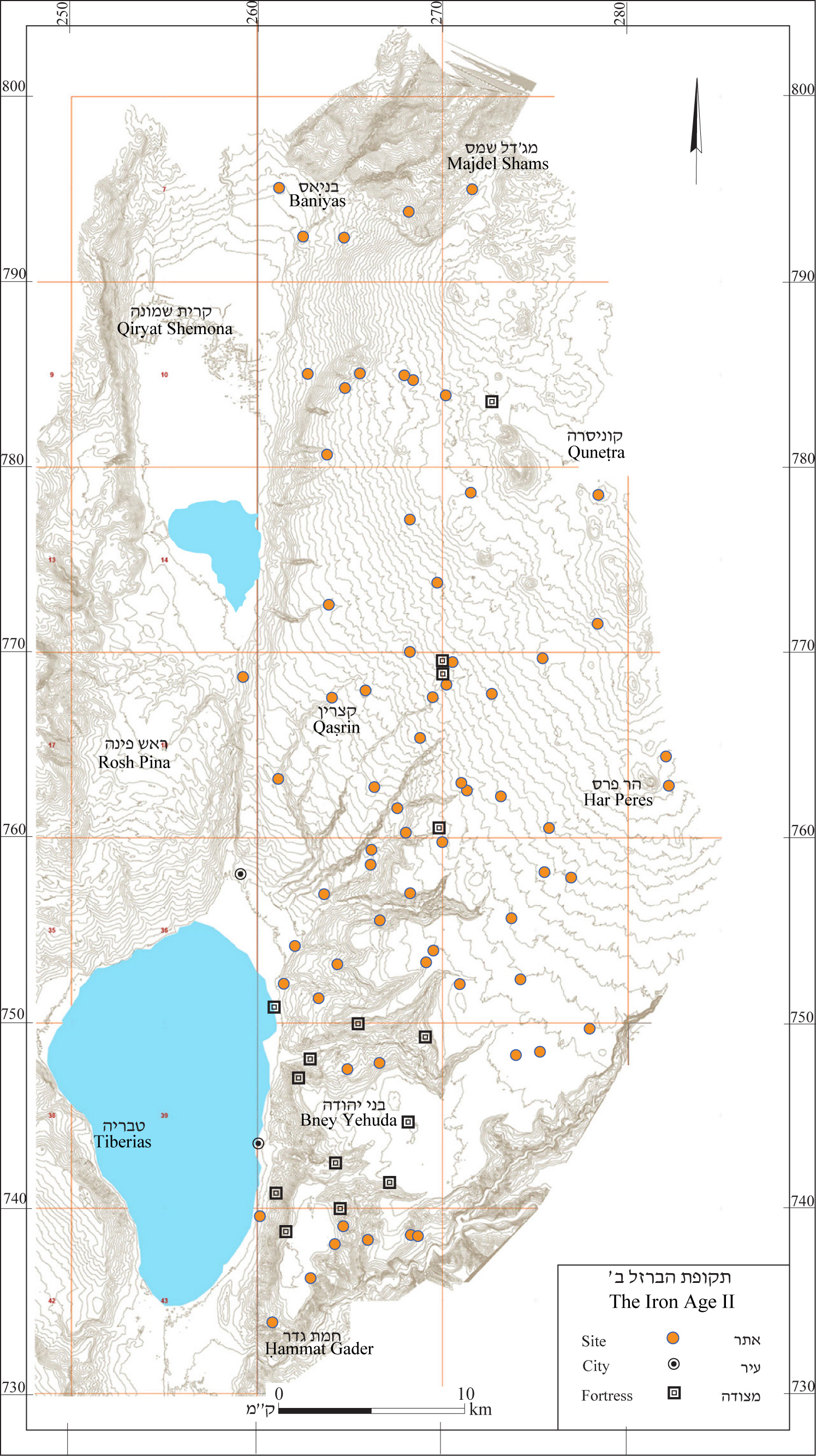
4.7 Iron Age II
During the Iron Age II the number of settlements grew. In the southern Golan the number increased from 20 to 39. In contrast, the northern Golan saw a sharp decrease in sites from 27 in the Iron Age I to 18 in the Iron Age II (see map 9). The reason for the decrease might have been the abandonment of small settlements that are typical of the beginning of the sedentary process, and consolidation into larger settlements.
In Naḥal Samak about half the Iron Age I settlements were abandoned and four new settlements were built, on hills with a controlling view of their surroundings and convenient to defend. Tel Sorag (‘Ein Gev Survey, site no. 89), as was the city at Tel ‘Ein Gev (‘Ein Gev Survey, site no. 68).
Sherds from the Iron Age II were also found at controlling points at the Ṣuqye Kawarot (‘Ein Gev Survey, site no. 111); at Rujem Fiq (‘Ein Gev Survey, site no. 66). At Maṣokey Onn Fortress (Ḥammat Gader Survey, site no. 2) and forts may also have been built at ‘Uyun Umm el-‘Azam (Ḥammat Gader Survey, site no. 27).
The change in settlement distribution reflects a change in the geopolitical situation at that time. During the Iron Age II the region was under the control of the Arameans and became the battleground between Israel and Aram (see below, 9.9.2). It was only natural for settlements to have been established in easily defensible locations and that fortresses were built as protection against invasion.
In the ninth century BCE settlement was renewed at Tel Hadar (Ma‘ale Gamla Survey, site no.89). Atop the ruins of public buildings a planned domestic quarter was built with streets, colonnaded structures and silos. During the last phases of the settlement in the eighth century BCE it served as a fishing a farming village and not as an administrative center. The settlement became more densely populated and the inner wall was done away with (see above, 4.5.1).
In Naḥal Meyṣar (Ḥammat Gader Survey), which was farther from the area of the battles, a number of smaller settlements were built, some of which continued settlements from the Iron Age I and others that were built during the Iron Age II.
New settlements were established in the central plateau (Rujem ae-Hiri and Qeshet surveys) and in the Meshoshim- Yahûdiyye basins (Qaṣrin Survey). These were apparently nomadic settlements. It seems that the process of sedentation, which began in the northern Golan during the Iron Age I, spread during the Iron Age II to the central Golan as well.
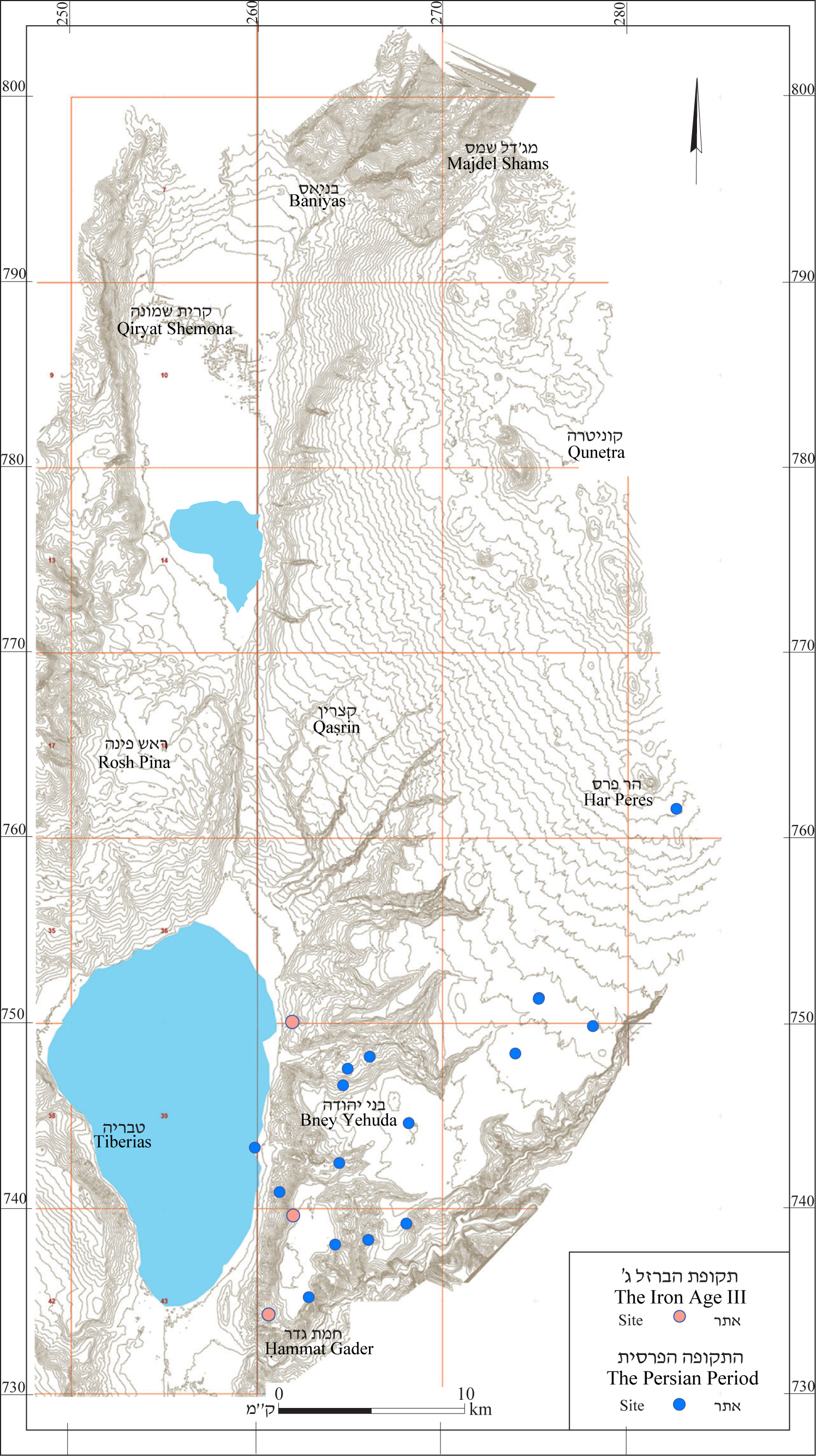
4.8 Iron Age III
The campaign of Tiglath-Pileser III against Israel in 732 BCE brought about the destruction of the settlements in the Golan. All the permanent settlements in the central and northern Golan were abandoned, leaving the area devoid of permanent habitations. The settlements in the southern Golan were also damaged and abandoned (see below 9.2.3)
Remains from the Iron Age III were found at only four sites (see Map 10). Three of these were built at controlling points in the area of the Ḥammat Gader Survey and one site was built in the area of the Ma‘ale Gamla Survey. With most of the Golan now devoid of permanent habitations, it seems that, as in other periods of settlement gap, the area was taken over by nomads and semi-nomads.
4.9 The Persian Period
In the northern and central Golan, the settlement gap persisted into the Persian period, however; in the southern Golan in this period settlement began again. Remains from the Persian period were found at 12 sites, most of which were in the southern Golan (see Map 10).
In the excavations of Tel ‘Ein Gev (‘Ein Gev Survey, site no.68), only pits were found from this period. At Tel Sorag (‘Ein Gev Survey, site no. 89) settlement was renewed and excavations revealed buildings and silos; the site may have been a village.
Sherds from the Persian period were also found at Ṣuqye Kawarot (‘Ein Gev Survey, site no.111) and in Naḥal Samak (‘Ein Gev Survey, site nos. 30 and 39). In Naḥal Meyṣar (Ḥammat Gader Survey 39, 56 and 67), in the Yarmuk Valley (Ḥammat Gader Survey, site no. 24) and on the southern plateau (‘Ein Gev Survey, site no. 66; Nov Survey, site nos. 14 and 23). Ḥorvat Boṭma (Har Peres Survey, site no. 2) is the northernmost site were remains from the Persian period were found.
4.10 The Hellenistic Period
During the early Hellenistic period the Jordan River was the eastern boundary of permanent settlement. There were no such settlements anywhere in the Golan and those that have been found seem to have been inhabited by nomads or semi-nomads. The nomads only began to become sedentary in the Late Hellenistic period, in the second half of the second century BCE (see map 11).
4.10.1 The Hermon – Four sites were found from the Hellenistic period at the foot of Mount Hermon, that is, in the area of hills south of the mountain ridge. The mountainous bloc of the Hermon still had no permanent settlement. On Mount Snaim (Dan Survey) a cult enclosure was found that included enclosures adjacent to the cliffs, where coins were found dating to the second and first centuries BCE. It seems that the site served as a cult site frequented by Itureans (see below, 12.1) even before they began to settle at the foot of Mount Hermon and in the northern Golan.
Near the enclosure an Iturean settlement developed where coins were also found from this period. In excavations and in a survey no pottery vessels were found from the Hellenistic period. The vessels published by Dar (1994: Pls. 1¬¬–7) are today defined differently.
4.10.2 The Northern Golan – Remains from this period were found at 48 sites. This is double the number of sites in the area during the Iron Age. During this period the northern part, with its volcanic peaks and valleys, was settled for the first time, relatively densely.
In 34 sites (nearly 3/4 of the northern Golan's sites) Golan Ware became common (see below, 6.1). These sites were situated mainly on the low hills at the base of the Hermon and the area of the volcanic peaks and valleys. The sites were not situated by water sources, nor were cisterns found near them due to the hard-to-quarry basalt rock on which the sites were built.
These were small sites, measuring between 1 and 5 dunams. They remains of unwalled settlements in each of which were remnants of a number of structures. The structures were built of fieldstones or slightly worked stones. The walls were one stone thick.
The settlements were concentrated in clusters between 200 and 1,000 m apart. At Khirbet Zemel (Merom Golan Survey: 13) one such site was excavated, uncovering a large structure built in the second half of the second century BCE. The site was abandoned after a few decades (Hartal 2002:75–122).
The area in which these small sites were found was not settled either before or after them which made it possible to discern them. Otherwise, they would have disappeared under remains of later settlements.
The inhabitants of these hamlets did not leave clear testimony of their identity, but the similarity in time and space between them and the historical sources regarding the Itureans indicate that the inhabitants were part of the Iturean tribes (see below, 12.1, 13.1).
4.10.3 – In the western part of the northern Golan 13 sites were found from the Hellenistic period that did not contain Golan Ware. In a ruin on a steep hill east of Buq‘ata (Birket Ram Survey) no remains of Golan Were found (but only Hellenistic pottery). This site, which is surrounded by sites with Golan Ware, served as a fortress, perhaps an administrative outpost in the heart of the Iturean settlement.
The rocky Odem lava flow (see above, 2.7), separates these two groups of sites – the sites with and without Golan Ware. The lava flow was densely forested and remained unsettled until the Late Roman period.
4.10.4 The Central Golan – The 12 western sites in the northern Golan (the 13th site is located in the eastern part of the area, in the heart of the Iturean territory, see above) belong to a group of 97 settlements that extends across the central Golan. Some of the sites were built on ridges or low hills. They were surrounded by broad walls encompassing a few remnants of construction and apparently used as farms or enclosures.
The dating of these sites is problematic given that they all revealed sherds from a number of periods, and without excavation the construction cannot be attributed to one of them. Most of the sherds from the Hellenistic period that were found at these sites were produced locally rather than imported and are of low quality. Other sites revealed sherds only and the character of the settlement is unclear.
The sites extend across the area in a pattern similar to that of the Iturean settlements in the northern Golan (see above, 4.10.2). It sees therefore that the sites in the central Golan may also be attributed to sedentary processes of nomads living in the area in the early Hellenistic period. Their material culture differs from the sites in the northern Golan and they therefore seem to have been part of a different ethnic group. The historical sources give no indication of the identity of these inhabitants, which we term Syrians (see below 13.2).
4.10.5 -- At the end of the Hellenistic period the region was conquered by Alexander Jannaeus (83–80 BCE, see below, 9.3.4). The picture of settlement on the eve of the Hasmonean conquest revealed by surveys is one of meager settlement that could not withstand the might of the Hasmonean army.
Following the conquest, the area was settled by Jews and it is interesting therefore to study the fate of the Hellenistic settlements that preceded them. Analysis of the findings at the sites and their history in the Roman period indicates that the area east of the Waterfalls Road had no Jewish settlement and the original settlers continued to live there (see details in the introduction to the Qeshet and Rujem el-Hiri surveys).
West of the waterfall road settlement changed. Half the sites were abandoned and did not continue in existence in the Early Roman Period. In most of them only local pottery was found and none was known later as a Jewish settlement. It therefore seems that in those locales settlement ceased to exist after the Hasmonean conquest. In the other half of the sites settlement continued unbroken into the Roman period. In some of them, synagogues were later built. These settlements were apparently inhabited by Jews.
According to Flavius Josephus (War 1, 105; Ant. 13, 394) Gamla (Ma‘ale Gamla Survey, site no. 43) was a fortress conquered by Jannaeus. In excavations at the site no remains of a fortress were found, but hundreds of Seleucid coins were found, attesting to the existence of a settlement at this time. In contrast, hardly any sherds were found from the periods prior to the Hasmonean conquest. Gamla seems to have been another of the Hellenistic settlements defined as a fortress due to its natural fortifications.
4.10.6 In the Southern Golan – Remains were found from the Hellenistic period at 43 sites. In this area settlement was renewed as early as the Persian period (see above, 4.9) and expanded in the Hellenistic period. At three sites, Kafr el-Mā (Nov Survey, site no. 33), el-‘Āl (Nov Survey, site no. 34) and Afiq (‘Ein Gev Survey, site no. 95) remains were found attesting to an Eastern cult, the type typical of the Bashan at this time. These findings postdate the Hellenistic period but seem to reveal the presence of a Syrian population (see below, 13.2), apparently associated with settlement in the Yarmuk River valley at that time.
In the excavations at Susita (‘Ein Gev Survey, site no. 81) sherds were found on the rocky surface dating from the end of the fourth and early fifth centuries BCE. The finding shows the possible presence of a military outpost. The city was apparently founded in the mid-second century BCE and became the region's main city.
In eight of the sites in the Susita area remains of ashlar construction were found. Such construction was also found at three sites in which sherds were not found from the Hellenistic period. At Height Point 108 m (‘Ein Gev Survey, site no. 20) a fortress was excavated built with ashlars. Ma‘oz, who excavated there, associated the ashlar construction with a fortress built during the Seleucid period.
As a polis, Hippus-Susita also controlled the southern Golan. Under its control were a number of Jewish towns, known as the "prohibited towns" in the territory of Susita (see below, 10.1, 11.1, 13.3.1). Ma‘oz (1986:83–84) posited that these cities were founded after the conquest of Alexander Jannaeus, that is, at the end of the Hellenistic period.
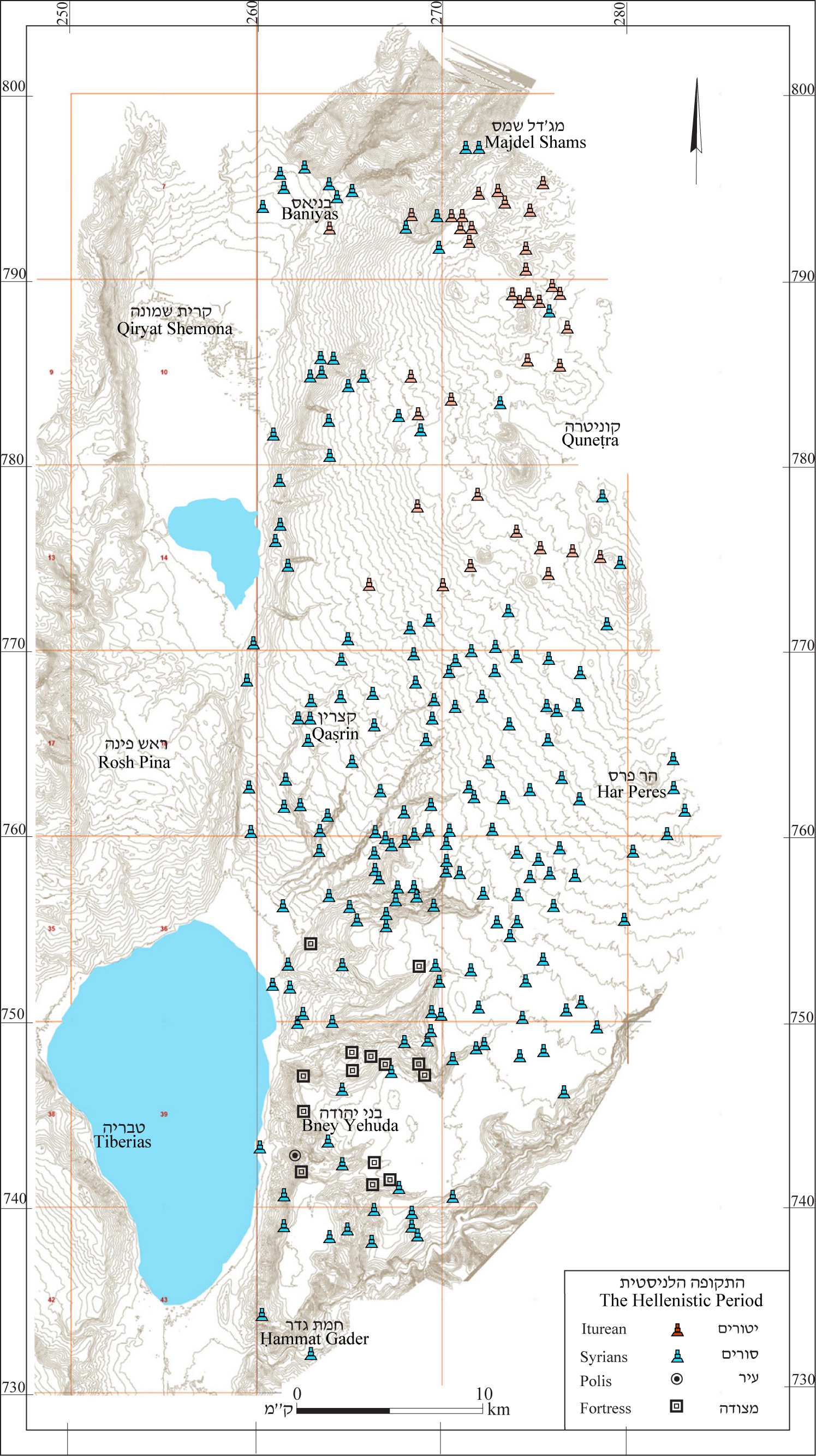
4.11 The Early Roman Period
One hundred and ninety-five sites from the Early Roman period were found in the surveys (see map 12). At this time the entire Golan was one political unit under Herodian rule (see below 9.44.2–9.4.9). However, the population was varied – Jews, Itureans and Syrians (see below, Chapter 13).
4.11.1 The Hermon – During the Early Roman period there were 11 sites on Mount Hermon. At that time, the Iturean settlements continued to exist in the Hermon foothills and for the first time, permanent settlement began in the mountainous part of the Hermon. This period was apparently the time when the process of Iturean settlement was completed (see below, 12.1,13.1); after the establishment of the city of Paneas, permanent settlement also penetrated areas that had not been previously settled. The Iturean settlement near the cult site at Mount Snaim was also apparently founded at this time.
Numismatic evidence indicates that worship at the cult enclosure continued until the first century CE. Three coins from this period were the latest found in the enclosure. The cult enclosure was replaced by a new enclosure, which was built at the foot of the Iturean settlement (see above, 4.10.1). The enclosure was surrounded by a wall; within it two shrines were found that showed Roman influence in their construction. The shrine was apparently established sometime during the first century CE, perhaps at the time of Agrippa II.
4.11.2 The Northern Golan – During the Early Roman period there were five settlements in the northern Golan. In 17 of these, settlement persisted from the Hellenistic period; the rest were founded at this time, some on earlier sites. The sites were scattered across the entire area except for the Odem lava flow.
Golan ware was found in 38 of the Early Roman sites. In 13 of these, settlement continued from the Hellenistic period, while about 20 of the Hellenistic sites were not settled in the Early Roman period. In 13 sites from the Early Roman period no Golan ware was discovered. In about half of those, settlement continued from the Hellenistic period; the other half were settlements founded during the Early Roman period.
Iturean settlement apparently continued without interruption. The Iturean sites were found mainly in the eastern part of the area, but the Itureans continued to penetrate the void in the center of the region in the Hellenistic period. A few Iturean settlements were also found in the western part of the region.
4.11.3 Paneas – at the end of the first century BCE Philip, son of Herod the Great, founded a city at Baniyas called Paneas or Caesarea Philippi. A mixed city, with pagan shrines as well as a Jewish community, Paneas served throughout the entire Early Roman period as the capital of the tetrarchy of northern Transjordan (see below, 9.4.3).
During the reign of Agrippa II the city expanded and suburbs were added to it, some of which were above the spring that provided the city with water. To ensure water supply to these suburbs an aqueduct was built that channeled water from a stream on the east.
4.11.4 In the Central Golan – A total of 73 sites were found. At the end of the Hellenistic period the region was conquered by Alexander Jannaeus, after which Jews began to migrate to it (see above, 4.10.5). Jewish motifs are rare before the Late Roman period and therefore Jewish settlement in the Early Roman period cannot be directly identified. However, the sites where no pagan findings were discovered, and which were later known to be Jewish, were probably settled by Jews as early as the Early Roman period.
In the eastern part of the central Golan 32 sites were found that were not settled by Jews after this time; they were probably not settled by Jews during the Early Roman period. These settlements continued to be inhabited by Syrians, who had settled there during the Hellenistic period (see below, 13.2).
In the western part of the region 27 sites were found with later evidence of Jewish settlement. The most important of these was Gamla, where excavations unearthed a synagogue, a ritual bath and stone vessels typical of Jewish settlements. Gamla was the only city that fought the Romans during the Great Revolt, after which it was destroyed and abandoned.
Bethsaida, a large village settled by Jews was located near the Jordan River north of the Sea of Galilee, received the status of a polis and was named Julias. This site was outside the survey area.
4.11.5 In the Southern Golan – During this period there were 60 sites in the region. The southern Golan served as the administrative outpost of Sussita, which was liberated by Pompey and joined the alliance known as the Decapolis (see below, 9.4.1).
Two aqueducts were built at this time, which brought water from Naḥal el-‘Āl to the city. The city was settled mainly by pagans although there was also a Jewish community there.
Evidence of pagans was found at a number of sites (see below, 12.2). At Kafr el-Mā (Nov Survey, site no. 33) a statue of the Arab god Shadrafa was found, dated (tentatively) to the first century CE.
A list of "prohibited towns" in the territory of Sussita appears in the ancient rabbinic sources. These towns were inhabited by Jews, and although they were located in a mainly pagan area, they were bound by the laws of the sabbatical year and tithes. Some of these towns can be identified by their name, which has survived to this day (see below, 11.1, 13.3.1). Others have been identified by stone vessels found there, evidence that they were settled by Jews.
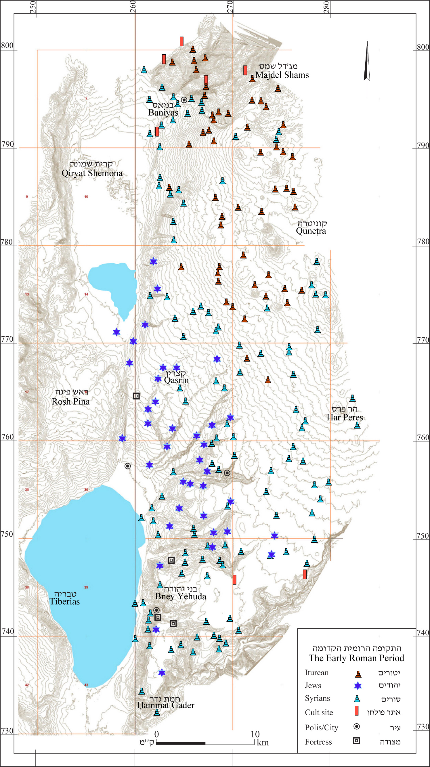
4.12 The Middle Roman Period
4.12.1 The Middle Roman period began in 100 CE after the death of Agrippa II and the annulment of tetrarchy of northern Transjordan (see below, 9.4.8). The dating of the sites to this period is based mainly on the finding of Kfar Ḥananya-type vessels (see below, 6.2).
In the northern Golan almost no vessels of this type were found so it is almost impossible to differentiate between the Middle Roman and the Late Roman periods at the various sites. To fill the gap in the information, we included in the map of the period the sites in the northern Golan and Mount Hermon that were settled both in the Early Roman and the Middle Roman periods, on the assumption that settlement in these towns was continuous. It is possible that a few of the settlements in the Late Roman period were already settled in the Middle Roman period; however, as noted, this cannot be proven. This period saw a slight rise in the number of sites – to 209 (see map 13).
4.12.2 Mount Hermon and the Northern Golan – Ten sites were found on Mount Hermon from the Middle Roman period. At this time the Iturean temples that had been established in the Early Roman period continued in operation. The Iturean settlements on Mount Hermon seem to have continued, but as noted above, information on this period is limited.
In the northern Golan the number of settlements rose to 60. The city of Paneas-Caesarea Philippi, lost its position as capital of the tetrarchy of northern Transjordan, when the tetrarchy was split up. However, it seems that this change did not affect the development of the city. Its cultic area, near the cave, was expanded and temples and open courtyards were added. Suburbs were built around the center of the city with spacious houses.
A pottery industry developed during this time in Paneas and nearby Ḥawarit. The pottery was marketed throughout the Paneas district, that is, the northern Golan to Mount Peres in the south. These vessels replaced the Kefar Ḥananya ware (see below, Chapter 6). In the second century BCE a road was built from Paneas to Damascus, which passed south of Naḥal Sa‘ar, through the Odem Forest and Buq‘ata, and forts were built along the road. As noted above (4.12.1) there are still no tools to define the ceramics of this period and therefore it is unclear whether the beginning of settlement at the Odem lava flow began as early as this period orin
the Late Roman period.
4.12.3 Central Golan – There were 79 settlements in the central Golan during this period, in which two separate populations developed. Jews inhabited the western part. As noted above, Gamla, which was destroyed in the revolt, was not resettled; its lands were apparently confiscated and four pagan communities were built on them. However, it seems that damage to Jewish settlement in the Golan was limited. Most of the sites that had been settled by Jews in the Early Roman period continued in existence in the Middle Roman period as well, and a number of new settlements were founded (see the introductions to the Qaṣrin and Ma‘ale Gamla surveys). Meanwhile, the city of Julias-Bethsaida declined in importance and seems to have ceased to exist.
In the eastern part of the region nomadic tribes became completely sedentary. Beginning in the Hellenistic period small villages were established, some of which belonged to the district of Paneas. Iturean settlement apparently did not reach this area.
Along the Lawiye Spur and the central plateau, another Roman road was built, along which fortresses were established and milestones installed.
4.12.4 The Southern Golan – During the Middle Roman period there were 58 sites in the southern Golan, with Hippus-Sussita maintaining its centrality. The number of settlements rose, especially in the stream valleys, whereas in the southern part of the plateau the number of settlements was small.
The fate of the Jewish towns in the Sussita region (see below 13.3.1) is unclear during this period. Ma‘oz (1986:82–83) posited that the Jews abandoned the area during the time of the revolt, which would mean that these towns were not inhabited by Jews during the Middle Roman period. However, only one of the sites that was identified as Jewish – Lower Wadi es-Sufera (‘Ein Gev Survey, site no. 4) did not continue to exist in the Middle Roman period. At other sites: Nov (Nov Survey, site no. 23), ‘Ein ‘Uwenish, Kfar Ḥaruv (‘Ein Gev Survey, site nos. 25 and 113) and Khirbet ‘Ayun (Ḥammat Gader Survey, site no. 60) settlement continued at this time and the population was apparently Jewish.
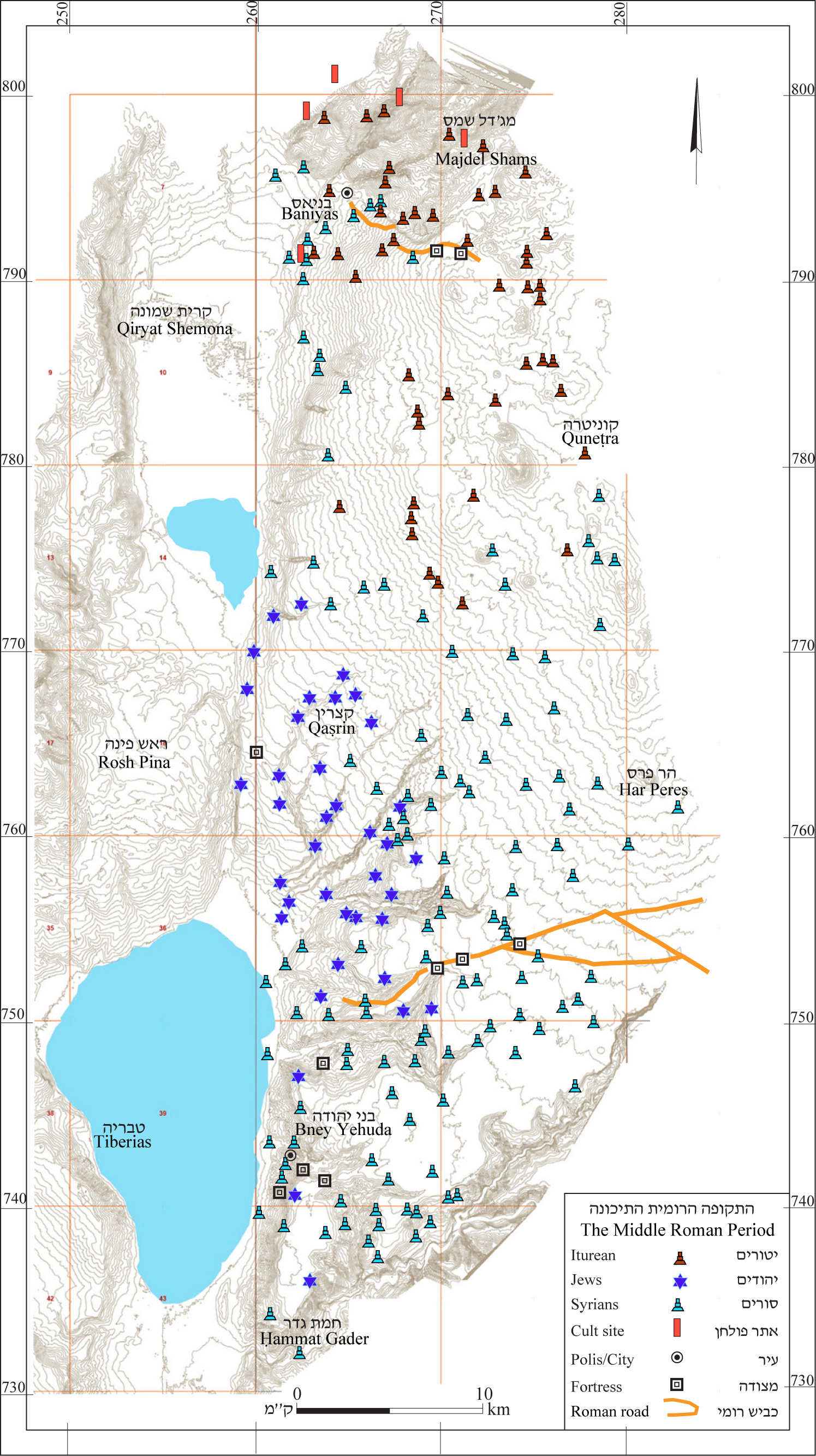
4.13 The Late Roman Period
During the Late Roman period there were 307 settlements on the Golan (see map 14) – more than in any other period on the Golan.
4.13.1 Mount Hermon and the Northern Golan –The Late Roman period saw settlement flourish in the northern Golan (see map 14). The number of settlements rose to 70 in the northern Golan and 19 on Mount Hermon. Most were inhabited by Itureans and only on the western edges did settlement continue in which Golan Ware was not found (and were probably not inhabited by Itureans).
4.13.2 During the Late Roman period the city of Paneas reached its greatest extent. It covered about 750 dunams ¬– most of the Baniyas plateau. During this period the aqueduct underwent renovations, which allowed it to continue in use until it became blocked with silt.
The city was a prosperous one. In addition to temples it had a colonnaded street, public buildings and spacious dwellings. Farms and grand villas were situated two–three hours' walk from the city; their owners would have enjoyed the pleasures of big-city life.
4.13.3 During this period, or perhaps as early as the Middle Roman period (see above, 4.12.2) settlement began on the Odem lava flow, which had not been settled before. The northern part of the flow was inhabited first, apparently following construction of the road from Paneas to Damascus.
The only settlement in the area, Khirbet Ra‘abneh (Dan Survey) was built near this road, perhaps developing from one of the forts that guarded it (see above 4.12.2. This settlement was large compared to others of the period, with an area of about 60 dunams.
The main limitations of the Odem lava flow, apparently preventing people from living there before this time, were a lack of soil and water. Suitability of the area for habitation t required a major investment in terms of clearing forests, removing rocks and constructing terraces to level the fields. These operations were likely to have been beyond the abilities of small farmers. It seems that such work was carried out in an organized manner and centrally financed. This is indicated by the large size of the agricultural terraces, the maximum size they could be considering the lay of the land, and the fact that they are not sub-divided, as would be expected in the case of with plots belonging to small farmers. It is therefore possible that there was a large estate at Ra‘abneh, all of whose lands were under single ownership. To overcome the lack of water, numerous cisterns were dug, some of which were particularly large.
4.13.4 Central Golan – The Late Roman period was a prosperous one in the central Golan as well, with 136 sites all in all. The Jewish settlements, which began after the conquest by Alexander Jannaeus developed and flourished. The area was agricultural, but the villages were relatively small. It seems that the size of the villages was restricted by the small volume of the springs, which was insufficient for larger settlements. The area's development was stable, but there was also a dynamic involved – new settlements were founded, but some of the veteran settlements were abandoned. The inhabitants' livelihood was based mainly on olive cultivation and olive-oil production. The eastern part of the region, where olives were not raised, developed more slowly and consisted of small villages and farms. All the settlements of the area were rural – there were no urban centers.
The Roman road, which was built in the Middle Roman period, continued in use during the Late Roman period as well; there were forts along the way to secure it.
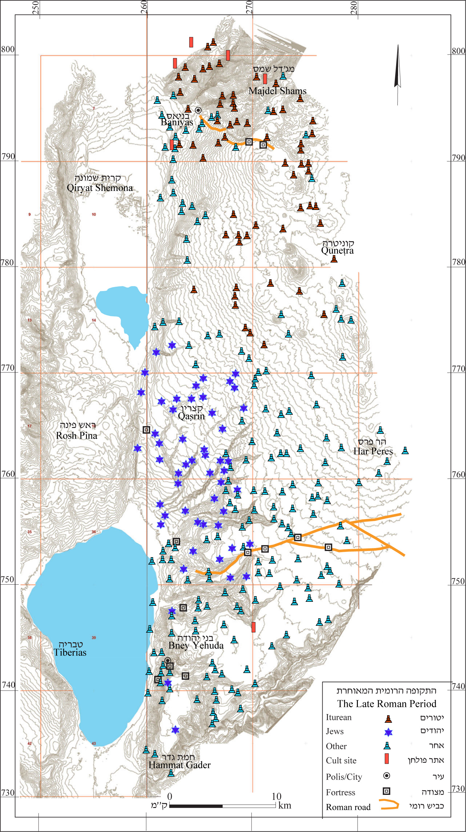
4.13.5 Southern Golan – The number of settlements in the southern Golan also grew, reaching 82. Hippus-Sussita continued to be the central city of the southern Golan and flourished, as did Paneas in the north. The settlement pattern of the Middle Roman period persisted into the Late Roman period. However, as in the central Golan, there were changes in the distribution of settlement; some were abandoned and others were established.
In the third century CE the Roman Empire was struck with an economic crisis (see below, 9.5.2). However, its impact on this region was apparently marginal, as most of the settlements persisted into the Byzantine period and the number of those abandoned equaled the number of new ones established. Some new locales may have been established in the wake of recovery from the economic crisis.
Nevertheless, the crisis seems to have weakened the settlements and the Jews may have left their cities in its wake. In any case, during the Byzantine period there is no evidence of Jewish presence in the Sussita area. In the sites in the southern Golan, such as Khirbet ‘Ayun (Ḥammat Gader Survey, site no. 60), el-‘Āl (Nov Survey site no. 34) and Khisfin (Rujem el-Hiri, site no. 147), inscriptions were found attesting to the settlement of Roman army veterans.
At Afiq (‘Ein Gev Survey site no. 95), eṣ-Ṣufeira (Rujem el-Hiri site no. 146) and el-‘Āl (Nov Survey site no. 34) findings attest to pagan cult. The findings at el-‘Āl are quite diffrent from those in the neighboring sites – Afiq in the south and Khisfin (Rujem el-Hiri Survey, site no. 147) in the north. No symbols or inscriptions were found attesting to the presence of Jews or Christians. The finds apparently attest to pagan settlement.
At Ḥammat Gader the large bathhouse continued to operate and a town grew up around it providing services for the many visitors.
4.14 The Byzantine Period
During the Byzantine period the number of settlements declined to 229 (see map 15). The weakening of settlement in the Golan was not uniform. There were only six sites on Mount Hermon, while in the northern Golan there were 40 and 104 sites in the central Golan. A major difference can be seen between the western and the eastern parts of the region (see below 4.14.2): Stability was preserved in the southern Golan, where 79 settlements were found (see below, 4.14.3).
4.14.1 Mount Hermon and the Northern Golan – Security worsened in this area during the Byzantine period and settlement on the Hermon ceased almost completely. The temples stopped functioning and settlements were abandoned or declined in size. Finds from this period are very meager. The settlements may have continued in use on an agricultural seasonal basis.
Paneas also suffered during this period although until the fifth century it continued to serve as the region's central city. A large basilica was built in the center of the city, apparently a church. According to Ma‘oz, the temples continued in use alongside the basilica. Excavations in the city revealed a huge conflagration that destroyed the city's main street of shops. This fire apparently marked the end of the city. The suburbs were also abandoned at this time and the aqueduct went out of use. South of Naḥal Sa‘ar a wall was built for the first time to protect that part of the city; however in most of the site there were no remains from the late Byzantine period. The villas around Paneas wer also abandoned. At el-Naqra, above the Sa‘ar Waterfall, a fortress was built. Paneas is mentioned by travelers in the Byzantine period, but as the headwaters of the Jordan, not as a city. This was the period during which the production of pottery ceased at Baniyas and Ḥawarit.
Rural life was also compromised at this time. The information gleaned from the survey is not clear enough to determine the date of the change, but the number of settlements declined from 69 to 40. The decline is particularly sharp in Iturean sites. But together with this major decline, it can be seen that in the sixth century a number of sites were established in this area – Quneṭra, Bab el-Hawa, Ra‘abneh and Za‘ura, where Ghassanids lived (see below, 13.4). The decline in security at this time does not seem to have been connected to the Ghassanids, but rather they penetrated an area that was already compromised, as can be seen by the excavations at Bab el-Hawa.
4.14.2 Central Golan – The Byzantine period was the height of Jewish settlement (see below, 12.3) in the western part of the central Golan. The villages were prosperous and well built. Magnificent synagogues were built in most of the villages, which also attests to economic prosperity. It seems that the source of wealth of the Golan’s Jews was the sale of oil produced from the many trees that grew in the region. In settlements where there were no olive presses, there were also no synagogues. It may be assumed that there is a connection in that respect – that the settlements that did not produce oil did not have the resources to build elaborate public buildings.
In the eastern part of the central Golan, crosses and tombstones were found at some sites, attesting to settlement by Christians (see below, 12.4.2). As opposed to the prosperity in the area of Jewish settlement, the eastern part of the Golan saw a decline in the number of sites. The finds from the survey are insufficient to determine a date for the decline, but it appears that undermined security in the northern Golan (above 4.14.1) affected this area as well. In any case, at the beginning of the Early Islamic period no permanent settlements remained in the eastern Golan, and it may be assumed that the decline began in at the end of the Byzantine period.
In the fifth century a new ethnic element penetrated the area where settlement had weakened. In the landscape unit of the volcanoes and valleys (see above 2.2.8), large and well-established villages were built. In Ḥorvat Boṭma, Rafid and ‘Ashshe (Har Peres Survey, sites 2, 5, and 8) and in Ṣurman (Har Shifon Survey) villages were constructed in high-quality Hauran style, of roughly dressed stone and ashlars (see below, Chapter 8). Some of the houses are decorated with reliefs and carvings. Decorative crosses were abundant in these villages and inscriptions in Greek were also found. Construction and decorations of buildings resembled those in the Bashan and Hauran regions of that period. It seems that these sites were settled by Ghassanids – Arabs who converted to Christianity and settled in the Bashan, whose center was in Jabiya near the eastern border of the Golan (see below, 12.4.4, 13.4).
4.14.3 The Southern Golan – Sussita (‘Ein Gev Survey, site no. 81) remained the main city and its administrative region extended throughout the southern Golan. Aqueducts built in the Roman period continued in use in the Byzantine period.
Christianity spread mainly in the vicinity of Sussita, and in the city itself were at least eight churches. At Kursi (‘Ein Gev Survey, site no. 14) a monastery was built with a church, an olive press, a bathhouse and other elements. Apparently there were churches at Bney Yehuda, Afiq and Kfar Ḥaruv (‘Ein Gev survey sits, 61, 95 and 113 respectively); they are attested to by crosses, chancel columns and inscriptions (see site descriptions). The findings at Kfar Ḥaruv show that this settlement, which according to ancient sources was a Jewish town in the area of Susita, because a Christian town. Crosses adorned burial caves as well; one of these caves was excavated at Bney Yehuda and the other south of Afiq (‘Ein Gev Survey, site no. 100).
In the eastern part of the region remains were found in Duweir a-Luz, in the Ruqqad Valley (Nov Survey, site no. 39), and remains of a church in Kafr el-Mā (Nov Survey site no. 33), At KHisfin (Rujem el-Hiri Survey site no. 147) three churches were found. Two, built as basilicas, have been partially excavated. The mosaic floor of a church was found at a site very close to Khisfin (Northeast) (141). The character of the site remains unknown; it may have been a neighborhood of Khisfin or a monastery.
Remains were also found at Khisfin of buildings constructed in Hauran stype (see below, Chapter 8). This site was especially rich in decorated architectural items. The similarity between these finds and the finds at sites in the eastern Golan (see above, 4.14.2), which were identified as Ghassanid sites attest to this site being the westernmost Ghassanid site.
Near Khisfin remains were found of a cemetery with numerous tombstones in Greek, apparently of Christians. At the rest of the sites, including el-‘Āl (Nov Survey, site no. 34), in which numerous architectural and artistic elements survived, no ethnic or religious identifiers of the inhabitants were found. On the one hand there is no evidence of Christian habitation and on the other hand they do not feature Jewish motifs. The findings in this topographical cell are very different from those in areas nearby to the northwest.
According to the survey findings it seems that most of the area was rural and that no Christians had settled there. Thus, the identity of the inhabitants at this time can only be speculated upon. It cannot be ruled out that descendants of inhabitants from the Roman period lived here, Jews and perhaps pagans as well. It is therefore possible that the Jewish settlement in this part of the Sussita area was more prolonged than had been previously thought; however, as noted, there is no proof.
At Afiq (‘Ein Gev Survey, site no. 95), architectural remnants were found attesting to the presence of a synagogue here. Lintels decorated with reliefs of menorahs as well as a column incised with a menorah and an inscription reading Ana Yehuda Hazana (I am Yehuda the cantor) were found here (see site description).
At the cemetery west of Afiq (‘Ein Gev Survey, site no. 100) where a cave was found decorated with a cross, another cave was found with a menorah carved at the entrance. This is the only testimony to the use of a cemetery by Jews and Christians together.
Afiq is the only site in the southern Golan in which evidence was found of a synagogue, although it is not included in the Jewish towns in the Sussita region (see below, 13.3.1). Settlement there began during the Middle Roman period and reached its zenith in the Byzantine and Early Islamic periods; the Jewish settlement and the synagogue should be attributed to this period.
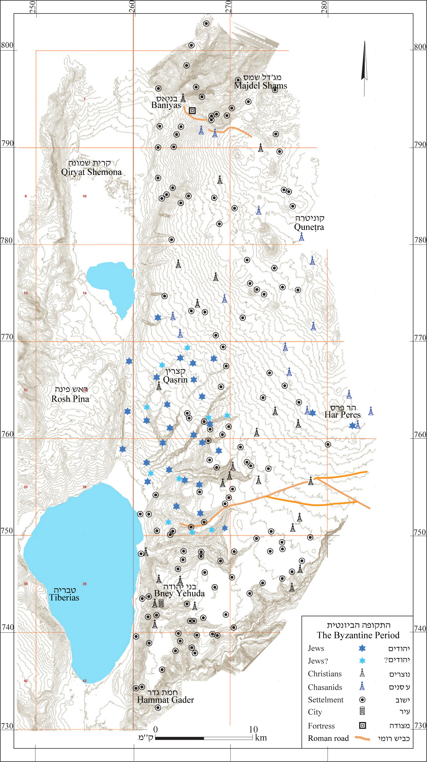
4.15 The Early Islamic Period
4.15.1. The number of settlements declined precipitously during this period (see map 16). Most of the sites of this period were concentrated in the southern Golan – 18 during the Umayyad period and only 8 during the Abbasid period (see map 16).
The population of Sussita (‘Ein Gev Survey, site no. 81) was mainly Christian and the city had many churches. Its status seems to have declined and it was mentioned only once in Islamic sources, by the name Susya. The aqueducts to the city apparently went out of use during this time and their stone segments were used to connect the Berenike aqueduct to Beit Yerah (Yardena Alexandre, pers. comm.). Without aqueducts a city could not exist at that site, and it may have been abandoned even before the 749 earthquake. The latter wrought major destruction in the city, which was not re-inhabited.
In the Naḥal Samak estuary, at Kursi, the monastery continued to exist (‘Ein Gev Survey, site no. 14). It, too, was destroyed in the 749 earthquake. Islamic sources mention a monastery at the foot of Aqabat Fiq (see below, 9.7.8) but so far, no remains have been found.
4.15.2. Afiq (‘Ein Gev Survey,site no. 95) now supplanted Susita in importance, becoming the main settlement in the southern Golan in the Umayyad and Abbasid periods. Ma‘oz proposed that a lintel decorated with a circumscribed menorah attests to the presence of a synagogue at the site in the Umayyad period. Numerous tombstones with Arabic Kufik inscriptions were found at Afiq. These inscriptions are dated to the Umayyad and Abbasid periods. Similar tombstones were also found at neighboring Bney Yehuda (‘Ein Gev Survey, site no. 61).
4.15.3 Afiq is situated on the edge of the main road between the Hauran and Akko, the road known as Darb el-Haurana, which was built by ‘Abd el-Malik. Two milestones, placed near the site, were found in secondary use in houses in the village of Fiq. The road replaced the Roman road, which had been built in the second century CE and apparently served until the end of the Byzantine period. The road ran along the southern plateau and included an ascent built at its southern end known as ‘Aqabat Fiq.
4.15.4 At Ḥammat Gader, the great bathhouse continued to operate. Near ‘Ein el-Jarab (the spring that is now used for bathing) paved squares were built along with a building with a mosaic floor, apparently for the use of bathers in the hot springs. The great bathhouse was destroyed in the earthquake of 749; however, the installations near ‘Ein el-Jarab, albeit not as grand, were expanded and took its place.
4.15.5 During the Early Islamic period, Tiberias was the capital of Jund Urdun and at this time flourished and reached its zenith. Considering that the southern and central Golan were close to Tiberias, it might have been expected that the city's prosperity would have had a positive impact on these regions. In the southern Golan a good many sites were indeed found, although fewer than during the Byzantine period; however, findings at these sites were very meager.
4.15.6 The decline in the number of settlements in the central Golan was much more marked and remains from this time were found at 10 sites from the Umayyad period and five from the Abbasid period. Most were Jewish sites that apparently had continued in existence from the previous period.
In the excavations at Umm el-Qanaṭir (Ma‘ale Gamla Survey, site no. 103) and Qaṣrin (Qaṣrin Survey, site no 41) evidence was found of the use of the synagogue during the Umayyad period. At Deir ‘Aziz (Ma‘ale Gamla Survey, site no. 77) remains of a synagogue and were found as well as findings from the Abbasid period.
Surveys revealed sherds from the Umayyad period at Ḥorvat Ḥoḥ (Ma‘ale Gamla, site no. 51). At Ahmadiyye (Qaṣrin Survey, site no. 30) and at Ḥorvat Kanaf (but not at the synagogue excavations) (Ma‘ale Gamla Survey, site no. 67) sherds were found from the Umayyad and the Abbasid periods. At el-Bir (Ma‘ale Gamla Survey, site no. 15), ‘Asâliyye and Yahûdiyye (Qaṣrin Survey, site nos. 75 and 116 respectively) sherds were found from the Abbasid period.
In the eastern part of the central Golan, which was not settled by Jews, no sites were found from this period.
4.15.7 This was also the situation in the northern Golan. Settlement in this area, which declined at the end of the Byzantine period, may have been mainly taken over by nomadic tribes at this time. Thus it seems that the decline in settlement was not the result of the Islamic conquest.
At the foot of Mount Hermon, three sites were found from this period. At Baniyas, which greatly declined during the Byzantine period, a few sherds were found from the Umayyad period. The city revived during the Abbasid period and continued to exist in the period that followed. Three more sites were found near the road from the Bnot Ya‘akov bridge to Quneṭra.
4.16 The Crusader and Ayyubid Periods
4.16.1. Generally speaking, the surveys did not reveal remains of the Crusader period in the Golan (see map 17), and thus it seems that there were no permanent settlements in the region at that time. This finding conforms to the historical sources that describe the Golan as a buffer zone between the Muslims and the Crusaders. Nevertheless, a more detailed study of the medieval ceramics, which was usually identified in the survey as Mamluk, might possibly reveal smaller sites in the area that were not found in the survey.
4.16.2 The only settlement in the area from this time is Baniyas, at the northwestern end of the Golan. Settlement there was renewed in the Abbasid period and in the Fatimid period Baniyas protected the road that passed from the northern Land of Israel to Damascus. The city was surrounded by walls and towers and contained a fortress. Throughout most of this time Baniyas remained under Islamic control, except for two brief periods when it was transferred to the Crusaders (see below, 9.8).
In the 13th century the Nimrod Fortress was built opposite Baniyas. As opposed to what was commonly thought until fairly recently, the fortress was not built by the Crusaders, but rather by the Ayyubids, to protect Damascus from the Crusaders (see below 9.9).
During that period Khan el-‘Aqaba was built at the top of ‘Aqabat Fiq, on the ascent built ‘Abd el-Malik.
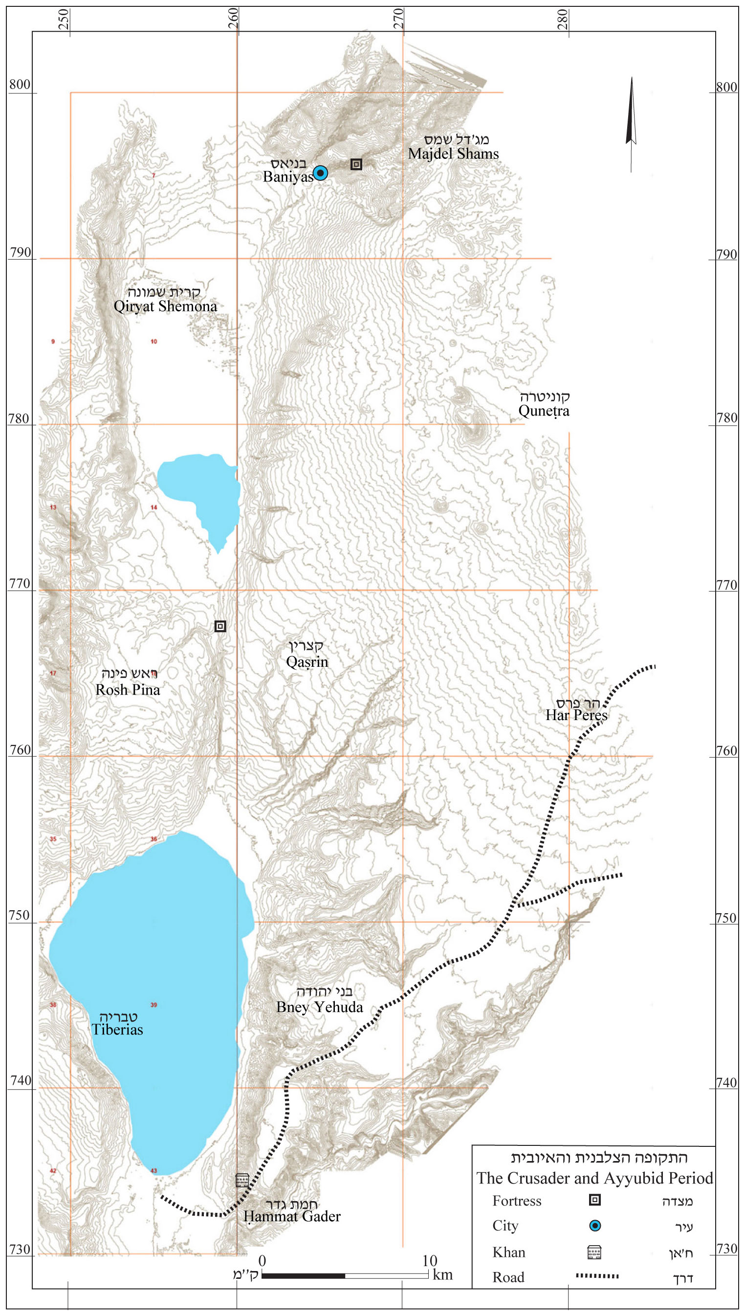
4.17 The Mamluk Period
After a long gap, permanent settlement was renewed during the Mamluk period. One hundred and ninety one sites from this period were found in the Golan, 64 of them in the northern Golan, 89 in the center and 38 in the southern Golan (see map 18).
4.17.1 The administrative center of the Golan in the Mamluk period was in the north – the city of Baniyas and the Nimrod Fortress. The fortifications at both of these sites were strengthened and new buildings were built. Sultan Baibars granted the Nimrod Fortress as a private estate to Bilik, his personal mamluk and ally (see below 9.10.3), and the entire Golan may have belonged to Bilik.
4.17.2 The Mamluk conquest brought with it a period of stable government, after which the Golan underwent a period of abrupt change. After a long period without permanent settlements or with only meager habitations, dozens of new settlements were built. Remains from the Mamluk period were found all over the Golan, most of which were villages and farms. Sherds from the Mamluk period were also found in cattle pens in the central and northern Golan, apparently showing that they were in use at that time.
4.17.3 Most of the Mamluk settlements were built over the ruins of ancient sites and the new inhabitants made secondary use of the stones. The houses that were built Hauran style during the Roman and Byzantine period were relatively well preserved, their stone roofs protecting them from collapse. It seems that the Mamluks found structures with relatively high remaining walls and they renovated them to a form similar to the original, using elements they found among the ruins.
4.17.4. Some of the sites from the Mamluk period are distinctive in their thick accumulation of tell soil. This is a phenomenon that is unknown either before or after this period. At eṣ-Ṣalabe (Ma‘ale Gamla Survey, site no. 11) remains were found of a mudbrick house whose remains had disintegrated into what is known as “tell soil.” It is therefore possible that such soil is the result of the disintegration of mudbrick structures.
Due to the wide availability of basalt in the Golan, throughout most periods the houses were usually built of such stone. The only exception is the Beteiḥa Valley, where villages from the modern period were also built of mudbrick. If mudbrick houses are not properly maintained they cannot survive the weather in the Golan. This seems to have been the case with such structures in the Mamluk period. It may be assumed that the inhabitants of the Mamluk sites brought with them a tradition of construction in mudbrick and that when these buildings were destroyed the tell soil accumulated. In many cases the accumulated soil covered early remains at the site, which were found only at the edges of sites or in military trenches built by the Syrians.
4.17.5 In addition to the fortified city of Baniyas and the Nimrod Fortress, other fortified sites were found. Near Nebi Ḥazuri (Dan Survey) an encampment was found surrounded by walls (Dar 1994:269–284). Gutman, who first discovered it, noticed that it was located on a back slope that could not be seen from the Nimrod Fortress, but it did have a view of the fortress and it also controlled the road to it. These characteristics led Gutman to dub the site "the siege camp." It is unclear whether the camp was indeed built to besiege the Nimrod Fortress and there is no such allusion in the historical sources. Gutman also reported the remains of fortifications at Khirbet Ḥawarit (Dan Survey), which controls Naḥal Sa‘ar and ‘Ein Quniyye. These remains have been destroyed and can no longer be seen. It seems that these two sites were part of a line of fortifications to which a small tower found between them also belongs. The fortification line probably protected the road from the Land of Israel to Damascus. However, the historical sources do not mention this line and therefore it is unclear who built it and why.
At Ghadir en-Naḥas (Qaṣrin Survey, site no. 34) – a site built above the Iris Waterfall, a hill was found surrounded by streams on three sides and protected by walls built of fieldstones and roughly hewn stones. The site apparently served as an encampment for a police unit and was not intended to protect the kingdom from outside invaders.
4.17.6 During the Mamluk period, a network of mail roads was developed, along which caravansaries and rest stops were built. In the southern Golan, Darb el-Haurana, which was built by ‘Abd el-Malik during the Umayyad period (see above, 4.15.3) continued in use. Also continuing in use were a caravansary built at Ḥanot Orḥa (Khan el-Jūkhadār; Rujem el-Hiri Survey, site no. 19) near the eastern border of the Golan, Khān el-‘Aqabeh (Ḥammat Gader Survey, site no. 70) at the top of ‘Aqabat Fiq – the ascent in which the road to the Jordan Valley was located.
A new road was built during this time, from Damascus to Tzfat via Quneṭra. The road crossed the Jordan River over a bridge, built for the first time during this period and known as the Benot Ya‘aqov Bridge (Rosh Pina Survey, site no. 109). Khân Benât Ya‘kûb (Rosh Pina Survey, site no. 112) was built.
4.17.7 Settlement did not flourish for long in the Mamluk period. At the end of that time, all the permanent settlements in the region were abandoned and it returned to Bedouin control. Absent excavations, the end of settlement cannot be determined, but it was probably brought on by a weakening of the central government that led to the undermined of security.
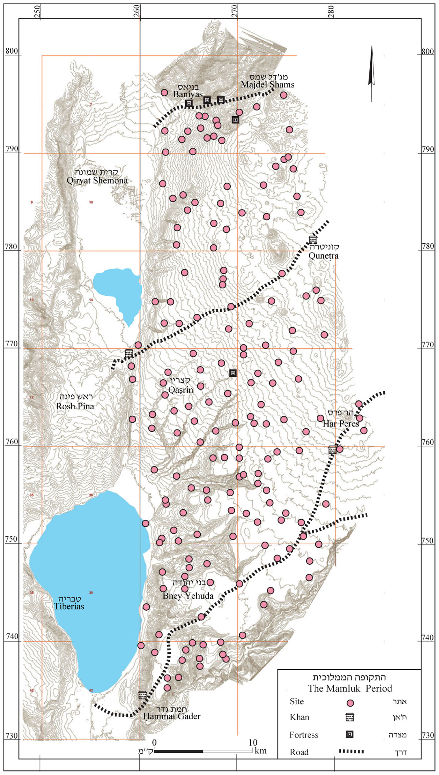
4.18 The Ottoman Period
Findings from the Ottoman period are very meager. Most of the sherds identified by surveys as Ottoman are from the end of that period. Settlement distribution in this period can be reconstructed based on written sources, which we will discuss in the chapter on history (see below 9.11 and maps 19 and 20).
In the southern Golan were apparently farming settlements whereas central and northern Golan were inhabited by tribes of Bedouins and Turkmen (nomads of Turkish origin). The latter established small temporary villages, which Schumacher called "winter villages." These villages were usually built over ruins whose stones the Bedouin utilized to build structures used to store feed and grain as well as for protection against the severe winter storms. The Bedouin usually preferred to live in tents and if they moved some distance from these villages they would abandon them and build others instead. Indeed, Schumacher reported quite a few destroyed winter villages.
Druze settled at the foot of Mount Hermon, at Majdal Shams and ‘Ein Quniyye. The Druze village of Buq‘ata was founded only in the 19th century.
The second half of the 19th century saw the beginning of Bedouin and Turkmen settlement. In the 1880s the Turks brought the Circassians to settle in the Quneṭra Valley and along the Bashanit Ridge. The Circassians established villages that were better built than what had been the norm for the Golan. The Circassians, who were experienced fighters, suppressed the Bedouin and brought security to the area. This led to the strengthening of settlement, which continued into the 20th century.
5. The Dolmens
Dolmens are ancient elements that are very common in the Golan. Their main area of distribution is in the central Golan, between Nov in the south and Naḥal Gilbon in the north, and between the Beteiḥa (Bethsaida) Valley in the west to the Bashanit Ridge (see map 19) in the east. There are thousands of dolmens in this area, clustered in groups and extending across rocky ridges. Dolmens are situated near rocks suitable for their construction and do not seem to be associated with settlement sites or water sources. A small number of dolmens are also found east and north of this area.
The dolmens are megalithic structures that served for burial. The entire construction was done out of field stones. They consist of a burial chamber built of large stones and roofed with large slabs that weigh a few tons each. Many dolmens are surrounded by one or more low walls and covered with a heap of rocks.
.
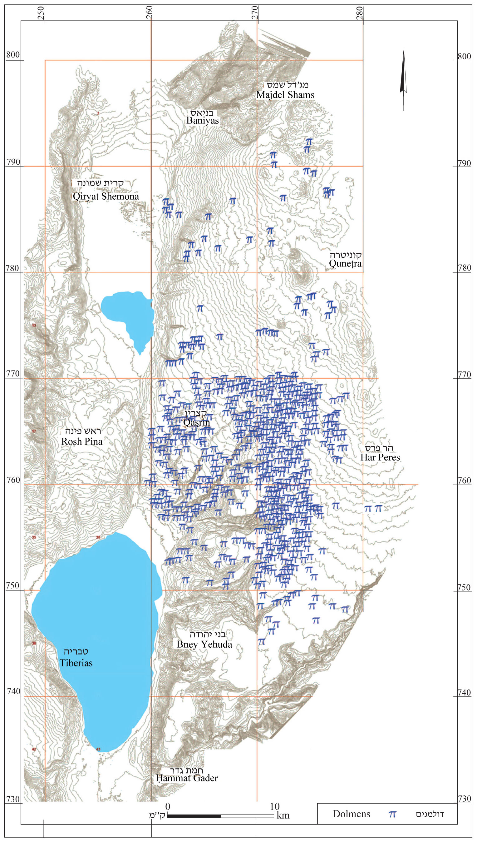
map 19.
The dolmans of the Golan are divided by Epstien into six types (Epstein 1985):
1. Trilithon – this is the smallest dolmen (see Fig. 1). It has two subtypes:
A. A structure built on the surface consisting of two upright slabs roofed with a large stone. The burial chamber is open on both sides. Sometimes the floor is paved with rough stone. The chamber is about 2 m long and 1 m wide. The burial chamber is low, usually about 1 m high (see Fig. 2). The chamber has the form of a table, hence the name dolmen, which in Breton means “stone table.” The burial chamber is not covered with a stone heap
.jpg)
B. Similar to type 1A, but the uprights are longer and are not roofed. The burial chamber is often surrounded by a heap of stones or a stone fence (see Fig. 3).
The trilithons are common between Gamla and Barak Hill as well as at Bab el-Hawa, north of Naḥal Gamla.
.jpg)
.jpg)
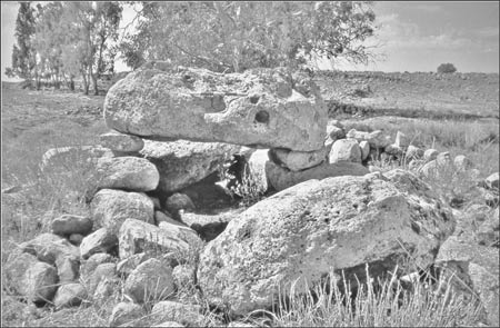
3. Rectangular burial chamber, built partly below ground. Each longitudinal wall is built of one or two stone slabs and a similar slab closes one of the narrow sides. The entrance, on the other narrow slide is narrowed by two doorpost stones, set at right angles to the longitudinal walls, and narrowing the passage. A large roofing stone is set on and supported by a protruding intermediate course and is set atop a similar roofing stone over the entrance. The burial chamber is surrounded by a low stone heap built of two concentric walls – one internal and one external – with a fill of stones between them (see Figs. 16–20). Dolmens of this type are not common; a few were found near Rasem el-Kabesh and at Height Spot 488 m, near Rasem Kharbush.
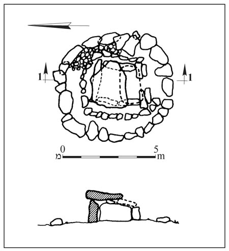
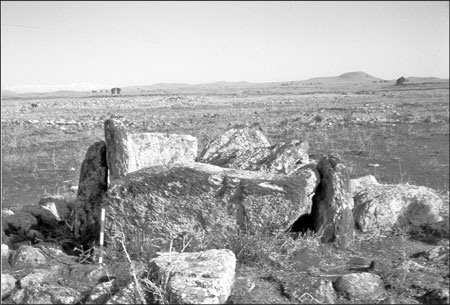
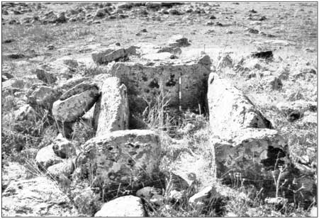
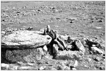
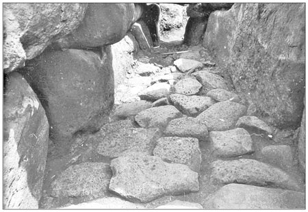
4. Almost rectangular burial chamber. Longitudinal walls and roof as in type 2 but each of the narrow ends is enclosed with an upright stone slab. The corners of the burial chamber are rounded and the chamber is surrounded by a stone heap. The corridor opens toward one of the longitudinal walls near the northeastern corner (see Figs. 21–30). Dolmens of this type were found at Deir Saras and the Yahûdiyye Forest.
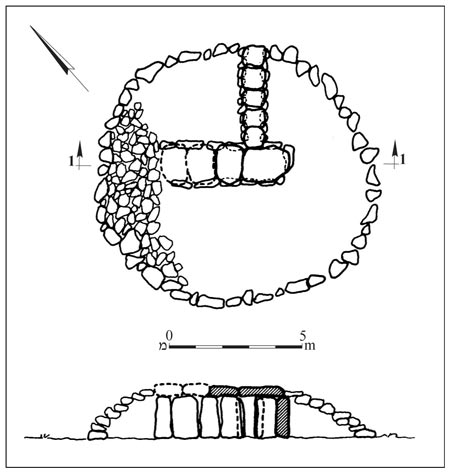
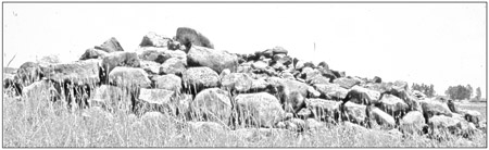
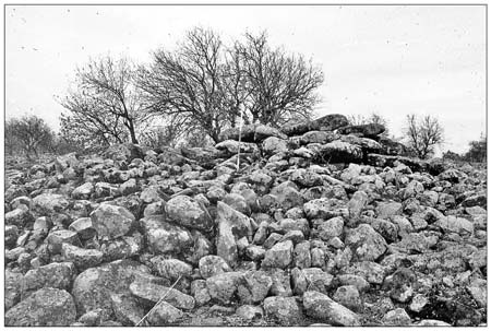
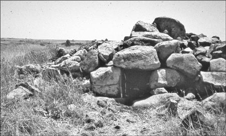
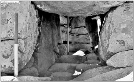
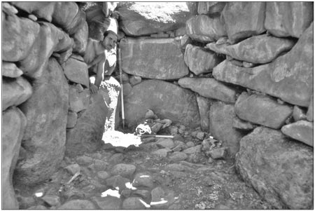
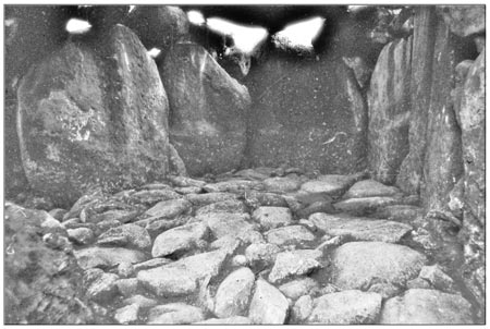
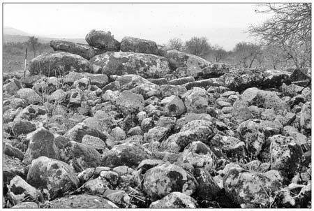
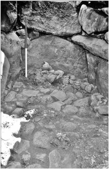
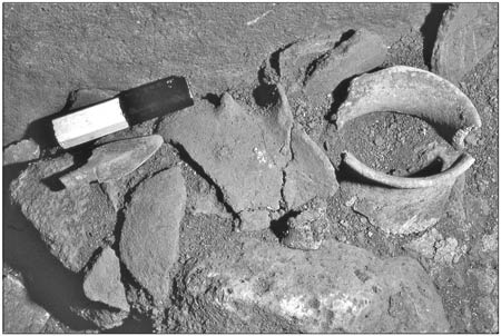
5. Rectangular to oval burial chamber, broad in the center, built partly below ground (see Fig. 31). There are two subtypes:
A. Oval burial chamber closed on one side by an obsidial wall built of three to five courses of medium-sized stones. The longitudinal wall is built in a similar manner, with each course protruding slightly inward relative to the one below it. The chamber is roofed by a single stone slab set above a small stone above the trance. The entrance is blocked by a stone heap (see Figs. 32, 33).
B. Burial chamber whose longitudinal walls are built of two or three upright stone slabs and one of the narrow sides is enclosed with a similar slab. The entrance to the chamber, on the other narrow side, is low and supported by two doorposts on the interior. The cell is roofed with three or four medium-size roofing stones set alongside each other. The roof stone above the entrance is much lower. The burial chamber is covered with a steep, well-built stone heap (see Figs. 34, 35).
Dolmens of this type were found in the Yahûdiyye Forest and at el-‘Arba‘in.
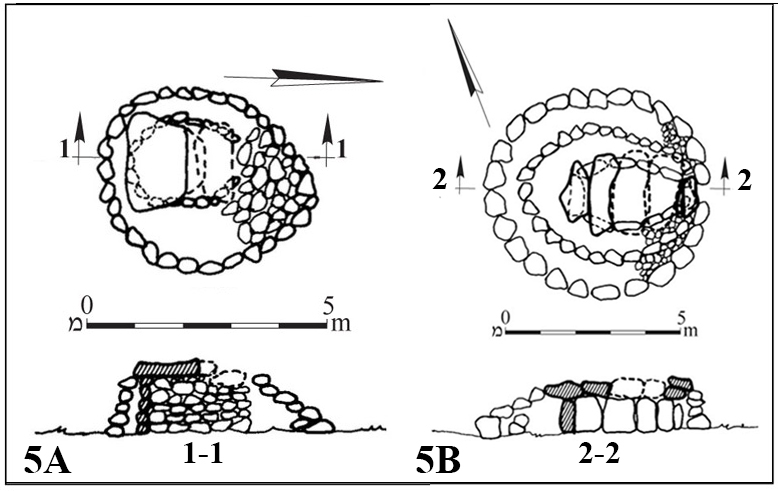
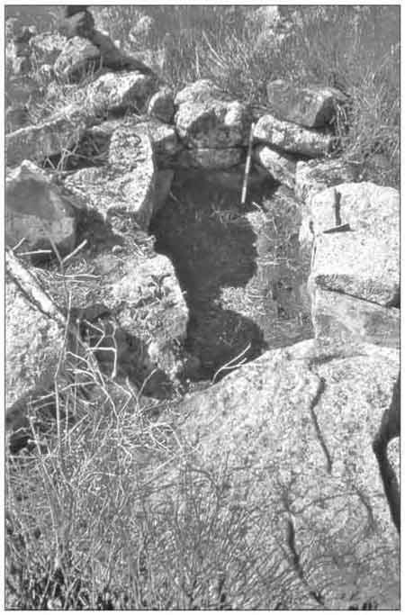
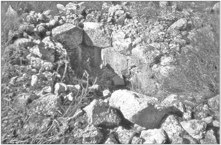
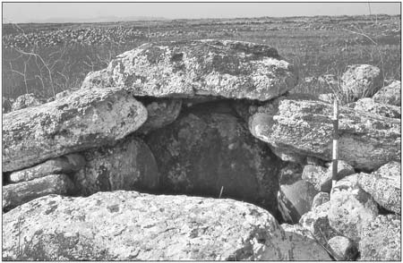
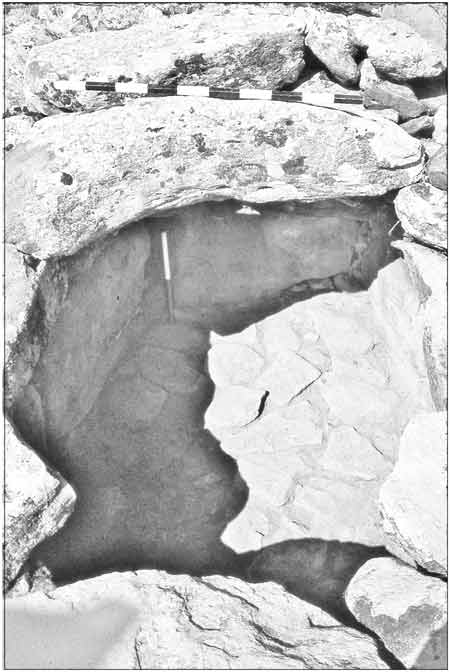
6. This type of dolmen is the largest in the Golan. It consists an almost rectangular burial chamber, broader in the center; four to six uprignt stone slabs in each longitudinal wall, above which are additional protruding courses. Inside, an upright stone slab closes one of the ends. Three to five horizontal roofing stones set one atop the other and rising as stepped courses from the two narrow sides to the center of the chamber. At the top of the stepped courses is a keystone. Above the entrance and above the enclosed side, the lowest of the roof stones are placed directly on the stones of the walls. Some use of plaster was observed in the joints (see Figs. 36–44). Dolmens of this type are found only on the spur between Naḥal Batra and Naḥal Yahûdiyya. When they were first discovered, by Epstein's survey team, they looked to the team like Syrian tanks, and so they were dubbed "tank dolmens."
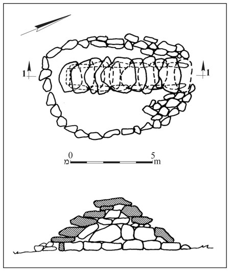
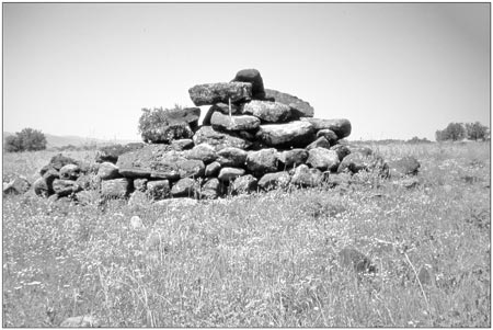
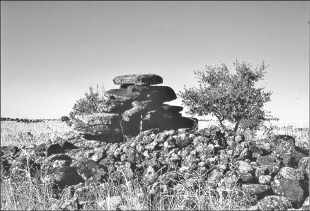
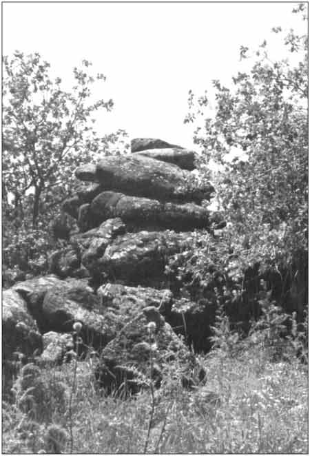
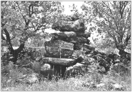
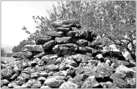
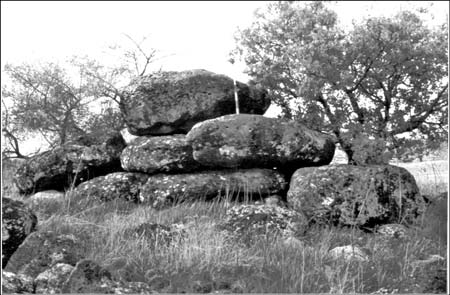
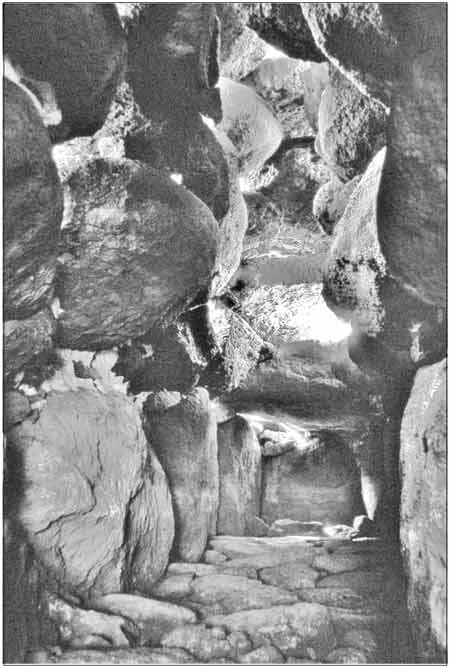

7. These dolmens are similar to type 2 except for the addition of a narrow corridor leading to the burial chamber. The length of the corridor varies to a maximum of the length of the burial chamber itself. The general form of the chamber is bottle- or pear-shaped. The burial chamber is bounded by two concentric walls, the interior of which abuts the entrance to the corridor (see Figs. 45, 46). Dolmens of type 7 are common in the central Golan. One of them, which was found near Rujem el-Hiri, was recently excavated by Michael Freikman, who identified it as type 7.
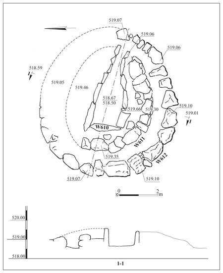
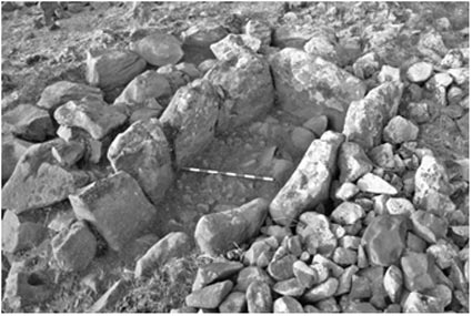
Dolmens were built in various places under various conditions, first and foremost the presence of suitable building stones. The dolmens in the Golan are built mainly of basalt, as are those extending across the Korazim Plateau west of the Jordan River. The preference was for Dalawa basalt, which erodes into large blocks of stone that are suitable for building the dolmens. However, dolmens have also been found made of Cover basalt, Muweisse and ‘Ein Zivan basalt. In places where the stone blocks were not large enough, the walls of the burial chambers were built of medium-size stones that were set in a number of courses.
Contrary to the common impression that dolmens were always built of basalt, in the northern Golan, east of Shamir, dolmens were found that were made of limestone; one of these featured two adjacent burial chambers (see Fig. 47). The builders in these cases apparently preferred limestone although the dolmens are located in areas were suitable basalt was present. Limestone dolmens are also found in the eastern Upper Galilee. Thousands of dolmens were found in Transjordan, most of them built of limestone or sandstone. Only in northern Jordan, in the area known as the Black Desert (which is at the southern end of the Hauran basalt) were basalt dolmens found.
Most of the dolmens were built on slopes, which made it easier to set the roofing stones in place by lowering them down the slope, and obviated the need to lift the stone above the walls. Most dolmens are partly dug into the ground, which had two advantages: a) greater stability to the walls so they did not collapse when roofing stone was set over them: b) Greater ease in installing the roofing stone; the stone heap that surrounded the chamber also made this work easier.
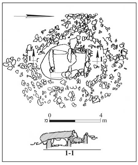
5.1 Dating the Dolmens
Dolmens are not unique to the Golan and Transjordan. They are common in many countries, from France and Britain to Japan, and were apparently used over thousands of years. Dolmens seem to have developed spontaneously in different places and periods, and direct influence from one country to another has not been observed.
Dolmens, which stand exposed on the surface, were mostly robbed in antiquity and contain no finds. Without datable finds various, dates have been proposed ranging from the prehistoric and pre-ceramic periods to the Intermediate Bronze Age (for the various dating proposals see Hartal 1987:56–57; Vinitzky 1992:101).
Stekelis was the first to be able to date the dolmens of the Land of Israel based on finds found within them – in the case of sandstone dolmens east of the Damya Bridge, where tools from the Early Bronze Age I were found (Stekelis 1965).
Epstein excavated 34 dolmens found at nine sites in the Golan: the Yahûdiyye Forest, Wadi Batra, Deir Saras, Giv‘at Bazak, Kipat Nesharim, Zenobar, Rasm Khrbush, Qaṣrin and Rasm el-Kabesh (Epstein 1985). At Rasm Khrbush a dolmen was excavated that was built over the ruins of a Chalcolithic dwelling and use was made of one wall of the house as one of the walls of the dolmen (see Fig. 7). The survey revealed a few more dolmens that were built over the remains of Chalcolithic dwellings at other sites. This finding shows that dolmens post-date the Chalcolithic period.
The dolmens' floors were paved with medium-size fieldstones that were laid over a foundation of earth and stones above bedrock. The deceased were laid on this flooring together with burial offerings, remains of which were found scattered as a result of natural and human disturbances. Earth and stone debris had accumulated above the floor to a height of about 0.50 m. The main finds on the floor were from the Intermediate Bronze Age (see Fig. 48:1–5). In addition to clay vessels common metal items were found – (see Fig. 48:6), pins and copper rings. Flint tools were also found, both in the debris and on the floor. Near Kipat Nesharim (Qub‘at Qar‘a) Epstein excavated two dolmens in which tools were found both from the Middle Bronze Age IIA and IIB (see Figs. 48:9–12) and from the Late Bronze Age. Weapons from the Late Bronze Age were found by Moti Aviam in a nearby dolmen (see Fig. 48:13).
The earliest find in a dolmen is dated to the Intermediate Bronze Age and therefore Epstein proposed that the dolmens were built in this period and that a number of them continued in use in later periods. Survey finds at two dolmens that had been cut through were dated to the Intermediate Bronze Age (see Fig. 48: 7, 8). A similar date was proposed by Dan Bahat (1973), who excavated a number of dolmens at Shamir. This period is typified by major investment in tomb construction, mostly single tombs, and in wide variation in types of tombs. The dolmens therefore mesh well with the general picture of the period.
In the survey of the northern Golan, dolmen fields were observed that were somewhat organized. In the center of the field were large dolmens, around which smaller dolmens were arranged. Sherds were found from the Late Bronze Age in two of the larger dolmens (Hartal 1989:119–121).
At Avital Junction, a relatively large dolmen was found whose burial chamber was built of medium-size stones arranged in a number of sources. Each of the courses protrudes slightly inward relative to the one below it, creating a false arch. The burial chamber is roofed with a large stone slab and surrounded by a stone heap which is bounded with one to three well-built perimeter walls. A number of dolmens of this type were found between Avital Junction in the north (see Fig. 49) and Rujem el-Hiri in the south. The burial chamber at Rujem el-Hiri also belongs to this type.
On the stone heap of the dolmen at Avital Junction sherds were found resembling tools from the Late Bronze Age found in Epstein’s excavations of the dolmens at Kipat Nesharim (see above). The burial chamber at Rujem el-Hiri was robbed in antiquity, but jewelry from the Late Bronze Age was found in the corridor leading to the chamber. Sherds from the Late Bronze Age were also found in a dolmen in the Mas‘adeh Forest. There is therefore no doubt that dolmens continued in use in the Late Bronze Age. However, without excavation it cannot be determined whether they were all in secondary use (as at Kipat Nesharim) or whether some were built at this time.
The survey made clear that that there were hardly any permanent settlements in the Late Bronze Age and the area was under the control of nomads or semi-nomands. It is possible that these are the people who used the dolmens for burial (see above, 4.5).
Vinitzky (1992) who studied the dating of dolmens in the Galilee and the Golan, posited that dolmens were built by sedentary inhabitants near their habitations. He found an overlap between the distribution of sites from the Early Bronze Age II and III and the distribution of dolmens and therefore proposed dating the dolmens to this period. In support of his theory, he cited the dolmens excavated by Stekelis (see above) near the Damya Bridge that were built during the Early Bronze Age I. In addition, in the area of the dolmens distribution no sites were found from the Intermediate Bronze Age, whereas in the southern Golan, where sites were found from that period, burial was in shaft tombs.
Vinitzky's dating, which has been generally accepted by scholars, seems to have been based on meager data. The basic assumption of Vinitzky's dating is, as noted, that the dolmens were built by sedentary inhabitants of nearby settlements. However, the dolmens are scattered over a wide area, which would have required transporting the deceased over long distances. It is more reasonable that a cemetery that belonged to a settlement would have been as close as possible to it and built densely, for convenience in burial. A good example of this is the cemetery from the Early Bronze Age I found at the foot of Mitḥam Leviah. Dolmen-like cist tombs were found in that cemetery; however, they are much smaller and close to one another.
Scattered cemeteries are suitable for nomads, who in any case do not permanently inhabit an area. If indeed the dolmens were built by nomads, there is no significance to their proximity to sites unless it can be proven that their dating is the same as that of the sites.
With regard to Vinitzky's theory regarding the dating of the dolmens – the earliest finding in dolmens excavated by Epstein is from the Intermediate Bronze Age. Sherds were also found from the Intermediate Bronze Age in dolmens used for secondary burial in later periods. In contrast, sherds from the Early Bronze Age were not found in the dolmens. The social character of the burial – mass burial in the Early Bronze Age – is completely different. There is therefore no reason to date the dolmens to the Early Bronze Age merely because of their proximity to sites from that period.
Settlements from the Early Bronze Age II–III are found throughout the Golan, as are dolmens. However, no link has been found that could connect the two phenomena. It should also be mentioned that a number of sites were discovered in the surveys in which dolmens were found that had been built on the remains of dwellings from the Early Bronze Age.
During the Early Bronze Age I settlement in the central and northern Golan was very sparse (see above, 4.2.1). Apparently most of the population during this period was nomadic or semi-nomadic. It cannot be ruled out that some of the dolmens were built at this time, such as at Damya; however so far no evidence of this has been found.
5.2 Dolmens in Jewish Sources and Popular Tradition
Dolmens are not mentioned specifically in the Bible, but it is possible that the stories of tribes of giants, and of Og, king of the Bashan, have their origin in the impression the large dolmens made on the Israelites. The Israelites almost certainly knew of the dolmens, since they were already very ancient by their time, but they did not know their origin. It is only natural that they would attribute them to giants, because the dolmens are built of gigantic stones, which it appeared an ordinary person could not have lifted.
The dolmens are mentioned in the Mishnah and the Talmud. In a discussion of idol worship, the worship of Merculius, apparently Mercury, is mentioned: "And thus are the stones of a Mercules way-mark arranged: one at each side, and a third on top of both" (Babylonian Talmud ‘Avodah Zara 50a; Baba Metzia 25b). This is a precise description of a trilithon. The cultic activity was not making offerings, but throwing stones at the Marculius stones: "He that throws a stone at a Merkolis…that is how it is worshipped “ (Mishnah Sanhedrin 7, 6). What we have here therefore is a cult focusing on a dolmen surrounded by a heap of stones.
According to the Talmud, the cult of Merculius was common until the time of the Hasmonean King Jannaeus (Babylonian Talmud, ‘Avoda Zara 50a). The cessation of the cult of Merculius may be connected to the conquest of by Jannaeus of Transjordan and the Golan, and the pushing out of pagans from those regions (see below 9.3.4). Even after most of this area reverted to pagan hands with the conquest of the land by Pompey (see below, 9.4.1) this cult was apparently not renewed. That is also the period in which the dolmens apparently began to be destroyed and the stones were used to pave "roads and streets" (‘Avoda Zara, ibid). We glean this from the talmudic discussion of whether Israelites could also use the stones of a Merculius house, i.e., a dolmen.
The Arabs have two traditions about the source of the dolmens. In the Golan and northern Transjordan they are called kubur bani israil, that is, the tombs of the ancient Israelites. In contrast, in southern Transjordan, in Ammon and Moab, they are called beit el-ghol, with the belief that they served as demons' dwellings.
6. Pottery of the Roman and Byzantine Periods
Pottery that was in use in the Hellenistic, Roman and Byzantine periods was numerous and varied. Much of it was found throughout the survey areas, but four families of vessels have significance in reconstructing the history of the Golan (Hartal 2006: 263–273).
6.1 Golan Ware
The most prominent pottery in assemblages in the northern Golan, from the Hellenistic period to the end of the Byzantine period, are large pithoi. They typically have a relatively narrow opening; low neck, sack-shaped body and are handmade; two large loop handles and a pointed base. Their fabric is rough with many inclusions and well-fired. The Golan pithoi are common in the northern and eastern Golan as far as Har Peres. But they are quite rare in the central and southern Golan.
6.2 Kefar Ḥananya Ware
Numerous high-quality vessels were made at Kefar Ḥananya. The most common are cooking vessels – pots and bowls. Manufacture of Kefar Ḥananya vessels began in the first century BCE and continued until the second half of the fifth century CE. The same type of ware was also found in the Golan and the surveys revealed evidence of a number of manufacturing centers (Adan-Bayewitz 1993, 2003).
Kefar Ḥananya ware constitutes a major component in the findings of surveys and excavations of sites in the Galilee, the central and southern Golan; they constitute one third of the entire finding. In the northern Golan they are rarer. Many vessels of the early type of Kefar Ḥananya ware are found at many sites in the northern Golan, albeit in relatively small numbers. However, vessels of types whose manufacture began in the second century CE were almost absent in the northern Golan.
6.3 Baniyas Ware
A pottery manufacturing center was found at Baniyas. The vessels were made of local clay, soft to semi-hard, light red to yellowish-red with small inclusions. From this material, mainly bowls of various sizes and lamps were made, and, in smaller quantities, cooking pots, jugs, basins and jars. Baniyas vessels were found in large quantities in excavations at Baniyas itself and in smaller quantities on Mount Hermon, the northern Golan and the northern Hula Valley, the region in which Baniyas was the center of settlement.
Baniyas ware appear for the first time, according to the excavations at the site of the city, in the mid-second century BCE, when the city was at its zenith. Their manufacture grew during the flourishing of the temples – in the third and fourth centuries CE. The workshops produced vessels mainly for use in the local temples – especially small bowls, which were found in large quantities in the temple and are almost entirely absent in the findings elsewhere. These bows served, according to Andrea Berlin, as open lamps (Berlin 1999). The use of Baniyas vessels ended in the fifth century CE.
6.4 Ḥawarit Ware
Another pottery manufacturing center was at Kirbet el-Ḥawarit at the foot of Mount Hermon above the Druze village of ‘Ein Quniyye north of Naḥal Sa‘ar. At Khirbet el-Ḥawarit cooking vessels – pots, bowls and lids, were manufactured, along with jugs (many with pinched lip), deep, bell-shaped bowls, basins and Golan pithoi. Most of the vessels were complementary to the production at Baniyas. Some of them, particularly the bell-shaped bowls, were apparently manufactured especially for use in the temple and were virtually absent from other sites. Production of Ḥawarit ware began in the early third century CE and continued into the mid-fifth century CE (Hartal, Hudson and Berlin 2008).
6.5 Conclusion
The study of pottery from the sites of the northern Golan during the Hellenistic, Roman and Byzantine periods shows that throughout most of this time the vessels used in the northern Golan were very different than those common in the central Golan and the Jewish Galilee. The Golan pithoi, which were common in the northern Golan from the mid-second century BCE, were almost absent from sites in the central Golan. Other vessels, which were manufactured during the Hellenistic period from Golan clay, did not reach the central Golan.
In the first century BCE and the first century CE, Kefar Ḥananya ware was common in the central Golan and constitutes a major component of the assemblage in the region. Such vessels were also found in the northern Golan, but in much smaller numbers. In the mid-second century CE use ceased entirely of Kefar Ḥananya vessels in the northern Golan. During that time manufacture began of Baniyas vessels. It was at that time that vessels began to be manufactured at Baniyas and shortly thereafter, at Kh. el-Ḥawarit.
In both manufacturing centers, and especially at Khirbet el-Ḥawarit, cooking vessels were produced that took the place of the Kefar Ḥananya vessels. These vessels were hardly used in the central Golan, were the use of Kefar Ḥananya vessels continued. Only for a short time, in the fourth century CE, were vessels imported from the northern Golan to Jewish settlements such as Qaṣrin and Dabyyeh.
In light of this information it may be stated with certainty that the material culture of the northern Golan differed from that of the central Golan and that there was almost no economic connection between these two neighboring regions, at least as far as pottery was concerned.
What was the reason for this disconnect? The Golan pithoi, which were large, coarse storage vessels, were, naturally, in local use and their commercial range was limited. Apparently these vessels were manufactured by the Itureans and were in use during the Hellenistic and Roman periods. It seems, therefore, that the main factor in the distribution of Golan ware was ethnic, although a few of these vessels were also found at sites in the central Golan.
The explanation for the distribution of the three other families of vessels is more complex. In the first century BCE, Kefar Ḥananya vessels were common in the central Golan; they were the most important component in the pottery assemblages in the region.
In the first century CE the Golan Heights was part of a single political unit under the control of the Herodian rulers. Kefar Ḥananya vessels were common during this time both in the central Golan, were they were found in larger quantities because of their proximity to the source of production, and in the northern Golan. In the beginning of the second century control of the region was split between two provinces. The central Golan was annexed, beginning at this time to Provincia Palaestina, while the northern Golan became a part of Syria and later to Provincia Phoenicia.
Shortly after the administrative division took place, workshops were established at Baniyas and Khirbet el-Ḥawarit, and their products began to be marketed in the northern Golan. Baniyas and Ḥawarit ware were distributed in Phoenicia and Kefar Ḥananya vessels in Palestine. Duties may have led to an increase in the price of the imported vessels, and a reduction of commercial feasibility of commerce in vessels manufactured in neighboring province. Because similar vessels of similar quality were manufactured in both production centers, there was no economic logic in importing vessels from outside the province.
The boundary between the sites containing the northern pottery and those with central Golan pottery thus reflects the border between the provinces. This border passed diagonally from south of the Hula Valley to Mount Peres. At ‘Ashshe (Har Peres Survey, site no. 8) east of Mount Peres, where Golan pithoi and Ḥawarit where were found, a boundary stone was also found (see below, 11.3), which indicates that the border of the province of Phoenicia passed there. At neighboring Ḥorvat Boṭma (Har Peres Survey, site no. 2), Kefar Ḥananya vessels were common including those of type 1E – the most common type of cooking bowl in the Kefar Ḥananya assemblage from the third to the fifth centuries CE. Northern vessels were found there in small quantities. It seems therefore that the border did indeed pass between these two sites.
After some 300 years, pottery production at Baniyas and Kh. el-Ḥawarit ceased, apparently in the mid-fifth century CE. At the end of the Byzantine period Ḥawarit ware was replaced by cooking vessels of unknown origin. These vessels were also used at this time in the Upper Galilee. Also appearing in the Galilee alongside the cooking vessels were black pithoi, which continued the tradition of the Golan pithoi. Petrographic examination of these pithoi revealed that they originated in southern Lebanon. It is thus possible that the production centers at Baniyas and Khirbet el-Ḥawarit were replaced by centers in southern Lebanon. Such a production center operates to this day in Rashya el-Fukhar.
7. Agricultural Installations
7.1 Olive-oil Presses
Olive cultivation and olive oil production was the most important branch of agriculture in the Golan during the Roman and Byzantine periods. Remains of olive-oil presses in the Golan have been studied by Ch. Ben David (1998), who documented them at 60 sites. In subsequent surveys remnants of oil presses were found in 20 more sites (see Map 20). However, the increase in numbers of sites where presses are found does not change Ben David's published conclusions, which are summarized below.
The olive-oil press includes devices to crush and press the olives. The crushing device hardly changed over these periods and consists of a crushing basin in the center of which is a socket for a vertical axis to which a stone wheel – the crushing stone – is attached. The crushing stone is moved under human or animal power.
In contrast, the pressing device changed considerably. During the Early Roman period a beam was anchored to a wall. Stone weights were attached to the beam, which pulled it down and exerted pressure on baskets – aqalim – containing the crushed olives.
Three beam-and-weight oil presses were found in the Golan; two at Gamla (Ma‘ale Gamla Survey, site no. 43). They are dated to the first century BCE and the first century CE. The third oil press was found in Naḥal ‘Ein Gev (Giv‘at HaYi‘ur, ‘Ein Gev Survey, site no. 67), dated to the first century CE.
At Naḥal ‘Ein Gev a direct screw press bed was found from the fourth century CE. In this type of device, pressure on the baskets was exerted by means of a large wooden screw, which replaced the beam and weights of the first century. In the excavation at ‘Ein Nashôṭ (Qaṣrin Survey, site no. 15) an oil press was found from the fourth and fifth centuries with a direct screw press bed. Beams and weights were found at a number of sites alongside which were direct screw press beds. The screw press apparently replaced the beam-and-weight device.
Most of the sites were remains of oil presses were found are in the southern Golan and in the western part of the central Golan. A few oil presses were also found in the northern Golan. They are prominently absent in the eastern Golan, including at major sites such as a er-Ramthaniyye and Ḥorvat Parag (Qeshet Survey, site nos. 8 and 85), Ṣurman (Har Shifon Survey) and Quneṭra (Merom Golan Survey).
Significantly, the eastern part of the Golan rises to 600¬–1000 m above sea level, while most of the oil presses are found at sites below 500 m above sea level. However, it should not be concluded from this that olives cannot be cultivated at the higher altitudes, because evidence exists of olive cultivation at heights of 700–1000 m above sea level, and remains of oil presses have been found in the northern Golan and on Mount Hermon. It seems that the main reason for the lack of olive cultivation in the eastern Golan is the type of soil. In that region, most of the soil developed on Muweisse basalt; this soil contains few stones and is suitable for field crops. The main disadvantage of this soil is its poor drainage. Olives, which make do with small plots of land, are very sensitive to water-drenched soil.
Soil type is apparently not the only factor in differing distribution of oil presses. In the Ashmora and Har Shifon surveys are extensive areas covered with Dalawa basalt and yet hardly any oil presses were found in these areas. This is particularly significant in light of findings at Ḥorvat Dvora (Ashmora Survey, site no. 35), in this area, in which eight oil presses were found. In contrast, at nearby Deir Saras and Na‘aran (Ashmora Survey, site nos. 36 and 49), no oil presses were found. The differences between these sites indicate that another factor was at work with regard to olive cultivation. Ḥorvat Dvora was a Jewish settlement, while the other two sites were Christian. Although oil presses are found at Christian sites too, especially in nthe southern Golan, these sites usually feature a single oil press per site, which apparently sufficed for local consumption. Exceptions in this regard are Deir Qeruḥ and Khisfin (Rujem el-Hiri Survey, site nos. 63 and 147), where two oil presses were found at each site; and Mazra‘at Quneṭra (Rujem el-Hiri survey, site no. 84) and Bney Yehuda (‘Ein Gev Survey, site no. 61), with three presses each. In contrast, two oil presses were found in each if 10 Jewish settlements in the Golan; in each of two settlements, three presses were found; and in each of two other settlements, five were found. In one settlement, nine presses were found. Two oil presses were also found in Afiq (‘Ein Gev Survey, site no. 95), which had a mixed Jewish and Christian population.
A third type of press consisted of a beam pulled downward by a screw attached to the end. Such presses were used only on Mount Hermon and at its foot. At Khirbet Ra‘abneh (Birket Ram Survey), which is 920 m above sea level, remains of an oil press were found including a crushing basin and a screw base. Two oil presses with a crushing basin and a beam press and screw were found at Lower Meghar Shab‘a Farm (650 m above sea level) and at Qala‘at Busṭra (786 m above sea level).
At higher sites: Kfar Dura (1000 m above sea level), Bir an-Suba (1350 m above sea level) Har Agas (1350 m above sea level) and Ḥawarta-Migdal Naqar (1400 m above sea level) screw bases were found but no crushing installations. Dar (1994) published these as remains of oil presses; however, the lack of crushing basins casts doubt on their identification as such. It seems that the beam press and screw were used to produce juice from other fruits.
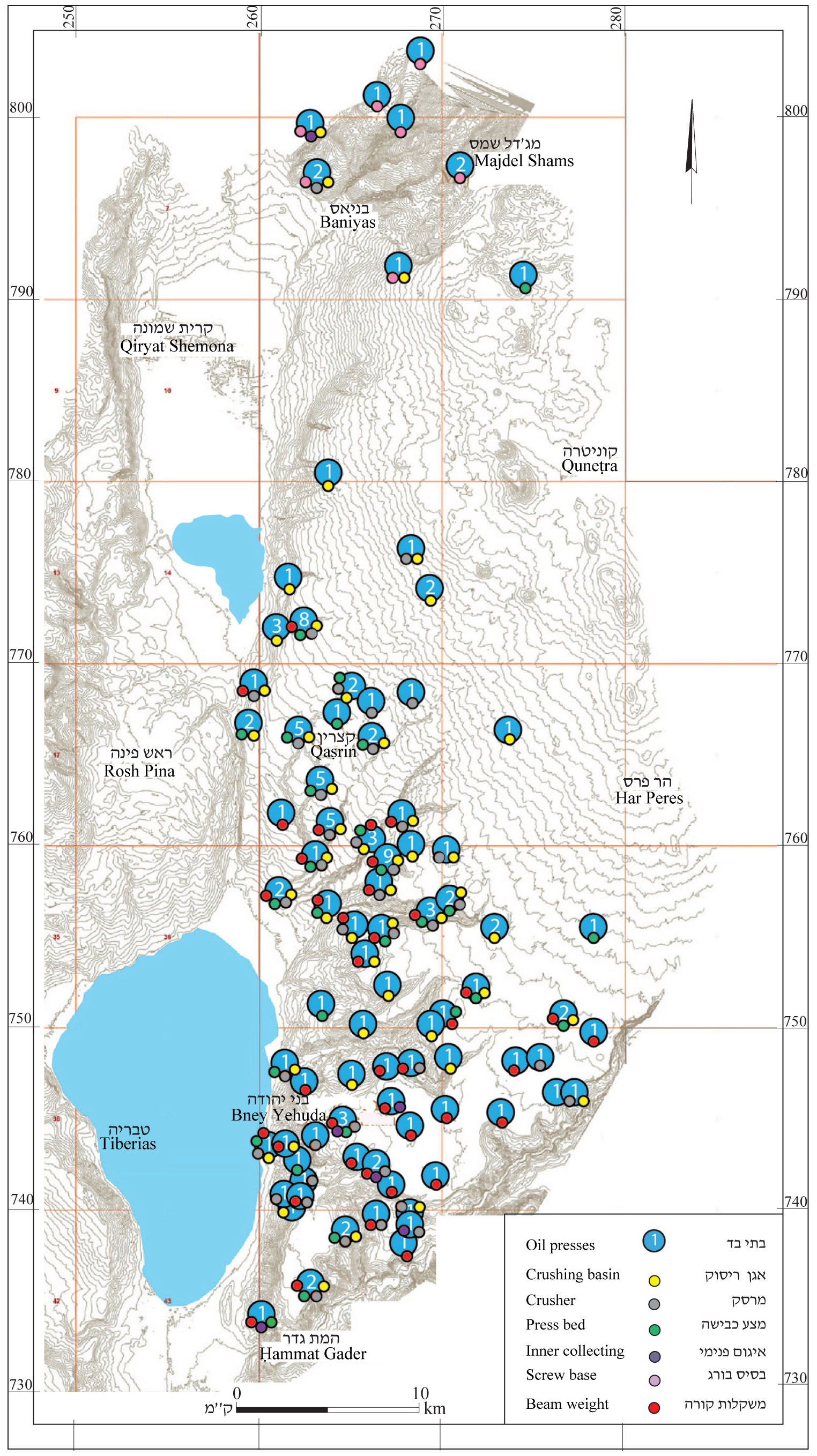
7.2 Wine presses
Wine grapes were also cultivated on the Golan. Certain sites have been marked on the map of the winepresses where evidence of grape cultivation was found. In the southern Golan, especially in the area of the Ḥammat Gader and ‘Ein Gev surveys, dozens of rock-hewn wine presses were found (see map 21). This area features chalk and limestone outcroppings in which winepresses could be hewn. All the winepresses found in surveys are small; no large winepresses, which would have been used for industrial wine production, were found; thus it seems that these installations were for local use.
Hewn winepresses are not commonly found in most of the Golan, as the region’s hard, fissured basalt rock is not suitable for hewing treading floors. However, the soil and the climate in these areas is suitable for the cultivation of grapes and it seems that viniculture was common even in areas were winepresses were not found. Indeed, the architectural motif of the grape vine and clusters is the most common in places where no remnants of winepresses were found (Hartal 2006:306–308). As treading floors could not be hewn in the basalt, they were constructed instead.
It is very difficult to identify built winepresses because after they are abandoned they look like the remains of ordinary structures. In the northern Golan a number of such winepresses were found that were for the production of dibbes (grape honey) by the 1960s. The built press is surrounded by low walls and paved with stone slabs. The collection vat is at a lower level.
In the treading floors of many winepresses outside of the Golan were small screw installations for pressing the juice after the treading. A number of screw bases were found in the surveys, none in situ and none connected to olive presses. It may be assumed that they were used in built winepresses and attest to the existence of such presses, even when the structure itself was not found. There were probably more such screw bases that remained embedded in winepress floors and were subsequently covered and not found in the surveys.
In the central Golan another kind of installation for the pressing of fruit juice was found. These consisted of a large block of basalt, frequently the roofing stone of a dolmen, which was partially leveled and into which a short channel was carved, apparently to channel liquid to jars that were placed at the foot of the block. All of these devices were found in areas outside of sites themselves. These installations were identified by Ben-Efraim (2005) as small winepresses, which were used to produce small quantities of wine, apparently right in the vineyard.
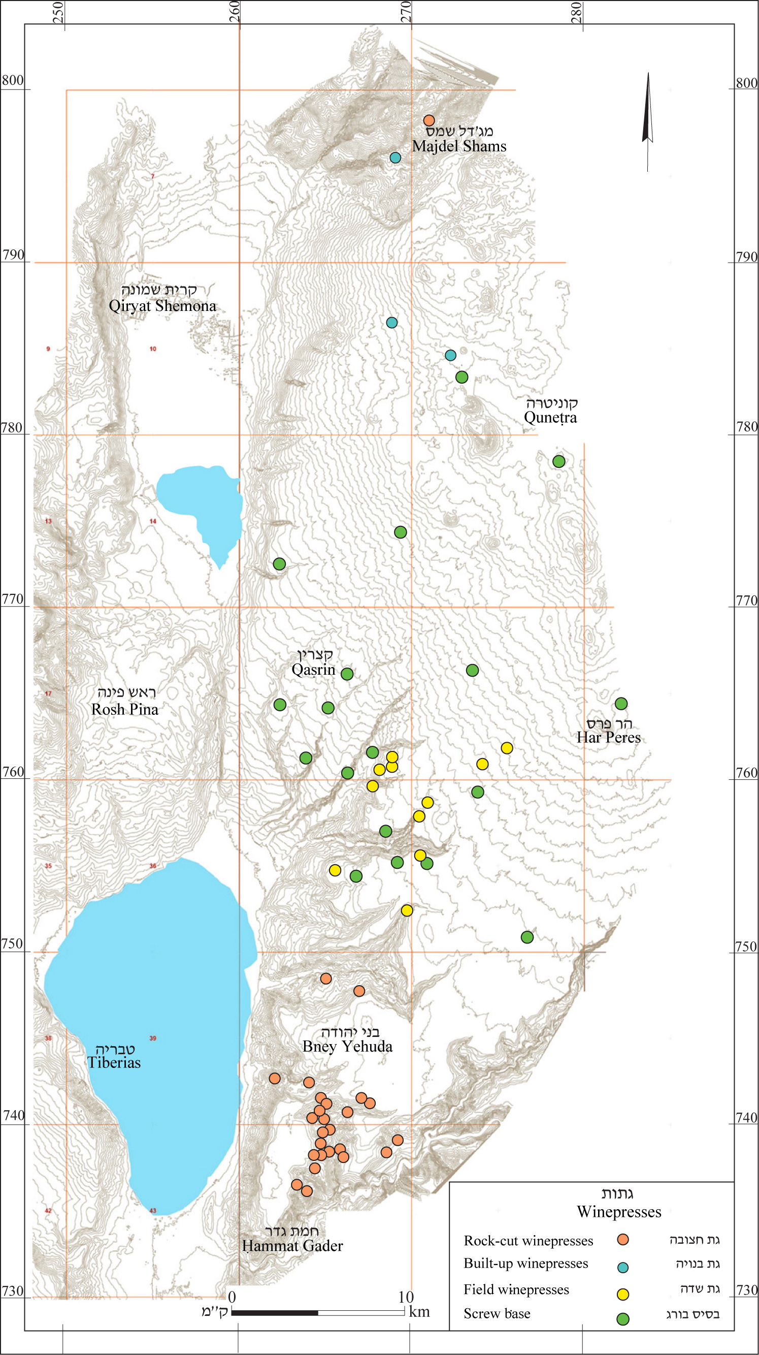
7.3 Flour Mills
Flour mills were operated by water, which was captured at a point upstream and flowed through a channel more moderately sloped than the stream. At the point where the height difference between the channel and the stream was greater than 4 m, the mill was built. The water flowed by means of a feeder channel a few meters down through a chimney where it operated a paddle wheel located under a vault beneath the grinding chamber. The wheel was turned by means of a pole attached to the top millstone, which turned above the base stone and ground the kernels. These mills, which apparently originated in the Land of Israel, allowed efficient milling even when water was not abundant.
The Golan's the numerous streams and steep topography makes it very conducive to the operation of mills. Indeed, most of the mills were found in stream valleys or near the outlets of the Hula Valley and the Beteiḥa (Bethsaida) Valley (see map 22). A few mills were found on the southern plateau, where they took advantage of small water sources and local height differentials.
The dating of the mills is problematic. Many of them were used over a long period and to the present time. It seems that the basic structure of the mill has not changed for a long time and so it is impossible to date them at this time.
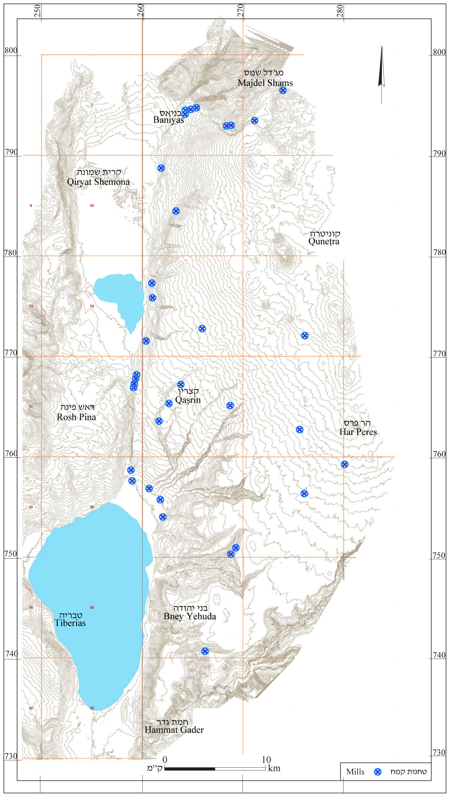
8. Hauran-Style Construction
During the Roman and Byzantine periods many structures were built in the Golan in a style originating in the Hauran, hence the name of the style. Such structures are found almost everywhere in the Golan and even at Korazin west of the Jordan.
This construction method cannot be attributed to a particular ethnic group, and is found in Jewish communities (such as Qaṣrin) and Christian communities (Deir Qeruḥ, for example). However, the widest distribution of Hauran-style buildings is found in the eastern Golan, which was settled by Ghassanids (see below 12.4.4). Sites in this part of the region featured well-preserved Hauran-style buildings. Among these sites are Ḥorvat Boṭma, Rafid, Ḥorvat Parag, er-Ramthaniyye, Ṣurman, Quneṭra and Bab el-Hawa.
The earliest structure roofed with stone beams is the olive press at Gamla from the first century CE. However, it seems that use of this construction style spread only in the Late Roman and Byzantine periods, in which it became very prevalent throughout the Bashan and the Hauran.
8.1 The entire structure was made of local basalt. The walls (with an average thickness of 0.80 m) were of dry masonry, consisting of two faces of roughly hewn basalt or basalt ashlars. Among the ashlars, medium-quality and high quality cutting can be distinguished. The wealthier houses were built of high-quality ashlars. Houses of this type were found at Rafid (Har Peres Survey, site no. 5). Structures of the three qualities of stone-cutting – roughly cut and high-quality ashlars, can be seen in the Hauran and the Bashan.
8.2 A dearth of trees in the Hauran and the Bashan on the one hand, and the tendency of basalt to crack and create long beams on the other, contributed to the special roofing of the buildings. The roofing was made of basalt beams that usually rested on corbels that protruded from the wall (see fig. 50). Most of the corbels were made of roughly hewn stones and in a number of houses, from ashlars. The length of the stone beams limited the space that could be roofed to 4 m, but this length could be doubled by constructing a central arch.
The stone beams laid on the arches protruded on either side and served as corbels (see fig. 51), rows of which made it possible to increase the roofed spaces. The beams were laid on the corbels in a crisscross manner. In the finer houses the beams were finely hewn, but they were usually rough-hewn. Above the stone roof a thick layer of compacted soil that sealed and insulated the roof.
The Golan was forested, and so stone beams were a kind of imitation of wooden beams. In the northern Golan there were no suitable stone beams for roofing and so wood was used.
8.3 Doorways and Windows were only in the front wall. The Lintels were made of long stone beams. To avoid breaking these beams, small windows or relieving arches were built above them. The outer doorways were built of ashlars cut as frames, with sockets for the door hinges and grooves for locks (see figs 52, 53). The doors opened inward and were locked from within the house. The original doors, which would have been made of woods, did not survive, but their shape can be gleaned from stone doors discovered at Kafer Nafakh (see fig. 54). Unlike in the Hauran, where stone doors were also used in dwellings, it seems that in the Golan such doors were used only for burial caves. In any case, none of these doors was found in situ.
8.4 The great weight of a stone roof required solid walls. For this reason there were few windows in the structure, as these inherently weaken the walls. The windows were usually built above the doorway lintel and also served to lighten the weight on the lintel (and see above). The most common windows were wade by leaving out one stone above the doorway lintel or in the front wall.
The windows were usually square (see fig. 52). In some cases they featured a built frame like the doorways. Some of the windows had an arch-shaped lintel and in one case a round window was found. There were usually no additional windows in the side walls or the back wall of structures; this, the house as quite dim inside.
The finer houses sometimes featured windows with carved stone grills. At Ṣurman (Har Shifon Survey) a well-carved window grill was found made of a stone slab (25 x 84 x 89 cm). The inner part was hewn as a trough to a depth of 20 cm, so that the thickness of the outside was only 5 cm. The outside of the grill was decorated with a wreath relief within which was a rosette with depressions. Between the leaves were six holes with a diameter of 8 cm to admit light into the structure (see fig. 55). The grill was found in secondary use in the minaret of a mosque. In Jaba, c. 10 km northeast of Ṣurman, in Syria, three similar windows were found. Similar stone grills were also found at sites in the Hauran.
8.5 At Rafid, a number of houses were found in whose façade was a round or arc-shaped niche (see fig. 56). Such niches were common in houses in the Roman and Byzantine period in the Bashan and Hauran, but were not found in sites in the Golan. Apparently pithoi containing drinking water were placed in them, a custom that remained common in Golan villages until the mid-20th century. In the courtyards of dwellings small shade structures were built in which large jugs were placed containing water for domestic use.
8.6 Steps, which were frequently built in the façade, were made of stone beams inserted into the wall and protruding from it without support. In many cases two flights of stairs ascend from the center of the structure. Such steps were found in the Golan only at Rafid (see Fig. 56). The steps led to a doorway in the second floor, if there was one, or to the roof. Balconies were also built in this way opposite doorways in the second floor. In the Bashan and the Hauran porticos were built in the façade of some of the buildings. The porticos were fronted by columns and roofed with stone slabs. Such porticos were not found in the Golan.
8.7 The basic unit of the structures included a high front room whose ceiling was supported by a central vault. Behind it were two narrow, low rooms, which created two half-stories and opened onto the front room. The front room was the main room in the house and was double or triple the size of the back rooms.
The roof was supported by one or more arches, which allowed flat roofing of a large area despite the limitations of the length of the basalt beams (see fig. 57) and see also the description of the roofing above). The roof was frequently supported by built pillars or columns (see figs. 58, 59).
The simple arches are built of roughly hewn stones or ashlars of the same width. They rest on built pilasters or in some cases on columns. Some structures featured well-hewn ashlars (see Fig. 60). These arches rested on built pilasters at the top of which was a console that expanded diagonally upward and from which the arch itself sprang. Such arches were often decorated with reliefs (see Fig. 61).
8.8 The front room was separated from the back room by a fenestrated wall (see Fig. 62) at a height of 0.60–0.70 m above the floor. The windows along the wall were separated by monolithic stone piers. Above them a solid wall rose to the ceiling. The main purpose of the fenestrated wall seems to have been to provide light and ventilation to the back room, which had no windows. The quality of the windows' construction is not uniform. Some are built of roughly hewn stones and others of ashlars.
Fenestrated walls had other uses as well, depending on the role of the back room. In many places the ground floor of the building served as a barn or a stable and troughs were installed in the windows. The front room in this case was used for the storage of animal feed and the farmer's tools. Troughs were found at Rafid (Har Peres Survey, site no. 5) and at Ḥorvat Parag (Qeshet Survey, site no. 85) in an area suitable for the raising of horses. In contrast, at other sites – at Bab el-Hawa (Merom Golan Survey) and at Khirbet Namra (Birket Ram Survey) in the northern Golan, no troughs were found in windows, which in those cases were apparently used as wall closets.
Windows without troughs were also found at Qaṣrin (Qaṣrin Survey, site no. 44), at Deir Qaruḥ (Rujem el-Hiri Survey, site no. 63) in the central Golan and at Khisfin (Rujem el-Hiri Survey, site no. 47) in the southern Golan.
8.9 The doorway to the back room was also situated in the fenestrated wall. This doorway was built without a specially designed frame. The door, if there was one, would have been placed in a wooden frame. The ceiling of the back room was frequently lower than that of the front room and an upper room was built above it, entry to which was via an opening in the fenestrated wall (see Fig. 63). The doorway to the upper room was built with a frame designed to allow door to be installed and locked. No windows were installed in the walls of the upper room which was lit only via the doorway and was fairly dim. It seems that the upper room was used as a bed chamber.
None of the houses surveyed in the Golan were found to have steps leading to the upper room; access to it was probably via a wooden ladder. A unique staircase, hewn from a single block of stone, was found not in situ at Ḥorvat Parag (Qeshet Survey, site no. 85, Fig. 46). It may have been used as a staircase to the upper room; however, absent parallels we cannot know for sure.
The inner walls also featured wall closets, built as square niches, similar in size to the windows in the fenestrated wall (see Fig. 64). Such closets were incorporated into the fenestrated wall or another wall.
8.10 Many structures consist of a number of basic units, sometimes built side by side, with each one having a separate outer doorway; sometimes a number of units are arranged around a central courtyard. In other cases the structure is built to a height of two stories; in the Hauran three-story structures were also found.
The ground floor in the two-story buildings was used to house work animals and store animal feed and the harvest, to protect them from the climate and and robbers. The upper floor was used by the inhabitants of the dwelling and guests. In the Golan, evidence of a second story was found only in Rafid.
8.11 Décor of the buildings was fairly modest. Most of them featured no decoration at all while in some, the lintels were adorned with reliefs and crosses. In the Bashan and the Hauran the windows sometimes featured decorated frames; however, in the Golan no decorated windows were found.
In the front rooms of the more lavish structures the lower part of the arches and the corbels supporting the roof were sometimes decorated at the corners. No decorated arches was found in situ in the Golan, but many arch stones were found in secondary use. A console decorated with the relief of a grapevine was found in Quneṭra (Merom Golan Survey) and a console decorated with a cross was found at er-Ramthaniyye (Qeshet Survey, site no. 8). Dozens of arch stones featuring spectacular reliefs were found, some in facades and some in a band featuring a vine along the outer edges of the arch; these were found in the Golan. These were the main decorative element in the houses.
9. History of the Region – Historical Documentation
9.1 The Late Bronze Age
The 14th-century el-Amarna documents contain two letters apparently describing events in the Golan. In letter no. 364 the governor of Ashtarot complains that the governor of Hazor had taken three cities from him. This letter indicates that Ashtarot bordered on the kingdom of Hazor. Nadav Naaman (1975) proposed that the event took place in the southern Golan. According to Ma‘oz, the southern Golan did not belong to the kingdom of Hazor and in his opinion the event happened in the central Golan (Ma‘oz 1986: 145–146). However, there are no remains of this period in the central Golan, which was apparently a buffer zone between these two political units. Sites in the northern Golan were likely connected to Hazor and it is therefore possible that the cities conquered by the governor of Hazor were situated at Naḥal Qanaf, on the northern border of the southern unit.
Another letter from the el-Amarna Archive (no. 256), from Mutbalu governor of Pahil to the Egyptian commander Ianhamu
"…-Marduk has returned home, hurried forth from the city of Aštarti, now that all the cities of the land Gari, (namely), Udumu, Aduri, Araru, Meštu, Magdalim, Hinianabi, Zarki, are hostile. Hawini (and) Jabišiba are conquered…"
The cities mentioned in the letter are in the area between Pahil and Ashtarot and therefore it has been proposed that they are in the southern Golan. This identification has found support in the identification of Hawini with Khirbet ‘Ayyun in one cuneiform symbol and that it should have been read Ga [Sho] Re, i.e., Geshur. His proposal has been accepted by most scholars although it has no proof) (Na’aman 2012). Ma‘oz (2006) and Epstein (1993) proposed identifications of the location of all the cities mentioned in the letter. Their identifications are based mainly on the preservation of the names.
Below are their proposals:
Udumu – ‘Ein Umm el-Adam (Ḥammat Gader Survey, site no. 4). Remains were found at this site from the Middle Bronze Age II and the Iron Age II; however, not from the Late Bronze Age. Epstein stated that at the Metsukei Onn Fort (Ḥammat Gader, sherds were found from the Middle Bronze Age; in the published survey (Epstein and Gutmann 1972: 290, site no. 193) sherds are mentioned from the Middle Bronze Age II and the Iron Age I, but not from the Late Bronze Age. In a renewed sorting of the sherds they were dated to the Middle Bronze Age II and the Iron Age III.
Aduri – Tel Abu Mador (‘Ein Gev Survey, site no. 39). Finds were discovered at this site from the Late Bronze Age.
Araru – Tel ‘Ein el- Ḥariri (Rujem el-Hiri). Body sherds were found at this site from the Middle Bronze Age II and the Iron Age II. No findings were discovered from the Late Bronze Age.
Meštu – Shuayyif (Ma‘ale Gamla Survey, site no. 84). Remains were found at this site from the Middle Bronze II to the Iron Age II and therefore this identification is suitable, at least in terms of the period.
Magdalim – Ma‘oz proposed identifying this city with Khirbet Majdñlyª (Rujem el-Hiri Survey, site no. 127) or Bjūriyye (Rujem el-Hiri Survey, site no. 130). At the first site, settlement started findings were discovered from the Middle Bronze Age II and the Iron Age, but not from the Late Bronze Age. Epstein proposed identifying Magdalu with Tel el-Fakhuri (‘Ein Gev Survey, site no. 9) or with es-Sfeira Fort (Ma‘ale Gamla Survey, site no. 104). Both sites revealed findings from the Middle Bronze Age II; however, not from the Late Bronze Age or from the Iron Age.
Hinianabi – Nab (Nov Survey, site no. 23). Remains were found at this site from the Middle Bronze Age II and the Iron Age II, but not from the Late Bronze Age.
Zarki – ‘Ayun a-Taruq (Nov Survey, site no. 32). Findings were discovered at this site from the Middle Bronze Age II to the Iron Age I and therefore in terms of the period, this identification fits.
Hawini – Khirbet ‘Ayun (Ḥammat Gader Survey, site no. 60). This site revealed finds from the Middle Bronze Age II and the Iron Age I and II. The lack of findings from the Late Bronze Age might be coincidental.
Jabišiba – Abila, in Transjordan (the only city identified in Transjordan and not in the Golan).
Of all the above-mentioned identifications, only three of the settlements, Aduri , Meštu and Zarki, and possibly one other settlement, revealed findings from the Late Bronze Age (on early identifications see Epstein and Ma‘oz, above).
9.2 The Iron Age
9.2.1. Two kingdoms are mentioned in the biblical period in the Golan – Geshur and Ma‘acah. The Bible describes the realm of Og, king of the Bashan:
…and the border of Og king of Bashan, of the remnant of the Rephaim, who dwelt at Ashtaroth and at Edrei and ruled in mount Hermon, and in Salcah, and in all Bashan, unto the border of the Geshurites and the Maacathites, and half Gilead, even unto the border of Sihon king of Heshbon (Joshua 12:4–5).
And describes its boundaries: “…and Gilead, and the border of the Geshurites and Maacathites, and all mount Hermon, and all Bashan unto Salcah…” (Joshua 13:11)
The Israelites conquered: “all the kingdom of Og in Bashan, who reigned in Ashtaroth and in Edrei—the same was left of the remnant of the Rephaim—for these did Moses smite, and drove them out” (Joshua 13:12).
The half tribe of Manasseh received the Bashan and settled in its fertile expanses: “Jair the son of Manasseh took all the region of Argob, unto the border of the Geshurites and the Maacathites, and called them, even Bashan, after his own name, Havvoth-jair, unto this day” (Deut. 3:14).
However, there was land that remained unconquered: “Nevertheless the children of Israel drove not out the Geshurites, nor the Maacathites; but Geshur and Maacath dwelt in the midst of Israel unto this day” (Josh. 13:13).
According to the sources cited above, it seems that the territories of Geshur and Ma‘acah were located west of the Bashan, between Gilead and Mount Hermon, i.e., in the Golan Heights. The sources do not state that Geshur and Ma‘acah were located in the Golan. The name "Ma‘acah" survived at the site of Abel Beit Ma‘acah in the northern Hula Valley, and it may indicate that Ma‘acah was the more northern of the two kingdoms. Geshur is usually identified in the southern Golan, among other reasons based on Mazar's correction of the "land of Ga-Re" in the el-Amarna letter, to the "land of Ga [shur] Re" (see above).
In contrast, the location of the city of refuge Golan is described in a number of places in the Bible:
Then Moses separated three cities beyond the Jordan toward the sunrising; that the manslayer might flee thither, that slayeth his neighbour unawares, and hated him not in time past; and that fleeing unto one of these cities he might live: Bezer in the wilderness, in the table-land, for the Reubenites; and Ramoth in Gilead, for the Gadites; and Golan in Bashan, for the Manassites. (Deut. 4: 41-43; Joshua 20:8; Joshua 21:27), and in greater detail: "Unto the sons of Gershom were given, out of the family of the half-tribe of Manasseh, Golan in Bashan with the open land about it, and Ashtaroth with the open land about it (1 Chronicles 6:56).
From this description it is clear that the city called Golan was in the allocation of the half-tribe of Manassah, in the Bashan, and thus, that it was not in the area of Geshur and Ma‘acah, the present-day Golan Heights.
David (1004–965 BCE) found refuge in Geshur from Saul (2 Sam. 15:7) and also married Ma‘acah, the daughter of Talmai king of Geshur. This marriage produced David's third son, Absalom (2 Sam. 3:3), who also found refuge in Geshur, for three years: “But Absalom fled, and went to Talmai the son of Ammihud, king of Geshur. And [David] mourned for his son every day. So Absalom fled, and went to Geshur, and was there three years” (2 Sam. 13:37–38; see also 2 Sam. 14: 23, 34).
These are the first sources that describe Geshur as a kingdom. It seems that the inception of this kingdom was in the eleventh century BCE. At Tel Hadar on the shore of the Sea of Galilee (Ma‘ale Gamla Survey, site no. 89) an administrative center, surrounded by a double wall, was established, containing storehouses in which taxes were apparently stored that were collected from the entire region. This center was destroyed in a powerful conflagration at the end of the eleventh century. Shortly thereafter, two walled cities were built, at Tel ‘Ein Gev (‘Ein Gev Survey, site no. 68) in the south and at Bethsaida (Capernaum Survey) in the north; the latter may have served as the capital of this kingdom.
David fought the Arameans and placed troops in Damascus (2 Sam. 8:5; 1 Chron. 18:6). It seems that the kingdom of Geshur did not join the Arameans and was allied with David. In contrast, Ma‘acah joined the Aramean alliance against David (2 Sam. 10:6). During the time of Solomon Aram-Damascus freed itself from Israelite control and became a sovereign kingdom (1 Kings 11:23-25), annexing Aram-Zobah, Arab Beit Rehov and Ma‘acah.
9.2.2. After the split of the united monarchy into Israel and Judah, the Arameans began to attack the kingdom of Israel. Around 886 BCE, Ben Hadad Iaunched a campaign against Israel: “And Ben-hadad hearkened unto king Asa, and sent the captains of his armies against the cities of Israel, and smote Ijon, and Dan, and Abel-beth-maacah, and all Chinneroth, with all the land of Naphtali” (1 Kings 15:20).
The war took place in the Hula Valley near the Sea of Galilee, and in the Galilee, and the army apparently passed through Ma‘acah in the northern Golan.
Toward the end of the reign of Ahab (854 BCE), an important battle took place near Afeq:
And Ben-hadad hearkened unto king Asa, and sent the captains of his armies against the cities of Israel, and smote Ijon, and Dan, and Abel-beth-maacah, and all Chinneroth, with all the land of Naphtali. And the children of Israel were mustered, and were victualled, and went against them; and the children of Israel encamped before them like two little flocks of kids; but the Arameans filled the country. And a man of God came near and spoke unto the king of Israel, and said: 'Thus saith the LORD: Because the Arameans have said: The LORD is a God of the hills, but he is not a God of the valleys; therefore will I deliver all this great multitude into thy hand, and ye shall know that I am the LORD.' And they encamped one over against the other seven days. And so it was, that in the seventh day the battle was joined; and the children of Israel slew of the Arameans a hundred thousand footmen in one day. But the rest fled to Aphek, into the city; and the wall fell upon twenty and seven thousand men that were left. And Ben-hadad fled, and came into the city, into an inner chamber. And his servants said unto him: 'Behold now, we have heard that the kings of the house of Israel are merciful kings; let us, we pray thee, put sackcloth on our loins, and ropes upon our heads, and go out to the king of Israel; peradventure he will save thy life.' So they girded sackcloth on their loins, and put ropes on their heads, and came to the king of Israel, and said: 'Thy servant Ben-hadad saith: I pray thee, let me live.' And he said: 'Is he yet alive? he is my brother.' Now the men took it for a sign, and hastened to catch it from him; and they said: 'Thy brother Ben-hadad.' Then he said: 'Go ye, bring him.' Then Ben-hadad came forth to him; and he caused him to come up into his chariot. And [Ben-hadad] said unto him: 'The cities which my father took from thy father I will restore; and thou shalt make streets for thee in Damascus, as my father made in Samaria.' 'And I[, said Ahab,] will let thee go with this covenAnt.' So he made a covenant with him, and let him go (1 Kings 20:26—34).
The battle apparently took place near Afiq in the southern Golan (‘Ein Gev Survey, site no. 95). At the site itself, which preserved the name, no findings were discovered from the Iron Age. D. Ben-Ami (2002) proposed that the battle in the upper part of Naḥal ‘Ein Gev near Tel Sorag (‘Ein Gev Survey, site no. 89) and that Tel Sorag was the location of Afeq. However, excavations at the site failed to confirm this identification. Afeq, it seems, should be identified at Tel ‘Ein Gev (‘Ein Gev Survey, site no. 68), where remains were found from the relevant period. Following the battle, Ben-Hadad made changes to his kingdom. He did away with the sovereign kingdoms, among them apparently Geshur and Ma‘acah, and organized the state in districts, appointing governors to lead them (1 Kings 20:25).
In approximately 850 BCE Stratum 6 of Bethsaida was destroyed and a new city was built on its ruins – Stratum 5 – under Aramean influence, as attested by a massebah found at the city gate.
In the late 40s of the ninth century BCE, King Hazael rose to power in Damascus, which led to the dissolution of the alliance that had fought Assyria in 853–845 BCE. The end of the alliance led to struggles between Damascus and Israel.
In 841 BCE, Shalmanessar conducted his third campaign to southern Syria, opposed only by Aram-Damascus. His victory inscription states that he struck Hazael at Mount Snir (Mount Hermon); that he besieged Damascus and then continued to the Hauran and to Mount Ba'el-Rosh, opposite the sea. Damascus was not destroyed in this battle and Shalmanessar returned in the 21st year of his reign and fought the cities surrounding Damascus.
With the Assyrian threat lifted, Aram-Damascus' imperial period was launched, during the reign of Hazael and after the reign of Ahab. Aram-Damascus spread south and conquered areas of the kingdom of Israel and Transjordan and even reached Gath on the border of Judah (2 Kings 10:33; 12:18—19).
After the campaigns of the Assyrian king Adad-nirari, the kings of Israel – Joash son of Jehoaz and thereafter, Jeroboam II, defeated Ben-Hadad III and liberated the portions of the Israelite kingdom that had been under Aramean control.
At Bab el-Hawa, in the northern Quneṭra Valley, a fortress was excavated that had been destroyed in a major conflagration. The destruction of the site, based on historical evidence, may have taken place during the time of Shalmanessar III, who reached southern Syria; however, it could also have happened as a result of internal struggles between Aram-Damascus and Israel, or perhaps as the result of a local event. It seems that after the destruction the site was only sporadically settled.
9.2.3 In 732 BCE, Tiglath-pileser III launched a military campaign, conquering the northern part of the Land of Israel.
In the days of Pekah king of Israel came Tiglath-pileser king of Assyria, and took Ijon, and Abel-beth-maacah, and Janoah, and Kedesh, and Hazor, and Gilead, and Galilee, all the land of Naphtali; and he carried them captive to Assyria (2 Kings 15:29).
It is unclear whether the war was also fought in the Golan; however, the impact on settlement in the area was dramatic. The settlements at Tel ‘Ein Gev (perhaps the biblical Afeq, see above) and Bethsaida (see above) were destroyed. All the permanent settlements were abandoned that the Golan was left almost empty of permanent settlements for hundreds of years, until the mid-second century BCE (see above, 4.8)
9.3 The Hellenistic Period
9.3.1 There were almost no permanent settlements on the Golan during the Early Hellenistic period. Following the decisive battle between the Ptolemies and the Seleucids, which took place in 200 BCE¸ Antiochus III defeated the Ptolemaic general Scopas, bringing southern Syria and the Land of Israel under his control (Polybius, Historiae XVI, 18—19). The battle took place near Paneon, the sacred cave to Pan at Panias, apparently at the foot of ‘Azaz Hill (Dan Survey).
Since the area where the battle was fought, on the edge of the northern Golan, had not yet been settled, in theory the battle would not have had immediately impacted settlement in the area. However, in the long term, the stabilization of Seleucid rule had a major effect on the region. That is because while the Ptolemies did not invest in development of this area and saw it only as a buffer zone between themselves and the Seleucids, the new rulers saw it as an integral part of their kingdom. Therefore, despite the political instability, the Seleucid period in the Golan was one of economic prosperity and settlement growth.
9.3.2 During the second century BCE settlements were established in the Golan Heights for the first time in the Hellenistic period and, apparently toward the end of the second century, the city of Hippos-Sussita (see above, 4.17.8). The Itureans settled at this time in the northern Golan (see below, 12.1), while the Syrians settled in the central and southern Golan (see above, 4.10.4 and below, 13.2).
9.3.3. Judah the Maccabee's Campaign in Gilead – In 164 BCE, Judah the Maccabee responded to a call for aid from Jews of the Gilead, who were under siege at the fortress of Dathema (1 Macc. 5:9–13). According to the description in 1 Maccabees, Judah and Jonathan his brother crossed the Jordan and for three days they marched through the desert, where they met Nabateans who reported to them on the situation of the Jews in Gilead that:
…many of them were shut up in Bosora, and Bosor, and Alema, Casphor, Maked, and Carnaim; all these cities are strong and great." Judah went by way of the desert to Bosroa and conquered it in a surprise attack. From there he went by night to the stronghold (Dathema?), fought the army of Timothy, which then fled to the temple of Carnaim. Judah conquered the city and burned the temple, gathered the Jews of Gilead and led them to Judah. On his way he sought to pass through Ephron, which did not allow him to do so, and so he destroyed that city as well and crossed the Jordan opposite Beth Shean (1 Macc. 5:24–54).
A parallel, but not identical description of these events appears in 2 Maccabees (12: 10–31). At the beginning of the campaign Judah and his forces were attached by Arabs (Nabateans?), whom he defeated and made an alliance with. A great deal of space is devoted to the battle for Caspin, described as a fortified city surrounded by walls and glacis and noting that so many of the city's defenders were killed in the battle that the nearby lake ran red with blood. From there, Judah's army advanced 750 stadia further to the fortress and to the Jews, whom were called Toubiani. Timothy was not there, but he left behind a strong garrison, which was destroyed by Judah's forces. Judah conquered Carnaim and the temple of Atargatis. From there he passed through Ephron, took it and continued to Beth-Shean. The description on 2 Maccabees exaggerates the strength of the cities and the numbers of their inhabitants and soldiers. Notable, the geographical knowledge of the writer of 2 Maccabees is imprecise and difficult to depend on.
Most of the identified places are located in the tributaries of the Yarmuk – an area that was settled as early as the 3rd century BCE. An exception is Caspin, which has been identified with Khisfin (Rujem el-Hiri Survey, site no. 147) in the southern Golan.
This identification, first proposed by Schumacher, has been accepted by most scholars (for a summary of the research, see Cohen and Telshir 1999: 137—139). Nevertheless, this identification is quite problematic. Almost no remains were found at Khisfin from the Hellenistic period. Moreover, according to 1 Maccabees, Caspin should be sought between Bosora and Carnaim, that is, east of Sheikh Sa‘ad. Settlement in the southern Golan began only a short time before Judah's campaign, and perhaps thereafter, and therefore there is no explanation for Judah's presence at the site at this time. The site is part of the territory of Susista but the city is not mentioned in connection with Judah's campaign, although the campaign may have taken place before Sussita was founded.
Alema, also mentioned in Judah’s campaign, has been identified at Kafr el-Mā (Nov Survey, site no. 33). The same reasons presented for not identifying Caspin with Khisfin apply in this case as well. This identification is not accepted by scholars; Alema should apparently be identified with Alma, in the southern Bashan.
9.3.4 The Conquest of Alexander Jannaeus – at the end of the second century and early first century BCE, the Nabateans grew stronger in the southern Hauran, as did the Itureans in the northern Golan and in Lebanon (see below, 13.1). Between these two peoples was an extensive area, which included the Golan, Sussita, the Bashan, Trachonitis and the northern Hauran, most of which had no permanent settlements. This area was a focus of attraction to the Jews in the subsequent centuries. There seems to be little to recommend the view of some scholars that the area was the scene of conflict between the Nabateans and the Itureans.
The Jews penetrated the area of northern Transjordan for the first time during the reign of Alexander Jannaeus. As early as 101 BCE Jannaeus was active south of the Yarmuk River. After a 10-month siege, he conquered Gadara, the first of the Decapolis cities to fall to him.
Jannaeus' second military campaign, from 83 to 80 BCE, was critically important for the history of the region. In 83 BCE, Tigranus, king of Armenia, invaded Syria and put a stop to Nabatean influence in Syria. Jannaeus took advantage of the situation and annexed Gilead and Golan. During this campaign, which lasted three years, he conquered Pella, besieged Gerasa and took it without a battle"He also cnnqnerecl Gnulanc and Sclcueeia and took the so-calkd 'Ravine of Antiochus'. He further captured the strong fortress of Gamala and dismissed its commader, Demetrius, in consequeence of numerous accusations." (War 1, 105; see below, 10.3). A parallel passage in Antiquities 13, 393–394 mentions the city of Dios instead of Pella.
Syncellus, a Byzantine-era chronicler, presents a description of Jannaeus' kingdom that differs from that of Josephus, and is based on a different source. Syncellus conflated Alexander Jannaeus' conquests into one campaign in Transjordan, from south to north, including also the area of Beth-Shean, Samaria, Mount Tabor and Geva (Syncellus, Chronographia 558–559). In our area there is no overlap between Josephus' list of cities and that of Syncellus – the latter does not mention the Golan and its cities: Golan, Seleucia, the Ravine of Antiochus and Gamla.
In contrast, Syncellus does describe the conquest of Sussita and Philoteria, south of the Sea of Galilee, two cities that are not mentioned by Josephus. It seems therefore, that the two lists complement each other. Syncellus did not distinguish between Jannaeus' various campaigns.
Jannaeus' wars were divided into two phases, different in their character. In the first he completed the conquest of the cities of the Decapolis north of the Yabok. Gadara was captured in 101 BCE. It seems that destruction in these cities was relatively minor. Their inhabitants continued to live in them, or relocated close by. In any case, none of these cities became Jewish and most of them were restored with the Roman conquest. In the second phase, Jannaeus acted against the cities in the Golan. These cities were not Hellenistic polei; in their character they apparently resembled the cities that Judah Maccabee had conquered 80 years before. These cities became Jewish and were not restored in the time of Pompey (see below 9.4.1).
Relations between Jannaeus and the Itureans seem to have been good and Jannaeus apparently did not invade them. He therefore took over the southern Golan (the area of Sussita) and the central part of the region (Golan), while the northern Golan (later the area of Paneas) remained under the control of the Itureans (on the administrative division of the Golan Heights, see below, Chapter 11).
Following Sussita's conquest by Jannaeus, Jews settled its agricultural hinterland, as attested by the list of prohibited towns in the territory of Sussita. "Prohibited towns" is a term in Jewish law meaning cities populated by Jews who were required to follow the laws of fallow land and tithing although they were in an area populated mainly by non-Jews, which would usually exempt them from these obligations (see below, 13.3.1). The list therefore shows that this was mainly a non-Jewish area that included well-off Jewish settlements. Indeed, in the Early Roman period there were in the area of Sussita more than 60 settlements, only eight of which were Jewish. The Jewish towns took the best agricultural land, perhaps because they had been established in a period of strong Jewish rule, i.e., the period of Jannaeus.
The district of the Golan, which was inhabited by small villages, became a source of attraction for a Jewish population and soon became a clearly Jewish area. While this is not specifically mentioned in the ancient sources (that is also the case for Jewish settlements in the Galilee), it may be deduced from later developments – none of the cities of the Golan was restored by Pompei and Gabinius; the cities of the Golan appear on the eve of the Great Revolt as clearly Jewish cities (War 2, 574, see below, 9.4.7).
Jewish settlement in the Golan should be seen in the context of the situation in Judea. Jewish settlement in the small areas of Judea expanded rapidly. On the eve of the Hasmonean revolt, overpopulation meant that some of the inhabitants were landless. These individuals formed the reservoir from which the Hasmoneans drew their soldiers, and in exchange for participating in the battles, they received land in the conquered areas. Jewish settlement in the Galilee also began to expand at this time. Jewish settlement that had developed in the Golan resembled such settlement in the Galilee during this time. There are many similarities in the material culture and behavior of the Jewish settlements in the Galilee and Golan. And because the Jewish-inhabited area in the Golan was relatively small, and close to the Galilee as well, despite the fact that the Golan was a separate administrative region, it is usually considered part of the Galilee. For example, Josephus, who was appointed commander of the Galilee at the beginning of the revolt, was also commander of the Golan.
9.4. The Early Roman Period
9.4.1. The Changes after Pompey's Conquests – In 63 BCE the Romans conquered Syria and the Land of Israel. The Roman general Pompey passed through the lands of Ptolemy son of Minaos, the Iturean ruler and confirmed his continued rule (below, 13.1.5). The fate of the Hasmonean kingdom was harsher. Pompey took away its independence and cut its territories (Ant. 14, 74—76; War 1, 155-157). He took from the Jews the cities that had conquered and liberated and restored the Hellenistic cities that had not been completely destroyed by the Jews (Ant. 14, 74–76; War 1, 156–158).
Pompey's actions on the Golan Heights differed from one district to another. The Hellenistic city of Sussita, which Jannaeus had conquered, was torn from the Hasmonean kingdom together with its rural hinterland. The city was restored and its autonomy was renewed (Ant. 14, 75; War 1, 156). Later it was numbered among the cities of the Decapolis. In contrast, the cities of the Golan, which had also been conquered by Jannaeus – Golan, Seleucia and Gamla – are not mentioned among the liberated cities, and on the eve of the Great Revolt they appear as Jewish cities (War 2, 574). It seems that as opposed to Sussita, where a considerable pagan population continued to live, the cities of the Golan had become Jewish cities in every way.
The ancient sources do not confirm the claim that Golan was torn from Judea. This fact is very important, as we will see below, in understanding the development of Jewish settlement in the Golan.
It had been widely accepted by scholars that Pompey granted the northern Golan to the Itureans, along with the Bashan, Hauran and Trachonitis. But apparently the status of the Itureans in northern Transjordan did not change at the time of Pompey (see below, 13.1.5). The northern Golan was already in their hands while the district of Golan, as noted, was settled by Jews and remained part of the kingdom of Judea.
9.4.2 Herod – Herod's rule over northern Transjordan expanded over a number of phases, in each of which he received one or more districts until he controlled the whole region. He received the Golan together with the former Hasmonean kingdom because Pompey left the entire region as an integral part of the kingdom. In 30 BE, after the battle of Actium, the territory of Sussita was also given over to Herod (Ant. 15, 217; War 1, 396). The background to this annexation is unclear; Herod's activities in this district are also unknown.
In 23 BCE, after Herod suppressed Zenodorus' bandits (see below, 13.1.7), he received the Hauran, the Bashan and Trachonitis (Ant. 15, 343; War 1, 398) and focused his main activities in this area. He tried to get the bandits to settle permanently, to persuade them to make their living as farmers rather than robbery. In the first years he was ostensibly successful. The bandits were afraid to act and Herod's status rose. In light of his achievements, in 20 BCE, he received Zenodorus' lands – the district of Paneas and Hulata (Ant. 15, 359—360); War 1, 399; Cassius Dio, Historia Romana, Book 9, 3) – thus completing his control of over the entire region.
In gratitude to Augustus, Herod's patron, the latter built an impressive shrine to the emperor at Paneas (Ant. 15, 363–364; War 1, 404–406). None of Herod's other activities in the Paneas district are known. It will be recalled that this area was already settled in the mid-second century BCE, apparently by Itureans.
Over the years it became clear that the bandits in Trachonitis had only been superficially suppressed. These people, who were used to a life of robbery, found it difficult to settle down permanently on poor lands, which did not provide them the income they were used to. And so, in 12 BCE, when a rumor spread of the death of Herod, the people of Trachonitis rebelled. The revolt was put down by the garrison Herod had stationed there; however, 40 of the ringleaders fled and found refuge with the Nabateans and continued their attacks on Herod's kingdom (Ant. 16, 130). Unable to persuade the Nabateans to give up the culprits, he invaded their territory, conquered the fortress and captured the bandits (Ant. 16, 271—285).
To prevent further rebellion Herod settled 3,000 Idumeans in and on the borders of Trachonitis (Ant. 16, 285). But the people of Trachonitis joined the Nabateans and wiped out the Idumean force (Ant. 16, 292).
After Herod was finally able to suppress this rebellion he established a military colony in the Bashan headed by Zamaris and his army (Ant. 17, 23–28). Zamaris, a Jew from Babylonia who headed a Jewish force of mounted archers, was brought to the Bashan by Herod and given exceedingly good conditions, including free land and exemption from taxes. These conditions attracted many Jews to the region, and for the first time in centuries permanent settlement was established. The Babylonian force justified the investment in it. Trachonitis did not rebel again and relative security was restored to the region.
This state of affairs insured security for caravans and pilgrims coming from Babylonia and a process of settlement began in the Bashan, the Hauran and apparently Trachonitis as well. The process sped up under Herod's successors. Most of Herod's investment was in strengthening settlement in the Bashan. But he also contributed to the construction of a regional temple in Sia‘ in the Hauran, whose construction was begun by local tribes 10 years before the area came under his control and as completed two years after his death (see below, 13.2).
Echoes of the rule of Herod and his successors are found in Safaitic inscriptions from Transjordan, which mention Herod, Phillip and Agrippa (these inscriptions, in Aramaic or ancient Arabic, are named after the place where inscriptions in these languages were found, in the Safa Desert east of Jebel Druze, see above, 2.1.6).
Herod did nothing in the Golan. The region was already settled by Jews, who came there with the help of the Hasmoneans. These Jews, like their brethren in the Galilee, felt no obligation toward Herod and no doubt retained their association to the memory of the Hasmoneans. The Jews of the Bashan, in contrast, owed their settlements and benefits to Herod, and remained loyal to him and his successors. The difference between the Jews of the Golan and those of the Bashan persisted in the coming generations and reached its height in the Great Revolt (see below, 9.4.7).
9.4.3 Philip and the Establishment of the Tetrarchy of Northern Transjordan – After the death of Herod (4 BCE) his kingdom was divided between his three surviving sons. Northern Transjordan fell to Philip (Ant. 16, 189, 318–219; War 2, 95). Only the Hellenistic city of Sussita, which was annexed in 30 BCE to Herod's kingdom, was torn from his kingdom and annexed to Provincia Syria (Ant. 17, 320; War 2, 97). Philip's tetrarchy covered an extensive area and included the Golan, the area of Paneas, the Bashan, the Hauran and Trachonitis. The population was varied. The western part, in the Golan Heights, was already settled with Itureans, Jews and Syrians. Part of the Bashan was settled with the Babylonian Jews who were concentrated in the military colony of Batira and the surrounding villages. The eastern regions – the Hauran, Bashan and Trachonitis, were populated by Syrians – Arameans and Arabs, who were in the midst of sedentarization. The lack of security in the region until the time of Herod was replaced with stability and tranquility that persisted for more than a hundred years.
Philip controlled his tetrarchy for 37 years (4 BCE–33 CE). He was apparently skilled a governing and he managed to unify his tetrarchy, which its varied population, into a unit marked by security and calm. There is no evidence of conflict among the various components of the population.
Philip's system of governing, his journeys throughout the tetrarchy accompanied by his court and his willingness to hold hearing wherever required, reflects a situation in which most of the population had not yet settled down permanently. Philip's capital was built at the edge of his tetrarchy (see below) and was not accessible to most of the population. In his travels, Philip therefore brought his rule to his subjects (Ant. 18, 106–108).
There were no real cities anywhere in the tetrarchy and so Philip had to establish a new city. In 1/2 BCE, Philip built his capital at Paneas (Ant. 18, 28; War 2, 168) and called it Caesarea. To differentiate it from other cities by that name, it was called Caesarea Philippi.
The place Philip chose for his new city, at the foot of Mount Hermon was near an abundantly flowing spring, extensive lands for construction and a comfortable climate; indeed, conditions were indeed very good here for habitation. Nearby was the temple of Augustus, which Herod had built (see above 9.4.2).
Philip built his capital at the edge of his tetrarchy, distant from its eastern regions. The reason for this was apparently two-fold. First, the location he chose was in an already populated area, while in the eastern parts of the region, as will be remembered, the population had only begun to settle down. Second, it was close to the neighboring tetrarchy of his brother Herod Antipas in the Galilee, as well as to the road to Jerusalem, which pilgrims from Babylonia used frequently.
The city was built in a place that had not been settled before, which made urban planning possible. In surveys and excavations in recent years has become clear that the city consisted of public buildings which included a sacred precinct above the spring, and of other public buildings. These structures were built in the area between the spring and Naḥal Sa‘ar and the bed of Naḥal Gobta and the Baniyas River. Remains of the cardo were discovered in this area as well as a colonnaded structure. These buildings apparently began to be built in the time of Philip. The sacred precinct began to be built near the cave. The public area was surrounded by residential quarters that spread onto the Baniyas plateau.
Since this was a new city, its residential quarters were also built expansively, and including mosaic floors and wall frescoes. Two suburbs of the city, in the east and the northwest, were above the spring, and water was supplied to them by means of a sophisticated aqueduct channeling water from the east, from the springs of ‘Ein Quniyye.
The second city that Philip founded was in the Beteiḥa (Bethsaida) Valley, near the point where the Jordan River flows into the Sea of Galilee. "He also raised the village Bethsaida, situate at the lake of Gennesaritis, to the ststus of a cityby adding residents and stregthening the fortifications He named after Julia, the emeror's daughter" (Ant. 18, 28). In the parallel description (War 2, 168), it states that Julias was located in the lower Golan. Excavations in recent years at the top of a-Tel (Capernaum Survey) revealed a stratum of settlement from the Hellenistic and Early Roman period. This stratum contains houses with broad courtyards, which are not densely constructed and are more suited to a village, where the price of land was low, than to a city. The comparison is intersting between the finds at a-Tel and at Gamla (Gamla Survey, site no. 43), from the same period and only about 10 km away from there as the crow flies. At Gamla the density of contruction was much greater, with the courtyards of dwellings the roofs of the dwellings below them.
Philip died at Julias in 33 CE and "his body was carried to the tomb that he himself had had erected before he died and there was a costly funeral” (Ant. 18, 108). It may be assumed that Philip built his tomb at Paneas, which was his capital and residence, and where many large and fine public buildings were built. It seems therefore that Philip's remains were conveyed in a grand procession from Julias to Paneas, where he was interred.
After Philip died, Emperor Tiberius annexed Philip's tetrarchy to the Province of Syria (Ant. 18, 108). But it seems that Tiberius had planned on only a temporary annexation and therefore he ordered the taxes that had been collected held and not transferred to the capital of the province.
9.4.4 Jesus in the Tetrarchy of Philip – Jesus' main activity in the Galilee and around the Sea of Galilee took place in the tetrarchy of Herod Antipas. However, some of his activities, among which are those with great importance to Christianity, also took place in Philip's tetrarchy. This area, which was close to Jesus’ realm of activity, served as both a personal and a political refuge for Jesus, apparently because of Philip's congenial nature. Three of Jesus' disciples – Peter, Philip and Andrew, came from Bethsaida (John 1: 45, 21–22) and so it is not surprising that this was the city he preferred in Philip's tetrarchy. The city is mentioned a number of times in the New Testament Mark 4: 35–41, 6: 36; Luke 10:13; Matthew 11:21). At Bethsaida, which is described as a village, Jesus restored a blind man’s sight (Mark 8:22–26). In a deserted place, in the area of Bethsaida, which in this case is described as a city, Jesus performed the miracle of the loaves and fishes (Luke 9:10–17). The event would have taken place in the lower Golan, an area that was settled by Jews.
Jesus also reached the north of the tetrarchy, to the villages of Caesarea Philippi, that is, to the area of Paneas. There, he revealed himself for the first time to his disciples as the Messiah, promised Peter the keys to the kingdom of heaven and made him leader of the disciples (Mark 8:27–33; Matthew 17:13–20). According to the ancient sources, this event took place in the rural area and not in the city. It was an area mainly inhabited by pagans, apparently Itureans; however, there may have been a number of Jewish settlements on the western edges of the northern Golan (see below 12.3.3).
Jesus was also active in the Golan south of Philip's tetrarchy. He came "through the midst of the region of the Decapolis to the Sea of Galilee (Mark 7:31). The meaning here is the area of Sussita, which was the only one of the Decapolis cities on the shore of the Sea of Galilee. The territory of Sussita did not belong to Philip, but rather to the administrative area of the Decapolis in the Province of Syria. This was also the area where the "miracle of the swine" took place, at a site called Gergesa, identified with Kursi (‘Ein Gev Survey, site no. 11) where Jesus healed a demon-possessed man. He sent the demons into a herd of 2,000 pigs that ran down to the Sea of Galilee and drowned (Mark 5: 1–5; Luke 8: 26–39).
9.4.5 Agrippa I – In the first century CE, northern Transjordan was the training ground for Herodian rulers. They were first granted small holdings and the Romans scrutinized the efficiency of their rule. If they succeeded, their area of control was gradually expanded.
When Philip died, his nephew Agrippa was in Rome. He was living a life of luxury there and had become close to the court of Emperor Tiberius. However, near the end of Tiberius' life, Agrippa was thrown into prison for six months (Ant. 18, 143–204). When Caligula came to power (37 CE) he released Agrippa, with whom he was on friendly terms, and granted him Philip's tetrarchy together with the title of king (Ant. 8, 235–237; War 2, 181; Philo, In Flaccus 25, 40).
Agrippa was in no hurry to return to his kingdom. Only in the second year of Caligula's reign (38 CE) did he leave Roma and return to his capital at Paneas (Ant. 18, 238–239).
Herod Antipas and his wife Herodias were jealous of Agrippa's royal title and in 29 CE they went to Rome to ask for the same title. But Caligula exiled them and transferred Antipas' tetrarchy to Agrippa as well (War 2, 181). This tetrarchy included the Galilee and Perea (War 2, 181). When Claudius came to the throne (41 CE), he confirmed Agrippa's rule and added Judea and Samaria to it, so that Agrippa now ruled almost all the kingdom of Herod the Great (Ant. 19, 274–275; War 2, 215).
Agrippa spent his final years in Judea and his capital Jerusalem. Northern Transjordan remained a remote area of his kingdom, which apparently did not receive much of his attention.
In 44 CE, Agrippa I died after a six-year reign, three years of which were over his expanded kingdom (War 2, 219). His son, Agrippa II, was too young to rule and so Claudius annexed his kingdom to Syria.
9.4.6 Agrippa II – The method of training Herodian rulers (see above, 9.4.5) was renewed at the beginning of Agrippa II's reign. In 48 CE he was given control over Chalcis (Ant. 20, 104; War 2, 223). Four years later, in 53 CE, Claudius took Chalcis from him and gave him Philip's tetrarchy in exchange as well as the kingdom of Lysanias the Iturean (see below, 13.1.6), Abilene and the tetrarchy of Varus. In 61 CE, Nero expanded Agrippa II's kingdom and granted him Tiberias, Tarichae and Perea (Ant. 20, 159; War 2, 252). Agrippa II therefore followed in the footsteps of his father. The rebellion that broke out against the Romans cut short the continued expansion of his kingdom. However, because of his support for the Romans, Agrippa II held on to his kingdom for the rest of his life. His capital was at Paneas, which he expanded and embellished (War 3, 514). The name of the city was changed to Neronias in honor of Nero (Ant. 20, 211). The aqueduct, which supplied water to the northern quarters of the city (see above, 4.11.3) may have been built in the time of Agrippa II.
The period of Agrippa II's reign was one of stability and prosperity in terms of settlement in northern Transjordan. The economic prosperity led nomads to evince an interest in settling down and working the land, a process that continued throughout the first century CE. Excavations at Sia‘ (see above, 13.2.3) and at Boṣra emphasize the importance of the second half of the first century CE in the development of the region. This period of peace was an important step in the agricultural development of the region.
9.4.7 Northern Transjordan in the Revolt – the kingdom of Agrippa II in northern Transjordan was composed of a mosaic of peoples: Itureans in the area of Paneas, Jews in the Golan and the Bashan and Syrians in the Bashan, the Hauran and Trachonitis (see below, Chapter 13).
The population responded differently to the revolt due to its ethnic variety. As would naturally be expected, the Itureans and the Syrians did not take part in it. But even among the Jews there were two groups with opposing views. The Jews of the Bashan, particularly the Babylonians, had settled in the region with the help of Herod and enjoyed special conditions. Even after their tax exemption was annulled, in the time of Philip, they apparently remained loyal to the Herodians. Some of them were drafted into Agrippa's army and were among its leaders. That is, not only did the Jews of the Bashan not revolt, some were among the troops that spearheaded its suppression.
In contrast, the Jews of the Golan – the descendants of the settlers from the time of Jannaeus, had not been supported by Herod. These Jews were no different than the Jews of the Galilee at the time, and certainly had family ties to them as well. They had no special relationship to the house of Herod, and those elements that stirred the Jews of Galilee to rebel against the Romans did the same with the Jews of the Golan. It therefore comes as no surprise that the inhabitants of the northern Golan were the only ones in northern Transjordan to join the revolt.
At first, the Golan was not involved in the rebellion. Agrippa, who apparently depended on the loyalty of the inhabitants of the region, sent two thousand horsemen from the Hauran, the Bashan and Trachonitis to strengthen the "peace party" in Jerusalem. Together with them was the general Philip son of Jacimus (War 2, 421). The army came from the regions that were settled with military men, Babylonians and pagans, who were loyal to the king. It did not include soldiers from the Golan because their loyalty was not ensured. The force that came to Jerusalem joined the war against the rebels but they were unsuccessful and withdrew from the city (War 2, 422–440).
In the first stage of the rebellion were riots and violent incidents between Jews and papgans. After the murder of Jews in Caesarea (War 2. 457) the Jews embarked on a campaign of retribution. A group of Jews struck the villages of the Syrians and the Decapolis cities, among them Sussita (War 2. 458–459) and the Golan. During that time the Golan was settled mainly by Jews and therefore it seems that the Jews struck the villages on its margins, perhaps on the boundary of the area of Sussita. In response to this attack, a massacre was perpetrated on the Jews living in the Hellenized cities. The inhabitants of Sussita and Gadara also killed some Jews and imprisoned others (War 2, 477–478). Some scholars attribute the demise of Jewish settlement in Sussita to these events.
The kingdom of Agrippa was not immune to these events:
In contrast, “Gamala remained loyal to Rome inder the following circumseances. Philip, son of Jacimus, King Agrippa’s lieutenant, after miraculously escaping from with his life from the royal palace in Jerusalem… to one of the villages under his jurisdiction on the conflines of the fortress of Gamala…he wrote a letter…to the younger Agrippa and Berenice which he delivered to one of his freedmen to convey to Varus; Varus having at the time been appointed administrator of the realm by the king and his royal sister…[Varus said] that he had mendaciously reported that Philip was fighting aqgainst the Romans with the Jews in Jerusalem and then put [the freedman] to death…Varus had been led to entertain great expectations by the Syrians of Caesarea [Philippi] who asserted that Agrippa, on the iondictment of the Jews would be put to death by the Romans and that he, as of royal lineage, would succeed him to the throne. As a descendent of Soemus, who had been a tetrarch int eh Lebanon district, Varus royal extraction was universally admitted…Moreover, to ingratiate himself with the Syrians of Caesarea, he put many of the Jews to death.
He had a further scheme of uniting with the people of Trachonitis in Banatanaea [Bashan] in an armed attak on the ‘Babylonian Jews…in Ecbatana. He accordingly summoned twelve of the most esteemed of the Caesarean Jews, and inbstructed them to proceed to Ecbatana and tell their compatriots ion that city that a report had reached Varus that they intended to march against the king; he did not credit this report, but had sent this embassy to urge them to lay down their arms…He further ordered them to send sevent of their leading men to answer the charge which had been laid against them. The twelve, finding on their arrival at Ectabana that their compatriots were innocent of any revolutionary designs, urged them to dispatch the seventy; they, with no suspicion of the fate in store for them, sent them off and the deputies traveled down with the twelve envoys to Caesarea. They were met by the royal troops under Varus, who put them all to death, including the envoys, and proceeded on the march against the Jews of Ectabana. One of the seventy, however, escaped and got ahead of him and brought the news to his countrymen; whereupon, seixing their arms, they withdrew with their wives and children to the fortress of Gamala, leaving their villages full of abunants stores and stocked with many thousand head of cattle.
On hearing of this, Philip also entered the fortress of Gamala...The king, meanwhile, hearing that Varus intended to massacre in one day the Jewish population of Caesarea, numbering many thousands, including women and children recalled him and sent Aequus Moduis to take over the command…The fortress of Gamala and the surrounding district were retained by Philip and thus preserved their allegiance to Rome.” (Life, 46–61; see also War 2, 481–483).
Josephus did not record whether Varus made good on his intention to attack the Jews of the Bashan. Varus may have wanted to hurt the men of Philip son of Jacimus, who were a threat to his standing in the court of Agrippa.
The moment Agrippa's rule over his kingdom stabilized, after he got rid of Varus, the king acted quickly to return the Babylonians to their villages in the Basham (Life 179–184) leaving only a few at Gamla (Life 177). The cavalry from the Bashan which had withdrawn from Jerusalem (2000 horsemen and 3000 infantry), were sent by Agrippa to support the forces of Cestius Gallus in his campaign to suppress the revolt in Jerusalem (War 2, 5000). In the battle, in which Cestius Gallus' forces were repulsed (War 2, 540–555), many of the soldiers in Agrippa's expeditionary force were also killed, because a year later, when Vespasian reached Galilee, Agrippa attached only about 1,000 horsemen and 2,000 infantry troops to the Roman general's forces (War 3, 68).
The fall of Cestius Gallus (War 2, 513–555) changed the attitude of the Jews of the Golan to the revolt. In its wake, Josephus Flavius was appointed commander of the Galilee and the Golan (War 2, 571). At Gamla, Joseph son of the midwife organized groups of young men who encouraged rebellion in the city (Life 185). Along with Gamla, the entire Golan rebelled, as far as the village of Shalem (Life 187), whose location is unknown. Josephus fortified three settlements – Gamla, Sogane and Seleucia (War 2, 574); 4, 2; Life 186–187). The initiative to fortify the cities came from their inhabitants, with Josephus only providing assistance (Life 186).
In the first stages of the revolt, before Vespasian reached the Galilee, Agrippa tried to suppress it in the Golan on his own. At first he tried to take Gamla with a force commanded by Aequus Modius, Varus' replacement. However, he did not have sufficient forces and he made do with a loose siege by placing guard posts at strategic points (Life 114). Later Aequus Modius tried to block the roads to Gamla and Seleucia, to prevent supplies from reaching them from the Galilee. To this end he sent cavalry and infantry forces under the command of Silas, who set up his camp five stadia (0.9 km) from Julias. Josephus, with a force of 3,000 men, tried to lift Silas' blockade. In the ensuing battle, Josephus fell from his horse and his army stopped fighting (Life 394–404). The next day, Silas set up an ambush for the rebels; they were saved from defeat only by reinforcements who arrived from Tarichae (Magdala) (Life 405–406).
The Jews of Paneas also found themselves in difficulty. To prevent them from joining the revolt, the authorities enclosed them within the walls of the city (Life 74). At their request, John of Gischala supplied them with kosher olive oil, at inflated prices (Life 74–76; War 2, 591–592). Josephus treated his as a profiteer, but it seems that John used the money he earned from the deal to finance the rebellion and the fortifications of Gischala.
After Vespasian's conquest of the Galilee, he came with his army for rest and recreation at Paneas, at the request of Agrippa, who hoped to put an end to the rebellion in the Golan with the Romans' help (War 3, 443–445). At this point the struggle on the Golan had reached its height. Sogane and Seleucia had surrendered to the Romans and Gamla remained alone in the battle (War 4, 2). After having taken Tiberias and Tarichae, Vespesian and his three battalions laid siege to Gamla (War 4, 11–13). Josephus describes the siege and the battles to take the city in great detail (War 2, 2–83). After two attempts to break into the city, one of which failed, the city surrendered and almost all the inhabitants were killed by Roman swords or died attempting to escape.
With the fall of Gamla, for all intents and purposes the rebellion in the Golan came to an end. There is no information on additional battled because the other centers of revolt on the Golan had surrendered even before the battle for Gamla. It seems that other than Gamla and its immediate surroundings, the Golan did not suffer at the hands of the Romans and thereafter as well, was a densely populated Jewish district.
After the siege on Jerusalem, Titus and his army came to Caesarea Philippi for rest and recreation, where “they remained for a considerable time, exhibiting all kinds of spectacles. Here many of the prisoners perished, some being thrown to wild beasts, others compelled in opposing masses to engage one another in combat” (War 7, 23–24).
9.4.8. Northern Transjordan after the Revolt – After the suppression of the revolt, Agrippa continued to rule his realm; however, unlike his father, his advancement was stopped and he did not win control of the entire land of Israel. Nothing is known of the events of this period. It seems that the impact of the revolt on the region was marginal. The only district that took an active part in the revolt was the Golan, including Gamla, which was the only city that was conquered. The rest of the settlements were hardly touched.
Ben-David's research (2006) showed that all the settlements in the Golan that were settled in the Early Roman period continued in existence in the Middle Roman period, with the exception of Gamla, which was not resettled after its conquest. Nearby, and apparently in areas that were in its immediate region, three new settlements were established in the Middle Roman period, which were not settled by Jews. The results of Ben-David's research contradict Ma‘oz‘s theory that the suppression of the revolt severely damaged Jewish settlement in the Golan, and led to their abandonment and a settlement gap that persisted until the fourth century CE.
Agrippa II was one of the last of the vassal kings. As early as the time of Vespasian, the districts of Amasa and Comagene, in Lebanon, were transferred to direct Roman rule. The smaller tetrarchies of southern Syria disappeared during the time of Trajan. Until that time, the local rulers served as intermediaries with the imperial rulers and the local population, and at this point their role ended. The process was completed in 106 CE with the annexation of the Nabatean kingdom and the establishment of Provincia Arabia.
The end of the rule of Agrippa II in northern Transjordan – either with his death (100 CE) or some years before – spelled the end of the hegemony of the Herodian house in the region. The Romans did not transfer control to his descendants; rather, the entire region came under direct Roman rule. Northern Transjordan, which for more than 100 years was a unified political entity, was now split between two provinces – the Hauran, Trachonitis and the district of Paneas were annexed to Provincia Syria. The Golan, and apparently also Galilee and Perea, were annexed to Provincia Judaea.
The Golan was the only district in northern Transjordan where the Jews constituted the vast majority of the population. It will be recalled that Jewish settlement in the Golan began in the days of Alexander Jannaeus and it became a Jewish district like the Galilee. This was also the reason it had not been torn from the Hasmonean kingdom when the Romans took over, and was given to Herod at the beginning of his reign. The Jewish inhabitants of the Golan differed in their relationship to the Herodian house than Jews whom Herod had settled in the Bashan, and were close to the Jews of Galilee. This was, apparently the factor that pushed the Jews of the Golan join the revolt, in contrast to the rest of the districts of Transjordan (see above 9.4.7).
The impact of the suppression of the revolt in the Golan was not destructive and the district continued to be settled by Jews. We have no ancient source that explains the Romans' considerations in separating the Golan from the rest of the districts of Transjordan, and we can only speculate as to the reason. It seems that because of the specifically Jewish character and rebellious tendencies of the Golan, the Romans decided that it would be easier to control it as part of Provincia Judaea, where most of the Jews of the land of Israel lived.
While Jews did inhabit other districts of northern Transjordan, they were a minority there and most of them were loyal to Rome. Over time, the Jewish settlement in the Bashan also became a Jewish enclave in the heart of a pagan region, as attested by the Varus affair. The Babylonians were loyal to Herod and the to the Romans and therefore there was no problem annexing them to Syria. When the Golan was separated from the other districts, the border between the Golan and the Paneas district, which was the internal border between Agrippa's two districts became the border between the provinces.
This change sheds light on the considerations in determining the borders. Apparently this determination was based on the demographics and economic factors. In the case before us, we can see how the Romans treated demographics, even in as small a district as the Golan. It cannot be said that these considerations were dominant in every case; however, it seems that the determination of borders was not arbitrary. The new border between Provincia Judaea and Syria was also the border between the Jewish and Iturean settlements in the Paneas disctrict. This move was to have results that impacted the history of the region for centuries to come.
The example of the Golan, which in the first century CE was part of a larger unit and was separated from it at the end of that century, makes it possible to follow changes that took place as a result of the separation. What began as a political division became over the years a barrier that created different material cultures.
9.4.9 The Contribution of the Herodian House to the Development of Settlement in Northern Transjordan
Northern Transjordan was in the hands of Herod and his successors for over a century. During this time the region underwent far-reaching changes that impacted future generations as well.
When Herod was given control of the region, in 23–20 BCE, it contained almost no permanent settlement. Only in the western part, the territories of Sussita, Golan and Paneas, was there permanent settlement, which had begun about 100 years before. The eastern regions – the Hauran and Trachonitis, and apparently the Bashan as well, were populated by nomads and semi-nomads. The inhabitants, particularly in Trachonitis, were bandits and highway robbers who also made their living attacking caravans and settlements in the area of Damascus. Zenodorus (see below 13.1.7) encouraged these listim, and consequently, he lost his hold on these regions. The goal of the Romans was to bring security to this untamed area, but they did not act directly there. Rather, they tasked Herod with the job. At first Herod defeated the bandits of Trachonitis and fought their attempts to rebel. As a second stage, he settled Jews loyal to him, at first in Trachonitis and then in the Bashan. The attempt to settle the Idumeans apparently failed. But settlement of the Babylonians, headed by Zamaris, succeeded in bringing calm to the region. Internal security and public order at the end of the time of Herod, and especially of his successors, allowed the area to develop economically and in terms of settlement. In the first century CE the number of settlements in the Hauran, the Bashan and Trachonitis grew; temples and public buildings were built and agriculture flourished – the Bashan became the breadbasket of Syria while the Hauran specialized in viniculture and the Golan in the cultivation of olive trees.
The capital of the region, Caesarea Philippi, which was built next to the Paneas spring, enjoyed a long period of economic prosperity and influenced the growth of the entire district – northern Golan and the northern Hula Valley,
During the time of Herodian rule, the region underwent demographic changes. The Itureans in the Paneas district lost their independence and gradually their national identity as well. The Jewish settlement in the Golan continued to develop, apparently without the help of the Herodian rulers. The Babylonians who had settled in the Bashan became the backbone of the army, which was loyal to the Herodian rulers and at their disposal at all times. The Nabateans remained beyond the reach of Herodian rule and their influence was relatively minor. Most of the inhabitants of the region were Syrians (see below, 13.2), who during this time lived mainly in the villages. They developed a local culture, which had originated within Syria and on which Hellenistic influence was marginal. Their main temple, at Sia‘ (see below, 13.2.3) was built even before Herod's time, but most of it was constructed in his day or during the time of his successors. Temples were also built in the Hauran, Bashan and Trachonitis.
The Jewish revolt impacted the region only marginally. Of all the districts, only the Golan, particularly Gamla, took an active part. But there was animosity between the pagans and the Jews in other places. The Jews of Sussita were attacked by their neighbors. The Jews of Paneas were besieged and some were killed by the Iturean Varus, with the encouragement of the pagan inhabitants of the city. The Jews of the Bashan, who were loyal to Agrippa, were also threatened with annihilation and they were forced to take shelter in Gamla (see above, 6.4.7). But it seems that in general, the impact of the revolt on the inhabitants of the region was marginal. Except for Gamla, which was completely destroyed, the rest of the settlements continued in existence.
The death of Agrippa II brought an end to this period. Security stabilized the region and the inhabitants grew used to Roman methods of rule. The Romans no longer needed a local ruler to mediate between them and the local population. Agrippa's kingdom was not handed down to his descendants, but rather was in the main annexed to Syria. Only the Golan, the Galilee and Perea were annexed to Judaea. The region was now ready for direct Roman rule, which was the hallmark of the next period.
9.5 The Middle and Late Roman Periods
9.5.1 In the second century CE the Roman Empire knew calm and stability, which brought prosperity to northern Transjordan. The events that shook the land of Israel, especially the Bar Kokhba Revolt, passed over the region. For nearly 100 years (96–192 CE) the Antonine emperors ruled. This was the period of emperors Nerva, Trajan, Hadrian, Antoninus Pius and Marcus Aurelius. Until 180 CE the regime was typically stable, continuously reformed law and public administration and working for the good of the provinces.
At the time of Emperor Comodos (180–192 CE), the empire declined into total anarchy and near bankruptcy. The economic prosperity that had existed at the end of the first century CE and up to this time ceased. The stability of the second century CE was replaced in the third by internal rebellions and invasions by outside enemies.
After the assassination of Comodus, civil war broke out that went on for four years. Septimus Severus took the throne and established the Severan dynasty after defeating Pescennius Niger, the governor of Syria. To prevent the governors of the provinces from accumulating too much power, as had Niger, Severus divided up a number of provinces, including Syria. Severus assured well-ordered and efficient government for the good of the provinces.
Despite the Parthian invasion of Syria in 162 CE and the struggle between Severus and Niger northern Transjordan remained prosperity until the third century CE. Caracalla, Severus' successor, known for his cruelty, who relied on the army, increased soldiers' salaries and emptied the empire's coffers. At the time of his successors, Macrinus and Elagabalus, the situation in the empire declined. Caesar Alexander Severus' attempt to restore public administration was cut short by his assassination in 235 CE.
9.5.2. The murder of Alexander Severus marked the beginning of a period of anarchy that continued for some 50 years (235–284 CE). Caesars were replaced rapidly and most did not die of natural causes. Among the many who ruled at this time, we mention Philip the Arab, born in the Hauran, who took the throne in 244 and turned his village, Shaba, into a city by the name of Philipopolis. But he also reigned only for a short time, and was killed during a military insurrection in 249 CE. Many legionaries hailed from the provinces and were less loyal to Rome. Military discipline unraveled; the soldiers maintained loyalty to their commanders and not to Caesar, and time and again attempted to have their commanders appointed emperor. The chaos that ensued encouraged outside enemies to invade the empire, causing major economic damage. The maintenance of a large army was a huge economic burden, leading to heavier taxation.
The desperate need for money led to a decline in the silver content of coins and to galloping inflation. Along with inflation came the demand for services as payment and the payment of taxes in kind. The burden of taxation and forced labor led many farmers to abandon their lands and move to the cities, which made life in the cities more difficult. Many farmers lost ownership of their lands and became tenants on their own farms. In addition to these troubles came highway robbery and extortion, as well as natural disasters – droughts and plagues, which reduced the size of the population and increased the burden on those that were left. The crisis led to a cessation of construction of cities and the construction of walls around those that remained.
The economic crisis did not affect all parts of the empire equally, nor all districts in a single province. It is difficult to know what effect the crisis had on northern Transjordan. On the one hand in some areas damage appeared to have been minimal. For example, the survey of the northern Golan revealed that the Late Roman period was one of the most intense periods of settlement in the area. Excavations at Kh. Namra revealed that it was settled precisely at the time of the crisis. At Bab el-Hawa, on the other hand, the situation was different. Apparently in the third century the site was not settled, with settlement being renewed only in the fourth century. In the third century, the pottery industry grew strong in Paneas and Khirbet el- Ḥawarit. The production of pottery in the northern Golan began in the second century and expanded in the third century, persisting until the fifth century. Throughout that period, similar vessels were produced; making it possible to date sites where the pottery was found. The economic crisis may have been a factor leading to the abandonment of the Jewish villages around Sussita, but it seems that this was the end of a process that began with the damage to the Jewish population at the beginning of the Great Revolt (see above, 9.4.7).
9.5.3 The Period of the Tetrarchy –The severe crisis in the Roman Empire in the third century CE was followed by the rise to power of Diocletian, who stabilized the government and created a new ruling structure – the tetrarchy.
At the head of the central government stood four leaders who were placed in charge of protecting and administering the empire – two augusti – Diocletian and Maximian, and alongside and just below them, two emperors, Constantius and Galerius. Diocletian was placed in charge of Thrace, Greece, Asia Minor, Syria and Egypt. The empire as a whole was divided into two parts – east and west, with each side divided into dioceses, each of which included a number of provinces.
Beginning in 284 CE, Diocletian reorganized the administration of the empire by dividing and changing the borders of the provinces, separating military and civil administration, changing the status of the provincial governors, who were no longer to be commanders of legions stationed in their areas, and launching a more active and positive approach to administration.
9.5.4 Boundary Stones – One of the most important aspects of Diocletian's reign was a reform of the tax structure that had been in place since 297 CE according to an edict promulgated in Egypt. The purpose of the reform was to tax agriculture more efficiently, with land taxes based on precise information about land ownership and borders between neighboring communities.
Part and parcel of the tax reform was therefore renewed mapping of the borders of villages and marking them by means of boundary stones. The mapping was apparently implemented throughout the empire, but boundary stones have been found only in the limestone massif of Syria, the area of Damascus, in the Bashan and the Hauran, in the northern Hula Valley and in the northern and southern Golan.
The boundary stones differ in their shape and size. It seems that no great effort was invested in hewing them; the inscriptions were written on elongated fieldstones and sometimes on building stones in secondary use. Instructions for their installation may have been given by censitors (see below) after surveying the area, and were apparently implemented, entirely or in part, by the local community.
The boundary stones were installed especially at sites where a lack of natural markers made the marking of a boundary necessary. The inscriptions vary from stone to stone but they may be divided into two groups: full versions and abbreviated versions. As an example of a full version we will present a boundary stone found east of Quneṭra:
Diocletianus and Maximianus, the augusti, and Constantius and Maximianus, the caesares, order (this) stone to be set up, marking the boundary of the fields of the villages of Sarisa and Berenice, under the supervision of Aelius Statutus, vir perfectissimus
The inscription includes three components. The first specifies the four rulers of the empire; the second notes that the stone marked the boundaries between the fields of two villages; the third notes that the act was carried out under the supervision of Aelius Statutus.
Boundary stones with abbreviated inscriptions included only the second part. For example, a stone found north of Quneṭra: "Stone marking the boundary (of the fields of the villages) of Achana and Sarisa." The first part of the inscription (in its full version) securely dates it to the period of the tetrarchy, between 293 and 305 CE. Of greater importance are the two other parts. The main part provides information on the names of the settlements, which we will discuss in the chapter on the preservation of names (see below, 10.5). But it also supplies information on the method of levying the taxes. Boundary stones were usually placed at the edges of villages and sometimes on the outskirts of estates or cities as well; this indicates that they did not mark individual plots. The boundaries of the villages had to be marked because the village was communally responsible for the payment of its land taxes. It is unclear whether villages in the territories of cities paid their taxes through the arbitration of the city but the long list of cities, based on boundary stones, attests to the importance of the villages in the economic system.
The last part of the inscription in its full version notes the censitor responsible for surveying the land. The censitor was the civilian official in charge of tax collection. The censitor Aelius Statutus is mentioned in boundary stones from the area of Damascus, the northern Golan and the northern Hula Valley. These regions were in the province of Syro-Phoenicia and therefore he was probably connected to that province. The boundary stone from ‘Ashshe (Har Peres Survey, site no. 8) shows that the province of Phoenicia extended as far as Mount Peres.
Boundary stones were erected to mark the boundaries of village farmlands. The full inscriptions seem to have been installed close to roads, where the name of the ruler could be seen without difficulty. In more remote places, it may be assumed that the short versions were deemed sufficient. There were probably thousands of these boundary stones, but less than 50 have so far been found. This may be explained by the fact that they looked no different than ordinary fieldstones, and so they are difficult to identify. Boundary stones were not found in rocky areas where farmland was scarce; apparently in these areas the boundaries were clear and there was no need for the central government to map them. That appears also to have been the case for the territory of Sussita and the Bashan. Only one boundary stone was found in the Golan – at Aḥmadiyye (Qaṣrin Survey, site no. 30), near the border of the district of Paneas, possibly because here too, the lay of the land – small plots whose association with their villages was unequivocal, as was the case in the rocky terrain of the northern Golan.
9.5.5 Roman Military Service – The belligerent nature of the region's inhabitants, which had previously found an outlet in robbery and extortion, was now channeled into military service in the auxiliaries or the legions. Inscriptions of soldiers and officers in the Roman army were found in the territory of Sussita: in Afiq (‘Ein Gev Survey, site no. 95) an inscription was found from the year 139 CE with the names of soldiers who had served in Syria-Palaestina. This is the earliest known reference in historical documents to the name Syria-Palaestina (Ma‘oz 2006: 54).
At Kefar Ḥaruv (‘Ein Gev Survey, site no 213), an inscription was found mentioning the Tenth Legion, additional testimony of the association of the southern Golan to Provincia Palaestina. At el-‘Āl (Nov Survey, site no. 34) a fragment of a lintel may perhaps attest to the presence of a Roman camp at the site. That site also produced the tombstone of a veteran of the Fist Parthian Legion from 289=225/226 CE, according to the calendar of Susita. At Khirbet ‘Ayun (Ḥammat Gader Survey, site no. 60), an inscription was found mentioning two veterans who had served in the pretorium (military command headquarters). Publications of the inscriptions (Applebaum, Isaac and Landau 1978) identified the praetorium with a military unit known from the mid-fourth century CE, but it is possible that the veterans may have served in a fortified installation in the southern Golan. The inscriptions show a Roman military presence in the southern Golan in the second and third centuries CE. At Khisfin (Rujem el-Hiri Survey, site no. 147) a commemoration inscription was found mentioning a veteran of the Third Legion Cyrenaica who had served in Syria and northern Arabia in the second and third centuries. Khisfin is identified as one of the villages in the territory of Sussita (although according to the survey the site was founded only in the Middle Roman period). If this identification is correct, it would have belonged to Palaestina and not Arabia. No similar inscriptions were found in the central or northern Golan, although they are common in the Hauran.
9.5.6 Rural settlement – The second century CE saw significant development in the region as a result of peace in Syria. The population settled in villages and tribal organization broke down, although people continued to identify themselves by their tribe, in addition to the name of their village. Most of the people who settled down as farmers were proud of their work.
Information about villages is more abundant in the Hauran, Bashan and Trachonitis than in the Golan. Numerous inscriptions were found in those areas, which reveal data about the administration and ethnic makeup of the population. However, the Golan Heights was also typified by a network of villages and it may reasonably be assumed that their internal network resembled those of the Hauran.
According to the inscriptions and architectural findings, the villages seem to have been landed agricultural communities, with no great differences between them in terms of property. The inhabitants lived in large family units, more or less, with a dwelling for each family, and the villages enjoyed a high degree of autonomy, almost that of cities. They had a council that approved laws, a joint treasury, common land and public buildings.
In the second and third centuries, the village officials bore the title strategos. The nature of the position and the name were a vestige of their nomadic phase. It is unclear whether the office of strategos was an elected one or inherited, but it seems to have been a prestigious one. From the mid-third century the character of village officialdom changed and they were thereafter headed by a council that was elected for one year. Direct Roman rule did not greatly impact village life. The inhabitants built their own public buildings, temples and water systems. Roman roads built in the region did not connect the villages to each other.
The villages made their living in farming, with the crops dependent on their geographical location. In the Golan the main crop was olives, as well as grapes, pulses and cereals. Animal husbandry was also widespread, as attested by numerous feeding troughs found in houses.
The villages underwent Hellenization, as shown by inscriptions in Greek found in many of them.The language of the inscriptions is flawed, showing that village life was conducted in koine Greek. In the early fourth century, official use of Semitic languages disappeared almost completely, replaced by Greek, although colloquial use of Semitic languages seems to have persisted in the villages.
9.5.7 Urbanization – The second century saw urbanization come to northern Transjordan. In the Golan Heights there were two cities, Paneas and Sussita, both of which had been established in the first century CE. Both had quite extensive territories. Caesarea-Paneas, which in the first century of the capital of the entire region, was now the capital of the Paneas distrct alone. However, the change did not impact its grandeur or wealth. In the second and early third centuries temples were still being built in the sacred enclosure at Paneas. Julias-Bethsaida, which also had the status of polis in the first century CE, declined in importance and disappeared from the sources.
9.6 The Byzantine Period
9.6.1 The Provinces of Northern Transjordan in the Fifth and Sixth Centuries CE – An imperial edict from the year 409 CE indicates that Palaestina was divided into three provinces. One of these was Palaestina Secunda, which included areas in the Jezreel Valley and the Galilee, west of the Jordan, as well as the Golan and Perea east of the Jordan. Phoenicia was also divided, into two parts – Phoenicia Paralios (coastal Phoenicia) and Phoenicia Libanensis (Lebanese Phoenicia). The information on these administrative divisions in the Byzantine period comes primarily from two lists, one of Hierocles, from the first half of the sixth century, and the other from Georgius of Cyprus, from the second half of the sixth century.
The capital of Phoenicia Paralios was Tyre and it also included Sidon, Beirut, Jebel, Akko and Paneas (Hierocles 715, 7-716, 9; Georgius Cyprus, 967—983). According to this information, Phoenicia Paralios extended along the Phoenician coast and the Lebanese Mountains as far as Paneas. It seems that relations between Paneas and the Galilee and the Phoenician coast led to its inclusion in Phoenicia Paralios.
The territory of Palaestina Secunda included, in northern Transjordan, Sussita-Hippos and Clima Gaulames (Hierocles 719, 12-720, 11; Georgius Cyprus 1028—1041). The territory of Sussita appears as part of Palaestina as early as the Onomasticon of Eusebius. Clima Gaulames was apparently the name of the district of Golan during the Byzantine period.
9.6.2 The Decline in Security in the Northern Golan – The survey of the northern Golan revealed a decline in the number of sites during the Byzantine period. From 69 sites in the Late Roman period, only 40 survived into the Byzantine period (see above 4.14.1). This situation differed greatly from elsewhere in the country where the Byzantine period was the height of settlement, including the central and southern Golan. The central Golan saw a flourishing of Jewish settlements at this time, and the southern Golan was densely settled as well. However, villas from the Late Roman period surrounding Paneas, whose inhabitants enjoyed a beautiful natural setting together with services available from the nearby city, disappeared in the Byzantine period. At that time the fortress was built at el-Naqara (Dan Survey) and walls were built around Paneas. The reason for the decline seems to have been worsening security at that time.
No remains were found In excavations at Paneas dating later than the first half of the fifth century CE. Only in a pit, dug in the remains of the temples, were finds discovered from the end of the Byzantine period. The city, which in the first century CE was the capital of northern Transjordan, had become a minor district center and had lost much of its economic power. Paneas still appears in Hieracles' and Georgius' administrative lists of cities (see above, 9.6.1) from the sixth century; however, a perusal of sources from the period reveals its decline. Most such sources, e.g., Sozmenus (378–428 CE), Theodosius (Theodosius 8, written in 518) and Malalas (Chronographia 126–127, written in 565) repeat the story of the statue from Paneas and its remnants, on display at a local church, but it seems that they had not visited the place and did not have the latest information about the city in their day. Only Philostorgius ( 475–476 CE, Historia Ecclesiastica) tells of a visit to Paneas and that he saw the church in which the statue was on display; that is, in the first third of the fifth century there was still a church at Paneas.
The factor that led to the decline of security in the northern Golan is unknown. It seems that the region was struck by raids by an enemy, apparently nomads. Two tombstones found in Quneṭra shed some light on the events. One of these marked the burial of Zenodorus, who fell in battle during his peacemaking efforts in Phoenicia. The second tombstone is of soldiers of Zenodorus who fell in the same battle. The second tombstone bears the date 463 = 461 of the Paneas calendar (Di Segni 1997: 169–174, Nos. 19, 20). Zenodorus, apparently a Phoenician duke, fought an unnamed enemy, perhaps nomads from the east.
The Byzantine street at Paneas was destroyed in a major conflagration in the first half of the fifth century CE. The cause of the fire is still unknown, whether from an earthquake or an enemy raid, or some other source. In any case, the fire led to the abandonment of a good part of the city. The city may have moved at this point to the southern bank of Naḥal Sa‘ar, which is the only part that was surrounded by a wall.
A new ethnic entity came into the picture in the sixth century as a result of the settlement gap created as a result of the decline in security in the Paneas region, the Ghassanids (see below, 12.4.4). The village-dwelling Ghassanids were fairly prosperous. According to the Archimandites' letter (see below 10.6), these villages had monasteries. Most of the villages were in the eastern Golan and were part and parcel of the area of the Ghassanid distribution that is now east of the present-day border with Syria (see below, 13.4)
9.6.3 The End of the Byzantine Period – The second half of the sixth century CE was marked by instability. In 542 and 600 there were outbreaks of plague, which seriously struck the Ghassanids and apparently other population groups in the region. Ma‘oz (2008:73–81) proposed that plagues wiped out most of the labor force, leading to the cessation of oil production in the Golan and of wheat in the Bashan, and eventually brought about the partial abandonment of Jewish settlement in the Golan. The excavation at Bab el-Hawa showed that settlement there ceased at the beginning of the seventh century.
In 613 CE, the Persians invaded Syria and won a battle in the Hauran. A number of monasteries were damaged during the invasion, among them the one at Kursi, but evidence exists of construction and renovation of churches at this time. In 630 CE the region was retaken by Emperor Hierocles, but renewed Byzantine rule did not last long and ended with the Muslim conquest in 634 CE.
9.7 The Early Islamic Period
9.7.1 With the compromise in the status of the Ghassanids in 582 CE (see below,13.4.5), the defense of the empire on the east and south was weakened. When the first Arab armies reached the region – in April-May 634, there was no strong military force to face them. After the Muslims won a battle near Pella in Transjordan, the cities of Transjordan and Syria fell to them, including the Golan, almost without a fight.
In 636 CE, a large Byzantine army attempted to stop the Muslims, and the latter withdrew from the cities they had conquered in Syria. The Byzantine army encamped at el-Yāqūṣa in the southern Golan (‘Ein Gev Survey, site no. 129). The battle, which took place in the area between the Ruqqad and the ‘Alan valleys, ended in a resounding Byzantine defeat and their final surrender of control over Syria and Palestine.
9.7.2 There are no historical sources that document the administrative division of the Golan Heights during the first period after the Muslim conquest. The first decades after the conquest saw no change in the administration, which continued in the Byzantine mode. Only in 696 CE (about 60 years after the Muslim conquest), did ‘Abd el-Malik institute comprehensive administrative reform, making Arabic the official language of the administration and minting coins with Arabic inscriptions.
The region of Palestine and Syria (al-Sham) was divided into five districts (jund). The Golan was divided into two districts: al-Urdum – the successor to the Byzantine Palaestina Secunda; and the district (jund) of Damascus. In the Muslim tradition about the conquest, whose sources come from the early or mid-eighth century CE, Susya (Sussita) is mentioned as a city in el-Urdun.
9.7.3 Following the decline in population in the central and northern Golan, the Golan and Baniyas districts were apparently united into one district, called el-Julan, and became part of the district of Damascus. Beginning in the ninth century, el-Julan is mentioned in Muslim sources as a district in the jund of Damascus together with el-Hauran and el-Bataniya (Bashan). The area of each of these was much larger than the area of the Golan in the Roman and the Byzantine periods. It seems that the boundaries of the Golan were east of the Golan Heights.
Later, too, the name el-Julan also described the area east of the Golan. According to el-Ya‘aqubi (891 CE), the capital of el-Julan was at Baniyas. In excavations at Baniyas, few finds were unearthed from the Umayyad or Abbasid periods and in the adjacent area only a few sites were found. Therefore the identification of Baniyas as the capital of the Golan seems strange. This is also the only testimony to the city as having this status. The border of el-Julan in the southern Golan can be identified according to el-Ya‘aqubi's description:
…and from the city of Damascus to Jund al-Urdunn four day's journey stations. The first of them is Jasim, that belongs (administratively) to Jund Dimashq; and Khisfin, that belongs (administratively) to Jund Dimashq; and Fiq to which belongs the well known steep mountain pass; from it to the city of Tabariyya, which is the main city of Jund al-Urdunn. (Al-Ya'qubi, Buldan, p. 327; according to Elad 1999: n. 69)
According to this description, Khisfin (Rujm el-Hiri Survey, site no 147) also belonged to the jund of Damascus, and thus to el-Julan. Thus it seems that the border between Jund el-Julan and Jund el-Urdun passed between Khisfin and Afiq (‘Ein Gev Survey, site no. 95). As mentioned above, Khisfin was the southernmost settlement of the Ghassanids. Apparently, therefore, the Ghassanid territory of settlement and the area that had been previously settled by Jews were unified with the territory of Paneas to create the new district of el-Julan. Ya‘aqubi described el-Julan as "the granary of Damascus." This description does not conform to the central Golan, where the terrain is mostly rocky and where only small plots are suitable for the cultivation of cereals. The description is more suitable to the area east of the Golan – the Bashan, where, like in the southern Golan, there were broad expanses of land where cereals could be grown.
9.7.4 The powerful earthquake of 749 CE led to major change in the settlements of the region. Many settlements, including Sussita and the monastery at Kursi, were destroyed completely and never rebuilt. The synagogues of Qaṣrin (Qaṣrin Survey, site no 47) and Umm el-Qanaṭir (Ma‘ale Gamla Survey, site no. 103) were also destroyed in the earthquake. But it seems that the Jewish settlement continued to exist, perhaps on a smaller scale, at least until the Abbasid period (see above 4.15.6).
9.7.5 In the northern Golan and in the eastern part of the central Golan, the permanent settlements were apparently abandoned at the end of the Byzantine period. Into this vacuum of destruction and abandonment nomadic tribes apparently entered, who controlled the area thereafter for centuries. It seems that these nomads, apparently also including Turkmen, came from outside the region and did not know the names of the settlements and the ruins. As a result, the ancient names of the settlements were forgotten (see below, Chapter 10).
9.7.6 At Baniyas there was apparently a small settlement during the Umayyad period. Its remains were not discerned in excavation, although findings from this period, particularly coins, were discovered in small quantities. It seems that during the Abbasid period the settlement grew stronger. At the end of the tenth century, el-Muqadessi described Baniyasas a city in the district of Damascus:
Baniyasis a city near the border of the Hulah, and lies at the foot of the mountain [of Hermon]. Its climate is softer and pleasanter than that of Damascus. To this place have migrated the greater part of the Muslim inhabitants of the frontier districts, since Tarsus was taken (by the Christians in 965 CE) and the population is still on the increase, for daily men come hither. There is here an extremely cold river, which rises from under the Mount of Snow (Hermon), gushing forth in the middle of the town. Baniyasis the granary of Damascus. Its river irrigates cotton-lands and rice-fields. The city is pleasant to inhabit, being situated lovely villages, and the sole drawback is that the drinking-water is bad. ….The river Jordan rises from above Baniyas, and descending, forms a Lake over against Kadas [the Hulah] (Al-Muqaddasi: 185).
Baniyas is described here as a city in the district of Damascus and the connection with el-Julan is not mentioned. It seems that the city controlled the northern Hula Valley, where there were fields of cotton and rice. The northern Golan, in contrast, apparently remained under the control of the nomads; and in any case does not fit the description of the granary of Damascus. The description of the drinking water of Baniyas as bad is more than a little strange. It is possible that the inhabitants of the city suffered from fever and the ancients attributed it to bad water. According to Muqaddasi, one factor in the expansion of the city was the migration of Muslim refugees from Tarsus. Ma‘oz (1998) associated these refugees with remains from this period discovered in the temple enclosure.
9.7.7 In the Cairo Geniza is a document from 1056 indicating the presence of a Jewish community in Baniyas, which had a court of law. The Jews called Baniyas Medinat Dan. Other documents, which are undated, provide additional information about the inhabitants of the place and their links with other places, and also mention that the city actually had two Jewish communities. An additional manuscript from the Geniza tells of one Ovadia HaGer, a Norman who converted in 1102. In 1121 he arrived at Dan, that is, Baniyas, where he met a Karaite by the name of Shlomo HaCohen, who was a false messiah.
9.7.8 In the southern Golan permanent settlements continued to exist throughout the period. This is an area with agricultural potential through which passed the main road from Hauran to Tiberias. The city of Susiya (Sussita) is still mentioned in the early ninth century as the center of the region, but by that time the city had lain in ruins for 100 years. It is possible that although the city was ruined, its name was preserved as the name of the district, It seems that because of its importance, the region was better protected by the central government. Muslim sources mention a monastery form that period:
This monastery is at the back of ‘Aqabat Fiq, in an area situated between it (= al-‘Aqaba) and the lake of Tiberias, in a mountain, adjacent to the mountain pass (al-‘Aqaba), dug in the stone. The monastery is populated by those (that dwell) in it, and by those Christians that visit it; this is due to its esteemed place in their eyesl while others besides them come to it for pleasure and drinking wine. The Christians claim that it is the first monastery built for Christianity, and that the Messiah, may God pray on him, used to find in it shelter and from it he called the apostles; there is a stone in it, and it was mentioned that the Messiah used to sit on it. And whoever entered this place broke a piece from this stone, in order to be blessed by it. This monastery was built in the place in the name of the Messiah[?], peace be on him (Al-Shabshati, in Elad 1999:75).
According to this description, this monastery was built on the lower portion of the ascent, close to the mountain and not far from the Sea of Galilee. Although the description of its location seems well founded, no remains have so far been found. In this context it is important to note that the large monastery of Kursi was completely covered with alluvium and its remains could not be seen on the surface. The church and monastery were discovered by chance during road construction.
9.7.9 In the second half of the eleventh century Tiberias declined in importance. The city that at its height had extended along the Sea of Galilee from today's city park in the north to the Ganei Menorah Hotel in the south, was mostly abandoned, leaving a much smaller inhabited area in the area of today's old city. The reasons for the fall of the city are not sufficiently clear; however, other cities in the region were also greatly diminished. Roni Ellenblum has recently proposed that the reason for the decline was a series of drought years (Ellenblum 2012).
The fall of the region's main city undoubtedly impacted its surroundings as well. Information from surveys is not complete enough to reconstruct the impact of the crisis on the settlements. Permanent settlements were found only in the southern Golan. It seems that most of them made their living from farming and if the cause of the crisis had been a continuing drought, they might also have been struck. In any case, we have no contemporaneous sources that describe events in the Golan at this time.
9.8 The Crusader Period
9.8.1 During the Crusader period most of the Golan was held by tribes of nomads; apparently the same inhabitants that held it during the Early Muslim period. There were only a few permanent settlements in the Golan at this time and they acted as a buffer between the Franks (as the Crusaders were known) and the Muslims.
In 1099, after the conquest of Jerusalem by the Crusaders, Tancred went north and established the principality of the Galilee. Tancred conducted a series of raids on the Golan, which was held by a Muslim emir who was subservient to the rulers of Damascus, and whom the Crusaders dubbed "the fat peasant" (Grossus Rusticus). The emir tried to fight back, but was defeated by Tancred. The victory led to an unwritten agreement in which income from the Golan was shared by the Muslims and the Franks.
9.8.2 Schumacher (1888: 215–216) who called the place Qaṣr Bardawil, describes it as:
A small ruin close to the fall of the Wady ed-Difleh, with several building stones and traces of a large building and choked-up cisterns. It is said great caverns are to be found in the perpendicular rock walls beneath the ruin. The position of this 'fortress of Baldwin,' who, according to tradition, gladly tarried here, is an imposing one and is naturally protected; it commands the deep and broad valley, as well as the surrounding plateau.
This description has led a number of historians to conclude that Baldwin built a fortress near el-‘Āl (Nov Survey site no. 34). After the emergency survey it was made clear that the place marked on maps as el-Bardawīl (‘Ein Gev Survey, site no. 43), remains were found from the Early Bronze Age to the Iron Age, but not from the Crusader period. From the point of view of Schumacher's descriptions, it seems that he was referring to the nearby village of Jidya (Nov Survey, site no. 15), where a large structure was found. However, no remains from the Crusader period were found at that location either. Moreover, Schumacher apparently did not visit the site, but rather described it from a vantage point on the east side of Naḥal el-‘Āl. It seems, therefore, that there is no basis for the claim that a Crusader fortress was built near el-‘Āl.
9.8.3 The only place that flourished during the Crusader period was the city of Baniyas, which was located at a strategic point between the Frankish kingdom and Damascus and was for most of this controlled by Muslims and subservient to Damascus. In 1126 Baniyas was given to the extremist Ismailiya sect, known as the Hashashim, which advocated the assassination of their opponents as a means to achieve their goals. The sect's leader, Baharam, rebuilt the city's fortifications.
After the death of Baharam, the ruler of Damascus ceased supporting the members of the sect and in 1129 its people were massacred in Damascus. Fearing a similar fate, the leaders of the sect, who lived in Baniyas, turned to the king of Jerusalem, Baldwin II, and proposed transferring the city to him in exchange for a place of refuge in the Latakya Mountains. Baldwin acceded to the proposal and gave the city to a knight by the name of Renier Brus.
Under Crusader control Baniyas became a bridgehead for attacks on Damascus. In 1129 Baldwin launched a failed attempt to capture that city. Between 1129 and 1132, Renier Brus rebuilt the city's fortifications, turning it into a base for his sorties against caravans of Muslim merchants. In response, Shams el-Malk, the ruler of Damascus, attacked Baniyas in Renier's absence. The city's defenders barricaded themselves in the inner fortress but shortly thereafter they surrendered and were taken captive, and Baniyas once again fell to Muslim control.
In the late 1130s, Zengi, the ruler of Mosul, began to unify the Islamic cities against the Crusaders. Ibrahim, ruler of Damascus, spearheaded the opposition to him. The governor of Baniyas rebelled and gave the city to Zengi. In response, an agreement was forged between Muslim Damascus and Fulk, the Frankish king of Jerusalem. Units of the armies of both sides clashed at Na‘aran (Ashmora Survey, Site no. 49) and went out together to besiege Baniyas. The siege lasted about a month at the end of which the city surrendered and was one again brought under Crusader control. Fulk gave the city back to Renier Brus. Good relations prevailed between the Crusaders and the rulers of Damascus for some 14 years thereafter, briefly disrupted during the second Crusade (1148 CE).
In 1153 the rulers of Damascus collaborated with Nur ed-Din, Zengi's successor and attacked Baniyas, but were unable to conquer it. A year later, Nur ed-Din took Damascus. In 1157 the ruler of Baniyas, Humphrey Count of Toron, asked the Hospitallers to help him defend the city. However, a caravan of members of the order was attacked by Nur ed-Din on the way to Baniyas and the Hospitallers annulled their contract with Humphrey. Nur ed-Din besieged the city, but Baldwin III came to its aid and was able to break the siege. Baldwin ordered the fortifications of the city restored and its ruined buildings rebuilt. He then set out to return to Jerusalem but on the way Nur ed-Din ambushed him near ‘Eynan. Baldwin’s army was defeated and he fled to Safed. Nur ed-Din besieged Baniyas anew, but was forced to withdraw when Crusader reinforcements arrived from Tripoli and Antioch.
IN 1164 Baldwin III and his successor, Amalric launched a campaign in Egypt, with the participation of Humphrey count of Toron. Nur ed-Din took advantage of the opportunity and after a brief siege, conquered Baniyas from the Muslims. The Crusaders once again tried to take it back, but were unsuccessful. The last attempt, which failed after a 15-day siege, was made by Amalric in 1174.
9.8.4 In the winter of 1178–1179, Baldwin IV built a fortress (Meṣad ‘Ateret) at the Ya‘akov Ford (Rosh Pina Survey, site no. 143) over the Jordan River. Near the place where the Benot Ya‘akov Bridge was later built. Saladin el-Ayubbi, who took over Egypt and Syria, regarded the fortress as a threat to Damascus and tried to prevent its construction. After the first phase of the fortress' construction was completed, the Crusaders, headed by Baldwin IV, raided the Turkmen and Bedouin tribes near Baniyas. Forces from Saladin's army came to his aid. The king was wounded and died later at the Honin Fortress. On August 25, 1179, Saladin besieged Meṣad ‘Ateret at the Ya‘akov Ford, His forces gathered on the Golan and from there they mounted their attack on the fortress. Excavations there showed that was never completed; only a wall and one tower were built. The fortress was taken after a five-day siege and all its defenders were massacred.
Eight years later, in 1187, the Crusaders were roundly defeated at the Horns of Hattin, and their entire kingdom, except for Tyre, fell to the Muslims.
9.9 The Ayyubid Period
9.9.1 In the early thirteenth century the Crusaders managed to reestablish their kingdom, albeit on a smaller scale — the second Crusader kingdom included only the coastal plain and the Galilee coast. The rest of the country remained under the rule of the Ayyubids, Saladin's successors.
To prevent more Crusades, the Ayyubids began the systematic destruction of the Crusader fortresses that had fallen to them. The city of Baniyas, which for 40 years during the twelfth century had been under Crusader control, did not return to them and came under control of al-‘Aziz ‘Uthman, one of the younger sons of Sultan Almalaq el-Adel, Saladin's brother and successor.
9.9.2 In 1227, the Crusader threat against the Ayyubids was renewed when the army of the German Kaiser Friedrich II came to the country. The Ayyubids feared that the Crusaders would try to take Damascus and to prevent this, they built the al-Ṣubayba (Nimrod Fortress) for the first time. Under pressure of time, at first a small fortress was built in the eastern and higher part of the spur. Al-‘Aziz ‘Uthman quickly built what was later to serve as the fortress' donjon. The inscription in one of the tower walls commemorates the construction of the fortress in AH 625 (1227–1228 CE). In the end the Ayyubids gave Jerusalem to Friedrich II. The danger that Friedrich would attack Syria and Damascus abated, and he left the country in 1229.
The tangible threat to Damascus made clear the necessity to fortify the approaches to it. In contrast to the scorched-earth policy and destruction of fortress in the western Land of Israel, the fortresses east of the Jordan were restored. New fortresses were built at Ba‘albek in the Beqa‘ Valley in Lebanon; at Baṣra in the Bashan; at ‘Ajlun in the Gilead; and at Mount Tabor. The Nimrod Fortress was built as part of this process.
9.9.3 Immediately after Kaiser Friedrich left the country, the Ayyubids began enlarging and strengthening the fortress. As shown by the inscriptions found there, the work was done by al-‘Aziz Uthman, governor of Baniyas. The fortress was expanded westward and reached its present-day size. Construction, which was underway for a year, was completed in 1230 CE. The fortress was built under time constraints, which accounts for the quality of construction. The important parts of the fortifications – the corners of towers, doorway frames and firing slits were built of well-cut ashlars – while the walls were built of roughly hewn stones. The towers were roofed with vaults built of small stones. This construction method, which was common in Crusader fortresses, was rapid and inexpensive but it did not compromise the strength of the structure.
9.9.4 In 1250 CE, the Crusaders attempted unsuccessfully to conquer the fortress. Seven years later it fell to another enemy, the Mongols. These were tribes originating in the Asian steppes who in the thirteenth century, led by Genghis Khan and his successors, spread to many countries – from China in the east to Europe in the west and to Persia and Iraq. Their invasions spread terror because they were accompanied with destruction, massacres and looting.
In 1260 the Mongols invaded Syria and Palestine. Damascus soon fell to them and they moved on, reaching Nablus, Jerusalem and Gaza. The Ayyubids, who were divided and militarily weak, could not stand up to them and surrendered their fortresses, including al-Ṣubayba. The fortress seems to have been handed over without a battle, since most of the Ayyubid structures are standing to this day.
9.10 The Mamluk Period
9.10.1 Mongol hegemony in Syria was short-lived. The first military force that was able to combat them on equal terms and overcome them was that of the Mamluks, who were not a people, nor were they a dynasty like the Ayyubids. In fact, their origin was similar to that of the Mongols.
The Muslim rulers of Egypt would purchase as slaves young boys who had grown up in the steppes of Asia. The severe conditions in their homelands steeled them physically to a high level of endurance and when they came to Egypt, they underwent harsh military training after which they were converted to Islam and liberated. They became the best of the Muslim soldiers. Because they had been cut off from their families, they were loyal only to their overlords, and their gratitude for having been converted from idol worship to Muslims with equal rights made them zealous for their adopted faith.
They were called mamluks (meaning "enslaved") and for many years they constituted the backbone of the Muslim army. In 1250, during the Crusader invasion of Egypt, which the sultan had been unable to stop, the Mamluks took over and crowned one of their own as sultan. They quickly took over all the key military and civil positions and instituted a strong and well-organized state.
Fear of a Mongol invasion of Egypt promoted the Mamluks to set out against them. Their army, headed by Sultan Qotuz, conquered Gaza and advanced to Palestine. In early September 1260, in the Harod Spring (‘Ein Jalud) in the Jezreel Valley the Mamluks defeated the Mongols in a decisive battle. Following the battle, the Mongols left Syria and the entire area came under Mamluk control.
A month later, the Mamluk amir Beybars made himself sultan, following the assassination of the previous sultan. From then until his death in 1277, Beybars expanded his kingdom, constantly battling the Crusaders and eating away at their realm. He continued the Ayyubid policy of utter destruction of the coastal cities that fell to his control – Haifa, Caesarea, Arsuf and Jaffa. In contrast, he strengthened the fortresses in the interior of the country, among them al-Ṣubayba. His reign was marked by numerous construction projects ¬– religious institutions, bridges and fortresses.
9.10.2 Roads in the Golan – Three roads went through the Golan. In the southern Golan, Darb el-Haurna (see above, 4.15.3) continued in use. Two caravansaries were built along this road: Khan el-Jūkhadār (Rujem el-Hiri Survey, site no. 99) and Khan el-‘Aqabeh (Ḥammat Gader Survey, site no. 70), which was built at the top of the ‘Aqabat Fiq.
The main road went through Quneṭra (Merom Golan Survey). Where a caravansary was also built, to the Benot Ya‘aqov Bridge, along which another caravansary was built, Khan Banat Ya‘aqub (Rosh Pina Survey, site no 112). This road was very important because of the rise in the importance of Safed during the Mamluk period. Until that time, the Jordan River was crossed where the channel widened at the foot of Meṣad ‘Ateret, which was called Vadum Ya‘aqub (the Ya‘aqub Ford). It was only possible to cross here in the summer when the water level was low. In the winter, crossing was nearly impossible. To insure a connection in all weather conditions, a bridge was built over the river, the Benot Ya‘aqov Bridge).
The northern road went from Damascus to S‘as‘a in the area of Syria (between Damascus and Baniyas) where there was also a caravansary. From there the road went along the foot of Mount Hermon to the foot of the Nimrod Fortress, to Baniyas and on to Tyre.
9.10.3 According to the Mamluk system of government estates and fortresses were commonly granted to military leaders. To prevent too much power concentrating in the hands of the Mamluk emirs, every few years the estates they were granted changed. Amir Badr al-Din Bilek el-Hazandar was the personal mamluk of Baybars and was appointed "vizier of the sultan." Relations between the two were close and it seems that in constrast to usual practice, Beybars gave Bilik the Nimrod Fortress – el-Ṣubeyba, as well as the city of Baniyas and the entire northern Golan as his private estate. This was an unusual act in Mamluk feudalism, and was carried out in exchange for Bilik's loyalty over the years. Bilik initiated and executed extensive building activities in the fortress, including the construction of towers, a gate, a governor's palace, soldiers' quarters and a mosque. Under Bilik's rule, el-Ṣubeyba served as the administrative center for the northern Golan. It is unclear whether the entire Golan was under Bilik's control, or only part of it.
9.10.4 The surveys revealed that settlement in the Golan flourished at this time like never before. After centuries in which there had been almost no permanent settlements in the region, dozens were founded, mainly over the ruins of abandoned settlements from the Roman and the Byzantine period. Historical information about settlements in the Golan during the Mamluk period is very meager.
9.10.5 Bilik did not rule long at the el-Ṣubeyba. A few days after Beybars died (1277), Bilik died of poisoning. In the years following his death, commanders who were appointed by the sultans ruled el-Ṣubeyba. The fortress declined in importance with the defeat of the Crusader kingdom (1291). In fact, it was no longer needed, because there was no longer an enemy in the west who could endanger Damascus. But human nature being what it is, recognition that security was indeed sustainable was slow to come and so the Mamluks took care to maintain the fortress. We have little information about the fortress. For a time after the Turks conquered the country, the fortress was abandoned entirely and was used as shelter for shepherds. Finds discovered in excavation show that it was abandoned in the seventeenth century.
9.10.6 The Mamluk settlements also did not last long. As the strength of the central government declined, damage was done to the settlements in the region and with time most of them were abandoned. We still lack detailed research on the Golan in the Mamluk period and so we do not yet know when and why the settlements were abandoned. It is possible that Bedouins took over the region as the central government weakened.
9.11 The Ottoman Period
9.11.1 The central and northern Golan, which Schumacher called the "rocky Golan" or "Ard el-Rabia‘ (land of the pasturage), are marginal in terms of agriculture. However, they are blessed with excellent pasturelands. These were an attraction to shepherds and cattle herders including many nomads. During the period in which the central government weakened, the Bedouin took over the area, and put the permanent settlements at risk. There were a number of "settlement cycles" in the history of the Golan, which began when nomads became sedentary, continued with the establishment of permanent settlements and was followed by the abandonment of the settlements and the renewed takeover by nomads. Such a settlement cycle came to an end during the Mamluk period, and thereafter, until the nineteenth century, the “stony Golan” remained under the control of nomads.
9.11.2 At the beginning of the Ottoman period the Golan belonged to two different administrative regions – the northern Golan belonged to Waliyet al-Sham (the district of Damascus) containing the districts (nahiyeh) of Hula (the Hula Valley) and Shara (the northern Golan). The central and southern Golan belonged to Kadeh Khoran (the term Kadeh is parallel to waliyeh = district), which included the districts of the Beteiḥa, and to the east, Jidur, Julan Ghrareb (southern Golan) and Julan Sharqi (eastern Golan, east of the Ruqqad Valley).
9.11.3 The Turkish tax rolls from 1596 (Hütteroth and Abdulfatah 1977) name 23 villages in the southern Golan, with a population of 964 farmers (see map 23). In the central Golan there were 11 villages with a population of 304 people, and an additional 10,603 Bedouins. There are no data for the northern Golan, but it seems that the situation there was similar to that in the central Golan. Thus it emerges that 90% of the inhabitants of the Golan were nomads (Bedouin and Turkmen). Most of the farmers lived in the south, where no Bedouin were recorded as living, while in the central and northern Golan the Bedouin constituted 97% of the population.
.jpg)
9.11.4 Descriptions of travelers through the Golan in the first half of the nineteenth century vividly illustrate the Bedouin control of the region. Seetzen, who toured the Golan in 1805, related that he had trouble finding a guide due to fear of the Bedouin. In his tour he found a desolate area, almost bereft of population. At the end of his visit he was robbed by his guide. (Seetzen 1854:342-344).
Burckhardt, who visited the Golan in 1810 and 1812, tells of a few permanent settlements at the foot of Mount Hermon (Baniyas, Gobta, Majdal al-Shams) and in the southern Golan (Kfar Ḥarib, Fiq and Jibin). The farmers in the villages worked only a small part of the agricultural land and broad areas remained uncultivated. Quneṭra was abandoned and there was not even one village between it and the Benot Ya‘aqov Bridge (Burckhardt 1822:36–47, 276—284, 313—315).
Wilson, who traveled the road from the Benot Ya‘aqov Bridge to Quneṭra in 1843, described an incursion of the el-‘Anazah tribes, which came in their thousands from the Persian Gulf and the Euphrates area. Between Na‘aran and S‘as‘a, Wilson counted 35,000 camels. According to the Turkish soldiers, the Bedouin robbed a number of caravans on their way to Damascus. The few people living in Quneṭra complained that the governor of Damascus could not protect them from the Bedouin (Wilson 1847:316–324).
A similar picture emerges from descriptions of other travelers: Thomson describes a journey the length of the Golan, through an area entirely under the control of the Bedouin and with no villages (Thomson 1886:432–436). During the visit of Travis Drake (1872) Quneṭra had only the encampment of the ‘Arab el-Fadil tribe (Drake 1872:181–182). Jenner, who toured the Golan in 1872–1873, encountered a large encampment of the el-‘Anazah tribes, who had come from the area of Aleppo in Syria. According to Jenner, just before his visit, the Bedouin had attacked a number of villages in the area and had killed a Turkish officer who had come with his troops to the aid of the villages. Following this incident, the governor of Damascus sent Ḥamid Sa‘ad Pasha to the region (Jenner 1874:229–230).
These descriptions reveal a clear picture of the Golan until the last quarter of the nineteenth century. The area was under the almost total control of the Bedouin, with permanent settlements only in the southern Golan and at the foot of Mount Hermon. Every year in the spring the area would be flooded with el-‘Anazah tribes, who robbed the few inhabitants. The central government was weak and unable to stand up against them.
9.11.5 The Druze apparently reached the Golan in the eighteenth century. During this time the Druze began to move from Lebanon to Mount Hauran, which was later called Jebel Druze. Some of the migrants stopped at Mount Hermon and established the village of Majdal Shams. According to local tradition, the original Druze settlers topped first at Khirbet el-Ḥawarit (Dan Survey). The Druze asked the notables of the settlement of Jubata ez-Zeit (Dan Survey) permission to live at Majdal Shams (Birket Ram Survey). The notables agreed, on condition that they kill a certain robber who had been plaguing the Golan for some time. The two clans ambushed the miscreant and killed him. They then received permission from Jubata and went to live in Majdal Shams. Burckhardt, who visited the foothills of Mount Hermon in 1810, wrote that Majdal Shams is inhabited by Druze along with four or five Christian families (Burckhardt 1822:45).
Another village at the foot of Mount Hermon was established at ‘Ein Quniyye (Dan Survey). It was first mentioned by Seetzen as a village where Druze and Christians live together (Seetzen 1854:335). At Mas‘adeh there was a seasonal village (mazra‘ah) belonging to Majdal Shams (Robinson 1867:399), which developed into a village in its own right only in 1948. There was only one Druze village on the Golan itself – Buq‘ata (Merom Golan Survey). In 1884 Schumacher found 35 houses, inhabited by 160 residents (Schumacher 1888:115). Relations between the Druze and their Bedouin neighbors were tense, with occasional armed clashes. In the northern Golan, there were two villages inhabited by Alawites (an ethnic religious group that emerged from Shi‘ite Islam) – ‘Ein Fit and Za‘ura (Dan Survey). They are both mentioned for the first time by Seetzen (1854:335).
9.11.6 In 1878 the Turkish government began to make things more difficult for the Bedouin. As Schumacher wrote:
Thanks to the vigorous action of the Turkish authorities during the last thirty years, this nuisance has been put a stop to successfully. The fighting tribes were threatened with extermination, which was, in fact, in part actually effected; a better administration was given to the Jaulan and the Hauran, and grants of Government with officials and soldiers were founded. Consequently, the traveller of to-day, provided with letters of recommendation from the Government, can travel through the whole countries of wide Jaulan and Hauran unmolested. (Schumacer 1888:51–52).
Schumacher also wrote that the ‘Arab en-Nu‘em tribe, whose center was around Har Peres in an area outstanding for its good pastureland and abundant water, were ordered to evacuate those lands in favor of Turkish military animals. There is no evidence that the Bedouin attempted to oppose this edict.
9.11.7 To stabilize the security situation in the Golan, the Turks brought Circassians to the area, who settled in the fertile lands in and around the Quneṭra Valley. The Circassians were Muslims from the Caucasus, who had migrated from their homeland after it was taken over by the Russians in 1864. The Ottoman Empire, which ruled most of the area south of Russia, and saw the Circassians as fierce and experienced warriors, took them in their territories and encouraged them to settle in problematic frontier areas. They were settled first in the Balkans and then on the Ottoman Empire's Christian borders. In 1878, after Bulgaria won independence, the Circassians were moved from the Balkans and dispersed throughout the empire. Most settled in Turkey; some returned illegally to the Caucasus and some came to the Middle East, to the Golan among other areas.
As brave warriors, the Circassians were able to push the Bedouin to the rocky western edges of the Golan. Schumacher describes the process, as well as the Bedouin response: "Voe to you Circassians. You rob us of all of our memorials, our consecrated places, and drive us back into the stony wilderness, but – Allahu Akbar!" (Schumacher 1888:69). However, the Bedouin could not overcome the Circassians, and they never returned to the fertile areas.
Restrictions on the Bedouins’ freedom of action compromised one of their main livelihoods – robbery, and the relative security made possible the establishment of permanent settlements. Among these, Circassian villages were particularly prominent, built on the higher part of the plateau than were the Muslim farming villages. At Schumacher’s time, the Circassians accounted for about a quarter of the Golan's inhabitants. For the first time in a long time, the number of permanent settlers equaled the number of nomads.
9.11.8 Gradually, the nomads also began establishing permanent settlements (see map 24). At the time of Schumacher, about one quarter of the Turkmen became sedentary and the rest continued their nomadic life. The Bedouin themselves, including the el-‘Azneha tribes, began to settle down as well. This was a gradual process that persisted into the first half of the twentieth century. Due to the harsh winter climate, the Bedouin built "winter villages":
As, however, the tent is not able to withst and the effect of the weather, especially the snow and cold, the inhabitants of these tent villages have erected out of the ruined old places which cover north and west Jaulan, and upon the sites of them, wretched low stone huts with wooden roofs. Here they store the in-gathered pasturage and barley, as well as the straw during the rainy season, and take refuge therein during the fierce winter weather. These winter villages consist of from 6 to 30 huts, which in summer are completely deserted; they are closed up by a wooden door made out of a strong oak, and serve only as haunts for the wild cats and foxes. Schumacher 1888:55).
In 1929, the archaeologist Pesah Bar-Adon was staying at Bab el-Hawa (Meron Golan map) together with a Bedouin tribe. There was still a winter village there, which he describes thus:
The ruin serves the 'clan' – about ten black tents – of ‘Arab el-Amir Fa‘ur, a trib of el-Fadil, who are named, after the ruin, ‘Arab Bab el-Hawa'. At the top of the ruin itself are 'stone houses' for the winter. The 'houses' are arranged out of the many scattered stones of the ruin as low fences coated with clay, with clay roofs of poles. These 'houses' are used mainly for cattle in the winter, which is usually harsh, being that not a year passes in which it does not snow there (Bar Adon 1933:187).
If the Bedouin had to change their location, and perhaps also for other reasons, they did not hesitate to leave their winter villages and establish new ones instead. In a number of places Shchumacher describes ruined huts and "modern ruins". A similar picture emerges from the description of the farming villages. The farmers preferred to build new houses instead of renovating ones where the roof had caved in (Schumacher 1888:43). This phenomenon makes it more difficult for researchers to calculate population size according to the number of settlements and houses. It should therefore be taken into account that not all the ruines discovered in surveys, even if their dates are contemporaneous, were populated at the same time.
.jpg)
9.11.9 Schumacher's population figures give us a clear picture of the population, its various ethnic components and different types of sites in his time.
Ethnic Group Population
Circassians 4625
Druze 160 (in Buq'ata)
Arab farmers 3075
Alawites 650
Bedouin 6725
Turkmen 1870
Type of site Number of sites
Villages 39
Winter villages 52
Ruins 105
Sheikhs' tombs 29
9.11.10 At the end of the nineteenth and the beginning of the twentieth centuries CE, Bedouin and Turkmen settlement expanded and was encouraged by the Turkish government. The good grazing lands around Tel Fares that had been under the control of the ‘Arab en-Nu‘em tribe, were confiscated in 1884 by the government for the use of military livestock. And indeed in 1913 Schumacher encountered herds of Turkish army mules near ‘Eynot Feḥam (Qeshet Survey, site no. 66), as well as Turkish soldiers harvesting hay. In 1898, Schumacher found a Bedouin tribe by the name of ‘Arab el-Khawashmi, which had not been present in the Golan beforehand. This tribe was given lands by the government on condition that they settled permanently and re-settle the Khan el-Jūkhadār area (Rujem el-Hiri Survey, site no 19). A similar policy was enacted with regard to the Circassians.
Meanwhile, the number grew of ruins that became villages settled by Bedouin, Turkmen, Circassians and Kurds. Some of the villages belonged to wealthy effendis, who invested in the construction of barns, flour mills and sometimes planted trees. Thus landowners from Damascus planted some10,000 dumans of olive trees near Kefar Ḥarib (‘Ein Gev Survey, site no. 113). ‘Ali Mansur Pasha, the owner of the lands of ‘Aliyqah (Ashmura Survey, site no. 26), took pride in the fruit trees he planted.
During the process of settlement changes took place in the composition of the population in some of the villages. Khushniyye (Qeshet Survey, site no. 37), which was still a winter village of the ‘Arab el-Ja‘atin tribe in 1898, was described in 1913 as a the largest Circassian village on the Golan; el-Faraj (Ḥorvat Parag, Qeshet Survey, site no. 85) was settled by Kurds; ‘Ein el-Warda (Har Shifon Survey) was settled by a Brdouin tribe that had been previously unknown in the area – Arab el-Bahatari. ‘Ein ‘Eiysha (Har Shifon Survey) was settled by a Turkmen tribe – Arab a-Zabakliya. Na‘aran (Ashmora Survey, site no. 49), which was ruined in 1884, was settled jointly by Turkmens and Bedouin; At Juweize (Har Shifon Survey) Circassians and Turkmens settled alongside each other and at Fazara (Qeshet, map 11) – Circassians and Bedouin.
9.11.11 The Circassian villages expanded and developed, but some were also abandoned, such er-Ruḥineh (today east of the border in Syrian territory) and the western village of Mumsiyeh (Har Shifon Survey), whose inhabitants suffered from malaria. These villages were rebuilt in areas distant from sources of sickness. Schumacher's descriptions reveal that the use of tile roofs, which was so common in the Circassian villages, was gradually introduced. In 1884 such roofs were not yet in use. Even in 1913, few houses were roofed with tiles. Thus it seems that the Circassians did not bring the method of tile roofing from their home country, but rather adopted it after they arrived in the Golan, perhaps under the influence of the Jewish and German villages.
9.11.12 Jews were also part of settlement in the Golan. At the end of 1885 an attempt was made to settle at er-Ramthanieyye (Qeshet Survey, site no. 8) by the Beit Yehuda association from Rosh Pina. There were about 30 families who were members of Beit Yehuda – young people who knew the conditions in the country and spoke Arabic. They would normally go out to the site once every two weeks to work their lands. They lived in a large stone building on a hilltop (see below, 12.4.4). However, they failed to obtain a kushan (title) to the land and they left the place after two years. After er-Ramthaniyye was abandoned, most of the members of Beit Yehuda left the group; only about 18 remained. They managed to purchase land at Bir esh-Shqūm in the southern Golan (‘Ein Gev Survey, site no. 59) and with the help of Sir Lawrence Oliphant, they established a settlement that survived for 32 years, and was described by Schumacher in 1898. He told of the purchase of land by Jews from Safed and about the Baron Rothschild's plan to purchase additional lands. In 1913, things deteriorated in the settlement, which contained only 15 Jewish homes. In 1920, after the events at Tel Hai, two members of the last families left at the site were murdered, and the settlement was abandoned. More extensive Jewish settlement took place in the Hauran, beyond the boundaries of the Golan.
9.11.13 Members of the Bahai sect settled at a-Samra on the shore of the Sea of Galilee, and the landowner planted deciduous fruit trees and groves.
9.11.14 The rows of pear cactus around the villages were planted only at the beginning of the twentieth century, as they are not mentioned before 1913. That was the time when the first eucalyptus trees were planced. In 1913, Schumacher mentions a large eucalyptus tree at ed-Dura (Qaṣrin Survey, site no.41), and a eucalyptus grove at Ṣemaḥ.
9.11.15 The Turkish government built a new caravansary at the Benot Ya‘akov Bridge. A new, good road was also built, called Darb el-Karrosa, by the administration of Jewish colonies in the Hauran; and another road was built from ‘Almin to Sanaber (Qaṣrin Survey, sites no. 49 and 22). At Quneṭra (Merom Golan Survey) a new bridge was built, as well as a road to Khan Arnabe, today east of the border in Syrian territory, and to Damascus. However, with the construction of the railroad across the Yarmuk River, the importance of Darb el-Hauran – the road through the southern Golan – declined. The cereals of the Hauran were brought to the markets of Acre and Haifa from then on by train and caravans ceased. In contrast, Ṣemaḥ increased in importance because of the railway.
9.11.16 A number of factors working in tandem led to a slowdown in settlement. The year 1913 was a difficult one in the Golan. According to Schumacher's descriptions there was apparently a lack of water, perhaps due to a drought. A plague of voles attacked the harvests, and a lack of food in the desert led to a migration of Bedouin tribes from the heart of the Arabian Peninsula, the first among them the Ruwala, who came with tens of thousands of camels and pitched their tents within the villages. The camels decimated the harvests, damaged the fruit trees and emptied the water reservoirs. The Arab farmers were helpless; however, the Ruwala's attempt to penetrate the grain fields of the Circassians was met with staunch resistance and rifle fore. The Bedouin fled and apparently did not return there again (Schumacher 1917: 144, 146–147).
The early nineteenth century saw similar migration waves; but at the end of the century the government managed to rein in the nomads. It seems, therefore, that harsh conditions of want in the desert were what forced the Bedouin to seek food in fertile regions, and except for the Circassians, no one could withstand their onslaught.
9.12 The French Mandate
9.12.1 Following World War I the League of Nations ratified the Sykes-Picot Agreement, signed between Britain and France. The agreement divided up the southern Ottoman Empire between these two countries. Britain received Palestine (on both sides of the Jordan River) and Iraq; France received Syria, which at that time included Lebanon.
The French reached Syria armed with their experience from their rule in Algeria – control typified by suppression by force of the population. Their method was to divide and conquer, strengthening minority groups to weaken the strongest group in Syria, the Sunni Muslims. They did so by dividing Syria into six states, each of which received certain powers, thus weakening the link between all parts of Syria. This move was welcomed by the minorities, whose status improved through their cooperation with the French.
9.12.2 In the first years of their mandate, relations between the French Mandate and the small Druze community were good. The French recognized the supremacy of the el-‘Aṭrash family – the strongest of the Druze families, and appointed Salim el-‘Aṭrash as the governor of Jebel Druze. In 1923, el-‘Aṭrash resigned due to health problems, and when no agreed-on successor could be found, a French governor was appointed who did not respect the community's extreme conservatism. In February 1925, a delegation from the community went to Beirut to meet with the commissioner, but instead of meeting with him, they were jailed. This act pushed Suleiman el-‘Aṭrash, the leader of the anti-French faction of the family, to plan a rebellion, which won widespread support at the time among the Druze.
The revolt began in 1925, led by Suleiman el-‘Aṭrash, and reached its peak when the Druze were successful, toward the end of the year, in driving the French soldiers from their positions on Jebel Druze. The Druze villages on the Golan also took part in the uprising. To suppress it in the Golan, the French sent a military contingent that took up a position in the Nimrod Fortress. To allow vehicles and cannons to enter the fortress, the southwestern courtyard was closed off and a dirt road was built that passed through an opening broken through the fortress wall.
The fortress bears more evidence of the French stay. A firing slit from the Ayyubid period, located in the western wall near the entrance road, was reshaped for the use of guns rather than bows and arrows. In one of the structures in the fortress, a glass bottle was found a few years ago with a letter written by a French soldier with the list of the names of his comrades in the unit.
9.12.3 The location of the Nimrod Fortress did not suit the needs of the French, as it did not afford a view of Majdal Shams. Apparently for this reason, they abandoned the fortress and built a new fortification east of Za‘ura, near ‘Ein el-Mghara. This fortress, Qala‘at Za‘ura or Qala‘at el-Mghara (Dan Survey) was apparently abandoned after the uprising was quelled.
9.12.4 The French left little impact on the Golan. The Bedouin apparently continued their process of permanent settlement there, a process that continued throughout the first half of the twentieth century. In 1945, 149 villages were counted in the Golan, which had 43,707 residents; 69 ruins were also counted.
9.13 Syrian Rule
9.13.1 Syria received independence in 1946. Two years later, the Golan served as a bridgehead to the Syrian invasion of Israel. After Israel's War of Independence and until the Six-Day War, for almost 20 years, the Golan was a frontier and border zone between Syria and Israel. The Syrians built a series of fortifications along the border, behind which they built army camps. A few roads were also built for the army and villages developed near the camps that supplied their needs. Villages were also built whose residents served in the Syrian positions. However, the impact of this activity on the region was nominal.
9.13.2 In the twenty years of Syrian rule, process of Bedouin settlement, which had begun at the end of the nineteenth century, continued (see map 25). In 1953, there were still Bedouin tribes in the Golan. In the northern Golan the ‘Arab el-Fadil tribe was situated, with its center at Waset. The Bedouin sought to maintain their nomadic traditions, but their territories were limited by the development of farming and construction of army camps, which pushed them spontaneously into permanent settlement, without government intervention.
The Bedouin maintains his herds and his tent but he builds a small hut without windows and with a flat roof, next to which the tent is placed, which is used when the weather is comfortable. In the snow season the building holds the animals and the people together. After he has decided his location in this way, the Bedouin begins to raise vegetables in small plots, which usually do not belong to him, but are an area that belongs to no one. The bond between him and his cultivated plot is not strong, and when the nearby grazing lands are depleted he does not hesitate to abandon the hut and the plot and wander with his flocks to a place rich in greenery. In the harvest season he returns to his plot and then he finds it trampled by animals. If a number of poor agricultural years come, he cuts the link to his land, but if he is blessed with a good harvest, he can find encouragement in this and become sedentary (Bagh 1958: 413).
.jpg)
9.13.3 The process of Bedouin settlement on the Golan Heights at the end of the nineteenth and the first half of the twentieth centuries consisted of a number of phases. The first was the "winter village" (see above 9.11.8), where they stored their possessions and used as shelter for themselves and their animals during storms. The rest of the time, they lived in their tents. The tent encampments were small and consisted of about ten tents (see Bar-Adon's description, above 9.11.8). The encampments were usually scattered randomly. In the second phase, the Bedouin moved to small villages and began a sedentary life (see above, Bagh's description, 9.13.2). In 1953, farmers constituted 88,5% of the population of the Golan, and a good many of them were Bedouin who had settled permanently (Bagh 1958:413).
9.13.4 On the eve of the Six-Day War there were 273 settlements in the Golan (222 of which were in territory conquered by Israel). These included one city – Quneṭra, which had 25,000 inhabitants and 162 villages. In 29 of these there were more than 1,000 inhabvitants; in 130 of them, more than 300 inhabitants; 60 settlements had less than 100 inhabitants and 19 were seasonal settlements (Kipnis 2005:130).
9.13.5 The distribution of settlements was clearly divided along ethnic lines. The Druze lived at the foot of Mount Hermon and only one settlement of theirs was in the northern Golan. The Alawites lived in two villages southeast of Baniyas (above 9.11.5), and a third village, Ghajar, on the banks of the Hatsbani. The Circassians were distributed along and south of the Quneṭra Valley. The Bedouin of the Talwiyyeh tribe settled in the Beteiḥa Valley; other Bedouin settled down in the northern and central Golan, while farmers continued to live in their village in the southern Golan (Kipnis 2005: 131).
9.13.6 The development of the villages was spontaneous, without government intervention. Families expanded their households to meet the needs of natural growth. Seasonal villages and farms developed and became villages. In most of these villages there were no paved streets. The family units included courtyards surrounded by stone fences within which were dwelling rooms, animal shelters and storerooms. The courtyards featured ovens for cooking and baking and large water storage jars.
Most of the construction was of poor quality. In the Beteiḥa Valley most of the houses were built of mudbrick. In other areas they were built of the stones of ruins or roughly hewn stones. The roofs consisted of wooden beams covered with a thick layer of earth, or of tin or straw. Some houses used concrete as an adherent and some had concrete roofs. The houses had no running water or toilets. The furniture was nominal and poor. The Circassian villages were different. Their houses were better built and some were roofed with tiles.
9.13.7 The limited network of paved roads was intended for the army and only the villages located next to it benefited from it. Dirt roads led to most of the villages; sometimes these were only donkey paths. There were few vehicles and people moved between villages mainly by animal power or on foot.
9.13.8 In the 1960s the government began to invest in improving the situation in the villages. Schools were built – simple structures consisting of a number of rooms and apparently only at the elementary-grade level. Electricity and phone lines were installed in a small number of villages. Generators were installed in others, while yet others were left without power.
The government also established two water systems. The northern one provided water from the springs of Mazra‘at Beit Jinn (at the foot of Mount Hermon in Syrian territory) to Qunteiṭra and its surroundings. The southern system provided water from the Jokhadar Springs to the southern Golan. Water towers were built in the villages and faucets for water distribution were installed, but not all houses had running water. The system supplied water to only about 40% of the villages. The rest continued to bring water from springs and streams and store it in courtyard storage areas.
10. Settlements Names – the Problem of their Preservation
A geographicel-historical analysis is based mainly on historical sources. To draw the most from each source, its historical background must be understood, along with the course of events and their impact, and the identification of settlement sites mentioned in the court. An essential tool in identifying settlements is the preservation of ancient names in contemporary ones. Descriptions of settlements, their location and connection with other settlements serve as additional tools.
Names are very often preserved in the Land of Israel, allowing numerous settlements to be identified from Bible days to the present. However, in the region under discussion, ancient names mainly in the southern Golan, as opposed to the center and the north. Thus, it is difficult to identify sites mentioned in historical sources (see map 26).
.jpg)
10.1 The Territory of Sussita
The Hellenistic city of Susita-Hippos (‘Ein Gev Survey, site no. 85) was located on a hill on the western slopes of the southern Golan, and the entire southern Golan came under its control. It is indetified with a site called in Arabic Qul‘at el-Ḥuṣn, the fortress of the horse, which preserves the ancient name both in Arabic and in Aramaic. The ancient name is preserved in a large ruin called Susya, located between Susita and Afiq. The ruin was described by Schumacher (1888: 244) and its remains have since disappeared.
In the Tosefta (Shvi‘it 4,11), the Jerusalem Talmud (Demai 2, 22d) and in the Rehov synagogue inscription is a list of "The forbidden towns in the territory of Susita: ‘Aynush, and ‘Ainḥarah, and Dambar, ‘Iyon and Ya‘arut and Kefar Yaḥrib and Nov and Ḥspiyyah and Kefar Ṣemaḥ, and Rabbi permitter Kefar Ṣemaḥ.
‘Aynosh – el-‘Awānīsh (‘Ein Gev Survey site no. 25),
Dambar – el-Mabra (West) (Ma‘aleh Gamla Survey, site no 96);
‘Iyon – Khirbet ‘Ayun (Ḥammat Gader Survey, site no. 60),
Kefar Yaḥrib – Kfar Ḥarb – Kefar Ḥaruv (‘Ein Gev Survey site no 113),
Nov – Nab – Nov (Nov Survey, site no. 23);
Ḥspiyyah – Khisfin (Rujem el-Hiri Survey, site no 147), but the finds were incompatible (see below, 13.3.1).
10.2 The Eastern Coast of the Sea of Galilee
Names of settlements were also preserved on the eastern shore of the Sea of Galilee. Kfar ‘Aqabiyah is mentioned in the Jerusalem Talmud, Tractate Nazir 9, 57d and in the inscription from the Ḥammat Gader Synagogue. The name was preserved at Kafer ‘Aqab (Ma‘aleh Gamla Survey, site no. 74), near the Kinar Recreation Village.
Khirbet Kursi (‘Ein Gev Survey, site no. 11) near the estuary of Naḥal Samak into the Sea of Galilee, apparently preserves the name Kursai or Kursi (Babylonian Talmud, Tractate Avodah Zarah 11b; Jerusalem Talmud, Mo‘ed Katan, 3, Halakha 5, 2c). East of the ruin, remains were found of a monastery dedicated to the Miracle of the Swine, which took place at Gergesa (Luke 8:26–39).
10.3 Central Golan Heights
In the center and north of the Golan Heights the picture is different. Almost all the names of settlements known from the historic soulrcs and inscriptions have disappeared and the names have not been preserved to this day. In the following, the settlements known from the sources will be mentioned, along with their proposed current identifications.
10.3.1 Golan – Appears in the Bible as the name of a city of refuge in the Bashan (Deut. 4:43; Joshua 20:8; 21: 27, 1 Chron. 6:56). The city is mentioned as a place near which Alexander Jannaeus was ambushed by the Nabatean King Oboda I (Ant. 13, 375; War 1, 90). The last time it is mentioned as a city it appears as one of the cities conquered by Jannaeus (Ant. 13, 393; War 1, 105). After Jannaeus conquered Golan, it disappears from the sources and the name Gaulanitis (Γαυλανίτιδας) was given to the administrative region of what is today the central Golan Heights. Josephus discinguished between the Upper Golan, the location of Sogane (War 4, 2) and Lower Golan, the location of Julias-Bethsaida (War 2, 186: 4, 2, see also below 11.2.1).
During the period of the Mishnah and the Talmud the settlement Golan was unknown. Its name may have been distorted and mentioned as Goblana (Jerusalem Talmud, Megilla, 3, 5, 73d), Gaulana (Jerusalem Talmud, Avoda Zara 2, 41c) and Gablan (Mishna Sota 9, 15). It seems that the sages no longer knew the location of biblical Golan and proposed identifying it with other places, such as Seleucia, Boṣra and Dabura.
The distortion of the name Golan in Jewish sources is surprising but because of the continuity of Jewish settlement in the Golan and because in the fourth century Eusebius still notes, “…it is a very large village called Gaulan in Bashan. And the district is called by the name of the village” (Eusebius, Onomastikon 64.1.6). That is, a settlement exists in the heart of the district that is named after the district. During the Arab period, the name was given to the entire Golan and to quite a large area east of it, preserved in Arabic as Jaulan. But the name of the city of Golan has disappeared and its location is unknown.
10.3.2 Flavius Josephus recorded a number of names of settlements in the central Golan. In Jannaeus’ campaign in Transjordan in 80–83 BCE, Golan was conquered, along with Seleucia, the Ravine of Antiochus and Gamla (Ant. 13, 394; War 1, 105).
Seleucia is mentioned again, at the beginning of the Great Revolt, as a naturally well-fortified village near the Hula Lake (War 4, 2; Life 187). The accepted identification is with Selukyye-Qaṣabiyye el-Jadideh (Qaṣrin Survey, site no. 58), but that locale is distant from the Hula Lake and archaeological findings there do not confirm the identification. It is more likely that it is Dardara or Khirbet el-Jalabineh (Ashmora Survey, site nos. 20 and 37). Both of these sites are protected and overlook the Hula Lake.
Ravine of Antiochus is described as a settlement near a narrow streambed, apparently the mountainous Jordan. At both ends of the streambed are sites that could be the Ravine of Antiochus: Meṣad ‘Ateret (Rosh Pina Survey, site no. 143) in the north and Bethsaida (Capernaum Survey) in the south. Both revealed evidence of a settlement from the Ptolemaic period.
Gamla is described as a city in the Lower Golan (War 4, 2). The city was conquered by Jannaeus (Ant. 13, 394; War 1, 105) and became the capital of the Golan. The city was destroyed during the Great Revolt (War 4, 1–70), and was never again resettled and its name was forgotten.
When settlement was renewed on the ridge above ancient Gamla a few centuries later, during the Byzantine period, the name Gamla was not preserved. Nor was the name of the Byzantine settlement; the site is known today as Deir Qeruḥ. Gamla is a good example of the difficulty in using preservation of names to identify ancient settlements. A village called Jamla, located east of the Ruqqad, ostensibly preserved the ancient name of Gamla and led for many years to a mistaken identification of the site of Gamla. The city was identified, based on its description and its location (War 4, 2, 4–8) on the a-Salem spur (Gamla Survey, site no. 43), where the ancient name was not preserved. Extensive excavations have proven this identification with certainty.
10.3.3 In his description of the Great Revolt in the Golan, Josephus mentions the following settlements:
Sogane – A village in the Upper Golan, fortified at the beginning of the revolt (War 4, 2; Life 187). Many scholars have proposed identifying this site with Yahûdiyye (Qaṣrin Survey, site no. 116). This identification is based on the name of the place, which attests to a Jewish settlement and on the remains of a wall described by Schumacher. However, it lacks sufficient support. The name of the village does show a local tradition that this was a Jewish site. However, Yahûdiyye is one of dozens of Jewish sites in the central Golan, and the wall Schumacher described is no more than a stone fence. Ma‘oz proposed identifying Sogane at Khushniyye (Qeshet Survey, site no. 37), but findings there are not suitable and it is located in the territory of Paneas and not what was then considered the Golan (see below, Chapter 11). Z. Ilan proposed Sogane’s location at Sir Sujan (Dan Survey) in the northern Golan, based on the preservation of the name. However, findings at that site are meager and do not predate the Late Roman period; moreover, the ruin is also located in the territory of Paneas rather than the Golan.
Shalem – Mentioned as the farthest extent of the spread of the revolt in the Golan (Life 187). Its location is unknown.
10.3.4 Bethsaida – The fishing village of Bethsaida was located near the Sea of Galilee (Ant. 18, 28; Life 406; Pliny Historia Naturalis V, 71), not far from where the Jordan River enters the Sea of Galilee (War 3, 515; Life 399). The settlement was granted the status of polis by Philip and its name was changed to Julias (War 2, 168; Ant. 18, 28). A battle was fought nearby between Josephus and the army of Agrippa II (Life 398–404).
Bethsaida is mentioned frequently in the New Testament (see above, 9.4.4) as the location of a number of Jesus’ miracles and the hometown of some of his disciples and apostles (John 1: 42; Luke 9:10; Matt. 11:21; Mark 8:22, inter alia). The accepted identification of the site is at et-Tell – the large archaeological mound in the northern Beteiḥa Valley. Other proposals include el-Mas‘udiyye and Beit HaBek on the Sea of Galilee shore (Capernaum Survey). Et-Tell has been excavated in recent years under Rami Arav, revealing remains from the late Second Temple period that support this identification. However, the character of the settlement uncovered does not conforim to the description of the site as densely populated and in this case as well, the name was not preserved.
10.3.5 Synagogues – Remains of synagogues were found at many sites in the central Golan, attesting to a region densely populated with Jewish settlements in the period of the Talmud and the Mishnah. The names of the sites are mostly Arabic: Umm el-Qanaṭir, Aḥmadiyye, ‘Asaliyye, el-Aḥsaniyye, Qaṣabiyye, Jarabâ, Dabiyyeh, eṭ-Ṭaybe, eṣ-Ṣalabeh, er-Rafid, ed-Dikka, Zomemira, Waḥshara, Zeita, Ḥokha (Ḥorvat Ḥoḥ), el-Khasha, Yahûdiyye. Two of the sites bear the prefix Deir (monastery): Deir ‘Aziz and Deir er-Rahib – according to Schumacher, this was apparently the name of the site now known as ‘Ein Nashôt. Two more synagogues were found at sites without names, and are now called Khirbet Zawitan and Khirbet Batra.
Only three of the 25 sites bear names that are not classically Arab: Qaṣrin, Dabura and Kanaf. Thus most of the names of places where synagogues are located in the central Golan did not preserve their original names; rather, they have the Arabic names given them in the subsequent centuries. The only synagogue in the southern Golan was in the town of Afeka, whose name is preserved at Fiq (‘Ein Gev Survey, site no. 95).
10.4 The Northern Golan
The northern Golan was part of the Iturean kingdom, which Josephus called the territory of Zenodorus. The only settlement mentioned there is the city of Paneas. The site was first mentioned as Paneon, nearby which a decisive battle was fought between the Seleucids and the Ptolomies in 200 BCE (Polybius, Historiae XVI 18–19). In the year 1/2 BCE, Philip, son of Herod the Great, built a new city called Caesarea (Ant. 18, 28) and to differentiate between it and the coastal Caesarea, it was called Caesarea Philippi, or in Jewish sources Qisarion. The name Paneas was distorted by the Arabs and is preserved today in the name Baniyas. This is one of the few places in the northern Golan with continuity of settlement, according to both literary sources and archaeological findings.
Another name in the northern Golan, which is known from Josephus’ writings is Phiale, a lake east of Paneas, considered at the time to be the source of the Jordan (War 3, 509–510).The early name was not preserved and the lake is known today as Birket Ram. Near Paneas was the site known as Tarnegola [which is above] Caesarion, mentioned as the boundary point of the territory possessed by the returnees from Babylon (Rehov Inscription, lines 18–22; Jerusalem Talmud Demai 2, 1, 22d). The location of Tarnegola is unknown as is whether it was a suburb of Paneas or a cultic site.
10.5 Boundary Stones
Boundary stones are an important source of place names from the Roman period in the Golan. During the time of Diocletian (end of the third century) the lands in the region were re-divided. Boundary stones were placed at the edges of village lands with inscriptions stating “This stone separates the villages of X and Y” (see above 9.5.3). The boundary stones are very important for our subject because they document the names of villages in the Roman and Byzantine periods. Indeed, almost none of the place names inscribed on boundary stones in the northern and central Golan survived to the present day.
The names that appear on the boundary stones from the northern Hula Valley and the Golan, appear in the list below. The list contains only boundary stones on which names of villages survived. In every inscription the name of the place where it was found and the name of the names of the villages.
1. Baniyas – Panion and the city
2. Jisr el-Ghajar – Chrisimianos estate
3. Ma‘ayan Barukh – Mamcia and Beth Aḥun
4. Tel Tanim – Beit a[ḥun] ?
5. Shamir – Galania and Rama
6. Shamir – Migrame and Galania
7. Shamir – Galania and Migrame
8. Shamir – Galania and [O]se[a] (?)
9. Shamir – Betoco[…] and Belo[…
10. Lahavot Habashan – Dera and Migrame (?)
11. Lahavot Habashan – Dera and Osea
12. Lahavot Habashan – Osea and Perise
13. Lahavot Habashan – Osea and Perise
14. Quneṭra – Sarisa and Berenike
15. Quneṭra – Achane and Sarisa
16. Quneṭra – Sarisa and Achane
17. El-Aḥmadiyye – Arimos and Eusom
18. ‘Ashshe – Agrippina and the fields of Rhadanos
19. Between Afiq and Kefar Ḥaruv – Kafar Harib
Cross-referencing the names on the boundary stones from known locations makes it possible to reconstruct the names of villages in the region from the end of the third century and the beginning of the fourth century CE.
A good example of this are three boundary stones from the Quneṭra area (14–16). South of Quneṭra a boundary stone was found that had been placed between Berenike and Sarisa (no. 14). In the Quneṭra Valley, north of the city, a boundary stone was found that had been placed between Achane and Sarisa (no. 15). A third boundary stone was found in Quneṭra which also bore the names of Sarisa and Achane (no. 14). Because these three stones, on both sides of Quneṭra, all bear the name Sarisa, there is no doubt that this was the ancient name of Quneṭra (Merom Golan Survey). Berenike was apparently the ancient name of Ṣureman (Har Shifon Survey) and Achane was apparently the ancient name of Khirbet el-Makhphy or Bab el-Hawa (Merom Golan Survey). As noted above, none of the names survived in the area.
A similar picture could emerge from the Hula Valley if reliable information can be had about the find-spots of boundary stones. In inscriptions 3 and 4, the name of the village Beit Aḥun appears, whose location was probably at Tel el-Betikha -Tel Beit Ahu (Metula Survey). In the area of Shamir-Lahavot Habashan, the names of villages appear, north to south (inscriptions 7–13):
Galania – Khirbet Sumin – Giv‘at Sefer,
Migrame – Sheikh Muḥamad – Giv‘at Yardenon,
Dera – el-Hamra,
Osea – Ḥiam el-Walid,
Perise – Lahavot Habashan.
The boundary stone found at el-Aḥmadiyye (no. 17) is incised with the names of the villages of Arimos and Eusom. One of these is certainly the former name of el-Aḥmadiyye and the other might be Qaṣrin (Qaṣrin Survey, site nos. 30 and 44).
At ‘Ashshe (Har Peres Survey, site no. 8) a boundary stone (no. 16) was found that mentions Agrippina, perhaps Grofina, a site on the list of places where torches were lit to announce the New Moon (Mishna, Rosh Hashana 2, 4; Babylonian Talmud, Rosh Hashana 22b) or a settlement named after King Agrippa in the area. Here too, the ancient name was not preserved.
Except Panion (no. 1), none of the names of the settlements incised on boundary stones of the northern Hula Valley and the northern and central Golan were preserved. In contrast, on the only boundary stone in the southern Golan on which the name of a settlement was preserve, which was found between Afiq and Kfar Ḥaruv (no. 17) the name Kefar Ḥarib appears – Kfar Ḥaruv (‘Ein Gev Survey, site no. 113). This inscription proves that ancient names were preserved in the southern Golan.
10.6 The Letter of the Archimandrites
A letter written in 570 CE mentions dozens of places where Monophysite priests lived (see below, 13.4.4) in Syria, apparently reflecting the areas of settlement of the Ghassanids in the sixth century CE. Most of the places are identified around Damascus and in a radius of about 20 km from Jasm in Bashan. However, it has been proposed that some of these places are in the northern Golan.
Surmnin – This site has been identified with Ṣurman (Har Shifon Survey), which was indeed settled in the Byzantine period and contains clear evidence of Chrisitan settlement. However, according to the boundary stone found between it and Quneṭra, it seems that at this time is was called Berenike (see above)
Kfr Za‘ura is identified with Za‘ura (Dan Survey) was settled in the Early Roman and the Late Roman periods and revealed little from the early Byzantine period. The findings from the site are therefore not compatible with the date of the letter, unless the remains of the Byznatine settlement are covered by the ruins of the present-day village.
Ar‘baniya – This site is identified with Khirbet Ra‘abne (Dan Survey) southeast of Za‘ura. Remains were found in Ra‘abne of a large village from the Byznatine period, including crosses.
Kfr Guza – Identified with Juweiza (Har Shifon Survey) which was indeed settled in the Byzantine period. Crosses and inscriptions were found here, including an eclesical inscription from the sixth century CE. Apparently the site was settled by Ghassanids.
Kfr Uwshi – Identified with ‘Ashshe (Har Peres Survey, site no. 8). This is a reasonable identification because remains were found at ‘Ashshe from the Byzantine period and it was in the heart of the Ghassanid settlement. However, according to the boundary stone found at ‘Ashshe, it seems that the name of the settlement there was Agrippina.
The conclusion from the extent of name preservation in the Golan Heights is clear. In the southern Golan, where there was settlement continuity, place names are important assistance in identifying ancient sites. However in the central and northern Golan, this tool must be used with caution, because, as we have seen, almost none of the names known from the historical sources and the boundary stones have been preserved.
11. The Administrative Division of the Golan Heights in the Roman and Byzantine Periods
During the Roman and Byzantine periods northern Transjordan (see above, 2.1) was divided into a number of districts. They differed in size and their boundaries were not always clear. Knowledge of the various districts is important in understanding the historical sources and wrongly identifying them has caused mistakes in identifying sites and analyzing historical events.
The fundamental assumption in geographicel-historical analyses is based on the “principle of continuity:” the assumption is that the basic boundaries of the districts have changed little over the years. In many cases control of a district passed from one entity to another but in almost all cases the entire district moved to the new political entity and was not divided. Based on this assumption, information can be gleaned from different time period and in this way a more detailed picture of the districts’ territories emerges (see map 27).
The main information about the boundaries of the districts is from the Second Temple period, mainly from the works of Flavius Josephus, and naturally this information has become the basis for discussion of the districts’ territories.
.jpg)
11.1 The Territory of Susista
The Hellenistic city of Susita-Hippos (‘Ein Gev Survey site no. 81) was located on a high hill surrounded by steep slopes, above Naḥal ‘Ein Gev. The territory of this district can be reconstructed mainly based on the prohibited cities in the territory of Susita (Tosefta, Shivi‘it 4, 10; Jerusalem Talmud, Demai, 22d, and the Rehov Synagogue inscription; see below 13.3.1). Five of the nine names mentioned in the list survive to this day and make possible identification of the boundaries of the district with certainty.
‘Iyon – Khirbet ‘Ayun (Ḥammat Gader Survey, site no. 60) – at the southeastern end of the southern Golan Heights, at the top of the slope down to the Yarmuk River.
Kefar Yaḥrib – Kfar Ḥaruv (‘Ein Gev Survey, site no. 113) – the southwestern end of the southern Golan Heights, c. 1.5 km south of Susita.
‘Aynosh – el-‘Awānīsh (‘Ein Gev Survey, site no. 25) – the southern slope of Naḥal Samak
Dambar – el-Mabara (West) (Gamla Survey, site no. 96) – On the southern slope of the Lawiyye Spur.
Nov – Nab, Nov (Nov Survey, site no. 23) – in the northern part of the southern plateau
Ḥispiyyah – Perhaps Khisfin (Rujem el-Hiri, site no. 147) – at the northern end of the good lands northeast of Ramat Magshimim. This identification is problematic because the stie was not settled before the Late Roman period. Based on the certain places it may be determined that the territory of Susita stretched across the southern Golan Heights. Based on proposals of the identifications of the other sites, whose names were not preserved, and in comparison to the Ottoman administrative division, Ma‘oz proposed that the district included in the northwest – the area of Moshav Ramot; in the north – Khisfin; in the east it bordered on the Naḥal Ruqqad cliffs and in the south – in included Naḥal Meyṣar and the top of the slope of the Yarmuk River (with Ḥammat Gader part of the district of Gadara); and perhaps also Ṣemaḥ. The western boundary was the Sea of Galilee.
11.2 Territory of the Golan
11.2.1 Many scholars tend to view Golan as a relatively large territory, more or less corresponding to the Golan Heights of today. However, a study of the sources reveals that Golan extended on the center of the Golan Heights between the territory of the Sussita in the south and Paneas in the north.
According to Josephus Golan included the settlements of Gamla, Bethsaida, Sogane, Shalem and perhaps Seleucia. In the south its boundary was the territory of Sussita.
The determination of the northern boundary of Golan was made mainly based on ceramic evidence (see below, 11.3.4). The boundary ascended from the southern part of the Hula Lake toward the southeast. This line also served partly as the northern boundary of Jewish settlement in the Golan. Based on the principle of continuity, this line may be seen as the boundary of Golan from the time the district was founded, apparently at the time of Jannaeus, and until the end of the Byzantine period. This boundary, which began between two districts, each of which had a different population, became with time the border between provinces in the Roman Empire (see above 9.4.8).
11.2.2 Upper Golan and Lower Golan – Josephus twice mentions the division of the Golan: “Phillip built Caesarea near the sources of the Jordan, the district of Paneas and Julias in lower Gaulanitis" (War 2, 168).
“Gamala formed part of the territory allotted to Agrippa, like Sogane and Seleucia; Gamala and Sogane were both in Gaulanitis, the latter belonging to what is known as Upper, the former to Lower, Gaulan; Seleucia was near the lake Semechonitis” (War 4, 2).
The first question the sources raise for research is whether the division was geographically or administratively significant. Were “Upper Golan” and “Lower Golan” two administrative districts or was it one district named Golan and the terms Upper and Lower referred to topographical elements in the district?
A number of districts in the Land of israel were divided into “Upper” and “Lower.” The best-known example is the Galilee (War, 3, 35–40; Mishnah, Shvi‘it 9, 2). There was a similar division in Judea as well (Ant. 5, 81; Midrash Tana‘im Deuteronomy 26, 3) and in Perea in Transjordan (Eusebius, Onomasticon 20, 1, 65). In all of the cases in the Land of Israel, the “Upper” was higher topographically than the “Lower.” That is, there is no permanent division in this country into “Upper” and “Lower” like there is in Egypt; such a division was only made where there was topographical justification.
According to Jewish law as well, the division was geo-botanical, not administrative:
[Galilee is divided into]: upper Galilee, lower Galilee, and the valley. From Kfar Hananiah and northward, [i.e.], all places in which sycamores do not grow, [are regarded as] upper Galilee. And from Kfar Hananiah and southward, [i.e.], all places in which sycamores do grow, [are regarded as] lower Galilee.” (Jerusalem Talmud, Shebi‘it 9:2a–f [Neusner]).
Moreover, the Galilee was not a single administrative region, but was divided into at least six administrative districts. In the various lists mentioning the districts in northern Transjordan (Ant. 17, 189; 18, 106; War 2, 249, 574). The Golan is always mentioned as one district and Upper and Lower Golan are not mentioned. The two sources cited at the beginning of this paragraph, which are, as noted, the only ones that mention the division, are clearly topographical descriptions, the purpose of which was to note the locations of cities they mention.
The second question that arises involves locating the geographical boundaries of Upper and Lower Golan. Only the central Golan Heights of today is called Golan. This area has two landscapes unites, with a considerable height differential between them and they differ in topography and climate. It seems that Lower Golan should be identified with the Beteiḥa Valley and its streams, while Upper Golan is the central Golan Heights. The border between Upper and Lower Golan passed along the tops of the cliffs bounding the central plateau from the west. This line, although it is a winding one, is very clear on the ground. According to this boundary, Gamla (Ma‘ale Gamla Survey, site no. 43) and Bethsaida (Capernaum Survey) are in Lower Golan, as mentioned in the sources.
The boundary is less clear in the north – in the portion between Naḥal Yahûdiyye and the Jordan. But west of the Yahûdiyye (Qaṣrin Survey, site no. 116) is a topographical step freom which the spur descents steeply west and can act as a boundary. This makes possible the identification of the village of Yahudiyye with Sogane, in the Upper Golan, although this is not certain. In any case, if the assumption is that the division had no administrative significance is right, there would have been no need for a precise delineation of a border.
11.3 The Territory of Paneas
11.3.1 The district of Paneas was originally an integral part, and perhaps the core, of the Iaturean tetrarchy of Zenodorus (see below, 13.1.7) and is mentioned for the first time when Herod the Great received it in 20 BCE: “… on the death of Zenodorus, he further assigned to him all the territory between Trachonitis and Galilee…” (War 1, 400).
Many scholars have seen this as evidence that the Golan was awarded to Herod. However, the parallel passages in Antiquities 15, 360, more specificailly defines the area Herod was given: “Caesar therefore gave his [Zenorodos’] territory, which was not small, to Herod. It lay between Trachonitis and Galilee and contained Ulatha and Paneas and the surrounding country.”
With the death of Herod, the district of Paneas is mentioned equally among the districts of northern Transjordan, which were given to Philip his son:
Gaulanitis, Trachonitis, Bashan and Hauran (Ant. 17, 189; War 2, 95). It should be remembered that during the time of Herod, Paneas was not yet a city; the rights of a polis were tranted only in the year 1/2 BCE by Phillip (Ant. 18, 28; War 2, 168).
11.3.2 When the city of Caesarea was established by Philip, it certainly must have received the district of Paneas as its administrative territory. This conclusion temps from the fact that there is no testimony to the division of the district and its territories, which apparently, as will be shown below, reached the boundaries of the district of Gaulanitis. The district of Paneas is also mentioned later in varous sources (War 2, 168; Pliny, Historia Naturalis V 16, 74; Matthew 17:13; Mark 8:27).
11.3.3 The territories of the district are identified according to the combination of a number of pieces of information: Lake Phiale, identified with Birket Ram (Birket Ram Survey), is located “at a distance of a hundred and twenty furlongs from Caesarea (Philippi) on the right of and not far from the road ascending to Trachonitis” (War 3, 509–510).
The Romans counted distances, which were marked by milestones, from the center of each city to the end of its territory. When a road passed from the territory of once city to that of a neighboring city, the counting method was changed and from that point on distances were counted to the center of the neighboring city. The distance of Phiale from Paneas thus shows that the lake was located in Paneas’ territory.
Inscriptions featuring dating according to the Paneas calendar show that they were found in the territory of Paneas. Such inscriptions were found at Baniyas and Har Snaim (Dan Survey), Quneṭra (Merom Golan Survey), Ṣurman and apparently also in Juweiza and Mumsiyeh (Har Shifon Survey) as well as at er-Ramthaniyye (Qeshet Survey, site no. 8).
In the third century CE northern Transjordan was divided into three provinces: Phoenicia, Palaestina and Arabaea. Among the districts of the Golan, only the territory of Panaeas was included in Phoenicia and thus inscriptions in the Golan heights, which attest to its belonging to Phoenicia, also reveal that it belonged to the territory of Paneas. For example, the village of el-Khader (now in Syrian territory, east of Majdal Shams) is associated with Phoenicia according to an inscription found in Tyre. In Quneṭra a tombstone of a duke of Phoenicia (see above, 9.6.2) was found, revealing that this place also belonged to Phoenicia.
The southernmost inscription associated with Syria-Phoenicia is a boundary stone (see above, 9.5.4) found at ‘Ashshe (Har Peres Survey, site no. 8) bearing the name of the censitor Aelius Statutus, who was in charge of surveying the lands of the villages in Syria-Phoenicia. This boundary stone bears the name of only once settlement, Agrippina (Ben-Efraim 2007). Apparently ‘Ashshe was close to the southern edge of the district of Paneas. The northern Hula Valley, which was apparently called Ulatha, was also within the territory of Paneas.
13.3.4 Another tool in identifying the territory of the district of Paneas is archaeological finds. The material culture, particularly the pottery, is different in the Paneas area from that of the Golan. Sites in which northern pottery dominates – Golan ware, Ḥawarit Ware and Baniyas Ware (see above, Chapter 6) belonged to the district of Paneas. Sites in which Kefar Ḥananya pottery dominates and northern pottery is rare or absent belonged to the territory of the Golan. The boundary between these two types of sites is sharp and clar, and makes it possible to determine, with a good deal of certainty, the southern boundary of the Paneas district (Hartal 2008).
This boundary was a diagonal line from the southern end of the Hula Lake to Har Peres. The district of Paneas included the landscape units of the northern plateau, the volcanic cones and valleys, Mount Hermon and the northern Hula velly. It seems that the district also included Jadur, north of the Bashan. In archaeological surveys conducted after the Yom Kippur War sites were found with Golan ware as much as 15 km east of Quneṭra.
13.3.5 In the east, the district of Paneas bordered on the district of Damascus. The precise border is not known due to a lack of data from the field. East of Ḥarfa, 12.5 east of Majdal Shams is a rocky basalt area, without agricultural land or settlements. This is the western extension of el-Wa‘ara – a rocky zone known as “little Leja.” West of this area is the el-‘Awaj River, one of the Damascus rivers. This area is a natural buffer zone between the districts of Paneas and Damascus and probably served as the border between them in the periods under discussion.
12. Archaeological Evidence of the Golan’s Population in the Hellenistic, Roman and Byzantine Periods
12.1. Itureans
According to survey findings, dozens of small villages were established in the Golan during the Hellenistic period. These villages were 1–5 dunams in size; in each one a number of buildings were surveyed. They were built on adjacent hills, c. 100–200 m apart, scattered across the landscape without proximity to water sources. About half of them were abandoned at the end of the Hellenistic period (see above, 4.10.2 and map 11).
The model described above is similar to the spontaneous settlement sites of the Bedouin, as we know them today. Usually these tents are scattered on small groups or family encampments, with the first buildings built next to the tents. Such structures today are built mainly out of galvanized tin sheets and are initially used for storage and as shelters for animals.
At a later phase, the Bedouin move into buildings adjacent to their tents and build more complex structures. Because the structures are within scattered encampments, small villages are created. In each such small village there are single structures usually a few hundred meters away from the next nearest such village. Over time, as the villages develop, the need arises for centralized services, which cannot be provided to them. At this point some of the villages and their inhabitants agglomerate, and develop into a larger village.
Excavations at Khirbet Zamal (Hartal 2002) confirm this model. It seems that this site was an encampment before the first buildings were built. The structure that was excavated was constructed by inexperienced builders. Its plan, especially its first phase, recalls the traditional tent. Jars found in it were apparently used to store food and water. The character of the structure and the site recall initial phases of settlement in other historical periods. It seems that the inhabitants of this small village made their living raising cereals and herding sheep and goats.
The combination of surveys and the archaeological excavation makes it possible to reconstruct the nomadic sedentary process. At first, small family villages are established at locales not previously inhabited. These settlements were apparently built over several decades, the houses expanded and made more complex. The inhabitants made their living from agriculture and herding. At a later stage some of the villages were abandoned. The findings at Khirbet Zamal show that the village was abandoned in an orderly manner.
The overlap in time and space between the small villages in which Golan ware was found and the territory of Iturean settlement, according to historical sources (see below 13.1) makes it possible to determine with certainty that these sites were settled by Itureans.
It seems that the Itureans entered a vacuum created by the destruction of the settlements of Ma‘acah after the campaign of Tiglath-pileser III in the eighth century BCE (see above 9.2.3). For a long time the Itureans continued to live as nomads or semi-nomads and only in the mid-second century BCE did they begin to become sedentary. At this stage, the small villages found by the surveys were established. During that period, many of the small villages were abandoned and their inhabitants moved to larger villages.
12.2. Pagans
12.2.1 Evidence of a pagan population has been found in a number of sites in the Golan (see map 27). At three sites findings were discovered of an eastern-influenced cult of the type found in the Bashan and the Hauran. At Kafr el-Mā (Nov Survey, site no. 3, Figs. 2, 3) an altar was found bearing the image of the Arabic deity Shadrafa in relief. At el-‘Āl (Nov Survey, site no. 34, Fig. 52) a relief was found of a man standing on a small animal. At Afiq (‘Ein Gev Survey, site no. 95, Figs. 139, 140) the relief of a man with raised hands was found, as was a large lintel decorated with reliefs of altars, animals, a vine and a chalice). All the finds were in a style common in the Hauran in the pre-provincial period (the Early Roman period). This style is not common at other sites in the Golan; one possible exception is a column base in the same style found in secondary use in the Umm el-Qanaṭir Synagogue (Ma‘ale Gamla Survey, site no. 103, Fig. 78); however, this may have been brought from another site.
These three sites are found in the southern Golan, an area already settled in the Persian period (albeit not with the type of sites under discussion). It seems that the population in these sites, and apparently that of additional sites in the southern Golan, was part of the Syrian population, which settled during the Hellenistic and Roman periods in the Yarmuk Valley, and against whom Judah Maccabee fought (see above, 9.3.3).
12.2.2 Along with cultic sites in the southern Golan, in the Early Roman period, Iturean cultic sites developed on Mount Hermon. These sites were built near large rocks or at the tops of cliffs. A relatively small structure abutted the rock, in which were two column drums, one thick, apparently symbolizing the deity, and one narrow, apparently symbolizing the goddess. No human or animal images were found at these sites. The largest site was found at Har Snaim (Dan Survey). Smaller sites were found at Bir en-Suba and Khirbet el-Ḥawarit (Dan Survey). At Iturean sites in the northern Golan, unlike on Mount Hermon, no cultic sites were found.
12.2.3 The second stage of development of the pagan population began with the establishment of the city of Hippos-Sussita as a Hellenistic polis. Excavations at the site revealed a pagan cultic site from the Hellenistic period. No significant remains were found in the city’s rural hinterland from this period.
During the Roman period the pagan settlement expanded and partially replaced the Jewish villages in the territory of Sussita. The cultic center developed in the city of Sussita and findings show that a pagan population was living at additional sites. The most important center was at el-‘Āl, where remains of numerous architectural elements from a public building were found. Since no evidence was found at the site of Jewish or Christian presence, it seems that these elements belonged to pagan cultic structures. Also found at the site were remains of altars decorated with a reliefs of a human head, an eagle and a wreath; a doorpost stone decorated with a relief of Nike; three fragments of human statues; an architrave bearing the relief of a human head. A sarcophagus, documented by Schumacher, also bore pagan reliefs. At Dabūsiyya (Ḥammat Gader Survey, site no. 21), a bronze figurine was found of a nude child, as well as a bronze woman’s head. A similar bronze figuring, of a nude youth, was found at Rujm Fiq (‘Ein Gev Survey, site no 66). At Afiq (‘Ein Gev Survey, site no. 95), fragments of statues of two human figures were found, as was the relief of a wreath at the center of which was a human head and two altars and a relief with a Latin inscription in the center.
At eṣ-Ṣufeira (Rujem el-Hiri, site no. 146), the statue of a griffon was found. At Khisfin (Rujem el-Hiri, site no. 147), a bronze figurine of Aphrodite was found, as well as a bronze lamp in the form of an elephant; an ivory figurine of a nude child holding a bird; the lid of an ivory box adorned with a relief of the Three Graces; the head of a statue of Dionysus; three arch stones decorated with a relief of a human head and an architrave with the relief of a human face.
At Khushniyye (Qeshet Survey, site no. 36) the fragment of statue of a human figure was found. At Quneṭra (Merom Golan Survey) a statue of Nemesis was found as well as the fragment of a theater mask. At Kafer Nafakh (Ashmora Survey, site no. 23) a statue of Athena Nike was found holding armor bearing a medusa head was found. At Khirbet el-Beida (Shamir Survey) the statue of a male figure wearing armor was found and at Buq‘ata (Merom Golan Survey) two statues of human heads were found.
12.2.4 At Horvat ‘Omrit (Dan Survey) a small temple was found, not within the boundaries of a settlement. This temple was apparently expanded by Herod and dedicated to Augustus. During the Middle Roman period it was expanded again. The temples, which were built on a hill with an excellent view of the Hula Valley, can be seen from afar.12.3 Jews
12.3.1 Jewish settlement in the Golan apparently began with the conquest of Alexander Jannaeus at the end of the Hellenistic period. Jewish settlement continued until the end of the Byzantine period and at a number of sites in the Early Islamic period as well (see map 28).
According to historical sources there was also a Jewish population at Paneas (Dan Survey), Bethsaida (Capernaum Survey) and Sussita (Ein Gev Survey, site no. 85).
12.2.5 When the city of Paneas-Caesarea Philippi was founded (in 2/1 BCE) it became an important cultic center. At first a temple was built in front of the opening of the cave, apparently to the god Pan. In the second and third centuries the cultic enclosure was expanded eastward and included open courtyards dedicated to Pan, the nymphs as well as Nemesis. A temple was also built to Zeus and two more buildings, which the excavator, Ma‘oz, attributed to sacred goats.
In the fourth century CE Paneas was still Pagan. Eusebius tells of rites that were carried out in the water of the Paneas cave (Eusebius, Historia Ecclestastica VII, 16b–17). It seems that worship in the Paneas temples continued for a long time even after the empire became Christian. Ma‘oz posts that cult in the Paneas temples persisted, perhaps in a more limited manner, until the mid-sixth century CE. This date seems late, since at this time the city was partially abandoned. The burn layer on the floor of the temple, in front of the cave, could be contemporaneous with the burned buildings on the Byzantine street and the northwestern suburb, that is, from the mid-fifth century.
12.2.6 Temples were also built on Mount Hermon. Near the Har Snaim cultic site (see above, 12.2.2), a cultic enclosure was built with two temples in Roman style, adjacent to a large rock. This is evidence to the persistence of the tradition of rock veneration. In one of the temples an altar was found adorned with a relief of Helios, the sun god. Three more temples were found: at Kafer Dura; Qal‘at Bostra and at the foot of Jabel Rub‘a a-Taban. East of Ramata a decorated altar was found but not the structure to which it was connected.
12.2.7 It seems that pagan cult continued to some extent during the Byzantine period as well. The temples at Baniyas continued to function until the fifth century. On Mount Hermon no findings were found that could be attributed to Christians. At el-‘Āl in the southern Golan no evidence of Christian settlement was found and it seems that it remained a pagan ritual center.
12.3 Jews
12.3.1 Jewish settlement in the Golan apparently began with the conquest of Alexander Jannaeus at the end of the Hellenistic period. Jewish settlement continued until the end of the Byzantine period and at a number of sites in the Early Islamic period as well (see map 28).
According to historical sources there was also a Jewish population at Paneas (Dan Survey), Bethsaida (Capernaum Survey) and Susita (‘Ein Gev Survey, site no. 85).
.jpg)
12.3.2 Reliefs with Jewish symbols provide incontrovertible evidence of Jewish presence, for example, a menorah, lulav and shofar, as well as inscriptions in Aramaic and Hebrew. Clear evidence of Jewish settlement is found also in the remains of synagogues and ritual baths. However, none of these were found at sites were towns were identified in the territory of Sussita (see above 10.1). Significantly, in the Early and Middle Roman periods, to which these towns are dated, it was still uncommon to decorate buildings with Jewish symbols, and so the identification of Jewish buildings in these periods is very difficult.
12.3.3 Another tool that makes it possible to identify a settlement as Jewish are cups and bowls made of soft limestone, which was in the exclusive use of Jews because according to Jewish law, stone does not absorb impurity.
Stone implements are rarely found in surveys; and yet, these finds can shed light on the distribution of Jewish settlement in the Early Roman period. Stone vessels were found at Lower Wadi es-Sufera (‘Ein Gev Survey, site no. 4); Gamla, a-Shuqayyif and el-Mabara (West) (Ma‘ale Gamla Survey, site nos. 43, 84 and 96); Kh. el-Durijat and Maqbarat Banat Ya‘aqub (Hula Valley Survey) and ‘Orpa (el-‘Ureifiya), Khirbet ҅Ein et-Tineh, and Khirbet el-Jalabineh ‘Areifa (Ashmora Survey, site nos. 5,1 and 37).
At Gamla, where extensive excavations were carried out, in addition to stone vessels, a synagogue, ritual baths and numerous Jewish coins were found.
12.3.4 Except for the Gamla synagogue, which was built in the Early Roman period, all the synagogues in the Golan were built during the Byzantine period, in the fifth and sixth centuries CE. At sites whose settlement ceased before the byzantine period, no synagogues were found. Nonetheless, they can be identified almost certainly as Jewish settlements. It is reasonable to assume that sites found in the heart of the Jewish settlement in which no pagan finds were found were settled by Jews.
Synagogues were found in 25 sites from the Byzantine period in the western part of the central Golan (Meir 2013); Ḥorvat Dvora (Ashmora Survey, site no. 35); ‘Kefar Ya‘aqov’ and Khirbet er-Rafid (Rosh Pina Survey, sites 114 and 268; ‘Ein Nashôt, Dabyyeh, Qaṣrin, Quṣbyyh, ‘Asâliyye, Jarabâ, Khirbet Zumâimîra, eṭ-Ṭaiybeh and Yahûdiyye, (Qaṣrin Survey, sites 15, 18, 30, 44, 69, 75, 94, 96, 104, 116); Khirbet Zawitan, eṣ-Ṣalabe, Waḥshara, el-Khashshe, Ḥorvat Batra, Ḥorvat Ḥoḥ, Ḥorvat Zeite, Ḥorvat Kanaf, Deir ‘Aziz, Umm el-Qanaṭir (Gamla Survey, sites 2, 11, 18, 24, 34, 38, 51, 53, 67, 77, 103) and e-Dikke (Capernaum Survey). Clearly Jewish finds were also found at e-Dura (Qaṣrin Survey, site no. 41) and e-Shuqayyif (Ma‘aleh Gamla Survey, site 84), where no remains of synagogues were found.
All the synagogues were found in relatively small villages. The structures were large and fine and their construction would have been costly. Public buildings in small villages show the wealth of these villages at the time. It seems that their wealth came from the raising of olives and production and trade in oil as their economic mainstay (see above 7.1).
At Afiq (‘Ein Gev Survey, site no. 95) while no remains of a synagogue were found, lintels decorated with menorahs, and particularly a column decorated with a menorah and the inscription Ana Yehuda Hazana attest that there was also a synagogue here. This settlement was far from the Jewish settlement block in the central Golan and its synagogue may have been later than the others.
12.3.5 In the eastern Golan, incised menorahs were found at two sites: Ḥorvat Parag (Qeshet Survey, site no. 85) and Ḥorvat Boṭma (Har Peres Survey, site no. 2). According to the findings, these settlements were mostly inhabited by Christians. It seems that the menorahs were connected to the settlement of a small number of Jews on the road leading to the Jewish settlement in the territory of Naveh in the Bashan (see above, 9.4.2).
12.3.6 According to the pottery findings of the surveys, it seems that Jewish settlement in the Golan declined at the end of the Byzantine period. However, a number of settlements continued to exist in the Early Islamic period as well (see above, 4.15.6).
12.4 Christians
12.4.1 The presence of Christians at sites was determined by archaeological findings. First and foremost architectural items decorated with crosses; however, also by the presence of churches, monasteries, Christian inscriptions and tombstones. It is obvious that sites where these findings were fund were inhabited by Christians. While there are many sites that lack indicative findings, the starting point is that if these settlements are found within a cluster of settlements in some of which Christian motifs were found, without a Jewish or a pagan association, it may be presumed that at least some of them were settled by Christians (see map 29).
12.4.2 Three groups of Christians lived in the Golan. The earliest group lived in the southern and western Golan. The territory of Sussita, which was settled mainly by pagans, converted gradually to Christianity; however, we have no information as to the process and its dating. It seems that like other places in the country, Christian populations were established first in the Hellenistic cities and only subsequently, in the fifth and sixth centuries, did Christianity spread to villages as well. Sussita was the Christian center for the entire region and it had at least eight churches, most of them large and grand.
.jpg)
No evidence was found in the Ḥammat Gader Survey area of Christian settlement. In the western part of the ‘Ein Gev Survey area a cluster of Christian sites was found: at Kursi (site no. 14) a monastery was established containing a church, olive oil press, bathhouse and other elements. There was apparently a church at Afiq (site no. 95) (according to the presence of crosses and inscriptions). Chancel columns and crosses found at Bney Yehuda (site no. 61) attest to the presence of a church. A dedicatory inscription of a Christian structure was also found. Remains of a chancel screen and crosses found at Kfar Ḥaruv (site no. 116) evidence that this site, which according to its name was one of the Jewish settlements in the territory of Sussita, became a Christian settlement.
In the Nov Survey area Christian remains were found only in two places: Kafr el-Mā (site no 33), which had been a pagan settlement in the Roman period, lintels were found with reliefs of crosses. At Duêr el-Lôz (site no. 39) in the Ruqqad Valley, remains of a church were found, perhaps of a monastery. In contrast at el-‘Āl (site no. 34), which was also settled by pagans in the Roman period, no evidence was found that would attest to a change in the population during the Byzantine period.
Remains of churches were found at three sites in the Rujem el-Hiri Survey: Deir Qeruḥ (site no. 63) a portion of a monastery was excavated containing a church built in Hauran style (see above, Chapter 8). At Khisfin (site no. 147) three churches were found, two of which, both basilicas, were partially excavated. Cemeteries were found near both sites containing many tombstones with inscriptions in Greek. A mosaic floor of a church was found at Khisfin (Northeast), site no. 141). The character of that site is unclear. It is very close to Khisfin, and may have been a quarter of that site, or it may have contained a monastery. Near Najil (9) a large cemetery was found with tombstones in Greek, one of which bore a cross. Crosses were also found at Mazra‘at Quneṭra (site no. 84) and Jerniyye (site no. 92). At Rasem el-Ḥayakat (site no. 85) two stones were found with reliefs of crosses, embedded in a modern-day building.
In the Ma‘ale Gamla Survey are, where many Jewish sites were found, crosses were found only in three locations: Deir ‘Aziz (site no. 77) where remains of a synagogue were found and a cross was also found incised on a lintel, perhaps from a later monastery. At Jerniyye (site no. 56) and Khirbet Daliyye (site no. 57), crosses adorned architectural items. At those two locales, which are close to Gamla, as well as at Mazra‘at Quneṭra and Deir Qeruḥ in the Rujem el-Hiri Survey area (above), non-Jews settled after the fall of Gamla, and there may have been a monastery at Khirbet Daliyye.
In the Qaṣrin Survey area, where most of the sites were also Jewish, crosses were found only at four sites: ed-Dānqalle (2) where an inscription in Aramaic and incised menorahs were found, a stone was found adorned with a cross. A stone adorned with a cross was also found at Suweihiyya (site no. 50), one of the sites founded in the Byzantine period. A small cross incised on a rock was found at Jebel Ju‘a (site no. 1), a site were no sherds from the Byzantine period were found. A cross was incised on the lintel at the Qaṣrin synagogue (44). The cross is very shallow and almost invisible, and was undoubtedly incised there after the synagogue went out of use.
In the Qeshet Survey, crosses were found at el-Mishta (site no. 32) , Khushniyye (site no. 37), Tell Tannūriyye (site no. 79), Umm ad-Dananir (site no. 96) and Deir M‘adal (site no. 100). Christian remains were also found at er-Ramthaniyye (site no. 8) and Ḥorvat Parag (site no. 85), which were settled by Ghassanians (see below).
In the Ashmora Survey area Christians remains were found at Ḥorvat Ḥapar (site no. 9), Ḥusniyyeh (site no. 13), Khirbet Mass‘ade (site no. 18), Ḥurvat Napaḥ (site no. 23), Sheikh Marzuq (site no. 34), Deir Sras (Site no 36), Qadiriyah (site no. 40), Na‘aran (site no. 49), ed-Dahashe (site no. 50) and ‘Ein Samsam (site no. 52). Numerous Jewish remains were also found at ‘Ein Samsam. Ancient building remnants at that site are very meager and it seems that architectural items wree brought there from nearby sites: from Christian Na‘aran on the one hand and Jewish ‘Ein Nashôt on the other. In the Shamir Survey area, one Christian site was found – at Sukeik. All these sites were outside the territory of Jewish settlement on the one hand, and of Iturean settlement on the other.
12.4.2 The second group of Christian sites developed in the area of Iturian settlement. At Paneas there was a small Christian community beginning in the second century. This community grew stronger in the fourth century and was headed by a bishop. According to Christian tradition, it was there that Jesus revealed himself to his disciples as the son of God and gave Peter the keys to heaven. In the fourth century, Eusebius relates that the Phoenician woman whom Jesus healed of an issue of blood, lived in Paneans and a relief depicting her, and a statue of Jesus, were placed at the entrance to her house. Between the legs of the statue a healing plant grew (Eusebius, Historia Ecclesiastica VII, 18). This statue was destroyed by Julian the Apostate but it was repaird and placed in a church (Sozomenus, Historia Ecclesiastica V, 21). In excavations at the site a large basilica was found with an apsis facing east. However, significantly, although this locale was undoubtedly settled by Christians, not one decoration of a cross was found.
This phenomenon recurs in the northern Golan and on Mount Hermon; the few crosses that are found belong to Ghassanids (see below). The reason for avoiding the use of crosses is unclear. It is reasonable to assume
that at some point the inhabitants converted to Christianity but the lack of finds does not allow the process or the date to be ascertained.
12.4.4 The latest group of Christians – the Ghassanids – settled in the eastern Golan. The Ghassanids were an Arab tribe that converted to Christianity in the sixth century and guarded the borders of the Byzantine Empire (see below 13.4). The center of Ghassanid settlement was the area of Tell el-Ḥara (in Syria) and south of there (see below 13.4), very close to the Golan Heights. It seems that their settlement penetrated the district of Paneas. Evidence of this is found in the Archimandrates’ Letter (see above, 10.6) which mentions a number of monasteries in the northern Golan.
Taken together, the evidence makes it possible to reconstruct Ghassanid settlement in the Golan. Ecclesiastical inscriptions were found at a number of sites attesting to extensive construction in the sixth century CE. One such inscription from the village of Mumsiyye (Har Shifon Survey) is dated between 531 and 533 CE; this was the Ghassanids’ heyday. At Bab el-Hawa (Merom Golan Survey), two ecclesiastical inscriptions were found. One is dated to 537 CE. An undated ecclesiastical inscription, attributed to the sixth century, was found at er-Ramthaniyye (Qeshet Survey, site no. 8) and at Mumsiyye (Har Shifon Survey). At er-Ramthaniyye the foundation inscription of the Martyrium of John the Baptist was found. The inscription is dated to 535 or 536 CE. At the top of the hill on which the village was built a large structure was found that was partly built in the modern era, and contains inscriptions and numerous reliefs in secondary use. It also has a large inscription, dated to the sixth century. These inscriptions attest therefore to the construction of churches and community buildings during the period of the flourishing of the Ghassanids.
At Khisfin (Rujem el-Hiri Survey, site no. 147), which was apparently in the territory of Sussita, structures were found built in Hauran style (see above, Chapter 8), as well as architectural elements resembling those found in sites in the eastern Golan. Three churches were also found at the site. The resemblance to findings at sites we identified as Ghassanid settlements suggests that Khisfin was also settled by Ghassanids and that it was apparently their southernmost settlement on the Golan.
Eastern Golan Heights – The Bashanit Ridge and its surroundings, where the abovementioned inscriptions were found, is close to the settlement zone of the Ghassanids. A number of sites wree found in this area built in Hauran style: Ḥorvat Boṭma; Rafid;‘Ashshe (Har Peres Survey, sits 2, 5, and 8); er-Ramthaniyye, Ḥorvat Parag (Qeshet Survey, site nos. 8 and 85), Ṣureman, Musmiyye, Juweize (Har Shifon Survey), Quneṭra, Bab el-Hawa (Merom Golan Survey). All these settlements were in existence before the time of the Ghassanids, but they underwent extensive construction in the Byzantine period. At the abovementioned sites, a large number of crosses were found, more than at all the other Golan sites together. It seems that the Ghassanids, as new Christians, were passionate about emphasizing their newly adopted faith.
Of the abovementioned sites, only Bab el-Hawa was excavated. The two structures excavated there were built at the end of the fifth or early sixteen century after a relatively long period in which it was not settled. Their construction can therefore be attributed to the Ghassanids and thereafter, later structures at the other sites. According to the Archimandrites’ Letter (see above, 10.6), both Ra‘abne and Za‘ura (Dan Survey) were settled by Ghassandids. The Ghassanids may have also settled other sites, for example Ḥurvat Napaḥ (Ashmora Survey, site no. 23), where many Hauran-style building were found.
12.4.5 Christian settlement declined at the end of the Byzantine period. Nevertheless, strong Christian presence remained in the Umayyad period at Sussita and at Kursi, both of which were destroyed in the earthquake of 749 CE. Islamic sources describe another monastery, at the foot of Mount Fiq, whose remains have not yet been found (see above 9.7).
13. Historical Evidence for the Population of the Golan in the Hellenistic, Roman and Byzantine Periods
13.1 The Itureans
The inhabitants of the northern Golan in the Hellenistic and Roman periods were apparently Itureans. Due to the historical importance of the region, we will discuss them in detail. The discussion will focus on their history in northern Transjordan (see above 2.1) and to a lesser extent, their history in Lebanon, which was their center.
13.1.1 Jetur is mentioned in the Bible as one of the sons of Ishmael (Genesis 25:15). The Bible also relates that the tribes of Transjordam – Reuven, Gad and the half-tribe of Manassah – went to war in Gilead against the Hagrites, Jetur and Naphish, attributed to the time of Saul (1 Chronicles 5:10).
Also in 1 Chronicles (1:31) they appear in a list of the sons of Ishmael; the other components on the list are not known before the ninth century BCE. The description in 1 Chronicles (5:18–22) tells of enmity between the Israelites and the Hagrites, Jetur, Naphish and Nodab. The Itureans, like the others, appear in this description as nomads with sheep and goats and camels, dwellers in tents and courtyards. This desctiption reflects a situation that prevailed for centuries after Saul, and so the inclusion of these groups in the biblical description of the war against the Hagrites in fact a later description by the writer of 1 Chronicles about a Saulite war that in fact never took place.
13.1.2 The origin of the Itureans – Their origin is similar to that of the Nabateans. Both of these peoples originated with nomadic tribes, which during the second century BCE began a process of sedentation. The two peoples took advantage of the crumbling of the Seleucid kingdom and established independent states. However, their development differed. While the Nabateans enjoyed high income from caravans and trade, the Itureans were far from trade routes and lived in economically marginal areas. The second-century CE writer Apuleius, in describing India as “the end of the world”, also described the peoples inhabiting the areas of the way there. He describes each people according to a typical characteristic:
India is a populous country of enormous extent. It lies far to the east of us, close to the point where ocean turns back upon himself and the sun rises, on that verge where meet the last of lands and the first stars of heaven. Far away it lies, beyond the learned Egyptians, beyond the superstitious Jews and the merchants of Nabataea, beyond the children of Arsaces in their long flowing robes, the Ityreans, to whom earth gives but scanty harvest, and the Arabs, whose perfumes are their wealth (Apuleius, Florida, 6: Stern 1980:201, 204–205, No. 362).
The comparison Apueleius makes is interesting between the Itureans, whose lands are poor, and the Nabatean merchants, the Arabs for whom perfumes were their source of wealth. It seems that there is no more precise definition of the difference between sources of livelihood of two peoples, and thus their possibilities for developments.
13.1.3 The settlement vacuum that was created following the military campaigns of Tiglath-pileser III to Damascus (733 and 732 BCE) and to the northern Land of Israel (733 BCE) was filled by nomadic and semi-nomadic tribes (see above, 4.8). It may be presumed that a good many of them were Arameans, but among them were also Arabs, against whom Ashurbanipal fought in the second half of the seventh century BCE. It seems that this was the time during which the Itureans penetrated northern Transjordam. Naturally, there is not a great deal of information about the Itureans as nomads, but according to the places in which they settled later, it seems that their nomadic region included the northern Golan, Mount Hermon and northern Lebanon.
The Iturean center gradually moved northward, to Mount Hermon, the Anti-Lebanon, the Beqa‘a Valley and the Mountains of Lebanon. When the Iturean state was established in the first century BCE, its capital was Chalcis, in the Beqa‘a Valley. Itureans also lived in Laudocia, in the northern Beqa‘a, and Ba‘albek was also under their control.
Sufficient information is lacking about the period in which the Itureans spread to the Beqa‘a. The first evidence in from the first century BCE, but it seems that the process began as early as the second century BCE, perhaps during the time of Antiochus IV. Strabo describes the Itureans thus:
Next to the plain of Macras is that of Massyas, which also contains some mountainous parts, among which is Chalcis, the acropolis, as it were, of the Massyas… The Ituræans and Arabians, all of whom are freebooters, occupy the whole of the mountainous tracts. The husbandmen live in the plains, and when harassed by the freebooters, they require protection of various kinds… (Strabo, Geographica XVI, 2 18)
13.1.4 The conversion of the Itureans – Flavius Josephus relates that Aristobulus I (104–103 BCE):
…made war on the Itureans and acquired a good part of their territory for Judaea and compelled the inhabitant, if the wished to be circumcised and to live in accordance with the laws of the Jews…as Strabo also testifies on the authority of Timogenes, writing as follows: ‘This man was a kindly person and very serviceable to the Jews, for he acquired additional territory and brought over to them a portion of the Iturean nation, whom he joined to them by a bond of circumcision.’ (Ant. XIII, 318–319).
This short report, which describes the military confrontation between the Hasmoneans and the Itureans at the end of which the Itureans were converted to Judaism, has been discussed extensively by scholars. Although it seems well founded and Josephus notes his source for the information, it raises a number of questions:
The conversion of the Idumeans is mentioned in three independent sources Josephus (Ant. 13, 257–258, 15, 254); Ptolemy (Historia Herodis in Stern 1974: 356, No. 146) and Strabo (Geographica XVI, 2, 34; Stern 1974: 294—311, No. 115). There is indirect evidence for the impact of the Idumeans’ conversion in subsequent generations as well. However, the conversion of the Itureans is mentioned only by Josephus. Moreover, it seems that Josephus had no internal Jewish source about the conversion, but relied solely on Timogenes, the first-century BCE Greek historian.
As opposed to the conversion of the Idumeans, there is no evidence of converted Itureans, either in Jewish sources or external sources, nor is their archaeological evidence of their presence. It seems therefore that this source should be approached with caution. If it may be relied on at all, it should be assumed that the events took place in the Upper Galilee. In any case, the conversion, if it took place, apparently involved a limited population and had no long-term effect. The convers should not be viewed as the core of the Jewish population in Galilee, which developed only in the time of Jannaeus.
13.1.5 Ptolemy son of Mennaeus – The first ruler of the Itureans about whom we have written evidence. According to this information, he ruled from 85 to 40 BCE. His official title was not “king” but rather “tetrarch and high priest.” It is reasonable to assume that the title came from the Arab custom in which the sheikh or his relatives also served as the religious leadership of the tribe. The center of the Iturean state was in the Beqa‘a Valley in Lebanon (which was called Masias at the time); this was the location of their capital, Chalcis. That city is usually identified with Majdal ‘Anjar near the road to Damascus, but some identify it to the north in the valleys of the anti-Lebanon, on the direct road between Ba‘albek and Damascus by way of Sar‘aya and Zabdani.
The territory of Ptolemy’s rule also included the mountains of Lebanon to the Mediterranean coast and the mountains of the anti-Lebanon as far as the boundaries of Damascus. In the south he held the Paneas area, which was later the core of the tetrarchy of Zenodorus (see below, 13.1.7). In the east, he rules almost as far as Damascus. On the eastern slopes of the anti-Lebanon, north of Damascus, he ruled a territory that extended northward to Abila. It is possible that as early as the reign of Aristobulus I there were Itureans in parts of the Galilee. In any case the Itureans shared a border with the Jews and created a similar state.
In 83 BCE, Tigranes king of Armenia invaded Syria and put a stop to the influence of the Nabatean kingdom in Syria. Jannaeus took advantage of the situation and annexed Gilead and Golan to his kingdom (see above 9.3.4). Ptolomy son of Mennaeus was busy at the time establishing and expanding the Iturean realm. There may have been coordination between the two rulers over their policies of conquest, to prevent unnecessary friction.
It seems that Ptolemy’s ties with the Hasmoneans were quite close. Apparently Jannaeus did not attack Ptolemy’s state and did not invade the northern Golan. The border between the territory conquered by Jannaeus in the southern and central Golan, and the northern Golan, which was settled by Itureans, and apparently included Ptolemy’s state, became the northern boundary of the district of the Golan, the northern boundary of Jewish settlement and over history, the northern boundary between the provinces and Judea and Syria, and alter between Palestine and Syro-Phoenicia (see above, 11.2.1).
In 63 BCE, Syria and the Land of Israel were conquered by the Romans. The Roman general Pompey passed through Ptolemy’s lands and destroyed his fortresses (Strabo, Geographica XVI 2, 18) and there is no doubt that he reduced the size of the country (Apian Mithridaticus Liber 106, 499). But Ptolemy amassed great wealth and Pompey needed money to pay his armies. Ptolemy paid the Roman general a thousand talents (Ant. 14, 38–39) –– a huge sum; and thus ensured the continuation of his rule.
It is likely that Pompey saw Ptolemy as useful in that he protected the inhabitants of the Beqa‘a from the mountain highway robbers. Some scholars believe that in the framework of changes by Pompey, the northern Golan and the Hula Valley were taken away from the Hasmoneans and given to Ptolemy son of Mennaeus. Indeed, findings from surveys and excavations in these areas show that they were settled by Itureans as early as the second century BCE. As noted, this area was not conquered by Jannaeus and therefore Pompey did not have to take it away from the Hasmonean kingdom.
The close ties between Ptolemy son of Mennaeus and the Hasmoneans manifested itself particularly in Ptolemy’s ties with Aristobulus II. In 49 BCE, Ptolemy took Aristobulus’ sons under his protection after Aristobulus was deposed and later assassinated by supporters of Pompey (Ant. 14, 124–126; War 1, 185–186). In 42 BCE Ptolemy support Antigonus, Arisobulus’ son, in the latter’s attempt to take over Judea (Ant. 14, 297–299). Ptolemy’s son married Alexandra, Aristobulus’ sister, and after Ptolemy killed his son, he married Alexandra. But this does not prove that he converted and his coins bear the image of Zeus.
13.1.6 Lysanias – Ptolemy son of Mennaeus died in 40 BCE during the Parthian invasion. He was succeeded by his son Lysanias. According to Cassio Dio, Anthony crowned him king of the land of the Itureans (Cassius Dio, Historia Romana XLIX, 32, 5). But on coins, he was called, like his father, “tetrarch and high priest” and not king. Lysanias rose to power during a stormy time and his reign did not last long.
In Rome, civil war was raging, during which Anthony took the east, from Greece to Turkey and Egypt, including Ituraea. Anthony imposed a heavy tax on the conquered lands (Mithridaticus, Liber, 104, 499, Bella Civila V 7, 31). He settled in Egypt and acted from there under the influence of Cleopatra, queen of Egypt.
In the first year of Lysanias’ reign the Parthians invaded Syria and the Land of Israel, led by the son of King Pakros. Lysanias, like Arisobulus his ally, joined the Parthians and helped them (Ant. 14, 330; War 1, 249). Cleopatra, who had long aspired to rule the Land of Israel and Syria, took advantage of this fact to persuade Antony that Lysanias was a traitor and the latter was executed in 39 BCE (Ant. 15, 91–92; War 1, 440; Cassius Dio, Historia Romana XLIX 32, 5) and in 36 BCE Antony awarded Lysanias’ territory to Cleopatra. This was part of Antony’s extensive land grants to Cleopatra along the Phoenician coast as well as the area of Jericho and Arabia (Ant. 15, 79, 91–95; War 1, 361; Cassius Dio, Historia Romana XLIX 32, 5). Cleopatra leased the lands back to the local rulers from which they had been taken. In this way she leased the lands around Jericho from her (Ant. 15, 96; War 1, 362).
13.1.7 Zenodorus – After the death of Lysanias, the Iturean kingdom split into four small units, or tetrarchies. The ruler of the southern tetrarchy was Zenodorus, who leased from Cleopatra territory that had previously belonged to Lysanias (Ant. 15, 244; War 1 398–399).
Zenodorus ruled large areas – in the Hauran, Trachonitis, Bashan, the Paneas district and Hulata – the northern Hula Valley. But the large size of these areas should not mislead us. Most of them were under the control of nomads or semi-nomads; while settlement in the Paneas district and Hulata was rural and fairly poor. Thus, the income from these large areas was quite low. The Romans leased them to Zenodorus so that he would bring order and security there. But the latter, whether because of his low income or because even after Cleopatra’s death they continued to lease the land rather than grant it to him outright, he fielded bandits whose center was in Trachonitis. These bandits acted against the territory of Damascus and the caravans arriving there. The inhabitants of Damascus complained to the Romans, who drafted Herod and his army, which suppressed the bandits (Ant. 15, 343–348; War 1, 398, see above 9.4.2).
Following the suppression of the bandits, the Hauran, Bashan and Trachonitis were taken from Zenodorus and given to Herod. Zenodorus retained the districts of Paneas and Hulata. These were given to Herod only three years later in 20 BCE, after Zenodorus dies (Ant. 15, 359–360; War 1, 400; Cassius Dio, Historia Romana LIV 9, 3). Control over the Itureans’ southern tetrarchies, such as Chalcis and Abila, were given to Herod’s family and gradually came under direct Roman control.
The Itureans lost their independence but continued to live in their own territory, including the northern Golan. No historical sources on the Itureans and their history have survived from this period.
13.1.8 The harsh conditions under which the Itureans lived prepared them to be excellent soldiers. They became especially famous as archers. Aristobulus II gathered an army from Lebanon and Trachonitis (Ant. 13, 427), apparently Iturean and Arab mercenaries. Iturean soldiers served in the armies of Philip, Agrippa I and Agrippa II. As a separate unit, they joined the wars the Roman army waged and served as an archers’ unit in the Roman army itself.
13.2 The Syrians
13.2.1 The local inhabitants of northern Transjordan, who were neither Jews, Itureans nor Nabateans, were called Syrians. They were of Semitic origin, particularly Arameans and Arabs. These inhabitants remained in the historical shadows, hardly mentioned by the ancient sources.
13.2.2 During the Hellenistic period the region was inhabited mainly by nomads or semi-nomads. They began to become sedentary beginning in the second century BCE in the Golan Heights and gradually spread eastward. The settlers of the northern Golan can be identified as Itureans, while those in the south and center were Syrians. In the southern Golan, the Syrians settled mainly in the large agricultural zones and were among the settlers of the Hellenistic city of Sussita, along with Greek veterans from the armies of the Diadochi, the Ptolemies and the Seleucids. It seems that they belonged to the population that settled the cities in the Yarmuk basin, some of which were conquered by Judah Maccabee in his campaign to Gilead (see above, 9.3.3).
In the center of the Golan are mainly small sites, apparently settlements of the Syrians (see above 4.10.4). The Syrian population was pagan and apparently worshipped local Semitic gods. As Hellenization became more prevalent, particularly in the cities, they began to worship Greek gods, apparently resulting in religious syncretism, with the Greek gods replacing the local Semitic ones.
13.2.3 In the first century BCE, at Sia‘ on the edge of the Hauran, a cultic center was established with temples to the Semitic god Ba‘al Shamin and the god Sia‘. The center was built by nomadic tribes from the Haruan, from the Ṣafa Desert, even before they began settling in the area. Sculpture in these temples is very different than Greek statuary. It is typified by a lack of reference to anatomical reality and the organic structure of a human image, for example, the head and eyes were over-emphasized. The face was stereotypically designed and almost abstract. There was a tendency toward geometric forms and carvings that remained partially as reliefs or engraving. The roots of the northern Transjordan culture can be found in the inner parts of Syria and also influenced Nabatean art.
13.2.4 The language of the Syrians was Aramaic. In the first century CE the use of Greek became more prevalent and gradually became the most common language in inscriptions. However, most of the population retained their loyalty to the Aramean tradition, in keeping local names and continuing to worship the local gods of their forefathers, with Hellenization only on the surface.
13.3 The Golan Heights in Rabbinic Literature
The Golan Heights is mentioned relatively rarely in rabbinic literature. Particularly surprising are the few mentions of the Golan that was settled mainly by Jews. Before we discuss the sources mentioning the Golan, we should first examine how the Jews from neighboring districts – the territories of Paneas and Sussita – related to it. In addition to them, the alliance between the territories defines the boundaries of the Land of Israel (see below, 13.3.4).
13.3.1 The Prohibited Towns in the Territory of Sussita – in the Tosefta (Shvi‘it 4, 10) in the Jerusalem Talmud (Demai 2, 22d) and an inscription from the Rehov Synagogue (Sussman 1974: 121–123), a list appears of “forbidden towns” in the territory of Susita: ‘Aynush, and ‘Ainḥarah, and Dambar, ‘Iyon and Ya‘arut and Kefar Yaḥrib and Nov and Ḥspiyyah and Kefar Ṣemaḥ, and Rabbi permitter Kefar Ṣemaḥ.” We have discussed above the identification of these towns in the chapter on the problem of the survival of ancient names (see above, 10.1).
This list also serves as a source for the history of Jewish settlement in the territory of Sussita. It reveals that the territory of Sussita, which according to Jewish law belonged to the Land of israel, was settled mainly by non-Jews and therefore should have been exempt from the commandments dependent on the Land of Israel. However, there were a number of Jewish settlements in the district, apparently wealthy, which were “prohibited” – that is, required to observe the commandments involving fallow land and tithing.
An examination of archaeological findings in the sites of these towns reveals, surprisingly, no evidence of Jewish settlement (menorahs, Hebrew inscriptions, etc.). In one of them, at Khisfin (Rujem el-Hiri Survey, site no. 147) remains of three churches were found. It is interesting that in a settlement that was not even mentioned in the inscription – at Afiq (‘Ein Gev Survey, site no. 95), which is identified with Afeqa, many Jewish remains were found, including an Aramaic inscription and reliefs of menorahs. Since such symbols were carved only beginning in the third century CE, it is clear that at that time Jews no longer lived there at this time.
When, therefore, did Jewish settlement cease at those sites? With the outbreak of the Great Revolt, violent clashes ensued between the Jews and their non-Jewish neighbors. Among these incidents were attacks by Jews on Sussita and the margins of the Golan that caused major damage (War 2, 459). In response a massacre was perpetrated on local Jews (War 2, 461). In light of this information, Ma‘oz proposed (2006: 82–83) that the abandonment of the Jewish villages was the result of the events of the revolt, and that thereafter, non-Jews were settled there. However, the list mentions that “Rabbi permitter Kefar Ṣemaḥ” –– that is, at the end of the second century CE or the beginning of the third, changes were still being made to the list; thus, it was still relevant. Therefore the Jewish villages were apparently abandoned during the third century.
Adan-Bayewitz’s research (1993, 2003) on Kefar Ḥananya vessels developed a typology that makes possible more precise dating in the Roman period. This tool also makes possible more precise dating of the Jewish settlements in the Golan. Surveys of sites identified with the towns in the territory of Sussita revealed that vessels dated to the third century are common in them, and later vessel types are rare. Assuming that Kefar Ḥananya vessels were more common in Jewish settlements, although they were also found in non-Jewish ones, we may cautiously propose that Jewish settlement in the towns persisted until the third century CE. If this assumption is correct, it may explain the abandonment of the settlements in the economic crisis of the third century (see above 9.5.2), which, possibly, undermined the economic foundation of the inhabitants.
This crisis alone was not the only factor that led to the abandonment of the towns. It seems that the situation of the Jews in the towns in the territory of Sussita was undermined earlier, during the persecutions of the Jews in the Great Revolt. These persecutions affected their economic situation and led to the final abandonment of the towns. The towns themselves were not destroyed and continued to be settled by non-Jews, perhaps veterans of the Roman army (see above 9.9.5).
13.3.2 The Territory of Paneas – The territory of Paneas is mentioned in the rabbinic literature, but unlike Sussita and Naveh, there is no list of towns, but rather a list of prohibited fruits:
These produce are forbidden in (Caesarea) Paneas during the seventh (sabbatical) year, and in other years of the sabbatical (cycle) are tithed as complete demai: the rice, and the nuts, and the sesame, and the Egyptians beans. Some say even early-ripening plums, in the seventh year these are seventh year (produce) and in the other years of the seven (years of the sabbatical cycle) are tithed as vadai (definitely requiring tithing), and even from Upper Tarnegola and beyond. (From the Rehov Synagogue inscription, lines 18–22; Sussman 1974: 129–131).
The parallel in the Jerusalem Talmud provides more details in discussing the issue:
R. Jonah in the name of R. Simeon b. Zechariah: ‘Kinds of produce forbidden in Paneas: walnuts, rice, sesame seeds and cowpeas.’Gamaliel Zugga said, “Early-ripening Damascene plums.” Said R. Jonah, ‘That which you have said applies from Tarnegola above Caesarion northward, but from Tarnegola above Caesarion southward it is like the land of Israel [and fully liable to tithing]’ (Demai II, 9a–c [Neusner]).
In the cities near the boundaries of the Land of Israel, even if they were exempt from sabbatical year commandments and tithes, fruits brought there from the Land of Israel were an issue. All the fruits that were exported from the Land of israel were required to be tithed and follow the sabbatical year commandments. To determine the produce to which these rules applied, the sages compiled detailed lists of produce considered to be produce from the Land of Israel requiring fulfillment of these commandments. The list before us is one such enumeration. There are also lists of fruit from Beit Shean and from Caesarea.
The list of produce from Paneas shows that the town was on the border that was considered the boundary of the Land of Israel according to Jewish law, or over that border. The produce mentioned in particular are rice, sesame and Egyptian beans, which were certainly raised in the northern Hula Valley, which belonged to the territory of Paneas. This area, as will be seen below, was within the territory of the Land of Israel according to Jewish law and therefore is required to observe the sabbatical year and tithing. Nuts also grow at higher altitudes, for example on Mount Hermon, but they can also be grown on the slopes above the Hula Valley.
According to Jewish law, Paneas was on the boundary of the land inhabited by the immigrants from Babylon. The landmark for the boundary was “Tarnegola which is above Caesarion” or "Tarnegola Caesarion”. This place is also mentioned in the Baraita of the Boundaries of the Land of Israel (Rehov Synagogue inscription, line 16). The significance and location of Tarnegola are not known. The written evidence indicates that it was located above Paneas and served as a boundary: “From Tarnegola Caesarion and below are considered the Land of Israel.”
Strengthening the identification of Paneas as right on the border are legends that tell of Moses, forbidden to cross the borders of the Land of Israel, asking God to at least allow him to enter a tunnel of Caesarion that is under Pomaeus (Midrash Tanaim 23, 19; Mekhilta, Beshalach 61, 2) -- that is, an underground passage, apparently a karstic tunnel connecting to the cave at Paneas and passing beneath the Land of Israel.
The Mishnah describes the location of the Jewish cemetery in Paneas “…the west side of Cesrin are graveyards" (Ohalot, 18,9). The use of the word “Cesrin” is misleading, because west of Caesarea is the sea. Paneas is surrounded by cemeteries. On the western slopes of the Baniyas plateau are numerous burial caves and that was apparently the Jewish cemetery of the city. And in another place the wall of the city is described as the boundary of the land of Israel: “…what is west of Caesarion?...To the end of the old wall and the rest is impure because it is the Land of the Gentiles” (Tosefta, Ahilot 18). The only wall found in the survey of Baniyas bounds the suburb south of Naḥal Sa‘ar, but that postdates the halakhic discussion. It seems that the term “wall” is used here to mark the boundaries of the city.
The picture drawn by the sources is that the city itself was still considered within the bounds of the land of Israel, while immediately beyond the walls the land of the Gentiles began. This halakhic understanding had a background in reality. There was a Jewish community in Paneas itself, mentioned as far back as Second Temple times. The community was strictly observant, as can be understood from its purchase of kosher oil from Yohanan of Gush Ḥalav (see above, 9.4.7). The presence of a Jewish community in Paneas, even after the destruction of the Temple, is alluded to in the Tosefta (Sukkah 1, 9): “…Rabbi Eliezer [son of Horkanos] would sit in Rabbi Ilai in Caesarion”. The Babylonian Talmud (Sukkah 1, 27b) states that Rabbi Eliezer sat in the Upper Galilee in the sukkah of Yohanan son of Ilai in Caesarea.
The territory of Paneas in the area above the city, i.e., the northern Golan and Mount Hermon, were never settled by Jews. In contrast, a number of sites on the eastern edges of the Hula Valley have recently revealed stone vessels typical of Jews (see above, 12.3.3). These vessels were not discovered at other sites in the territory of Paneas. It seems therefore that on the slopes of the Golan toward the Hula Valley there were Jewish settlements. Most of the coins found at Darbashiyye and Giv‘at Yardenon, were minted by the Hasmoneans and strengthen the identification of Jewish settlements in these places. The halakhic boundary of the Land of Israel in the territory of Paneas thus reflects the situation as it was in the time of the Second Temple, as well as after the establishment of the city and the establishment of the district of Paneas.
13.3.3 Golan – the rabbinic literature makes hardly any mention of the Golan and its settlements, despite the considerable Jewish settlement there. Almost none of the ancient names in the Golan have survived to the present day (see above, 10.3). It is thus possible that names mentioned in the sources that have not been identified are of places in the Golan. Moreover, the sages considered the Golan part of the Galilee and therefore it is possible that some places attributed to the Galilee should be identified in the Golan. The Golan was located on the edges of the center of Jewish settlement, which was in the Lower Galilee; perhaps this is the reason it was not mentioned more frequently in rabbinic literature.
The location of the city of Golan was not known and the sages proposed its location at Boṣra (Midrash Devarim Rabba, V’ethanan [Lieberman Edition: 62]), at Seleucia (a fragment from the Cairo Geniza of Midrash Tanhuma: Shechter Geniza 1:112) or at Dabra (Targum Yonatan Ben Uziel to Devarim 4:42).
The name of the district of Golan is never mentioned, but the Mishnah describes the events following the coming of the Messiah:
When the footprints of the Messiah’s presumption shall increase and dearth reach its height; the vine shall yield its fruit but the wine shall be costly’; and the empire shall fall into heresy and there shall be non to utter reproof. The council-chamber shall be given to fornication. Galilee shall be laid waste and Gablan shall be made desolate; and the people of the frontier shall go about from city to city with none to show pity on them. (Mishnah, Sotah 9,15; see also Babylonian Talmud, Sanhedrin 97a).
Another source perhaps mentioning the Golan is in the Jerusalem Talmud, Shebi‘it (III, 18a [Neusner]):
R. Huna wanted to exempt from the agricultural rules produce grown in Yabluna. He came to R. Mana and said to him, ‘Here, sign this document [exempting Yabluna],’ but he did not agree to sign. The next day R. Hiyya bar Madia came to [Mana] and said to him, You did well not to sign, for R. Jonah, your father, used to say, ‘Antoninus gave Rabbi two thousand fine fields as a tenancy.’ Therefore during the Sabbatical year in Yabluna aftergrowths may be eaten but the fields may not be worked.
The issue in question is Rabbi Hona’s attempt to release a place called Jablona from commandments relating to the sabbatical year and tithes. The reasoning of Rabbi Hiya Bar Madya for rejecting the attempt: the place was given to Rabbi as a tenancy and therefore it is obligated to sabbatical year obligations but released from tithes. The issue therefore deals with a state-owned estate that was leased to Rabbi. But where was Jablona? Its location, identified with Golan, is unknown, although there are many suggestions.
Bethsaida (Capernaum Survey) is unusual in terms of the many times it was mentioned. Among these sources, the most important is a portion from the Jerusalem Talmud (Avoda Zara 4, 44d). The story is told of a wagon containing wine, which was driven by a gentile. The Jewish man who was accompanying it left it, and yet the wine is not considered yein nesekh (wine that is not kosher due to its use by gentiles in pagan ceremonies). The Jerusalem Talmud explains this rule by saying that the gentile saw bushes and believed that the Jewish man was watching him and therefore he did not use the wine in a pagan ceremony. It seems that the location where the story took place, “the main road of Ṣeidan, which was entirely [inhabited by] Israel” is a reference to Bethsaida since it cannot be said of the area of Sidon that it was completely Jewish. The road mentioned here might be the Roman road ascending from the Bethsaida Valley on the Lawiyye Spur, and continuing to the Bashan. Kfar ‘Aqabya, identified with Kafr ‘Aqab (Ma‘ale Gamla Survey, site no. 74), is mentioned in the dedication inscription from the synagogue of Ḥammat Gader (Naveh 1978: 57–59) and in the Jerusalem Talmud (Nazir 9, 57d).
13.3.4 The Baraita of the Boundaries – The most detailed geographical discussion in the rabbinic literature is the Baraita of the Boundaries of the Land of Israel – everything held by the returnees from Babylon… (Jerusalem Talmud, Shebi‘it 6, 1, 36c; Tosefta Shebi‘it 4, 11 [Lieberman p. 181]; Sifri Devarim 56; Rehov inscription, lines 13–18). The gist of the Baraita is a detailed description of the northwestern boundary of the Land of Israel, which has been extensively researched. The situation of the settlements on the northwestern boundary depicted in the Baraita could only have been such in the Hasmonean period or at the latest at the time of Herod.
In the Golan the boundary surrounded the city of Paneas and the area above it, i.e., the northern Golan and Mount Hermon were outside the boundaries of the Land of Israel. It seems that the boundary ran along the western edges of the northern Golan, where stone vessels were found attesting to Jewish settlements (see above, 12.3.3). The border between Golan and Paneas was also the boundary between Jewish and Iturean settlement. And beginning in the second century it was also the boundary between the provinces of Palaestina and Phoenicia (see above, 11.2.1).
It is reasonable to assume that the boundary of the returnees from Babylon also passed along this line, that is, between the Hula Lake and Mount Peres, and continued east. It seems that the boundary of the returnees from Babylon, as described in the Baraita of the Boundaries and other clauses of Jewish law, was based on actual historic background, and that it reflects the Jewish settlement situation in northern Transjordan at the end of the period of Herodian rule, at the end of the first century CE.
The northern Golan and Mount Hermon in the territory of Paneas remained outside the boundaries of the Land of Israel and were inhabited by Itureans. Trachonitis, the Hauran and the territory of Boṣra also remained outside the land. None of these ever had a significant Jewish settlement; Jews lived there only as individuals or as communities within non-Jewish settlements. According to this boundary, the territory of Sussita and the territory of Naveh were included in the Land of Israel because they were settled with Jews. When the situation changed, the status of the settlements changed, as can be seen in the list of towns (see above).
13.4 The Ghassanids
13.4.1 The Hauran enjoyed the protection of the Byzantines’ Arab allies, who, in exchange for payment in cereals and gold, agreed to protect the population from Bedouin raids. In the fourth century these were the Lakhmids tribes. In the fifth, they were replaced by the emirs of Saliḥ, and these were replaced at the end of the fifth century CE, by the Ghassanids. These tribes were a segment of the el-‘Azed association of tribes. The Ghassanids migrated at the end of the fifth century from southern Arabia and settled in Provincia Arabia, after they converted to Christianity and agreed to pay a tax.
In the early sixth century CE (502–503), the Ghassanids received the title of “ally” of the Byzantine Empire. The ties between them and the empire were enumerated in a contract, by which they received an annual fee and in exchange they gave the Byzantine army cavalry units. Their leaders were called phylarchs. They contributed greatly in wars against the Persians and in fighting the Lakhmids, who went over to the Persian side. They also watched over the desert nomads. The most important Ghassanid ruler was el-Ḥarit ibn Jabalah, who in 531 received the title phylarch of all the Arab in the Byzantine Empire.
13.4.2 The Ghassanid summer encampments consisted of thousands of nomads and their animals. They needed water- and pasture-rich lands, and such a place was Jabiya, located not far from the eastern Golan. The Ghassanids who were in charge of guarding the limes did not settle near the border; rather, in western Arabia and Damascus. The presence of el-Ḥarit and his sons at Jabiya and Jailliq did not necessarily bring the whole tribe there. The Ghassanid forces monitored the border even without the presence of the phylarchs there.
The Byzantines did not rely on the Ghassanids to guard the Arabian border. Their job was to maintain quiet in the agricultural regions and protect the passage of the tribes through Phoenicia. That could be done better from the Bashan than from the border.
13.4.3 The Ghassanid tribes benefited from their service to the Byzantines. The increase in their sources of income and their settlement in an agricultural zone led them to settle down, at least partly, and build many buildings. Remains of the Ghassanid settlements are found in the Damascus Valley, in the Bashan – in ‘Aqrabeh, Jailliq, Ḥirat el-Julan (el-Ḥara) and elsewhere. The presence of the Ghassanids in the Bashan could explain the wealth of its villages. The houses are large and reflect the wealth and architecture of the Ghassanids.
The Ghassanid phylarchs became the main patrons of civil and ecclesiastical architecture and were the patrons of the churches in all the areas under their control. Remains of their activities are seen in the area south of Damascus and north of Boṣra. The Ghassanids built churches and monasteries, which were constructed near the large settlements of the phylarchs. They were not all built by Ghassanids, but the phylarchs gave their patronage to the monasteries and contributed to their development.
13.4.4 The Ghassanids fulfilled an important function in the history of the Monophysites in Syria. According to the Monophysites, Jesus had one nature stemming from two natures, because his human aspect was subsumed by his divine essence. The Monophysites were considered heretics by the dogma set in Constantinople, which held that Jesus had two natures. It was prohibited by Emperor Justinus I in 518–527.
In 540, el-Ḥirat ibn Jabalah, with the assistance of Empress Theodora, was able to appoint two Monophysite bishops – Theodoros and Jacob Baradeos, after whom the Jacobite church was named. These bishops reestablished Monophysite beliefs in Syria.
13.4.5 It seems that Ghassanid support of the Monophysites cast a shadow over their ties with the Orthodox emperors and in the end led to their downfall. Their last rulers, Mundhir ibn el-Ḥarit and his son el-Nu‘aman, ruled from 569 to 582. Mundhir was arrested by Emperor Maurice in 582, accused of treason and sent into exile. His followers revolted with the emperor cut the supply of grain as a way of controlling them. The rebels were active in large parts of Arabia and besieged its capital, Boṣra. They withdrew only after Nu‘aman ibn Mundhir was allowed to reestablish his pylarchate. But in 584, Nu‘aman was also exiled and the Ghassanid pylarchate was divided into a number of smaller units. Although some of the Ghassanids continued to fight alongside the Byzantines, their force was broken and their country was left without protection, which opened the door to its conquest by the Muslims (see above, 9.7.1).
Editor’s Forward
"The Arabah Expedition" headed by Professor Beno Rothenberg, commenced work in 1959, although the Arabah survey began earlier in 1957. Beno, who accompanied Professor Nelson Glueck on his surveys of the Negev (1953-1957) and Professor Yohanan Aharoni (1953-1960) on the surveys of the Judean Desert Caves and in the Sinai (1956-1957), “migrated” south and started an independent survey career with the Arabah Survey. The expedition conducted surveys, excavations and related studies, with an emphasis on archaeometallurgy, until 2003.
Beno was particularly attracted to the Arabah by the mining and smelting industry, which led him to delve into the subject of archaeometallurgy, the study of which he pioneered. Beno established the first department in this field at University College, London and his students, some of whom were members of the Arabah Expedition, created similar departments around the world.
The security conditions in the remote Arabah and absence of settlements there hampered both movement and access. Consequently, the expedition’s expenses increased and life in the field during the first years was similar to that of an army unit.
The methodology was refined and adapted for the Arabah. It included aerial photographs and surveys conducted on foot and in vehicles. First the sources of water were checked, as well as the areas suitable for cultivation and ancient roads.
The Israel Antiquities Authority believes it is extremely important the data from the sites and the related studies of the Arabah Survey be published and has therefore allocated the necessary resources. The publication of the Arabah Survey adheres to the original written text, without scientific editing. It was Beno’s intention that the survey be published as a book. The text has been altered only where necessary. Thus the site numbers and comments have been kept as they were written by him and as a result the manuscript sometimes lacks uniformity.
At this point I would like to acknowledge the many people who were involved in bringing this work to fruition. First and foremost I want to thank Shuka Dorfman, director of the Israel Antiquities Authority and his deputy Dr. Uzi Dahari. My gratitude to Dr. Gideon Avni, head of the Archaeology Administration and Dr. Jon Seligman, director of the Department of Excavations, Survey and Research. To Yehudit Gavish, a member of the Arabah expedition, for her support, guidance and meticulous attention to detail, to Yehuda Rapuano, Leticia Barda and Danit Levy for their technical assistance in producing the plates and maps, and to Sonia Itkis for preparing the illustrations. I wish to express special thanks to Miriam Feinberg for editing the manuscript and Dr. Gaby Mazor for translating it to Hebrew.
The Arabah Survey includes 272 sites spread out the length of the Arabah. Some 194 of these sites are located south of Latitude 430, maps 255, 257, 258, 260 - 266, which we will present within the framework of the Survey of Israel maps. In the Arabah the borders of the State of Israel resemble a triangle with its apex in Eilat and are actually the width of a survey map (10 × 10 sq km), flanked by narrow margins that are parts of maps. The 78 survey sites north of Latitude 430 are presented at the end of the general introduction on the Map of Timna Cliffs, from north to south according to their affiliation with the survey maps.
Ofer Sion
February 2014
Introduction
The Arabah Survey since 1959
The Arabah Chronology
I. The Archaeological Finds
1. The Early Pottery of the Arabah 6th–3rd Millennia BCE
1.1 Petrographic Model of Ceramic Phases: The Sinai-Arabah Copper Age – Early, Middle and Late Phases – Jonathan Glass
1.2. The Three Ceramic Phases - Jonathan Glass
1.3. The Application of the Proposed Scheme to a Wider Regional Context –– Jonathan Glass
1.4. Typological Considerations – Ivan Ordentlich
1.5. Historical Considerations – Jonathan Glass
2. The Later Pottery - 2nd millennium BCE – Jonathan Glass
3. The Pottery of the Hellenistic and Later Periods in the Western Arabah – Mordechai Gichon
4. The Character and Provenance of the Nabatean Pottery in the Arabah –Jonathan Glass and Beno Rothenberg
5. The Flint Industries of the Arabah – Sorin Hermon
II. The Archaeo-Metallurgical Finds
The Slags and the Archaeo-Metallurgy of the Southwestern Arabah –Evelyn Krawczyk-Bärsch
Chronological Site List of the Arabah Survey
Site list of the Arabah Survey According to Maps
Conversion Table
The Arabah Survey map
Distribution maps according to chronological periods
Bibliographical references
During the early 1950s I worked with Nelson Glueck in his Negev Survey (Glueck 1958). We visited the Timna Valley (formerly Wadi Mene>iyeh), which Glueck had published as the area of “King Solomon’s Copper Mines”. It was rather strange that Glueck actually did not see any mines in Timna and in his publications only mentioned smelting sites. His description of the metallurgy of Timna and other sites in the region also left many problems (Rothenberg 1962).
In 1959 I founded the Arabah Expedition at Haaretz Museum, Tel Aviv, later to become part of the Archaeological Institute of Tel Aviv University, for archaeological and archaeo-metallurgical research in the Arabah. Its first task was the detailed survey of the Timna Valley, where we located evidence of widespread mining, most of it by underground workings, as well as a number of smelting sites of different ages, which had not been previously documented (Rothenberg 1972).
Because at that time we did not have a mining expert in our team, we decided to concentrate first on the excavation of smelting sites and on archaeo-metallurgical research based on the excavated samples (Rothenberg 1990). During our extensive travels in the Arabah, especially on the way to our excavations of the archaeo-metallurgical sites in the south, we documented all sites noticed on our way. Obviously, I also studied the literature dealing especially with the Arabah, e.g., the publications by F. Frank (1934) and A. Alt (1935).
Beginning in the late 1980s we organized several special teams for the survey of the Arabah, with Judith Gavish in charge of the survey maps in the field. It soon became clear that the archaeology of the Arabah needed a chronology different from that of the settled regions and we suggested the “Sinai-Arabah Copper Age (SA-CA) Early Middle and Late Phases” (Rothenberg and Glass 1992).
Editor: Ofer Sion
Text Editing: Ruti Erez Edelson
Introduction: Statement of Problem
Archaeologists long ago recognized that in the Sinai and the Arabah are numerous small sites, some consisting of a single circle of stones or a cluster of such stone circles. The few potsherds and lithic fragments found at these sites indicated that the majority belong to a timespan that encompasses the Chalcolithic period and the Early Bronze Age. At most sites, the pottery consisted of small, undiagnostic body sherds, and even in cases where a rim, handle or a base fragment was found, satisfactory dating was often not possible.
The surveys in Sinai by Beno Rothenberg, Itzhaq Beit-Arieh and others (Rothenberg 1972; Beit-Arieh 1972–1973) indicated a widespread distribution of this type of site and revealed several aspects of their nature and distribution patterns. Sites were located in dense clusters or in widely spaced linear arrangements. The clusters were found close to water resources, while the linear arrangements represented stations along the major routes. The presence of slag at many sites enabled us to determine that metallurgical activities had been undertaken there. There is also a clear connection between these sites and the structures known as nawamis ( Rothenberg 1979; Bar-Joseph et al. 1977).
These surveys provided us with a collection of surface finds consisting mainly of lithics and pottery. The lithics as well as the pottery indicated that the sites most probably represent the Chalcolithic period and Early Bronze Age; but only very few could be dated more accurately. Excavations Rothenberg 1979; Beit-Arieh 2003; Bar-Josef et al. 1977) provided the first conclusive evidence with regard to dating and cultural affinities of some of the sites. Beit-Arieh’s excavations focused on some of the relatively large sites that showed close cultural affinities with the Early Bronze Age of Palestine, especially with the city of Arad. Amiran, Beit-Arieh and Glass (1973), on the basis of a preliminary petrographic study, concluded that southern Sinai was in contact with the city of Arad during the EB II.
This contact is most conclusively demonstrated by the exchange of pottery between these two areas. Cooking pots, manufactured in southern Sinai from local clay-poor arkosic deposits, were transported in considerable quantities to Arad over vast stretches of desert and Arad Ware, including jars of varied forms and small red-burnished vessels, was transported down to the Sinai sites (see Chapter 1.5 Historical Consideration) This comparative study enabled an accurate dating to the EB II of the sites at Nebi Salah in central southern Sinai and sites in other parts of the Sinai Peninsula . However, this preliminary study also indicated that the situation was more complicated than it first appeared. Petrographic analysis indicated that in addition to the typical Sinaitic cooking pots and the imported Arad Ware, the Sinai sites at Nebi Salah contained another ware, not known in Arad, which is certainly alien to the southern, granitic part of the Sinai Peninsula. In the paper presented by Amiran, Beit-Arieh and Glass (1973), this group was named the ‘bioclastic limestone group,’ since it was tempered with limestone fragments that were mostly recrystallized fossil fragments. At that stage of our petrographic research, before other Sinai sites had been investigated, it was not yet known that this special ware was very common at many of the sites. However, it already indicated that in addition to the Sinai sites with affinities to Arad, there must have been other sites or centers in the Sinai where this special ware was manufactured and where an indigenous population was living. Since this ware is composed of sedimentary materials only, and is never contaminated by igneous ingredients, its origin was most probably in the central regions of Sinai, north of the southern ridge of the Tih Plateau.
Kozloff (1972–1973) attempted for the first time to develop a classification of survey surface finds, based mainly on the lithic assemblages. His study, which indicated that the sites belong to the Chalcolithic-Early Bronze Age timespan, revealed several lithic industries; however these could not be used for accurate dating (Rothenberg and Glass 1992). What his study did show was that there were two main lithic industries, which occur over the entire Sinai, are characteristic of it and thus reflect the special material culture of the local desert population. We called these two industries the Eilatian and Timnian lithic industries. Although it was not clear whether they were contemporaneous, that lithic distinction could at least be used as a tool for a primary classification of the sites.
At that stage of the investigation, two other questions concerning these sites remained open. The first concerned the significance of Egyptian pottery found at some of the Sinai sites, while the second was related to the significance of the EB IV pottery, found among the surface finds at several of the sites on the Tih plateau.
It was decided to attempt to solve these problems by petrographic analysis––the first time that such a regional petrographic study was attempted. We carried out a systematic ware analysis of the ceramic surface finds from every site in the region, including even sites with a single body sherd, in an attempt to arrive at a workable classification of the sites and, at a later stage, to examine the correlation between this classification and the lithic industries, architecture, metallurgical finds, geographic regions etc.
A clear-cut classification was not obtained, although the differences between the various sites proved to be very extensive. There were sites represented by only one sample, while others contained more than 10 distinct wares. Some sites contained large quantities of Egyptian pottery and some none at all. EB IV ware was invariably found in association with ware that seemed to be somewhat earlier. Some sites had local pottery only, while in many others the pottery was imported. Most of the known wares occurred in association with other imported wares, at least at some sites. We then began to suspect that the pottery from a significant number of these sites must be mixed, despite their simplicity, since we had some indirect evidence that not all the wares were contemporaneous. Although our main purpose, of obtaining a chronological basis, was still not achieved, important clues to an understanding of the overall picture emerged: Five major ware families were recognized.
Arkosic Holemouth Cooking Pot Ware Family
Arkosic cooking pots were found throughout Sinai in both granitic and sedimentary terrain. At a large number of sites they were associated with many different types of pottery and usually with the Timnian lithics (Kozloff 1972–1973).
At most sites containing this ware, Arad Ware was totally absent. Detailed petrographic analysis proved that several arkosic wares were present, differing in the mineral and lithic composition of the arkosic sands used in making the typical cooking pots. This indicated that more than one cooking-pot workshop existed in the granite regions of the Sinai Peninsula and the Negev. We had no indications of whether these workshops were contemporaneous, or of their exact location. One very common type of arkosic cooking pot was characterized by the mineral muscovite, occurring in large platy fragments. This type proved to be dominant in Nebi Salah and in Arad, but was also found at many other sites lacking Arad Ware. We believed that the workshop of the muscovite-bearing arkosic cooking pots was in the vicinity of Nebi Salah. We were then able to conclude that many of the sites that contained arkosic cooking pots did not belong to the same group of sites excavated by Beit-Arieh at Nebi Salah and other places in Sinai. We considered this a very clear indication that the arkosic cooking pots, first discovered in Arad, later in Nebi Salah and then over the entire Sinai and Negev, reflected the desert population of Sinai, rather than the EB II settlers at Arad. Another aspect of these cooking pots is that they have been found in association with Egyptian pottery in certain areas of Sinai where Egyptian pottery was relatively common. They were also found in association with EB IV pottery in other parts of Sinai where this pottery is quite common. 1
Although by this stage we were aware that the pottery of some of the sites was probably chronologically mixed, or represented a long continuity or reoccupation, the recurring association of the arkosic cooking pots with EB IV pottery suggested that the local tradition, expressed by the cooking pots, continued after EB II, seemingly extending into EB IV.
The Platy Carbonate Ware Family
This group, tempered with platy laminar carbonates, which we named ‘Platy Carbonate Ware’ ('PLC Ware'), and corresponds to the bioclastic limestone group (Amiran, Beit-Arieh and Glass 1973), is composed of sedimentary materials only, and its origin is therefore in the sedimentary part of central Sinai. This ware can be found throughout the entire Sinai. It was found in the southern granitic part of the peninsula, where it is certainly not local, since materials for its manufacture are totally lacking. It was also found in various parts of central Sinai and the Negev, in the Arabah, in the Uvda Valley, in the Temed region and all the way across the Tih to its western boundary at Wadi Shalala. In fact, this ware is more widespread than the arkosic cooking pots, and is present at almost every site. These two wares, the arkosic cooking pots and the PLC Ware, occur together many times and appear to be contemporaneous, or at least to overlap each other over a lengthy period of time. As noted above, PLC Ware was recognized during an earlier study that dealt with the relationship between Arad and southern Sinai.
As in the case of the arkosic cooking pots PLC Ware occurs at many sites where Arad pottery is totally absent; this too was a widespread local Sinaitic ware, which has also been found on many occasions associated with the so-called Timnian lithics. In fact, this association is almost ubiquitous, and although we were not absolutely certain about the dating of the Timnian culture, we realized that PLC Ware was typical of the Timnian culture.
The Nile Ware Family
Another ware family of paramount importance for the understanding of the overall picture of the Sinai sites is Egyptian Ware. To understand the distribution of Egyptian ware in Sinai, we carried out a petrographic study of a large collection of Egyptian pottery from various sites along the Nile. Thus we were able to establish the petrographic criteria for identifying Egyptian pottery in our Sinai assemblages, and no longer required the diagnostic typological sherds. We could safely rely on petro-graphic analyses to determine whether any tiny body sherd was of Egyptian origin or not. We discovered that Egyptian wares are also spread over the entire Sinai. Nevertheless, the distribution of Egyptian pottery is not uniform; a considerably larger proportion was found at sites in the central/western part of Sinai, around Wadi Shalala.
The EB IV Ware Family
Another group of wares that should be mentioned are those of the EB IV (MBI). These were first identified on the basis of their typical combed decoration. It should be remembered that most of our material was retrieved in small quantities, sometimes tiny body sherds, so that one could not rely on typology. Identification therefore had to be based on other diagnostic features, such as combed decoration. We found this on some sherds from a number of sites in central Sinai and immediately realized that this ware differed in many details from all the others present at the sites. We therefore decided to investigate the petrography of the combed sherds and use the results as a basis for identifying EB IV body sherds where the typical combed decoration was missing.
Petrographic analysis of the combed sherds revealed that they belong to several distinct material groups that can be easily distinguished from each other, though still sharing many properties, especially those reflecting the more advanced ceramic technology of these wares as compared to the other wares present at the site. After establishing the petrographic characteristics of EB IV combed ware, we proceeded with our comparative study and found that potsherds with identical petrography were present in a relatively large number of sites in Sinai, especially in the central region. The same wares occur over a wide geographical region, indicating that we were dealing with extensively traded wares.
Most striking was the fact that at no site do these wares occur alone, but always accompanied by coarser grained wares of a distinctly different nature. We understood from this that either all the sites without exception were mixed and included an earlier Early Bronze or even Chalcolithic element, or that at least part of the coarse grained wares were contemporaneous with the compact, thin-walled, medium grained wares of EB IV.
These associations increasingly convinced us that at least in part, the coarser wares and those of the EB IV were contemporaneous, despite the distinct technological and petrographic differences between the two groups. This possibility suggested to us that in terms of the local Sinaitic culture, there was no gap between the Early Bronze and EB IV. At that stage of our research, these were merely conjectures, since we had no hard facts to support this view, but neither was there anything to contradict this assumption.
The Arad Ware Family
Several of the Arad Wares, were recognized at Nebi Salah. Most easily distinguished were the flint-tempered wares belonging to necked jars and the red-burnished ware. These cannot be confused with any Sinaitic ware. Therefore when they were found, in small non-distinctive body sherds, we could date the site to EB II. We knew which vessels were represented and could point to the cultural affinity of the site.
The presence of Arad Ware in the Sinai had been known for some time. However, we can now state definitely, that the distribution of these wares in Sinai is somewhat restricted compared with the distribution of other wares, such as the arkosic cooking pots and the PLC Ware. Our regional ware analysis indicated that the Arad Ware is restricted mainly to the central southern part of Sinai. Even there, the proportion of Arad Ware is smaller than the local Sinaitic ware. These were some of the interesting results of our studies in the Sinai.
In addition to the five major ware-groups mentioned so far, there are many other wares that are restricted to either one site or to a small number of sites and are thus local in the narrow sense of the term. Some of these wares belong to distinct typolo-gies and appear to be of a different cultural affinity or of a different chronology than the wares described above. Among these, we noticed a great variety of crude wares, technologically the most inferior ceramics in Sinai. These were characterized by the simplest and crudest forming and finishing techniques, by the lack of any well- formed rims, handles, bottoms etc. and by the frequent use of vegetal temper. Some of them possess typical Chalcolithic affinities in terms of typology. However, as noted, a clear chronological picture did not emerge from the ware analysis. The more we attempted to comprehend the significance of the ware assemblages found at the sites, the more we came to the conclusion that many of the sites were mixed, i.e., the same structure, even the same house, was reused many times. Therefore, in spite of the fact that architecturally the sites are very simple, perhaps a circle of stones or a cluster of such circles, the history of such a simple structure may be very complex. This had already been recognized by B. Kozloff, based on his excavations in the Temed area (Kozloff 1972–1973). Our petrographic study revealed increasingly more evidence to suggest that this might be the case, but we still had no conclusive proof.
At this stage of our research we felt that something was lacking. We knew a great deal about the different wares and their distribution throughout the Sinai, their origin and various associations; but a clear picture of dating and the cultural affinity of differen-ces between various parts of the Sinai had failed to emerge.
Solving the Riddle in the Arabah
When summing up the surveys and excavations of the Arabah Expedition, the first question we posed was whether the Arabah was part of the Sinai, or a special area with a different history, geographic and cultural affinities, as well as different chrono-logical development.
We commenced our petrographic study of the Arabah with Site 201A, which had attracted our attention since it was an excavated site, unlike most of the other sites, which had only been surveyed. Its architecture was simple and clear, it exhibited a close resemblance to the so-called Timnian structures found all over Sinai, and it contained abundant pottery fragments. Petrographic analysis proved that Site 201A was extremely rich in different wares. This time we were convinced that all the wares belonged to one stratigraphic level, since the excavation had been carried out meticulously. Nevertheless, we still did not know the timespan represented by this occupation level.
To improve our understanding of the Site 201A assemblage, we started a detailed study of nearby sites, which appeared to be of a distinctly different nature in all their attributes, i.e., architecture, metallurgy, pottery assemblages and even lithics. The sites we analyzed, in addition to 201A, were F2, 248 and 249. These became the key site to the threefold subdivision of phases we established and later applied to all the sites of the Arabah and surrounding areas. The expansion of our research yielded further information on the phases and led to several modifications to the original scheme. The final results of our research are reported in the following chapters.
The comparison of the three adjacent sites provided us, for the first time, with distinctly different ware assemblages of the local Sinaitic pottery in stone circles that differ architecturally as well as in their lithic content and metallurgical finds and therefore they must be of different periods within the Chalcolithic–EB IV timespan. The latest assemblage (Sites 248, 249) reaches EB IV. Site 201A is within the Early Bronze Age and most probably not earlier than EB II, while F2 is the earliest of the three.
The presence of typical EB IV (combed ware), Arad EB II wares and characteristic Chalcolithic typologies greatly simplified the dating of sites. However, these wares are uncommon and therefore an independent tool had to be developed. The comparison of the three above sites provided us with such a tool, based on petrographic-technological observation of small chips of body sherds. The next step in our study was to create a threefold grouping of all sites in the Arabah that corresponded to the three key sites, following up with a further subdivision.
We decided to define phases not in terms of external chronologies but according to the observed features of the ceramic finds in the area, as follows:
1. The Sinai-Arabah Copper Age (S-A CA) – Early Phase
2. The Sinai-Arabah Copper Age (S-A CA) – Middle Phase
3. The Sinai-Arabah Copper Age (S-A CA) – Late Phase
S-A CA Early Phase sites include all those that correspond to Site F2, namely that possess all the attributes of the crude wares and lack (1) the characteristic thin-walled arkosic wares with thickened holemouth rims; (2) Arad ware; (3) EB IV ware.
S-A CA Middle Phase sites include all sites where thin-walled, arkosic wares with thickened holemouth rims occur abundantly (with or without Arad Ware), but lack (1) EB IV pottery; (2) pottery that corresponds technologically to the F2 ware; (3) a high-grade variant of the PLC Ware.
S-A CA Late Phase sites include all those where PLC Ware is abundant (with or without combed EB IV ware), especially if its black, hard, high-grade variant is present and the thin-walled arkosic wares with thickened holemouth rims are lacking.
1When referring to EB IV pottery, we mean the thin-walled, buff, yellowish and sometimes greenish ware, usually characterised by a high grade and uniform firing and, in several cases, by the typical combed decoration.[ back ]
REFERENCES
Amiran R., Beit Arieh I. and Glass J. 1973. The interrelationship between Arad and sites in southern Sinai in the Early Bronze Age II: Preliminary report. IEJ 23:193–197.
Bar-Joseph O., Belfer A., Goren A. and Smith P. 1977. The Nawamis near 'Ein Hudera, Israel Exploration Journal 27:86.
Beit Arieh, I. 2003 Archaeology of Sinai: The Ophir Expedition (Monograph Series of the Institute of Archaeology of Tel Aviv University 21). Tel Aviv.
Kozloff B. 1972–1973. A brief note on the lithic industries of Sinai. Museum Haaretz Yearbook 15/16: 35-49.
Rothenberg B. 1972. Sinai Explorations 1967-1972, Museum Haaretz Yearbook 14:31–45.
Rothenberg B. 1972–1973. Sinai Explorations III, Museum Haaretz Yearbook 15/16:16–34.
Rothenberg B. 1979. Badiet el Tin, the Desert of Wandering Archaeology of Central Sinai. In B. Rothenberg ed. Sinai. Berne. Pp. 119–120.
S-A CA Early Phase
As mentioned above, the key site for S-A CA Early Phase ceramics was Site F2. The technological and petrographic attributes of the pottery from this site differed so greatly from Site 201A that there was no doubt that we were dealing here with an assemblage of different date. It was a distinctly ‘mono-ceramic’ site (a term we use to designate sites where all the sherds belonged to one petrographic group only), compared with Site 201A, which had more than ten different petrographic groups. The ware was also technologically different: External surfaces did not exhibit a clay-rich slip and the coarse temper included organic fragments. Finally, the few typological hints we could gather also indicated that we were dealing with a distinct type of pottery.
This clear distinction encouraged us to seek more ‘mono-ceramic’ sites in the Arabah, so that an expanded picture of this group of sites might be achieved. We found that not all the sites sharing the same petrographic and technological attributes were ‘mono-ceramic’ in the strict sense of the term, although many of them were, and the rest had two or at most three petrographic groups. This first attempt to define a large group of sites sharing petrographic-technological-typological features, but differing from Site 201A, led us to the following definition of S-A CA Early Phase assemblages.
Petrographic Characteristics of S-A CA Early Phase Sites
The characteristic features of the pottery fragments found at the S-A CA Early Phase sites are as follows:
- Most of the sites are petrographically uniform, i.e., all fragments are made of identical materials––clays as well as non-plastic materials. These are the abovementioned ‘mono-ceramic’ sites.
- Total absence of the typical, thin-walled arkosic wares that characterise and dominate the assemblage of Site 201A.
- Absence of thickened holemouth rims, typical of the Site 201A assemblage; instead, the rims are thin, irregular and formed with no special care.
- Common use of coarse organic fragments as the sole temper, or in addition to another coarse, mineral temper.
- Use of coarse, arkosic sand as temper at some of the sites, but a total absence of pottery tempered with muscovite-bearing arkosic sand, a ware that occurs in the Site 201A assemblage, and proved to be the dominant arkosic temper of the Early Bronze Age II south Sinaitic sites and the Sinaitic cooking pots found in Arad.
- Lower quantity of PLC Ware.
- Absence of wares with Nilotic petrography.
- Absence of wares with ‘Aradian’ petrography.
- Absence of wares with petrography characteristic of EB IV combed pottery.
The S-A CA Early Phase Sites
The sites that share the above-mentioned characteristics are (from north to south): 270, 668, 209, 217, 44, 203, 201F, F2, 189A, 250, 250B, 39, 200, 112, 152, 119B. These sites mark a line on the map beginning in the Haẓeva area and run all the way to the Timna Valley. They seem to suggest stations along an ancient route connecting the Timna area with the northern territories. S-A CA Middle Phase and S-A CA Late Phase sites fail to show the same distribution pattern.
Site 270 (near Haẓeva) (Fig. 2:1, Pl. 1:5)
This is the northernmost site that belongs to the S-A CA Early Phase assemblage. Three fragments were analysed from this site, revealing a highly zoned ware with a gray core and thin red external zones. The external surface is rough and exhibits no slip. It is tempered with quartz-rich sand, some mica grains and coarse organic fragments. It is most probably a local ware, using the Ḥaẓeva Formation sediments for both clays and temper.
Site 668 (near >En Yahav) (Fig. 1:1–10, 18, 19; 2:5, 6, 8, 11; Pl. 1:1, 2, 7)
This is a relatively rich site with abundant handles, rims, bottoms and body sherds.
Ware 1 (most of the ware; 18 rims, handles, bottoms, and 45 body sherds): It was found to be rough and handmade, with irregular surfaces showing some smoothing marks. The thickness is not uniform and the colors are patchy, indicating uneven firing to red and even greenish colors. One piece shows mat impressions. The ware is medium- to fine-grained, tempered with a polymict sand with quartz, carbonates and shale fragments. This ware most probably represents the same provenance as the ware of Site 270, i.e., the Neogene province of the Ḥatzeva Formation.
Ware 2: One single bottom sherd of a totally different ware, fired to pale gray and buff colors, tempered with PLC (silicates are totally absent). This very typical ware was found abundantly in association with S-A CA Middle Phase and S-A CA Late Phase assemblages and is one of the most widespread wares of the Sinai. In S-A CA Early Phase assemblages it is rarely found. Site 668 Ware 2 indicates that the center where this special ware was manufactured and existed as far back as S-A CA Early Phase times.
Site 209 (between Yotvata and Grofit)
Ware 1 (45 sherds): A special and rather uncommon ware with abundant chaff and shale fragments, with no mineral inclusions. It shows a black core and somewhat oxidised rims. The use of a sedimentary clay and not a wadi deposit is rather uncommon among the S-A CA Early Phase wares; however, it can be explained in the location of Site 209 distant from granitic exposures and close to the Ora shale outcrops
Ware 2: A single small body sherd of a coarse arkosic ware, identical to S-A CA Early Phase arkosic wares of the Timna Valley, such as those found at Site 250. This ware is therefore an import at Site 209.
Site 213 (2 km south of Site 209) (Fig. 1:16; Pl. 1:4)
Only one ware is represented at this site (14 body sherds and one rim sherd) and is identical to the ware at Site 209, Ware 1. It is a rough, handmade ware with a wide black core (due to the organic component in the temper) and very thin, non-uniform external oxidised brown zones. The surface is rough with irregular smoothing marks. In addition to its organic fragments, the ware has shale fragments (mineral non-plastics are totally absent). It reflects the same provenance as Ware 1 at Site 209.
Site 44 (Yotvata) (Fig. 1:12, 13; 2:7; Pl.1:3)
This is a mixed site with several wares, some of which definitely belong to post-EBIV assemblages. Only one fragment of S-A CA Early Phase ware is described here. It is a single large bottom piece, composed of a mixture of coarse arkosic and organic frag-ments. The arkosic consists of quartzes, feldspars and large quartzo-feldspathic lithic fragments. Fine mica flakes make part of the clay-rich ground mass. This ware was therefore an import at this site.
Site 203 (3.5 km southwest of Site 44) (Fig. 1:14; 2:2; Pl. 3:1, 2)
Two wares were encountered here:
Ware 1:(52 body sherds, 2 knob handles and 1 bottom fragment): A typical, rough, handmade coarse arkosic ware with angular quartzo-feldspathic lithic fragments as much as 10 mm in diameter, and organic fragments. As in Sites 209 and 44, this ware was an import at this site, probably from the Timna Valley.
Ware 2: (5 body sherds): Buff ware, tempered with PLC fragments.
Site 201F(3 km south-southwest of Site 203, at the foot of Mount Argaman)
Two wares are encountered here, as in Site 203.
Ware 1:(5 body sherds).: Coarsely tempered, arkosic ware with abundant organic fragments
Ware 2: Buff, gray and reddish wares, tempered with PLC fragments.
Comments
201F, Ware 1 is a typical S-A CA Early Phase ware. 201F, Ware 2 was not diagnosed and since this ware occurs abundantly in a S-A CA Middle Phase assemblage at Site 201A, which is close to 201F, it may be that 201F is mixed. On the other hand, the absence of the typical thin-walled arkosic wares in the 201F assemblages would suggest that the 201F, 201F, Ware 2 is part of the S-A CA Early Phase assemblage
S-A CA Early Phase sites in the Timna Valley
Site F2
All 20 body sherds, 2 rim sherds and the single bottom sherd collected at this key site belong to the same ware––very coarsely tempered arkosic ware with a high proportion of reddish feldspar grains and some lithic fragments, with hornblende attached to leucocratic aggregates. Arkosic grains are sub-rounded (feldspar cleavage fragments are absent). The surface is rough and a self-slip is almost absent (the feldsquartz grains are only partially covered with a thin clay film).
Site 189A (Estuary of Na?al Timna, 5 km south of Site 201F)
A single, highly weathered body sherd of rough, handmade coarse arkosic ware with abundant organic fragments.
Site 250 (Estuary of Na?al Timna, Giv>at Sasgon, 1.5 km east of Site 189A/1) (Fig. 1:11, 20; Pl. 1: 6, 3:9)
All the sherds collected at this site belong to the same ware–– rough, handmade, coarse arkosic ware with large quartzo-feldspathic lithic fragments (up to 7 mm in diameter) and abundant organic fragments.
Site 250B––Same findings as Site 250.
Site 39 (Estuary of Na?al Ne?ushtan, 4 km south of Site 250)
Ware 1 (3 body sherds and 1 primitive holemouth rim). Rough, handmade arkosic ware with irregular surface and smoothing marks. Arkosic temper is rich in angular feldspathic cleavage fragments and hornblende. Organic fragments are almost absent.
Ware 2: Two rim sherds of a holemouth vessel. The form is regular and shows a higher degree of craftsmanship, compared with the typical S-A CA Early Phase wares. Surfaces are regular, firing is more uniform and tempered with PLC inclusion. The body is buff to yellowish red and the platy temper is gray.
Site 200 (Fig. 2:14–17)
The four rim sherds on which the description is based come from the lowest level of the Timna Temple. It is important to note that rims with such typology have been found only at this site. Hence, their petrographic analysis is of great value.
Ware 1: Samples 378, 596/2. A coarse arkosic ware, with large (up to 10 mm) lithic fragments of quartzo-feldspathic lithologies, mica flakes and coarse organic fragments. The section shows a distinct zoning with an external black zone and an internal gray buff core. This zoning pattern is relatively uncommon. However, it could be explained in terms of the possible use of these vessels as oil lamps. The surface shows a simple slip with rough smoothing striations. Petrographically and technologi-cally, it shows a close affinity with the common arkosic wares of S-A CA Early Phase.
Ware 2: Sample 570/2. This sample is also an arkosic ware with quartz, feldspars, micas and organic fragments. It is distinguished from Ware 1 by its relatively low volume proportion of mineral temper.
Ware 3: Sample 564/4. A fine grained, compact, fully oxidized (unzoned) light red arkosic ware with fine, somewhat rounded quartzes, feldspars and hornblende (mica and organic fragments are absent). This sample, with its fine grain and uniform firing, and absence of organic fragments, deviates from the typical arkosic S-A CA Early Phase ware.
Comments
All the samples are arkosic in composition and should therefore be considered local (most probably manufactured in the Timna Valley). They stand out typologically, but in terms of technology and petrography they belong to the S-A CA Early Phase assemblage. This group is another indication linking the S-A CA Early Phase with the Chalcolithic period (see below, discussion on typology).
Site 112 (Pl. 3: 3, 4)
Three wares were distinguished here:
Ware 1 (3 rim sherds and 3 body sherds): Rough, handmade ware, tempered with shale and organic fragments.
Ware 2 (3 body sherds): Coarse arkosic ware with abundant organic frag-ments. The arkosic is made of a feldspar-rich assemblage, with some quartzo-feldspathic lithic fragments. Tiny mica flakes make up a part of the silty clay-rich ground mass.
Ware 3 (5 body sherds): Rough, handmade ware tempered with angular flint fragments. Ware 3 is less common at S-A CA Early Phase sites of the Arabah, but nevertheless shows the same typological and technological characteristics of the more common arkosic wares. This ware was also found among the >Uvda Valley S-A CA Early Phase assemblages. The >Uvda Valley is surrounded by flint-rich formations and is a possible source for this ware.
Site 152 (Mount Bosmat, on the cliffs above the Timna Valley)
(3 small body sherds). A rough, handmade arkosic ware with abundant organic fragments
Site 119B (Nahal Shehoret)
Rough, handmade ware with irregular smoothing marks, tempered with organic fragments; coarse arkosic ingredients are absent, but mica is seen in the clay-rich ground mass.
Discussion
Provenance
Geologically, the southern Arabah is quite variegated. In the Timna Valley, igneous rocks of the Precambrian are widely exposed. Around the valley and along the border of the Arabah, almost the entire sedimentary section is exposed, including the Paleozoic and Mesozoic formations up to the Senonian. Almost every type of ware could have been manufactured here, and therefore it is not easy to identify intrusive wares.
Arkosic Wares
These wares most probably originated in the Timna Valley. They are also found at sites close to Yotvata, where only sedimentary rocks are exposed, indicating that not all the pottery is strictly local. Since many of the arkosic ware fragments seem to belong to cooking pots or other holemouth vessels, it is suggested that centers producing arkosic cooking pots began to develop during the S-A CA Early Phase. This process continued into and culminated in the S-A CA Middle Phase, when centers such as the one at Nebi Sala? in southern Sinai spread their products over the entire Sinai Peninsula, the Negev and the Beersheba Valley.
We can trace these wares to the >Uvda Valley, thus supporting the view that the Arabah and the >Uvda Valley were not detached from Sinai during the S-A CA Early Phase.
Flint-tempered Wares
Based on general geological arguments, these wares could not have been manufactured in the Timna Valley or in the southern Arabah. Flint-bearing formations are abundantly exposed on the western boundary of the >Uvda Valley, and since S-A CA Early Phase pottery was found at all the sites examined in the >Uvda Valley during our survey, we propose that valley as the origin of this pottery.
Platy Laminar Carbonate (PLC) Ware
The provenance of this ware is somewhat problematic. It occurs in the Arabah in an S-A CA Early Phase context, but only in small quantities. In an S-A CA Middle Phase context, this ware occurs at almost every site and in much larger quantities. Moreover, we know from our regional analyses that this very distinctive ware is found throughout the Sinai, regardless of the geological surroundings, and usually in association with lithic objects belonging to the Timnian industry (Kozloff 1972–1973). Based on these observations, it may be proposed that the origin of this ware should be sought in the large centers of the so-called Timnian sites on the Tih plateau.
The occurrence of this ware in a S-A CA Early Phase context indicates that its center of production already existed during S-A CA Early Phase times.
Chronology
S-A CA Early Phase sites represent a time span that includes the Chalcolithic period, but could have started earlier, and could have very well extended into the Early Bronze Age. The dating of S-A CA Early Phase is not easy. By definition it predates the EB II, but its earliest appearance is quite questionable. Radiocarbon dating from Timnian sites in the Sinai (see below) indicates that these early sites of Sinai had occupational levels starting as early as the 6th millennium BCE. The crudest pottery of the S-A CA Early Phase cannot be compared to Chalcolithic pottery from the Be area–– it is much more primitive and on technological grounds it must therefore be earlier. Finally, crude pottery with vegetal temper has been found at late Neolithic sites of the northern Negev, strongly indicating that at least some of the EP sites belong to this early stage. Therefore, the S-A CA Early Phase began most probably in the late Neolithic and includes the Chalcolithic period and the EB I.
Petrographic analysis has shown that the connections between Arad and Sinai probably began during EB Ib (Amiran and Ilan 1993, 76). So far we cannot sub-divide the S-A CA Early Phase into sub-phases on the basis of pottery or other finds. Nevertheless, we must stress that the sites included in this phase may reflect a long and complex development. The variation in lithics and metallurgical technology suggests that the answer is far from simple. On examining the lithics of these sites, we find that most, though not all, lithic assemblages correspond to the ‘Eilatian culture’. This might be explained in terms of several coexisting lithic cultures, reflecting functional variations between the sites, or coexisting tribes of different cultural origins. Our classification supports Kozloff's view, that the Eilatian industry is Chalcolithic. However, the occurrence of PLC ware in a S-A CA Early Phase context suggests that the Timnian element was already present. We therefore proposed, as noted, that during the Chalcolithic period at least two cultural elements existed in Sinai - the Eilatian and the Timnian . We also need to consider that Eilatian lithics were most probably a variant of the widespread Timnian lithic culture – see Chapter II.5. It appears that most of the S-A CA Early Phase sites in the Arabah belong to the Eilatian element. The absence of Timnian sites during this period suggests that Timnian people settled elsewhere, perhaps around the springs of Sinai, cultivated the land and lived a pastoral-nomadic life (Kozloff 1972–1973). Therefore, due to the occupation of the same sites in subsequent times, the early stage cannot be distin-guished as a separate stage. Carbon-14 dates from Timnian sites of the Temed area (see below) support the view that the earliest stages of these sites are early Chalcolithic, or even earlier.
Conclusion
The realisation, on the basis of petrographic-technological observations, that the thin-walled arkosic wares with thickened holemouth rims are totally absent from some sites, and that these sites share a number of other features, make it possible to distinguish the earliest sites of the local population of the southern Arabah and parts of Sinai, and to date the S-A-EP to a period beginning in the late Neolithic period, including the Chalcolithic and also, most probably, the EB I.
S-A CA Middle Phase
Site 201A
Site 201A is the richest, and the most carefully studied site among the S-A CA Middle Phase sites. This key site exhibits the main characteristics of the S-A CA Middle Phase, and thus its description serves as the definition of this phase.
Petrographically, 13 different wares could be distinguished (Fig. 3:11–21; 4: 1-7; Pl. 4:1–9)
Ware 1: Arkosic ware with hornblende and biotite (Fig. 3:11–20; 4:1–5).
Ware 2: Arkosic ware with hornblende only.
Ware 3 :Arkosic ware with biotite only.
Ware 4: Arkosic ware with biotite and muscovite.
Ware 5: Arkosic ware with abundant muscovite (Fig. 3:11, 12).
Ware 6: Fine, calcareous vitrified ware with no arkosic component, with some yellowish grog and carbonate fragments (Fig. 3:21).
Ware 7: Calcareous ware tempered with PLC fragments.
Ware 8: Hard, compact ware tempered with rounded quartz grains, exhibiting petrographic affinity with EB IV wares of Sinai.
Ware 9: Fine, silty ware with strong petrographic affinity with Egyptian Nile Ware.
(Fig. 4: 6).
Ware 10: Fine, silty calcareous ware with strong petrographic affinity with Egyptian Nile Ware. (Fig. 4:7).
Ware 11: Coarsely tempered ware with shale fragments and angular flints.
Ware 12: Fine, red-burning argillaceous ware.
Ware 13: Coarsely tempered ware with large pegmatitic quartz fragments, with strong petrographic affinity with Negev pottery of the Late Bronze–Early Iron Age.
Comments
It is clear that we are dealing with a totally different assemblage than at Site F2 and the other S-A CA Early Phase sites. At Site F2 only one petrographic group was distinguished, as was the case at many other S-A CA Early Phase sites. This group was totally absent from Site 201A. None of the many sherds of Site 201A subjected to petrographic examination (microscopic and binocular observations) showed coarse organic fragments as at Site F2 and many other S-A CA Early Phase samples.
The two assemblages also differ technologically. As noted, at Site F2, and many other S-A CA Early Phase sites, the sherd surface is rough and shows no slip. At Site 201A the arkosic wares are thin-walled, with a smooth slipped surface. The slip is not of the decorative type and never burnished. It serves mainly to seal the porous body of the cooking pot. (It appears that without exception all arkosic wares represent cooking pots.)
The forming techniques also appear to be different, a fact that manifests itself in the final stages of rim forming. The holemouth rims of Site 201A are much thicker than the thin walls of the body and are carefully formed, thus giving a regular rim. Weak turning marks occur on some of these thickened rims, suggesting that some sort of primitive turning device was used.
The bases of the arkosic cooking pots from Sites F2 and 201A appear to differ as well. In the large collection of sherds of the arkosic ware from Site 201A, no base fragments could be discerned and it therefore appears that Site 201A cooking pots had no base, but were absolutely rounded. This is in distinct contrast with bottom fragments found among the few arkosic sherds of Site F2.
Some general remarks on the variability of Site 201A assemblages are required at this stage of the discussion.
The 13 wares of Site 201A reflect distinctly different geological environments. There can be no doubt that at least some of the wares are not local; among the arkosic wares, at least one (Site 201A, Ware 5) is not local. This very typical muscovite-bearing arkosic ware has been encountered in every part of the Sinai peninsula, in the Negev and in the EB II levels of Arad. Large muscovite plates in a granite context are not common, which supports our conclusion that this ware must have been manufac-tured in one production center,which was most probably located in or close to the southern Sinai site of Nebi Salah, where this ware is predominant and found in large quantities. It is interesting to note that at Site 201A, Ware 5 rims differ in profile from those of the other arkosic wares. Site 201A, Wares 9 and 10 exhibit a close petrographic affinity with Egyptian Nile Wares. These samples are also typologically distinct (see below, Typological Notes).
This discovery is of utmost importance, since Egyptian pottery had thus far been found at the southern Sinai sites associated with the EB II ware of Arad, but not in the Arabah.
From these two imports we may conclude that Site 201A had direct or indirect contact with Egypt and southern Sinai. None of the Aradian wares was found at Site 201A, which makes the precise dating of this site uncertain. However, the presence of Ware 5 and the thickened rims of the other arkosic ware indicate that Site 201A is EB II or somewhat later. (We have not excluded the possibility that the typical arkosic pots reflect a local pottery tradition that did not end with the Aradian settlements in Sinai.)
The comparison of Sites F2 and 201A leads us to conclude that we are dealing with sites of different periods and that Site F2 predates Site 201A. This conclusion is strongly supported by the metallurgical finds and reflected by the distinct differences in the technological know-how at the two sites; with Site F2 exhibiting a primitive stage of copper smelting, whereas copper smelting at Site 201A is much more advanced.
Other Sites
In addition to Site 201A, which is, as noted, a key site, only three other sites are considered to belong to S-A CA Middle Phase (Sites 191, 111, 144). These three sites approximately center around the Timna Valley, located outside of Timna in various directions, and are not spread along the Arabah in a linear pattern like the S-A CA Early Phase sites. S-A CA Middle Phase assemblages are also common in the >Uvda Valley at mixed S-A CA Early Phase, S-A CA Middle Phase and S-A CA Late Phase sites, and along routes connecting the >Uvda Valley with the Arabah (see below). The three Arabah sites do not add much to the detailed picture of petrographic and technological characteristics of the to S-A CA Middle Phase.
Site 191
Ware 1 (50 body sherds): High-grade, uniformly fired red ware tempered with abun-dant limestone grains, sandy limestone grains (with abundant rounded quartzes) and haematitic inclusions. Almost all the carbonates are milky white and decomposed, indicating a high firing grade. This ware was not found in the rich and varied assemblage of Site 201A.
Ware 2 (13 body sherds): Thin-walled, slipped arkosic ware of the common type––one sample with large muscovite flakes.
Ware 3: Coarse, uniformly fired Nilotic ware.
Site 111
Ware 1 (7 body sherd): Thin-walled arkosic ware with smooth slipped surfaces.
Ware 2 (1 body sherd): Handmade ware tempered with PLC and with abundant shale fragments.
Ware 3 (1 body sherd): Red ware tempered with coarse quartz sand and shale fragments
This appears to be a mixed site since Ware 4 shows close affinity with the typical arkosic wares of S-A CA Early Phase.
Site 144
Ware 1(8 body and 2 bottom sherds): Buff, handmade ware tempered with PLC.
Ware 2 (1 carefully formed, thickened holemouth rim): Thin-walled arkosic ware with slipped surfaces
Ware 3: Rough, handmade arkosic ware with abundant feldspathic fragments and organic temper. This ware shows a close resemblance to the common S-A CA Early Phase arkosic wares, suggesting that this site is also mixed.
Comments
Common to all three sites is the presence of the thin-walled arkosic wares, the typical S-A CA Middle Phase ware. Nevertheless, the sites are most probably mixed, also showing earlier elements (Site 111, Ware 4 and Site 144, Ware 3). As in Site 201A, the key S-A CA Middle Phase site encountered, the second typical S-A CA Middle Phase ware is found in these assemblages, namely the buff, gray ware tempered with PLC (Site 111,Ware 2, Site 144, Ware 1) and one sample of Nilotic ware (Site 191,Ware 3). Site 191, Ware 1 is outstanding and may be S-A CA Late Phase ware.
S-A CA Late Phase
The key sites of S-A CA Late Phase are Sites 248 and 249. Since they exhibit many of the S-A CA Late Phase characteristics their description should be considered a primary definition of S-A CA Late Phase. However, in this case the other S-A CA Late Phase sites add much to our understanding of this phase as well, so that a complete picture can only be gained when the data from the other sites is also taken into consideration.
The Key Sites
Site 248
This is a cluster of several stone circles. The description of the ware is based on samples from ten of the circles.
Circle 1
Ware 1:Buff, thin-walled ware, tempered with PLC fragments.
Ware 2: Other calcareous wares;
arkosic wares totally absent.
Circle 2
Ware 1: same as Circle 1, Ware 1.
Ware 2: compact hard ware with petrographic affinity to combed EB IV wares of the
Sinai.
Ware 3: Other wares.
Circle 3
Ware 1: Same as Circle 1, Ware 1.
Ware 2: Other calcerous wares
Ware 3: Red ware tempered with rounded quartz grains
Circle 5
Ware 1: Same as Circle 1, Ware 1
Circle 6
Ware 1: Variant of Circle-1, Ware 1, with PLC fragment and abundant shale frag-ments. This ware is characterised by a light-cream surface indicating a relatively high firing grade.
Circle 7
Ware 1: Same as Circle 1, Ware 1.
Ware 2: Hard black ware with PLC
Circle 8
Ware 1: Same as Circle 1, Ware 1.
Ware 2: Same as Circle 7, Ware 2.
Circle 9
Ware 1: Same as Circle 1, Ware 1.
Ware 2: Fine-grained, compact ware showing petrographic affinity with combed EB IV wares from the Sinai.
Circle 12
Ware 1: Same as Circle 1, Ware 1.
Circle 15
Ware 1: Hard, gray relatively thick-walled ware, tempered with oval carbonate inclusions and shale fragments (a high-grade variant of Circle 1, Ware 1, in which the platy laminar inclusions are transformed into rounded oval shapes, due to decomposition and reaction of the carbonate inclusions at high temperature).
In Circles 4, 10, 11, 13 and 14 no pottery was found during the survey.
Site 249
Site 249 is close to Site 248 and is also composed of several circles. Pottery was found only in Circle 7. Three wares can be distinguished:
Circle 7
Ware 1: Buff, thin-walled ware tempered with PLC fragments. Same as Site 248, Circle 1, Ware 1.
Ware 2: Black, hard, high grade variant of Ware 1 with shale fragments. The same as 248, Circle 6, Ware l
Ware 3: Quartz tempered thin-walled ware, exhibiting petrographic affinity with combed EB IV ware from Sinai.
Discussion of Sites 248 and 249
Sites 248 and 249 are identical in their ware assemblages. In comparing Sites 248 and 249 with Site 201A, the following points are important:
- At Sites 248 and 249 we examined more than 200 samples and not even one sherd was found to contain arkosic ingredients. This is an extremely important point since at Site 201A the arkosic wares comprise the bulk of the pottery finds. Additionally, we noticed that the thickened holemouth rims, so typical of the thin-walled arkosic wares of Site 201A, are absent at these two sites.
- The predominant ware of Sites 248 and 249 is characterised by PLC temper. It occurs in all the circles of Site 248, except for Circles 6 and 15, in which a high-grade variant of the dominant ware occurs. This ware is not totally lacking at Site 201A; it occurs there (201A, Ware 7) in a very small proportion (five samples, three of which are from the excavation and two from the surface). Judging only on the basis of this comparison between Site 201A and Sites 248 and 249, we suggest that perhaps the two families (the arkosic and the PLC) are mutually exclusive and that Site 201A, Ware 7 constitutes accidental contamination. However, the two wares occur together at many Sinaitic sites, and the same holds true for some sites in the Arabah.
- The occurrence of black, hard, high-grade variants of the dominant ware (Circle 6, Ware 1; Circle 7, Ware 2; Circle 8, Ware 2 and Circle 15, Ware 1 of Site 248, and Circle 7, Ware 2 of Site 249). This variant is totally absent from Site 201A, as are the forms associated with it.
- The occurrence of thin-walled compact wares with petrographic affinities to combed EB IV wares of Sinai (Circle 2, Ware 2; Circle 8, Ware 3 and Circle 9, Ware 2 of Site 248, and Circle 7, Ware 3 of Site 249). Wares that belong to the Early Bronze Age IV family were also encountered at Site 201A; however they are much more common at Sites 248 and 249.
- Egyptian pottery is absent at Sites 248 and 249.
The most obvious picture that emerges from all of the above is as follows:
- Sites 248 and 249 are later than Site 201A, probably dating to the EB IV.
- At some time between the EB II and IV, the typical thin-walled arkosic cooking pots with thickened holemouth rims ceased to exist.
- Two major ware families coexisted during the EB IV––coarse-grained and fine-grained.
The coarse-grained family, characterized by a typical coarse temper of PLC grains, is known from many sites throughout Sinai. As noted above, it is commonly associated with EB II pottery also, indicating a very long existence of a potting center in Sinai which produced uniform ware over an extended period. High-grade variants of this ware, usually black, occur in association with EB IV pottery, suggesting that during the EB IV or somewhat earlier, the local potters began to employ a different firing technique, enabling them to reach higher temperatures.
The fine-grained family of wares is characterized by a thin, compact wall, fine non-plastics, the common use of grog, a high degree of vitrification and usually possessing a high carbonate content. These features are shared by typical EB IV wares found in the Sinai and elsewhere. The typical combing is only rarely found, and so petrographic comparison is needed to establish its EB IV character. This family is much more like the EB IV pottery of the Negev and other regions farther north.
The fact that these two families coexisted in the EB IV leads to an important conclusion, namely, that coarsely tempered wares were not restricted to the EB II.
Other S-A CA Late Phase Sites
In addition to our Key Sites 248 and 249, only three other sites are considered part of the S-A CA Late Phase ––Sites 263, 232 and 149. Site 263 (near Yotvata) is a rich site, which adds to our knowledge of S-A CA Late Phase characteristics, and Site 149 (at the estuary of Na?al Timna) is most probably a mixed site with S-A CA Early Phase and S-A CA Late Phase elements.
Site 263 (near Yotvata) (Fig. 4: 10, 19, 20; 5: 1–3, 5, 6, 8, 11; Pl. 1:16, 22, 25–28; Pl.5: 4–9)
The main features of the assemblage of this site correspond to what was found at Sites 248 and 249. Altogether 89 sherds were examined. Thin-walled arkosic wares were totally absent. Also absent are chaff-tempered arkosic ware, Aradian as well as Nilotic wares.
The assemblage of Site 263 may be divided into three major groups: the largest (48 sherds) comprises a number of variants of the platy carbonate ware. The second group (20 sherds) comprises arkosic ware of distinct petrographic properties, separating it from the thin-walled arkosic wares of the S-A CA Middle Phase and the coarse, chaff-tempered arkosic wares of the S-A CA Early Phase. The third group (13 sherds) comprises various wares with petrographic affinity to the EB IV wares of Sinai.
1. The PLC Wares
Four different variants were recognised: low-grade gray, low-grade buff, high-grade red and high-grade black.
Ware 1(4 body sherds): low-grade characterised by a uniform gray color and grayish-white PLC inclusions (no petrographic indications for carbonate decomposition). This is therefore a low-grade ware, fired at a relatively low temperature under reducing conditions. The sherds are strongly weathered and tend to disintegrate easily.
Ware 2(12 sherds): low-grade buff characterised by a uniform buff to brown color (in a few cases the external surface is gray) and grayish-white PLC inclusions. This is a low-grade ware fired at a relatively low temperature under oxidising conditions. The sherds show much less weathering than Ware 1 and are harder. This would indicate a somewhat higher firing temperature and/or a longer firing time. Some sherds exhibit a typical self-slip. Some of the carbonate inclusions on the external surface show a milky-white color, indicating their decomposition. Some of the sherds reveal an almost complete leaching of the carbonate inclusion on inner surfaces, which suggests that the vessels were used for storing water.
Ware 3(7 sherds): high-grade red characterised by a deep red colour in outer zones and a black core, as well as PLC inclusions of gray, white and milky-white color. These milky white inclusions usually occur in the external zones or throughout the section. These properties indicate relatively high-grade and non-uniform firing conditions––most probably reducing at the beginning with abundant smoke and oxidising at the end. Carbonates are strongly leached, although the voids are surrounded by a yellowish rim indicating a reaction between carbonates and the surrounding clay-rich ground mass.
Ware 4(25 sherds): high-grade black. This ware is typically black on inner and outer zones and throughout the core. In some sherds a reddish inner zone is observed, but the external surface is black. These zoning patterns suggest that the firing procedure at the beginning is similar to that of Ware 3, but that the final stages of firing are intentionally smoky. The high grade is easily proved since almost all carbonate inclusions are milky white, indicating total carbonate decomposition throughout the section. As in Ware 3, carbonates at the surface are leached and the voids thus formed are surrounded by yellowish vitrified reaction rims.
Site 263, Wares 1, 2, 3, and 4 differ in appearance to the naked eye; however they are made of the same materials. It is impossible for all four wares to have been products of the same firing procedure. Wares 1 and 2 could represent variants of the same firing procedure, and the same is true for Wares 3 and 4.
In S-A CA Early Phase and S-A CA Middle Phase assemblages we find only the low-grade variants. In S-A CA Late Phase assemblages we find all four variants and the high-grade variants tend to dominate quantitatively.
It may be concluded that the firing procedure changed during S-A CA Late Phase times, mainly in terms of firing temperature.
2. The arkosic wares
Ware 5 (20 sherds): This ware is red, compact, medium grained, without slip and without organic fragments. It therefore differs from the typical thin-walled arkosic wares of the S-A CA Middle Phase and the coarse, chaff-tempered arkosic wares of the S-A CA Early Phase. In fact, it is not a purely arkosic ware, since the non-plastic sand is a mixed assemblage of arkosic and calcareous components. It differs from the earlier arkosic ware insofar as it contains shale fragments. This ware is also different from the earlier arkosic wares in terms of firing conditions. The S-A CA Early Phase arkosic wares are either black or buff, indicating low-grade firing conditions of a reducing and oxidising nature. The S-A CA Middle Phase wares are usually black or gray, indicating predominant reducing conditions. Ware 5 was fired under oxidising conditions of a relatively high grade (red color). Technologically, Ware 5 also differs from the earlier arkosic wares. The use of chaff, so common in S-A CA Early Phase arkosic ware, is absent here and the slip, so characteristic of S-A CA Middle Phase cooking pots, is totally absent in Ware 5.
We may conclude that arkosic wares are present in S-A CA Late Phase assemblages, but that the whole technological approach to the working and firing of such material had changed drastically. The higher temperatures reflected at Site 263 by Wares 3 and 4 of the PLC wares, and of Ware 5, suggest that knowledge of high-grade firing was quite common in this area, and applied to various materials.
3. Various sherds with petrographic affinity to the EB IV pottery of the Sinai (3 sherds belong to this group).
Ware 6 (5 sherds): fine-grained, compact with a fine dolomitic clay-rich ground mass and yellowish gray temper. The section is uniformly red, and the external surface smooth and yellowish buff. Carbonates are milky-white.
Ware 7 (2 sherds): fine-grained, compact with a fine dolomitic clay-rich ground mass. The section is uniform buff with a weak, grayish core. Carbonates are milky white. Surface is smooth.
Ware 8 (2 sherds): fine-grained, compact with a fine quartz fraction. The section is uniform buff and the surface is smooth and somewhat yellowish.
Ware 9 (2 sherds): fine-grained, compact with a fine quartz fraction. The section is uniform greenish and the surface is smooth and greenish.
Ware 10 (2 sherds): compact with a medium-grained carbonate sand. The section is uniform and the surface is smooth and yellowish. Carbonate inclusions throughout the section are milky-white.
Site 263, Wares 6, 7, 8, 9 and 10 share the following features: They are all fine- or medium-grained (no coarse non-plastics); they are all uniformly fired to high or even a very high grade (in the case of the greenish samples of Ware 9); and they are all made of highly calcareous clay-rich ground mass. The surfaces are smooth and the sherds of uniform thickness. In their petrographic details these wares closely resemble the combed EB IV wares of Sinai.
4. Other wares
Ware 11 (1 sherd): a thin-walled ware with abundant brown shale fragments embedded in a buff dolomitic clay-rich ground mass. The surface is rough and coated with a self-slip.
Ware 12 (2 sherds): a thick-walled (2 cm), highly porous brown ware with a smooth yellowish surface.
Discussion
This appears to be a typical S-A CA Late Phase assemblage. Wares 1, 2, 3 and 4 represent the local Sinaitic ware of wide geographical distribution. Ware 5 represents local ware of limited occurrence and Wares 6, 7, 8, 9 and 10 represent EB IV pottery of wide distribution, though not necessarily Sinaitic. The EB IV wares could have originated in the Negev Mountains or even further north, thus proving that the Arabah sites of the S-A CA Late Phase, and many Sinaitic sites in which identical wares were found, were not isolated during this period.
REFERENCES
Kozloff, B. 1972–1973. A brief note on the lithic industries of Sinai. Museum Haaretz Yearbook 15/16: 35-49.
1.3 The Application of the Proposed Scheme to a Wider Regional Contex– Jonathan Glass
The >Uvda Valley and Adjacent Areas
After the threefold subdivision had been established, we attempted to use it to examine another, nearby area. The >Uvda Valley and its surroundings appeared to be the best choice. Although no excavations had been conducted there, the survey collection could be analysed in terms of wares. Several sites (166, 167, 167A, 168, 233, 170, 192, 231) along the eastern boundaries of the valley were examined during the survey and sherds collected from the surface. Sites 166, 167, 167A, 233 and 168 are situated between the estuaries of Naḥal Sheḥoret and Naḥal Yitro. Site 170 is situated at the estuary of Naḥal Yitro, whereas Sites 172 and 231 are further north. All these sites represent a curved line of sites, 8 km long.
Naḥal Sheḥoret was probably the starting point of the main road connecting the >Uvda Valley and the Arabah. Samples were taken from several sites along this ancient route: Site 234 at the outlet of Naḥal Sh'choret; Site 236, approximately 3 km southeast of Site 234; Site 239, approximately 2.5 km from Site 236, down the mountain slope toward Yotvata, and Site 237, 1 km northwest of Site 239.
Site 226 and Site 227, at Bir Milḥan, are well situated on another route connecting the >Uvda and Timna valleys.
The last site we included in this examination was Site 31, located on the modern road to Mitzpeh Ramon, 1.5 km west of the Ketura Plain and probably representing an ancient road from the >Uvda Valley to the north.
The >Uvda Valley Sites
Site 166
Five major wares were distinguished:
Ware 1(27 body sherds and 2 rim sherds): thin-walled, buff and gray ware tempered with PLC fragments.
Ware 2: black, hard high-grade variant of Ware 1; petrographic affinity with 227, Ware 1; typical ware of S-A CA Late Phase.
Ware 3 (3 body sherds): thin-walled, buff, compact, calcareous ware); petrographic affinity with the combed EB IV wares of Sinai.
Ware 4 (5 body sherds): rough, handmade ware tempered with abundant coarse organic fragments. (petrographic affinity with Site 172, Ware 1 and Site 170, Ware 2; most probably a S-A CA Early Phase ware.
Ware 5: other wares, including a single sherd of a thin-walled arkosic ware and two body sherds of quartz tempered wares.
Comments
Site 166 is a mixed site with distinct S-A CA Early Phase and S-A CA Late Phase elements (Ware 4 and Wares 2 and 3 respectively). S-A CA Middle Phase is probably also present, though represented by only one diagnostic sherd (Ware 5). However, it must be remembered that Ware 1 may be S-A CA Middle Phase, at least in part.
Site 167 (Fig. 4: 8, 9, 15, 18; Pl.1: 19, 23).
Nine wares were distinguished at this site, which is approximately 500 m north of Site 166:
Ware 1 (52 body sherds): same as Site 166, Ware 1; thin-walled, buff and gray ware, tempered with PLC fragments.
Ware 2 (1 body sherd): variant of Ware 1; same as Site 166, Ware 2.
Ware 3 (55 body sherds): thin-walled arkosic wares.
Ware 4 (1 body sherd): red-slipped and burnished Aradian ware
Ware 5 (10 body sherds): same as Site 167A, Ware 6; slipped calcareous ware with rounded carbonate fragments.
Ware 6: thin-walled, compact, buff ware with fine white rhombohedral crystals; petrographic affinity with combed EB IV wares of Sinai.
Ware 7: thin-walled, compact ware tempered with a fine sand, mainly composed of quartz and carbonate grains; petrographic affinity with combed EB IV Sinai wares.
Ware 8: thin-walled, compact ware tempered with a fine sand composed of various carbonate grains. Petrographic affinity with combed EB IV Sinai wares.
Ware 9: other wares, including coarse, thick-walled wares roughly handmade, resembling typical S-A CA Early Phase wares, another EB IV ware and various calcareous wares.
Comments
Again, this is a mixed site. It revealed a weak S-A CA Early Phase element (Ware 9), a pronounced S-A CA Middle Phase element (Wares 3, 4) and a S-A CA Late Phase element (Wares 2, 6, 7 and 8). As will be seen below, Ware 5 may be transitional between S-A CA Middle Phase and S-A CA Late Phase. In Site 167, in many Sinai sites, the thin-walled arkosic wares and the PLC wares predominate.
Site 167A (Fig. 3: 5; Pl.1:14).
The site is located approximately 200 m east of Site 167. Seven distinct wares were recognised:
Ware 1 (6 body and 2 bottom sherds): buff and gray thin-walled ware, tempered with PLC fragments.
Ware 2 (4 body sherds): dark gray-black, hard, thin-walled ware, tempered with PLC fragments. A high-grade variety of Ware 1.
Ware 3: rough handmade ware, tempered with abundant coarse organic fragments with some quartz, carbonate and shale fragments.
Ware 4 (4 body sherds and one holemouth rim fragment): relatively thick-walled ware, tempered with shale fragments only.
Ware 5 (2 body sherds): relatively thick-walled ware, highly calcareous and tempered with fine quartz sand.
Ware 6: gray calcareous ware, tempered with rounded carbonate fragments (one ‘degenerated’ holemouth rim); petrographic affinity to Site 226, Ware 1.
Ware 7 (2 ‘degenerated’ holemouth rims): thin-walled arkosic ware petrographic affinity with Site 226, Ware 3.
Comments
Although this site is mixed like the others, it is different in several ways:
- Typical thin-walled arkosic wares with thickened holemouth rims are absent.
- EB IV pottery is lacking.
- A high-grade variant of the PLC ware is present.
- An unusual holemouth rim occurs (Wares 6, 7). The rim is thin and irregular, but shows clearly that it was formed by folding. We therefore propose that this rim represents a degenerated variant of the thickened holemouth rim. It is probably the final stage of the thin-walled arkosic wares typical of S-A CA Middle Phase. It is difficult to date these rims precisely. They could date from the EB III or even the beginning of the EB IV. At Site 226 we found the two wares with degenerated holemouth rims together with wares showing petrographic affinity with the EB IV wares of Sinai. This might indicate that the final stage of the degenerated rims continued into the EB IV. These ‘degenerated’ rims are rare and totally missing at many S-A CA Late Phase sites. We propose that they be considered a transitional phase between S-A CA Middle Phase and S-A CA Late Phase.
Site 168 (Fig. 3:2–4; Pl. 1: 12, 13).
This site is located approximately 800 m northeast of Site 167.
Ware 1: coarse, rough handmade, thick-walled, hard ware, tempered with large, angular flint fragments.
Ware 2: thin-walled arkosic ware of the Nebi Salah type, including three typical rim sherds of holemouth cooking pots.
Comments
Site 168 is a mixed site with a typical S-A CA Early Phase element (Ware 1) and a typical S-A CA Middle Phase element (Ware 2).
Site 233
The site, which is approximately 300 m southwest of Site 168, revealed seven wares.
Ware 1(7 body sherds): rough, coarse, handmade arkosic ware, tempered with a mixture of arkosic ingredients and coarse organic fragments.
Ware 2 (1 rim sherd): chaff-tempered, rough, handmade ware, oxidised on the surface and with a wide black core petrographic affinity with Site 172, Ware 1 and Site 166, Ware 4.
Ware 3: rough handmade ware, tempered with chaff and shale fragments (one bottom fragment).
Ware 4 (4 body sherds): thin-walled, gray and buff ware, tempered with PLC fragments
Ware 5 (4 body sherds): thin-walled arkosic ware.
Ware 6: thin-walled compact ware with fine, milky-white rhombohedral carbonate crystals. Petrographic affinity with the combed EB IV wares of Sinai.
Ware 7: other wares, including a single sherd of quartz tempered ware with shale fragments and a dark gray, hard ware, tempered with PLC.
Comments
Site 233 is a mixed site with a strong S-A CA Early Phase element (Wares 1,2, 3), an S-A CA Middle Phase element (Ware 5) and a S-A CA Late Phase element (Wares 6, 7). Ware 1 was identified at several S-A CA Early Phase sites in the Arabah. In the >Uvda Valley this ware is not local and was most probably imported either from the Timna Valley or other granitic terrain.
Site 170
The site is located at the outlet of NahalYitro, approximately 1.5 km northeast of Site 168.
Ware 1: coarse, rough handmade ware, tempered with abundant organic fragments; petrographic affinity with Site 172, Ware 1.
Ware 2: a single body sherd of a buff, thin-walled ware, tempered with PLC fragments.
Ware 3: coarse arkosic ware with abundant organic fragments.
Ware 4: quartz tempered ware.
Ware 5: thin-walled, compact ware with fine rhombohedral carbonate crystals; affinity with the combed EB IV wares of Sinai.
Comments
Site 170 is a mixed site with a dominant S-A CA Early Phase element (Wares 1, 3) and a S-A CA Late Phase element (Ware 5). S-A CA Middle Phase is probably missing.
Site 172 (fig.2: 4; pl.1: 8)
This site, located approximately 2.5 km north of Site 170, revealed six wares:
Ware 1: rough, handmade ware, tempered with coarse organic fragments.
Ware 2: same as Site 168, Ware 1; rough, handmade ware, tempered with coarse angular flint fragments.
Ware 3: rough, handmade coarse arkosic ware, tempered with large feldspars and coarse organic fragments.
Ware 4: rough handmade coarse arkosic ware, tempered with a polimict sand dominated by volcanic fragments, quartz and feldspars embedded in calcareous clay-rich ground mass.
Ware 5: thin-walled, compact buff ware, tempered with fine rhombohedral carbonate crystals. Affinity with the combed EB IV wares of Sinai.
Ware 6: thin-walled buff gray ware, tempered with platy carbonate fragments.
Comments
Site 172 is dominated by a S-A CA Early Phase element (Wares 1, 2, 3 and probably Ware 4). S-A CA Late Phase is represented by Ware 5.
Site 231 (Fig. 4: 17; Pl.1: 21)
The site marks the northern edge of the >Uvda Valley, approximately 4 km north of Site 172 and about 7 km north–northeast of Site 166. Seven wares were recognised.
Ware 1(18 body sherds, 1 bottom and 1 rim sherd): thin-walled, buff and gray ware, tempered with PLC fragments.
Ware 2 (3 body sherds and one rim sherd): rough handmade coarse arkosic ware with organic fragments.
Ware 3: thin-walled arkosic ware with smooth slipped surface, tempered with muscovite-bearing arkosic (several body sherds and one holemouth rim sherd); petrographic and typological affinity with the Nebi Salah cooking pots.
Ware 4: other arkosic wares, some thin-walled.
Ware 5: thin-walled ware, tempered with coarse limestone fragments and some rounded quartz grains. Affinity with Ware 1.
Ware 6: black, hard ware, tempered with oval carbonate fragments (decomposed and leached). High grade variant of Ware 1.
Ware 7: other wares, including rough handmade ware, tempered with organic fragments and quartz; petrographic affinity with the combed EB IV wares of Sinai; single sherd of Egyptian Nile Ware.
Comments
We find all three phases represented at Site 231: S-A CA Early Phase by Ware 2 and 7; S-A CA Middle Phase by Wares 3, 4 and 7; and S-A CA Late Phase by Wares 6 and 7.
Discussion of the Uvda Valley Sites
This analysis of the >Uvda Valley proved that the wares recognised in the Arabah also occured in the >Uvda Valley, and therefore both areas derived their different pottery types from the same sources. Thus, it is possible to use the criteria established in the more carefully studied sites of the Arabah to date the >Uvda Valley sites.
All eight sites from the >Uvda Valley are mixed, i.e., all have wares representing more than one phase of the three major phases identified in the Arabah. Without exception, all sites exhibit a S-A CA Early Phase element. Only one site (Site 168) failed to show an S-A CA Late Phase element and S-A CA Middle Phase appears to be lacking at Sites 167A, 170 and 172. Three sites: 166, 167 and 231 exhibit all three phases. We should not attach too much significance to these differences among the >Uvda Valley sites, since this analysis is based on a small sample, at times not exceeding 15 fragments per site. However, the general picture that emerges must be correct and may be summaryzed as follows:
- The distribution pattern of sites belonging to the three major phases in the >Uvda Valley differs from that of the Arabah. Whereas in the Arabah, wares representing the three phases appear to be spatially separated, in the >Uvda Valley they are superimposed .
- Almost all wares and ware variants that were identified in the Arabah are present in the >Uvda Valley, indicating that both shared the same historical development and the same cultural connections. Exceptional are: (a) a single fragment of red-burnished and slipped Aradian ware at Site 167 in the >Uvda Valley (Ware 4) that has not so far been found in the Arabah; (b) so-called ‘degenerated’ holemouth rims were found at Site 167A of the >Uvda Valley (Wares 6 and 7) and not in the Arabah.
- The 8-km line of sites on the northeastern boundary of the >Uvda Valley was settled over a rather long period, beginning in the Chalcolithic period and ending in or after the EB IV.
Sites in Adjacent Areas
During our survey, we sampled a number of other sites that appeared to belong to the S-A CA Early Phase, S-A CA Middle Phase and S-A CA Late Phase context of the Arabah and the >Uvda Valley.
Derech Sheḥoret––a line of sites that begins along Naḥal Sheḥoret and then descends the mountain to the southeast toward Ein Yotvata.
Site 234, at the estuary of Naḥal Sheḥoret (Fig. 3: 6; Pl.1:15)
Two wares were identified:
Ware 1: thin-walled arkosic ware (5 body sherds and one holemouth rim sherd). The rim belongs to the normal thickened type and the arkosic temper is muscovite-bearing, as in the Nebi Salah arkosic cooking pots.
Ware 2: thin-walled, buff and gray ware, tempered with PLC fragments.
Comments
This is probably an S-A CA Middle Phase site, although it must be remembered that the Ware-2 ware found at Site 234 occurs abundantly in S-A CA Late Phase assemblages,
Site 236 (approximately 3 km southeast of Site 234) (Fig. 3: 7)
Two wares were recognised:
Ware 1 (7 body sherds and one holemouth rim sherd): thin-walled arkosic ware, some fragments with muscovite mica; petrographic affinity with Nebi Salah holemouth cooking pots.
Ware 2: two body sherds of Egyptian Nile wares.
Comments
This also appears to be a purely S-A CA Middle Phase assemblage. The coexistence of Egyptian Nile wares with the typical S-A CA Middle Phase ware has also been observed at Site 201A in the Arabah.
Site 239 (approximately 3 km west of Site 236 on a route descending the mountain toward Yotvata):
Only one ware is recognised here, represented by two body sherds of Egyptian Nile ware. The ware on its own is somewhat risky to use as a dating tool. So far, it has only been found in otherwise pure S-A CA Middle Phase assemblages, and in view of its coexistence with the typical Nebi Salah cooking pot ware at Site 236, we suggest that this site should also be regarded as an S-A CA Middle Phase site.
Site 237 (approximately 1 km north of Site 239)
Two wares were recognised:
Ware 1: thin-walled arkosic ware, including one ‘degenerated’ holemouth rim sherd and one primitive bottom sherd.
Ware 2: compact, calcareous ware, tempered with milky-white rhombohedral crystals; petrographic affinity with the combed EB IV wares of Sinai.
Comments
This appears as a simple, contemporaneous assemblage of ware representing the transitional phase between S-A CA Middle Phase and S-A CA Late Phase. Identical assemblages occur at Site 226.
Discussion
It becomes obvious that like at the Arabah sites and unlike at the >Uvda Valley sites, these four ‘stations’ on the way between the two areas, are represented by simple assemblages typical of single phases. It is striking that S-A CA Early Phase wares, that are ubiquitous at the >Uvda Valley sites, are totally lacking in the four sites, where the predominant ware is S-A CA Middle Phase. It appears therefore that the route was active mainly during the S-A CA Middle Phase. The sample is too small to permit further conclusions.
The Bir Milḥan Sites
Bir Milhan is a well on a possible route connecting the southern part of the >Uvda Valley and the Timna Valley. Sites dating to various periods are found in the vicinity of the well, among which three sites are part of our study (Sites 226, 153, 227). The remainder are much later.
Site 226 (Fig. 4: 11-14, 16; Pl.1:18, 20)
Six wares were recognised:
Ware 1 (5 ‘degenerated’ holemouth rim sherds, 14 body sherds): thin-walled gray ware with crystalline limestone temper (see above figure reference).
Ware 2A (2 body sherds): calcareous buff ware.
Ware 2B (2 body sherds): calcareous greenish ware. Petrographic affinity with Ware 1. Ware 2A is an oxidised variant of Ware 1, and Ware 2B is perhaps a higher grade variant.
Ware 3 (4 body sherds and 2 ‘degenerated’ holemouth rims): thin-walled arkosic ware.
Ware 4: Thin-walled, compact ware with fine milky-white rhombohedral crystals; petrographic affinity with the combed EB IV wares of Sinai.
Ware 5: thin-walled, compact ware with medium grained grog, calcareous fragments and some rounded quartz grains; petrographic affinity with the EB IV combed wares of Sinai.
Ware 6: yellowish-green, cream coated, thin-walled calcareous ware, tempered with fine quartz sand; petrographic affinity with the combed EB IV wares of Sinai.
Comments
Site 226 exhibits mainly elements of S-A CA Late Phase (Wares 4, 5, 6) and elements considered as representing the transitional stage between S-A CA Middle Phase and S-A CA Late Phase (Wares 1, 3). If these two elements are contemporaneous at this site, then one may conclude that the ‘degenerated’ holemouth rims still existed during the S-A CA Late Phase.
Site 153 (Bir Milḥan)
Ware 1(1 body sherd): the special high-grade ware of Site 191, Ware 1 with calcareous sandstone.
Ware 2 (2 body sherds): tempered with yellowish and greenish grog and rounded carbonate fragments, in a thin-walled compact calcareous ware; affinity with the EB IV wares of Sinai.
Ware 3 (4 body sherds): low-grade variant of PLC.
Ware 4 (4 body sherds): black, high-grade variant of PLC.
Ware 5: somewhat high-grade arkosic ware (resembling neither the thin-walled arkosic wares nor the S-A CA Early Phase arkosic wares).
Comments
The whole assemblage of Site 153 appears to belong to the -A CA Late Phase.
This association confirms our previous view that Site 191, Ware 1 is late (arkosic wares do occur in th -A CA Late Phase, but they tend to show a higher grade).
Site 227 (approximately 400 m west of Site 226)
Three wares were recognised:
Ware 1 (9 body sherds): black, hard ware, tempered with PLC fragments.
Ware 2A (1 body sherd): thin-walled red-black ware, tempered with PLC.
Ware 2B (1 body sherd): thin-walled red-brown ware, tempered with platy and other carbonate fragments.
These wares most probably represent high grade variants of Site 227, Ware 1, fired under more oxidising conditions (Site 227, Ware 2A) or at somewhat lower temperatures (Site 227, Ware 2B).
Ware 3 (7 body sherds, one ‘degenerated’ holemouth rim sherd): thin-walled arkosic ware.
Comments
At Site 227 we find the ‘degenerated’ rims associated with another typical aspect of the S-A CA Late Phase, namely the abundant presence of high-grade variants of various colors of the PLC ware. This is therefore an S-A CA Late Phase site.
Discussion of the Bir Milḥan Sites
The three sites at Bir Milhan exhibit a uniform assemblage that most probably reflects the early S-A CA Late Phase. As in the case of Derech Shehoret, mixed assemblages appear to be absent here.
Site 31 (Fig. 3: 8, 9; Pl.1:17)
This is an isolated site, north of the >Uvda Valley, on the modern road to Mitzpeh Ramon, 1.5 km west of the Ketura Plain. Six wares were recognised:
Ware 1: buff gray, thin-walled ware, tempered with PLC.
Ware 2: thin-walled arkosic ware with smooth slipped surface; arkosic temper with abundant muscovite mica petrographic affinity to the Nebi Salah holemouth cooking pots.
Ware 3: hard, quartz tempered yellowish combed ware; affinity with combed EB IV wares of Sinai.
Ware 4: buff, thin-walled ware, tempered with rhombohedral crystals and shale fragments; petrographic affinity with the combed EB IV wares of Sinai.
Ware 5: same as Ware 3, but without shale fragments.
Ware 6: gray tempered ware resembling Aradian ware of necked jars with ledge-handles.
Comments
This is a mixed site with S-A CA Middle Phase (Wares 2, 6?) and S-A CA Late Phase (Wares 3, 4, 5) elements.
Comparison with the Early Pottery of Sinai
Now that the relationship between the Arabah and the nearby areas has been established, we turn our attention back to the Sinai sites for a general comparison. This is done, not in order to present the reader with a complete picture, but to prove how the southern Arabah is linked to Sinai and shares so many details with this area.
Almost all the wares described in the Arabah also occur in Sinai. Thus the same threefold sub-division established in the Arabah may also be applied here:
- Rough, handmade wares tempered with chaff, with or without arkosic ingredients typical of the S-A CA Early Phase ware, occur throughout Sinai. Arkosic S-A CA Early Phase wares occur outside granitic areas, such as Temed (northeastern Sinai) and Wadi Shalala (northwestern Sinai), indicating that these wares were traded and that none of these areas was ever isolated. This is the same situation as in the >Uvda Valley. "Routes" with widely spaced mono-ceramic sites of S-A CA Early Phase wares can also be distinguished in Sinai, similar to the line of S-A CA Early Phase mono-ceramic sites from Timna to the northern Arabah.
- Thin-walled arkosic wares with thickened holemouth rims, typical of the S-A CA Middle Phase, occur throughout Sinai. More important is the fact that the very typical muscovite-bearing arkosic cooking pots of Nebi Salah are present everywhere in Sinai. This is also true with regard to the Egyptian Nilotic wares, although in the Arabah, >Uvda Valley and Temed this ware seems to be very rare indeed. Wares tempered with PLC are common in S-A CA Middle Phase sites in Sinai, including the sites around Nebi Salah, where this ware is necessarily an import. One may therefore conclude that the Arabah was also an integral part of Sinai during the S-A CA Middle Phase.
- The picture is almost the same when we compare S-ACA Late Phase assemblages. We have mentioned frequently that we found several wares in the Arabah with close petrographic affinity to the combed EB IV wares of Sinai. In Sinai, we found these wares mainly in the large cluster of sites around Temed and Wadi Shalala. As in the Arabah and the >Uvda Valley, these typical wares never occur alone. They are always accompanied by wares of coarser grain, especially some of the variants of the PLC tempered ware. Lastly, mono-ceramic S-A CA Early Phase sites with only one ware, namely the black, hard high-grade variety of the PLC ware that marks the closing stage of S-A CA Early Phase, have been observed in Sinai as far as Wadi Shalala.
The distribution patterns of sites and superimpositional relationships also appear to be the same in Sinai. That is, clusters of mixed sites with two and three phases, as in the >Uvda Valley, were also found in Sinai. The Temed area provides us with the best analogy––widely spaced monophasal sites were also identified in Sinai.
The above summary is adequate. It proves beyond any doubt that the Arabah, the >Uvda Valley and sites along the ancient routes con-necting them belong to a wider regional and cultural context of distinctive features reflecting the population of Sinai and that this phenomenon encompasses three major phases within the Late Neolithic–Chalcolithic– EB IV range.
S-A CA Early Phase (Figs 1, 2; Pl. 1:1–11)
The pottery is coarse and handmade. Although no complete vessels were preserved, two distinct pottery groups could be distinguished:
1. Small bowls with a wide opening, their walls slightly inclined, with a flat base (Fig.1:1–9, 11; Pl. 1:1, 2).
2. Medium-sized bowls with a wide opening, almost vertical walls and flat base (Fig.1: 10, 12; Pl.1, 3).
In both groups, the rim is a continuation of the vessel wall, in most cases somewhat thinner than the wall, especially in the small vessels. Side by side with this rim-type are medium-sized vessels with a slightly rounded or curved rim, or a slightly curved, everted rim, thus creating the beginning of a neck. (Fig. 1:16; Pl. 1:4). (Comparisons for the rims: Fig. 1:1–6, 10, 12: Ghassul II, Pl. 79:8–10; Beit-Arieh, and Gophna, 1977:107 and Fig. 4:1; Amiran 1978, Pl. 1:1–12, 15, 17; Pl. 7:1–23; comparisons for the bowl, Fig. 1:15: Ghassul I, Fig. 42:5).
The bases of the smaller bowls are attached to the walls by a small curve, Fig. 2:5–8, 10, 11 (see Ghassul I, Fig. 42, 43; Pl. 41. Perrot 1955: 81, Fig. 16). In the case of the medium-sized bowls, the wall is more or less perpendicular to the base. In those cases the bases are clearly of the ring-base type, albeit roughly made. (Fig. 2:12, 13; Pl. 1:10, 11).
In isolated cases (Sites 668, 250, 270, 203) these vessels exhibit handles of the following types:
- Rounded knob-handle beneath the rim or on the upper section of the vessel (Fig.1:18) (Ghassul I, Fig. 56:3; Perrot 1955, Pl. 16/B).
- Flattened knob-handle near the mouth of the vessel (Fig. 1:17). Another variant of this type is the flattened knob pierced by three deep holes, which do not pass through the knob (Fig. 1:19).
- A large sharp-edged knob on a medium sized vessel attached to the most curved section of the wall. (Fig. 1:20; Pl. 1:6).
- A slightly flat curved handle with an irregular rectangular cross section (Fig. 2:1; Pl. 1:5), spherical (Fig. 2:2). (Ghassul II, Pl. 92; Beit-Arieh and Gophna 1977:107, Fig. 4:3; Amiran 1978, Pl. 6:11, 12).
Based on the sherds discovered, one may assume that in most cases this handle type is located on the upper part of the vessel, though not extending from the rim and not rising above the height of the vessel. Due to the sparse number of finds, it was not possible to ascertain the number of handles a particular vessel had. The wall surface of the vessel is irregular and roughly made; and in no case did we find signs of burnishing, incised decoration or painted ware. Special mention may be made of a number of sherds from Site 37 in the Arabah Valley and Site 172 in the >Uvda Valley. The sherds belong to the upper sections of medium-sized vessels with a horizontal decorative strip in relief, with vertical symmetrical incisions (Fig. 2:3, 4; Pl. 1:8). (McDonald 1932, Pl. XXXV; Ghassul I, Fig. 60; Ghassul II, Pl. 86:2, 5, 16, 18; Pl. 88:5, 9).
A unique pottery group discovered in this context was composed of the non-plastic PLC Ware. Pottery of this group was preserved in a relatively small quantity of sherds in the Arabah Valley (Sites 39, 201F, 203, 668 and Mining Area T). In contrast to the non-plastic PLC Ware this one lacks any form of decoration. Moreover, there were no sherds showing signs of knob handles, but mainly walls of vessels of medium size and handmade, although the technique is less coarse than the previous type.
Two most exceptional finds are a vessel base and a fragment of an oil lamp, discovered in Mining Area T of the Timna Valley, in Gallery No. 40. The base is flat and belongs to a medium-sized vessel. The wall is vertical, everted and oblique to the base (Fig. 2:1). The second sherd, in Area T, Gallery No. 31, belongs to an oil lamp of the ‘hemispherical bowl’ type, with a thin, vertical wall and wide curved wall (Fig. 2:9; Pl.1:9). (Amiran 1978, Pl. 1:19, 20 (Strata IV–V), Pl. 13:1–11, 14–19 (Stratum III). The oil lamps from Stratum I (Early Bronze Age) and Pl. 52:1, 2, 5–7, are much deeper and flatter than those from Strata V–III.) Also found was a base similar to the fragments discovered in Area T, Gallery No. 40, found at Site 668 (Fig. 2:5, 11).
This pottery group appears at nearly all the known sites at the >Uvda Valley. However, the pottery of the Arabah Valley and Timna Valley is of foreign origin, while the pottery from the >Uvda Valley is a local platy carbonate and is characteristic of this area. Another interesting pottery group from the Arabah, discovered in Mining Area T of the Timna Valley, contains a considerable quantity of natural flint fragments . Two fragments are of large vessel bases, which are at right angles to the slightly everted wall (Fig. 2:13; Pl. 1:11). Notably, identical pottery, fired using the same technique, was found in Sinai at Site 585.
With regard to the decoration, a unique group is represented by proto-historical sherds unearthed beneath the Timna Mining Temple (Site 200, Egyptian New Kingdom (14th–12th centuries BCE). (Fig. 2:14–17) (McDonald 1932, Pl. XXXIII; Ghassul II, Pl. 85:1–3; Amiran 1978, Pl. 8:17–20). This pottery, discovered in a closed context together with a large number of flint objects, may be safely dated to the Early Phase. Another sherd, belonging to the upper section of a straight-rimmed vessel, which becomes noticeably thin, is decorated in relief with deep asymmetrical incisions.
The second group, consists of thin narrow-necked vessels with a straight rim and sharp shoulder beneath the neck. (Fig. 2:14–17). These two motifs discovered in the Timna temple, are distinguishable both by the decorative and manufacturing technique from the contemporary pottery context of the Arabah Valley and >Uvda Valley. On the other hand, pottery with identical decoration is well known at Ghassul.
S-A CA Middle Phase (Fig.3, 4:1–17; Pl. 1)
Site 201A––the Key Site
At Site 201A only one habitation stratum was observed. The pottery found on the surface and that of the two dwellings A1 and A5 are identical. The pottery mainly consists of sherds from handmade, medium sized cooking pots. Among the sherds were also several rims of cooking pots (Fig. 3: 11, 13–24; 4:1–7).
The rims may be typologically classified into two groups:
- Cooking pots with curved walls, slightly inverted rims with a rounded upper section (Fig. 3: 11, 13, 21).
- There are also cooking pots in this group (Fig. 4: 1–5) but the walls are straighter with a somewhat wider mouth than the cooking pots of Group 1. The upper section of the rim is also straight.
Within the context of this assemblage we found only one handle (Fig. 3: 12), elongated and slightly curved, rectangular in section, apparently belonging to a jug. Also within this context of handmade vessels we found sherds of Egyptian ware:
a. Wall fragment of a small wheel-made cooking pot, which had at least one handle (Fig. 4:6).
b. Wall fragment, apparently from a wheel-made bowl. The outer surface has a light cream slip (Fig. 4:7).
Other Sites in the Arabah and Sinai
Pottery that is characteristic of the Middle Phase includes spherical cooking vessels with holemouth rims. It is well known from numerous sites in Sinai under the name "cooking vessels of the Nebi Salah type." The Nebi Salah site in Wadi e-Sheikh (Site 380) was discovered in 1968 by B. Rothenberg and attributed to the Chalcolithic period and the Early Bronze Age (Rothenberg 1969: 30; 1970: 15, 27). The findings of excavations carried out in 1971–1972 by the Tel Aviv University Institute of Archaeology revealed that the site dated to the EB II (Beit-Arieh 1974: 144). Cultural and chronological affinities were subsequently found between Nebi Salah and Strata III–I of Arad (Amiran, Beit-Arieh and Glass 1973:193–197; Pl. 49–51; Amiran 1978:116. For the Nebi Salah pottery: Beit-Arieh 1974: Figs. 9–14; Beit-Arieh and Gophna 1976:142, Fig. 8:15; Beit-Arieh 1977: Pl. 1:6–27, 2:1–16; Pls. 5–7; 1978:8–11; 1981:95, Fig. 7:1–10; 1982:146, Fig. 5:1–4). In the Arabah Valley this type is found at Sites 111, 191 and 131 (Fig. 3:1) and partly at Site 201A (Fig. 3:11–21, 4:1–7; Pl. 4:1–9). While, as noted, Site 201A is the key site in the Arabah Valley for the Middle Phase, this phase is also known at Site 167 (Fig. 4: 8, 9, 15, 18; Pl. 1:19, 23), Site 167A (Fig. 3:5), Site 168 (Fig. 3:2–4), Site 226 (Fig. 4:16), Site 239 and, on the way between the Arabah and the >Uvda Valley, at Site 234 (Fig. 3:6; Pl.1: 15), Site 236 (Fig. 3: 7) and Site 177 (Fig. 3:10).
Despite the small number of sherds that were found and their lack of definite typology, petrographic analysis was possible; however, typological conclusions were difficult to reach. One may assume that the sherds were medium-sized, and came from vessels that were vertical-walled or relatively so.
As for the imported ware at the Nebi Salah site, imported pottery was found there from Egypt (Beit-Arieh 1977:112, 113, Fig. 10:16–18, 13: 5, 10; 14: 2) and Arad (Amiran, Beit-Arieh, and Glass 1973:193). Pottery with characteristics of Nebi Salah types were found at Arad, Strata III–I (Amiran 1978: Pl. 21, 43, 45, 48, 49, 54). Two pottery groups that generally appear in a ‘Nebi Salah-type’ context are noteworthy:
- Pottery that can be dated to Strata III–I at Arad first appeared in Sinai at most sites, and complements the local ‘Nebi Salah’ Ware in the Arabah and at sites on the way to the >Uvda Valley. Since there is no link between Arad and this area, the pottery group is lacking in the >Uvda Valley. The Arad ware appears at Site 167 only in the form of a small wall fragment of a vessel.
- The unique Egyptian Ware appears in small quantities at various sites and because of the paucity of material it is difficult to date. Most of the fragments belonged to small vessels, e.g., the small bowl from Site 201A (Fig. 4: 6, 7; Pl. 4: 2, 3). This Egyptian ware also appears at Sites 168 and 239 and at the >Uvda Valley. Site 201A, where the pottery is characteristic of the ‘Nebi Salah’ cooking vessels (Fig. 3: 11–21; 4:1–5; Pl. 4:1–9), is vitally important for understanding the development of this type. Another pottery group (Fig. 4:13, 15–17), identical in form to that discovered in Strata III–I Arad and the Sinai Peninsula, if it originated in Sinai, would present for the first time a number of variants within a closed context:.
Variant 1
Made of muscovite granitard (petrographic analyses No. 1141, Fig. 3: 12; No. 1347, Fig. 3:11), this variant it is identical with the material used in Sinai and the Arabah. Belonging to this same petrographic variant is a loop-handle fragment, elongated and somewhat curved in cross-section (Fig. 3: 12), apparently belonging to a jug. Complete vessels, as well as fragments of this type, are known from sites in the Sinai Peninsula and at Arad, manufactured from muscovite granitard (Amiran 1978b:182–184). However, no vessels of this material were found with a handle or part of a handle.
Variant 2
Rim fragments of this sub-group are identical in form to Variant 1, though with the passage of time different characteristics appear. Compared to Variant 1, the outer surface lacks burnishing and the manufacturing technique is coarse. But the main difference lies in the composition of the hiatite granitard (petrographic analyses No. 1758, Fig. 4:3; No. 1759, Fig. 3:14). Nevertheless, this variant, composed of granitic material, is well known, and was used in the manufacture of Variants 1 and 2.
Variant 3
This variant is fine calcareous vitrified ware’ (petrographic analysis No. 1351, Fig. 3:21). To understand this innovation, it must be emphasised that at Arad Strata III–I the holemouth cooking vessels are contemporaneous with those imported from Sinai. In every case, where the material composition is granitic, the pottery typology is homogenous. This is also noticeable at Site 177 (Fig. 3:10), Site 234 (Fig. 3:6) and Site 236 (Fig. 3:7), on the way between the Arabah and the >Uvda Valley. This characteristic was meticulously maintained, apparently because of the specific demands of the principal buyers. One may therefore assume, that the Sinai granitic pottery found at Arad is in greater quantity than the pottery of this type discovered in the Sinai Peninsula, after the termination of the settlement at Arad at the close of the EB II.
With the decline in quantity and quality of the ‘Nebi Salah’ cooking vessels, the first signs are seen of degeneration and the use of additional material in the manufacture of this type of pottery. This process is not due to geographic reasons, a conclusion supported by the fact that at the remaining sites of the region these symptoms do not appear.
Nevertheless, the degeneration of the ‘Nebi Salah’ cooking vessels can be seen at a number of settlements, situated mainly in the >Uvda Valley, and is first discernable at Site 201A. Because of its special situation, we may assume that it can be dated to the period immediately following the termination of the settlement at Arad.
A degenerate form of the ‘Nebi Salah’ cooking vessels is clearly discernible at Site 231 (Fig. 4: 17; Pl. 1: 21), Site 227 and Site 167 (Fig. 4:15) in the >Uvda Valley. It is noticeable in both form and technique, as well as in the method of application of the various materials (e.g., Site 226) (Fig. 4: 11–14, 16; Pl. 1: 18, 20), which was not the case with the cooking vessels of the period paralleling Strata III-I at Arad. On the rim fragments one can notice the tendency to make the vessel somewhat thinner. In other cases, the thicker section of the vessel is roughly manufactured, i.e., the irregular inner section lacks burnishing. A flat base fragment was retrieved from Site 226 that is of granitic composition, identical to the ‘Nebi Salah’ type cooking vessels. Significantly, in the entire ceramic repertoire of the ‘Nebi Salah’ material discovered at Arad and at other sites in Sinai, there is no known vessel or flat base of this type. The appearance of the flat base within the range of granite cooking vessels shows a marked differentiation of form.
S-A CA Late Phase
The pottery of this phase may be divided into two groups: ‘Classical EB IV Pottery’––bowls with combed decorations (Fig. 4:18–20; Pl. 1: 22, 23) and ‘Local EB IV Ware’––bowls that accompany the first group (Fig. 5: 3, 5, 6, 8, 11; Fig. 6:1–4; Pl. 1:25–28; 5:6). There is no doubt that the first group incorporates a foreign element. On the other hand, it is now possible to define the local ware, manufactured in the Arabah and >Uvda Valley. The vessels of the Late Phase are much larger than those of the earlier periods. In all cases, vessel bases show the same characteristics––they are flat and large with vertical walls (Fig. 5:1, 3, 4; Pl. 1: 16,25) and only in a few instances do they possess a wide curve (Fig. 6: 2, 5, 6, 8; Pl. 1: 28; 5: 1). However, the rims have several variants, especially with regard to form, showing a clear and definite variety.
Group No. 1
Large, massive jar(?) with a curved, protruding neck and a straight, everted rim (Fig. 5:2). On one fragment, the entire upper section of the body, directly beneath the neck, had a horizontal decoration in relief, with an intertwining rope design (Fig.4:19).
Group No. 2
Broad-mouthed bowls, with straight rim at right angle to the body (Fig. 5:5, 6; Pl. 1:26).
Group No. 2a
Cooking pot with continuous body and exceptionally wide rim. The vessel is high on its external side and beneath the rim is a round perforation piercing the wall horizontally (Fig. 5: 7; Pl. 1:24).
Group No. 3
Degenerate holemouth rims (Fig. 4: 13, 15, 17; Pl. 1:18, 19, 21)––the only form that appears in the Middle Phase and continues into the Late Phase. It is apparently a transitory stage from the Middle to the Late Phase.
Group No. 4
Large and somewhat thick, straight and slightly inverted rims (Fig. 5:1), mostly of jars.
Group No. 5
Straight and wide rim, belonging to a thin-walled vessel. The first four groups no doubt belong without exception to medium or large size thick-walled vessels, made by a relatively coarse technique. Only in Group 5 do thin-walled vessels appear. Within the pottery range of this period in the assemblage of this survey one may assume that vessels possessing handles are rare. In fact, there are only two examples of loop-handle fragments, belonging to two different types. Type No. 1 has a sharp horizontal projection from the body (Fig. 5:10), whereas Type No. 2 is a large spherical loop handle, flat in cross-section (Fig. 5:11).
Sites 248 and 249––the Key Sites
Most of the pottery found at these key sites consists of body sherds of cooking vessels, although three rim fragments (Fig. 5:4, 7, 9; Pl. 1: 24) and a single loop handle fragment (Fig. 5:10) were also found. Because of the very poor condition of the sherds, it was impossible to reconstruct any complete vessels characteristic of this site, nor was any vessel base found to indicate the form of the lower section of the vessels. Nevertheless, a number of conclusions could be reached:
All the vessels are handmade, and small vessels are totally absent. This fact gains further support from the discovery of three rims belonging to either medium-sized vessels (Fig. 5:4, 9) or large vessels (Fig. 5:7). Since the three rims are typologically diverse, one may conclude that there were several vessel types. However, all are wide-mouthed with vertical rims.
Figure 5:4 shows a rim fragment from a medium-sized vessel with a wide mouth, vertical rim and short neck. The rim fragment in Fig. 5:7 belongs to a large bowl with a wide mouth, vertical rim and spherical body. On the wall, just below the mouth, round perforations can be discerned, probably used for suspension. One rim fragment (Fig. 5:9), because of its small size, did not lead us to any conclusion regarding form. Nevertheless, it may be noted that, contrary to the previous examples, this fragment is part of a vessel whose wall becomes gradually thinner toward the mouth.
The finding of only a single loop handle fragment (Fig. 5: 10) might be due to the fact that vessels with handles were rare. This handle belongs to a vertical open-mouthed vessel, where the handle is attached to the upper part of the rim.
REFERENCES
Amiran, R. 1978. Early Arad. Jerusalem.
Amiran, R., Beit Arieh, I. and Glass, J., 1973. The Interrelationship between Arad and Sites in Southern Sinai in the Early Bronze Age II, IEJ 23.
Beit Arieh, I. 1974. An Early Bronze Age II Site at Nabi Salah in Southern Sinai, Tel Aviv 1:144–156.
Beit Arieh, I. 1977. South Sinai in the Early Bronze Age (Ph.D. diss. Tel Aviv University (Hebrew; English summary).
Beit Arieh, I. 1978. A Canaanite site near Sheikh Mukhsen. Expedition 20 (4): 8-11.
Beit Arieh, I. 1981. An Early Bronze Age II Site near Sheikh 'Awad in Southern Sinai, Tel Aviv 8:95–127.
Beit Arieh, I. 1982: An Early Bronze Age II Site near the Feiran Oasis in Southern Sinai, Tel Aviv, 9:146–156.
Beit Arieh, I. and Gophna, R. 1976: Early Bronze Age II Sites in Wadi el-Qudeirat (Kadesh-Barnea). Tel Aviv 3:142–150.
Koeppel, R. 1940. Teleilat Ghassul II, Rome
Macdonald, E., Starkey, J.L. and Harding, L. 1932: Beth Pelet II. London.
Mallon A., Koeppel, R. and Neuville R., 1934: Teleilat Ghassul I. Rome.
Perrot, J., 1955: The Excavations at Tell Abu Matar, near Beersheba, IEJ 5: 17–40, 78–84, 167–189.
Rothenberg, B. 1969. An Archaeological Survey of South Sinai, Museum Haaretz Bulletin, 11.
Rothenberg, B. 1970: An Archaeological Survey of South Sinai,PEQ 102:4–29.
Rothenberg, B.1972: Timna, Valley of the Biblical Copper Mines. London.
Rothenberg, B. 1979: Sinai. Berne.
TEL AVIV Tel Aviv, Journal of the Tel Aviv University Institute of Archaeology.
PEQ Palestine Exploration Quarterly, continuation of PEF QSt.
Had.Arch. Hadashot Arkheologiyot (Archaeological News, Hebrew).
IEJ Israel Exploration Journal.
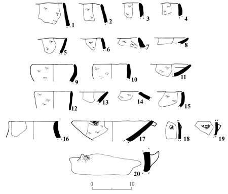
Fig 1
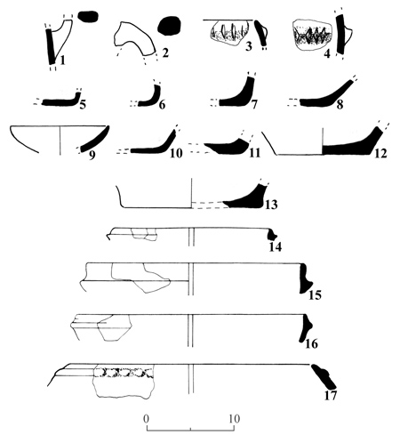
Fig 2
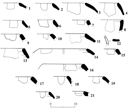
Fig 3
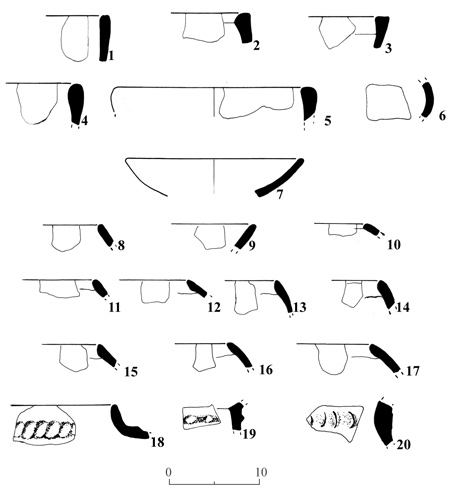
Fig 4
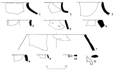
Fig 5
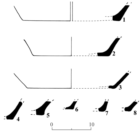
Fig 6
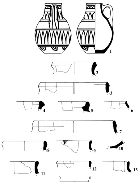
Fig 7
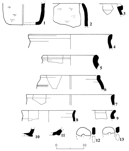
Fig 8
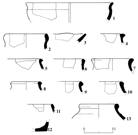
Fig 9
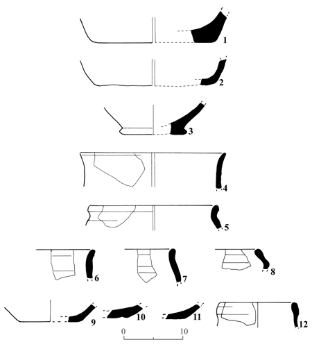
Fig 10
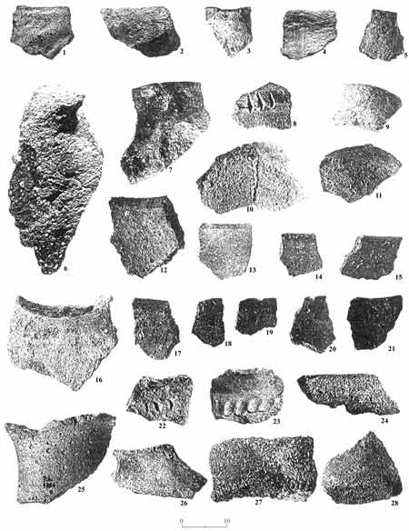
Plate 1
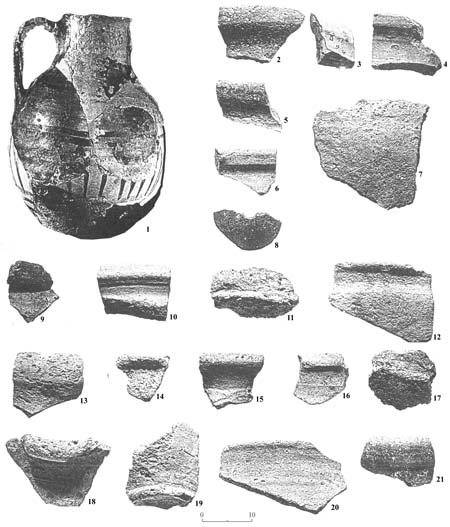
Plate 2
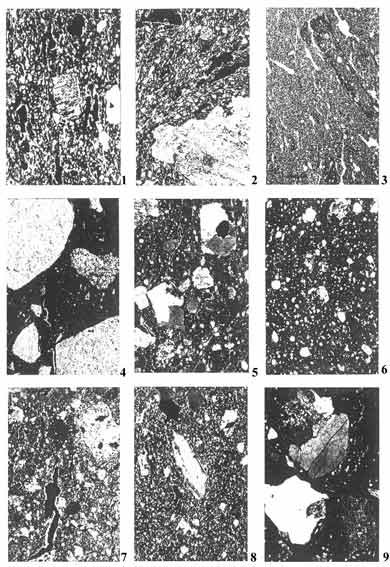
Plate 3
Plate 4
Plate 5
Based on our ceramic analysis, we propose the following historical reconstruction of the periods from the late Neolithic to the Early Bronze Age IV (MB I).
It is well established that during the Neolithic period, the >Uvda Valley was already inhabited (Yogev 1983). We identified the S-A CA Early Phase in the >Uvda Valley and assumed that this period may have been either contemporaneous with or in direct continuation to the abovementioned Neolithic sites. The technological resemblance of the main ware family of our S-A CA Early Phase to the Late Neolithic Qatifian Ware of the northern Negev supports this assumption. In evaluating our data from the S-A CA Early Phase it emerges that the pottery, as well as the lithic assemblages, are not homogeneous. Such a situation would imply either chronological, functional or cultural differences among the sites, or a combination of such differences. So far, we cannot point to distinct chronological relationships, though it appears that the sites included in this category belong to a long time-span that began in the 6th or 5th millennium BCE, and ended at the end of the Chalcolithic period.
The lithic assemblages found in S-A CA Early Phase sites often belong to the Eilatian culture. However, other lithic assemblages, containing Timnian lithics, also occur. Although Kozloff suggested that the Eilatian lithics are Chalcolithic and Timnian lithics are later, we found no clear support for such a proposition. In fact, in the light of radiocarbon dating, which was not available at the time Kozloff made his suggestion, it appears these lithic industries could have begun as early as the 6th millennium BCE. Timnian and Eilatian lithic assemblages quite probably overlap during the S-A CA Early Phase, or part of it, and there is so far no way of telling which was earlier. It appears, however, that the Eilatian culture disappeared at the end of the Chalcolithic period and the Timnian culture remained––possibly the only lithic culture during the Early Bronze Age and perhaps until as late as the early part of the Early Bronze Age (EBIV) in the Arabah/Sinai.
One of the most interesting wares found in the Arabah and throughout the Sinai, is Platy Laminar Carbonate Temper Ware (PLC). This ware is abundant in the mixed sites of the >Uvda Valley, but it also occurs at S-A CA Early Phase sites of the Arabah. The PLC group was found at most sites associated with Timnian as well as Eilatian lithics, and with almost every ware distinguished at S-A CA Early Phase, Middle Phase and Late Phase sites of the Arabah and the >Uvda Valley, as well as at many sites in the Sinai. This situation indicates that the PLC Ware is the most stable pottery tradition in the region. In fact, it is more than probable that a pottery workshop producing this ware operated continuously from the S-A CA Early Phase through S-ACA Middle Phase and until the very end of the S-A CA Late Phase––a period covering at least 1,000 years. This sounds almost impossible, considering the desert conditions of the Sinai and the Arabah, and the way nomadic populations come and go. However, we should also remember that the climate during at least part of this period may have been more humid than in later periods, and that the inhabitants probably led a pastoral-nomadic life. Indeed, the abundance of sites in the >Uvda Valley belonging to all three phases indicates that the desert was probably more populated than in later periods. In any case, our evidence, especially the presence of PLC Ware, indicates continuous habitation of this area through the S-A CA Early, Middle and Late Phases. This quite firmly establishes the concept of the autochthonous Sinai population, which appeared and began to prosper during the S-A CA Early Phase, namely as early as the 6th or 5th millennium BCE.
Regarding the relations between the Sinai and other areas during the CA-EP, there are several indications. First, the total absence of Chalcolithic wares from Be<er Sheva> Valley points strongly to the conclusion that the Be<er Sheva> -Abu-Matar people did not reach as far as the southern Arabah. After petrographically analysing every single sherd found at the S-A CA Early Phase sites, it can be stated with certainty that the typical wares of the Be<er Sheva> Valley are absent. (I examined many Chalcolithic assemblages from the Be<er Sheva> area, including Arad, and they are clearly dominated by one type of ware––a coarse, variegated carbonate sand that is easily recognized.)
We cannot exclude the possibility that a connection with Ghassul in the eastern Jordan Valley did exist. In fact, the chain of S-A CA Early Phase sites leading from the Timna Valley northward to eva does indicate connections with the north. However, it must be emphasised that pottery at S-A CA Early Phase sites is mostly local, which would mean that during the S-A CA Early Phase, the Sinai population was relatively isolated. This is also supported by the fact that Nile wares are absolutely absent from the S-A CA Early Phase sites of the Arabah, showing the absence of contacts with Egypt as well. Still, this cannot be said of the entire Sinai. And as we shall see below, this state of relative isolation changes in the S-A CA Middle Phase.
Another interesting point as we attempt to trace aspects of the region’s history and trade relations is the early history of the arkosic Sinaitic cooking pot. This cooking pot is perhaps the most common vessel in the Sinai. During the EB II it was traded extensively, reaching as far as Arad. Our evidence from S-A CA Early Phase sites suggests that arkosic cooking pots were manufactured in the Sinai well before the Aradian market came into being during the EB II and created a high demand for it.
The S-A CA Early Phase cooking pot may have differed from its later variant in several aspects. The main differences are the flat bottom and the non-thickened, primitive rims, while it shares its <holemouth shape and arkosic composition with the more advanced EB II arkosic cooking pot. The earliest inhabitants of the Sinai in the S-A CA Early Phase knew how to work with arkosic materials to produce holemouth cooking pots. Moreover, trade in these pots must have begun during the S-A CA Early Phase, although so far we cannot show that this trade extended as far as it did later, during the S-A CA Middle Phase.
Arkosic, holemouth, thin-walled pots were found in distinctly sedimentary terrains, such as the >Uvda Valley and other places in the Sinai, indicating that the pots had been transported over distances of up to several dozens of kilometers. Findings in these areas also clearly show that vessels other than cooking pots were traded. Most common among these are PLC Ware, which were manufactured in central Sinai and were found in the southern part of the peninsula.
It may also be assumed that the rounded bottom of the S-A CA Middle Phase cooking pots is a Sinaitic innovation and not an element introduced from the north by Aradian people. The main argument supporting this idea is that in Arad itself only the imported arkosic pots have a rounded bottom, whereas local holemouth jars tempered with calcite always have flat bottoms.
It is clear that at least some of the S-A CA Early Phase population was involved in prospecting for and smelting copper, but is this the complete story? The S-A CA Early Phase sites in the >Uvda Valley and some clusters of S-A CA Early Phase sites in central Sinai, where there is no copper, suggest a more complicated picture. We may be dealing with more than one group. Would this explain at least some of the variations among the lithic assemblages of the S-A CA Early Phase?
The S-A CA Middle jaseP by definition is marked by the appearance of the more advanced arkosic cooking pots with thickened rims. In addition, the pottery assemblages from S-A CA Middle Phase sites are much more variegated than those of S-A CA Early Phase sites. While more than a few S-A CA Early Phase sites are mono-ceramic––that is they contain only one ware of uniform petrographic composition––S-A CA Middle Phase sites show many different wares, some of which are always imported. At Site 201A and other S-A CA Middle Phase sites we found Nile wares, indicating that connections with Egypt embraced the entire Sinai and also reached the southern Arabah. The presence of muscovite-bearing holemouth cooking pots at Site 201A and other sites in the Arabah also indicates that the distribution of this special cooking pot, which was most probably manufactured in the high mountain region of southern Sinai, reached as far as these areas. Moreover, the presence of Aradian burnished pottery at some of the >Uvda Valley sites points to connections with Canaan. However, it must be remembered that imported wares, such as Aradian and Nile wares, occur only in small quantities.
What happened to the Sinaitic cooking pot during the S-A CAMiddle Phase? As mentioned above, the rounded bottom is most probably a Sinaitic innovation, although we would only be able to prove this by being able to look at a complete S-A CA Early Phase cooking pot. Still, the thickened rim appears to be an imported aspect. What may have happened is that the Aradian market found the local tradition of producing cooking pots highly effective, and suddenly created demand for large quantities of this pot. However, the new market demanded not only quantity but quality. The Aradian market was accustomed to holemouth vessels with thickened, carefully formed rims––quite probably with the aid of a simple turning device––as well as to slipped surfaces. We shall never know for certain who produced these cooking pots ––local Sinaitic potters who upgraded their craft to satisfy the new market by modifying an already existing manufacturing tradition, or new settlers who absorbed know-how from the local people. Might newcomers and locals have even worked together, sharing their knowledge?
Be that as it may, the new cooking pots became very popular, not only in the more civilized centers such as Arad, but also among the local inhabitants of the Sinai, as can be seen by the extensive occurrence of this pot at sites showing no Aradian Ware at all and no other indications (such as architectural design) of the presence of the Aradian people.
What happened when the city of Arad came to an end? Here we confront one of the most difficult parts of our story. How can we distinguish local Sinaitic pottery that belongs to the period between the EB II and EB IV? This is a period of several hundred years during which there were probably no connections with Canaan. Moreover, so far we have found no Canaanite pottery at the Arabah sites dating to the EB III. But this obviously does not mean that the local population disappeared.
The best proof, perhaps the only proof, which we have for continuity in local Sinaitic pottery, is the presence of PLC Ware in association with typical EB IV combed wares, which can be considered the mark of renewed connections between the local Sinaitic population and Canaan. The fact that PLC Ware was found with S-A CA Early Phase and Middle Phase wares and with Aradian and combed EB IV wares, provides us with the best support for our hypothesis of the continuous presence of the autochthonous Sinaitic population from Chalcolithic times to the EB IV.
So far, we have discussed the impact of Aradian connections the local pottery industry mainly as it can be seen in arkosic cooking pots. The PLC Ware, on the other hand, shows no distinct modification during S-A CA Middle Phase. This may be explained by the fact that the major Aradian sites in the Sinai are in the high granite region of southern Sinai, the natural provenance of the arkosic cooking-pot industry, while the main distribution of combed EB IV pottery is in the central sedimentary terrain, the natural provenance of the PLC Ware.
However, PLC Ware did undergo modifications during the S-A CA Late Phase, modifications that can be explained in terms of ceramic technology in Canaan during EB IV.
Let us describe the changes in the local Sinaitic pottery industry in the S-A CA Late Phase. The normal type of PLC Ware is low grade, buff or pale gray ware with gray platy laminar carbonates that show no signs of decomposition, indicating a relatively low firing temperature. The calcareous matrix of this normal type is anisotropic and shows no signs of vitrification. It is an extremely uniform ware that is found in S-A CA Early, Middle and Late Phase sites. However, higher grade types of PLC Ware occur only in S-A CA Late Phase assemblages.
Among the higher grade we distinguish two types: red PLC Ware and black PLC Ware. In the red PLC Ware, the carbonate temper shows various degrees of decomposition, indicating a temperature of firing higher than that for the normal buff or pale gray type. Transitional types between the normal and the red also occur, although there is no textural or other noticeable difference between the normal and the red, except for those that can be related to firing temperature. However, in the black type, the carbonate temper was modified completely. It transformed into a milky white cryptocrystalline aggregate with a glassy reaction rim against the argillaceous matrix. The temper also changed from a platy to a more rounded shape. Moreover, the matrix of the black type is completely vitrified and smoked through. The black type is therefore the highest grade among the three, a fact that manifests itself also in its great hardness. We can find also transitional types between the red and the black types. These changes show that something happened to the firing procedure of the Sinaitic potters–– a move from open firing to a primitive kiln. That would explain both the higher temperatures and the heavy charring.
We also noticed differences between S-A CA Early Phase and S-ACA Middle Phase in the repertoire of forms of the PLC Ware. We know very little about the form of the pottery produced during S-A CA Early Phase and S-A CA Middle Phase. Rim and bottom sherds of PLC Ware indicate that the forms are extremely simple, mainly bowls with a trapezoidal section and probably some holemouth jars with flat bottoms. But in the S-A CA Late Phase at least one is added to this very basic repertoire––the necked jar.
The change in the firing procedure is more remarkable than the change in form, and for us it is more important, because it allows us to date S-A CA Late Phase sites on the basis of a few body sherds of the red and, especially, the black types, even if the combed EB IV wares are totally missing.
Thus, the transition from EB III to EB IV in Canaan is marked by several technological changes among which the increased use of the kiln and the application of higher temperatures are conspicuous. These changes might even have been behind other technological changes, such as the disappearance of burnished slips. I shall not discuss here this extremely important aspect of the transition between EB III and EB IV in Canaan, which has been overlooked by archaeologists, since our main concern is with the local pottery of the Sinai. However, a general remark had to be made to support our hypothesis that the red and black PLC Ware types reflect the impact of renewed connections between the Sinai and Canaan.
At some S-A CA Late Phase sites we find all three types of PLC Ware: the normal buff, red and black, and in others we find only the black type. As noted above, at some sites the black PLC Ware is the only ware found; no granitic ware, no combed EB IV wares, just this one type of local pottery. We propose, as a further speculation, that the black PLC Ware constitutes the latest phase of the continuous story of Sinaitic pottery making. But did that phase post-date the EB IV? Although we cannot be certain it did, this possibility cannot be excluded.
But what happened to our arkosic cooking pots during the transition to the S-A CA Late Phase? At S-A CA Late Phase assemblages we no longer find the typical, thickened holemouth rims of these pots that were so characteristic of S-A CA Middle Phase sites. When did they disappear, and why? The only hint we have are some arkosic holemouth rims showing almost no thickening and no turning marks, although they do show a folding of the rim. This type of folding, in an almost uniformly thick rim was by this time no longer functional – but rather continued as a tradition after the original purpose for folding the rim was lost. We propose therefore, that these are degenerated rims, namely a vague memory of S-A CA Middle Phase times, during which the folding was functional and was a stage in the forming of the thickening holemouth rim of the arkosic cooking pot. When the Aradian market closed, there was no external demand for standardized high-grade products, and the local potters regressed to the good old primitive ways. But a vestige of their episode of progress remained in the way the rims were folded.
When did all this happen? So far, the degenerated rims have been found only in association with S-A CA Late Phase assemblages, so the best we can offer is that degeneration took place between EB II and EB IV, and that some potters in the Sinai continued to produce these arkosic cooking pots during the EB IV. It should be noted that these degenerated rims are extremely rare and they probably account for only a small part of the cooking pot industry. More common are holemouth rims with a typical EB IV profile, which were found among the black PLC Ware samples. Here we have evidence of more impact of the connections with the north. The degenerated rims may represent a sub-phase belonging to the early S-A CA Late Phase, but with possible roots in the transitional period between the EB II and EB IV. Because of the extreme rarity of the degenerated rims, there are too few to prove this possibility.
Other changes also characterise the S-A CA Late Phase. One is in the approach to arkosic materials. In the S-A CA Early Phase and S-A CA Late Phase assemblages, clays as well as nonplastics are weathering products of granite rocks. In the S-A CA Late Phase we find abundant examples of wares with an arkosic sand temper embedded in a calcareous clay-rich ground mass. It is quite possible that the change in firing procedure spurred the potters to search for clays that would be highly affected by increased firing temperature. A carbonate-rich clay is definitely such a material.
To complete our story of S-A CA Late Phase times, it should be mentioned that Nile ware, relatively common to the S-A CA Middle Phase assemblages, is absent from the S-A CA Late Phase assemblages we investigated. It appears that there were no connections with Egypt during the S-A CA Late Phase, which makes a great deal of sense if we remember that this was the First Intermediate Period between the Old and the Middle Kingdom, a time of unrest and internal struggles in the land of the Pharaohs.
REFERENCES
Yogev, O. 1983. A Fifth Millennium BCE Sanctuary in the `Uvda Valley. Qadmoniot16 (4) (:118–122) ( Hebrew).
Introduction
The present analysis is aimed principally at confirming the dating of the Arabah Survey sites and is therefore directed toward showing the petrographic similarities between these wares and the wares of the excavated sites.
The first comprehensive petrographic study of Egyptian New Kingdom pottery was concerned with the pottery from the Timna Mining Temple (Rothenberg 1988). This study was intended to establish a pottery classification to be used in all the other detailed studies of the pottery of the New Kingdom period in the Timna Valley and the surrounding areas of the southern Arabah, in order to identify imported Egyptian wares and contribute to various technological and provenance questions. Another study focused on the questions of provenance and technology of the Midianite Ware (Rothenberg and Glass 1983). Following these studies, two other projects were undertaken, one concerning pottery of the smelting camps Site 30 and Site 2 at Timna. Hundreds of samples were analyzed petrographically, comparisons between the sites were carried out and various stratigraphic, technological and provenance questions resolved. All this work concerned pottery from excavated sites, which were the main focus of the archaeological and archaeo-metallurgical research of the Timna Valley. However, pottery was also collected at sites from the Arabah Survey by Rothenberg. Based on these samples, it became obvious, that these sites also belonged to the complex of the New Kingdom sites of the Arabah.
Typologically, the more diagnostic samples are represented on Figs. 7 up to 10 and Pl. 2. These samples were analyzed petrographically under a binocular microscope (thin sections were not prepared). Fig. 7 shows 13 samples representing Sites 198, 13 and 15; Fig. 8 shows 13 samples representing Site 34; Fig. 9 shows 13 samples from Sites 35, 185, 185a, 254 and 254a; and Fig. 10 shows 12 samples representing Site 254b.
Petrographic Analysis
The samples analyzed fall into several distinct petrographic groups, all known from the excavated sites.
1. Normal Pottery
This is the predominant group among the 11 survey sites. Of the 45 samples analyzed, 28 belong to this ware, which was quantitatively the most important at the excavated sites as well. The ware represents a local wheel-made industry, responsible for producing everyday household vessels, such as jars, cooking pots, bowls, etc. As at the excavated sites, this group can be subdivided into two main subgroups, called here Ware A and Ware B.
Ware A
Ware A was identified in 13 samples from Sites 13, 15, 34, 185 and 254. It is characterized by a relatively fine texture (coarse non-plastics are absent or very few), a rich silty fraction with quartz and carbonates and finely divided organic fragments. The coarse non-plastics are made of quartz, carbonates, gypsum and fragments that share the petrographic properties of both wares. Ware A is usually hard and compact and was fired to a relatively high temperature. Its surface is buff or cream coated. Most jars are of Ware A.
Ware B
Ware B was identified in 12 samples from Sites 13, 34, 35, 185 and 254. It is composed of the same ingredients as Ware A, but in different proportions and with different texture, this is a rather granular ware with abundant coarse shale fragments and rounded quartz grains. Some samples are rich in gypsum and others in organic fragments. The texture is rather porous, due to shrinkage cavities in and around the shale fragments. The color is usually dark brown or red and the outer surface is commonly charred since many of the vessels of this group are cooking pots.
Three samples from Sites 13, 15 and 34 share the petrographic properties of both wares and are classed as intermediate. Such samples were also present at the excavated sites.
2. Negev Ware
Six samples out of the 45 analyzed belong to the so-called Negev Ware group.
At the excavated sites, this ware shows great petrographic variety. It is rough, handmade ware, tempered with a wide variety of coarse tempers of local origin and fired under a wide range of temperatures, including very high ones. The six Negev Ware samples from the survey sites show the same petrographic attributes and at least four distinctly different coarse tempers.
Three samples (one from Site 34 and two from Site 254) are tempered with fragments of metallurgical slag. Plate 2:7 is a typical Negev cooking pot and is tempered with a mixture of metallurgical slag and arkosic sand. The slag fragments are sharply angular, indicating that the original slag was crushed (crushed slag was found at several places in the excavations. Plate 2:17 is a fragment of a flat base, typical of Negev cooking pots. This sample is tempered by a mixture of crushed metallurgical and coarse organic fragments. Figure 9:3 is a rim fragment from a simple oil lamp. It is a rough, handmade ware, tempered with coarse organic fragments and angular, pegmatitic quartzes. Such temper was identified among the Negev pots of excavated Sites 30 and 2.
3. Midianite Pottery
Three samples from Sites 198 (Pl. 2:1), 34 and 254 respectively, have been identified as Midianite pottery.
This ware is distinctly different from any other ware of this assemblage. All the typical petrographic attributes that distinguish this ware in the samples from the excavated sites are present in these three samples. The colors of the clay-rich ground mass are pale (usually a light gray core and light cream outer zones), and the coarse non-plastics are the very typical red and black rectangular and oval shale fragments.
4. Egyptian Pottery–Nile Ware
One sample, Fig, 8:12 and Pl. 2:8 (from Site 34) is true Nile Ware. It is a red burnished ware, which was broken and re-used as a weight. At the excavated sites, the only wares that exhibit burnishing are imported Egyptian wares.
This sample shows a sandy fraction of quartzo-feldspathic composition and a silty fraction rich in opaque silicates, possibly hornblende (the precise mineralogical composition of the silty fraction cannot be determined by binocular examination). The composition and texture are typical of common Nile Ware.
True Egyptian pottery was also found at the excavated sites, including Site 200, the Timna Mining Temple, where Egyptian wares are relatively abundant (5%).
5. Other Wares
This group includes seven samples that either do not belong to the above groups, or for which definite identification could not be made.
Figure 7:12 (from Site 15) is probably Egyptian Red Ware, tempered with fine sand consisting of quartz and carbonate grains. This is not true Nile Ware, but could very well be a mixture of Nile mud with carbonate-bearing wadi deposits, a material that was much in use in New Kingdom Egypt.
Figure 7:13 (from Site 15) is a rough, handmade ware, tempered with abundant shale fragments. It either belongs to the Negev Ware group or represents another handmade ware.
Figure 8:8 (from Site 34) is a wheel-made ware, tempered mainly with coarse organic fragments. It shows compositional affinity with Negev Ware, but not with handmade pottery.
Figure 8:9 (from Site 34) is a red ware with a thick, dark gray core and a cream outer surface, tempered with assorted organic fragments and quartz sand. It has an affinity with Normal pottery.
Figure 8:11 (from Site 34) is a red ware with a black core and cream surface, tempered with coarse organic fragments and some gypsum. It has an affinity with Normal pottery, Ware-B.
Figure 8:13 (from Site 34) is a red ware with a gray core, tempered mainly with coarse organic fragments.
Figure 10:10 (from Site 254b) is a brownish-red, rough, handmade ware, with a wide, greenish-gray core, tempered with coarse shale fragments.
Conclusions
The samples from the Arabah survey sites, described in this chapter, form a typical assemblage of wares, very similar in both composition and relative proportions to pottery assemblages of the excavated Egyptian New Kingdom sites of Timna.
The major groups are the locally manufactured Negev Ware and other pottery, the latter being the predominant group. These two groups exhibit the same petrographic variations that were recognized among the samples from the excavated sites of Timna. The Normal pottery group is represented by the two mainend-members (here named Ware A and Ware B). The Negev Ware pottery exhibits the same variations in the composition of the coarse temper, although because of the relatively small sample (only six samples) not all the compositional types identified at the excavated sites are present at the survey sites.
The two minor imported groups: Midianite pottery (imported from the Hedjaz in Arabia) and the Nile Ware (imported from Egypt) are present at the survey sites in approximately the same proportions as in the excavated sites.
As in the excavated sites, the different wares of the survey sites, are present at all the sites and there appears to be no differentiation of wares according to site. The main conclusion is, therefore, that the survey sites belong to the same Egyptian New Kingdom complex as the excavated sites, and must be considered contemporaneous with them.
REFERENCES
Rothenberg, B. 1988. The Egyptian Mining Temple at Timna, Researches in the Arabah, Vol. I. London.
Rothenberg, B. and Glass, J., 1983. The Midianite Pottery. In J.F.A. Sawyer and D.J.A. Clines eds. Midian, Moab and Edom, Journal for the Study of the Old Testament, Supplement Series, 24. Sheffield. Pp. 65–124.
INTRODUCTION
The pottery discussed below was collected by Prof. Beno Rothenberg from a total of 106 sites, during his survey of the Arabah (see Chapter 1). The chapter begins with a description of the geographical boundaries of the material to be dealt with. It proceeds to a list of the periods to which the pottery may be securely dated, followed by the catalogue. Historical and other conclusions will be presented at the end of the chapter.
The geographic boundary of the material dealt with is as follows
Geographical Boundaries
In the north, Naḥal Peres (Israel Grid coord. width 047) and in the south, the northern slopes of the Jebel el Aseifir and Wadi Taba (Israel Grid coord. width approx. 875). To the west, the survey included the >UvdaValley and Naḥal Hiyon (Wadi Huneik), and further to the south, the Naḥal Milḥan (Wadi Milḥan) and the north west of Elat, and the line of border hills of Sinai from Har Shani southward to Mount Yehoshafat. In the east, the survey terminated along the border with Jordan. Major emphasis was given to the southern region up to Mount Qetura (Israel Grid coord. width 940).
When attempting to date our material upon commencing our work in the early 1980s, we became sorely aware of the unsatisfactory state of our knowledge of the everyday pottery of these regions, produced locally and in adjacent regions. This deficiency was all the more severe as we were dealing exclusively with surface finds. Fortunately, more recent updates are able to take advantage of various studies that had been conducted meanwhile. These, however, only confirmed the fact that most types of pottery continued in use from one period to another. In many vessels only small divergences were detected in the shape of certain parts over the 700 years from the Nabatean period to the end of Byzantine rule and even later. 1
As for fabric and ware, with the help of Dr. J. Glass we were able to trace some of our finds to Egypt since they were made from Nilotic clay. Others hailed from Petra. A large quantity of pottery was locally produced, although it could have been made from clays found not only in the Arabah but also in the Negev (see J. Glass, Three Ceramic Phases). However, local wares have not been sufficiently published and one can only reiterate that many early and late products, from Hellenistic times onward, have practically the same appearance, particularly in the case of homemade pottery.
In the absence of a sufficient quantity of clearly defined period pieces, such as Megarian bowls, fishplates, Terra Sigillata Ware, Late Roman Ware, glazed and painted Islamic pottery or distinctive kitchenware or lamps, there must perforce be a certain amount of chronological overlap.
The periods to which pottery may be securely dated are:
A. The Hellenistic period, commencing with possibly a few sherds from the Persian period up to the 2nd century BCE.
B. The period of the Nabatean penetration and Roman conquest, with emphasis on the 1st century BCE to the 2nd century CE, including Herodian Judaea.
C. The Middle and Late Roman periods (mid-2nd to mid-4th centuries CE)
In the absence of very obvious wares, such as relevant types of lamps, this period is one of the most difficult to define using only material collected during a survey, which could not be checked by excavation of the site. Many of the 2nd-century shapes continue with slight changes into the 3rd century or later, while many shapes found in the 5th century may have had their beginnings earlier. In any case, we are convinced that the early stages of this period are well represented. Nothing definite can be said about its later stages, though the Diocletian presence in the Arabah is beyond doubt. 2
D. Byzantine periods, 5th–7th centuries CE, and the transition to the Early Islamic period.
Historical and archaeological evidence for the presence of the Byzantines in the Arabah is very meager3 and the state of the sherds collected from the sites surveyed by Rothenberg does not permit us to define a clearly Byzantine phase for any of them. We must therefore repeat that our material may not be earlier than Period E (below), the transition from Byzantine to Early Islamic times, commencing with the latter part of the 6th century CE. It must be remembered that the Arabah survey did not turn up a single ‘Late Roman’ sherd or any of the ‘Eastern Mortaria’, to quote two types of wares exceedingly common at Byzantine sites. Yet, since, as stated above, the Byzantine presence in the area, especially a military one, cannot be ruled out, we have decided to publish all material that has a strong link with known Byzantine wares under this heading. If these wares are eventually shown to belong to the Byzantine period, a reason must be sought for the absence of the above-mentioned Late Roman or E. Mortaria Wares and other hallmarks of the pottery of the period.
E. The Early Islamic period (7th–10th centuries CE)
Owing to the gradual penetration of Arab tribes into the Arabah during the Byzantine period, a large portion of the pottery in use during the first (three?) centuries of Arab rule can in most cases be dated only with difficulty, even after the publication of material from relevant sites
––alas, so far in most cases without sufficient stratigraphical profiles. This goes, of course, primarily for the everyday wares, which are the overwhelming majority of pottery collected during the survey. The two features we observed throughout our work are also evident in other publications, i.e., the transitional nature of the pottery of the earliest phases of this period and the continuity of shapes of vessels throughout the entire period.
F. Fatimid and later periods (10th–16th centuries CE)
Since almost all of the sites surveyed ceased to be occupied permanently at some time during the Middle Ages and with the almost complete absence of glazed, painted and otherwise decorated wares or lamps that serve for a more easy and exact dating, all material from the Fatimid period onward is being dealt with under one heading.
The complete absence of common bichrome painted wares, which are a major hallmark of the Ayyubid and later popular pottery throughout Palestine, makes it almost certain that sedentary settlement in the area of our survey did not continue into that period, although a very small quantity of sherds of this family may possibly come from as late as Mamluk times.
G. Glazed sherds ––the few such sherds are discussed together under this heading.
H. Unidentified wares
At least part of the unidentified wares, belong to homemade (?) wares produced with little change from earlier periods onward and continued to be produced in more remote regions in the Negev and Sinai almost until the present. Owing to the nature and purpose of our survey there is no point in discussing these wares in detail.
M. Ottoman period
The abandonment of sedentary settlement in the Western Arabah throughout the Ottoman period is well attested. These wares of this period, which were left by wayfarers and roaming tribes, have bearing neither on the history of settled life in the area of the survey in general nor on its metallurgical industries in particular. We have this abstained from discussing them.
Following here is the catalogue of finds, arranged chronologically according to the major types of vessels. The catalogue includes a selection of sherds from those found at all the sites, chosen as representative of either typical wares or unique or infrequent items of interest. All types of pottery that are helpful in dating the sites surveyed have been included.
DISCUSSION
A - Hellenistic Wares
(Cat. Nos: 1–3, Fig. 1: 1–3). These rims belong to the family of "large cylindrical to bag shaped jars" of type ii, Lapp, PCC. However, this rim type does continue into the 2nd century CE and it is only with reservations that dating could be based solely on these rims. Our allocation is based upon the ceramic context and almost exact parallels from published material. Under the jar rims of Type A1, we differentiate between:
A1a - Round collar: (Cat. No. 1, Fig. 1:1)
A1b - Elongated collar, triangular (Cat. No. 2, Fig. 1:2)
A1c - Elongated collar with shallow groove under lip: (Cat. No. 3, Fig. 1:3)
A2 - Fishplates (Cat. Nos. 4–9, Fig. 1:4–9).
Fishplates are common to all Palestinian sites under Hellenistic influence. They were discussed extensively by C. Kenyon in 1957, when dealing with the pottery from Samaria. The Samarian finds "begin with a few Attic imports of the late 4th century" and include "a large local output in the 2nd century."4 We would allocate our finds both on the basis of historical probability and comparison with the published material of the 3rd–2nd centuries BCE, the period of Diadoch, Ptolemaic and Seleucid penetration into the Arabah. The average standard of production is of good quality and above. The ‘pseudo–Attic’ dark slip has the typical Palestine slip, varying in hue from black to brown. Some sherds have a definite red slip5. Some at least must have originally been highly polished. The bases were all ring bases, either rounded or angular in section, and on average smaller than the published examples from Samaria. The heavy disc of type 52 Lapp PCC is completely absent from our finds. According to the differently shaped rims, the fishplates can be divided into three shapes:
A2a - With broad drooping rim: (Cat. No. 4, Fig. 1: 4)
A2b - With narrow, drooping rim: (Cat. No. 5 Fig. 1: 5)
A2c - With horizontal ledge rim: (Cat. No. 6 Fig. 1: 6)
A3 - Carinated bowls (Cat. Nos. 10–11 Figs. 1: 10, 11)
These vessels have no exact parallel in their ware that is equal to that of the fishplates and with the same slip. However, they do foreshadow the mid-1st century BCE cups, represented with sundry other shapes under Type 51, Lapp CPP. The nearest parallels come from mid-2nd century contexts in Shechem and Samaria, which have been related to late 2nd century bowls from the Athenian Agora.6
The thin incised groove under the rim reappears in Nabatean and Herodian period cups. 7
A4 - Bowls with rounded, upright or, more commonly, slightly incurved rim (Cat. Nos. 12–18 Fig. 1: 12–18).
Similar in fabric and surface treatment to A3 above. In shape these bowls are rounded or slightly carinated, compared with the rather carinated sides of A3. There is a variant of this shape in a more orange colored clay and without the ‘pseudo- Attic’ slip, but with slip of the same clay as the body and band smoothed, giving a "Fine Byzantine" appearance. This vessel is referred to as Vessel 4b, as against the dark slipped 4a.
The production quality is slightly lower than of the fishplates. Both shiny and dull imitation Attic black glaze (the ‘pseudo–Attic’ brownish slip) were found. Often the outside or inside were only partly slipped.
These vessels also often have an incised groove under their pointed rim. While Lapp has collected for this type 1.1 and 2 published specimens that feature disc bases8 , their absence from our find material makes us reconstruct these bowls like the fishplates with ring bases.
Some of the bowls of this type are of an orange colored ware and similar slip, and may possibly be dated later than the ‘pseudo-Attic’ colored wares, i.e., to the second half of the 1st century CE.
A5 - Small rounded bowl or cup (Cat. Nos. 21 (Fig. 1:21) (rim), 22 (Fig. 2: 1); 23 (Fig 2:2) (ring base).
These vessels are of a redder hue than A1–A4 and have a red, well-burnished slip that shows the same signs of wear from exposure to the elements, such as the erosive desert winds of the Arabah, as the ‘pseudo-Attic’ wear. The bases of these cups are of various ring shapes.
A6 - Ring bases (Cat Nos. 24 [Fig. 2:3]–43 [Fig. 2: 22])
Various ring bases of the same ware and surface treatment as our bowls A1–A4 and obviously belonging to them. They come from large and small vessels.
According to their shape in cross-section, we observe:
A6a - Rounded, slightly everted bases, fitting large, heavy bowls and plates (Cat. No. 25 Fig. 2:4)
A6b - As above, but square in section (Cat. No. 26 Fig. 2:5)
A6c - Pointed, slightly everted base ring, belonging to a small vessel (Cat. No. 27 Fig. 2: 6)
A6d - As above, with outside of ring diagonally bevelled (Cat. No. 28, Fig. 2: 7)
A7 - Ledge-rimmed cooking pot (Cat. No. 29 Fig. 2:8)
Cooking pots of this type, with concave outflaring rims, are not uncommon in this period. They fall within type 7 2, 1 of Lapp's corpus, although none mentioned there offer a close parallel. Similarity in the shape of the rim occurs in Petra, but that of the body differs. Where the ledge rim and body shape are alike, the vessel, a casserole, has a black wash (Petra Street, Pl. XXVII:53). The vessels, ibid. Pl. XXXI:123–126 also have certain affinities. Prototypes could be found among the Persian period craters cited by E. Stern9
The inward extending ledge facilitates the covering of the pot with a lid rim or another vessel.
B - Nabatean and Early Roman Wares
Undecorated wares of the Judean and Nabatean realms are in most cases continuous in shape and technique from the 1st century CE well into the 2nd century CE and even beyond. They may be allocated with certainty to before and after the Roman takeover (105–106 CE).
B1 - Jars
No jars could be allocated beyond doubt to the Nabatean or Early Roman period by virtue of their distinct shape. According to their shape, some of the rims belonging to the types A1 above, represented in our catalogue only by samples, may well have belonged to this period. Ribbed body sherds, not discussed here but represented in the list of finds (see Table 1), must have belonged to Nabatean and Roman times respectively.
B2 - Jugs and Juglets
B2a - Oinochoe Cat. No. 30, Fig. 2:9)
Red clay, red slip; good Pseudo Sigillata Ware, globular jug, recognized by its peculiar out-turned, heavy funnel-shaped ledge rim with sharp lip and undercut10.
These vessels have been encountered at Petra as early as Nabatean contexts and continue at Tsafit into the 2nd century CE or later 11
B2b - Globular jugs
Body and base fragments from medium size globular jugs, some of which at least may have been oinochoai (B2a above). The wares vary from fine Eastern Terra Sigillata to coarser imitations.
B2b(1) - Cat. Nos. 31, 32 (Fig. 2:10, 11).
Eastern Terra Sigillata with gray core imitation. They have a concentric groove incised just inside the thin base ring, on the flat dish of the base, and the rings themselves are often somewhat angular in section. The incised groove is a typical mark of Nabatean production and appears on various vessels.
B2b(2) - Cat. No. 33 (Fig. 2: 12).
As above, but with rouletted or otherwise impressed notches on the base.
B2b(3) - Cat. Nos: 34–36 (Fig. 2: 13–15).
These are walled vessels, wet-smoothed on the outside with a thin ring base carved out from the underside of the body.
B2b(1) and B2b(2) are typical ‘Nabatean’ vessels. According to the publications, their floruit was between the 1st and 2nd centuries CE. The base of B 2b(3) is not well represented in published material and may even belong to small open bowls and saucers, such as those found at Qumran.12
B2b(4) - Cat. Nos. 37, 38 (Fig. 2:16,18).
Diverse ring bases, not necessarily carved out. The fragmentary state makes detailed allocations to definite vessels difficult.
B2c(1) - Cat. No. 39–41(2:17, 19, 20).
Concave ring bases with a cup shaped bottom, belonging to jugs or (less likely) bowls. Their lifespan, according to published counterparts, was similar to B 2b(5) above. This base also appears with thicker sided and larger jugs of which a large portion, but not all, were oinochoai.13
Note the section of No. 40 (Fig. 2:19), which is typical of derivations and imitations of Eastern Terra Sigillata jugs from the 1st to 3rd(?) centuries CE.14
No. 41 (Fig. 2:20) is a transitory type.
B2c(2) - Cat. Nos. 42, 43 (Fig. 2:21, 22)
No. 42: base, similar to B2c(1) but without central cavity.
B2d - Globular Juglet Cat. Nos. 44, 45 (Fig. 2:23, 24)
This juglet was another typical vessel at sites dating from the Hellenistic period onward. The peculiar shape of its cup rim is dated to the latter half of the 1st century BCE. These juglets may have variously shaped bases. This specimen has a hollow disc base: 45 (Fig. 2:24). >En Boqeq II, p. 40 sums up fittingly: "most [of these jugs] are from 1st century BCE to the 1st century CE contexts and to a lesser extent the 1st half of the 2nd century context."
B2e - Strap-like Loop Handles
These handles are typical for various Nabatean (and contemporary Judean) vessels and seem to have developed out of Hellenistic prototypes. The majority of our handles seem to belong to jugs and juglets. A considerable variety exists in the details of these handles. Some of these are represented among our finds:
B2e(1) - Cat. No. 46 (Fig. 2:25).Double ribbed, broad strap handle with incised grooves.
B2e(2) - Cat. No. 47 (Fig. 2:26). Double-ribbed, narrow strap handle with incised groove(s).
B2e(3) - Cat. No. 48 (Fig. 2:27). Double-ribbed, narrow strap handle without incised grooves.
B2e(4) - Cat. No. 49 (Fig. 2:28). Thick, double-ribbed strap handle with grooves.
B2e(5) - Cat. No. 50 (Fig. 2:29). Thick, narrow strap handle without grooves.
Unfortunately, in most cases published material pays at best insufficient attention to these handles. Several relevant comparisons accessible to us have been included in the catalogue. It does not appear to be a coincidence that the dating of subtypes B2e(1)–(3) and B2e (5) is post-Roman conquest. The remaining specimen, subtype B2e (4), has a parallel at Petra allocated by Horsfield in his Petra, p. 118 Pl. IX:29, to the 1st century BCE–1st century CE. Yet this jug was discovered together with a definitely later painted bowl fragment, so even in this case the pre-conquest date is not beyond doubt.
There is one parallel to subtype B2e (1) (Fig. 2:25), which comes from the excavation of Migdal Tsafit and was found in Stratum 1, i.e., under the post-anarchy reconstruction floor 15. This stratum commenced with Trajan or somewhat later. We have thus a post-conquest parallel to our sherd, the dating of which is without doubt 2nd century CE Roman. In view of all the comparative evidence, we suggest a 2nd to 3rd century Roman date for these handles, with the proviso that any one of them, and according to A. Negev certainly subtype B2e (1), could have been produced in pre-conquest Nabatea . 16
B2f - Small elongated pouring vessels (Cat. Nos. 51, 52 Fig. 2:30, 31)
Various body sherds may best be assigned to vessels such as Hammond, Pottery from Petra, p. 41, nos. 12–20; Mampsis Necropolis, No. 44 and the like. The former include types from the Nabatean to the Late Roman periods, which are differentiated by portions of the vessels missing from our fragments. The latter had its floruit in the second half of the 2nd century CE.
B3 - Bowls, Cups, Plates and Dishes
The absence of close parallels from Judean sites as Tel >Ira and >En Boqeq underlines the Nabatean-Arabian sphere of ceramic productions.
B3a - Rounded bowl with upright upper portion (Cat. Nos. 53, 54 Fig. 3:1, 2).
This is akin to A4 but thicker, coarser and of different clay. The rim is either tapered or thickened: B3a(1) and (2) respectively. The bowl might conceivably be contemporary with A4 (see Catalogue).
B3b - Carinated bowl (Cat. No. 55 Fig. 3:3).
Deep, thick sided, with rounded rim and deep groove beneath.
B3c - Deep, sharply carinated bowls and cups of coral color and related hues. The thin groove under the sharp, straight rim, which gives the impression of a tiny ledge, is the hallmark of the Nabatean bowls of this family.
B3c(1) - Cat. Nos: 56–58, 60, 61 (Fig. 3:4, 5,6; 3:8,9).
Without rouletting on the outside.
B3c(2) - Cat. Nos. 59, 62, 63, 64 (Fig. 3:7,10.11,12) .
Rouletting may be in a simple notch pattern such as Cat. Nos. 63 and 65 (Fig. 3:11 and 13), or with a pattern of rhombi, teeth and others as in Cat. No. 64 (Fig. 3:13). Comparisons such as Petra Street Pl. IX:1, 24; Pl. XXXI:114–116, point to a 1st–2nd-century date. A complete and exact counterpart from Sabra, south of Petra, has been published by Linder 17. N. Khairi published his comprehensive article "Fine Nabatean Ware with Impressed and Rouletted Decorations18." Following other colleagues, he mentions the Athenian West Slope Ware as a possible source of inspiration for the Hellenistic pottery of Middle East countries, including the relevant Nabatean ware. Khairi mentions the continuation of rouletting in debased form even into the 3rd century, a remark which should be seconded by all with experience of work in this field. It is noteworthy that the exact shape of our bowl is not represented among Khairi's many examples, though similar patterns of rouletting are illustrated, cf. Fig. 2:6–8 therein.
B3c(3) - Cat. No. 65 (Fig. 3:13).
Same as B3c(2) but larger.
B3c(4) - Cat. No. 66 (Fig. 3:14)
With slanting, slightly protruding lip
B3d - Thin-walled, carinated bowl Cat. No. 67 (Fig. 3:15)
This vessel has no exact parallels. The closest is the family of bowls represented by Qumran I, Fig. 4: 1–3, etc., especially no. 9 and those examples cited in the Catalogue.
B3e - Thin-walled bowl, with variously shaped upright rim (Egg-shell Ware) (Cat. Nos. 69, 70, 71, 72, 73, Fig. 3:18,19,20,21 (and others; not published). This typical Nabatean vessel is the unpainted counterpart of the painted Nabatean bowls discussed under B5 below. The shape of Cat. No. 68 Fig. 3:17 falls into the family of Hammond's pottery from Petra nos. 83–87, with 85 being the closest parallel. They are dated "from the end of the Hellenistic period onwards." 19 In Hammond's classification this shape is found with certain variations within his category I3(b) and possibly I3(c), belonging to approximately the 1st century BCE. Cat. No. 72 belongs to the category I2(c)4, 7, i.e., "end of the Hellenistic period.20 Cat. No. 71 (Fig. 3:19) has its parallel in Petra Theatre Pl. LIX.13, which comes from period 1c, which is 2nd century Roman. Cat. No. 73 is an exact counterpart of Hammond's I1(a), 1: "end of Hellenistic period.21 In its general form it also parallels Mampsis Necropolis, Fig. 7, 51 belonging to Phase 2. Both comparisons are, however, from painted bowls; ours is definitely unpainted. Type B3e seems to belong, at least partly, to the pre-conquest 1st century CE of the Nabatean realm. According to comparisons with published material, the vessels with the thinnest walls among our finds may be reconstructed with a rounded bottom, such as Cat. No. 69 (Fig. 3:16) (cf. reference to Macheronte).
B3f - Cat. No. 74 (Fig. 3:22).
Same as above, but much thicker ware
Following the general observation that throughout the 2nd and 3rd centuries CE Nabatean shapes tended toward coarser and simpler outlines, one is inclined to allocate this sherd to the Roman period.
B3g - Cat. No. 75 (Fig. 3:23).
Pseudo-Sigillata Ware, upright moulded rim
Bowls with similar rims were common both in the western and eastern parts of the Roman Empire. A Hellenistic antecedent comes from Beth Zur. A near parallel is the rim from Samaria (Samaria Sebaste, Fig. 81:28). The general shapes akin to B3g in the west are Ritterling Type 5, Loeschke Type 10a and related wares. In the east, these bowls appear among the Eastern Sigillata A wares. A local example is Shikmona III 35–36, which has its counterparts in the Early Roman Pergamene of Antioch (Waage, Antioch, shapes 453–460). We are thus well within the 1st–2nd centuries CE.
B4 - Cooking Pots
The cooking pots will be analyzed according to the distinct shape of their necks and rims. Sherds collected from other parts of the vessels do not suffice to attempt a reconstruction of the pots as a whole. However, sufficient comparative material has been published to allocate most of our finds to a specific category. Once more, the general closeness to certain cooking-pot ‘families’ of the Judean repertoire must be pointed out, together with the considerable divergence in detail.22
B4a - Thick, angular in cross-section, outsplayed rim, with undercut
Cat. No. 76 (Fig. 4:1).
This shape is typical for Petra during the Early (2) Roman period has been allocated variously between the 1st and 3rd centuries CE. The outsplayed rim and the narrow internal ledge at its base are ideally suited for covering the pot with a well-fitting lid.
B4b - Cat. No. 77 (Fig. 4:2).
Similar to the above, but with elongated rim collar and groove, this shape is even more convenient for a hermetic closure by lids. Its period seems to be parallel to the above.
B4c - Cat. No. : 78 (Fig. 4:3).
Different in shape, but with an inner ledge hold a lid and with a groove. This neck has its nearest parallel in shape among the finds from Jaffa and Machaerus. It may well be of Roman date.23
B4d - Cat. No. : 79 (Fig. 4:4).
Thin rim with slightly protruding collar and a slight groove. These grooves are typical of many Herodian and Roman cooking pots. They enjoyed a distinct comeback in the Arabah during the Early Islamic period (see Catalogue Nos. 117–124 Fig. 5:16- 6:6). Although the period B rims are distinctly different in detail from those of period D, parallel cooking pots from west of the Jordan and the Arabah, such as Cave of the Letters, Fig. 41:21, Tsafit, Fig. 14:1, etc. are very similar to our period D rims. Comparative material points to a range of time from not later than the 1st century CE. (such as the pot from Herodian Jericho, Pl. 42:10, 43:6) to well into the Roman period (Tsafit). As with type B4c above, a Nabatean date is therefore not certain and our specimen may be post-Roman conquest 24
B4e - Neck of thin-walled, ledge rim, broad mouthed cooking pot
Cat. Nos. 80, 81 (Fig. 4:5-6).
These vessels continue the tradition of the best-levigated and best-fired Nabatean kitchen ware. They are dated by their published parallels to the mid-2nd century CE. (cf. the sealed deposits of period 1c at the Petra Theater: Petra Theatre, pp. 35, 97, Pl. LVIII:22).
B4f - Cat. No. 82 (Fig. 4:7).
Unique and unparalleled in publications. Probably pertaining to a cooking pot. Even this shape has the fashionable groove of the time.
B4g - Cat. No. 83 (Fig. 4:8).
This vessel may well have been a jug; however, it belongs to the best Nabatean kitchen ware and its function remains doubtful. Somewhat similar fragments have been catalogued in Alayiq, both as Roman cooking pots (ibid. Pl. 23 X 76) and as jars (ibid., X67, 108). However, there is a similarity in shape with the Hellenistic cooking pots from Kenyon's family nos. 8–21 (Samaria Sebaste, Fig. 41) and especially Nos. 15 and 16. Both have the inner ledge, created by the shape of the neck and its attachment to the body as a ‘lid device’ i.e., shaped to take a lid on top of it. The shape of our rim is similar, but the inner ledge is formed by the interior cavity, which could have served the same purpose as the groove on the rim. Though a 3rd-century BCE date cannot be ruled out, we have assigned this vessel tentatively to the Nabatean or Early Roman period. This date is sustained by the cooking pot from Samaria, 1a deposit, which has the same type of groove (clearly a lid device) as our pot (Samaria -Sebaste, Fig. 69-10), and a second one from the same place with a very similar neck (ibid., 7).
B4h - Base of cooking pot or cooking pot ware jug
Cat. No. 84 (Fig. 4:9).
Flattish fragment with concentric ribs and omphalos on the inside and outside. This sherd must be dated post-Roman conquest according to its closest comparisons.
B5 - Painted Wares Cat. Nos. 84–101 (Fig. 4:10–26).
About 50 sherds belonging to Nabatean Painted Wares are represented in the pottery examined.
Following Schmitt-Korte's attempt at a generalized, 25 based on published material and opinions, we may have sherds belonging to this Phase I (1st century BCE), Phase II (1st –2nd centuries CE) and Phase III (2nd–3rd centuries CE).
Schmitt-Korte's Phase I tallies with the early phase of Parr's sequence (contemporary with Phase V of the British School excavations), while his phase II seems to correspond to the later phase of Parr's sequence (1st century CE.26 Parr, referring to the following period, which includes the deterioration and phasing-out of Nabatean pottery during Roman rule after(?) the Antonine period, stated in 1970 that "for the time being, the later history of the development of Nabatean painted pottery remains obscure." 27. A. Negev's research also sheds light mainly upon Phases I and II. In his monograph on the Necropolis of Mampsis, he counted three phases of Nabatean pottery history, and terminates Phase III at the end(?) of the 3rd century, when the painted pottery died out.28 .
Fortunately, however, we may now use Zayadine’s excavation of the pottery kilns at Zurrabeh in Petra29 to support our opinion and that of several other colleagues, that considerable production of painted wares continued well into the 3rd century and that their relatively debased quality and rough production, may serve as criteria for their inclusion in a separate group, as Schmitt-Korte and others have proposed.30 . It is important to note, that Zayadine, speaks of mass production in the later period31. Small wonder then that Early as well as Late Nabatean material is attested among our finds. A terminus ad quem about 300 CE for the production of Nabatean Painted Ware is suggested by our interpretation of the Mishnah (Niddah 7, 3) : "All stains (=ketamim) brought from Petra (=Reqem) are pure", which is taken to refer to the stained designs of the above.32
B5a - Phase I
Very few sherds can be allocated with certainty to Phase I, which is in line with the generally limited amount of pre-Roman Nabatean wares. Outstanding examples are Cat. Nos. 85 and 86 (Fig. 4:10 and 11). According to Hammond's classification, both belong to Class I, type I, i.e., both are Fine Nabatean, "Bent Rimmed Bowls." Their rims are of the curved variety. According to the comparisons offered by Hammond, these bowls belong to the end of the Hellenistic period.
B5b - Phase II
Because of the very fragmentary state of the Phase II bowls, most specimens were allocated to this group because of their being of very thin eggshell ware, or their great excellence in production.
A fine example of these wares is the bowl of Hammond's Class I, type 2(c), Cat. No. 87. The rim and wall shape is akin to Hammond's No. 6 of the above type. 33
A body sherd belonging to Phase II products, Cat. No. 55:117, bears the painted design of a wind-blown palmette, not unlike examples from Oboda (Oboda-Negev Pl. 4:6, 7 or Pl. 6:13, etc.
Our cup or deep bowl, Cat. No. 85 (Fig. 4:10), probably has a nearly exact parallel in the cup from the Mampsis Necropolis (ibid., p. 117, no. 70, Fig. 9, p. 128). The latter is a surface find. Owing to the thinness of the walls and the fine execution, we tend to allocate this vessel to Phase II.
Cat. No. 94 (Fig. 4:19) has a design that I propose to identify as the head of a dolphin or related sea creature. The broken-off part contained the body.
B5b - Phase III
Allocation to the later phase of production was also based on fabric, fabrication and designs. The background pattern of parallel lines or gridding disappears from those published examples with large palmette designs, attributed to the later periods, such as bowls from Phase XII or XIV at Petra, or the kiln wasters from Zurrabeh. Without going into the details of A. Negev and R. Sivan's contention as to the dates and time limits of production, we wish to quote their observation that at the Mampsis Necropolis "palmettes and the “double cone” motifs [are] the only decorative elements employed in the decoration of the painted bowls of Phase II," i.e., during the 2nd century CE. The illustration they present (Fig. 9:62), significantly, lacks the striped background34
We were also inclined to see an indication of a later date in the absence of parallel stripes or intricate, small filling designs: dots, drops, leaves and so on. This is an interesting phenomenon that must be seen as an autochthonous development that was later arrested by the influx of Arabian taste which, toward the end of the Byzantine period, reintroduced designs with a pronounced horror vacui. According to the above, we allocate to our period B5c bowls the fragments such as Cat. Nos. 98, 99 (Fig. 4:23, 24) and the Cat. No. 101 (Fig. 4:26) cup. Cat. No. 96 (Fig. 4:21) may well belong to a late stage of B5b.
Of special interest is No. 97 (Fig. 4:22), which has a late palmette, like those from the Petra bowls mentioned above, but on a background design of small dots in straight lines. We have found no published examples of this background design. On the strength of the fabric and the palmette, we propose a 2nd- to 3rd-century date CE, possibly early in Phase III.
C - The Middle and Late Roman Period ( Hadrian to and including the Tetrarchy ).
As indicated above, much of the early 2nd-century pottery CE continues into the later part of that century and beyond. My own experience at Migdal Tsafit 35has confirmed my conviction that many of these shapes continue without change into the reigns of the Severan emperors, and that only in Illyrian times did new shapes make an appearance that became distinct throughout the 4th century. Distinguishing new shapes of kitchen and other utility wares from among sherds only is often difficult, to say the least, and makes allocation of sites to any given period, in the absence of very distinct wares, questionable.
Consequently, there is evidence of pottery that can be allocated with certainty to the 3rd–4th centuries CE. A few of the vessels that were classified as Byzantine/Early Islamic may in fact belong to this period. Had they been acquired by excavation, it would have been possible to be more exact. Excavation in the military sites of Ḥaẓeva and Yotvata did indeed uncover a clear Diocletian to mid-4th century level.36
Certain types of vessels are presented below that might belong to the Middle and Late Roman periods. Alternatively, some could be dated to the 2nd century and others to the 5th century CE. According to J. Glass, C ware clays came from local deposits (See Glass, Chapter 2).
C1 - Jars and Container
C1a- Cat. No. 102 (Fig. 5:1)
From among the many body and other sherds from vessels with shapes that were common for prolonged periods, one single base stands out: the stump base. This short, broad and hollow stump with a slightly sunken central knob has no exact published counterpart avAylable to us from Greater Palestine, nor in material from the Mediterranean. Affinities with amphorae of Zemer Types 30–32 and 42 cannot be denied, nor with Egyptian shapes such as Kelley 1976, Pl. 99.5:133. Zemer Type 41 is dated to the 2nd–3rd centuries CE, Kelly's example to the 3rd–4th centuries CE. Undated bases from Israel, which again have some common features, come from Nessana (Pl. LVIII: 36, 37). When we add to the above the ribbing of the body, clearly apparent on our fragment, we feel permitted to allocate this amphora to the Roman or Early Byzantine period. For the latter, examples exist from Egypt and Cyprus, but none has exactly the same shape as ours.
C1b - Handles. Cat. Nos. 103, 104 (Fig. 5:2, 3).
These handles are massive, broad straps with up to seven parallel, narrow ribs between shallow grooves. The vessels had a sharply(?) carinated transition from shoulder to sides, and a collar at the base of the neck.
No published comparisons have been encountered. R. Cohen has, however, been able to identify these wares as 3rd–4th century products similar to finds from his excavations. We note that the ribbing continues the Nabatean-Early Roman fashion of smaller vessels (see Type B2e, above).
C2 - Cooking Pots
C2a - Cat. No. 105 (Fig. 5:4).
High necked with protruding, squarish cross-section, rounded lip and rim collar.
C2b - As above, with narrow collar.
Cat. Nos. 106, 107 (Fig. 5:5-6).
This shape has no exact parallels, but has similarities with features from the 1st century onward (Petra Theatre, Form G, 18, etc.). The 2nd century CE offers related features in vessels from Petra and Mampsis. The shape and ware are similar to pots from Tamara, which were discovered in 4th-century CE layers.
C2c - Low, convex in cross-section neck with square in cross-section rim collar
Cat. No. 108 (Fig. 5:7).
The shape of this neck follows the trend of development beginning in the 2nd century CE. (Wadi Daliya, Cave of Letters). However, our specimen is a lower-necked vessel and reminds us of 3rd–4th century CE pots from Jerusalem (North Wall, Fig. 23:10, 18).
C2d - High- and medium-necked cooking pots with strongly pronounced rim collar of mediocre ware and firing.
C2d(1) - High-necked .Cat. No. 109 (Fig. 5:8)
Necks are mostly ribbed (not published). These necks have sometimes a slightly everted rim, suitable for a lid. D57/A/21 has a distinct groove for this purpose. The collars are rounded in section, sometimes with a slight undercut. Comparative material is scarce. At Tamara similar necks were allocated to the 3rd century CE. Type KT4 at ‘En Boqeq, which is higher and lacks ribbing, cannot be allocated with certainty. The earliest example of this type comes from the 4th–5th centuries37. High- necked cooking pots were, on the whole, more common in the Roman than the Byzantine period, but C2d/1 also fits into post-Roman times38
C2e - Lower and unribbed necks.
These rims, often without even a light undercut, although on vessels other than cooking pots, are definitely Roman39. There are definite affinities to Late Roman cooking pots from Meiron.40
C2e(1) - Cat. Nos. 110, 111 (Fig. 5:9, 10)
Everted, concave on the exterior or straight necks with variously shaped collar rims. Some have lid posing devises (e.g., Cat. Nos. 110, 115).
C2e(2) - Cat. No. 115 (Fig. 5:14)
Low necked, as C2e(1), but similar in shape to C2d
C3 - Casseroles. Cat. No. 116 (Fig. 5:15)
Unribbed, bell-shaped vessels with perpendicular loop handle. This vessel has composite characteristics. Its color and technical execution are much like the best cooking-pot ware from period B, while the shape of the ridge handle and the sharp inturned slanting rim are common in the Late Roman, Byzantine and Early Islamic periods. The perpendicular loop handle appears on casseroles on Nabatean sites from pre-occupation times such as Petra,41 and in contemporary Herodian period sites such as Qumran. 42The rim and body shape of these casseroles is, however, quite different from our specimen. In the Late Roman and Byzantine periods the perpendicular loop handle became very common but, according to publications, as a distinct north-Israeli feature. 43In Judea and the Negev, no perpendicular loop handles were reported until 1982, but the horizontal loop is still the dominant casserole handle in those parts.
The similarity in the number of sites where Period B and C pottery was discerned
(29 and 31 respectively; see Table 2), does need to be mentioned. In the absence of more distinct material this could mean, not only as assumed, that the earlier phases of the post-Roman conquest are preponderant, but that we were unable to be more precise than to consider periods B and C as one entity ( and see below)
J. Glass has suggested a possible Nilotic extraction of the clay of our vessel, which, if correct, might explain the deviations from common local features. The authors have not been able to find an exact Egyptian parallel. Another region where there is evidence for the perpendicularly attached loop handle on a casserole or pan, albeit with a differently shaped ring, is found in the Northern Hijaz survey (Site 200/83 ATLAL 5, 1981, Pl. 84:1). This site has produced a considerable quantity of Nabatean pottery. The attachment of the handle, shape of the vessel and rim, as well as the quality of treatment during production lead us to date this vessel to the Middle or Late Roman period, although an earlier date is possible.
The conclusions from the above have been anticipated in our opening remarks to Section: C Much of the early 2nd-century pottery CE continues into the later part of that century. Thus distinguishing new shapes of kitchen and other utility wares from among sherds only is difficult and makes allocation of sites to any given period questionable. There is evidence of pottery that can be allocated with certainty to the 3rd–4th centuries CE. A few of the vessels that were classified as Byzantine/Early Islamic may in fact belong to this period.
D - The Byzantine Period.
The author collected 4th century Byzantine pottery between 1958 and 1966, from the following sites: >En Tamar, Meẓad Haqiqar, Ḥaẓeva, Moa - (Mojet Avad), the Farm, towers north of Elat.44
The mining sites and other sites connected with this industry produced very few sherds that can be assigned with complete confidence to the Byzantine period, as far as shapes and wares are known from Judea and published material from Southern Transjordan, such as Mount Nebo, Heshbon, Dhiban and Ayla. We would have doubtless identified as Byzantine a certain quantity of body sherds and handles, mainly from large jars and cooking-pot -ware vessels, if we had but a few of the corresponding rim and neck pieces definitely known as such.
Lacking these, and also the corresponding necks etc. from later periods, we must emphasize that the Byzantine nature of many find complexes is based on an argumentum ex silentio: the absence of convincing indicators for allocation to other periods. Further research and, above all, excavation are of course needed in order to be more explicit.
In this section on the Byzantine period, we shall deal with pottery that seems truly Byzantine in character but has also been excavated in Early Islamic contexts. This continuity is a well-known phenomenon in all of ancient Palestine. The author was confronted with it at Emmaus and >En Boqeq. It is also apparent from the research in Trans-Jordan including Ayla and its region 45.
Consequently it must be borne in mind that the pottery examined might embrace either the Byzantine or the Early Islamic periods. It could be argued, that the Period D pottery could have been treated within Period E (Transition and Early Islamic times). The differentiation stemmed from the desire to examine all evidence pertaining to the Byzantine period proper (mid-4th to 7th centuries) for the operation of the Western Arabah mines in this period. Because of the solid literary evidence for the Byzantine presence northern (Zoara) and southern (Ayla) edge of the Arabah and adjacent districts from Diocletian to Justinian and beyond, this was a must, although as it turned out, much of the material examined is not to be dated unambiguously. Scholars point to the earthquake of 636.CE as the date for the end of occupation of the military sites: Ḥaẓeva, Moa and Yotvata. Although it would be harsh to assume a complete parallel cessation of occupation in all sedentary settlements, we could, unfortunately produce no solid proof for a continuation. 46
D1 - Cooking Pots Cat. Nos. 117–119 (Fig. 5:16, 17; 6:1, 2).
D1a - A narrow-mouthed, medium high, broad shouldered cooking pot with deeply grooved rim and elongated handle. The walls are thin to very thin and recall Herodian and Nabatean wares.
D1b - The same vessels, but larger, heavier-walled and of different clay; rather well baked.
Cat. Nos. 120–122 (Fig. 6: 1–4), etc. (not published)
Attention has been drawn to the appearance of the groove in Herodian/Nabatean times. At Tsafit (Fig. 4:1–10) these rims reappear in exactly the same shape as our D1a, not later than the early 4th century and possibly before. Allowing for the differences in style between northern and southern Israel encountered in most vessels, the Meiron pots, commencing with the 3rd century CE, are much akin to ours.47 At Tamara exact parallels to our pots come from 4th–5th-century levels, according to coins and pottery. The Tamara pots have the same handles, with an elongated upper part that is nearly horizontal and consequently drops off rather perpendicularly towards the edge of the shoulder. This handle is usually double ridged (Cat. No. 121 Fig. 6:3). At >En Boqeq, where the shape of these pots was designated as BA.48 They are all ribbed and the base is flat. Small fragments of bases and body sherds, answering to this description, have been retrieved from sites that produced these rims.
The comparative material quoted is in ware related to D1a above. The D1b specimens are similar in shape and fabric to cooking pots from Early Islamic sites, excavated in the Arabah (pers. comm. from the excavators) and we must discover by further research whether our tentative assignment of D1a to the Byzantine period and D1b to Early Islam times is to be maintained.
D1c - Cat. Nos. 123, 124 (Fig. 6:5, 6), etc.(not published)
Pots with various shapes, related in ware and rim design to D1b above. However, the rim is more ledge- than groove-shaped. This is a feature that was also developed in the Herodian/Nabatean sphere. 49.
D1d - Cat. Nos. 125–127 (Fig. 6:7–9), etc. (not published)
These large pots are well fired and produce a high metallic ring when struck. They are brown-gray to gray (Munsell 5 PB 7/4; see Catalogue), with large purple- blue grits. The authors have only collected vessels of this make in the Arabah during survey. J. Glass has traced some of the vessels, belonging to this group, to local lay deposits. The quality of the production and the color of the core are reminiscent of earlier, but not later medieval products. Therefore we have included these vessels in our period D. The typical neck is convex in section.
D1e - Jug or small cooking pot. Cat. No. 128 (Fig. 6:10)
This vessel bears certain affinities to Cat. No. 109. Its fabric and finish are, however, rather different from most contemporary cooking-pot ware vessels and it could have been produced at an earlier time. Our allocation to the Byzantine period is based partly on the incised cross on the handle. However, this could be an owner's mark or similar symbol, without religious connotations.50
D2 - Casseroles
Casseroles with inward sloping rim and horizontal loop handles.
Cat. Nos. 129–132 (Fig. 6:11, 12, 7:1, 2).
This is the typical casserole throughout the Byzantine period, abundant in the latter part (6th–7th centuries). The pushed-up handle is also a common feature in those days. At ‘En Boqeq these casseroles were in use during the post-conquest period, which may have lasted until the end of the 7th century ('En Boqeq I, pp. 230–235, Discussion of Byzantine Casseroles [Kasserollen, KAS]). At Abu Gosh two casseroles of our type, but with a non-pushed-up handle, belong to the "ceramique rouge du X-XI siècles" (ibid., Pl. B:25–26). Cat. No. 131 (Fig. 7:1) is made of similar clay to D1b and, like those vessels, we considered an Early Islamic date. A good comparison for D2 from Jordan comes from site F 3-3, east of the Dead Sea and the Lissan Peninsula. The sherd there is designated as a bowl fragment, which is possible because of its shallowness (cf. Wadi >Isal, 1981, Fig. 14:F, p. 270). It is attributed to the Late Byzantine period. The published samples cover the typical variants in rim forms. These include:
D2a - Cat. No. 129 (Fig. 6:11)
D2b - Cat. No. 130 (Fig. 6:12)
D2c - Cat. No. 131 (Fig. 7:1)
D2d - Cat. No. 132 (Fig. 7:2)
D2e - Cat. No. 133 (Fig. 7:3) – casserole lid.
for specifications, see Catalogue.
D3 - Jugs
D3a - Stirrup jugs (flasks)
D3a(1) - Heavy sides, high neck and pushed-out collar at height of attachment of the handles.
Cat. No. 134 (Fig. 7:4). The pushed-out neck collar and the attachment of the handles to it are the hallmarks of the pilgrim's flasks from >En Boqeq that were produced from the same yellowish-green clay and covered with the same ‘floury’ white to cream-colored slip like the Arabah flasks. Our specimen has a heavy out-flaring rim, which was encountered neither at >En Boqeq nor in published material.51 Whether it was a jug or pilgrim's flask cannot therefore be ascertained. The time frame at >En Boqeq was from the 5th century onward, with a decline in Early Islamic times. D3a(2) As above, without the pushed-out collar, and with a less flaring rim and of pink clay. Cat. Nos. 135, 136 (Fig. 7:5, 6).
This is a common shape at >En Boqeq in the 5th–7th-century levels.
D3b - Trefoil Jug
Trefoil jugs are frequent in the Nabatean pottery repertoire (Petra Theatre, Pl. LVI:2, Petra Street, Pl. XXXII.137, etc.) and reappear in sizeable quantities in the Byzantine period. Their fabric is cooking-pot ware. Diverse forms have been discussed in ‘En Boqeq. None is exactly parallel to our specimen, but all belong to the same family.
D3b(1) - Straight-necked and with pushed-down foils. Cat. No. 137 (Fig. 7:7).
D3b(2) - As above, but with a thin collar around the neck.
Cat. Nos. 138. 139 (Fig. 7:8-9).
The clay is yellowish turning grey in color.
D3b(3) - This variant lacks the pushed-down ‘side foils’, but has the same collar as D3b(2).
Cat. Nos. 140, 142 (Fig. 7:10-11).
An exact counterpart of this sub-type comes from Bethany (Fig. 58:628).
D3c - Similar to D3b, but with round (not trefoil-shaped) rim.
Cat. No. : 143 (Fig. 7:13).
This jug also has an exact Byzantine (6th century ?) parallel from Bethany (ibid., Pl. 127:6 and note the same sort of handle).
D3d - High-necked jug with variously shaped rim collars.
Cat. No, 144, 145, 146 (Fig. 7:14-16) = D3d(1), D3d(2) and D3d(3) respectively.
For particulars see Catalogue.
These jugs of light gray clay and cream-colored slip belong to the type of jugs K1-K3 of >En Boqeq,52 although they are not exactly the same. Our jugs belong to the 4th–6th centuries CE. The trefoil jugs continue, mainly with a strainer, into the Middle Ages and beyond (see Catalogue).
D4 - Jars
Bag-shaped jars with sharply ribbed body and rounded bottom dominate the repertoire of Byzantine storage jars. Since they contain shapes that evolved from Herodian times onward and continue into the Ottoman period, occasional small differences, mainly in the shape of neck and rim, are often the only means of visual differentiation. However, ribbing on jars decreases drastically from Umayyad times onward 53and the great paucity of ribbed jar-body sherds, which may be safely allocated to the D4 jar necks, tends to assign these jars to a late Byzantine family of vessels. In that case we would, however, lack evidence for Umayyad and later jars from the otherwise Islamic or probably Islamic sites, which would be difficult to explain.
D4a(1) -Plain necked jar with slightly out-turned rim.
Cat. Nos. 147, 148 (Fig. 8:1-2).
D4a(2) - As above, with rim collar.Cat. Nos. 149, 150, 151 (Fig. 8:3-5).
D4a(2)a - Straight necked, right angled attachment of neck to body.
Catalogue No. 149 (Fig. 8:3)
D4a(2)b - Inverted neck, rounded collar rim and rounded interior attachment of neck to body. Cat. Nos. 150, 151 (Fig. 8:4-5).
The neck shape D4a(1) has affinities to those of some variants of the Byzantine jar VK1 and VK2 from >En Boqeq, of a type usually dated to the 4th–5th centuries, with a slight possibility of continued use in the 6th–7th centuries. There are, however, distinct differences. See EB I pp 134-135. D4a(2) has no exact parallel in published material, but the narrow neck and the collar at the base of the neck suggest a Byzantine date.
General parallels exist however (see Catalogue, cf. Nazareth, Fig. 219:5). Cat. No. 149 (Fig. 8:3) is of green ware, which in >En Boqeq appears from the late 6th century (?) onward and continues into the Islamic period. The surface survey conducted by the authors over the past years has produced green ware from Islamic sites that have been considered medieval. Moreover, the sites in the Arabah, where the jars were collected, produced no other pottery types of distinct Byzantine date. Nor did the sites with Early Islamic pottery produce any jars of different shape. Therefore, we tentatively propose an Early Islamic date for at least the great majority of all Type D jars.
D4a(3) - Typical round bottom fitting the above Fig. 8:6 –No.152.
D4b - Stump base of amphora. Cat. No. 153 (Fig. 8:7).
These bases appear throughout the Roman and Byzantine period. They might even belong to a sub-type of Byzantine amphorae (Gaza Storage Jars). Wine jar (Zemer 49–53). Stump bases appear in ‘En Boqeq 54Kh.el- Mefjer (Fig. 15:4), etc.
E - Late Byzantine and Early Islamic period (6th/7th–10th centuries )
In contrast to the vessels discussed under Type D, which have a definite leaning toward pottery of the Byzantine age in spite of their easy accommodation in later ensembles, Type E-period pottery can be more securely fixed partly into the transition period after the Islamic conquest and partly into the following times, up to the end of Abbasid rule.
Even the most recent excavations have, as far as published, not yet provided sufficient stratigraphically documented material to distinguish clearly between Abbasid and earlier material, based upon a broad consensus. Following the widely supported revision of the dating of the Kh. el-Mefjer wares, the whole structure of Early Islamic pottery chronology for Palestine has come under new scrutiny.
Kh. el-Mefjer and associated wares, plain, molded, incised and appliqué, some of which may date to an earlier time, are almost absent from our sites. Our identification of part of the material, largely non-published body sherds, to the Umayyad period, was influenced by the close examination of this author's study of the Umayyad pottery from J. Kaplan's excavation at the White Mosque of Ramle.
Clay analysis of some of our pottery proved Egyptian import as well as local production in this period. We hasten to add that the abundance of Samaria Ware in the Aqaba excavation proves that ties also existed with the north, which, as to be expected, became distinctly evident in the Abbasid period.
E1 - Large and Heavy Necked Storage Jars Cat. Nos. 154, 155 (Fig. 9:1-2).
The form of this neck comes within the scope of D4 above. The heavy walls and diameter of the neck suggest Byzantine jars, exhibited in various museums and collections in Israel. They could well have continued into the Middle Ages. Their pottery context from the sites concerned is, however, Early Islamic, or even later.
E2 - Fine Byzantine Ware. Cat. No. 157 (Fig. 9:4)
Only four fragments of Fine Byzantine Ware were identified with certainty , see Cat. Nos. 158–162 (Fig. 9:5-9). These were cups of Type γ.55 Some sherds from juglets and jugs were made from similar ware (c.f. Cat. Nos. 156, 163 (Fig. 9:3, 10). Fine Byzantine Ware, originating in the Byzantine period, continued to be produced up to the Abbasid period and possibly later. Form γ is among the most long-lived .56 The sherds collected in the survey are akin to the latest specimen in >En Boqeq i.e., probably of late 7th-century date or thereafter(?); see Catalogue.
E3 - Jugs
E3a - Flat and disc-based juglets Cat. Nos. 163–166 (Fig. 9:10-13).
Numerous bases of these vessels, with and without omphalos, marks of string cutting, etc. were collected. We tend to associate most of these with the later periods because of their general appearance. See Catalogue for subdivisions.
E3b - Jugs or bottles with elongated and ribbed bodies
Cat. No. 167 (Fig. 9:14); Reg. No. 90/56.
Jugs of this type from a Byzantine context have been published in various places such as Bethany (Fig. 62). There is also a possibility of reconstructing this fragment as a flask, not unlike those from Bet She>arim III, p.195, Fig. 94:12) or the jugs from Mount Nebo (Nebo II, Pl. 150:1–8). These jugs are quite abundant in unpublished finds from museum and other collections and are all considered Roman-Byzantine. However, certain affinities exist to (Early) Islamic wares, such as the jugs and juglets of wares 21 and 22 from Kh.el- Mefjer (pp. 72 ff. and Fig. 14).
E3c - As above but broader and larger
Cat. No. 168 (Fig. 9:15).
This vessel, and to a lesser degree those of E3b, have much in common with Cafarnao Typo E1. Loffreda stresses both the affinities with "Mefjer Ware" and the Byzantine date in Capernaum (Cafarnao II, Pls. 61–65, Fig. 15, 1).
E3d - High-necked and narrower than E3b
Cat. No. 169 (Fig. 9:16)
The nearest comparison, from Nazareth (I, Fig. 219:2), is undated.
E3e - Flat jug bottoms. Cat. No. 170 (Fig. 9:17).
Flat-based jugs are common in the Middle Ages. They were used with various wares at Kh. el-Mefjer (Fig. 5) and again with White Ware jugs in 10th–11th-century layers at Abu Ghosh (Pl. C). This bottom is not at all common in Roman and Byzantine vessels.
E3f - Disk-bottomed jugs. Cat. Nos. 171, 172 (Fig. 9:18-19), etc.
The disks are often only tiny offsets between the sloping wall and the flat bottom of the jug. They are quite easily detected and are distinct from E3e above. Like the flat bottoms, they have their counterparts, but in different clay, at Kh. el-Mefjer (Figs. 14, 15).
F - Later Islamic: Fatimid, Crusader, Ayyubid and Mamluk Periods (10/11th–15/16th centuries)
F1 - Jars
F1a - Large storage jar with broad ring under outsplayed rim.
Cat. No. 179 (Fig. 10:5).
The fabric and color are uncommon in Byzantine and earlier vessels. Jar Y60 and some other Nitla jars have some affinities. The Byzantine prototype, with average thick walls, has been traced to Kh. al-Karak (Pl. 55:4). The same rim also comes from a latter 6th century-CE context in Dibon (ibid., Fig. 12, 8–12, 28, etc.). Our later allocation is based on the difference in form, clay heaviness and color, which, according colleagues we queried, and to published reports from Jordan, bear a great resemblance to later Medieval wares. The tendency to thick-walling can however not be denied.57
F1b - Rim.Cat. No. 180 (Fig. 10:6)
This rim differs in details from the above, but probably belongs to a vessel of a much larger size and same family. However, it could belong to a heavy bowl (cf. Abu Gosh, Pl. G:8).
F2 - Jugs
F2a - Heavy stirrup-handled strainer jug. Cat. No. 181.
This vessel continued the general tradition of vessels like the Byzantine “Bügel Kannen” (BK3) from ‘En Boqeq and their comparisons.58 The closest from the Arabah survey is D3a(1). (Our allocation to the Middle Ages may be mistaken and is based upon unpublished material from predominantly Medieval sites.)
F3 - Bowls––Unglazed Wares
F3a - Large ‘sugar bowls’.
Cat. No.: 182 (Fig. 10:8)
These rather deep and heavy bowls are said to have been used for the production of sugar-cones from crushed and processed cane sugar. According to medieval sources, sugar cane grew in the Jordan Valley and on the southern shores of the Dead Sea. A large quantity of these vessels was discovered on and around Tel Shalem in the Jordan Valley, south of Bet She’an.59 In Jordan, sugar mills were discovered as far south as Moab and Edom, where the Ayyubid and Mamluk periods are the main periods of sugar production.60
F3b - Small ‘sugar bowls’
Cat. Nos. 183, 184, 185 (Fig. 10:9; 11:1-2).
Smaller in size than E3e above, with a distinct rim collar. The comparative material for these vessels covers yet frequently deep the period between Umayyad rule and that of the Mamluks, such as Kh. el-Mefjer, Fig. 92:13–22 and Abu Ghosh, Pl. G.14. For further comparisons, see the Catalogue. We wish to stress the differences in detail, but consider these vessels as belonging to one family. The proposed definition of the F3a and b bowls as sugar bowls rests on their reconstruction with a conical bottom. This seems the logical form of the F3b bowls. The F3a bottom, though definitely deeper than indicated in the drawing, is relatively shallow. But parallels have been collected by the author, together with standard specimen, at Tel Shalem (not yet published).
F3c - Thin-walled bowl with thumb impressions on rims.
Cat. No. 186 (Fig. 11:3).
This bowl seems to resemble F3b above in its general outline, but with narrower rim. Thumb impressions occur on local Arab wares until the present. Cf. Dibon, Fig. 7.40 from the Ayyubid destruction layers, which resembles ours, but is identified as a jar rim. Another thumb-impressed bowl rim, but from quite a different type of vessel, comes from Mamluk Abu Ghosh (Pl. G:37). Medieval thumb impressions, other than on bowl rims, come from Dibon, Mefjer and Bethany.61 Byzantine prototypes for thumb-impressed rims do exist (Dibon, 10.44, RR.7:15), but they are rare. An Abbassid period(?) Coptic casserole with thumb- impressed rim hailed from Ayla.62
F3d - Bowl with heavy outsplayed collar rim.
F3d(1) - With wavy line impressions on rim.
Cat. Nos. 187, 188 (Fig. 11:4-5).
F3d(2) - With parallel grooves on rim
Cat. No. 189 (Fig. 12:1).
In shape, this bowl continues well-known ‘Late Roman’ types. At Bethany it was allocated to the 12th–13th centuries, following the stratified finds at Qubeibeh (Bethany) Fig. 57:3, p. 285).
F3e - Bowl with heavy in-turned rim
F3e(1) - Akin to the above. Cat. No. 190 (Fig. 12:2).
F3e(2) - With slight offset between the rim and the outside. Cat. No.: 191 (Fig. 12:3)
F3e(3) - Without offset. Cat. No.: 192 (Fig. 12:4).
F3e(3) is like F3e(2), but with incised wavy lines. Although these bowls may also be assigned typologically to an evolvement from "Late Roman" bowls, the in-turned rim is typical for the Middle Ages (cf. Abu Ghosh, Pl. E (1–6). A rim of this type was excavated at Be
F3f - Large bowl or basin with narrow elongated rim collar.Cat. No. 193 (Fig. 12:5)
There are incised wavy lines on the collar. There are unpublished parallels, but the ware and decoration are similar to F3d and F3e above. On these grounds the vessel was assigned to the Islamic Middle Ages.
F3g - Bowl with high, upright thickened rim, similar in outline, ware and decoration to F3f. above
Cat. No. 194 (Fig. 12:6).
As in the case of the F3f bowl, this bowl has no published parallel known to us. Both F3g and F3f trace their typological antecedents to Late Roman wares.
F3h - Flat bottomed and straight sided bowl. Cat. No. 195 (Fig. 12:8).
The flat bottom was widely used during the Islamic Middle Ages. The same applies to straight or approximately straight-sided bowls and larger basins. Comparisons (see Catalogue) are mostly somewhat different in size or form. Dibon II, Fig. 8:24, 27 comes close. Close parallels also exist in not-yet published wares from the Bathhouse at Emmaus, found in the Mamluk-period layers. Flat-bottomed and somewhat related vessels were collected from the surface at Qurayyah (Survey of Northwest Arabia). This indicates their occurrence in the repertoire of Arab potters but does not assist us in dating our finds more exactly, since the dateable wares collected at the latter site range from Midianite to Nabatean only, although the site is known to have existed before and long after these periods.
Bowls akin in many aspects to the above F3b to F3h hail inter alia from Ayla Aqaba, both from the Muslim town and the kiln site. Some vessels appear to be Mahesh ware or related to it. All of these elements indicate that these vessels should be dated to the Umayyad or Abbasid period (see Catalogue), although they appear in a later context, a problem to be solved only by excavation.
F4 - Jugs or jars Cat. No. 196 (Fig. 12:7)
G - Glazed and other decorated later wares
The pottery dealt with in this section, totaling some 40 sherds, was partly examined by M. Ayalon. Whenever we cite her name, we are basing ourselves on her opinion; in all other cases the conclusions are our own and were arrived at independently. We wish to take this opportunity to offer Prof. Ayalon our sincerest gratitude for her kind assistance.
Although our material was in a fragmentary state, we made the best use possible of published material, such as F.E. Day's Islamic Glazed Wares (in Kh. al-Karak, pp. 44 ff.) and more recent publications enumerated by Pringle63 Our search for comparisons led us both north and south (i.e., Egypt), since Elat-Ayla and, to a much lesser degree, the land routes, may have served as venues of Tulunid-, Fatamid-, Ayyubid- and Mamluk-period pottery into the Arabah Valley.64
Owing to the small size of most of our glazed sherds, much of the following is tentative, the more so since the study of everyday medieval ceramics in the Near East is still at the stage of compilation of a basic chronological corpus of its manifold types, and continues to suffer from the past focusing of attention on "the more magnificent, complete vases, the 'museum pieces'" as pointed out by Waage in 1948.65
Only the more prominent pieces from each group have been described and published in the Catalogue; even these are often small fragments.
G1 - Cat. No. 197 (Fig. 13:1).
Cream to pinkish-beige colored clay interior; glazed green exterior; slipped in cream-to-beige color. The evidence at Kh. Mefjer for this ware (16, p. 70 = 16a, p. 74) is not conclusive (see Catalogue). It may be pre-Abbasid as in Kh.al- Karak.
G2 - Reg. Nos. 43/38, 43/68, 224, 577, etc. (not illus.)
Sherds are green-glazed on inside and outside. The clay is yellowish-brown (2.5 BG 7/4 and similar shades) to reddish and pale=pink buff (such as 7.5 YR 8/4). The glaze is often dull and sometimes brittle with clear ‘veins’. The breaks have rough edges because of the glaze, but the paste is not very well fired. The author has excavated a considerable number of similar sherds in the Transition and Early Islamic layers at Arad. The Arabah sherds of this type were all small wall-fragments and therefore none was included in the Catalogue.
G3 - Cat. Nos. 198, 199 (Fig. 13:3).
Reg. Nos. 119, B4; 119 B05; 119 B5, etc. (not drawn)
The clay is pink buff (10 YR 8/4). The vessels were decorated with motifs in olive green and dark brown or black lines on a light creamish-green to mustard-green background glaze. The interior was unglazed. These are characteristics of the Umayyad wares which, in turn, influenced later Abbasid products.66
We propose an 8th– 9th-century date. However, no exact parallel to the designs on our sherds could be established (cf. Antioch - Waage, Group VI F4, p. 95 f).
G4 - Reg. No. b43/3 (unpublished)
This sherd has a mustard-colored glaze, reminiscent of Syrian wares such as Kh. Kanak, p. 45 No. 9, which is of Syrian provenance and dated to the 9th–10th centuries. Our sherd could therefore belong to the Abbasid period. However, throughout the surveyed region we lack the typical sgraffiato wares, which are an important hallmark of the period; therefore we may consider a later date: Fatimid, Ayyubid or Crusader-Mamluk.
G5 - Cat. Nos. 200, 201 (Fig. 13:6-7).
Black arabesques against a greenish, beige-blue to blue background, produced by the glaze covering the design. This cream-colored ware has decorative motifs that, so far as they could be made out, have affinities with Abbasid Samarra wares. However, sufficient similarities exist in fabric and decoration to compare these sherds with Ware 17 of Kh. el-Mefjer and Group IXB from Antioch,67 as well as the ‘Silhouette Wares’ from Syria and from Egypt. One published specimen from Fustat seems to have an exact parallel design to our Cat. No. 200 (Fig. 13:6).68
G6 - Buff >Atlit Ware (Proto-Maiolica)
Cat. Nos. 202 (Fig. 13:5), 203 (Fig. 13:4), 204 (Fig. 13:8).
This "painted blue and black ware over whitish opaque glaze" may come from a different workshop and have a different provenance from that of the ‘Atlit vessels, since their clay is of a more pinkish hue. However, as far as our material permits, we conclude that our vessels are contemporary with the former and belong to the 13th–14th centuries69
G7 - Cat. Nos. 205– 207 (Fig. 13:9-11)
Cream-colored ware, well fired and blazed both on the inside and outside. Glaze on the fragments preserved has a turquoise to green color. This ware has been dated by Prof. Ayalon to the 13th–14th centuries.
G8 - Cat. Nos. 208–210 (Fig. 13:12-14).
Mainly small fragments of variously glazed vessels of clays that are different although similar in color. The prominent glazes are in the blue-to-green range and may partly be related to G1 and G6 above. Some of the sherds in this group have been dated byM. Ayalon to the 12th–14th centuries; one has been dated to the 9th–10th centuries (see Catalogue).
G9 - Cat. No.: 211 (Fig. 13:15)
Gray-brown ware, recalling the texture and color of hand grenades.70
G10 - Moulded ware. See Catalogue.
H - Unidentified wares
Pottery was collected from numerous sites in the area surveyed the defied attempts at identification. Some wares were so disfigured by abrasive sandstorms and other climatic influences that they could not be made out. Our pythos handles C2 (above) furnish an excellent example of this disfiguration. On both handles large parts of the surface had been eaten away, leaving handles so shapeless that no identification could have been attempted if the upper portions had not been better preserved.
The most distinctive of these wares, which the author had not previously encountered by in any of his own excavations, could be identified neither by colleagues who had experience of excavating in the Arabah, nor in relevant publications. We have named this ware ‘Ware H.’ It was collected by Prof. Rothenberg, the writer and others, from the surface of many Sinaitic sites, and was sometimes the only pottery found.
H1 - Cat. Nos. 213–215 (Fig. 13:19, 20, 17)
A large number of chronologically undefined vessels were storage vessels, pithoi and large jars. They are of various clays and shapes, usually relatively well fired. Their walls are up to 1.5 cm thick and covered with slip. Most have medium to large grits as degraissant, white or black particles, including crushed limestone, shell and basalt.
The less carefully produced vessels are of a coarse, black-colored ware, with inside slip only.
The shape of the necks and rims, as well as of the bases of the majority of these vessels, is definitely Roman to Ottoman. There is practically no published material to use as a guide. Some of the material might feasibly be Egyptian import; the petrographic analysis tends, however, to indicate local production.
H2 - No drawn examples
This ware may have belonged to a family of local, rustic products, probably home-made. The paste included large grits and the finished product reminded us both of vessels produced up to recent times by local tribesmen as well as of Bronze Age pottery. We are unable to take these wares into consideration for chronological definitions and look forward to their future identification in stratified excavations in these parts, present-day boundaries notwithstanding.
.
L - Lamps
L1 - ‘Slipper’ lamps with radiating ribs and two ridges around the filling hole
Cat. Nos. 219– 222 (Fig. 14:3-6).
The small fragmentary nature of the sherds does not permit us to more precisely assign our lamps to any of the sub-groups of this type, beyond the observation that the distinct double-ridged filling hole is a feature of larger lamps ( of Rosenthal and Sivan’s Type B, 1978: 116ff). This is a fair indicator of the larger lamps, in spite of the occasional occurrence of two concentric ridges in smaller lamps as well (Rosenthal and Sivan 1978:112ff); however, they are much less pronounced (although there are borderline cases). With this reservation, our specimens belong to the later group, with a longer duration. While the smaller lamps commence in the 4th century, the larger ones are dated between the early 5th and early 8th centuries. With only the rib and part of the fill hole to go by, we may assign these lamps to both the Byzantine and Islamic periods up to and including Umayyad times.
Cat. No. 220 (Fig. 14:4) has a ribbed body and a design that could be akin to the cross, depicted on a lamp presented by Kennedy 1963, Pl. XXV.631. Cf. also ibid., XXVI.699.
Cat. No. 221 (Fig. 14:5), probably the base of Cat. No. 220 (Fig. 14:4), has concentric base rings akin to a Late Roman specimen from Ramat Rahel (Aharoni, Pl. 32, 1, 2, 3) or to lamps from Beth Shearim III, Fig. 92. Only the first of these examples are ‘slipper’ lamps; their bases are not as concave as our example.
Cat. No. 222 (Fig. 14:6) suggests an unknown pattern beneath the nozzle of what seems to be a slipper lamp.
Five more small fragments of the upper sides of lamps with the definite ribbing of ‘slipper’ lamps were retrieved and registered.
L2 - Disc- shaped lamp with rosette and pellet decoration
Cat. Nos. 223, 224 (Fig. 14:7-8).
The base of Cat. No. 224 most probably derived from the same type of lamp. Note also the similarity of the clay. No parallel designs have been found, although rosettes, pellets and radial ribs do appear as late as Byzantine times. However, a completely identical rosette on a ribbed body is the hallmark of a certain type of Nabatean lamp (Rosenthal and Sivan 1978: 97, Lamp No. 394). A lamp of similar shape and another with rosette was found at Timna (see Catalogue), the former tends to lead our specimen to a 3rd-century date. That type was lamp Fig. 88:3 from Timna. In our fragments the rosette is not sitting on top of the ribs. The rosettes on our fragment on Cat. No. 224 (Fig. 14:8) are akin to those of Timna Fig. 88:3. The Timna specimens are Late Roman. The raised arched double ridge of Cat. No. 223 (Fig. 14: 7) may not have been an ornament surrounding the wick hole, but rather a design on the lamp's shoulder, like those on lamps 408 and 410 of the Rosenthal and Sivan Corpus, dated to the 3rd and 4th century CE. Rosettes and pellets as ornaments on lamps can be traced in Western Palestine to the 1st– 2nd centuries CE, see Sussman 1972, Note 71, below. The petrographic analysis points to Nilotic wares and a Nilotic origin for this lamp. The author could not find Egyptian parallels.71 The problems connected with dating our Cat. Nos. 223 and 224 are somewhat akin to those of Timna 16 and 17 (Fig. 88:3 and 4; these lamps are discussed there on pp. 256–257). Owing to all the above, the small size of our fragments makes their dating uncertain.
L3 - Radially ribbed Islamic lamps
Cat. No. : 225 (Fig. 14:9)
Closely ribbed patterns were frequently applied to decorate various Islamic lamps. See Rosenthal and Sivan 1978:37–38, "Lamps with Linear Patterns", which are dated mainly to the 7th–8th centuries and also their comparative material which suggests a possible beginning in the 6th century (ibid.). Bagatti also suggested a 7th–8th-century date is also suggested by Bagatti.72 See also Kaplan in the Catalogue.
We have similar, unpublished lamps from the uppermost layer at Tamara and from Emmaus. We accept the dating from the eve of the Islamic Conquest to Abbasid times.
S - Fragments of stone vessels
Four fragments of straight-walled, flat-bottomed vessels made of stone were collected from three sites of B. Rothenberg's Survey of the Arabah. Two fragments represent walls and the other two represent bottoms. Though all have been deemed to be "steatite,"73 the analysis proved that they are of varying composition.
S1 - Rounded rim on vertical wall of bowl, made of dark stone
Cat. No. : 175. Fig. 10.1. Provenance: >En Marzev. 74
Petrographic analysis 75: "Biotite (mica) schist. A metamorphic rock". Diameter 14 cm, wall thickness 0.55 cm.
The wall is decorated with incised, double concentric circles around a punch hole within a rhomboid-border pattern of double diagonal lines.76
Similar ‘steatite’ vessels come from:
- Mount Nebo:
Two decorated steatite bowls with almost identical design. (Saller, Nebo II, Pl. 133, Fig. 1:1, 2). Date: end of the Byzantine, beginning of the Islamic period. Cf. Saller, Nebo I, pp. 125, 299 ff, 180, 181 and p. 300.
- Saudi Arabia, Central Province site, 212-262.
A fragment of steatite lid with similar decoration, dated not later than 500 CE. Cf. ATLAL 3, 1979, Pl. 24:175 and p. 33 (related to the Fau material).
- Saudi Arabia, Northern Province site 204-7:
A fragment of a steatite vessel with decoration of incised lines, crossed diagonally to create triangles and rhombi of empty spaces. The given date is Islamic. Cf. ATLAL 5, 1981, Pl. 37:43.
S2 - Wall fragment of bowl. Cat. No. : 176. (Fig. 10.2)
This fragment, made of gray stone, has a narrow ledge 4 cm above the bottom. Petrographic analysis shows: "Metamorphic rock. Schists, containing the semi-precious mineral garnet. The green minerals belong to the mica group". Cf. no. 2, p.1. Diameter c. 18 cm, wall thickness 0.6–0.8 cm. From the following comparisons there is a possibility that this bowl also had incised decorations on some part of its surface.
Similar vessels come from:
- Mount Nebo:
A steatite bowl with narrow ledge encircling the wall. Diameter 13 cm, dated to the 7th and 8th centuries CE. Cf. Saller, Nebo II, Pl. 133, Fig. 2:2. Saller, Nebo I, p. 300:f. 195, p. 301, Fig. 34:2, p. 302.
- Jericho:
A bowl made of "hard grey stone: with encircling ledge, but with two grooves on lower part of the wall, diameter 18 cm". No dating given. (Cf. Herodian Jericho, Pl. 52:7, p. 53).
- Ma>abiyat in northwestern Saudi Arabia:
A steatite bowl with encircling ledge, dated "early Islamic, even Byzantine". Cf. Survey in N.W. Arabia, 1968, pp. 201, 202, Fig. 3:20.
- Site 205-69, 20 km south of Khaibar, northwest Saudi Arabia:
A fragment of steatite bowl with ledge on wall, but with two grooves at the lower part of the wall and two grooves just beneath the rim. Dated ‘Hellenistic’ from 500 BCE or later. Cf. ATLAL 6, 1982, Pl. 33A:15, p. 16.
S3 - Bowl fragment, Jezirat Fara >un . Cat. No.: 177, (Fig. 10.3)
A fragment of a bowl: flat bottom with part of the wall, made of gray stone. Petrographic analysis: "Feldspar-rich rock. Probably a feldspar-quartz porphyry dike. The brown-red stuff is composed of feldspar (orthoclase possibly). On the margins there is a contact with gray stuff which may be part of the metamorphic (schist) country rock". Diameter 22 cm, thickness 0.6–0.9 cm, on the bottom a hole (diameter 0.3 cm) is bored 4 cm from the wall.
Similar vessels come from:
- Mount Nebo:
Fragments of steatite bowls of which the bottoms are similar to our no. 3. Cf. Saller, Nebo II, Pl. 133, Fig. 2.2, 3, 5, 6, 8. Saller, Nebo I, p. 300 no. 195, offers an example of the mending of broken vessels by threading copper wire through perforations in the fragmented bowl.
- Ma>abiyat in N.W. Saudi Arabia:
The bottoms of two steatite bowls resemble the bottom of bowl of Cat. No. 177 (Fig. 10:3). The dating is "Early Islamic, even Byzantine". Cf. Survey of N.W. Arabia, 1968:201, 202, Fig. 3:19, 20.
S4 - Bottom of bowl made of white stone
Cat. No.: 178 (Fig. 10:4).
Petrographic analysis: "Coarse crystalline limestone with fauna, mainly pelecypodes". A pattern of straight grooves is incised on what remains of the wall. Owing to its fragmented state, the complete pattern of the incised decoration cannot be reconstructed. Parallel grooves are visible, rising at a right angle from a straight groove incised diagonally on the bottom. The bottom is slightly convex, diameter 7 cm, wall thickness 0.8–1.0 cm. No parallels have been encountered. Numerous steatite fragments exist in the Riyadh Museum, with decoration of incised double circles round a punch hole. They are however dated to earlier periods; for example, the prototypes of this design go back to Akkadian/Ur III wares of the third millennium BCE.
Steatite mines were found at Najd, Yemen, and the Asir and Oman mountains and are mentioned as a source for the material of steatite vessels. Cf. ATLAT 2 (1978), Pls. 71, 71A: 103, 235, 300, 336, pp. 66, 67.
However, it should be stressed here that metamorphic rocks are found in surface exposure at the piedmont on both sides of the Arabah Valley. At the east of the Arabah these outcrops are found at several places along the valley, from Aqaba to the southern end of the Dead Sea. To the west, these outcroppings extend from Elat to the area surrounding Timna.77 Whether or not these rocks were exploited in ancient times must still to be investigated, but we may consider them as one possible source for our bowls.
The fragments of stone vessels dealt with above must be viewed within the scope of the ancient usage of stone vessels, with or without decoration. Specifically related examples of steatite vessels that come from: Mesopotamia,78
Saudi Arabia,79 Israel80 and Crete81 , give a general view of the geographical range and time span of these objects. Their popularity in Arabia before and after the introduction of Islam is known. Their relative abundance in Early Islamic Ayla has been pointed out by Whitcomb.82
The decoration on our vessel,מספיק כך אין צורך ממספר הרישום Cat. No. 175 (Fig. 10:1 also very common on vessels and other items made from a diversity of materials in the Near East.83
These materials are dated from the 3rd millennium BCE onward. Although, as mentioned above, the use of steatite vessels was very extensive in time and geographical region, we are inclined to accept Saller's dating of his steatite vessels from Mount Nebo.
Our dating of the stone vessels is as follows:
- (Cat. No. 175; Fig. 10:1): end of the Byzantine period and beginning of the Islamic period.
- (Cat. No. 176: Fig. 10:2 7th and 8th centuries CE.
- (Cat. No. 177: Fig. 10:3 7th and 8th centuries CE.
Since the above fragments were surface finds from the Arabah Survey, we suggest that our stone bowls were brought by Arabs who infiltrated the area in growing numbers during the last phase of the Byzantine period, and by the waves of Arab invasions during the Islamic period.
HISTORICAL CONCLUSIONS
The following are our historical considerations related to regional history, based on the ceramic finds of the Arabah Survey. At the outset of any discussion on the history of the Arabah Valley it is helpful to visualize the setting. Although the valley offers a natural and direct access from the head of the Gulf of Elat (Aqaba) to the Dead Sea, climatic conditions and the poor quality of the water tended to divert the main roads into the mountains to the west and east of the Arabah.
The few permanent settlements in the valley were largely centered around its northern and southern ends and at the crossings of the main roads and tracks that connected the highlands to the east and west of the Jordan, largely outside the confines of the present survey. 84
The major sites Zoar, Ḥaẓeva, Yotvata and Elat-Ayla go back to biblical times.85 Almost all others were Hellenistic or Nabatean in origin, all were reoccupied in the Middle Roman period and existed throughout the 2nd to the mid-4th centuries.86 Permanent settlement in Byzantine times in the inner Western Arabah has so far left no clear trace.87 The timespan from Early Islamic times to the Abbasid period was the zenith of local settlement, other than in the abandoned military stations Ḥatẓeva, Moa and Yotvata. The unsettled conditions in the Crusader period were a major factor in the final decline and extinction of permanent settlement in the inner Arabah.88 . The above-named major sites were basically military installations: Hellenistic and Nabatean Φρούρια, and then Roman castella, which served at one and the same time as border control and defense and as way stations serving the caravan trade. Civil settlement complemented the military establishment. The former had to become more substantial throughout the late Roman period, when the troops stationed in these castella assumed limitanean, i.e., farming-militia status.89
The dearth of avAylable land, sufficient to feed the limitanei seems to have been among the reasons for the abandonment of the military bases in the Byzantine-period Arabah. This in its turn influenced the decline in the now-unprotected copper-producing enterprises. The large copper deposits in sundry Eastern regions, such as Asia Minor, Cyprus and Nubia made the wheels of the Imperial metal industry turn without the ores from the western Arabah. The more so, since east of the Western Arabah, mining and smelting sites in and around Feinan, were decidedly active in Byzantine times (see below). However, the great socioeconomic upsurge of the Levant in the Early Islamic period made the renewed exploitation of the Western Arabah mines and smelters worthwhile ( at BeAmram, in addition to Timna).
Until recently it was still uncertain whether lateral communications along the Western Arabah between the settlements were anything more than secondary tracks, infrequently used except by local tribesmen and by the military when necessary. However, the occurrence of mile stones as far north as 65 km away from Ayla, strengthen the arguments for the existence of a more substantial communication infrastructure.90
The southwestern sector of the Arabah valley, which is our main concern here, although extremely hot, windy and arid, was probably the most extensively settled region of the Arabah Valley, south of the Qiqar (that borders the Dead Sea). Significantly, this was the area that contained the geological formations that produced the copper ores, which had been exploited since the late Neolithic period.
Considering the prevailing averse environmental conditions, the occurrence of the ores was doubtlessly the main reason for the existence of permanent settlement in these parts, other than the main limitanean bases in their military and commercial capacities.
Twenty-one of the 85 sites surveyed by Rothenberg that yielded pottery, contained clear vestiges of mining and/or smelting. The other 64 sites include 24 forts, fortlets and towers, most of which are recognized by their location as having been connected to the guarding and policing of the industrial sites and their access roads. Further remains include camp sites that may have housed, at least partly, forced laborers who operated the mines and smelters and their families. Some of these sites may have sheltered beasts of burden assigned to the transport of ore, supplies, water, etc. Two of the three burial sites, and the 20 odd buildings that comprise nearly all the remaining sites cannot be assigned with any assurance to the activities connected with services rendered to mining, but even this possibility cannot be ruled out.
The mining operations in the Western Arabah seem to have relied to a considerable extent, as in earlier periods, on Ptolemaic, then Roman and subsequently Islamic bases in Egypt, whatever their political affiliation and status, as proven inter alia by pottery imported from there. Yet, without going into detail, the exploitation of the Arabah Valley itself must not be underestimated, especially for the provision of food, charcoal and other necessities. The great, irrigated agricultural estates in the >Uvda Valley, at Yotvata and at Evrona, conceivably served not only the townspeople of 7th(?)–10th(?)-century Ayla 91, but also the mining enterprise. Earlier agricultural enterprises there and further north at BeEn Yahav and >En Rahel, would have supplied part of the food in their time.
The Palestinian hinterland on both sides of the Arabah as far north as Moab and southern Judaea as well as the Qiqar, would have also contributed their share. The extent to which supplies from distant locales was organized in Late Roman and Byzantine times is evident from the fact that the "rations" at the small fort of >En Boqeq on the Dead Sea shore included fish from the Gulf of Ayla, from the Mediterranean and from fresh water.92
From biblical times onward, whenever the Southern Arabah was politically connected to the north, sufficient roads must have linked it to the more northern regions, to the detriment of the preponderant reliance on Egypt. The defense infrastructure connected with these roads, evident from their survey and excavation, is proof of this.93
For the later periods, suffice it to mention the Trans-Negebite roads, and for Roman times the great artery mentioned by Ptolemy and represented in the Tabula Peutingeriana––the road from Hebron, through Beer Sheba, Elusa to Ad Dianam and Ayla. In Eastern Palestine, the King’s Highway, and later the Via Trajana to Ayla and its branches such as that to Arieldela, provided accesses to satisfy regional needs, if , as in the west, the authorities had the means and thought it expedient to do so.94
Thus, the inclusion of the Negev and Edom in Arabia and subsequently Palaestina Secunda and thereafter the creation of Palaestina Tertia as independent province, can and must be explained by the capacity of the former to administer and look after the needs of the southern extremities of the country, and to the province's ability to look after itself.95
The extensive Early Islamic mining activities imply maintenance of this Roman-Byzantine road system, a phenomenon that has been proven in other areas.
While at the beginning of the period we covered, Antigonids and later Seleucids contested the Nabatean bid for exploitation of the Dead Sea asphalt and its shore plantations, the Ptolemies attempted to secure control over the Gulf of Ayla, so as to establish their monopoly over the Red Sea trade and to strengthen their position on the King's Highway, the main commercial artery along the East Jordan highlands. Another goal was to forestall Seleucid expansion southward. Among the Ptolemaic achievements was the temporary of Nabatean expansion and the founding of the Egyptian naval base at Ayla in about 278 BCE, later renamed Berenike.96
While we may connect Hellenistic pottery discovered at 14 of our sites, with Ptolemaic domination, a sole Hellenistic sherd from Site 38 is no proof of the operation of mining centers during that period.97
There is, however, no complete assurance that some or most of this pottery should not be attributed to the Nabatean re-occupation of the Gulf area. The earlier this occurred, the more feasible this would be. But permanent reoccupation cannot be argued without reservation before 31 BCE, when Cleopatra VII, the last of the Ptolemies, tried in vain to elude Roman domination by transferring her fleet to the Gulf of Elat, with a view to sailing south to find a new home.98 Only then, when largely due to Roman interference, Ptolemaic power and independence finally collapsed, were the Nabateans completely free to operate independently in this area.
Thereafter, and until the time of Trajan, the Nabateans were free to return to the Gulf and the whole Arabah. This was the period of their greatest prosperity and it would be in keeping with first-century CE realities, if the Nabateans had also operated the mines of the Western Arabah. 99
Nabatean or Early (Trajanic -Hadrianic) Roman pottery was collected from 29 sites, only three or possibly four of which may have been connected with mining. Yet, as stated above, the raison d'être of most of these sites can best be explained by their ancillary function to that industry. However, Nabatean painted wares were discovered at only six sites (38/A, 46, 47, 50A, 50/B, 55, 70) and only one was connected with mining. The remainder could well have belonged to a time after the Roman takeover. Moreover, practically all datable material, both Nabatean painted and Nabatean plain wares, may be, and some undoubtedly must be, assigned to the 2nd century CE or even later. Their provenance from the kilns of Petra has been established by petrographic analysis. Until our final historical analysis is made, we present the situation as one of limited industrial Nabatean involvement in the southwestern Arabah, and a considerable Roman presence following the annexation of Arabia and the creation of Provincia Arabia. The rock scribbling of soldiers of the Legio III Cyrenaica, discovered by Frank, afford epigraphic proof of this phase.100 Six or seven of our sites, belonging to the 2nd –4th centuries (Middle and Late Roman periods), are connected with mining. Further archaeological evidence for a Roman presence comes from military posts and road stations: >En Tamar, >En Yahav, >En Rahel, Be101
Five out of a total of thirty sites that produced the pottery designated above as C were directly connected with mining and/or smelting. As stated above, this pottery might not exceed the second or early third century. This would indicate a cessation of mining during the upheavals following the Severan period, which in itself was an age when the regions on both sides of the Jordan flourished.
The military occupation of the western Arabah and its approaches, up to and throughout the Tetrarchy, is however established beyond doubt for sites such as: 'En Tamar, Ḥaẓeva (Eisiba?), >En Yahav, >En Rahel, Be102 The milestones on the above mentioned Roman road pertain to the periods of Diocletian and Constantine and the Yotvata castellum inscription pertain to the period of Diocletian103
Yet the military presence may be sufficiently justified by reasons of security, including protection of the road within the reorganization of the imperial defense undertaken by the abovementioned emperors. This vast enterprise included, significantly for our deliberations, the attachment of southern Arabia up to the River Arnon to the province of Palaestina, and in its wake the transfer of the Legio X Fretensis from Aelia Capitolina (Jerusalem) to Ayla-Aeleana (Aqaba).104
Diocletian's deviation from his general policy of reducing provinces in size was, of course, strategic.
105And so, as long as the garrison and its dependants, no less than 20,000 souls, could be fed, both by the increasing number of agricultural settlements in the Negev and Southern Transjordan and, during the frequent droughts in the south, by crops from inner Palestine, there were no problems. However, after the establishment of the south as an independent border province, Palaestina Salutaris c. 358 CE (renamed Palaestinia Tertia after 400 CE), the difficulties in procuring the necessary foodstuffs from the frequently unaccommodating authorities of neighboring provinces, would have spurred southern Palestine’s governors to try their utmost to develop local supply.106
Nevertheless, we have little if any evidence for agricultural and other settlement in the inner Arabah, after the disastrous earthquake of 363 CE that wrought much havoc throughout this region or another quake not much later. Once it was decided to abandon the military bases that were devastated in the quakes, neither civil nor military initiative was forthcoming to renew agricultural enterprises even in the oases. The civilians may have been reluctant to face the nomadic pastoral population, which extracted the Kuvah, protection monies, and exploited them in other ways, and the military having become limitanean, must have been resettled on more easily arable land.107
According to our present day knowledge, and in the context of the above background, we can therefore not argue with any certainty that the mines remained in operation throughout the Late Roman period, between the downfall of the Severans and the Tetrarchy.
Moreover, judging by the nature of the D and E pottery, there is no solid proof that mining operations revived during the Byzantine period; evidence for a military presence, mainly in the eastern Arabah, can be amply explained by the continuing need for border defense and policing.
Literary evidence proves that Justinian was indeed involved in the Arabah, but his activities centered around thwarting the Sassanid efforts to gain supremacy in the Red Sea and in reestablishing Byzantine ascendency there. This included his subjugation of the de facto Jewish trade post on the island of Iotabe, and aid to Christian Ethiopia against the then- Jewish dominated Yemen.108
All of the above boosted Ayla as a naval base and commercial hub. Although the renewed interest in the area must have also reflected on the Arabah as the gulf’s hinterland, there is no evidence that these events brought about a revival of the metallurgical industry there.
It could be that the D pottery reflects the inclusion of the Arabah into the polyarchate of Abu Karib and his descendants. As will be remembered, Byzantine-period border defense on the eastern frontiers included the enlisting by various means the aid of desert-fringe Arab tribes as foederati. Their task was either to serve as an additional tier of defense against the "razzu" of the nomads from within the Arabian peninsula and Sinai, or, whenever the permanent limes defenses were diminished, to undertake a major portion of the mobile border defense.
The Arab ("Sarraceni") federates operated under their tribal heads the Φυλαρχοι and, as scholars have pointed out over the years it became Roman policy to create larger federations of Arab allied tribes under a supreme phylarch, much as the Persians did, and to use these tribal forces not merely as buffers, but also as offensive tools in the confrontation between the two empires 109
Against this background This is the context in which we should note the installation of Abu Karib as officially endorsed and supported supreme tribal chief in the Arabah and all of Palaestina Tertia , as reported by Procopius, a propos Justinian’s activities around Ayla and Iotabe .110
The permanent penetration of Arab tribes into the Arabah and further west is attested in the written sources from the fourth century onward. With the creation of a local phylarchate in that century and its later merging with the tribal federation of Abu Karib, favorable conditions were created for further infiltration and adoption of a sedentary life by growing numbers of families, both in and beyond existing towns and villages.111
The nomads, no less than their settled kinsmen, would have adopted some of the sedentary pottery repertoire, the former largely under the influence of the latter. These vessels included mainly the simple4 and common basic household wares rather than the more costly and in some cases less robust table wares.
D-period pottery seems to reflect these conditions to some extent. This is true also for its provenance. Camping and squatting at abandoned sites of a permanent nature was and is an outstanding pattern of behavior among nomads and even more so in transitional periods while they are in the process of adopting a semi-sedentary lifestyle. If we can prove this proposition, we would possess the essential ceramic evidence for the "Saracen" presence in the Arabah proven by the literary sources. This identification might furnish a clue for the absence of the ‘Late Roman’ (Hayes 1972) pottery from the western Arabah mining area sites. Nomad communities, like the Christian tribe(s) organized in the Episcopal See of the Perembole, and all those unidentified specifically not having resources to spend, will have produced their own pottery, which may or may not have been open to local influences (see above. The same situation still prevailed among the Bedouins of Sinai as recently as 40 years ago.
As to metallurgy in our area, even if D-period pottery from mining sites is proven to be what might be called ‘Byzantine Arab’, it would surely mean that this activity was restricted to itinerant miners and tinkers who were part of the local tribes or related to them.
Interestingly, petrographic analysis shows that clays from Petra are absent among D pottery and later wares. This corroborates all the other evidence for the gradual decline in the importance of that city during the latter Roman and Byzantine periods, at least as far as the western Arabah was concerned.
The transition to the Islamic period after the Muslim conquest in the 630s is reflected in the survival of shapes and wares that makes it impossible for us to use our E pottery as a means of accurately dating the beginning of the Early Islamic mining activities in our area.
Whether the origin of Arab mining was pre-Umayyad or not (Palaestina having been fully conquered only in 638 CE), the great expansion of metallurgical activities in the Western Arabah was under Umayyad rule (666–750 CE). With due caution because of the surface nature of the findings we still declare that this period saw the most extensive exploitation since Hellenistic times. While period B (Nabatean–Early Roman) is represented by 3–4 mining sites out of a total of 29, period E (Early Islamic, mainly Umayyad and Abbasid ) was established in at least 9 mining sites out of a total of 64 sites belonging to these times. Thirteen of the total of 263 B-period sherds collected pertained to the mining sites. Period E is represented by 440 sherds out of a total of 1,425. As far it may be predicted, excavation may reduce this overwhelming preponderance, but not cancel it.
The general political and economic background for this phenomenon was the central position of the former provinces of Palaestina in the Umayyad Empire, which aimed at outbalancing the Islamic heartlands in the Arabian Peninsula and in Iraq. The spiritual emphasis on Jerusalem was accompanied inter alia by widespread economic activities. In the industrial sphere "Sarrazene blades" stand pars pro toto for the great and prolific Umayyad and Umayyad-inspired metal production. Thus the Early Islamic metallurgic activity in the Arabah, is well understood, within the scope of state and private enterprise.
As to be expected, the port city of Ayla, profited from these developments, and, as already mentioned, sophisticated agricultural enterprises north of the Gulf of Aqaba catered both to that city and the mining district.112
More recent research has provided considerable evidence that makes a strong argument for a continuing flourishing of the settlement in the Arabah and elsewhere in Palestine in Abbasid times. Thus Whitcomb demanded to revise the prevailing consensus that with the Abbasid takeover Palestine became a political and economical backwater. His excavation in Ayla-Aqaba demonstrated the continuing prosperity of that port and the evidence from other sites tends to show a similar picture, the more so since ceramic interpretation has to be readjusted.113
Even so, taken in the wider frame of the Islamic East, we must still hold to the decisive shift of the centers.114
However, as far as the Arabah is concerned, life seems to have continued as intensively as before. The importance of the port of Ayla, though diminished as far as the Indian Ocean sea trade was concerned, continued as the vital head of the sea lanes to Egypt, the Hijaz and its holy cities. Maintenance of life in Ayla necessitated continuing reliance on the agricultural hinterland in the Arabah and there is no reason to exclude, in the absence of evidence to the contrary, the regular continuation of the exploitation of the Arabah mines. The archaeology of the Ayyubid Arabah is, however, still shrouded in obscurity.115
On the eve of the Crusader period Mukaddasi sings the praises of Ayla, "the great port of Palestine and the emporium of the Hijaz" (cf. note 211), which points to the continuing of favorable conditions for mining in the area of our survey throughout Fatimid times. A major (?) portion of the sites yielding period F pottery must have been produced in the Fatimid period, even where shapes and wares continued as before. The complete absence of the distinct painted wares, so abundant and common throughout all of 12th- and 13th -century Arab Palestine and thereafter, from the area of our survey, points to the Crusader hold in the late eleventh to the late twelfth centuries over Al-Jibal and Ash-Sharah, i.e., biblical Edom.
Although the Negev ( the "Great Barrier" ) was completely outside Crusader control, Baldwin I created the Seigneurie of Oultre Jourdain , the main southern stronghold of which was the quadrilateral of fortifications around ancient Petra. Baldwin himself pushed down to Ayla and the Isle de Graye (Jezirat Far>un, present day Coral Island), and the lords of Kerak established an intermittent presence on the Gulf shores. Add to all these the frequent clashes and the raiding of the caravan routes between Syria and the Hijaz, it is easily understood that under these conditions mining enterprises in the Western Arabah ceased to operate.
The small quantity of pottery datable to the later Middle Ages in the area of our survey must once more be connected mainly to nomad (Bedouin) presence.116
There is then no real pottery evidence for a permanent Ayyubid117 and Mamluk presence in the Western Arabah. The main artery connecting Egypt with Palestine south of the Mediterranean coastal road, the Darb el Hadj, passed from Qulsum, (Suez) – through Temed and Nehel to Ayla.118 Its primary connections were however through the Via Traiana with East Jordan and through the caravan routes with the Hidjaz and its holy cities. Site number 224, Ras el-Naqb, was a major camp site, identified by Rothenberg as a work camp that served the builders of the difficult ascent from the Gulf shores to the Sinai plateau. Mamluk glazed ware served to determine its date.119
Neither the proximity to the district of Kerak and Shobaq, which was one of the main centers of Mamluk political activity in present-day Jordan and beyond, nor that to the Darb el-Hadj , did however revive permanent settlement in the Western Arabah. Even the road up north fell to the best of our knowledge into disuse as a major caravan thoroughfare. The only site where a Mamluk presence was established was the Wadi Amram copper mines. It is not beyond doubt that the Mamluk glazed pottery there indicates a regular and permanent exploitation of the mines and the smelters.120
The division between the Western and Eastern Arabah is in most ways artificial and an outcome of modern boundaries. We must therefore draw attention in these closing remarks to our historical reflections on the Arabah Valley survey of King et al. Lenzen, Newhall, King, Deemer and Rollefson from 1982 (published 1989) and to the Southeast Arabah Archaeological Survey carried out by Smith, Stevens and Niemi in 1997.121
Comparison proves the similarity in the intensity of the remains from the Nabatean and Early Roman Period with a large percentage of buildings connected with area and road defense, that are dated to the 2nd–3rd centuries. In the case of the 1997 survey, the definite assignment of pottery to the late Roman and Byzantine periods evidently proved difficult and the identification with limes sites, mentioned in the sources, helped. Late Byzantine presence was much less distinct than that of earlier periods. It could be that in this region, too, most of the presence was that of foederati.
The 1989 survey of the area between Qasr Tilah (Talcha) beneath the biblical Qiqar (in present day Southern Ghawar) and Gharandal (Arieldela), proved the intensive Byzantine-period mining in the Feinan (Punon, Phaino) district122 in the eastern Arabah The evidence is attested by the great abundance of relevant pottery at the mining sites, their defensive belt and ancillary agricultural enterprises. This contrasts with the situation in the western Arabah for reasons that are not clear to us. The demand for copper was clearly met without recourse to the western ores. One contributing factor to the closing down of the western Arabah mines may have been the insufficient provision of convict labor. Even Phaino had to rely (at times?) on convict deportees from Egypt, although there was constant demand for convict labor in the mines and quarries and for sundry public works at home. 123
The Eastern Arabah mines drastically decreased their production in Early Islamic times judging by the near absence of contemporary pottery.124
This is another development that is the polar opposite of what happened in the on the western side of the valley . Perhaps previous exploitations had exhausted the eastern Arabah mines, necessitated the reopening of those in the west. It might, however, be more correct to assume that only the more accessible veins were exhausted when the Phaino mines completely or partly closed down, since they reopened once again in the Mamluk period, when the thriving metal industry and the easy accessibility made this economically worthwhile.125
One distinct feature of both the 1982 and the 1997 surveys was the dearth of Early Islamic pottery in the eastern Arabah, which must be explained by the above-mentioned absence of mining activities. This seems to be borne out by the fact that the surrounding area , where the only securely dated vestiges of this period outside Ayla have been located, may have served as collecting site of feldspar for glass production.
Twenty-two sites out of a total of 34, from the 1997 survey, have pottery belonging to the tenth(?)– eleventh centuries and later, including Ottoman times, to which only a very few sherds could be attributed. Four to six of the above were mining sites .126
As stated, the 1982 survey produced little if any post–Muslim-conquest pottery in the non-mining regions.127 . The post-Umayyad period was not represented at all. Even if recent insight into Abassid and later pottery demands somewhat revised conclusions, the historical fact seems to be that just as in the western Arabah, other than in its northern and southern border regions, the fluctuations in permanent settlement reflect the destinies of the mining districts. They definitely dwindled in the east and revived in the northern sector, the Ghawar, only in Mamluk times. This region complemented that of Aqaba as a connecting link with Palestine.128
Indeed, as was to be expected, the three surveys complement each other. Certain conclusions pertaining to Jordan may now be either elaborated or readjusted, such as recognition of the chronological discrepancy in the operation of the mines in the western and eastern Arabah from Byzantine times onward.
The three mining sites excavated and published so far in the western Arabah (all by Rothenberg) sustain the above observations as follows: Timna's last phase in the excavated area uncovered a substantial Early Roman mining site in the nature of its pottery, which is identical with that of our period B. The other site, BeAmram, the only site so far where a Mamluk presence must be considered.
To conclude, the survey and the excavations conducted by Rothenberg have enabled us to fix the beginning of the exploitation of the "land …out of whose hills thou mayest dig brass" (Deut. 8:9) in the Chalcolithic period and the termination of these enterprises in the high Middle Ages. The evidence for the later periods is provided by the examination of the relevant pottery in these pages.
Abbreviations
ADAJ Annual, Department of Archaeology of Jordan
AJA American Journal of Archaeology
ANAW Aufstieg und Niedergang der Römischen Welt Temporini.
AO Der Alte Orient
APEF Annual of the Palestine Exploration Fund
BASOR Bulletin of the American Society of Oriental Research
HA Hadashot Arkheologiyot the Israel Antiquities Authority
IEJ Israel Exploration Journal
JEA Journal of Egyptian Archaeology
LA Liber Annuus, Studii Biblici Franciscani, Jerusalem
NEARHL New Encyclopedia of Archaeological Research in the Holy Land
PEQ Quarterly of the Palestine Exploration Fund
PCC See PCC Lapp
QDAP Quarterly, Department of Antiquities in Palestine
RB Révue Biblique
RivAC Rivista d. Archeologia Critiana
TIR Tabula Imperii Romani, Judaea Palestina, Y. Tsafirct alii edd.
ZDPV Zeitschrift des Deutschen Palaestina Vereins
Bibliography
Abu Gosh P. de Vaux and A.M. Steve, Fouilles a Qaryet el Enab-Abu Gosh, Paris (1950).
Adan-Bayewitz 1987 D. Adam-Bayewitz, The Kefar Hanauniah Pottery. Ph.D. diss, Hebrew University of Jerusalem. Jerusalem (Hebrew).
Adan-Bayewitz 1993 D. Adam Bayewitz, Common Pottery in Roman Galilee, Ramat Gan.
Ain Karim P.B. Bagatti, Il Santuario Della Visitazione ad Ain Karim, Jerusalem (1948).
Al Ansany 1982 A.R. Al Ansany, Qaryat al Fau, A portrait of a pre-Islamic Civilisation in Arabia, Riyahd.
Alayiq-Nitla J. Kelso and D. Baramki, Excavations at New Testament Jericho and Khirbet En Nitla, New Have (1955).
Alt 1953 A. Alt, "Aus der Araba III", ZDPV58.
Altheim and Stiel 1964 F. Altheim und R. Stiel, Die Araber in der Alten Welt I-VBerlin.
Antioch-Waage F.D. Waage, Antioch on the Orontes IV, Part 1, Ceramics and Islamic Coins, Princeton (1948).
Aqaba Kilns A. Melkawi, K. Amr, D.S. Whitcomb, "Excavation of Two Seventh Century Pottery Kilns at Aqaba", ADAJ XXXVIII 1994), pp. 447-468.
Avner and Magness, 1998 U. Avner and J. Magness, "Early Islamic Settlement in the Southern Negev", BASOR 310, pp. 39-60.
Survey of North WestArabia P.J. Parr, G.L. Harding and J.E. Dayton, Preliminary Survey in N.W. Arabia- 1958, London (1970).
Ashdod I M. Dothan and D.N. Freedman, Ashdod I, Jerusalem (1967).
Ashdod II-III M. Dothan, "The Second and Third Seasons of Excavations 1963, 1965, Sounding in 1967", Atiqot, IX-X.
ATLAL 2, 3, 5, 6 The Journal of Saudi Arabian Archaeology.
Vol. 2, 1398 A.H. - 1978 A.D.
Vol. 3, 1399 A.H. - 1979 A.D.
Vol. 5, 1401 A.H. - 1981 A.D.
Vol. 6, 1402 A.H. - 1982 A.D.
Published by the Department of Antiquities and Museums, Ministry of Education, Riyadh, Kingdom of Saudi Arabia.
Atlit (1930-31) C.N. Johns, "Medieval Slip Ware from Pilgrims' Castle", Atlit (1930-1), QDAP III, pp. 137–144.
Avigad, 1981 N. Avigad, The Upper City of Jerusalem, Jerusalem (Hebrew).
Avi-Yonah, 1995 M. Avi Yonah, "Eilat as a Gateway to the Indian Ocean", in Eilat-Studies in the Archaeology, History and Geography of Eilat and the Arabah, J. Aviram et al. eds..The IES, Jerusalem. (Hebrew).
Avizur, S. 1960 S. Avizur, Man and Work, Jerusalem 1976 (Hebrew).
Avizur,S.1976 S. Avizur, The History of Hydraulic Energy in Erez Israel, Tel Aviv (Hebrew).
Bagatti, 1953 B. Bagatti, "Bombe a Fuoco Greco" in Palestina, VIII-XII secolo" Faenza 39, pp 35-38.
Bagatti, 1964 P.B. Bagatti, "Lucerne Fittile di Palestina dei Secoli VII-VIII Rv. A. C. 1964, pp. 253-257.
Balatha (1960) N.R. Lapp, "Pottery from some Hellenistic Loci at Balatha" (Shechem), BASOR 175 (1964).
Barag, 1985 D. Barag, "Phoenitian Stone Vessels from the 8th and 7th cent. B.C.E.", Eretz Israel 18, Jerusalem, pp. 215-232 (Hebrew).
Beer Ora M. Gichon apud B. Rothenberg (ed.) in preparation for publication.
Beth Shean 1931 G.M. Fitzgerald, Beth Shean Excavations 1921-23, The Arab - Byzantine Levels, Philadelphia 1931.
Beth Shean 1962 N. Tzori, "An Archaeological Survey in Beith Shean", Seventeenth Archaeological Convention, Israel Exploration Society, Jerusalem 1962 (Hebrew).
Ben Dov, 1983 M. Ben Dov. The Dig at the Temple Mount, Jerusalem (Hebrew).
Benvenisti, 1970 M. Benvenisti, The Crusaders in the Holy Land, Jerusalem.
Bethany S.J. Saller O.F.M., Excavations at Bethany, 1949-1953, (Studium Biblicum Franciscanum 12), Jerusalem (1957).
Beth She'arim III N. Avigad, Beth She'arim, Report on the Excavations during 1936-1940, Vol. III, Catacombs 12-23, Jerusalem (1976).
Beth Zur (1933) O.R. Sellers, The Citadel of Beth Zur, Philadelphia (1933).
Beth Zur (1968) O.R. Sellers, The 1957 Excavation at Beth-Zur, AASOR XXXVIII(1968).
Caesarea J.A. Riley, The Pottery from the First Season of Excavations in the Caesarea Hippodrome, BASOR 218 (1975), pp. 25-63.
Cafarnao II S. Lofreda O.F.M., Cafarnao II - La Ceramica, (Studium Biblicum Franciscanum 19), Jerusalem (1974).
Cohen and Israel, 1995 R. Cohen and Y. Israel, En Hazeva 1990-1994, Excavations and Surveys in Israel 15, Jerusalem 1996, pp. 110-116.
Davidson, 1962 M.B. Davidson ed., Lost Worlds, New York.
Dibon I, II F.D. Winnett, "The First Campaign, 1950-1951", W.L. Reed, "The Second Campaign, 1952", AASOR XXXVI-XXXVII (1964).
Dibon III A.D. Tushingham, "The Third Campaign, 1952-53", AASORXI (1972).
Dominus Flevit P.B. Bagatti and J.T. Milik, Gli Scavi del "Dominus Flevit" (Monte Oliveto - Gerusalemme), Parte I - La necropoli del Periodo Romano, (Studium Biblicum Franciscanum 13), Jerusalem (1958).
'En Boqeq I M. Gichon, En Boqeq, Ausgrabungen einer Oaseam Toten Meer,I. Geographie u. Geschichte, Das Kastell, Mainz 1993.
'En Boqeq II M. Fisher, M. Gichon, O. Tal, 'En Boqeq, Excavation in an Oasis on the Dead Sea,II. The Officina.
Evenary, Shanan and Tadmor, 1982 M. Evenary, L. Shanan , N. Tadmor, The Negev - The Challenge of a Desert, Cambridge, Mass.
Frankfort, 1970 H. Frankfort, The Art and Architecture of the Ancient Orient, London.
Gerasa C.G. Kraeling (ed.), City of the Decapolis, C.S. Fisher, Tombs - The South West Cemetery, New Haven (1938), pp. 549-571.
Gichon, 1967 M. Gichon, The Limes in the Negev from its Foundation to Diocletian Times. Dissertatio Hierosolymitana. (Hebrew).
Gichon, 1974a Idem, "Fine Byzantine Ware from the South of Israel", PEQ 106 (1974), pp. 119-139.
Gichon, 1975 Eretz Israel 12, The Sites of the Limes in the Negev, pp. 149–166 (Hebrew).
Gichon, 1980 Idem. "Research on the limes Palaestinae, A. Stocktaking", RomanFrontier Studies 1979, Hanson and Keppie eds., BAR Int. s. 71 (iii) 1980 pp. 843-864.
Gichon, 1989 Idem,"When and why did the Romans commence the defence of southern Palestine?",Roman Frontier Studies 1989 V.A.Haxfield and M.J.Dobson (eds). Exeter. pp. 318–328.
Gichon, 1997 Idem, The Strategic Conception and Tactical Functioning of the Limes Palaestinae after the
Diocletian Reorganisation", Roman Frontier Studies 1995, W. Groenman - Waateringe et al.(eds), Oxford.
Gichon, 1999 Idem, "Developments in the research on the limes Palaestinae during the last two decades". Roman Frontier Studies XVII.
Gichon, 2002 I“45 years of research on the Limes Palaestinae - the findings and their assessment in the of the criticism raised” in Limes XVIII, Ph. Freeman, J. Bennett, Z. T. Fiema B. Hoffman edd. Oxford, pp. 185-2006.
Heshbon J.A. Sauer, Heshbon Pottery 1971, A Preliminary Report on the Pottery from 1971 Excavation at Tel
Hesban, Andrews University Monographs VII, Berrian Springs (1973).
Herzog and Gichon, 1997 C. Herzog and M.Gichon, Battles of the Bible, London.
Himus - Dictionary G.W.Himus, A Dictionary of Geology, Harmondsworth, 1954.
Hirbet Dor-Weippert Manfred Weippert, "Nabatäisch-Römische Keramik aus Hirbet-Dor in Südlichen Jordanien", ZDAP 95 (1979), pp. 87-110.
Hirschberg, 1995 H.Z. Hirschberg, Jewish Settlement in the Gulf of Eilat Region during the Middle Ages", Eilat Studies (see above Avi Yonah 1995) pp. 272-280 (Hebrew).
'Ira. M. Fischer and. O. Tal. ‘Byzantine and Early Islamic Periods” in I. Beit-Arieh, ed. Tel 'Ira, Jerusalem 1999.
Jericho J.B. Pritchard, "The Excavation at Herodian Jericho 1951", AASOR XXXII-XXXIII, 1952–1964.
North Wall R.W. Hamilton, "Excavations against the North Wall of Jerusalem, 1937-8", QDAP X (1944), pp. 1-54.
Kaplan, 1975 J. Kaplan, Excavations at Tel Aviv – Jaffa in the years 1974-1975, Ha Aretz Museum 17-18. Tel Aviv (Hebrew).
Kelly, 1976 A.L. Kelly, The Pottery of Ancient Egypt, Dynasty I to Roman Times, Royal Ontario Museum, Ontario (1976).
Kennedy, 1963 G.A. Kennedy, Berytus XIV (1963), pp. 67-115.
Khairi,1982 N. Khairi, “Fine Nabatean Ware with impressed and rouletted decorations", Studies in the History and Archaeology of Jordan, I, A. Hadidi ed., Amman 182, pp. 257–283.
Kh. al-Karak P. Delougaz and R.C. Haines, A Byzantine Church at Khirbat al-Karak, University of Chicago, Oriental Institute Publications LXXXV, Chicago (1960).
King et al. 1989 G.R.D. King, C.J. Lenzen, A. Newhall, J.L.King, J.D. Deemer and Islamic Sites in Jordan. 3rd Prelim. Report 1982, The Wadi Arabah (part 2). "ADAJ XXXII".
MacDonald, 1984 B. MacDonald, "A Nabatean and/or Roman Monitoring Zone Along the South Bank of the Wadi el Hesa", Classical Views/ Monde Classique 27,3 pp 219-234.
Idem 1992 The Southern and North East 'Araba Archaeological Survey. (Sheffield Arch. Monographs) Sheffield.
Macheronte 1980 Loffred, "Alcuni Vasi Ben Datati della Fortezza di Macheronte", LA (1980), pp. 377-402.
Magness, 1993 J. Magness, Jerusalem Ceramic Typology: 200-800 CE, Sheffield 1993.
Mampsis Necropolis A. Negev and R. Sivan, "The Pottery of the Nabatean Necropolis at Mampsis", Rei Cretariae Romanae Fautorum, Acta XVII/XVIII (1977), pp. 109-133.
Ma'oz Haim V. Tzaferis, "The Ancient Synagogue at Ma'oz Haim", IEJ 32 (1982), pp. 228-240.
Kh. el-Mefjer D.C. Baramki, "The Pottery from Khirbat el Mefjer", QDAP X (1943), pp. 65-103.
Meiron III E.M. Meyers, J.F. Strange, C.L. Meyers, Meiron Vol. III, Excavations at Ancient Meiron, Upper Galilee, Israel 1981. The American School of Oriental Research, Cambridge (1981).
Mugharat el-Wardeh R.A. Coughenour, "Preliminary Report on the Exploration and Excavation of Mugharat el Wardeh and Abu Thaweb", ADAJ 21 (1976), pp. 71-79.
Nazareth B. Bagatti, O.F.M., Excavations at Nazareth, Volume I, From the Beginning to the XIIth Century, (Studium Biblicum Franciscanum 17), Jerusalem (1969).
Nebo I S.J. Saller O.F.M., The Memorial of Moses on MountNebo, part I, The Text,Jerusalem (1941).
Nebo II S.J. Saller O.F.M., The Memorial of Moses on MountNebo, part II, The Plates, Jerusalem (1941).
Nebo III H. Schneider, The Memorial of Moses on MountNebo, part III, The Pottery, Jerusalem (1950).
Negev, 1977 A. Negev, "The Nabateans and the Provincia Arabia", ANRW
II.8 pp. 530 ff.
Nessana H.D. Colt (ed.), Excavations at Nessana I, T.J.C. Baly, Pottery, London (1962).
Oboda - Negev A. Negev, The Nabatean Potter's Workshop at Oboda, Bonn (1974).
PCC – Lapp, P.W. Lapp, Palestinian Ceramic Chronology 200 B.C. - 70 A.D., New Haven (1961).
Parker, 1986 S.T. Parker, Romans and Saracens, A History of the Arabian
Frontier, WinonaLakeIN.
Parker, 1997 Idem, "Preliminary Report on the 1994 Season of the Roman
Aqaba Project. BASOR 305, pp. 19-44.
Parker, 1998 Idem, "The Roman Aqaba Project: The 1996 Campaign", ADAJ XLII, pp. 375-394.
Petra – Conway High Place R.L. Cleveland "The Excavation of the Conway High Place and Sounding at Kh. Ader", AASOR XXXIV-XXXV (1960).
Petra–Hammond P.C. Hammond, "Pottery from Petra", PEQ 105 (1973), pp. 27-49.
Petra– Horsfield G. Horsfield and A. Horsfield, "The Rock of Edom and Nabatene", QDAP IX (1940), pp. 105-204.
Petra – Parr P.J. Parr, "A Sequence of Pottery from Petra", apud J.A. Sanders (ed.), Near Eastern Archaeology in the TwentiethCentury, Essays in Honour of M. Glueck, New York (1970), pp. 348-381.
Petra– Street M.A. Murrey and J.C. Ellis, A Street in Petra, London (1940).
Petra Theatre P.C. Hammond, The Excavations of the Main Theatre at Petra 1961-62 Final Report, London (1965).
Porath, 1987 J. Porath, "Qanats in the 'Aravah", Qadmoniot 20: pp 106-14 (Hebrew).
Pringle, Medieval Pottery D. Pringle, "The Medieval Pottery of Palestine and Transjordan (AD 636-1500). An Introduction, Gazetteer and Bibliography", Medieval Ceramics (1981), pp. 45-60.
Pringle,Levant D. Pringle "Some more Proto-Maiolica from Atlit…",Levant 14, (1982) pp. 104-117.
Qubeibeh P. Bellarmino Bagatti O.F.M. I Monumenti di Emmaus el-Qubeibeh e dei Dintorni, Jerusalem (1947).
Qumran I R.de Vaux. Foulilles au Khirbet Qumran. Rapport Preliminaire. Rev. Biblique(1953) 60:83–106.
Qumran II R. de Vaux, "Fouille au Khirbet Qumran", Rev. Biblique 61 (1954), pp. 206.236.
Qumran III Idem, ibid, 63 (1956), pp. 533-577.
Ramat Rahel Y. Aharoni, Excavations at Ramat Rachel, Seasons 1959 and 1960, Rome (1962).
Raikes, 1985 Th. Raikes, "The Character of the Wadi Araba" in Studies in
the History and Archaeology of Jordan II ed. A. Hadidi, Amman.
Ritterspach, 1974 A.D. Ritterspach, "The Meiron Cistern", BASOR 215
Roll, 1989 I. Roll, "A Latin Imperial Inscription from the Time of Diocletian Found at Yotvata", IEJ 39, pp. 239-260.
Rosenthal and Sivan, 1978 R. Rosenthal - R. Sivan, Ancient Lamps, Qedem 8 (1978) Jerusalem.
Rothenberg, 1967 B. Rothenberg, Negev -Archaeology in the Negev and the Arabah, Tel Aviv (1967) (Hebrew).
Rothenberg, 1971 Idem, "The Arabah in Roman and Byzantine Times" in Roman Frontier Studies 1967, S. Applebaum ed, Tel Aviv.
Rothenberg, 1972 Idem, Timna, Valley of the Biblical Copper Mines, London
Rothenberg, 1988 B. Rothenberg, The Egyptian Mining Temple at Timna, London.
Rothenberg, 1999 Idem, "Archaeo-Metallurgical Researches in the Southern Arabah. 1959-1990", PEQ 1999, Part 2: Egyptian New Kingdom (Ramesside).
Rubin I, II B. Rubin, Das Zeitalter Iustinians I 1960, II 1995, Berlin.
Sabra - Linder M. Linder, "An Archaeological Survey of the Theatre Mound and Catch Water Regulation System at Sabra South of Petra 1980", ADAJ XXIV (1982), PP. 231-242.
Samaria Sebaste J.W. Crowfoot, G.M. Crowfoot, K.M. Kenyon, Samaria Sebaste III, The Objects. 1957, London
Sauer, 1982 A.J. Sauer, "The Pottery of Jordan in the Early Islamic Period" in A. Hadidi ed. Studies in the History and Archaeology of JordanI, Aman, pp. 329-333.
Sauer, 1986 J.A. Sauer, "Umayyad Pottery from Sites in Jordan" in Gerati and Herr eds., The Archaeology of Jordan and other Studies, Presented to S.H. Horn, Berrien Springs, MI. pp. 301-330.
Sauer,1993Idem, "The Pottery at Hesban and its relation to the History of Jordan" in Heshban after 25 Years, D. Merling a. L.T. Gesaty edd. Berrien Springs, Michigan, pp. 225-280.
Sbaita (1936) G.M. Crowfoot, "The Nabatean Ware of Sbaita", PEF 68 (1936), pp. 14-27.
Scanlon,1971G.T. Scanlon, "The Fustat Mounds", Archaeology 24.
Schmitt-Korte "Beitrag zur Nabatäischen Keramik", Archaeologisher Anzeiger (1968) Heft 3, pp. 496-519.
Shahîd, 1995 I. Shahîd, Byzantium and the Arabs in the Sixth Century I,WashingtonD.C.
Shavei Zion N.W. Prausnitz, Excavations at Shavei Zion, The Early Christian Church, Rome (1967).
Shepherd's Field V. Tsaferis, "The Archaeological Excavation at Shepherd's Field", Liber Annuus XXV (1975), pp. 5-45.
Shikmona III J. Elgavish, Archaeological Excavations at Shikmona, The Pottery of the Roman Period, Haifa (1977) (Hebrew).
Siyar el-Ghanam P. Virgilio Corbo O.F.M., Gli Scavi di Kh. Siyar el Ghanam, Jerusalem (1955).
Smith, Stevens and Niemi, A.M.Smith, M.Stevens a. T.M.Niemi, The South East Araba
1994 Survey Archaeological Survey. Prel. Report of the 1994 season. BASOR 305 (1997) pp. 45-71.
E. Stern, E. Stern, The Material Culture of the Land of the Bible in the Persian Period, Jerusalem (1973).
Sussman, 1972 V. Sussman, Ornamented Jewish Oil Lamps from the fall of the Second Temple throught the Revolt of Bar Kokhba, Jerusalem.
Tamara M. Gichon, in preparation.
Tarn, 1929 W.W. Tarn, "Ptolemy the 2nd and Arabia", JEA 15 pp. 9–25.
Tel Mevorakh E. Stern, "Excavations at Tel Mevorakh 1973-1976, part I, From the Iron Age to the Roman Period", QEDEM 9, Jerusalem (1978).
Timna B. Rothenberg, TheEgyptianMiningTemple at Timna, London 1988.
Tsafit M. Gichon, "Migdal Tsafit, a burgus in the Negev", Saalburg-Jahrbuch XXXI (1974), pp. 16–40.
TyropoeonValley J.W. Crowfoot and M. Fitzgerald, "Excavations in the TyropoeonValley", APEF 1927, London (1929).
Van Berchem, 1952 D. Van Berchem, L'Armée de Dioclétien et la Réforme Constantinienne, Paris.
Wadi Daliya P.W. Lapp, "Discoveries in the Wadi ed-Daliya", AASOR XLI (1974).
Wadi 'Isal 1981 L.K. Jacobs, "Survey of the South Ridge of the Wadi 'Isal, 1981", ADAJ XXVII (1983), pp. 245-274.
Weber, 1901 O. Weber "Arabian vor dem Islam" AO III pp 15-37.
Yotvata Z. Meshel, "A Fort at Yotvata From the time of Diocletian".IEJ 39 (1989) pp. 228-238.
Whitcomb, 1988a D.S. Whitcomb, "A Fatimid Residence in Aqaba" ADAJ XXXII pp. 207–224.
Whitcomb, 1988b Idem, Aqaba, Port of Palestine on the Red Sea, Amman.
Whitcomb, 1989 "Mahesh Ware, Evidence of Early Abbasid Ocupation from Southern Jordan", ADAJ XXXIII (1989), pp. 269-285.
Whitcomb, 1992 Idem. "Reassesing the Archaeology of Jordan of the Abbasid Period", in Studies in the History and Archaeology of Jordan IV. M. Zaghloul, Zayadine a. Nabeel edd.,Amman.
Whitcomb, 1995 Idem, Ayla: Art and Industry in the Islamic Port of Aqaba, Chicago. O.I.U.C.
Winnet, 1964 F. V. Winnet.The Excavatios at Dibon (Dhiban) in Moab. New Haven.
Zayadine, 1982 F. Zayadine, "Recent Excavations at Petra, 1979-80", ADAJ 26 (1982).
Zayadine, 1994 Idem, "Ayla Aqaba in the Light of Recent Excavation", ADAJ XXXVIII pp. 485-505.
Zemer, 1977 A. Zemer, Storage Jars in Ancient Sea Trade, Haifa (197
End Notes
1. In spite of the achievements of the intervening years, Winnet's remarks of 1964 are still largely true: "The assimilation of the Nabatean and Roman culture makes it impossible to distinguish certain vessels as either Roman or Nabatean. Comparative studies.... based upon dates of coins makes it clear that the pottery extends from the 1st to the 4th century" (Dibon III, p. 53) [back]
2. Tsafit, pp. 25 ff. Comparison of C pottery with unpublished material from our limes surveys in the Negev also shows close affinity with pottery from sites later proven by excavation to belong to the 2nd–4th centuries, such as Moa-Moyat Avad (Cohen 1987) and Ḥatẓeva (not yet published) (for Diocletian: e.g., Cohen and Israel 1995; for discussion, see below).[back]
3. (The author has picked up Justinian and later folles on agricultural enclosures near Moa. Excavations at the unnamed site further to the north ( Map Coordinates 1668 9955) have yielded 5th–7th century pottery according to the state of knowledge in 1977 (Hadashot Arkheologiyot. 45, 1977, pp 39–41 ). All proven further evidence belongs to the outer edges of the Arabah (Cf. Gichon 1980 and 1999) [back]
4. Samaria - Sebaste, pp. 220 ff., pp. 260 ff, see references cited therein: p. 262. [back]
5. Samaria - Sebaste, p. 217. Less similar is Balatha (1960), p. 22, pl. II:26. [back]
6. Samaria - Sebaste, p. 259, fig. 53:2.[back]
7. See catalogue and discussion, p. 14, type B3c. Horsefield 1942: p.155, Fig. 19:217 (The figure itself= Fig. 19 is found on p.156) Pl.XXVII:19; Cf. PCC Type 51:7.[back]
8. PCC, pp. 177–178. [back]
9. E. Stern, The Material Culture of the Land of the Bible in the Persian Period, Jerusalem 1973, p. 102, Fig. 125 (Hebrew). [back]
10. Petra Street, Form 86, pp. 201–221. Petra - Hammond, p. 28:9. Petra - Parr, Fig. 6, no. 79 from Phase IX: pre-Trajanic. Tsafit, pp. 35–36, jug nos. 41 (Fig. 14:7), 41a (Fig. 13:18), and others; see also Catalogue).[back].
11. Petra – Hammond, pp. 40:10, 11; 41:14, 15 (jugs); 45:76, 77 (bowls): 46:88, 91 (beakers); etc. Petra -Horsfield,: p. 191, Fig. 52:385 (beaker); etc.[back]
12. The writer has picked up bases of this type at several sites in the Negev, where the Nabateans preceded the Roman presence. They have no exact parallel in published material. Related forms that may belong to bowls of our type are to be found in: Qumran III, Fig. 2:6 and Dibon III, Fig. 3:20, 22. [back]
13. See Catalogue. Petra Street, nos. 73, 113, 137. Qumran III, fig. 5:15 (period II: Herodian). [back]
14. The ring base shows affinities to such bases as Petra – Street, pl. xxxiii: 131, 139 and more closely to Petra - Horsfield 1942 Fig. 19:218. The complete vessels of this type are assigned by Hammond "to the late Hellenistic, through the Early Byzantine period" (ibid., p. 28). Cf. Sbaita, Pl. IV:4. Sivan Mampsis Necropolis, Fig. 2:6 belongs to our general type, although the jug has some divergences in details. Cf. Samaria - Kenyon, Fig. 82:2. Gerasa Fig. 41:8 of early 3rd-century context. [back]
15. Tsafit, by oversight not published. The omitted sherd is parallel to No. 78, Fig. 16:3.) [back]
16. Negev and Sivan, Mampsis Necropolis, Fig. 3:17.[back]
17.See no. 65 in Catalogue.[back]
18.N. Khairi, 1982. "Fine Nabatean Ware with impressed and rouletted decorations", In Studies in the History and Archaeology of Jordan, I, A. Hadidi ed., Amman, pp. 257–283.[back]
19. Petra - Hammond, p. 46.[back]
20. Hammond 1959, p. 375.[back]
21. Ibid.[back]
22. For the discussion, see the relevant comparisons in the Catalogue.[back]
23. Cf. also Gerasa, fig. 41:58, but rim is different.[back]
24.Cf. Petra–- Conway High Place, as cited in Catalogue. At Tsafit, the distinct and deep rim groove continues into the late 2nd century, e.g. No. 18, p. 27. [back]
25. See Schmitt-Korte. [back]
26. Petra – Parr, pp. 357–358. [back]
27. Ibid., p. 359.[back]
28. Mampsis Necropolis, especially pp. 118-119.[back]
29. See Zayedine, 1982, in list of abbreviations. [back]
30. Schmitt-Korte, p. 502.[back]
31. Zayedine, 1982, p. 393.[back]
32. The Mishna was codified around 200 A.D. Cf. H. Danby, The Mishna, Oxford, 1933, Introduction, pp. xx-xxi. [back]
33 cf. Jean-Marie Dentzer, "Ceramique et Environnement Natural: La Ceramique Nabateenne de Bosra", Studies in the History and Archaeology of Jordan 11, p. 151, nos. 173-174. [back]
34. Mampsis Necropolis, pp. 116, 128. [back]
35 Tsafit, see note 2 above. [back]
36 Cohen and Israel 1995; Yotvata, pp. 228 ff. [back]
37. 'En Boqeq, I, p. 218, pl. 39:40– 42. We cite this vessel because high cooking-pot necks are a peculiar feature. [back]
38.Cafarnao II, p. 46, Tipo C 3 has the ribbed neck (but the rim is much less pronounced). "Floruit nel periodo bizantino. Inizi verso la fine del periodo romano". [back]
39.A.D. Ritterspach, 1974, pl. III:6. [back]
40. Meyers, et al. Meiron III, 1974, Fig. 10:4, 13–17.[back]
41 Petra Street, Pl. xxxi:123, 124, etc. [back]
42. Qumran III, Fig. 5:3, etc. [back]
43. For instance, Nazareth, fig. 226:1-3, 4, 12. Cafarnao II, fig. 5:16, 18, etc. This observation of the 1960s has been borne out by Adam-Bayewitz 1993, though the geographical restriction of these handles is not explicitly mentioned. [back]
44 The pottery from the Arabah sites was collected during the work on the author's Ph.D. dissertation, (Gichon 1967). Mezad Haqiqar, see also Rothenberg 1967: 117. [back]
45 See the pottery published by Kelso and Baramki in Alayiq - Nitla; Whitcomb 1989: 269; Idem in Aqaba Kilns, p. 456: " affinities with Byzantine ceramics of Palestine and Egypt …"; Whitcomb 1989, p. 460 cit. Zemer: main jar used in sea transport during the Byzantine II to Early Islamic period; Whitcomb 1989, p. 460: "…red ware lamps common to late Byzantine Palestine. Whitcomb 1989, p. 463 the corpus of the Mahesh ware must be viewed as "part of a late Byzantine Palestinian corpus …", etc. Sauer has done much to clarify the distinct characteristics of the different periods. In his Pursuing Sauer’s ceramic summary (Sauer Hesban 1993), one discerns however the overlap as well as the stratigraphic peculiarities of Hesban which alert us to the necessity of an open mind towards possible adjustments. [back]
46 E.g. Cohen and Israel 1996. P. 111 [back]
47 Meiron III. 1974:16 [back]
48. 'En Boqeq I, p. 226. [back]
49 West of the Jordan, the ledge-like development of the grooved rim can be followed, for instance, in Samaria - Kenyon, Fig. 72:10; J. Pritchard, "Herodian Jericho",AASOR xxxii - xxxiii (1952.1954), p. 59:1; Jericho, Pl. 59: 1, Alayiq - Nitla. East of the Jordan, see Loffreda 1980 Pl. 95–21, 26, Petra - Street, Pl. viii:78, xxx:103, 35c. [back]
50. These ‘crosses’ are more common than is apparent from published accounts. Examples from >En Boqeq are Pl. 39 : 46a–c, 40 : 61b. A pre-Christian (?) example comes from the Tyropoeon Valley, Pl. xi, 32 (low level). Cf. Nessana, Pl. LXI : 7 is certainly an owner's mark. [back]
51.A typical example of the Byzantine types is given in Nessana, Pl. LVII under form RDH: 4, 5. [back]
52 'En Boqeq I, pp. 157 - 158, 158 - 9 and the relevant illustrations. This is one more example for the different production tradition of the potteries serving the above and the region of our survey. [back]
53 Sauer 1986: 307, 317, 326. [back]
54 'En Boqeq I, pp. 213 14, Taf. 38:7– 11. [back]
55 For Fine Byzantine Ware see Gichon 1974a. Magness 1993, pp. 166– 1 71 argues for a Jerusalemite origin of the FBW. This does however not rule out the persistence of an originally Nabatean tradition in their production. In this connection it might be of interest that the writer picked up on late Hellenistic - Early Roman sites in Judaea, sherds that bore the distinct ‘pseudo rouletting’, typical for part of the FBW vessels. [back]
56 Gichon 1974a, pp. 138–139. Form γ. ibid., pp. 125- 126. [back]
57 Sauer 1986: 308. [back]
58. See above note 52. [back]
59. See catalogue nos. 181–185. For medieval sugar production in Israel: S. Avizur 1976, pp. 100–102 (Hebrew); ldem 1960, Tel Aviv, 1960, p. 44 (Hebrew). [back]
60 Sauer 1994, p. 265, who considers the probability of the sugar mills there going back to Abbasid times. [back]
61.Kh. el-Mefjer, Fig. 4:26. Dibon III, fig. 7:30, 8L4, etc. Bethany, Fig. 56:7331. [back]
62 Aqaba Kilns, p. 458, Fig. 9:h,k. [back]
63. Pringle, Medieval Pottery, pp. 45-60. [back]
64. Whitcomb, 1988b. [back]
65. Antioch - Waage, p. 82. A general survey of the pottery of the period: Sauer 1982 and 1986 and 1994. [back]
66. F.E. Day in Kh.al-Karak, pp 40–43. [back]
67. Kh. el-Mefjer, pp. 70–74, Fig. 11, pl. XVI. Antioch - Waage, p. 98, Fig. 51.[back]
68. Scanlon, 1971, Pl. 3, item F.[back]
69. Atlit (1930–1931)], pp. 137-138. Pringle, Levant 14:1982, pp. 104–117. On p. 104 Pringle mentions that this ware tends to be "sometimes pinkish in fracture", i.e. rather like our specimen). [back]
70. Bagatti attributed these vessels to a period between the 8th and 13th centuries. Both from personal experience and from Bagatti's findings, it seems that the floruit of these ‘bombs’ (?) was during the 12th and 13th centuries. Cf. Bagatti, 1953: 35–38. [back]
71. Cf. Sussman 1972:106, Fig. 115 and further examples there of both motifs, including a rosette made of pellets.No. 92).[back]
72. Bagatti, 1964, pp. 253-257. [back]
73 Himus, p. 133 s.v. Steatite ("soapstone"): "A massive variety of talc = Hydr. Silicate of magnesium".[back]
74. B. Rothenberg, Negev, Tel Aviv, 1967, p. 129, fig. 166 (Hebrew). [back]
75 The petrographic analysis for these items was furnished by Prof. A Flexer of Tel Aviv University. We wish to take this opportunity to express our sincerest gratitude to Prof. Flexer. [back]
76 See Note 74 above. Schist: "Foliated metamorphic rock" (Himus, p. 127). [back]
77. See Israel Geological Map 1:500,000 - Survey of Israel, 1979.[back]
78. Frankfort, 1970, pp. 40–42, Figs. 31, 32 (3000–2340 BCE); pp. 98, 99, Fig. 101, the Gudea Vase (Akkadian/Ur III, beginning of the 21st century BCE). [back]
79.Cf. our references related to numbers 1, 2, 3. Al Ansary 1982, pl. 69:6-8 (2nd–5th centuries CE). My thanks to J. Porath for informing me about the al-Fau vessels. [back]
80.Cf. our references related to Beth Shean 1931 nos. 1, 2, 3 ("under Arab level"), p. 89, could even be Arabic. Bethany, pp. 335, 340 n. 2 (7th–8th centuries CE). Harding, 1951, p. 10, nos, 17-19, pp. 7, 11 (Ummayyad). Excavations at Na'aran, 1983, by H. Hizmi, a fragment of a steatite vessel with a decoration of concentric circles around a punch hole, was discovered at the 6th–7th century-CE level. My thanks to Y. Magen and H. Hizmi for the information and permission to mention that item before publication. [back]
81.Davidson, 1962, p. 254, the "Chieftain's Cup" from Hagia Triada in Crete (circa mid-2nd millennium BCE). [back]
82 Whitcomb 1995, pp. 27 - 28. [back]
83. Cf. our references related to no. 175. Barag, 1985:215–232, Pls. 42–47; Avigad, 1981: 45: Fig. 20, 45, Fig. 23 stamped jar handles (end of the 8th to the end of the 7th centuries BCE); Figs. 224, 236 decorated bone items (last phase of the Second Temple period). Ben Dov, 1983: figure on p. 164 of the English edition, decorated bone items (last phase of the Second Temple period). Yadin, 1966: figure on p. 145, decorated ivory and bone items from Masada (terminus ad quem 73 CE). [back]
84 The eastern edge of the valley seems to have had more extensive occupation and fortification than the western edge, particularly in its central and northern areas, according to surveys by Musil, Glueck and others. The latest general survey is by Th. Raikes, 1985:95–101, esp. 100–101. For a general historic survey of the Area, see 'En Boqeq I: 13–36. [back]
85 Aila: NEAEHL s.v.; Hatẓeva: ibid. s.v.; Yotvata: ibid s.v.; Zoar, Zoara: Genesis 19:20–23 etc. c. f. Abel, R.B. 38 (1929) pp. 252– 255. [back]
86 Gichon 1999. [back]
87 See the above pottery discussion. [back]
88 Our finds by and large conform to the findings of Avner and Magness’ meticulous 1998 study. Crusader period: below. [back]
89 For the Roman defenses in the Arabah within the military strategy of the empire, see Gichon 1997 and especially pp.125–127. For the deployment of troops and their bases, above no. 86.[back]
90 Rothenberg doubted the existence of lateral communications to the west, maintained by the present author as being a military necessity: Rothenberg 1971:211–213. Rothenberg is correct in denying the existence of a major interprovincial thoroughfare in the western Arabah, though not that of a via militaria. Militaria bearing the names of Diocletian, Constantine and Licinius prove that this road was either constructed or improved at about the same time the Legio X was transferred to Aila. Warmest thanks to Prof. Roll who sent me the manuscript of his part of an article (meanwhile published, see Roll 1989), Dr. Z. Meshel and Dr. U. Avner who deal in extenso with this road. [back]
91 Aila: Whitcomb 1988a, 1988b, 1994; Parker 1997, 1998; Zayadine 1994. [back]
92 'En Boqeq I pp. 111, 444.[back]
93 Two sites serve pars pro toto for the biblical period protection of roads connecting Judaea with the South and West: >Uẓa which continued into Hellenistic and later times, see: NEAEHL s.v., and Qadesh Barnea of the 10th–6th centuries BCE, where ostraca prove its role as commercial base. see: NEAEHL s.v. cf Herzog and Gichon 1997:228–233. [back]
94 See Graf 1995. The main road from Aila to the central and coastal areas of Judaea-Palaestina ranched off from the Arabah, according to the Tabula Peutingeriana at ad-Dianam, which is identified with Yotvata and thence traverses the Negev to Oboda. Cf. A. Alt, "Aus der 'Araba II", ZPDV 58, 1935, pp. 23 ff. Y. Aharoni, "Tamar and the Roads to Elat", Eretz Israel V, 1985, pp.130 ff. (Hebrew). B.Rothenberg, Negev, p.163. T.I.R. Judaea-Palestina, s.v. "Ad Dianam", p.57. [back]
95 Gichon 2004 and especially pp. 218–219, cf. idem. 2002 p. 193.[back]
96 For Dead Sea exploitation, see Diodorus XIX: 98–100; for fighting over Tranjordan, see Polybios V; Strabo I, 509. A comperehensive up-to-date history of Eastern Palestine in Hellenistic, pre-Nabatean times is still a desideratum. Direct Ptolemaic presence was rather intermittent. West of the Jordan their hold persisted until Panion (201 BCE) became decidedly much more firmly established. This may explain their penetration into the Western Arabah to connect to Aila - Berenike and the Gulf (Cf. Weber 1901, Tarn 1929:22; Althein and Stiel 1964-1965:65–78). [back]
97 Further Ptolemaic (?) pottery was collected by the author from the courtyard building above 'En Tamar (Isr. Grid 1834 - 0438) adjacent to the Late Nabatean/Early Roman building there: Gichon, "The Sites of the Limes in the Negev", E.I.XII, Jerusalem, 1975, p. 155. The results of more recent trial excavation was assigned to the Nabatean period and the pottery as later, c.f. R.Cohen, HA. 83, 1983, p. 68. More significant is the numismatic evidence for the First Phase at the fortress of Moa-Mojet Awad, above the Nabatean Khan which has been proved to be Ptolemaic: R. Cohen, HA 75, 1981, p. 37. Avi-Yonah 1995: 181–190. [back]
98 Plutarchos Antonius 61, 69. Dio Cassius LI, 7. [back]
99 It should be noted that the 1st century BCE to the 2nd century CE was by no means a peaceful period; but the Nabateans were able to compensate for reverses at the hand of Romans and Jews. C.f. the historical development sketched by P. Hammond, 1973, and A. Negev, "The Nabateans and the Provincia Arabia", ANRW ii.8, 1977, pp. 520 ff. Negev, p. 638, there emphasizes the activities of Rabel II, from 77 CE onward, which might logically have included increased mining activity. A. Alt has tried to prove these activities by the scanty and vague epigraphic evidence at his command: idem 1935:60–61. [back]
100 Frank, apud Alt op. cit. endnote 99 above, p. 62. Cf. E.D. Kollman, "A Soldier's Joke or an Epitaph?", IEJ 22,1972, pp.145–146. [back]
101 'En Tamar: R. Cohen, HA, 83, 1983: 60; Be’er Menuha: idem, ibid., pp. 70-71; Moa: idem., HA 76, 1981:36–37. For the rest: Gichon, 1980, 1999. [back
102 Gichon, 1980; 1999; Meshel 1998[back]
102a Roll 1989[back]
103 Gichon, 1995. Pp. 25–27.[back]
104 Ibid. The great military reorganisation: Van Berchem 1952. And esp. pp. 17–26.
Parker 1986. pp. 135-143, Gichon 2004, p. 218 and n. 47. ?? [back]
105 Van Berchem 1952:100–101 permits a glimpse of the problem. On the incentive of the dux to improve the economic status of the limitanei, i.e. import their agricultural endeavors, see Van Berchem 1952:33–36 cf. Gichon 1995: 27; 2002:198: 2004 [back]
106. For the heavy hand of the nomadic tribes on the sedentary population, the imposition of the Kuvah, and related matters, see Gichon 1989: 320–322. Interestingly, the saltus, which to my understanding were established to help in provisioning the troops, were situated on the northern periphery of the province: TIR p. 220. There climate and security offered the optimal conditions within its confines [back]
107 For Justinian's involvement in the Arabah, see Rubin 1960, Vol. I:268–316; Parker 1986:148–152; Shahîd 1995: especially pp. 125ff, 149f. For Justinian in Aila and related matters, Avi-Yonah, 1995; Hirschberg 1995; Altheim and Stiel 1964: 384-391; Shahîd 1995: 125ff, 149f,. [back]
108 'En Boqeq I: 22–26 and bibliography there; Shahîd I. [back]
109 Procopius I, XIX, 8–13. [back]
110 Certain types of Early Islamic pottery make their appearance in Byzantine levels in excavations in Palestine. I have proposed to see these as proof of the infiltration of Arabs into the sedentary population there: ('En Boqeq I:170; for the Arabization of the limitanei, see Dussaud: 1955:157; for the 5th century Arab presence in the Arabah, Ghassanid and others, Abu Karib, his brother Harit the Kindite Qays and related matters, see Shahîd 1995, note 107 above and pp. 99–100, 159, 166ff). [back]
111 Ayla – Whitcomb 1988b, Whitcomb 1994 and esp. pp. 8–9. Parker, 1998, p. 391 sumarizes the archaeological evidence from the transition of Byzantine to the flourishing Early Islamic city. Agriculture: Porath 1987; Evenari, Shanan and Tadmor 1982. Muqaddasi exalts the fertility of 10th-century Aylah "the great port of Filistin (Palestine) and the emporium of the Hijjaz" (Ahsan at. Taqâsîm, 178.). [back]
112 Whitcomb 1992. [back]
113 Sauer 1995, pp. 266–267. [back]
114 Above no. 111. The general situation has been summed up by Avner and Magness 1998. Our findings peculiar to the mining district must be added to, and coordinated with theirs to provide the data for the regional history of much of the Western Arabah in Early Islamic times. [back]
115 Runciman 1954: 97–98, 436-437, etc; Prawer 1975: 30, 58, etc. For a short survey of the subject, see Benvenisti 1970: 319–321). The vital importance of the Gulf of Elat-Aqaba during Saladin's war against the Crusaders is self-evident from maps 96 a. 101 of Gichon 1974. and their sources p.117 there. [back]
116 The vital importance of gulf of Elath-Aqaba during Saladin's war against the crusaders is self-evident from maps 96 a. 101 of Gichon 1974 and their sources, p.117 there. The archaeology of the Ayyubid Arabah is however still shrouded in obscurity. Early Islamic Ayla as abandoned during the clashes with the Crusaders. An Ayyubid castle on the site of the present Ottoman fort seems to have been the nucleus of the Mamluk and later Aqaba. C.F.Khouri and Whitcomb 1988, p. 33 and Whitcomb 1995, p. 7. For the problem of differentiating Ayyubid and Early Mamluk pottery, see Sauer 1994, pp. 267–268. This is, of course, aggravated by dealing with surface finds. The complete absence of the geometric design Ayyubid painted wares as published by Sauer 1994 , pp. 267–268is as noted above p…a telltale indication for the insignificance of Ayyubid and Mamluk presence in the area of the mining. [back]
117 For the importance of this imperial life line even in the latter Mamluk period, see the inscription of Sultan Kansuh el Ghuri: D.S. Margoliouth in APEF 1914–1915, p. 147. The operation of this life like see Gichon 1974, maps 115, 121. [back]
118 Isr. grid ref. 1388 8882. Rothenberg 1972, p. 226. [back]
119 See note 116 above. Wadi Amram: Rothenberg 1972, pp. 224 - 226. The later medieval pottery from Wadi Amram has been processed by Z. Shaham and is to be published soon. Z.S. diagnosed some of the material as Mamluk. I am grateful for his information. [back]
120 King et al. 1989; Smith, Stevens and Niemi, 1994. Other in various ways complementary surveys to ours are those of Mac Donald 1984 and Mac Donald 1992 (and see also idem. 1988). They link with the above and we did not deem it necessary to discuss their important finds for the purpose of the present research. [back]
121 For this and following, King et al. 1989, and see conclusions there, pp. 207–208.
122 Eusebius, De Martyribus Palaestinae 7 (Migne P.L. XX col 1484 etc., 1529). Athanasius, Hist. Arianorum ad Monachos Migne P.G. XXV p. 675. [back]
123 King et al., pp. 203– 205, and conclusions. [back]
124 Ibid. [back]
125 Smith, Stevens and Niemi, see note 120 above. [back]
126 King et al. 1989, conclusions. [back]
127 Ibid. p. 205.[back]
128 Rothenberg 1988, pp. 253–260. My historical implications, there p. 258 fit exactly into the deductions made from the survey in these pages. The same applies to Beer Ora: Rothenberg 1972, pp. 222–223. The full ceramic report is to be published soon. For evidence for Early Islamic mining at Beer Ora and Wadi Amram, see Rothenberg 1999, pp.165-167. Mamluk period, above note 119.[back]
Fig 1
Fig 2
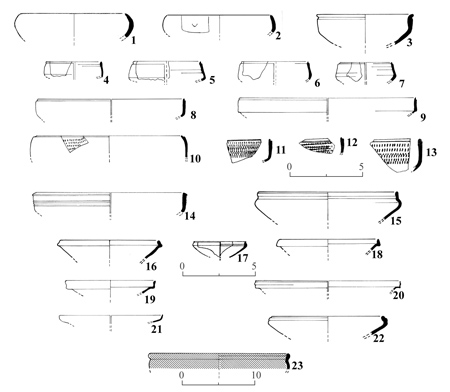
Fig 3
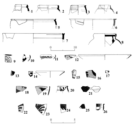
Fig 4
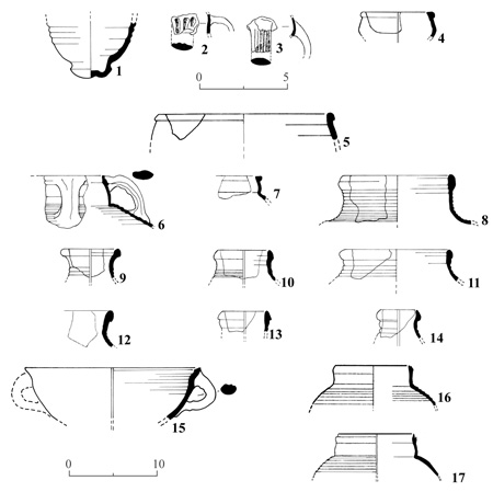
Fig 5
>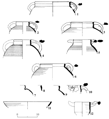
Fig 6
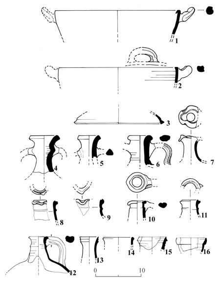
Fig 7
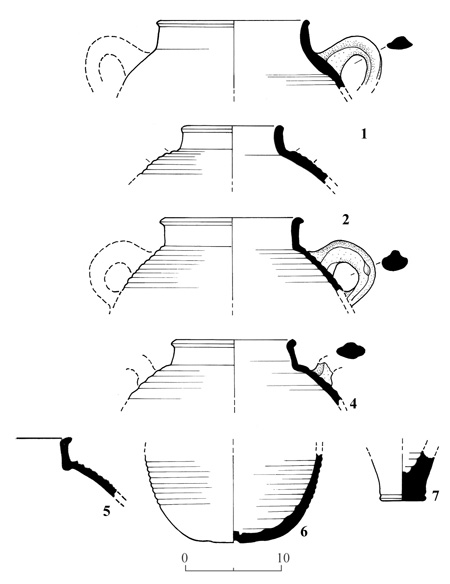
Fig 8
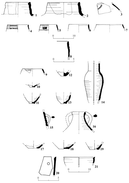
Fig 9
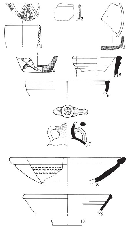
Fig 10
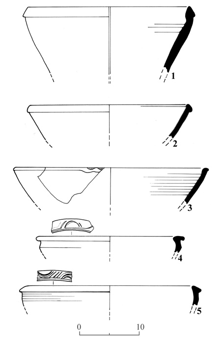
Fig 11
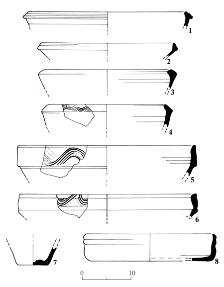
Fig 12
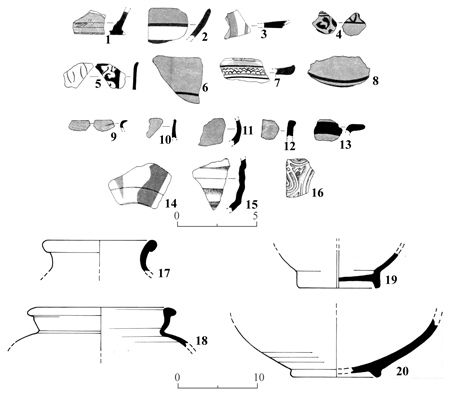
Fig 13
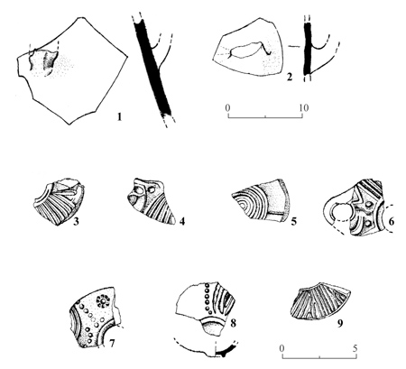
Fig 14
Catalogue
|
Catalogue No
|
Regist. No.
|
Site
|
Type
|
Fig.No.
|
Description
|
Comparisons: Sites/Dating
|
|
1
|
43/1
|
Site 43
Jezirat
Fara>un
|
A1a
|
1: 1
|
Jar rim; elongated collar: rounded in section; color: sandwich light brown to beige (7.5 YR - 2.5 Y 7/4); levigation: good; firing: good; grits: small, white; slip: interior and exterior: beige (7.5 YR 7/6); diam: 12 cm.
|
Balatha (1960), Fig. 2:1, p. 19 (last quarter of 3rd c. BCE)
|
|
2
|
43/18
|
Site 43
Jezirat
Fara>un
|
A1b
|
1:2
|
Jar rim; collar: prismatic in section; color: sandwich: light brown to beige (7.5 YR - 2.5 Y 7/4); levigation: good; firing: good; grits: small, white, brown; slip: interior and exterior: beige (7.5 YR 7/6); diam: 12 cm.
|
|
|
3
|
43/30
|
Site 43
Jezirat
Fara>un
|
A1c
|
1:3
|
Jar rim; elongated collar with shallow groove under lip; color: sandwich: light brown to beige (10 YR 7/4 - 5 YR 8/4); levigation: good; firing: good; grits: medium, white; slip: interior and exterior: beige (5 YR 7/6); diam: 10 cm.
|
|
|
4
|
43/9
|
Site 43
Jezirat
Fara>un
|
A2a
|
1:4
|
Bowl rim; fish plate with drooping rim; color: orange-pink (2.5 YR 7/10); levigation: excellent; firing: excellent; grits: fine, white; paint: red (2.5 YR 5/10); diam: 22 cm.
|
Samaria - Kenyon, Fig. 54:7, 18, p. 262 (2nd c. BCE); Ashdod II–III, Figures and Plates, Fig. 98:20 (with brown core); Ashdod II–III, Text, p. 24 (stratum III: Hellenistic).
|
|
5
|
43/25
|
Site 43
Jezirat
Fara>un
|
A2b
|
1:5
|
Bowl rim; fish plate with drooping rim; color: sandwich: brown-pink (10 YR 7/4 - 2.5 YR 7/6); levigation: good; firing: good; grits: fine, white; paint: red brown (5 YR 4/4); diam: 14 cm.
|
Beth Zur (1968), Fig. 24, p. 74 (first half 2nd c. BCE); Samaria - Kenyon, Fig. 54:20, p. 262 (2nd c. BCE); Ashdod II–III, figures and Plates, Fig. 8:2,8; Ashdod II–III, Text, p. 45 (late 2nd c. BCE).
|
|
6
|
43/24
|
Site 43
Jezirat
Fara>un
|
A2c
|
1:5
|
Bowl rim; fish plate with horizontal ledge rim; color: brown (7.5 YR 6/6); levigation: good; firing: good; grits: fine, white; paint: brown (7.5 YR 5/6); diam: 22 cm.
|
|
|
7
|
43/15
|
Site 43
Jezirat
Fara>un
|
A2d
|
1:7
|
Bowl base; fish plate, low angular ring base; color: sandwich: brown-orange (7.5 YR 6/6 - 2.5 YR 7/8); levigation: good; firing: good; grits: fine, white, gray; paint: interior: red gray-brown (2.5 YR 5/10 -5 YR 5/2); exterior: brown-orange (2.5 YR 5/10); diam. 4 cm.
|
Ashdod II–III, Figures and Plates, Fig. 98:20; Ashdod II–III, Text, p. 24 (Stratum III: Hellenistic).
|
|
8
|
43/28
|
Site 43
Jezirat
Fara>un
|
A2d
|
1:8
|
Bowl base; fish plate, rounded ring base, cone-like center; color: orange (7.5 YR 7/8); levigation: excellent; firing: excellent; grits: fine, white; paint: interior: orange-brown (2.5 YR 7/10 - 7.5 R 7/1); exterior: brown-gray (5 YR 8/4 - 7.5 R 3/1); diam. 4.5 cm.
|
PCC-Lapp, p. 206, No. 153.1 fish plates (200-100 BCE) (general resemblance)
|
|
9
|
43/34
|
Site 43
Jezirat
Fara>un
|
A2d
|
1:9
|
Bowl base; fish plate, angular in section, cone-like center; color: light brown (7.5 YR 8/4); levigation: good; firing: good; grits: fine, white, brown; paint: interior: brown (5 YR 5/10); exterior: brown-red (5 YR 5/10 - 7.5 YR 8/4); diam. 6 cm.
|
See No, 8 above
|
|
10
|
67/9
|
Site 67
>En Tamar
|
A3
|
1:10
|
Incurved upright deep cup; 3 grooves 5 mm distant from rim; color: gray-beige (5 YR 7/2 - 2.5 YR 7/6); levigation: good; firing: good; grits: fine, white; paint: interior and exterior: brown-gray (5 YR 4/2 - 2.5 YR 5/4); diam. 14 cm.
|
No exact comparison. Antioch - Waage, Pl. 2:57 i,k,p. Decorated between grooves and so connected to Megarian bowls. Similar but with only one groove: Qumran II, Fig. 3:1-3 (50–31 BCE). Qumran III, Fig. 1:17 (period IB); Fig. 4:1 (period II). Ashdod II–III, Fig. 102:11 (Late Hellenistic).
|
|
11
|
43/37
|
Site 43
Jezirat
Fara>un
|
A4a
|
1:11
|
Bowl with upright rim; color: sandwich: brown-pink (7.5 YR 6/4 - 2.5 YR 7/10); levigation: good; firing: good; grits: fine, white; paint: interior and exterior: brown (2.5 YR 4/2); diam. 10 cm.
|
|
|
12
|
43/27
|
Site 43
Jezirat
Fara>un
|
A4a
|
1:12
|
Bowl with upright rim with groove on outer wall 3mm from rim; color: brown-orange (7.5 YR 6/8 - 2.5 YR 6/10); levigation: good; firing: good; grits: fine, white, brown; paint: interior and exterior: brown (2.5 YR 4/6); diam. 18 cm.
|
|
|
13
|
43/5
|
Site 43
Jezirat
Fara>un
|
A4a
|
1:13
|
Bowl with slightly incurved rim; color: brown (10 YR 7/4); levigation: good; firing: good; slip: interior and exterior: brown (2.5 YR 5/2); diam. 15 cm.
|
|
|
14
|
43/35
|
Site 43
Jezirat
Fara>un
|
A4a
|
1:14
|
Bowl with slightly incurved rim; color: brown (10 YR 7/6); levigation: good; firing: good; grits: small, white; paint: interior: brown (7.5 YR 6/6); exterior: dark brown (7.5 YR 3/2) diam. 18 cm.
|
Falkner 1985:264, Fig. 13:2
|
|
15
|
67/51
|
Site 67
>En Tamar
|
A4a
|
1:15
|
Bowl with slightly incurved rim; color: brown-gray (10 YR 6/1); levigation: good; firing: good; grits: fine, white; paint: interior and exterior: dark brown (10 YR 4/1) diam. 12 cm.
|
|
|
16
|
67/4
|
Site 67
>En Tamar
|
A4a
|
1:16
|
Bowl with slightly incurved rim; color: beige (7.5 YR 7/6); levigation: good; firing: good; grits: fine, black, white; paint: interior and exterior: brown (2.5 YR 4/6) diam. 20 cm.
|
|
|
17
|
67/52
|
Site 67
>En Tamar
|
A4b
|
1:17
|
Bowl with slightly incurved rim; color: brown (5 YR 5/4); levigation: good; firing: good; grits: small, white, gray; slip: interior: brown (7.5 YR 7/2); exterior: light brown (7.5 YR 8/2) diam. 12 cm.
|
|
|
18
|
67/7
|
Site 67
>En Tamar
|
A4b
|
1:18
|
Bowl with slightly incurved rim; color: orange (2.5 YR 6/12); levigation: good; firing: good; grits: small, white, brown, sand grains; slip: interior: pink-orange (2.5 YR 7/6); paint: interior: brown-red (10 R 5/6); exterior: brown (2.5 YR 2/7) diam. 11 cm.
|
|
|
19
|
67/1
|
Site 67
>En Tamar
|
A4b
|
1:19
|
Bowl rim thickened, slightly incurved; color: orange (2.5 YR 6/2); levigation: good; firing: good; grits: white, brown; slip: interior and exterior: orange (2.5 YR 7/8); diam. 11 cm.
|
|
|
20
|
11/A/1
|
Site 11/A
Yotvata
|
A4b
|
1:20
|
Bowl rim thickened, slightly incurved; color: brown-orange (10 YR 4/1 - 2.5 YR 6/8); levigation: good; firing: good; grits: small, brown, sand grains; slip: interior: orange-brown (2.5 YR 6/8 - 10 YR 6/6); exterior: brown gray (10 YR 6/6 - 10 YR 5/1) diam. 12 cm.
|
|
|
21
|
43/17
|
Site 43
Jezirat
Fara>un
|
A5
|
1:21
|
Bowl rim, tapering on top of rounded wall; color: sandwich: orange (2.5 YR 6/8); core light brown (10 YR 7/4); levigation: good; firing: good; grits: fine, white, gray; paint: interior and exterior: red (7.5 R 4/10); diam. 13 cm.
|
|
|
22
|
43/23
|
Site 43
Jezirat
Fara>un
|
A5
|
2:1
|
Ring base of bowl, rounded in cross-section; color: orange (2.5 YR 6/8); levigation: good; firing: good; grits: small, white; paint: interior: erased; paint and slip: exterior: brown-orange (2.5 YR 6/8 - 4/4); diam. 5 cm.
|
|
|
23
|
43/21
|
Site 43
Jezirat
Fara>un
|
A5
|
2:22
|
Bowl ring base, bottom; double thickness of the wall; height of ring base: interior: 0.3 cm; exterior: 0.8 cm; color: orange (10 R 7/8); core: light brown (5 YR 8/12); levigation: good; firing: good; grits: fine, brown, white; paint: interior: orange (10 R 6/10); exterior: orange (10 R 6/10 - 7/8); diam. 4 cm.
|
|
|
24
|
43/2
|
Site 43
Jezirat
Fara>un
|
A6
|
2:3
|
Ring base of bowl, rounded in cross-section, convex bottom; color: orange (2.5 YR 6/8); levigation: good; firing: good; grits: small, white, brown; slip and paint: interior and exterior: orange (2.5 YR 6/8 - 6/14); diam. 4 cm.
|
Oboda-Negev, Pl. 28:167
|
|
25
|
43/6
|
Site 43
Jezirat
Fara>un
|
A6a
|
2:4
|
Ring base, rounded, slightly everted; color: gray-brown (10 YR 6/1); levigation: good; firing: good; grits: fine, white; paint: interior: gray-brown (10 YR 6/1); slip: exterior: brown-cream (7.5 YR 8/4 - 5/4); diam. 8 cm.
|
Beth Zur (1968), Fig. 24:17; (Stratum III: 175–165 BCE)
|
|
26
|
43/14
|
Site 43
Jezirat
Fara>un
|
A6b
|
2:5
|
Ring base, square in cross-section; slightly everted as No. 25; color: brown (7.5 YR 7/4); levigation: good; firing: good; grits: fine, white, brown; paint: interior: brown (5 YR 6/4); exterior: orange brown (2.5 YR 6/14 - 10 R 6/6); diam. 6 cm.
|
|
|
27
|
43/16
|
Site 43
Jezirat
Fara>un
|
A6c
|
2:6
|
Ring base, pointed; slightly everted; color: brown (2.5 YR 7/6); levigation: good; firing: good; grits: fine, white, brown; paint: interior and exterior: brown (7.5 YR 5/2)
|
Antioch - Waage III: 80 (Early Hellenistic)
|
|
28
|
11/A/2
|
Site 11/A
Yotvata
|
A6d
|
2:7
|
Ring base, outside of ring diagonally bevelled; color: dark purple-red (10 R 3/2 - 7/8); levigation: good; firing: good; grits: fine, brown, sand grains; paint: exterior: brown (10 R 5/2); diam. 6 cm
|
|
|
29
|
38/3
|
Site 38
Naḥal
>Amram
|
A7
|
2:8
|
Ledge rim of cooking pot; color: sandwich: red-dark gray (7.5 R 5/8 -N (Munsel's Neutral Value Scale) 3.5/9.0% R); levigation: good; firing: good; grits: small, white; slip: interior: brown (5 YR 6/4); exterior: red-brown (10 R 5/8); diam. 15–19 cm
|
Gerasa - Fisher, p. 39, Fig. 38:19, Tomb 6; p. 44, Fig. 42:13-17, Tomb 9; same family casseroles; p. 49, Fig. 47:86, Tomb 12, smaller diameter, different color. Petra-Street IX:12, resembles rim but not shoulder; XXVII:53 thin black wash; XXXI:123. Beth Zur (1968), Fig. 24:4. Stern, E. (1973), p. 102 (Persian period)
|
|
30
|
70/17
|
Site 70
Moje Awad
|
B2a
|
2:9
|
Jug rim, flattened and tapered with exterior undercut (resembles rim of leukythos); color: sandwich: brown-orange (10 YR 5/2 - 2.5 YR 5/10); levigation: good; firing: good; grits: fine, white, gray; slip: interior and exterior: red orange (2.5 YR 6/8); diam. 2–5 cm
|
Gerasa - Fischer, Fig. 47:70, Tomb 12, (early c. CE). Petra-Street, Pl. 9:46, pp. 20–21 (mid-second c. CE); Pl. 23:154. Heshbon, Fig. 2:58 (Late Roman), Dibon I, II, Pl. 69:10, 11 (Nabatean Roman II, 135–235 CE). Tsafit, Fig. 13:17. Tel Mevorakh - Stern, Fig. 2:15–18, but different fabric (Late Hellenistic - Early Roman). Hirbet Dor - Weippert, p. 100, No. 18, p. 110 (1st c. CE). Atlal 5, Pl. 82:32, text p. 76 (1st–2nd c. CE)
|
|
31
|
70/14
|
Site 70
Moje Awad
|
B2b(1)
|
2:10
|
Ring base of closed vessel, pointed in cross-section; color: orange (2.5 YR 6/14); levigation: good; firing: excellent; grits: small, white, sand grains; slip: interior and exterior: orange (2.5 YR 6/4); diam. 3.5 cm
|
Petra-Street, Pl. XXXII, 131
|
|
32
|
57/A/113
|
Site 57A
>En Raḥel
|
B2b(1)
|
2:11
|
Pseudo ring base of closed vessel with an inner concentric groove at the base of the ring; color: sandwich: exterior: orange (10 R 6/8); core: gray - N (3.5/9.0% R); levigation: good; firing: good; grits: fine, white; slip: interior: red-orange (10 R 5/6); exterior: red-orange (10 R 5/8); diam. 3.5 cm
|
|
|
33
|
70/16
|
Site 70
Moje Awad
|
B2b(2)
|
2:12
|
Ring base of closed vessel; color: orange (2.5 YR 6/12); levigation: excellent; firing: excellent; grits: fine, white; slip: interior and exterior: orange (2.5 YR 6/10); diam. 4 cm
|
Sbaita, Pl. III, Fig. 2, upper photo. Petra-Street, Pl. III:40, Pl. XXV:8, p. 22 (form 22(8) to end of 2nd c. CE). Petra - Conway High Place, Fig. 7:6. Hammond (1962) II2(a)3, II2(c)4.
|
|
34
|
57/115
|
Site 57
>En Raḥel
|
B2b(3)
|
2:13
|
Pseudo ring base of closed vessel; color: orange (2.5 YR 7/10); levigation: good; firing: good; grits: small, white; slip: interior: orange (2.5 YR 6/8); exterior: orange (2.5 YR 6/6); diam. 4 cm
|
See text p. 11
|
|
35
|
57/116
|
Site 57
>En Raḥel
|
B2b(3)
|
2:14
|
Pseudo ring base of closed vessel; color: sandwich: orange (10 R 6/8); core: gray (5 YR 5/1); levigation: good; firing: good; grits: small, white; slip: interior and exterior: orange-red (10 R 6/6); diam. 4 cm
|
|
|
36
|
55/A/107
|
Site 55/A
Ḥaẓeva
|
B2b(3)
|
2:15
|
Shallow ring base of closed vessel; color: orange-brown (2.5 YR 6/10 - 5 YR 5/2); levigation: good; firing: good; grits: fine, white, sand grains; slip: interior: orange (5 YR 7/4); exterior: orange (2.5 YR 6/10); diam. 5 cm
|
|
|
37
|
55/A/106
|
Site 55/A
Ḥaẓeva
|
B2b(4)
|
2:16
|
Ring base, rounded at cross-section, of closed vessel; color: orange (2.5 YR 6/10); levigation: excellent; firing: excellent; grits: small, brown; slip: interior and exterior: orange (2.5 YR 6/8); diam. 6 cm
|
|
|
38
|
58/17
|
Site 58
>En Marzev
|
B2b(4)
|
2:18
|
Ring base, similar to No. 37, but higher, 0.8 cm; color: orange (2.5 YR 5/10); levigation: good; firing: good; grits: medium, brown, sand grains, small cavities; slip: interior and exterior: orange (2.5 YR 6/8); diam. 4 cm
|
|
|
39
|
57/A/118
|
Site 57/A
>En Raḥel
|
B2b(5)
|
2:17
|
Ring base of closed vessel, tapered in cross-section; color: sandwich: interior: orange (10 R 6/8); core: brown (5 YR 5/16); levigation: good; firing: good; grits: small, brown; slip: interior: and exterior: brown-orange (10 R 6/8); diam. 6 cm
|
|
|
40
|
57/119
|
Site 57
>En Raḥel
|
B2b(5)
|
2:19
|
Ring base of jug or bowl; color: orange (2.5 YR 6/14); levigation: excellent; firing: excellent; grits: small, white, brown, sand grains; slip: interior and exterior: orange (2.5 YR 6/8); diam. 7 cm
|
See text p. 11
|
|
41
|
57/120
|
Site 57
>En Raḥel
|
B2b(5)
|
2:20
|
Thick ring base of closed vessel, pared at inner and outer edges creating a triangular tip at cross-section; color: orange (2.5 YR 6/8); levigation: excellent; firing: excellent; grits: small, white; slip: interior: orange-brown (2.5 YR 6/8); exterior: orange-brown (2.5 YR 7/6); diam. 5 cm
|
See text p. 11.
Tsafit, Fig. 16:7 (1st–3rd c. CE)
|
|
42
|
57/A/4
|
Site 57/A
>En Raḥel
|
B2c
|
2:21
|
High ring base with convex bottom disc, of thin-walled closed vessel; color: orange (2.5 YR 5/10); levigation: good; firing: good; grits: fine, white; slip: interior: orange (2.5 YR 7/10); exterior: orange (2.5 YR 8/8); diam. 8 cm
|
Petra-Street, Pl. XXV:1, 93, ff.. (2nd c. CE)
|
|
43
|
57/A/117
|
Site 57/A
>En Raḥel
|
B2c
|
2:22
|
High ring base of thin-walled closed vessel; color: sandwich: exterior: orange (2.5 YR 7/10); core: brown-gray (5 YR 4/1); levigation: good; firing: good; grits: small, white, sand grains; slip: interior and exterior: brown-red (2.5 YR 7/6); diam. 7 cm
|
As above and text p. 11
|
|
44
|
70/6
|
Site 70
Moje Awad
|
B2d(1)
|
2:23
|
Thin walled globular juglet; stub of handle, rectangular in cross-section, 1 cm from rim; height of neck: 2.5 cm; color: orange (2.5 YR 5/10); levigation: excellent; firing: excellent; grits: small, white, sand grains; slip: interior: orange (2.5 YR 5/10); exterior: orange-brown (2.5 YR 3/2 - 4/6); diam. of rim: 2 cm
|
Petra-Street, Pl. IX:38, 39.
Petra-Horsefield, Pl. XXI:154 (1st c. BCE–1st c. CE)
Beer Ora 5 (D28/025).
|
|
45
|
255/D/031
|
Site 255/D
Timna
|
B3d(2)
|
2:24
|
Disc base of juglet, spirals at bottom formed by string cutting; color: brown (5 YR 6/8); levigation: good; firing: good to medium; slip: interior: brown (5 YR 6/8); exterior: brown (5 YR 6/6); diam. 2.5 cm
|
Petra-Street, Pl. IX:37 (62c)
|
|
46
|
70/31
|
Site 70
Moje Awad
|
B2e(1)
|
2:25
|
Jug handle, strap-like in cross-section with two flat ridges and three grooves, the middle one is deepest; color: sandwich: orange (2.5 YR 6/10); core: gray-brown (10 YR 5/1); levigation: good; firing: good; grits: fine, white, brown; slip: exterior: orange (2.5 YR 7/8); width: 2.5 cm; thickness: 0.5 cm
|
Petra-Street, Pl. XXVI:34, trefoil mouthed jug; Pl. XXXI:139 (69K4) oinochoe
|
|
47
|
70/05
|
Site 70
Moje Awad
|
B2e(2)
|
2:26
|
Jug handle, strap-like in cross-section with two flat ridges and three grooves, the middle one is deepest; color: sandwich: orange (2.5 YR 7/10); core: brown (7.5 YR 7/2 - only a shade); levigation: good; firing: good; grits: fine, brown; slip: exterior: orange (2.5 YR 7/10); width: 2.2 cm; thickness: 0.4 cm
|
Petra-Theatre, Pl. LLII,I 3rd row, 3rd sherd from left (period Ic, Roman mid-2nd c. CE)
|
|
48
|
70/4
|
Site 70
Moje Awad
|
B2e(3)
|
2:27
|
Jug handle, strap-like in cross-section with two flat ridges and groove in between, and on the narrow sides of the handle, one and two grooves respectively; color: gray-brown (10 YR 5/2); levigation: good; firing: good; grits: fine, white; slip: exterior: orange-beige (5 YR 7/6); width: 2.1 cm; thickness: 0.6 cm
|
Petra-Theatre, Pl. LII,I, 3rd row, second from left (period Ic, mid-2nd c. CE); Pl. LIV,2, 2nd row, second from left (period V 2nd–4th c.).
Dibon-III, Fig. 3:26, 27 similar Petra-Horsefield, Pl. XVIII:130, but also has groove on the interior (2nd c CE)
|
|
49
|
70/41
|
Site 70
Moje Awad
|
B2e(4)
|
2:28
|
Jug handle with two flat ridges and six grooves, the one between the ridges is the deepest; comb-like grooves on the narrow sides; finger impressions at attachment to the jug body; color: sandwich: orange (2.5 YR 6/10); core: brown-gray (10 YR 6/2); levigation: good; firing: good; grits: fine, white, gray, sand grains; slip: exterior: orange (2.5 YR 6/10); width: 2.2 cm; thickness: 0.9 cm
|
Petra-Horsefield, Pl. XIX:131 (1st .c. BCE–1st c. CE)
|
|
50
|
70/10
|
Site 70
Moje Awad
|
B2e(5)
|
2:29
|
Jug handle with two ridges and a groove in between; a piece of waste clay is stuck on the interior; color: brown-gray (10 YR 6/2); levigation: good; firing: good; grits: small, white, brown; slip: exterior: pink-orange (2.5 YR 7/8); width: 1.7 cm; thickness: 1.8 cm
|
Petra-Theatre, Pl. LII, I, 3rd row, second sherd from left (period Ic mid-2nd c. CE)
|
|
51
|
57/303
|
Site 57
>En Raḥel
|
B2f
|
2:30
|
Fragment of lower part of juglet or bottle with distinct ribbing; color: gray-brown (10 YR 6/1); levigation: good; firing: good; slip: interior: brown-beige (2.5 YR 8/4); exterior: orange (2.5 YR 7/8)
|
|
|
52
|
57/304
|
Site 57
>En Raḥel
|
B2f
|
2:31
|
Fragment of ribbed wall of juglet or bottle; color: orange (2.5 YR 6/12); levigation: good; firing: good; grits: small, white, brown; slip: interior: orange (2.5 YR 6/10); exterior: orange (2.5 YR 6/10)
|
Petra-Theatre, Pl. LV, I, second row, first from left (period III, 3rd c. CE (?) or later)
|
|
53
|
57/106
|
Site 57
>En Raḥel
|
B3a(1)
|
3:1
|
Bowl rim, tapered and slightly incurved, rounded walls; color: orange (10 R 6/10); levigation: good; firing: good; grits: small, mica; slip: interior and exterior: orange-red (10 R 5/8); diam. 14 cm
|
PCC-Lapp, p 172. Type 51-1 (200 BCE–66 CE): A,C,D,E,H. Incurved rim of small, deep bowl. PCC-Lapp, p. 173, Type 52-2, same dating: A,C,E,F,G. Hemispherical rim of small, deep bowl. PCC-Lapp, p. 201, Type 151 (200-100 BCE): A,B,D,E,F,G. Incurved rim of small, deep bowl. Antioch-Waage, Pl. I.18-20, p. 10 (not later than 4th c. BCE). Beth Zur (1968), Fig. 24:10, 11, same family, p. 74 (2nd c. BCE). Samaria-Kenyon, Fig. 49:7-15, Fig. 56:8-11, p. 249 (dating: 3rd, 2nd c. BCE), p. 265 (dating: 2nd–1st c. BCE). Ashdod I, Fig. 5:4,5 (stratum 3B: Late Hellenistic). Ashdod II–III, Fig. 8:11-15, Fig. 10:12-14, Fig. 98:1-9, Fig. 102-11. Of the same family (Stratum 3Bm late 2nd c. BCE).
|
|
54
|
57/A/109
|
Site 57/A
>En Raḥel
|
B3a(2)
|
3:2
|
Bowl rim, slightly thickened, incurved, incised sign 1.5 cm from rim; color: gray-brown (5 YR 6/1); levigation: good; firing: good; grits: small, brown; slip: interior: light brown (5 YR 6/4); exterior: brown-gray (5 YR 5/2); diam. 12 cm
|
|
|
55
|
168/2
|
Site 168
Ma>ale
Shaḥarit
|
B3b
|
3:3
|
Bowl rim, rounded inside with a groove 5 mm from rim on exterior, carinated 2.5 cm from rim; color: sandwich: exterior: orange (5 YR 7/8); core: gray (10 YR 6/2); levigation: good; firing: good; grits: small, white, brown, sand grains; slip: interior: orange (5 YR 7/8); exterior: orange-cream (5 YR 7/8 - 9/2); cream color on exterior top 3 cm of the bowl, resulting from stacking bowls in kiln
|
Alayiq-Nitla, Pl. XXIII:A.71. Tsafit, Fig. 15:1-5 (see comparison to this type, but ware and slip are different). Jerusalem –North Wall, Fig. 20:( 1st c. CE)
|
|
56
|
57/A/2
|
Site 57/A
>En Raḥel
|
B3c(1)
|
3:4
|
Thickened bowl rim, rounded, thin walled, carinated 2 cm from rim; color: orange (10 R 6/6); levigation: good; firing: good; grits: fine, white; slip: interior: orange (10 R 5/6); exterior: brown (7.5 YR 6/6); diam. 15 cm
|
|
|
57
|
57/A/14
|
Site 57A
>En Raḥel
|
B3c(1)
|
3:5
|
Bowl rim, stepped groove 0.1 cm below rim, upright wall, carinated 2.5 cm from rim; color: orange (2.5 YR 6/12); levigation: good; firing: good; grits: small, white, brown, black; slip: interior and exterior: orange (10 R 6/8); diam. 24 cm
|
Petra-Parr, Fig. 5:72, phase XI (1st c. CE). Tsafit, Fig. 15:2-5, 8 (2nd–3rd c. CE)
|
|
58
|
57/A/16
|
Site 57A
>En Raḥel
|
B3c(1)
|
3:6
|
Bowl rim, grooved as above No. 57, upright wall, carinated 2 cm from rim; color: orange (10 R 6/10); levigation: good; firing: good; grits: small, white, black, sand grains; slip: interior: orange (10 R 7/8); exterior: orange (10 R 7/8 - 7.5 YR 6/6); diam. 20 cm
|
As for No. 57
|
|
59
|
57/A/17
|
Site 57A
>En Raḥel
|
B3c(2)
|
3:7
|
Bowl rim, as above No. 57; color: sandwich: orange (2.5 YR 6/8); core: gray-brown (5 Y 7/1); levigation: good; firing: good; slip: interior and exterior: orange (2.5 YR 6/8); fine rouletting on exterior wall near base; diam. 17 cm
|
As for No. 57 but with rouletting
|
|
60
|
57/A/104
|
Site 57/A
>En Raḥel
|
B3c(2)
|
3:8
|
Bowl rim, as above No. 57, but with a more distinct groove; color: sandwich: orange (10 R 5/6); core: gray (10 R 6/1); levigation: good; firing: good; grits: small; slip: interior: orange (2.5 YR 6/8); exterior: orange (10 R 6/6); diam. 18 cm
|
|
|
61
|
57/A/105
|
Site 57/A
>En Raḥel
|
B3c(1)
|
3:9
|
Bowl rim, as above No. 57, upright wall, carinated 2 cm from rim; color: sandwich: orange (10 R 7/6); core: gray (N 5.5/24.6% R); levigation: good; firing: good; grits: small, white, brown; slip: interior and exterior: orange (10 R 6/6); diam. 16 cm
|
|
|
62
|
55/110
|
Site 55
>En Ḥaẓeva
|
B3c(2)
|
3:10
|
Bowl rim, grooved, step-like, rouletted on exterior with short, broad, vertical grooves on the slightly incurved fragment of wall; color: orange (1.5 YR 5/10); levigation: excellent; firing: excellent; grits: small, white, sand grains; slip: interior: orange (2.5 YR 5/10); exterior: orange (2.5 YR 5/8); diam. 15 cm; wall thickness: 0.3 cm
|
Sbaita, Pl. III:1. Petra-Street, Pl. IX: 1, Pl. XXXI:116
|
|
63
|
70/3
|
Site 70
Moje Awad
|
B3c(2)
|
3:11
|
Bowl rim, grooved, step-like, rouletted short lines on exterior curved towards bottom, 2.5 cm from rim; color: sandwich: orange (very thin layer on the inner side 2.5 YR 6/10); core: gray-brown (10 YR 5/1); levigation: excellent; firing: excellent; grits: fine, white, brown; slip: orange (10 R 6/10); diam. 16 cm; wall thickness: 0.25–0.35 cm
|
|
|
64
|
70/5
|
Site 70
Moje Awad
|
B3c(2)
|
3:12
|
Bowl rim, slightly grooved, step-like, rouletted short vertical lines on slightly incurved wall fragment; color: orange (2.5 YR 7/8); levigation: excellent; firing: excellent; grits: small, white, brown; slip: interior: orange (2.5 YR 7/8); exterior: orange-brown (2.5 YR 5/10); diam. 16 cm; wall thickness: 0.25–0.35 cm (similar to sherd from Site 47 (Evrona).
|
|
|
65
|
70/7
|
Site 70
Moje Awad
|
B3c(3)
|
3:13
|
Bowl rim, grooved, step-like, rouletted short lines on the exterior wall fragment curved towards the bottom 3.5 cm from rim; color: sandwich: orange (2.5 YR 6/10); core: gray-brown (2.5 Y 6/2); levigation: excellent; firing: excellent; grits: small, white, sand grains; slip: interior and exterior: orange (2.5 YR 5/10); diam. 20 cm; wall thickness: 0.3–0.5 cm
|
Sbaita, Pl. III:1,3. Petra-Parr, Sequence, Fig. 7:110 (stratum XIII). Petra-Street, Pl. IX:1,2,4, XXXI:114-116,118, form 18, Pl. 18 post-Trajanic. Sabra-Linder, p. 231-242, Pl. LXIV:1, but fabric thinner, color: orange. I. Beit-Arieh: >Uẓa excavations, No. 1157/2 (thanks to Beit-Arieh for permission to mention this item before publication)
|
|
66
|
57/A/112
|
Site 57/A
>En Raḥel
|
B3c(4)
|
3:14
|
Bowl rim, rounded top, with an exterior undercut, two grooves 1.1 cm from rim, upright wall, carinated 2.5 cm from rim; color: sandwich: orange (10 R 6/6); core: gray-brown (5 Y 7/4)
|
|
|
67
|
55/2
|
Site 55
>En Ḥaẓeva
|
B3d
|
3:15
|
Thin walled carinated bowl, upright rim, rounded at top, internal groove 0.5 cm from rim, groove-like depression on external wall at carination; color: sandwich: orange (2.5 YR 7/8); core: brown-gray (2.5 YR 5/1); levigation: good; firing: good; grits: small, white, brown; slip: interior: orange (2.5 YR 6/6); exterior: orange (5 YR 6/6); diam. 20 cm; the shape recalls Hellenistic carinated bowls
|
Petra-Street, Pl. VIII:83. Petra-Parr, Fig. 6:92 (different color), phase XII (1st c. CE Similar to Hellenistic ware). Samaria-Kenyon, Fig. 39:5, with dull glaze, p. 226 (Late Hellenistic), Fig. 57:1, p. 267 (2nd c. BCE)
|
|
68
|
55/1
|
Site 55
>En Ḥaẓeva
|
N3e(1)
|
3:17
|
Thin walled bowl rim, slightly inverted, nearly upright, rounded top; color: orange (2.5 YR 6/8); levigation: good; firing: good; grits: small, white, medium, brown; slip: interior and exterior: orange (2.5 YR 6/8); diam. 14 cm; same as No. 70
|
Schmitt-Korte, Abb:3:2, p. 504, unpainted Nabataean pottery contemporary with the painted ware. Petra-Street, Pl. XXIX:85 similar. Hammond (1962), I, 3(b)5, I 3(c)7 similar
|
|
69
|
57/A/5
|
Site 57/A
>En Raḥel
|
B3e(1)
|
3:16
|
Thin walled bowl rim, slightly inverted, nearly upright, edge rounded interior, slightly everted exterior; color: pink-orange (2.5 YR 4/8); levigation: good; firing: good; grits: small, brown, white; slip: interior and exterior: pink-orange (2.5 YR 6/6); diam. 15 cm
|
Hammond (1962), I, 2(c)5-6. S. Loffreda, "Alcuni Vasi....della fortezza di Macheronte" LA XXX (1980), p. 96:40
|
|
70
|
43/19
|
Site 43
Jezirat
Fara>un
|
B3e(1)
|
3:18
|
Thin-walled bowl rim, as No. 68
|
|
|
71
|
55/106
|
Site 55
>En Ḥaẓeva
|
B3e(1)
|
3:19
|
Bowl rim, rounded on top, vertical, carinated 1 cm from rim; color: orange (2.5 YR 6/10); levigation: excellent; firing: excellent; grits: fine, white, sand grains; slip: interior and exterior: orange (2.5 YR 6/8); diam. 19 cm; wall thickness: 0.2 cm
|
Schmitt-Korte, p. 507, abb:3:2, p. 504, unpainted Nabataean pottery contemporary with the painted ware. Cf. No. 68
|
|
72
|
55/107
|
Site 55
En Ḥaẓeva
|
B3e(2)
|
3:20
|
Bowl rim, tapered, a ridge 0.5 cm and carination 1 cm from rim; color: orange (2.5 YR 6/10); thin gray core (5 Y 5/1);; levigation: excellent; firing: excellent; grits: fine, white; slip: interior and exterior: orange (2.5 YR 7/8); diam. 16 cm; wall thickness: 0.2 cm
|
Petra-Parr, Sequence, Fig. 5:69, 71, phase XI (end of 1st c. CE). Schmitt-Korte, abb:3:2 similar
|
|
73
|
55/108
|
Site 55
En Ḥaẓeva
|
B3e(3)
|
3:21
|
Bowl rim, tapered, incurved; color: orange (2.5 YR 6/10); thin gray core (5 Y 5/1);; levigation: excellent; firing: excellent; grits: fine, white; slip: interior and exterior: orange (2.5 YR 7/8); diam. 16 cm; wall thickness: 0.2 cm (probably painted ware)
|
|
|
74
|
44/11
|
Site 44
Yotvata
|
B3f
|
3:22
|
Bowl rim, rounded on top, slightly grooved at exterior near edge, slightly inverted, nearly upright, carinated 1.5 cm from rim; general resemblance to No. 57 but with thicker wall; color: brown-beige (5 YR 7/4); levigation: good; firing: excellent; grits: small, white, brown; slip: interior and exterior: brown (7.5 YR 7/6); smoothed exterior
|
|
|
75
|
43/29
|
Site 43
Jezirat
Fara>un
|
B3g
|
3:23
|
Bowl rim, rounded at top, slightly thickened, two incised lines in the groove-like depression on the exterior wall at base of rim; color: beige (5 YR 8/4); levigation: excellent; firing: excellent; grits: fine, white, brown; paint glazed interior and exterior: brown (5 YR 7/8); diam. 16 cm. Eastern Terra Sigillata Ware
|
Beth Zur (1968), Fig. 24:12, p. 74 (2nd c. BCE) similar. Samaria-Kenyon, Fig. 81:9, 28 similar, p.339 (1st c. CE). Shikmona III, No. 56 general resemblance. Kaplan (1964), Fig. 3:10 general resemblance, p. 18 (50-67 CE). Beth Zur (1933), Pl. XI:10 (Hellenistic Forms)
|
|
76
|
57/A/18
|
Site 57/A
>En Raḥel
|
B4a
|
4:1
|
Cooking pot rim, arrow-head shape in cross-section, outsplayed with an exterior undercut, inside sloping towards the sharply angled edge; neck: interior: concave; exterior: convex with a groove on outside wall at base of neck; color: orange (2.5 YR 8/10); levigation: good; firing: good; grits: fine, brown, white, sand grains; slip interior and exterior: orange (2.5 YR 6/8); diam. 12 cm
|
Petra-street, Pl. IX:22, XXX:100, XXXII:130 resemblance (2nd c. CE). Petra-Conway High Place, Fig. 7:1, 2 (3rd c. CE) some resemblance. Petra-Theatre, Pl.LVIII:1, 5, 11 (Roman mid-2nd c.). Petra-Parr, No. 86, p. 370 (Phase XI, 1st–2nd c. CE). Petra-Hammond, No. 2, p. 27, p. 39, Nos. 1–3 general resemblance. Hirbet Dor-Weippert, p. 94, Abb. 3:4* (*=secondary number)
|
|
77
|
57/A/12
|
Site 57/A
>En Raḥel
|
B4b
|
4:2
|
Cooking-pot rim, rounded inside, collar 1 cm high, concave in cross-section, 0.3 cm from rim, bounded by grooves at top and bottom edges, interior: concave 1.5 cm from rim, sharp, angular edge at base; color: sandwich: orange (2.5 YR 6/8); core: gray (10 Y 4:1); levigation: good; firing: good; grits: small, white, sand grains; slip interior and exterior: orange (2.5 YR 6/8); diam. 14 cm
|
Sbaita, Pl. IV:9f, but with higher and upright neck, p. 27 (2nd c. CE). Petra-Street, Pl. XXX:104, higher neck, XXXII:129, higher neck. Petra-Parr, Fig. 8:132 but with upright neck and collar at the same level as rim, general resemblance. Hirbet Dor, p. 94, Fig. 3:1*,2* (*=secondary numbers), (Nabataean-Roman)
|
|
78
|
57/A/1
|
Site 57/A
>En Raḥel
|
B4c
|
4:3
|
Cooking-pot rim, outer narrow ledge, two ribs rounded in cross-section 1 cm and 2 cm from rim, on exterior wall of neck; neck height 3 cm; color: brown-orange (5 YR 6/8); levigation: good; firing: good; grits: fine, gray, white; slip interior and exterior: brown (10 YR 6/2); diam. 12 cm. Interior: angled edge 1 cm from rim
|
Kaplan (1964), Fig. 2:9. Macheronte, p. 95, 24
|
|
79
|
57/A/8
|
Site 57/A
>En Raḥel
|
B4d
|
4:4
|
Thin-walled cooking-pot rim, tapered with undercut 0.3 cm from rim; interior concave neck 1.3 cm high; color: orange (10 R 6/10); levigation: good; firing: good; grits: small, white, brown, sand grains; slip interior: orange (2.5 YR 6/8); exterior: orange (10 R 6/10); diam. 8 cm
|
Sbaita, Pl. IV:9e but with higher neck. Petra-Conway High Place, Fig. 7:1, 2 general resemblance but broader mouth, p. 69 (3rd c. CE). Petra-Parr, Fig. 7:104 but with larger dimensions (1st–2nd c. CE)
|
|
80
|
57/A/3
|
Site 57/A
>En Raḥel
|
B4e
|
4:5
|
Thin-walled cooking-pot rim, flat rim 0.9 cm wide, extending 0.5 cm with an incised line underneath and a groove at base, slightly curved wall concave in cross-section; color: orange (10 R 6/6); levigation: good; firing: good; grits: small, brown; slip interior: orange (10 R 6/10); exterior: orange (10 R 6/8); diam. 16 cm
|
Petra-Street, Pl. XXI:125, 126 (mid-2nd c. CE), Pl. XXIX:97. Petra-Theatre, Pl. LVIII:22
|
|
81
|
57/A/7
|
Site 57/A
>En Raḥel
|
B4e
|
4:6
|
Cooking pot, flat rim 0.9 cm wide, extending 0.5 cm with a groove at base, slightly curved wall, concave in cross-section, diagonal incised groove 1.5 cm from rim; color: brown-orange (5 YR 6/2 - 2.5 YR 6/6); levigation: good; firing: good; grits: small, white, gray, sand grains; slip: interior: orange (2.5 YR 7/6-6/4); exterior: orange (2.5 YR 7/6); diam. 14 cm. Similar to No. 80 but thicker and coarser fabric
|
Petra-Street, Pl. XXXI:125, 126 (mid-2nd c. CE) same family. Petra-Theatre, Pl. LVIII:22 same family but shaved at interior edge. Alayiq-Nitla, Pl. XXIII:X107, XXVI:N11A (Late Roman) context, but examples belong to same family only
|
|
82
|
57/A/6
|
Site 57/A
>En Raḥel
|
B4f
|
4:7
|
Cooking pot, shallow grooved rim, insplayed, with sharp edge at cross-section, upright wall; color: sandwich: orange (2.5 YR 6/8); core: gray (5 YR 5/1); levigation: good; firing: good; grits: fine, white, black; slip: interior: orange (2.5 YR 6/10); exterior: orange (2.5 YR 6/6); diam. 22 cm
|
|
|
83
|
57/110
|
Site 57
>En Raḥel
|
B4g
|
4:8
|
Cooking pot, grooved rim, curved neck, interior: concave in cross-section 2 cm high, rounded shoulder; color: sandwich: orange (5 YR 7/6); core: light brown (10 YR 8/4); levigation: good; firing: good; grits: small, white, brown; slip: interior: orange-red (5 YR 7/6); slip and wash exterior: red (10 R 6/8); neck painted on the inside with the same wash as on the exterior; diam. 12 cm. Remark: can be a small vase or a jug
|
Petra-Street, Pl. IX:33 has inner ledge, Pl. XXVI:23 but with an outer groove
|
|
84
|
57/305
|
Site 57
>En Raḥel
|
B4h
|
4:9
|
Cooking pot, spiral ribbed bottom, omphalos-like center; color: orange (5 YR 7/6); levigation: good; firing: good; grits: small, white, brown; slip: interior and exterior: orange (2.5 YR 6/10)
|
Petra-Street, Pl. XI:26. Petra-Theatre, Pl. LII:2 upper row, first 2 sherds from left (period Ic, Roman mid-2nd c. CE)
|
|
85
|
46/2
|
Site 46
Elot
|
B5a(1)
|
4:10
|
Bowl rim, tapering, incurved; color: orange (10 R 6/10); levigation: excellent; firing: excellent; grits: fine, white, brown; slip: interior and exterior: orange (2.5 YR 7/10) painted in red tint (7.5 R 5/10); decoration: painted floral petals; wall thickness 0.2–0.3 cm
|
|
|
86
|
55(1)16
|
Site 55
Ḥaẓeva
|
B5a(2)
|
4:11
|
Bowl rim, tapering, incurved; color: orange (10 R 6/10); levigation: excellent; firing: excellent; grits: fine, white, brown; slip: interior and exterior: orange (2.5 YR 7/10) painted in red tint (7.5 R 5/10); decoration: painted floral petals; wall thickness 0.2–0.3 cm
|
Hammond (1959), p. 375, A:1b (without interior painted rim). Oboda-Negev, Pl. 4:7, 13:13, p. 15 pattern 5
|
|
87
|
55(1)103
|
Site 55
Ḥaẓeva
|
B5b(1)
|
4:12
|
Bowl rim, rounded, incurved and carinated 0.5 cm from rim; color: sandwich: orange (2.5 YR 6/8); core: brown-gray (5 YR 4/2); levigation: excellent; firing: excellent; grits: fine, brown; slip: interior and exterior: orange (2.5 YR 6/6) painted in red-brown tint (7.5 R 4/8); undefined stains and straight lines in between, dots on inner side of rim; diam. 19 cm
|
Hammond (1962) classification class I Type 2(c):6 (end of Hellenistic period). Further example, see text p. 24
|
|
88
|
55(1)117
|
Site 55
Ḥaẓeva
|
B5b(2)
|
4:13
|
Bowl fragment; color: orange (2.5 YR 6/10); levigation: excellent; firing: excellent; grits: fine, white; slip: interior and exterior: orange (2.5 YR 6/10); painted red-brown (2.5 YR 5/8); decoration: tadpoles and dots; wall thickness: 0.2 cm
|
Petra-Street, Pl. XII:32. Petra-Horsfield, p. 187, Fig. 49 (369), Pl. XLII (369) (Stratum II, 1st–2nd c. CE). Dibon II, Fig. 2:60-61. Hammond (1959), p. 376, J:11, p. 377, J:18a. Oboda-Negev, Pl. 4:6-7, p. 20, reign of Aretas IV (mid-Nabataean)
|
|
89
|
50/B/103
|
Site 50/B
Qiqar Sdom
|
B5b(3)
|
4:14
|
Bowl rim, carinated; color: orange (2.5 YR 6/8); levigation: excellent; firing: excellent; grits: fine, white; slip: interior and exterior: orange (2.5 YR 6/8); painted red-brown (2.5 YR 5/4); decoration: leaves and straight lines and dots; diam. 14 cm; wall thickness 0.15 cm (Petrographic analysis by J. Glass)
|
|
|
90
|
55(1)118
|
Site 55
Ḥaẓeva
|
B5b(4)a
|
4:15
|
Bowl fragment; color: orange (2.5 YR 6/10); levigation: excellent; firing: excellent; grits: fine, white; slip: interior: orange (2.5 YR 6/10); exterior: orange (2.5 YR 6/8); painted red (10 R 4:8); decoration: small and medium sized dots and lines, thicker than No. 87; wall thickness: 0.15 cm
|
Schmitt-Korte, Abb. 13:54, p. 502 (phase I: 1st c. BCE–1st c. CE)
|
|
91
|
55/3
|
Site 55
Ḥaẓeva
|
B5b(4)b
|
4/16
|
Bowl fragment; color: orange (2.5 YR 6/8); levigation: excellent; firing: excellent; grits: fine, white; slip: interior: orange (2.5 YR 7/10); exterior: orange (2.5 YR 6/8); painted red (10 R 5/6); decoration: leaves, palmettes and straight lines in the field; wall thickness: 0.25 cm
|
Schmitt-Korte, Abb. 3:12-13 (Phase II: 1st– 2nd c. CE). Petra-Street, Pl. XII:10A similar
|
|
92
|
50/B/115
|
Site 50/B
Kikar Sdom
|
B5b(4)c
|
4:17
|
Bowl fragment; color: sandwich: orange (2.5 YR 7/10); core: gray-brown (5 YR 6/1); levigation: excellent; firing: excellent; grits: fine, white; slip: interior and exterior: orange (2.5 YR 6/8); painted red-brown (2.5 YR 5/8); decoration: palmettes crossed by lines (part of lines dotted)
|
Schmitt-Korte, Abb. 3:5, 6, 28, 29, p. 502 (Phase II: 1st– 2nd c. CE). Petra-Street, Pl. XII:10A, XXV:4. Dibon II, Pl. 68:9
|
|
93
|
55(1)115
|
Site 55
Ḥaẓeva
|
B5b(4)d
|
4:18
|
Bowl fragment; color: orange (2.5 YR 6/10); levigation: excellent; firing: excellent; grits: fine, white; slip: interior and exterior: orange (2.5 YR 6/8); painted red-brown (2.5 YR 5/6); decoration: palmettes and pyramids, in field thick dotted lines and a few small dots; wall thickness: 0.2–0.3 cm
|
Schmitt-Korte, Abb. 3:27, p. 502 (Phase II–III : 2nd–3rd c. CE)
|
|
94
|
70/34
|
Site 70
Moje Awad
|
B5b(4)e
|
4:19
|
Bowl rim, carinated 0.4 cm from rim; color: orange (2.5 YR 6/10); levigation: excellent; firing: excellent; grits: fine, white; slip: interior and exterior: orange (2.5 YR 7/10); painted brown-red (10 R 4/8 - 3/6); decoration: head of dolphin (could be the tip of a leaf) and dotted lines in field; diam. 16 cm; wall thickness: 0.2 cm
|
|
|
95
|
57/A/19
|
Site 57/A
>En Raḥel
|
B5b(5)
|
4:20
|
Rim of cup or deep bowl, everted, beak-like in cross-section, 4 combed grooves 1.5 cm from rim; color: brown-orange (10 R 7/8); levigation: excellent; firing: excellent; grits: fine, broken sand grains; slip: interior and exterior: brown (10 R 7/8); painted brown (2.5 YR 4.4); decoration: palmettes; diam. 10 cm; wall thickness: 0.15–0.25 cm
|
Mampsis-Necropolis, Fig. 9:64, p. 117 (surface find)
|
|
96
|
47/102
|
Site 47
Ḥorvat
Evrona
|
B5c(1)a
|
4:21
|
Bowl sherd; color: sandwich: orange (2.5 YR 7/10); core: brown (7.5 YR 7/8); levigation: excellent; firing: excellent; grits: fine, white, brown; slip: interior: orange (2.5 YR 5/10); exterior: orange (2.5 YR 5/10); painted red-brown (2.5 YR 4/4); decoration: palmettes and straight lines in the field; thickness: 0.2 cm
|
Petra-Street, Pl. XII:10A, XXV:4. Dibon I, Pl. 68:9. Hammond (1959) J4, 7a, p. 376: "which is equivalent to the double cone". Mampsis-Necropolis, p. 116, Type 1. Petra-Sela, Pl. XXXVI:229, 300, Type 2 (as Catalogue No. 98 without lines)
|
|
97
|
55/114
|
Site 55
Ḥaẓeva
|
B5c(1)b
|
4:22
|
Bowl sherd; color: sandwich: orange (2.5 YR 5/8); core: light-brown (5 YR 6/4); levigation: excellent; firing: excellent; grits: fine, white; slip: interior: orange (2.5 YR 6/8); exterior: orange (2.5 YR 6/6); painted red-brown (2.5 YR 4/6); decoration: palmette with dots and dashes in straight lines in the field; thickness: 0.2–0.25 cm
|
|
|
98
|
55/112
|
Site 55
Ḥaẓeva
|
B5c(2)
|
4:23
|
Bowl sherd; color: sandwich: orange (2.5 YR 5/8); core: orange-brown (5 YR 5/8); levigation: excellent; firing: excellent; grits: fine, white; slip: interior and exterior: orange (2.5 YR 5/8); smoothed exterior; painted red-brown (2.5 YR 4/4); decoration: palmette; thickness: 0.20–0.25 cm
|
Petra-Street, Pl. XII:2. Dibon I, Pl. 68:8. Zayadine (1982), Pl. XXIX:436, palmette near a pyramid, p. 393 (Late Roman period, 2nd– 3rd c. CE)
|
|
99
|
55/113
|
Site 55
Ḥaẓeva
|
B5c(3)a
|
4:24
|
Bowl sherd; color: orange (2.5 YR 7/8); levigation: good; firing: excellent; grits: small, white, sand grains; slip: interior: orange (2.5 YR 5/8); exterior: orange (2.5 YR 6/6); painted red-brown (2.5 YR 4/6); decoration: palmette; thickness: 0.25 cm. Fabric coarser than No. 97, 98
|
Petra-Street, Pl. XII:2. Dibon I, Pl. 68:8. Schmitt-Korte, Abb. 3:4, Pl. 502, (Phase II, 1st–2nd c. CE). Zayadine (1982), Pl. XXXIX:436, p. 293 (Late Roman, 2nd–3rd c. CE)
|
|
100
|
55/120
|
Site 55
Ḥaẓeva
|
B5c(3)b
|
4:25
|
Bowl sherd; color: sandwich: orange (2.5 YR 7/8); core: dark gray (N 3.5/9.0% R); levigation: excellent; firing: excellent; grits: fine, white, sand grains; slip: interior and exterior: orange (2.5 YR 6/8); painted red-brown (2.5 YR 5/1); decoration: interior: pyramid (?); exterior: dot; thickness: 0.2 cm. Unusual fabric
|
|
|
101
|
38/A/1827
|
Site 38/A
Naḥal >Amram
|
B5c(4)
|
4:26
|
Bowl/cup rim, outcurved, rounded inside, tapered edge; color: orange (2.5 YR 7/10); levigation: excellent; firing: excellent; grits: fine, white; slip: interior: orange (2.5 YR 6/8); exterior: red (10 R 6/8); painted brown (2.5 YR 5/2); decoration: two stains; diam. 12 cm; wall thickness: 0.3 cm
|
|
|
102
|
95/9
|
Site 95
Timna
|
C1a
|
5:1
|
Knob base of jar, hollow interior, omphalos center; color: brown (10 R 6/8); levigation: good; firing: good; grits: small, white, brown; slip: interior: brown (2.5 YR 7/6); exterior: pink-brown (5 YR 8/4); painted brown (2.5 YR 5/2); diam. 5.5 cm
|
Kelley (1976), Pl. 97:19. Bucheum This is a site in Egypt, D4, E, K, slightly similar, 275-395 CE Nessana, Pl. LVIII:36 (probably)
|
|
103
|
55/305
|
Site 55
Ḥaẓeva
|
C1b
|
5:2
|
Handle of a large container (pithos or basin) with 4 ridges and 3 wide grooves; color: brown-gray (5 YR 7/8 - 10 YR 5/1); levigation: medium; firing: medium; grits: small, white, sand grains; slip (remains only): brown-cream (10 YR 7/4); width: 7.5 cm; thickness 2.5 cm
|
No published comparisons have been encountered. R. Cohen has, however, been able to identify these wares as 3rd–4th century products similar to finds from his excavations.
|
|
104
|
55/306
|
Site 55Ḥaẓeva
|
C1b
|
5:3
|
Handle of a large container (pithos or basin) with 5 low ridges; color: orange (2.5 YR 7/10); core: brown (5 YR 6/4); levigation: medium; firing: good; grits: small, white, brown, sand grains; slip orange-brown (2.5 YR 7/6 - 7.5 YR 8/2); width: 6.5 cm; thickness 2.3 cm
|
See text page 27
|
|
105
|
57/A/11
|
Site 57/A
>En Raḥel
|
C2a
|
5/4
|
Cooking-pot rim, protruding with undercut on the exterior flat top, sharp inside, rounded outer edge (in cross-section); color: orange (2.5 YR 5/10); levigation: good; firing: good; grits: small, white, gray; slip: interior: orange (2.5 YR 7/10); exterior: orange (10 R 6/8); diam. 14 cm
|
Nessana, Pl. XKVIII; 15:2-4, Roman by shape.
|
|
106
|
57/A/13
|
Site 57/A
>En Raḥel
|
C2b
|
5:5
|
Cooking-pot rim, protruding with undercut, pointed top and rounded on either side in cross-section; color: orange (2.5 YR 7/10); levigation: good; firing: good; grits: small, white, brown; slip: interior: orange (2.5 YR 7/8); exterior: orange (2.5 YR 7/4); diam. 18 cm
|
Wadi Daliya, Pl. 29:4. ("Second Revolt").
|
|
107
|
43/13
|
Site 43
Jezirat
Fara>un
|
C2b
|
5:6
|
Cooking-pot rim, tapered, protruding with undercut 1 cm from rim, neck 3 cm high, carinated at neck/shoulder attachment, ribbing at shoulder, vertical single ridged handle from rim to shoulder; color: orange (2.5 YR 5/10); levigation: good; firing: good; grits: small, white, brown, sand grains; slip: interior and exterior: orange (10 R 7/8); diam. 16 cm
|
Faintly reminiscent of Petra-street, Pl. XXVIII:76, p. 30 (mid-2nd c. CE). Flattish single ridged handles occur in the pre-Byzantine periods. cf. Wadi Daliya, Pl. 24:4, 7, through nearer to C2b than to other rims, this is really a distinct shape of its own.
|
|
108
|
244/3
|
Site 244
>En Yotvata
|
C2c
|
5:7
|
Cooking-pot rim, tapered, protruding with undercut on the exterior, flat top, sharp inside, rounded outer edge in cross-section, neck 2 cm high, convex exterior, concave interior, carinated at neck/shoulder attachment, vertical handle from rim to shoulder, square in cross-section; color: brown-orange (5 YR 5/4); levigation: good; firing: good; grits: small, white, black, sand grains; slip: interior and exterior: brown (5 R 5/4); diam. 12 cm
|
Petra-Street, Pl., XXX:101 (red coarse) (1st–2nd c. CE). Jerusalem, North Wall, Fig. 16:7, p. 30 (1st–2nd c. CE), cf. Fig. 23:18 (but handle strap-shaped in cross-section), p. 45 (3rd-4th c. CE)
|
|
109
|
58/14
|
Site 58
>En Marzev
|
C2d(1)
|
5:8
|
Cooking-pot rim, thickened, forming a rounded collar, neck 4 cm high, ribbing begins 1 cm from rim extends to shoulder, curved neck/shoulder attachment; color: brown-red (2.5 YR 5/6); levigation: good; firing: good; grits: small, white, gray, sand grains; slip: interior and exterior: brown-red (2.5 YR 5/6); diam. 10 cm
|
|
|
110
|
57/A/21
|
Site 57/A
>En Raḥel
|
C2d(2)
|
5:9
|
Cooking-pot rim, thickened, rounded slightly, everted with a groove on the interior 0.8 cm from rim, short neck 2 cm high, ribbing begins 2 cm from rim, curved neck/shoulder attachment; color: dark brown (5 YR 3/1); levigation: medium; firing: good; grits: small, white, sand grains; slip: interior and exterior: reddish (2.5 YR 5/4); diam. 12 cm
|
See text page 29.
|
|
111
|
57/A/15
|
Site 57/A
>En Raḥel
|
C2d(2)
|
5:10
|
Cooking-pot rim, thickened, slightly everted with an undercut forming a collar, neck 2 cm high, ribbing 2 cm from rim, curved at neck/shoulder attachment; color: orange (2.5 YR 5/10); levigation: good; firing: good; grits: small, sand grains; slip: interior: orange (2.5 YR 6/6); exterior: reddish-brown (10 R 4/4); diam. 11 cm
|
|
|
112
|
58/16
|
Site 58
>En Marzev
|
C2d(2)
|
5:11
|
Cooking-pot rim, shaped as No. 111; color: orange (2.5 YR 5/10); levigation: good; firing: good; grits: small, white, brown, sand grains; slip: interior: reddish (2.5 YR 6/6); exterior: red (10 R 5/6); diam. 10 cm
|
|
|
113
|
127/2
|
Site 127
Avrona
(Fughara)
|
C2d(2)
|
5:12
|
Cooking-pot rim, thickened with a distinct undercut 1 cm from rim, slightly everted, neck 2.5 cm high, ribbing begins 2 cm from rim, curved but sharper than No. 111 at neck/shoulder attachment; color: orange (2.5 YR 5/10); levigation: good; firing: good; grits: small, brown, sand grains; slip: interior: brown (2.5 YR 4/4); exterior: brown-gray (5 YR 4/3); diam. 12 cm; wall thickness: 0.6–0.8 cm
|
|
|
114
|
57/A/9
|
Site 57/A
>En Raḥel
|
C2d(2)
|
5:13
|
Cooking-pot rim, thickened, rounded on top, with an undercut 1 cm from rim, ribbing begins 1.5 cm from rim; color: orange-brown (2.5 YR 4/8); levigation: good; firing: good; grits: small, white, sand grains; slip: interior and exterior: brown (10 R 3/6); diam. 10 cm
|
|
|
115
|
57/A/10
|
Site 57/A
>En Raḥel
|
C2c(2)
|
5:14
|
Cooking-pot rim, shape similar to No. 111, but fabric is thinner; color: orange (2.5 YR 5/10); levigation: good; firing: good; grits: small, white, sand grains; slip: interior: brown-gray (10 R 5/2); exterior: brown-red (10 R 6/6); diam. 12 cm
|
|
|
116
|
38/A/1824
|
Site 38/A
Naḥal >Amram
|
C3
|
5:15
|
Cooking-pot (casserole) rim, flat with inside cutting, upright wall, vertical loop handle with 2 ridges, narrow ridges on the interior wall; color: orange-brown (5 YR 6/10-6/12); levigation: good; firing: good; grits: small, white, brown, gray, sand grains; slip: interior: orange (2.5 YR 6/8); exterior: red (10 R 6/8)
|
Nazareth, Fig. 226:1,3, p. 287 (Byzantine). Cafarnao II, Fig. 5, photo 6, p. 37, 38, No. 16-20, Type A12 (mid-Roman). Shiqmona III, same family, No. 128-134, Pl. XVI, XVII, XXI, p. 23 (3rd c. CE).
|
|
117
|
38/2
|
Site 38
Naḥal >Amram
|
D1a
|
5:16
|
Cooking-pot rim with a deep narrow groove, neck 2 cm high, concave in cross-section, angular edge at shoulder/neck attachment, ribbing on shoulder, wavy ribbing on interior shoulder wall; color: orange-brown (10 R 6/10-5 YR 6/2); levigation: medium; firing: good; grits: small, white; slip: interior: brown (2.5 YR 5/4); exterior: brown (2.5 YR 5/2); diam. 9 cm
|
Petra-Theatre, Pl. LVII:2,3,6,14, p. 65, 79 (40-106 CE) may be the same family. Tsafit, Fig. 13 (1-10), (second half 3rd c. CE). Tamara (Mezad Studien zu den Militaergrenzen Roms, II.,Vortraege des 10. Internationalen Limeskongresses in der Germania Inferior 1977), No. T/141/1 (Room 2) (5th c. CE), T/312/2 (Room 2) (5th c. CE), T/312/2,3, T/319/2 (Room 4) (4th–5th c. CE).
|
|
118
|
38/103
|
Site 38
Naḥal >Amram
|
D1a
|
5:17
|
Cooking-pot rim with a deep narrow groove, neck 2 cm high, concave in cross-section, angular edge at shoulder/neck attachment, ribbing on shoulder; color: orange-red (10 R 5/8); levigation: good; firing: good; grits: medium, white, brown; slip: interior: orange-red (10 R 5/8); exterior: orange-red (10 R 4/8); diam. 10 cm
|
Same references as No. 117
|
|
119
|
38/A/0101
|
Site 38/A
Naḥal >Amram
|
D1a
|
6:2
|
Same as No. 118 with double-ridged vertical loop handle; color: orange (2.5 YR 5/10); levigation: good; firing: good; grits: small, brown, sand grains; slip: interior: orange (2.5 YR 5/10); exterior: brown (2.5 YR 6/4); diam. 16 cm
|
Same references as No. 117
|
|
120
|
38/A/02
|
Site 38/A
Naḥal >Amram
|
D1a
|
6:1
|
Cooking-pot rim with a narrow groove, neck 2 cm high, concave in cross-section as No. 117, vertical one-ridged loop handle; color: gray-purple (10 R 3/4); levigation: medium; firing: good; grits: medium, white; slip: interior: gray-purple (10 R 3/4); exterior: gray-purple (10 R 6/2); diam. 9 cm
|
Same as No. 117
|
|
121
|
95/1
|
Site 95
Timna
|
D1b
|
6:3
|
Cooking-pot rim with a deep narrow groove, slightly curved neck with angular edge at shoulder/neck attachment (in cross-section), double ridged vertical strap handle attached at rim and shoulder, ribbing on shoulder, neck 3 cm high; color: brown-pink (7.5 R 7/6); levigation: good; firing: good; grits: small, white, sand grains, mica; slip: interior: brown-pink (7.5 YR 6/4); exterior: brown (10 YR 7/2); diam. 13 cm. Cooking pot larger than Type D1a
|
Same as No. 117, (but ours is larger)
|
|
122
|
95/01
|
Site 95
Timna
|
D1b
|
6:4
|
Cooking-pot rim, same as No. 121 but handle thicker with distinct double ring, crescent in cross-section; color: brown-pink (10 R 5/4); levigation: good; firing: good; grits: small, white, brown, sand grains, mica; slip: interior: brown-pink (10 R 6/4); exterior: brown-pink (7.5 R 6/6); diam. 13 cm
|
Same as No. 117
|
|
123
|
38/A/0100
|
Site 38/A
Naḥal >Amram
|
D1c
|
6:5
|
Cooking-pot rim with shallow groove, narrow ledged, neck 2 cm high, external ridge at mid-neck, rounded at neck/shoulder attachment, handle stub attached to the rim and shoulder, shallow wavy ribbing on interior and exterior wall of shoulder; color: orange-brown (2.5 YR 6/12-7.5 YR 7/8); levigation: good; firing: good; grits: sand grains; slip: interior: orange (2.5 YR 7/10-7.5 YR 8/6); exterior: orange-brown (2.5 YR 6/8); diam. 12 cm
|
Petra-Street, Pl. XXX:103 (only nature of rim). Bethany, p. 236, Fig. 46:3935 (Byzantine) similar only in grooved rim, otherwise different. Shavei Zion, Fig. 15:2 (Byzantine 5th c. CE) but handle and neck slightly different. Meiron, Pl. I:16, 20 (3rd c. CE) and onward.
|
|
124
|
38/A/1823
|
Site 38/A
Naḥal >Amram
|
D1c
|
6:6
|
Cooking-pot rim, similar to No. 123, neck 1.8 cm high, concave interior with a ridge 1.3 cm from rim, rounded at neck/shoulder attachment (in cross-section), shallow wavy ribbing on shoulder; vertical one-ridged loop handle attached to rim and shoulder; color: orange (2.5 YR 6/14); levigation: good; firing: good; grits: small, white, sand grains; slip: interior: orange (10 R 7/8); exterior: brown (5 YR 6/8); diam. 11 cm.; Green-copper particle stuck under rim-handle attachment
|
|
|
125
|
87/03
|
Site 87
Timna
|
D1d
|
6:7
|
Cooking-pot rim, neck 2 cm high, curved, concave interior with an angular edge at neck/shoulder attachment; rounded, ribbed shoulder, thin fabric; color: gray-purple (7.5 YR 6/4); levigation: good; firing: good; grits: small, white; slip: interior: brown-gray (5 YR 5/4); exterior: brown-gray (10 YR 5/2); diam. 10 cm
|
|
|
126
|
255/D/03
|
Site 255/D
Timna
|
D1d
|
6:8
|
Cooking-pot rim, rounded inside, grooved outside, thickened, neck 2.5 cm high; color: sandwich: orange (10 R 7/8); core: brown-gray (7.5 YR 5/2); levigation: good; firing: good; grits: small, black, orange, sand grains; slip: interior: orange (2.5 YR 7/8); exterior: orange-brown (5 YR 7/6-5/2); diam. 14 cm
|
Tamara (to be published), No. T108/7 (Room 2) (5th c. CE)
|
|
127
|
255/D/02
|
Site 255/D
Timna
|
D1d
|
6:9
|
Cooking-pot (or jar) rim, thickened and grooved on the exterior, neck 2.5 cm high, concave interior with rounded edge at neck/shoulder attachment, ribbing on shoulder; color: brown-gray (5 Y 6/1); levigation: good; firing: good; grits: small, white; slip: interior: brown-gray (2.5 Y 5/2); exterior: brown (5 YR 6/8-7.5 YR 4/2); diam. 15 cm
|
|
|
128
|
59/11
|
Site 59
>En Marzev
|
D1e
|
6:10
|
Cooking-pot rim, thickened and rounded with an undercut on the exterior forming a collar, handle stub attached to rim, oval in cross-section, a cross (1.5 × 1.5 cm) is incised on the handle 2.5 cm from rim; color: orange-red (10 R 5/8); levigation: good; firing: good; grits: small, white, gray, sand grains; slip: interior and exterior: orange-red (10 R 5/8); diam. 10 cm. The cross may also indicate property ownership aside from its Christian connotations
|
En Boqeq (4th–5th c. CE), catalogue No. KT6:46. Tamara (Room 5) No. 437/2 but casserole horizontal handle (a late 3rd c. CE type).
|
|
129
|
51/9
|
Site 51
Qiqar Sdom
|
D2a
|
6:11
|
Casserole or cooking pot lid, flat rim, pointed interior and exterior edges with an interior undercut in cross-section, distinct ribbing on wall 0.6 cm from rim; color: brown-red (2.5 YR 5/6-3/2); levigation: good; firing: good; grits: fine, black, white; slip: interior: brown-red (2.5 YR 5/4); exterior: brown-red (10 R 5/6); diam. 22 cm
|
Dibon III, Fig. 9:40 (third quarter of 6th c. CE). En Boqeq, catalogue No. Kas 4:10 (not earlier than 6th c. CE; bulk of casserole finds are from 7th c. CE). Bethany, p. 246, No. 4003 (Byzantine). Nazareth, Fig. 226:7-11, p. 288 (Byzantine period). Beth She'arim
, Fig. 3:14 (3rd-4th c. CE).
|
|
130
|
87/01
|
Site 87
Timna
|
D2b
|
6:12
|
Casserole rim, diagonal flat in cross-section, pointed interior and exterior edges with an interior undercut, straight wall, 5.5 cm high curved towards the bottom, no external ribbing, horizontal handle attached 0.5 cm from rim, handle is slightly pushed up at center with a distinct channel on its upper side forming two ridges in cross-section; color: brown-pink (2.5 YR 5/10); core: brown (5 YR 6/6): levigation: good; firing: good; grits: small, white, brown; slip: interior: red-brown (10 R 6/8); exterior: light brown (7.5 YR 7/6-10 R 6/8); diam. 20 cm
|
Gerasa-Fisher, p. 43, Fig. 46:103, same family but different color (3rd c. CE). Dibon III, Fig. 9:30-35, same family but different color (Byzantine, third quarter of 6th c. CE). Bethany, Nazareth and Beth She'arim, same as No. 129 but ribbed. Ramat Rachel (1960), Fig. 17:14 (5th–6th c. CE). Caesarea, p. 34, Fig. 26, Type 1A (early to mid-6th c. CE). Meiron, Pl. 8.12:16 (250-365 CE) different color.
|
|
131
|
87/02
|
Site 87
Timna
|
D2b
|
7:1
|
Casserole rim, wall and horizontal handle as No. 130 but distinct interior undercut; color: orange-brown (5 YR 7/8-10 YR 6/4); levigation: good; firing: good; grits: small, white, brown; slip: interior: gray-brown (7.5 YR 7/2); exterior: light brown (10 YR 8/4); diam. 22 cm
|
Same as No. 130
|
|
132
|
55/01
|
Site 55
>En Ḥaẓeva
|
D2c
|
7:2
|
Casserole, flat rim with a broken horizontal handle slightly pushed up at centre; color: orange (2.5 YR 6/14); levigation: good; firing: good; grits: small, red, brown, sand grains; slip: interior: orange (2.5 YR 6/8); exterior: red-orange (10 R 5/6); Same family as No. 130
|
Sherd fragment too small to give exact references. Comparisons given in No. 130 generally apply here also.
|
|
133
|
51/12
|
Site 51
Kikar Sdom
|
D2d
|
7:3
|
Cooking-pot lid, flat rim, sharp interior and exterior edges, with an inner uppercut, exterior groove 1.2 cm from rim where the lid curves towards the centre; color: orange (5 YR 5/8); levigation: good; firing: good; grits: small, white; slip: interior and exterior: orange (5 YR 5/8)
|
Dibon III, Fig. 9:51. Tamara (Room 17) L.1, level 5, -148, -157, No. T/1608/2.
|
|
134
|
43/22
|
Site 43
Jezirat
Fara>un
|
D3a(1)
|
7:4
|
Stirrup jug (flask), everted rim, protruding ring on neck 3 cm from rim, exterior convex, interior concave, 2 handle stubs attached, entire neck 8 cm high; color: cream (10 Y 8/10); levigation: good; firing: good; grits: small, medium, white, brown; slip: interior and exterior: white-cream (10 Y 9/2); diam.: rim 7.0 cm, protruding ring 5.0 cm, neck wall thickness 0.7 cm
|
Bethany, Pl. 117:6. En Boqeq, B:K:3 (5th–end of 7th c. CE)
|
|
135
|
95/07
|
Site 95
Timna
|
D3a(2)
|
7:5
|
Stirrup jug, everted rim thicker than No. 134, without a protruding ring, handle stubs attached 4 cm from rim; color: brown (2.5 YR 7/8); levigation: medium; firing: medium; grits: small, white, brown; slip: interior: pink-cream (2.5 YR 6/8); exterior: pink-cream (7.5 YR 6/4); diam. rim 5 cm, wall thickness 1.1 cm
|
En Boqeq, Pl. IX:14. Quite common at En Boqeq, Byzantine (5th–7th c. CE).
|
|
136
|
37/21
|
Site 37
Naḥal Nimra
(Timna)
|
D3a(2)
|
7:6
|
Stirrup jug, everted, thickened rim rounded on top, handle stubs attached 2 cm from rim, entire neck 6 cm high, a slight bulge at same level and between handles (on one side only), handle oval in cross-section with 3 low ridges; color: greenish (10 Y 7/6); levigation: good; firing: good; grits: small, white, brown; slip: interior and exterior: brown-greenish (7.5 Y 5/4); diam. rim 6 cm, wall thickness 0.7–1.1 cm
|
|
|
137
|
38/A/2
|
Site 38/A
Na>al >Amram
|
D3b(1)
|
7:7
|
Trefoil jug, rim, ledged, 0.8 cm wide with inner ridge, shallow groove around ridge, ledge protruding 0.5 cm from wall, pinched spout, neck 5 cm high, green-copper particle stuck on rim; color: pink-purple (5 R 6/6); levigation: good; firing: good; grits: small, white, brown, sand grains; slip: interior pink-purple (5 R 6/6); exterior: brown-pink (2.5 YR 8/2); maximum diam. 4.5 cm
|
Petra-Street, Pl. XXXII:137. Petra-theater, Pl. LVI:2, both references are only the Nabataean prototypes of or jug.
|
|
138
|
37/24
|
Site 37
Na>al Nimra
|
D3b(2)
|
7:8
|
Trefoil jug with grooved and pinched rim, protruding 0.3 cm from wall, ridged collar 1.5 cm from rim; color: beige (10 YR 8/4); levigation: good; firing: good; grits: small, white, brown, sand grains; slip: interior and exterior: cream (5 Y 9/2); diam. 4.5 cm
|
|
|
139
|
87/014
|
Site 87
Timna
|
D3b(2)
|
7:9
|
Trefoil jug, same as No. 138; color: brown-beige (7.5 YR 4/9); levigation: good; firing: good; grits: small, white, brown; slip: interior: brown (7.5 YR 7/4); exterior: brown (10 R 7/4)
|
|
|
140
|
37/23
|
Site 37
Naḥal Nimra
|
D3b(3)
|
7:10
|
Trefoil jug, same as No. 138 but with shallower groove, rim protruding 0.4 cm from wall, handle stub attached to rim, stepped collar 1.5 cm from rim, a hollow ring on interior wall 1.5 cm from rim; color: red-orange (10 R 6/10); levigation: good; firing: good; grits: small, white, brown, sand grains; slip: interior: red-orange (10 R 7/8); exterior: light brown (7.5 YR 7/6); diam rim 4.5 cm
|
See text p. 37
|
|
141
|
26/2
|
Site 26
Timna
|
D3b(3)
|
7:11
|
Trefoil jug, same as No. 138 but slightly everted, with deep narrow groove, exterior rounded protruding 0.5 cm from rim; color: orange-brown (10 YR 7/2); levigation: good; firing: good; grits: small, white, brown, sand grains; slip: interior and exterior: orange (5 YR 7/4); diam rim 3 cm. Fabric polished due to blowing sand forming a lustrous sheen
|
|
|
142
|
7/1
|
Site 7
Timna
|
D3b(4)
|
7:12
|
Jug fragment, everted rim, interior rounded, protruding 0.4 cm from wall, collar ridged 2 cm from rim, hollow ring on interior wall 2 cm from rim, neck 5 cm high, thick vertical handle attached to rim and shoulder, curved at neck/shoulder attachment, shallow wavy ribbing on shoulder; color: orange-pink (10 R 6/8); levigation: good; firing: good; grits: small, white, gray, sand grains; slip: interior: orange-brown-pink (2.5 YR 7/6); exterior: brown-gray (5 YR 4/2); diam rim 4 cm
|
Bethany, Pl. 127 c:6, p. 291, Fig. 58:4134, text p. 308:3 (Byzantine). Shepherd's Field, Pl. 17:1-2, p. 35 (4th–5th c. CE)
|
|
143
|
26/1
|
Site 26
Timna
|
D3c
|
7:13
|
Jug rim, slightly everted, exterior ridged collar 1.5 cm high; color: brown-gray (7.5 Y 6/2); levigation: medium; firing: good; grits: small, white, brown; sherd worn by wind-blown sand; diam .4 cm
|
|
|
144
|
57/A/200
|
Site 57/A
>En Raḥel
|
D3d(1)
|
7:14
|
Jug rim, rounded, slightly protruding; color: beige (10 YR 8/6); levigation: good; firing: good; grits: small, white, brown; slip: interior and exterior: cream (5 Y 9/2); diam. 6 cm
|
|
|
145
|
26/13
|
Site 26
Timna
|
D3d(2)
|
7:15
|
Jug rim, tapering, beak-shaped in cross-section; color: greenish-cream (2.5 GR 8/4); levigation: good; firing: good; grits: small, white, brown, gray, sand grains; slip: interior and exterior: greenish-cream (5 Y 8.5/2); diam. 5 cm
|
En Boqeq, K1-K3
|
|
146
|
26/11
|
Site 26
Timna
|
D3d(3)
|
7:16
|
Jug rim, arrow-like in cross-section with external undercut 1.5 cm from rim; color: cream-beige (2.5 Y 7/4); levigation: good; firing: good; grits: small, white, brown, gray, sand grains; slip: interior and exterior: greenish-cream (5 Y 9/2); diam. 6 cm
|
|
|
147
|
95/3
|
Site 95
Timna
|
D4a(1)
|
8:1
|
Jar rim, slightly everted, triangle in cross-section, neck 3 cm high, curved at neck/shoulder attachment, one looped ridged handle attached to shoulder 1 cm from neck; color: orange-brown (5 YR 7/8); levigation: medium; firing: medium; grits: small, white, brown; slip: interior: brown (7.5 YR 7/6); exterior: yellow-green (5 Y 8/4); exterior surface weathered; diam. 12 cm; wall thickness 0.6–1.1 cm
|
See text p. 37
|
|
148
|
38/A/05
|
Site 38/A
Nahal >Amram
|
D4a(1)
|
8:2
|
Jar rim, slightly everted, rounded edge, neck 3 cm high, slightly carinated at neck/shoulder attachment, signs of a handle attachment 1 cm from neck, wavy shallow ribbing on shoulder; color: brown (2.5 YR 6/6 - 2.5 Y 8/4)); levigation: medium-good; firing: medium-good; grits: small, white, brown, gray; slip: interior: brown (7.5 YR 7/6); exterior: cream (2.5 Y 9/4); diam. 12 cm; wall thickness 0.8–1.1 cm
|
|
|
149
|
38/A/1822
|
Site 38/A
Na>al >Amram
|
D4a(2)
|
8:3
|
Jar rim same as No. 148 but distinct edge of rim with external undercut, one ridged and looped handle attached 1.5 cm from neck, wavy ribbing on shoulder starting at neck; color: yellow-green (5 Y 8/4); levigation: good; firing: good; grits: small, white, sand grains; slip: interior: yellow-green (5 YR 8/6); exterior: brown-green (2.5 Y 7/6); diam. 2.5 cm; wall thickness 0.7–0.9 cm
|
Dibon III, Fig. 6:20
|
|
150
|
95/09
|
Site 95
Timna
|
D4a(2)
|
8:4
|
Jar rim, slightly everted and thickened, protruding 0.6 cm from neck, neck 3 cm high, concave interior, slightly angled at neck/shoulder attachment, rounded interior edge forming a shallow hollow on the exterior at neck/shoulder attachment in cross-section, wavy ribbing on shoulder, stub of handle attached 2 cm from neck; color: orange-brown (10 YR 9/2 - 10 R 5/10); levigation: medium-good; firing: medium-good; grits: small, white, brown, gray, sand grains; slip: interior: orange (2.5 YR 7/8); exterior: cream (2.5 Y 9/2); diam. 12 cm; wall thickness 0.6–0.9 cm
|
|
|
151
|
95/4
|
Site 95
Timna
|
D4a(2)
|
8:5
|
Jar rim, slightly everted as No. 149, but neck/shoulder attachment same as No. 150, a ridge protruding 0.3 cm at beginning of ribbed shoulder; color: brown (2.5 YR 6/8); levigation: medium-good; firing: medium-good; grits: small, white, brown; slip: interior: cream (2.5 Y 8.5/4); exterior: brown-cream (2.5 Y 8.5/4 - 2.5 YR 7/6); diam. 11 cm
|
|
|
152
|
95/08
|
Site 95
Timna
|
D4a(3)
|
8:6
|
Rounded bottom of jar, small knob attached at interior centre, like omphalos, ribbing 9 cm from bottom centre; color: brown-pink (7.5 YR 8/6 - 10 YR 8/4); levigation: good; firing: good; grits: small, white, brown, gray; slip: interior: brown (10 Y 8/4); exterior: cream (2.5 Y 8.5/4); wall thickness: 0.6 –1.1 cm
|
Nebo III, p. 32, Fig. 2:5, p. 37, para 87 (not before 6th c. CE) (but ribbing begins from bottom centre, different color). Dominus Flevit, p. 125, Fig. 28:8, p. 126, para. 47 (early Byzantine)(ribbing like Nebo III, different color). Tamara, Room 2 (Gate) T113/8. Zikhrin – storage jars of late Byzantine to Early Arabic period (pers. comm. with Dr. Fischer). We thank Dr. Fischer for permitting us to mention this item before publication.
|
|
153
|
119/01
|
Site 119
Na>al >Amram
|
D4b
|
8:7
|
Stump base of jar; color: pink-gray (2.5 YR 8/4); levigation: good; firing: good; grits: small, brown, gray; slip: interior: brown-gray (7.5 YR 6/4); exterior: green-brown (10 YR 7/4); wall thickness: 1.3 cm
|
|
|
154
|
58/7
|
Site 58
>En Marzev
|
E1a
|
9:1
|
Jar rim, thickened, rounded interior, upright neck 6 cm high, carinated on exterior neck/shoulder attachment, hollow interior ring 1 cm wide and 1.2 cm from rim, hollow exterior ring 1 cm wide, 2 cm from rim forming slightly thickened rim in cross-section; color: brown-gray (10 YR 6/2 - orange 10 R 6/10); levigation: good; firing: good; grits: small, white, sand grains; slip: interior: orange-brown (2.5 YR 6/10 - 5 YR 7/4); exterior: cream (2.5 Y 8.5/4); diam. 13 cm
|
|
|
155
|
43/48
|
Site 43
Jezirat
Fara>un
|
E1b
|
9:2
|
Jar rim, rounded on top, neck 6 cm high, concave interior, convex exterior, curved at neck/shoulder attachment; color: sandwich: orange (5 YR 7/8) core: brown (5 YR 6/6); levigation: good; firing: good; grits: small, white, brown; slip: interior: pink-brown (2.5 YR 7/6); exterior: cream-pink (7.5 YR 8/4 - 10 YR 9/4); diam.: inner 13 cm, outer 16 cm; wall thickness: 1.2–1.6 cm
|
|
|
156
|
5/A/5
|
Site 5a
Mountains west
of Elot
|
E2a
|
9:3
|
Wall-shoulder fragment of jug with a nick incised on exterior; color: gray-brown, orange (2.5 Y 6/4 - 2.5 YR 7/10); levigation: excellent; firing: excellent; grits: small, white, brown; slip: interior: brown-beige (7.5 YR 7/6); exterior: brown-beige (5 YR 6/4 - 7/6); smoothed on the exterior; width of nick 0.3–0.6 cm; wall thickness: 0.25–0.50 cm
|
Gichon (1974), Type ³, p. 132 (table) (end of Byzantine period).
|
|
157
|
58/1
|
Site 58
>En Marzev
|
E2b(1)
|
9:4
|
Bowl rim, tapering, slightly inverted on upright wall; color: sandwich: orange (5 YR 7/6); core: gray (10 YR 6/2); levigation: excellent; firing: excellent; grits: fine, white, gray; slip: interior and exterior: orange-brown (5 YR 7/6 - 10 YR 4/4); partly burnished darker bands on exterior; diam. 9 cm; wall thickness: 0.15–0.30 cm
|
Gichon (1974), Type T, Fig. 3:12A, C.
|
|
158
|
59/4
|
Site 59
>En Marzev
|
E2b(1)
|
9:5
|
Bowl rim, tapering, slightly incurved on upright wall; color: gray-brown (10 YR 2.5/2); levigation: excellent; firing: excellent; grits: fine, white; slip: interior and exterior: orange-brown in bands (5 YR 7/10 - 10 YR 4/2); partly burnished darker bands on exterior; diam. 9 cm; wall thickness: 0.15–0.30 cm.
|
Gichon (1974), Type T, Fig. 3:12A, B, C.
|
|
159
|
59/7
|
Site 59
>En Marzev
|
E2b(1)
|
9:6
|
Bowl rim, tapering, slightly incurved on upright wall; color: sandwich: orange (2.5 YR 7/10); core: brown-gray (5 YR 8/2); levigation: excellent; firing: excellent; grits: fine, white, brown; slip: interior and exterior: orange-brown (5 YR 8/8); partly burnished in bands on exterior; diam. 9 cm; wall thickness: 0.15–0.30 cm
|
Gichon (1974), Type T, Fig. 3:12A, C, Pl. XXI Type T 1b. Parallels: 581:2 but core is grayer and burnishing bands browner. Nebo III, p. 112, Fig. 13:13, 14, pp. 114, 116, paras. 503, 504, p. 118 (end of Byzantine period and beginning of Arabic period). Nebo II (plates), Pl. 156/44, 49, 52.
|
|
160
|
59/2
|
Site 59
>En Marzev
|
E2b(2)
|
9:7
|
Bowl rim, tapering, slightly incurved wall, shallow groove on exterior side of rim; color: orange-brown-gray (2.5 YR 6/8 - 5 YR 6/1); levigation: excellent; firing: excellent; grits: fine, white, brown; slip: interior: orange-brown in bands (5 YR 7/10 - 7.5 YR 5/4); exterior: orange-brown (5 YR 5/8); smoothed in bands on exterior; diam. 10.0 cm; wall thickness: 0.3 cm
|
Gichon (1974), Type T, Fig. 3:12A, C
|
|
161
|
50/B/123
|
Site 50/B
Kikar Sdom
|
E2c(1)
|
9:8
|
Bowl rim, slightly rounded, thickened on vertical wall; color: brown-pink (5 YR 7/6); levigation: good; firing: good; grits: fine, white, brown; slip: interior: pink-brown (5 YR 7/6); exterior: light brown (5 YR 6/6); smoothed; diam. 12 cm
|
Gichon (1974), p. 125, Fig. 3:14A, Type T, pp. 136–139 (Late Byzantine well into 8th c. CE). Nebo II, Pl. 156:41–44, 49, 52. Nebo III, p 118 (end of Byzantine period and beginning of Arabic period).
|
|
162
|
58/4
|
Site 58
>En Marzev
|
E2c(2)
|
9:9
|
Bowl rim, rounded, thickened, shallow groove 0.25 cm from rim, slightly incurved wall; color: sandwich: orange (2.5 YR 7/6); core: brown-gray (5 YR 7/2); levigation: excellent; firing: excellent; grits: fine, white, brown; slip: interior: brown-orange in bands (7.5 YR 8/6 - 5/4); exterior: brown in bands (7.5 YR 5/4); smoothed; diam. 9 cm; wall thickness: 0.30–0.45 cm
|
Gichon (1974), Type T, Fig. 3:14A, Pl. XXI, Type T2B.
|
|
163
|
38/A/1826
|
Site 38/A
Na>al >Amram
|
E3a(1)
|
9:10
|
Disc base of juglet, curved at base, body attachment 5 cm from bottom, base on the inside concave with omphalos, spiral string cutting marks (Fine Byzantine Ware); color: gray-brown (5 Y 7/2); levigation: good; firing: good; grits: small, white; slip: interior: light brown (10 YR 8/6); slip material absorbed by the core gives sandwich-like effect; diam. 3 cm
|
|
|
164
|
87/010
|
Site 87
Timna
|
E3a(2)
|
9:11
|
Disc base of juglet, as No. 163, slightly curved at base, body attachment 0.6 cm from bottom, inclined body wall; color: sandwich: orange (2.5 YR 6/10); core: gray-brown (5 Y 5/1); levigation: good; firing: good; grits: fine, white, brown, sand grains; slip: interior and exterior: orange-brown (2.5 YR 6/10); diam. 3 cm. (Fine Byzantine Ware).
|
Bethany, Pl. 129:5. Tamara, Room III, No. T212/9; T283/52.
|
|
165
|
38/A/1825
|
Site 38/A
Na>al >Amram
|
E3a(3)
|
9:12
|
Disc base of jug; color: orange (2.5 YR 6/8); levigation: good; firing: good; grits: fine, white, sand grains; slip: interior: red (10 R 6/8); exterior: cream (2.5 Y 8/6); diam. 3 cm; wall thickness: 0.8–1.0 cm
|
|
|
166
|
55/70
|
Site 55
>En Ḥaẓeva
|
E3a(4)
|
9:13
|
Omphalos base of juglet; color: orange-brown (2.5 YR 5/10); levigation: medium; firing: good; grits: small, white, brown; weathered sherd, impossible to define slip color; diam. 2.5 cm; diam. of external omphalos: 0.8 cm; wall thickness: 0.4–0.6 cm
|
Rahmani (1973), Pl. 57, middle photo (latest date 568 CE).
|
|
167
|
95/06
|
Site 95
Timna
|
E3b
|
9:14
|
Cylindrical body sherd of jug, upright wavy ribbed wall, rounded shoulder, curved at neck/shoulder attachment; color: brown (5 YR 5/6); levigation: medium; firing: medium; grits: small, white, brown; slip: interior: brown (5 YR 5/6 - 7.5 YR 7/8); exterior: cream-brown (2.5 YR 8.5/4); diam. of cylinder: 10 cm; wall thickness 0.4– 0.7 cm
|
Tyropoeon, XV:30 (not exactly). Bethany, Fig. 62 (related family). Beth Shearim, p. 195, Fig. 94:12 (probably uncommon type). Nebo II, Pl. 150:1, 8 (related family). Abu Ghosh, Pl. C:9, (similar material). Hayes (1976), Fig. 297 but smaller, p. 57 (Late Roman ?).
|
|
168
|
87/011
|
Site 87
Timna
|
E3c
|
9:15
|
Body sherd of jug, upright, wavy ribbed wall, vertical handle 5 cm long, protruding 2 cm from body, parallel thumb rib-like marks; color: brown-cream (5 YR 8/4); levigation: good; firing: medium-good; grits: small, white, brown; slip: interior and exterior: yellow-cream (2.5 Y 8.5/4); diam. 10 cm
|
Cafarnao, Tipo E1, pp. 61–63
|
|
169
|
95/5
|
Site 95
Timna
|
E3d
|
9:16
|
Sherd of jug, slightly everted rim, triangular in cross-section, neck 8 cm high, widens towards shoulder, vertical handle attached at rim and beginning of shoulder; color: brown (10 R 5/6); levigation: good; firing: good; grits: small, white, brown; slip: interior: brown (2.5 YR 6/8); exterior: cream-brown (2.5 Y 9/2 - 7.5 YR 8/4); diam. rim 5 cm; wall thickness 0.4–0.6 cm
|
Nazareth I, Fig. 219:2.
|
|
170
|
46/2/20
|
Site 46/2
Elot
|
E3e
|
9:17
|
Flat bottom of jug or bowl, angular at exterior base/wall attachment; color: greenish-cream (7.5 Y 8.5/4); levigation: good; firing: good; grits: small, brown, sand grains; slip: interior and exterior: greenish-cream (7.5 Y 8/4); diam. 6 cm; wall thickness 0.4–0.6 cm
|
Be
|
|
171
|
95/05
|
Site 95
Timna
|
E3f
|
9:18
|
Jug base, disc bottom almost flat, sloping wall; color: pink-brown (10 YR 6/6); levigation: good; firing: good; grits: small, white, brown; slip: interior and exterior: pink-brown (10 R 6/6); diam. 6 cm; wall thickness 0.4–0.7 cm
|
|
|
172
|
46/2/19
|
Site 46/2
Elot
|
E3f
|
9:19
|
Jug base, disc bottom almost flat, sloping wall; color: gray-brown (2.5 YR 5/10 - 10 YR 6/6); levigation: good; firing: good; grits: small, white, brown; slip: interior: red-brown (2.5 YR 7/8); exterior: faded brown (10 YR 7/4); diam. 5 cm; wall thickness 0.5–0.8 cm
|
|
|
173
|
46/2/04
|
Site 46/2
Elot
|
E3g
|
9:20
|
Bowl rim, tapering, rounded interior, slightly everted, hole 1.5 cm below rim; color: beige-pink (2.5 YR 7/8); levigation: good; firing: good; grits: small, white, brown, red, sand grains; slip: interior and exterior: cream-beige-pink (5 Y 8.5/4 - 2.5 YR 7/8); diam. 16 cm; wall thickness 0.4–0.6 cm; hole 0.4 cm
|
See below, No. 174
|
|
174
|
4/10
|
Site 4
West of the road
to Elot
|
E3h
|
9:21
|
Bowl rim, tapered, everted; color: green-cream (10 YR 7/6); levigation: good; firing: good; grits: small, white, brown, black; slip: interior and exterior: yellow-green (2.5 Y 8/4); diam. 16 cm; wall thickness 0.5 cm
|
Heshbon, Fig. 3:123, 124. Tamara, Room 3, T11424/6 (but color different). Beer Ora, No. 49/1 (Umayyad).
|
|
175
|
59/9
|
Site 59
>En Marzev
|
S1
|
10:1
|
Stone vessel, rounded rim of bowl made of biotite (mica) schist (metamorphic rock), decoration on wall: incised double concentric circles round a punch hole within a rhomboid pattern of double diagonal lines, hole 3 cm from rim; color: gray-black (N 2.25%/3.8%) with shiny particles; diam. 14 cm; wall thickness 0.5 cm
|
Rothenberg (1967) p. 129, Fig. 166. Nebo I, pp. 125, 196, paras. 180-181, p. 300. Nebo II, Pl. 133, Fig. 1:1, 2 (end of Byzantine, beginning of Arab period). Siyar el-Ghanam, tavola 27, fot. 76, 7, 8, 12, pp. 131–132 (Byzantine-Arabic period). Atlal 3 (1979) Pl. 24:175, p. 33 (not later than 500 CE)(decoration only). Atlal 5 (1981) Pl. 87:34 (Islamic period).
|
|
176
|
5/A/4
|
Site 5/A
|
S2
|
10:2
|
Stone vessel, wall fragment of bowl with narrow ledge 4 cm above the bottom, metamorphic rock, schist with semi-precious mineral garnet; color: gray-green (5 GY 4/4) with shiny particles; diam. 18 cm; wall thickness 0.5–0.8 cm
|
Nebo I, p. 300, para. 195, p. 301, Fig. 34:2, p. 302. Nebo II, Pl. 133, Fig. 2:2 (7th–8th c. CE). Jericho, Pl. 52:7, p. 53 (hard-stone). Survey in North-West Arabia (1968), pp. 101–102, Fig. 3:20 (Early Islamic or even Byzantine). Atlal 6 (1982), Pl. 33A:15, p. 16 ("Hellenistic" of 500 BCE or later).
|
|
177
|
43/C/01
|
Site 43/C
Jeziran
Fara>un
|
S3
|
10:3
|
Stone vessel, fragment of vertical wall and flat bottom, feldspar-rich rock, chisel and knife marks visible especially on exterior bottom, hole at base 4 cm from wall; color: gray with shiny red-brown particles (5 GY 4/1 - 10 R 4/8); outer diam. 22 cm; wall thickness: 0.6–1.0 cm
|
Nebo I, p. 300, para. 195, p. 301, para. 198, Fig. 34;2, p. 302. Nebo II, Pl. 133, Fig. 2:2, 3, 5, 6, 8 (7th–8th c. CE). Survey of North-West Arabia (1968), pp. 201–202, Fig. 3:19, 20 (Early Islamic, or even Byzantine).
|
|
178
|
5/B/5
|
Site 5/B
|
S4
|
10:4
|
Stone vessel, bottom of bowl made of coarse crystalline limestone with fauna, pattern of incised grooves forming rectangles based on a diagonal line, the stone is partly porous; color: white Munsell Neutral Value Scale (N 9.5/90.0% R); diam. 7 cm; wall thickness: 0.8–1.1 cm; thickness of bottom: 1.6 cm.
|
|
|
179
|
67/8
|
Site 67
>En Tamar
|
F1a
|
10:5
|
Large jar rim, thickened, rounded on top, ring depression 2 cm wide between edge of rim and a lower ridge 2.8 cm from rim, forming a double ridged collar in cross-section, breakage mark of attached handle on neck 3 cm from rim; color: pink-orange (2.5 YR 5/8); levigation: good; firing: good; grits: medium, white, brown; slip: interior: brown (2.5 YR 6/6); exterior: brown-gray (5 YR 6/2); diam. 14 cm; rim width: 1.9 cm.
|
Alayiq-Nitla, Pl. 32:Y60 (Arabic)(similar shape). Dibon III, Fig. 12:18-11, 28 (Byzantine)(same general family). Nazareth, p. 275, Fig. 219:6 (Byzantine). Different shape but same ware: cf. Survey of North-West Arabia (1968), Fig. 3:15, p. 203, Fig. 6:6, p. 211, Fig. 18:3, 6, p. 237.
|
|
180
|
38/26
|
Site 38
Naḥal >Amram
|
F1b
|
10:6
|
Large jar (or basin) rim, thickened, rounded on top, exterior 2 shallow ring depressions 1.5 cm and 1 cm wide respectively, interior concave, neck begins 1.3 cm from rim; color: red-pink (10 R 6/8 - 10 YR 7/8); levigation: good; firing: medium; grits: small, brown, sand grains; slip: interior: cream (2.5 Y 8/4 - 5 YR 7/8); exterior: cream (5 Y 8/4); diam. interior 26 cm; exterior: 29 cm; wall thickness: 0.9–1.2 cm
|
Abu Ghosh, Pl. G:8 (medieval, 13th c. CE)
|
|
181
|
38/A/1
|
Site 38
Naḥal >Amram
|
F2a
|
10:7
|
Stirrup-handled strainer jar, handle attached to lower part of neck and on rounded shoulder, stub of second handle attached to neck opposite the first handle, small lump attached to neck under the handle attachment; color: yellow-green (2.5 Y 7/6); levigation: medium-good; firing: good; grits: small, white, brown; slip: interior: yellow-green (5 Y 7/4); exterior: yellow-green (5 Y 8/4); diam. interior of neck: 2.3 cm; wall thickness: 0.6–0.9 cm
|
Bethany, Pl. 116:11. Same family of stirrup jars common in Byzantine period and with strainer as in specimen, from En Boqeq, Type B K.
|
|
182
|
224/2
|
Site 224
|
F3a
|
10:8
|
Large sugar bowl rim, spade-like in cross-section, interior and exterior undercut, rim: flat top, slanted and concave in cross-section, external undercut forms a groove, short running lines 4, 5 and 7 cm from rim on exterior wall; color: red-orange (10 R 5/8); levigation: medium; firing: good; grits: medium, white, black; slip: interior: red (10 R 4/6); exterior: red (10 R 5/6); diam. 38 cm; wall thickness: 1.0–1.4 cm
|
|
|
183
|
95/02
|
Site 95
Timna
|
F3b
|
10:9
|
Small sugar bowl rim, triangular in cross-section with an external undercut; color: brown-orange (2.5 YR 6/10); levigation: good; firing: good; grits: small, white, brown, sand grains; slip: interior: white-cream with pink hue (5 YR 8/4); exterior: green-yellow-cream (5 Y 8/4); diam. 28 cm; wall thickness: 0.6–0.8 cm
|
Heshbon, Fig. 3:120. Atlal 2 (1978), Pl. 78:13 (Early Islamic) (not exactly, but same family). Atlal 2 (1978), Pl. 82 but without decoration (Late Islamic I). Atlal 2 (1978) Pl. 84:9 (Late Islamic II)
|
|
184
|
95/03
|
Site 95
Timna
|
F3b
|
11:1
|
Small sugar bowl rim, triangular in cross-section with an external undercut, slightly larger dimensions than No. 183; color: brown with pink hue (5 YR 7/8); levigation: medium; firing: good; grits: small, white, brown, sand grains; slip: interior and exterior: cream (2.5 Y 9/4); diam. 30 cm; wall thickness: 0.9–1.1 cm
|
Beth Shean, N. Tzori paint 3, p. 164. BASOR 222 (1976), Fig. 24 on right. The East Jordan Survey; Mamluk sugar pot. Mugharat el-Wardeh, Pl. 32:1, lowest row left.
|
|
185
|
87/09
|
Site 87
Timna
|
F3b
|
11:2
|
Small sugar bowl rim, beak-shaped in cross-section; color: pink-brown (10 R 5/8); levigation: good; firing: good; grits: small, white, brown, sand grains; slip: interior: white-cream with red hue (2.5 Y 8.5/4); exterior: yellow-green (10 YR 8/6 - 10 R 5/8); diam. 26 cm
|
Heshbon, Fig. 3:121 (Umayyad). Abu Ghosh, Pl. G:14, C. Crusader and Mamluk Ain Karim, Fig. 35:10. Similar only: Kh. el-Mefjer, Fig. 12:20-21.
|
|
186
|
87/08
|
Site 87
Timna
|
F3c
|
11:3
|
Bowl rim, slightly thickened with splayed edges, two thumb impressions on rim, shallow depression 1 cm wide, 1.2 cm from rim, on interior, shallow wavy ribbing 2.2 cm from rim; color: sandwich: orange (5 YR 6/10); core: brown-gray (7.5 Y 7/2); levigation: good; firing: good; grits: small, white, brown; slip: interior: orange (5 YR 7/8 - 2.5 Y 7/2); exterior: orange-brown (2.5 YR 7/8 - 10 YR 6/1); diam. 32 cm; wall thickness: 0.4–0.7 cm.
|
Dibon III, Fig. 7:40, thumb impressions, Ayyubid destruction. Cf. 8:6, 8. Abu Ghosh, Pl. G:37. Mefjer, Fig. 12, 1:3 (?).
|
|
187
|
46/4/2
|
Site 46/4
Elot
|
F3d(1)
|
11:4
|
Bowl rim, flattened, inturned, protruding edges, interior concave in cross-section, exterior protruding 0.7 cm with an undercut, decoration on top: wavy lines and 3 parallel very shallow grooves near the internal edge; on wall below undercut 2 very shallow parallel grooves; exterior, 1.5 cm from rim: ridge; color: yellow-beige (10 YR 8/6); levigation: medium; firing: good; grits: small, white, gray, brown; slip: interior and exterior: cream (2.5 Y 9/4); diam. 22 cm; rim width: 2 cm; wall thickness: 0.7 cm
|
Beer Ora. Abu Ghosh, Pl. E:2–4, same pottery family but without external protruding edge (10–11th c. CE)
|
|
188
|
46/2/15
|
Site 46/2
Elot
|
F3d(1)
|
11:5
|
Bowl rim, same as No. 187; color: sandwich: pink (10 R 7/8); core: cream (10 YR 8/6); levigation: medium; firing: good; grits: small, red, brown; slip: interior and exterior: cream with pink tint (7.5 Y 9/2); diam. 24 cm; rim width: 1.7 cm; wall thickness: 0.7 cm
|
Beer Ora. Mefjer, Fig. 10:2 but larger, without the wavy lines on rim. Mefjer, Fig. 12:16, 18 without wavy lines. Heshbon, Fig. 3:120 (Umayyad period) without the wavy lines. Bethany, p. 285, Fig. 57:3. Qubeibeh (13th–14th c. CE). Alayiq-Nitla, A68, Pl. XXXI, p. 40, Type 49 (Arabic) but without the wavy lines. Alayiq-Nitla, Pl. 30, A391 (Arabic) but without the wavy lines on rim.
|
|
189
|
46/6/4
|
Site 46/6
Elot
|
F3d(2)
|
12:1
|
Bowl rim, like No. 187, but without wavy lines, 3 parallel grooves on rim, protruding 0.5 cm externally; color: cream (5 Y 9/4); levigation: medium; firing: good; grits: small, brown, sand grains; slip: interior and exterior: cream (7.5 Y 9/2); diam. 28 cm; rim width: 2 cm; wall thickness: 0.6 cm
|
Alyiq-Nitla, Pl. 30:X109 but horizontal rim, p. 39, para. 161, Type 42(e) (Arabic).
|
|
190
|
46/1/2
|
Site 46/1
Elot
|
F3e(1)
|
12:2
|
Bowl rim, inturned, triangular in cross-section with an external undercut, shallow groove 0.55 cm wide on rim; color: cream (2.5 Y 8.5/4); levigation: medium; firing: good; grits: small, gray-brown; slip: interior and exterior: cream (5 Y 8/4); diam. 30 cm; wall thickness: 0.5 cm
|
Beer Ora. Nessana, shape 70, B4-6, p. 293 (Byzantine) (cf. Shivta, Arab.). Alayiq-Nitla, Pl. 30:X109, X104, p. 39 (Arabic). Mefjer, Fig. 12:58 but ware different. Abu Ghosh, Pl. E:2–4 same family (10th-11th c. CE).
|
|
191
|
46/6/2
|
Site 46/6
Elot
|
F3e(2)
|
12:3
|
Bowl rim, like No. 190 but with more rounded edges and without external undercut, with very low ridge on rim; color: greenish-cream (2.5 GY 9/2); levigation: medium; firing: good; grits: small, gray-brown; slip: interior and exterior: cream (7.5 Y 4/4 - 2.5 GY 9/2); diam. 24 cm; rim width: 1.7 cm; wall thickness: 0.5 cm
|
Abu Ghosh, Pl. E:2–5, same family with grooves (10th–11th c. CE)
|
|
192
|
46/2/13
|
Site 46/2
Elot
|
F3e(3)
|
12:4
|
Bowl rim, same as No. 190 but without external undercut and wavy combing; color: sandwich: pink-cream (7.5 Y 7/8); core: cream (10 YR 9/4); levigation: medium; firing: good; grits: small, brown, gray; slip: interior: pink (2.5 YR 8/4); exterior: cream (2.5 Y 9/2); diam. 26 cm; rim width: 2.3 cm; wall thickness: 1 cm
|
Beer Ora. Abu Ghosh, Pl. E:2–5, same family (10th–11th c. CE)
|
|
193
|
46/2/1
|
Site 46/2
Elot
|
F3f
|
12:5
|
Bowl or basin collar (4.2 cm high) rim, rounded on top, protruding 0.5 cm from wall, 5-8 incised wavy lines on collar; color: cream-beige (10 YR 8/6); levigation: medium; firing: good; grits: small, brown-gray, sand grains; slip: interior and exterior: cream (7.5 Y 8.5.4); diam. 30 cm; wall thickness: 0.7–0.9 cm
|
Beer Ora. Shape reminiscent of Bethany, p. 259, para. 7, No. 4823 (Fig. 49)
|
|
194
|
46/2/7
|
Site 46/2
Elot
|
F3g
|
12:6
|
Thickened, upright bowl rim, rounded on the interior, outside decorated with a 3 cm high band of 3-5 incised wavy lines, carinated 3.8 cm from rim; color: cream (5 Y 8/4); levigation: medium; firing: good; grits: small, brown, gray, sand grains; slip: interior and exterior: cream (5 Y 8/4); diam. 30 cm; rim thickness: 1.2 cm; wall thickness: 0.8 cm
|
Be
|
|
195
|
224/03
|
Site 224
|
F3h(1)
|
12:8Leave as is
|
Fragment of bowl or jar; color: red-gray (10 R 6/8 - 10 YR 5/1); levigation: good; firing: medium-good; grits: small, white, brown, gray; slip: interior: red (7.5 R 6/6); exterior: brown (2.5 YR 6/6); diam. 9 cm
|
|
|
196
|
87/06
|
Site 87
Timna
|
F3h(2)
|
12:7
|
Bowl fragment, rim edge shaped in cross-section, upright wall 5.8 cm high, rounded at the attachment to the flat bottom; color: cream-pink (5 YR 7/8); levigation: medium; firing: good; grits: small, red, sand grains; slip: interior: cream (5 Y 8.5/2); exterior: cream (5 Y 9/2); diam. 28 cm; wall thickness: 0.9 cm; base thickness: 0.5 cm
|
Mefjer, Fig. 6:1-3, but decorated ware and the wedged shaped rim is on the inside, different fabric. Alayiq-Nitla, Pl. 30:A24, p. 39, para. 159, Type 40A but painted and the wedged-shaped rim is on the inside (Arabic). Nebo II, Pl. 153:2
|
|
197
|
82/11
|
Site 82
In the mountains
West of Timna
|
G1
|
13:1
|
Disc base of bowl, exterior bottom dense spiral marks of string cutting; color: cream (8.5 Y 9/2); levigation: good; firing: excellent; grits: small, pink, red; glaze: interior: green (5 GY 7/6 - 5 G 6/4); slip: exterior: cream (2.5 Y 8/8); diam. 7 cm; wall thickness: 0.6 cm
|
Mefjer, Ware 16, Fig. 11.5, p. 74 (Abbasid or earlier). Khirbet Karak, Pl. 62:2, pp. 42–43, para. 2 (Umayyad period). Dibon (1972) Fig. 7:46 but more slanted wall and glazed green and violet.
|
|
198
|
119/B/3
|
Site 119/B
South of
Naḥal >Amram
|
G3
|
13:2
|
Rounded rim of bowl; color: beige-pink (7.5 YR 8/4); levigation: medium-good; firing: good; grits: small, red, brown, white; glaze: interior: green (10 GY 5/6), yellow (2.5 Y 8.5/10), dark brown (2.5 Y 3/2); slip: exterior: yellow-beige (2.5 Y 8.5/6); smoothed exterior; diam. 26 cm; wall thickness: 0.6 cm
|
General resemblance to Khirbet Karak, p. 45, para. 7 (9th–10th c. CE). Mefjer, Ware 16a.
|
|
199
|
119/B/06
|
Site 119/B
south of
Naḥal >Amram
|
G3
|
13:3
|
Flat base of bowl (probably of No. 198), same color and glaze; diam. 10 cm
|
|
|
200
|
43/42
|
Site 43
Jezirat
Fara>un
|
G5
|
13:6
|
Glazed sherd; color: cream (5 Y 9/1); levigation: medium; firing: good; glaze: interior and exterior: light blue (2.5 B 8/4); interior: decorated black (2.5 B 2.5/2), floral design; exterior: decorated, black ellipses based on a line; wall thickness: 0.5 cm
|
Ayalon (pers. comm.) (13th–14th c. CE). See text p. 50.
|
|
201
|
43/44
|
Site 43
Jezirat
Fara>un
|
G5
|
13:7
|
Everted rim of bowl or vase; color: cream (5 Y 9/1); levigation: medium; firing: good; grits: fine, brown, red; glaze: interior and exterior: cream (10 Y 9/1); decoration: interior: brown (10 YR 5/1), floral design; exterior: brown (10 YR 5/1) elongated ovals; thickness: 0.4 cm
|
Ayalon (pers. comm.) (13th–14th c. CE).
|
|
202
|
43/B/57
|
Site 43/B
Jezirat
Fara>un
|
G5
|
13:5
|
Fragment of bowl or vase; color: cream (5 Y 9/2); levigation: medium; firing: good; grits: fine, gray, white; glaze: interior and exterior: blue (2.6 BG 6/6 - 5 B 4/6); decoration: exterior: thick black (5 B 2.5/1) line; wall thickness: 0.4–0.7 cm
|
Ayalon (pers. comm.) (13th–14th c. CE).
|
|
203
|
222/1
|
Site 222
Northwest
of Elat
|
G6
|
13:4
|
Flange rim of bowl or vase, slightly upraised edge with very shallow, wide thumb prints; color: pink (10 R 6/8); levigation: good; firing: good; grits: small, white; glaze: interior and exterior: from cream to turquoise (5 Y 8.5/6 - 7.5 GY 7/6); interior decorated: 2 wavy and one straight blue lines between two brown lines; diam. 19–24 cm; wall thickness: 0.7 cm
|
Atlit (1930-31), Fig. 2
|
|
204
|
222/2
|
Site 222
Northwest
of Elat
|
G6
|
13:8
|
Bowl fragment; color: pink (10 R 7/8); levigation: good; firing: good; grits: small, white; glaze: interior: dark green (5 G 4/6); exterior: worn glaze (2.5 GY 9/2 - 10 YR 8/6); wall thickness: 0.7–0.8 cm
|
Ayalon (pers. comm.) (9th c. CE ?)
|
|
205
|
43/39
|
Site 43
Jezirat
Fara>un
|
G7
|
13:9
|
Rim fragment of jug or vase; color: cream (5 Y 9/2); levigation: medium; firing: good; grits: fine, brown; glaze: interior and exterior: turquoise (10 G 7/4); wall thickness: 0.3–0.5 cm
|
Ayalon (pers. comm.) (13th–14th c. CE)
|
|
206
|
43/40
|
Site 43
Jezirat
Fara>un
|
G7
|
13:10
|
Rim fragment of jug or vase; color: cream (5 Y 9/2); levigation: medium; firing: good; grits: fine, brown; glaze: interior and exterior: turquoise (10 G 7/4); wall thickness: 0.3–0.5 cm
|
Ayalon (pers. comm.) (13th–14th c. CE)
|
|
207
|
43/43
|
Site 43
Jezirat
Fara>un
|
G7
|
13:11
|
Sherd; color: cream (2.5 Y 9/4); levigation: medium; firing: good; grits: small, white, brown, gray; glaze: interior: green (2.5 G 4/6); exterior: green (2.5 GY 8/4 - 2.5 G 5/6); wall thickness: 0.4–1.0 cm
|
Ayalon (pers. comm.) (13th–14th c. CE). Qariat al Fau, Pl. 64:2, 3, 4, only the glaze and clay (bottles)
|
|
208
|
224/2/1
|
Site 224/2
Northwest
of Elat
|
G8
|
13:12
|
Rim fragment of jug or vase, thickened on exterior, collar-like; color: pink-beige (2.5 YR 8/6); levigation: medium; firing: good; grits: fine, brown, sand grains; glaze: interior and exterior: turquoise (2.5 BG 9/2 - 7.5 G 8/4); diam. 8 cm; wall thickness: 1 cm
|
|
|
209
|
224/2/2
|
Site 224/2
north-west
of Elat
|
G8
|
13:13
|
Flanged rim of vase or bowl; color: yellow-cream (5 Y 9/4); levigation: medium; firing: good; grits: fine, brown, sand grains; glaze: interior: from green to black (2.5 Y 7/8 - 2.5/2); exterior: green (2.5 B 5/8); diam. interior 9 cm; wall thickness: 0.75 cm
|
|
|
210
|
43/044
|
Site 43
Jezirat
Faraun
|
G8
|
13:14
|
Glazed fragment; color: brown-beige (10 YR 9/4); levigation: good; firing: good; grits: small, white; glaze: interior: brown-cream (2.5 Y 7/4); exterior: greenish-cream (2.5 Y 7/4), brown-red (5 R 3/6), sky blue (7.5 BG 9/2); wall thickness: 0.5–1.0 cm
|
Ayalon (pers. comm.) (9th c. CE). Ma'oz Haim, Fig. 11:11, p. 239 (8th c. CE)
|
|
211
|
23/26
|
Site 23
Jezirat
Faraun
|
G9
|
13:15
|
Pottery fragment, probably of "hand grenade"; color: brown-gray (2.5 Y 6/6); levigation: good; firing: good; grits: small, gray, sand grains; slip: interior: gray-brown (5 Y 4/1 - 2.5 Y 8.5/6) exterior: gray (5 Y 2.5/1); exterior step-like ribbing; wall thickness: 0.6–0.9 cm
|
Mefjer, Fig. 5:1 but flattened bottom. Khirbet al Karak, pls. 34:13, 56:2, p. 47. Site 340 of Sinai Survey. Ayalon (pers. comm.) (9th– 11th c. CE)
|
|
212
|
43/7
|
Site 43
Jezirat
Faraun
|
G10
|
13:16
|
Moulded fragment of jug with arabesque decoration in relief: color: cement-like (5 GY 8/2); may have been glazed initially; levigation: good; firing: good; grits: small, white, brown; slip: interior and exterior: (5 GY 8/2)
|
Ayalon (pers. comm.) (9th–14th c. CE)
|
|
213
|
52/5
|
Site 52
Kikar Sdom
|
H1
|
13:19
|
Ring base of large jar; color: gray-brown (N 3.75/10.4% R); levigation: good; firing: good; grits: medium, white, brown; slip: interior: orange-pink (2.5 YR 7/6); exterior: cream-brown (10 YR 8/2); diam. 11 cm; wall thickness 0.8–1.0 cm
|
|
|
214
|
57/301
|
Site 57
>En Raḥel
|
H1
|
13:20
|
Fragment of large jar with handle stub; color: gray-brown (5 Y 7/1); levigation: good; firing: good; grits: medium, white, brown; slip: interior: brown-gray (2.5 Y 8/2); exterior: brown (2.5 Y 7/4); wall thickness 1.1–1.8 cm
|
|
|
215
|
67/35
|
Site 67
>En Tamar
|
H2
|
13:17
|
Jar rim, slightly everted, thickened, rounded on exterior forming a collar, neck 3 cm high, curved at neck/shoulder attachment; color: gray-brown (10 Y 7/2); levigation: medium; firing: good; grits: medium, white, brown; slip: interior: brown-gray (7.5 YR 7/6); exterior: brown-orange (2.5 YR 7/6); diam. 13 cm; wall thickness 0.6–0.7 cm
|
|
|
216
|
67/13
|
Site 67
>En Tamar
|
H2
|
13:18
|
Jar or crater rim, slightly rounded on top, 1.5 cm wide, protruding 0.6 cm on exterior, neck exterior convex, interior concave in cross-section, shoulder nearly horizontal, carinated at neck; color: gray-brown (10 Y 7/1); levigation: good; firing: good; grits: medium, white, brown; slip: interior: light brown (2.5 Y 8.5/4); exterior: brown (2.5 Y 5/2); diam. 16 cm; wall thickness 0.5–0.7 cm
|
|
|
217
|
67/34
|
Site 67
>En Tamar
|
H2
|
13:20
|
Ring base of jar; color: gray-brown (10 YR 7/1); levigation: good; firing: good; grits: medium, white, brown, red, sand grains; slip: interior: orange-pink (5 YR 7/8); exterior: orange-brown (5 YR 7/6); diam. 11 cm; wall thickness 0.3–0.7 cm.; ring base height: interior 0.9 cm; exterior 1.8 cm; 3 shallow grooves on external base wall
|
|
|
218
|
67/33
|
Site 67
>En Tamar
|
H2
|
14:2
|
Fragment of a large jar with a stub of vertical handle; color: gray-brown (10 YR 7/2); levigation: good; firing: good; grits: medium, white, brown, sand grains; slip: interior: brown-black (5 YR 4/1); exterior: brown (5 YR 6/6); handle width 5 cm; thickness 2 cm; wall thickness 0.6–0.7 cm
|
|
|
219
|
38/A/06
|
Site 38/A
Naḥal >Amram
|
L1a
|
14:3
|
Oil lamp fragment, rear left-hand upper part with a broken stub of the knob handle, double concentric ridges around the filling hole with radial pattern; color: orange (2.5 YR 6/8); levigation: good; firing: good; grits: small, white, brown; slip: interior: orange (2.5 YR 7/10); exterior: orange (2.5 YR 7/6 - 7/8)
|
Rosenthal, Sivan (1978), p. 125, nos. 515, 517, similar, p. 124 (Roman and Byzantine periods). Dibon III, Fig. 5:51, Byzantine phase C, Fig. 11:45, p. 75, c. 500 CE. En Boqeq, Pl. 33:11. Tamara, Room 9, T/833/5.
|
|
220
|
87/05
|
Site 87
Timna
|
L1b(1)
|
14:4
|
Oil lamp fragment, upper left-hand part and nozzle, with radial pattern and ridged intersection, decoration on the nozzle; color: sandwich: orange (2.5 YR 7/6); core: gray (10 YR 6/1); levigation: good; firing: good; grits: small, white; slip: interior and exterior: orange (2.5 YR 7/6)
|
Kennedy (1963), Pl. XXV:631, 632, Pl. XXI:699
|
|
221
|
87/04
|
Site 87
Timna
|
L1b(2)
|
14:5
|
Oil lamp fragment, base, decoration concentric ridges and one perpendicular ridge from bottom to side of lamp; color same as No. 220 (probably belongs to the same lamp)
|
Ramat Rachel (1962), Fig. 32:2 (an example of concentric ridges - base)
|
|
222
|
38/25
|
Site 38
Naḥal >Amram
|
L1c
|
14:6
|
Oil lamp fragment, nozzle and upper part of body, two concentric ridges around the filling hole, radial pattern, and a ridged intersecting decoration; color: orange (10 R 6/8); levigation: good; firing: good; grits: fine, brown; slip: interior and exterior: cream (2.5 YR 9/2); diam of wick hole: 1.2 cm
|
Dibon III (1972), Fig. 11:45, the ribbing only. Kennedy, Kari XIV (1963), Pl. XXV:631, 632, similar
|
|
223
|
38/A/03
|
Site 38/A
Naḥal >Amram
|
L2a(1)
|
14:7
|
Oil lamp fragment, upper right-hand part with ridge 0.25 cm high, around filling hole, 2 ridges 1.5 cm from filling hole, pellets on the field and around the filling hole, a rosette in relief 1.5 cm from filling hole; color: orange-brown (2.5 YR 7/8 - 5 YR 6/1); levigation: good; firing: good; grits: fine, white, brown; slip: interior and exterior: brown (2.5 YR 7/6 - 6/6)
|
Petra-Hammond (1973), Fig. 47:94, rosette decoration. Rosenthal, Sivan (1978), pp. 96–97, No. 389, densely pelleted, No. 392 densely pelleted, No. 394 rosettes. Dibon III, Fig. 11:42, rosette (Byzantine).
|
|
224
|
38/A/04
|
Site 38/A
Naḥal >Amram
|
L2a(2)
|
14:8
|
Oil lamp fragment, ring base, 4 radial ridges and a line of 6 pellets starting from the base; color same as No. 223 (may be part of No. 223)
|
|
|
225
|
38/30
|
Site 38
Naḥal >Amram
|
L3
|
14:9
|
Oil lamp fragment with radial decoration; color: orange (10 R 7/6); levigation: good; firing: good; grits: small, white, brown; slip: interior: orange (10 R 7/6); exterior: orange (10 R 6/8)
|
Kaplan (1975), Fig. 1:L, p. 151, Type 1 (Byzantine to Early Arab period). Tamara, Room I, T/15/5
|
4. The Character and Provenance of the Nabatean Pottery –
Jonathan Glass and Beno Rothenberg
Introduction
As part of a comprehensive petrographic study of pottery found in the excavations and surveys by Beno Rothenberg in the Arabah, a systematic analysis of ‘late pottery’ (Roman, Byzantine, Early Islamic) was carried out. Among the ‘Late Wares’ analyzed, were some painted, thin-walled wares, identified as Nabatean pottery. These samples came from various sites in the Arabah, representing a wide range of geological conditions. Petrographically, however, these samples were almost identical, suggesting a common origin––not in the Arabah. It was reasonable to assume, that the large Nabatean centers were the most probable manufacturing sites; Avdat, west of the Arabah, and Petra to the east, appeared to be the foremost candidates for a first examination. Both sites were major Nabatean centers, connected by important trade routes (the so-called Spice Route) and pottery kilns were found in both.
However, even before analyzing samples from these two sites, it was clear, that geologically Petra was the more likely possibility, since its geological surroundings are much more in harmony with the mineralogical composition of the Nabatean pottery from the Arabah. This simple, straight-forward conclusion, which created no problems for a petrographic specialist, contradicted the views of most Israeli archaeologists. Indeed, since the discovery of a pottery kiln at Avdat and its interpretation by A. Negev (1974) ] as a Nabatean pottery kiln, it was widely agreed that the characteristic delicate, painted and thin-walled bowls, found in the southern terrains of our area, had originated from this kiln.
These unexpected petrographic conclusions involving the Nabatean sherds of our Arabah survey, led to an expansion of our study to incorporate material from Avdat, Kurnub, and, most importantly, from Petra. When samples from these sites proved to have the same composition as the samples from the Arabah, Negev’s long-standing hypothesis concerning Avdat and its kiln as a Nabatean pottery center was no longer acceptable.
The present study is a short account of the petrographic studies concerned with the character and provenance of the Nabatean pottery found in our Arabah survey, the Negev and Petra.
Petrographic analysis
This petrographic study is based on 38 samples: 11 from Petra, four of which are not Nabatean ware2 ), Six of the samples were from Avdat, five from Kurnub, four from >En Tamar and three from >En Rahel.
As stated above, there appears to be no difference in the petrographic attributes of the samples from the various sites and, therefore, there is no need to separately describe the samples from each site.
Fine Nonplastics
In general, Nabatean pottery is a fine-grained ware with very few or no coarse nonplastics. It is rare to find individual grains any greater than 1 mm in diameter. In most cases these are rounded quartz, probably derived from a quartz-pure sand. The shale fragments, which are so typical of Nabatean pottery, may also reach this grain size. Some of the samples can, in fact, be considered clay tempered with a ‘sand’ of shale fragments. It is very rare to find a grain of carbonate in this grain-size fraction.
Three Fabrics
The majority of nonplastics belong to the silt fraction, with a quartz-dominant silt being the most frequent. The grain size is usually extremely uniform and different fabrics can be defined, based on the grain size and volume proportion of the quartzose silty fraction and the coarser shale fragments. The major fabrics thus defined are:
Fabric A: shale fragments: In this fabric, the predominant nonplastics are relatively coarse shale fragments. The texture of these fragments usually corresponds with the texture of the clay-rich groundmass, suggesting a common origin. In most cases, both the shale fragments and the clay-rich groundmass are free of even the finest silty quartz. Rounded domains of much deeper color represent points of iron oxide enrichment. In some cases these domains are smeared into flat lenses, indicating that they are mainly clay and behave in a plastic manner; in other cases they are surrounded by a corona of somewhat paler colors, indicating either the original mode of iron oxide distribution in these domains, or a later dissolution and diffusion process. This fabric may appear totally anisotropic or totally vitrified, depending on the firing conditions.
Samples from Avdat (Avd 2), Kurnub (Kur 1) and Ḥaẓeva (Haz 4 and 5) belong to this fabric.
Fabric B: shale fragments with coarse, silty quartz: Among the samples analyzed, this is the most common fabric. It is characterized by a mixture of two main nonplastic ingredients: coarse, silty quartz and shale fragments. Quartzes are usually less abundant in volume proportion, compared with the shale fragments, and in fact a complete transition can be seen between Fabric B and Fabric A, with diminishing quartz content. There appears to be no transition in the opposite direction, i.e., toward increasingly fewer shale fragments and increasingly more quartz content in this grain-size fraction. The quartzes of this fabric do not appear to be an original constituent of the shale used to prepare the clay, and the shale fragments never contain such quartzes. Therefore their origin is either in a natural silt deposit or in a man-made deposit that accumulated at the bottom of the clay pond in which gravitational settling took place. In any event, this quartz fraction is well sorted and there appears to be no gradual passage into the fine quartz of Fabric C. In all other respects, Fabric B resembles Fabric A. Once again, we can find samples indicating various grades of firing, from totally anisotropic to virtually totally vitrified variants.
Samples belonging to this fabric are from Avdat (Avd 3), Kurnub (Kur 2 and 4), Ḥaẓeva (Haz 3, 6 and 7), >En Tamar (ET 2 and 4) and from Petra (Pet 7, 8 and 11).
Fabric B1: This variant of Fabric B shows a dark gray core, but is otherwise identical to Fabric B. The core is commonly central and its boundary with the oxidized rims is wavy and sharp. In a thin-walled ware like Nabatean pottery such a core could mean either a highly compact texture with a rather quick rise in temperature into the range of vitrification, or a relatively short phase of oxidizing atmosphere during the final stages of firing.
Samples belonging to this variant are from Avdat (Avd 4), Ḥaẓeva (Haz 8) and >En Tamar (ET 3).
Fabric C: fine-grained, silty quartz: This fabric is characterized by a proportionally high volume of very fine, quartz-rich silt fraction. Shale fragments are rare, as are quartzes of a larger grain. The general appearance of this ware is therefore distinctly different. Transitions between this fabric and the previous ones, in terms of either the volume proportion and grain size of the quartzes, or the abundance of shale fragments, have not been encountered. Variants based on different firing conditions are observed. The origin of the fine silt is not clear and a distinction between an originally silty shale and a man-made mixture of shale and silt cannot be made. The second possibility is the more likely since no shale fragments of this composition have been observed under the microscope.
Samples in this group are from Avdat (Avd 5), Kurnub (Kur 3 and 5), Ḥatẓeva (Haz 1 and 2) and Petra (Pet 9 and 10).
Ḥaẓeva
Haz 1 85 46/2 Nabatean (C) - Phase I
Haz 2 86 55/1/16 Nabatean (C) - Phase I
Haz 3 90 55/1/118 Nabatean (B) - Phase II
Haz 4 93 55/1/115 Nabatean (A) - Phase II
Haz 5 94 70/34 Nabatean (A) - Phase II
Haz 6 98 55/112 Nabatean (B)
Haz 7 99 55/113 Nabatean (B)
Haz 8 100 55/120 Nabatean (B1)
Haz 9 29 55A/102 Nabatean (B) Gray Core
>En Tamar
ET 1 22 50B/102 Nabatean ? Arkosic
ET 2 23 50B/103 Nabatean (B)
ET 3 24 50B/109 Nabatean (B1) Grey Core
ET 4 25 50B/118 Nabatean (B)
>En Raḥel
ER 1 32 57/115
ER 2 36 57A/104
ER 3 37 57A/113
Avdat
Avd 1 Nabatean
Avd 2 Nabatean (A)
Avd 3 Nabatean (B)
Avd 4 Nabatean (B1)
Avd 5 Nabatean (C)
Avd 6 Nabatean
Kurnub
Kur 1 Nabatean (A)
Kur 2 Nabatean (B)
Kur 3 Nabatean (C)
Kur 4 Nabatean (B)
Kur 5 Nabatean (C)
Petra
Pet 1 PET.I.122.15 Arkosic (Granitoid)
Pet 2 PET.I.122.2 Ribbed, sandy cooking pot
Pet 3 PET.I.122.14 Arkosic (Gneissic)
Pet 4 PT Terra Sigillata
Pet 5 PT Nabatean fabric
Pet 6 PET.I.122.22 Gray Late Nabatean
Pet 7 PT Nabatean (B)
Pet 8 PT Nabatean (B)
Pet 9 PT Nabatean (C)
Pet 10 PT Nabatean (C)
Pet 11 PT Nabatean (B)
Conclusions
It is clear from the above that the three main Nabatean pottery wares appear among the pottery of almost all the sites petrographically analyzed and it is reasonable to assume that, given a larger sample from each of these sites, the similarity would be even greater. In other words, none of the wares is site-characteristic. Therefore, the fabrics could represent different workshops of Nabatean pottery, using practically the same geological materials but treated in different ways. We may assume that these workshops operated simultaneously, or reflected a gradual change in basic technology over time, or that they were a combination of both. A chronological significance in the fabrics is suggested by the few samples from Ḥatẓeva, which were distinguished according to the phases of Nabatean pottery. Haz 1 and 2, both of Fabric C, belong to Phase I, attributed to the first century CE. The other samples belong to later phases, none of which shows Fabric C. A much larger sample would be needed to establish a technological sequence for Nabatean pottery. Meanwhile, the close similarity between the samples in terms of geological provenance (see below), strongly suggests, that they originated from one central production site.
The Provenance of the Nabatean pottery
To establish the provenance of the Nabatean pottery found at sites in the Arabah, the Negev and, of course, Petra, it is essential to establish the local geological environments and compare these with the petrographic consistency of our pottery samples. We shall concentrate mainly on the geological situation of two major sites, Avdat and Petra, where large numbers of Nabatean sherds were found and that are located in very different geological environments.
Geological considerations
Avdat: Avdat is situated on a mountain plateau, mainly formed by chalks of the Eocene. It is a rather monotonous geological environment with very few rock types exposed. The surrounding area is chalky with lenses of flints. Several kilometers to the north, softer marly sediments of the Paleocene are exposed in the deep valley of Naḥal Ẓin. All these rocks are rich in carbonate and not very suitable for making pottery. The marly sediments are the potential clay-rich deposits from which pottery could have been made. However, on firing, such materials usually yield a rather pale yellowish or greenish color, quite unlike the deep red colors so typical of Nabatean pottery. Pottery manufactured from any combination of the available materials should be pale in color, highly calcareous, and contain a high proportion of microfossils (which may represent either the marly deposits, the chalks, or both) and be poor in quartz or devoid of it.
Petra: Petra is situated in deeply dissected mountain terrain, caused by faulting. The immediate vicinity of the site (in a radius of about two kilometers) is geologically quite homogeneous. Here the dominant rocks are quartz- rich or quartz-pure sediments, mostly sandstones but also siltstones and shales of the Paleozoic and Mesozoic. Toward the east, the predominantly quartz-rich rocks give way to younger sediments of the Cretaceous, which also include carbonate rocks. To the west they pass into Precambrian rocks of various types, including igneous rocks.
Pottery manufactured from Paleo-Mesozoic sandy formations, so abundantly exposed at the site itself, should be rather deep in color, since many of these sediments have quite a high content of iron oxides. It should be poor in carbonate, rich in quartz and could also contain hard shale fragments if an original, clay-rich deposit was used. Microfossils are not expected, unless the clay-rich materials are derived from Cretaceous sediments.
Conclusions
The sediments at and a few kilometers around Avdat and around Petra, if used for pottery making, produced wares that differ distinctly from each other under the microscope and there should be no reason to confuse the pottery made at the two sites. Consequently, all the samples of Nabatean pottery analyzed in this study must have originated in Petra. This conclusion does not necessarily exclude the possibility of other manufacturing centers of this very special type of ware, but so far we have not encountered a typical Nabatean sherd with petrographic attributes other than those diagnosed for Petra.
2 It has so far not been possible to establish whether these samples represent imported pottery or pottery manufactured in Petra from material of its wider surroundings. It is clear that a comprehensive petrographic study of all types of pottery from Petra should be carried out so that the pottery making of this area and its historical implications will be better understood.
REFERENCES
Negev A. 1974 The Nabatean Potter's Workshop at Oboda.Acta Rei Cretariae Romanae Fautorum Suppl. 1Bonn Habelt.
Captions
Avdat. Avd-2, obj-10, NPL; Nabatean pottery, Fabric B
Avdat. Avd-2, obj-2,5, NPL; Nabatean pottery, Fabric B
Avdat. Avd-4, obj-2.5, NPL; Nabatean pottery, Fabric B
Avdat. Avd-5, obj-2.5, NPL; Nabatean pottery, Fabric C
Avdat. Avd-6, obj-2.5, NPL; Nabatean pottery, unusual with relatively high content of coarse carbonates
Ḥatzeva. (86) Haz-2, Nabatean pottery, Fabric C
Ḥatzeva. (99) Haz-7, Nabatean pottery, Fabric B
Ḥatzeva. Haz-8, 55/120, obj-2.5, NPL. Nabatean pottery, Fabric B1
Petra. Pt-1. Coarse grained arkosic ware
Petra. Pt-2. Cooking pot. Tempered with coarse Nubian sand
Petra. Pt-4. Terra Sigillata
Petra. Pt-7. Nabatean pottery, Fabric A
Petra. Pt-8. Nabatean pottery, Fabric B
5. The Flint Industries of the Arabah – Sorin Hermon
Introduction
Sixty-one sites surveyed in the Arabah Survey yielded more than 1,500 lithic artifacts. among them some 300 tools. At most sites only few items were found; therefore the study concentrated on typological aspects of the collection. Each assemblage was separately analyzed in order to identify possible cultural hallmarks; the working hypothesis was that the relationship between sites and their cultural affinity is unknown.
The flint industries were analyzed according to the general framework proposed for proto-historic lithic research (Gilead 1995; Rosen 1997) and applied to the analysis of various Chalcolithic and Early Bronze Age assemblages of the desert areas of the southern Levant (Roshwalb 1981; Rowan 1990; Gilead and Hermon in preparation). Artifacts were divided between waste products and tools––items with intentional modifications along their edges. The waste items were further classified into debitage. and their position within the chaîne opératoire (see Pelegrin et al. 1988; Boëda et al. 1990) was determined following the definitions of Tixier (1963), Brezillon (1968) and others (e.g., Bordes 1950. Lee 1973. Inizan et al. 1992). Unretouched items smaller than and 1 cm (chips) were classified together with chunks (non-definable flint pieces) into the group of debris.
Description of the flint assemblages
A total of 1.663 flint artifacts was collected and analyzed (Table 1). Most (86%) contained less than 40 flint items 10% had 50 to 100 artifacts while only at two sites (37 and 151) more than 150 items were collected (Figure 1).
There is a positive correlation between the quantity of flint artifacts and amount of tools (R2=0.982) (Fig. 2). However, the correlation between tools and waste products is very weak (R2=0.157) (Fig. 3), given the fact that at about 20% of sites from where tools were collected (n=46) no waste products were found (see above).
Inter-site variability
Core-trimming elements and flakes and tools were found at 29 sites. Hammerstones were found at 13 of them, while at others only hammerstones and tools or flakes were found; the assemblage of one site only (91) consisted of all basic waste products, tools and hammerstones. Four sites (33, 188, 235 and 241) contained only tools and cores. At a few sites, it seemed that all stages of lithic production were observed (151, 53 or 37). At others. most items were debitage and tools with few hammerstones (94, 179 or 191) or most artifacts were tools (91, 133 or 170).
The sites can be clustered into three groups, each containing a similar number of sites; in the first group of sites tools form the majority (34%) of the assemblage; the second group consists of sites where debitage dominate (44%) while in the third group of sites most artifacts were debris (36%). Sites in the first group typically contain up to 10 tools, mostly retouched flakes and/or notches (Table 2). These sites can be interpreted as locales to which a few flint tools were brought, used for a limited number of activities and discarded. Outstanding in this group is site 60, possibly of Neolithic tradition, where retouched blades dominate and the single core found is naviform (see below). Sites of the second group are characterized by a dominance of flakes; two sites only (53 and 177) contained all debitage classes and thus it is believed that these locales were tool-production sites. The possibility that some sites of the third group contained flint items that were not modified by human agents cannot be excluded, especially where only a small amount of debris was collected (such as site 248 and its sub-sites). Notable are sites 37, 111 and 246, where debris dominates assemblages containing all classes (Table 1) and thus may represent additional locales of flint tool production. Generally speaking, therefore, one may divide sites into locales where flint tools were produced (dominated by waste products) and sites where tools were used and discarded (their flint assemblage consisting of mostly tools).
Technological Aspects
The lithic production is generally flake-oriented at all except five sites (146, 152, 164, 231 and 583). where blades dominate; however, the small quantity of artifacts collected at these sites precludes any further conclusions. At more than 90% of sites the ratio debitage/tools is less than 10; at three sites it reaches values of between 11 and 16, while at one site (111) the debitage/tool ratio is 25.
Flakes were struck off globular cores, usually with more than one striking platform. They have various sizes, depending on the original size of the pebbles; no preferred size was noted. Most flakes have a flat striking platform and few cortexes on their debitage surface, having been knapped with a hard hammer, occasionally an anvil, and/or a direct heavy blow, which left a prominent bulb scar on the ventral face. Thus, flake production is in most cases crude, heavy, casual and oriented toward the production of large, angular items.
Among blade cores, a naviform core, collected at site 60, made on light brown flint and characteristic of Neolithic tradition stands out (Pl. 1:1). Other examples of blade cores are shown in Pl. 1: a blade core with one faceted striking platform and removals along its entire circumference (Pl. 1:2) and a bipolar blade core (Pl 1:3), used on half of its circumference, characteristic of site 53 (Table 1). Bladelet cores made on semi-translucent flint, were found in limited amounts; most have one faceted striking platform (Pl. 2:1. 2) and were extensively exploited. A few discoid cores were found as well (Pl. 8:3), which were apparently used to knapp Levallois-like flakes (Pl. 8:1. 2). A single core-chopper, on pebble flint and apparently used as a core (lacking battering signs or a worn working edge) (Pl. 2:3) completes the group of cores.
Typological Aspects
The lithic assemblages of most sites contained less than 10 tools each (at 80% of sites with tools. Ntot = 46); 15% of sites had between 11 and 22 tools, while 5% of sites had up to 31 tools. Two sites (151 and 179) had 27 and 31 tools, respectively. It should be noted that while site 151 had one of the largest collection of artifacts (n=150), at site 179, c. half of flint collection consisted of tools (see above).
Common among tools are retouched flakes (24%), scrapers (20%), borers (15%) and notches (12%). Noticeable is the absence of these tools at a third of the examined sites; however, at a quarter of sites they represent the most common tool-type (cf. Table 2). This dichotomy may represent the variety of activities performed at sites, those lacking ad hoc tools specializing in some particular activities, such as sites 246 and 620, where a relatively high quantity of tabular scrapers was found. Another explanation may be the outcome of cultural dichotomies, as apparent was the case at site 60, probably of Neolithic tradition, where the majority of tools are retouched blades and tabular scrapers.
Scrapers are of various shapes and sizes, ranging from large items, with an invasive retouch covering almost half of the dorsal face (Pl. 3:1. 3), elliptical, with a sub-parallel retouch covering most of the circumference of the item (Pl. 3:2) or end-scrapers with a semi-abrupt retouch at their distal end (Pl. 3:4). These were found in almost half the sites with tools, in relative quantities ranging from c. 10% to 70%. Most common were tool assemblages where scrapers represent a quarter of all tools (Table 2).
Tabular scrapers were found at a quarter of the sites with tools, which represents 18% of all the survey sites. Despite the fact that at some sites these tools appear in relatively high frequency (such as sites 246, 620), no direct evidence for on-site production of tabular scrapers was found there.
Tabular scrapers seem to appear at sites with a relatively large quantity of tools. This tendency may be tentatively interpreted as an index for the duration and intensity of occupation at these sites–– the longer or more intense the occupation, the higher the number of tools and the likelihood that the assemblage will contain tabular scrapers. Common is the total absence or the scarcity (a few items) of tabular scrapers at most analyzed sites.
Most tabular scrapers retrieved were found broken (Pl. 4:2. 3) although in some cases their original shape was preserved: elliptical (Pl. 4:4) or fan-shaped, with a ventral modification thinning the bulb of percussion (Pl. 4:1). The variety of raw materials from which they were produced suggests various sources; all items were brought to the sites as end-products.
Borers may be divided into massive awls (made on large flakes or blades), with the point obtained by the abrupt retouch of two notches (Pl. 5:1. 2), awls on smaller-size flakes (the majority of borers), with a point shaped by fine retouch (Pl. 5:3) and drills varying in sizes from massive blades backed along both edges (Pl. 5:5) to microdrills made on blades or bladelets (Pl. 5:5).
Approximately half of the sites where tools were collected revealed borers, which usually represented a third of all tools found. These sites may be divided in four groups: 42% with less than 20% borers among their tools, 60% of sites with a frequency of borers varying from 30% to 50% of all tools, and two sites (187 and 94) where awls formed the majority (67% and 100% respectively) of tools. Notably, at site 146, six out of the eight borers were drills. Thus, sites like 94 or 146 may represent spots where a special activity involving borers was performed.
Bifacials were collected from eight sites, at each of which one or two items were retrieved; site 53, with four bifacials, was exceptional, as was site 168, where the single tool collected was a bifacial (Table 2). It should be noted that site 53 is outstanding in its large quantity of blade tools and blade cores. Most bifacials are crude items, not polished and with various production modes, the aim being to create either chisels or adzes. Items were usually shaped from two striking platforms located along the edges, by bifacial large-flake removals (Pl. 6:1–3).
Notches were made either on large flakes or blades; occasionally they were made on other tools, such as end-scrapers (Pl. 7:2) or end-scrapers/retouched flakes (Pl. 7:3). They were found at less than half of the sites from which tools were collected.Tools on blades represent 11% of all tools and were apparently produced on site (blank blades also represent 11% of debitage). The 20 sites where retouched blades were collected may be divided into three groups: one site, site 151, with 4% of all tools being retouched blades, 13 sites with retouched blades varying from 12% to 25% of all tools and five sites in which retouched blades constituted between 30% and 40% of all tools. Exceptional is site 248, Structure 8, where the only three of the tools collected were retouched blades.
The varia group consists of seven Levallois-like points, with a broad, faceted butt and a triangular shape (Pl. 8:1. 2) Even though a Middle Paleolithic origin may be suspected, their association with discoid cores (cf. above), the similarity of raw materials with other items and their mint condition suggest that they formed an integral part of the proto-historic lithic assemblages. A similar phenomenon observed in other proto-historic assemblage of the Southern Levant has been noted and discussed (Hermon 2004), the conclusion being that these items should not be regarded as intrusive. The varia group is completed by a burin on natural break and an arrowhead resembling a Neolithic-like Jericho point (Pl. 7:1).
Three items, collected at sites 133, 91, and 179 are of particular interest, because they are found only in Arabah Valley and Sinai assemblages. These are tools with a fan-shaped working edge and two large notches located on each of their edges, forming a kind of handle (Pl. 9:1–3). Similar items were found in the East Sinai Survey (Hermon 2004). They apparently represent a distinct tool type of proto-historic lithic assemblages of this area.
Summary
Two main flint industries were described from the proto-historic Sinai Peninsula and the Arabah Valley – the Eilatian and the Timnian. The first was limited to the coast of the Red Sea, over the west coast of Sinai and into the Southern Arabah Valley (Ronen 1970; Kozloff 1974; Rothenberg and Glass 1992), while the second covered regions in the Timna Valley (Rothenberg and Glass 1992), southern Jordan (but see Genz 1997) and Sinai (Kozloff 1974; Henry 1995). Kozloff (1974) suggested a date contemporaneous to Chalcolithic-Beer Sheva for the Timnian industry. A rough dating to the 4th millennium BCE was proposed for the Eilatian industry by Ronen (1970). An alternative periodization dates the Eilatian industry “...from the end of the Neolithic to the Late Chalcolithic, whilst the Timnian...extended into the Early Bronze Age...including EB IV...” (Rothenberg and Glass 1992:145. but see Eddy et al. 1999).
A synthesis of the settlement history in the southern Negev and Sinai places the Timnian and the Eilatian industries in the 5th–4th millennia BCE (Avner et al. 1994). Timnian sites in Southern Jordan were C14 dated to 4000–5700 B.P. (Henry 1995:359), while in eastern Sinai, Timnian sites were dated to 5700–3200 B.P. and Eilatian sites to 6575 and 6160 B.P. (Eddy et al. 1999).
The Eilatian industry has been described as "reminiscent of Palaeolithic traditions...The tool kit consists of end scrapers, side scrapers, Levallois-like points, chopping tools, retouched blades, axes and adzes (which are rare), borers and scrapers made on tabular flint (with an index of 5% or less)...The basic type of tabular flint scrapers are convex and ellipsoidal, occasionally fan-shaped or circular..." (Kozloff 1974).
The Timnian industry was characterized by "...a scraper which is formed on the end of … a bladelet core (Timnian scraper)...small size of tools, flakes and cores (compared to the chunky and large size of the Eilatian industry)...Steep, carinated, simple and shouldered types make up the component of end-scrapers. Truncations, borers, retouched blades, notches and side scrapers are also represented. There is a lack of Levallois technique...Picks, axes, burins, trunchets, knives, fan scrapers and other tabular flint scrapers, also appear in small components..." (Kozloff 1974).
A survey of eastern Sinai (Avner, in preparation) yielded a lithic assemblage that may be divided in two main groups: one, the Wadi Sa>al sites (Timnian) and the second consisting of all the others (Eilatian) (Hermon 2004). Knappers exploited local raw materials; tabular flint appears to be the only raw material brought from farther sources, having been imported from several sources (different workshops?) as end-products––the tabular scrapers––as testified by the different raw materials and methods by which they were produced. We observed that a deliberate choice had been made for specific raw materials; delicate tools were made on a high quality black raw material, while larger and cruder tools were made on brown flint. Large flakes were commonly produced, except at Wadi Sa>al, where the dominant support was a small flake. Cores are mostly unipolar; the presence of a few items resembling Levallois points/flakes suggests the use of discoid cores as well. A few tools can be said to be characteristic: retouched flakes. notches and denticulated pieces are common. One unique tool type was a flake or a blade with a wide working edge, fan-shaped by semi-abrupt retouch and two notches along its edges, thinning the mesial and proximal parts, forming a handle-like part (cf. Hermon in preparation. Pl. 49:2. 3).
The lithic assemblages reflected an outstanding lack of relations between the desert zone and areas north of it. The only type that connected the two regions was the tabular scraper, used both as a tool for domestic activities and in cultic contexts (Hermon 2004). The absence of arrowheads from the flint assemblages described above suggests a discrepancy between them and Late Neolithic flint assemblages of Southern Levant or nawamis sites (Bar-Yosef et al. 1977). The high diversity of frequencies of tool-types and their production mode hamper the possibility of clustering sites according to typo-technological characteristics of the flint industry. No particular pattern of tool-type association was observed. However, several aspects may relate the assemblages described above to typical lithic traditions of the Arabah and eastern Sinai. The presence of Levallois-like items at sites 140, 177, 179, 203, 248 and 583, together with the presence of elliptic/fan-shaped tabular scrapers at sites 91 and 620 and the core-chopper found at site 91 suggest these sites can be classified as belonging to the Eilatian tradition.
Two basic (and somehow contradictory) descriptions of Timnian lithic assemblages have been published: Henry (1995) describes Timnian lithic assemblages of southern Jordan characterized by a high frequency of microliths but lacking all basic attributes of Timnian assemblages as described by Kozloff (Kozloff 1974). On the other hand, no Timnian scrapers, as defined by Kozloff (1974), were found among the assemblages described above. Therefore, it is suggested here that Timnian assemblages have a few unique characteristics and display a high variability of tool-types related to their geographic distribution. Within this context, the Eilatian industry (identified at sites 140, 177, 179, 203, 248 and 583, 91, 620) may be regarded as a variant of the Timnian, where knappers modified discoid cores in order to obtain long and pointed flakes and to knap flint in a cruder manner. Remaining assemblages (except from site 60, with clearly Neolithic lithic artifacts), may be grouped under the term ‘Timnian’, being distinct from other Southern Levantine proto-historic assemblages (with well-defined lithic characteristics; see Hermon 2004, Rosen 1997), and geographically located in the Arabah, southern and eastern Sinai Peninsula and possibly extended into southern Jordan.
The presence of a naviform-like core at site 60, the site 53 assemblage and the arrowhead collected at site 81 suggest Neolithic occurrences within the study area. The drills and microdrill of sites 146 and 233 respectively may suggest links with Chalcolithic/Early Bronze Age assemblages. On a wider scale, the presence of tabular scrapers indicates a similar chronological link with other proto-historic Southern Levantine assemblages.
Fig. 1. Distribution flint artifacts at survey sites.
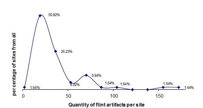
Fig. 2. Correlation between quantity of tools and all flint items
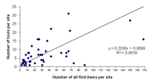
Fig. 3. Correlation between quantity of waste products and tools.
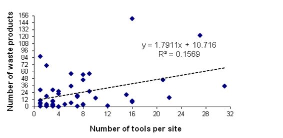
Fig. 4. Distribution of tools at survey sites
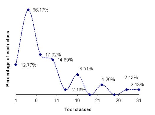
REFERENCES
Avner, U. in preparation. Archaeological Survey and Excavations in Sinai.
Avner, U., Carmi. I., Segal, D. 1994. Neolithic to Bronze Age Settlement of the Negev and Sinai in Light of Radiocarbon Dating: a View from the Southern Negev. In O. Bar-Yosef and R.S. Kra eds. Late Quaternary Chronology and Paleoclimates of Eastern Mediterranean. Tucson. Pp. 265–300.
Bar-Yosef. O., Belfer, A., Goren, A., Smith, P. 1977. The Nawamis near Ein Huderah (Eastern Sinai). IEJ 27:65–88.
Boëda, E. Geneste. J -M., Meignen, L. 1990. Identification de chaînes opératoires lithiques du Paléolithique ancien et moyen, Paleo 2:43–80.
Bordes, F. 1950. Principe d'une méthode d'étude des techniques et de la typologie du Paléolithique ancien et moyen, L'Anthropologie 54:19–34.
Brezillon, N.M. 1968. La dénomination des objets de pierre taillée. Paris.
Eddy, F.W., Wendorf, F. 1999. An Archaeological Investigation of the Central Sinai. Egypt. Boulder. Colorado.
Genz, H. 1997. Problems in defining a Chalcolithic for Southern Jordan. In H.G.K. Gebel. Z. Kafafi and G.O. Rollefson eds. The Prehistory of Jordan. II. Perspectives from 1997. Berlin. Pp. 441–448.
Gilead, I. and Hermon, S. in preparation. The Lithic Assemblages from Abu Matar and Bir es-Safadi (Be’er Sheva). Two Chalcolithic sites in the Northern Negev. Jerusalem.
Henry, D.O. 1995. Prehistoric Cultural Ecology and Evolution. New York.
Hermon, S. 2004. Socio-Economic Aspects of Chalcolithic (4500-3500 B.C.) Societies in Southern Levant – the Lithic Evidence. Ph.D. diss. Ben-Gurion University of the Negev, Be’er Sheva.
Inizan, M-L., Roche, H. and Tixier, J. 1992. Technology of Knapped Stone. Meudon.
Kozloff, B. 1974. A brief note on the lithic industries of Sinai. Ha'aretz Museum Yearbook 5/16:35–49.
Pelegrin, J., Karlin, C. and Bodu, P. 1988. Chaînes opératoires: un outil pour le préhistorien. In J. Tixiered. Technologie Lithique. Paris. Pp. 55–62.
Ronen, A. 1970. Flint Implements from Southern Sinai: Preliminary Report. PEQ 102:30–41.
Rosen, S.A. 1997. Lithics After the Stone Age. Walnut Creek, CA,
Roshwalb, A.F. 1981. Prehistory in the wadi Ghazzeh: A typological and technological study based on Macdonald Excavations. Ph.D. diss. London University. London.
Rothenberg, B. 1978. Excavations at Timna Site 39. Archaeo-Metallurgy 1:1–20.
Rothenberg, B., Glass, J. 1992. The Beginnings and the Development of Early Metallurgy and the Settlement and Chronology of the Western Arabah, from the Chalcolithic Period to the Early Bronze Age IV. Levant 24:141–157.
Rowan, Y. M. 1990. A Chalcolithic Chipped Stone Assemblage from the Northern Negev Desert: Phase II (1987-1989) Investigations at Shiqmim. Austin. Texas.
Tixier, J. 1963. Typologie de l'Epipaléolithique du Maghreb. Paris.
Table 1. Inventory of the Lithic Assemblages
|
Site Name
|
Primary Elements
|
Flakes
|
Blades
|
Cores
|
Core Trimming Elements
|
Chips
|
Chunks
|
Tools
|
Total
|
Hammer-
stones
|
|
207
|
0.0
|
57.1
|
42.9
|
0.0
|
0.0
|
0.0
|
0.0
|
0.0
|
7
|
|
|
164
|
0.0
|
11.1
|
33.3
|
0.0
|
0.0
|
0.0
|
0.0
|
55.6
|
9
|
2
|
|
168
|
0.0
|
50.0
|
33.3
|
0.0
|
0.0
|
0.0
|
0.0
|
16.7
|
6
|
|
|
191
|
0.0
|
30.8
|
30.8
|
0.0
|
0.0
|
0.0
|
11.5
|
26.9
|
26
|
4
|
|
140
|
0.0
|
50.0
|
25.0
|
12.5
|
0.0
|
0.0
|
0.0
|
12.5
|
8
|
|
|
153
|
0.0
|
20.0
|
20.0
|
0.0
|
0.0
|
0.0
|
0.0
|
60.0
|
5
|
|
|
231
|
0.0
|
12.0
|
16.0
|
12.0
|
12.0
|
0.0
|
8.0
|
40.0
|
25
|
|
|
177
|
2.8
|
33.3
|
13.9
|
2.8
|
0.0
|
0.0
|
5.6
|
41.7
|
36
|
1
|
|
53
|
3.0
|
16.4
|
13.4
|
16.4
|
1.5
|
0.0
|
17.9
|
31.3
|
67
|
1
|
|
146
|
0.0
|
7.9
|
13.2
|
10.5
|
10.5
|
0.0
|
0.0
|
57.9
|
38
|
4
|
|
152
|
0.0
|
0.0
|
12.5
|
0.0
|
0.0
|
0.0
|
0.0
|
87.5
|
8
|
|
|
583
|
0.0
|
0.0
|
7.7
|
0.0
|
0.0
|
0.0
|
69.2
|
23.1
|
13
|
|
|
179
|
0.0
|
13.6
|
6.1
|
12.1
|
3.0
|
1.5
|
16.7
|
47.0
|
66
|
|
|
250/B
|
0.0
|
35.0
|
5.0
|
0.0
|
0.0
|
0.0
|
50.0
|
10.0
|
20
|
|
|
203
|
0.0
|
34.8
|
4.5
|
3.0
|
0.0
|
34.8
|
9.1
|
13.6
|
66
|
|
|
67
|
0.0
|
33.3
|
4.2
|
0.0
|
0.0
|
0.0
|
33.3
|
29.2
|
24
|
4
|
|
156
|
0.0
|
7.1
|
3.6
|
0.0
|
0.0
|
0.0
|
89.3
|
0.0
|
28
|
|
|
248/12
|
0.0
|
46.7
|
3.3
|
0.0
|
0.0
|
0.0
|
36.7
|
13.3
|
30
|
1
|
|
620
|
0.0
|
31.4
|
2.9
|
14.3
|
2.9
|
8.6
|
14.3
|
25.7
|
35
|
|
|
248
|
0.0
|
37.0
|
2.7
|
2.7
|
1.4
|
13.7
|
39.7
|
2.7
|
73
|
|
|
246
|
0.0
|
23.8
|
1.6
|
1.6
|
0.0
|
6.3
|
54.0
|
12.7
|
63
|
|
|
248/9
|
0.0
|
33.3
|
1.6
|
0.0
|
0.0
|
17.5
|
38.1
|
9.5
|
63
|
|
|
151
|
1.3
|
36.2
|
1.3
|
4.7
|
1.3
|
13.4
|
23.5
|
18.1
|
149
|
1
|
|
111
|
0.0
|
23.0
|
1.1
|
2.3
|
2.3
|
21.8
|
48.3
|
1.1
|
87
|
1
|
|
37
|
0.0
|
27.5
|
0.0
|
4.8
|
4.8
|
4.2
|
49.1
|
9.6
|
167
|
1
|
|
39
|
0.0
|
0.0
|
0.0
|
0.0
|
0.0
|
0.0
|
100.0
|
0.0
|
7
|
|
|
66
|
0.0
|
50.0
|
0.0
|
0.0
|
0.0
|
6.7
|
40.0
|
3.3
|
30
|
|
|
81
|
0.0
|
0.0
|
0.0
|
0.0
|
0.0
|
0.0
|
25.0
|
75.0
|
4
|
1
|
|
91
|
0.0
|
20.8
|
0.0
|
0.0
|
0.0
|
0.0
|
12.5
|
66.7
|
24
|
|
|
92
|
0.0
|
50.0
|
0.0
|
16.7
|
0.0
|
0.0
|
0.0
|
33.3
|
6
|
2
|
|
94
|
0.0
|
7.7
|
0.0
|
11.5
|
0.0
|
0.0
|
65.4
|
15.4
|
26
|
3
|
|
95
|
0.0
|
40.0
|
0.0
|
4.0
|
0.0
|
0.0
|
28.0
|
28.0
|
25
|
|
|
98
|
0.0
|
20.4
|
0.0
|
13.0
|
0.0
|
0.0
|
51.9
|
14.8
|
54
|
2
|
|
116
|
4.9
|
29.3
|
0.0
|
0.0
|
0.0
|
2.4
|
48.8
|
14.6
|
41
|
1
|
|
117
|
0.0
|
60.0
|
0.0
|
0.0
|
0.0
|
0.0
|
40.0
|
0.0
|
10
|
|
|
131
|
0.0
|
25.0
|
0.0
|
0.0
|
0.0
|
0.0
|
25.0
|
50.0
|
4
|
|
|
132
|
0.0
|
58.3
|
0.0
|
8.3
|
8.3
|
0.0
|
0.0
|
25.0
|
12
|
2
|
|
133
|
0.0
|
0.0
|
0.0
|
7.1
|
7.1
|
0.0
|
0.0
|
85.7
|
14
|
2
|
|
167
|
0.0
|
50.0
|
0.0
|
0.0
|
0.0
|
0.0
|
0.0
|
50.0
|
2
|
|
|
170
|
0.0
|
7.7
|
0.0
|
19.2
|
3.8
|
0.0
|
7.7
|
61.5
|
26
|
|
|
187
|
0.0
|
16.7
|
0.0
|
16.7
|
16.7
|
0.0
|
0.0
|
50.0
|
6
|
|
|
188
|
0.0
|
0.0
|
0.0
|
33.3
|
0.0
|
0.0
|
0.0
|
66.7
|
3
|
|
|
212
|
0.0
|
30.8
|
0.0
|
0.0
|
0.0
|
0.0
|
23.1
|
46.2
|
13
|
2
|
|
222
|
0.0
|
25.0
|
0.0
|
33.3
|
33.3
|
0.0
|
0.0
|
8.3
|
12
|
1
|
|
226
|
0.0
|
27.3
|
0.0
|
0.0
|
0.0
|
0.0
|
0.0
|
72.7
|
11
|
|
|
233
|
0.0
|
0.0
|
0.0
|
0.0
|
0.0
|
0.0
|
0.0
|
100.0
|
4
|
1
|
|
234
|
0.0
|
0.0
|
0.0
|
0.0
|
0.0
|
0.0
|
0.0
|
100.0
|
4
|
|
|
235
|
0.0
|
0.0
|
0.0
|
28.6
|
28.6
|
0.0
|
0.0
|
42.9
|
7
|
|
|
241
|
0.0
|
0.0
|
0.0
|
20.0
|
20.0
|
0.0
|
0.0
|
60.0
|
5
|
|
|
108A
|
0.0
|
0.0
|
0.0
|
75.0
|
0.0
|
0.0
|
25.0
|
0.0
|
4
|
|
|
248/10
|
0.0
|
0.0
|
0.0
|
0.0
|
0.0
|
0.0
|
100.0
|
0.0
|
6
|
|
|
248/11
|
0.0
|
0.0
|
0.0
|
0.0
|
0.0
|
0.0
|
100.0
|
0.0
|
9
|
|
|
248/14
|
0.0
|
20.0
|
0.0
|
0.0
|
0.0
|
0.0
|
80.0
|
0.0
|
20
|
|
|
248/15
|
0.0
|
0.0
|
0.0
|
0.0
|
0.0
|
0.0
|
100.0
|
0.0
|
5
|
|
|
248/5
|
0.0
|
51.9
|
0.0
|
3.7
|
0.0
|
0.0
|
44.4
|
0.0
|
27
|
1
|
|
248/6
|
0.0
|
10.0
|
0.0
|
0.0
|
0.0
|
0.0
|
90.0
|
0.0
|
10
|
|
|
248/7
|
0.0
|
0.0
|
0.0
|
0.0
|
0.0
|
0.0
|
100.0
|
0.0
|
6
|
|
|
248/8
|
0.0
|
59.4
|
0.0
|
0.0
|
0.0
|
0.0
|
31.3
|
9.4
|
32
|
|
|
250/A
|
0.0
|
25.0
|
0.0
|
25.0
|
25.0
|
0.0
|
25.0
|
0.0
|
4
|
|
|
255/B
|
0.0
|
15.0
|
0.0
|
0.0
|
0.0
|
0.0
|
85.0
|
0.0
|
20
|
1
|
|
60
|
0.0
|
16.7
|
0.0
|
8.3
|
8.3
|
0.0
|
0.0
|
66.7
|
12
|
|
|
Total
|
7
|
437
|
63
|
89
|
37
|
101
|
547
|
343
|
1624
|
39
|
|
%
|
0.4
|
27.0
|
3.9
|
5.5
|
2.3
|
6.2
|
33.7
|
21.1
|
|
|
Table 2. Inventory of the tool assemblages
|
Site
|
Scrapers
|
Tabular Scrapers
|
Awls
|
Retouched Flakes
|
Notches
|
Truncations
|
Retouched Blades
|
Bifacials
|
Varia
|
Total
|
|
60
|
|
25.0
|
|
25.0
|
|
12.5
|
37.5
|
|
|
8
|
|
37
|
37.5
|
25.0
|
|
6.3
|
12.5
|
6.3
|
|
12.5
|
|
16
|
|
53
|
28.6
|
4.8
|
23.8
|
|
9.5
|
|
14.3
|
19.0
|
|
21
|
|
66
|
|
|
|
|
100.0
|
|
|
|
|
1
|
|
81
|
|
|
33.3
|
|
|
|
33.3
|
|
33.3
|
3
|
|
91
|
12.5
|
6.3
|
12.5
|
37.5
|
6.3
|
|
12.5
|
6.3
|
6.3
|
16
|
|
92
|
|
|
|
50.0
|
|
|
|
|
50.0
|
2
|
|
94
|
|
|
100.0
|
|
|
|
|
|
|
4
|
|
95
|
14.3
|
|
28.6
|
14.3
|
14.3
|
14.3
|
14.3
|
|
|
7
|
|
98
|
37.5
|
|
|
50.0
|
|
|
12.5
|
|
|
8
|
|
111
|
|
|
|
100.0
|
|
|
|
|
|
1
|
|
116
|
16.7
|
|
50.0
|
|
16.7
|
|
16.7
|
|
|
6
|
|
131
|
|
|
|
|
100.0
|
|
|
|
|
2
|
|
132
|
66.7
|
|
33.3
|
|
|
|
|
|
|
3
|
|
133
|
50.0
|
|
8.3
|
25.0
|
|
|
|
8.3
|
8.3
|
12
|
|
140
|
|
|
|
|
|
|
|
|
100.0
|
1
|
|
146
|
13.6
|
4.5
|
36.4
|
36.4
|
9.1
|
|
|
|
|
22
|
|
151
|
14.8
|
11.1
|
11.1
|
18.5
|
33.3
|
7.4
|
3.7
|
|
|
27
|
|
152
|
|
|
14.3
|
57.1
|
14.3
|
|
14.3
|
|
|
7
|
|
153
|
|
|
|
33.3
|
33.3
|
|
33.3
|
|
|
3
|
|
164
|
|
|
|
40.0
|
60.0
|
|
|
|
|
5
|
|
167
|
|
|
|
100.0
|
|
|
|
|
|
1
|
|
168
|
|
|
|
|
|
|
|
100.0
|
|
1
|
|
170
|
|
|
18.8
|
31.3
|
18.8
|
|
18.8
|
12.5
|
|
16
|
|
177
|
20.0
|
|
|
40.0
|
13.3
|
|
13.3
|
|
13.3
|
15
|
|
179
|
25.8
|
|
6.5
|
16.1
|
16.1
|
16.1
|
12.9
|
6.5
|
|
31
|
|
187
|
|
|
66.7
|
33.3
|
|
|
|
|
|
3
|
|
188
|
|
|
50.0
|
50.0
|
|
|
|
|
|
2
|
|
191
|
42.9
|
14.3
|
14.3
|
28.6
|
|
|
|
|
|
7
|
|
203
|
22.2
|
11.1
|
11.1
|
11.1
|
22.2
|
|
|
|
22.2
|
9
|
|
212
|
33.3
|
|
|
33.3
|
16.7
|
|
|
16.7
|
|
6
|
|
222
|
|
|
|
100.0
|
|
|
|
|
|
1
|
|
226
|
25.0
|
|
37.5
|
37.5
|
|
|
|
|
|
8
|
|
231
|
50.0
|
10.0
|
10.0
|
|
|
|
30.0
|
|
|
10
|
|
233
|
50.0
|
|
25.0
|
|
|
|
25.0
|
|
|
4
|
|
234
|
50.0
|
|
|
|
|
|
25.0
|
|
25.0
|
4
|
|
235
|
|
|
|
66.7
|
|
|
33.3
|
|
|
3
|
|
241
|
|
|
33.3
|
33.3
|
33.3
|
|
|
|
|
3
|
|
246
|
|
62.5
|
|
12.5
|
12.5
|
|
12.5
|
|
|
8
|
|
248
|
|
|
50.0
|
|
|
|
|
|
50.0
|
2
|
|
248/8
|
|
|
|
|
|
|
100.0
|
|
|
3
|
|
248/9
|
16.7
|
|
16.7
|
66.7
|
|
|
|
|
|
6
|
|
248/12
|
25.0
|
|
25.0
|
50.0
|
|
|
|
|
|
4
|
|
250B
|
|
|
|
100.0
|
|
|
|
|
|
2
|
|
583
|
|
|
33.3
|
33.3
|
|
|
|
|
33.3
|
3
|
|
620
|
11.1
|
33.3
|
11.1
|
|
11.1
|
11.1
|
22.2
|
|
|
9
|
|
Total
|
66
|
23
|
52
|
80
|
42
|
11
|
36
|
14
|
12
|
336
|
|
%
|
19.6
|
6.8
|
15.5
|
23.8
|
12.5
|
3.3
|
10.7
|
4.2
|
3.6
|
|
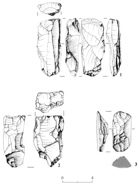
PLATE 1
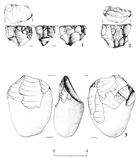
Plate 2
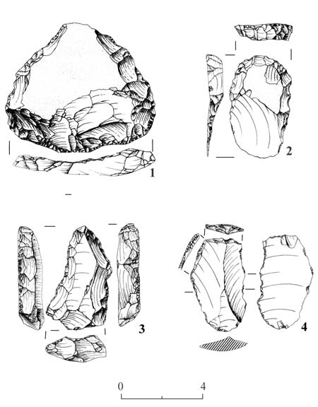
Plate 3
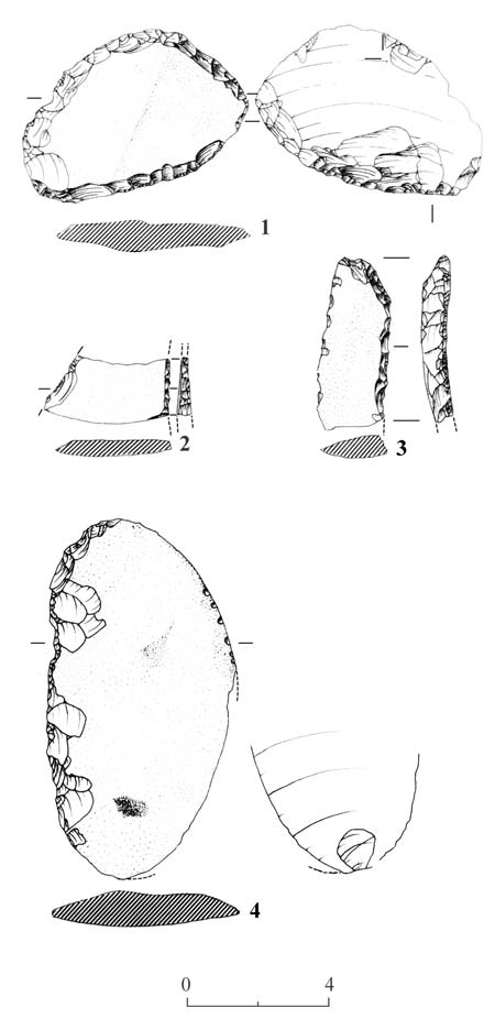
Plate 4
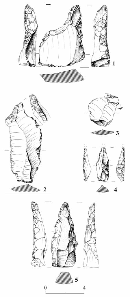
Plate 5
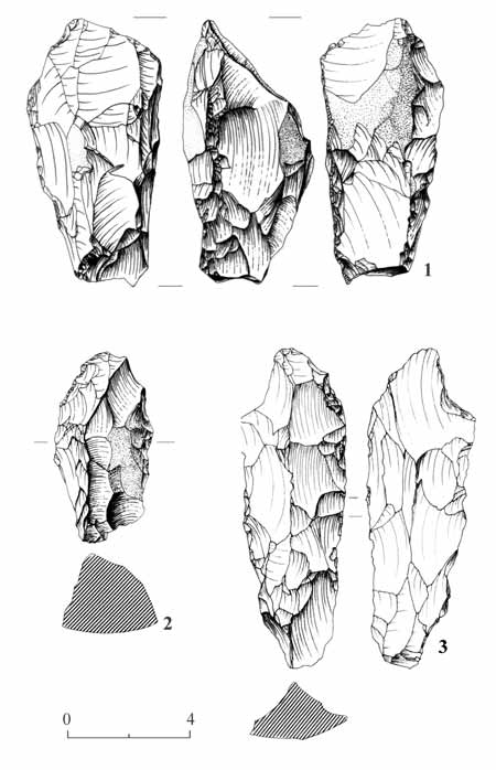
Plate 6
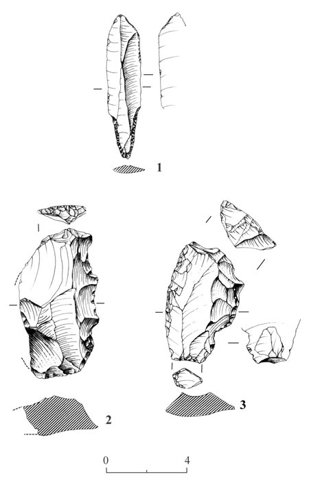
Plate 7
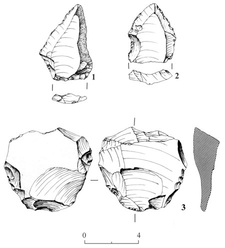
Plate 8
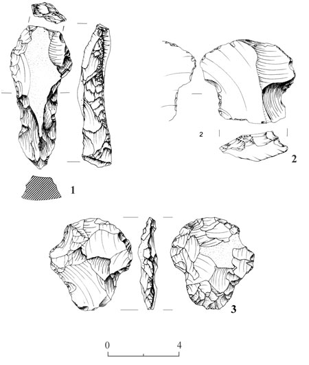
Plate 9
II. The Archaeo-Metallurgical Finds
The slags from the copper smelters and the Archaeo-Metallurgy of the southwestern Arabah – Evelyn Krawczyk-Bärsch
1. Slags of the Arabah
Products of extractive metallurgy are metal and, predominantly, siliceous waste. Among the latter, slags are the most abundant materials. In ancient times, slags were usually left behind by metal workers at the smelting sites. Because of their often high residual metal content, ancient slags were frequently removed and recycled in modern times; e.g., Laurion (Greece) and Rio Tinto (Spain).
Numerous slag heaps were discovered during systematic archaeological surveys of the Southern Arabah by Rothenberg’s Arabah Expedition. All the sites where slags have been found and from which samples have been incorporated in this research are recorded on the map (Fig.1). Concentration of smelting sites in the Timna Valley, close to the copper mineralisation in the local Nubian sandstone formation, is obvious.
Dating of associated archaeological finds, permits correlation of most slag sites to certain periods of metallurgical activity. The Arabah slag samples investigated may be placed in the chronological sequences listed in Table 1.
The mineralogical composition of Arabah slags, their metal content and their outer appearance depend on several parameters:
- Ores used (copper, manganese and iron ores)
- Ore beneficiation (e.g., crushing, selecting)
- Additives (fluxes: Fe2O3, MnO2, SiO2, CaCO3, return slag, charcoal ash)
- Fuel and reducing agent (charcoal)
- Type of furnace (‘hole in the ground’, bowl furnace, shaft furnace, crucible)
- Construction material of furnace
- Furnace lining (e.g., clay, loam)
- Size of furnace
- Air supply and conduct
- Number of tuyeres
- Process parameters inside the furnace: (temperature, distribution of heat, partial pressure of oxygen, etc.)
- Retention time of charge inside the furnace
- Viscosity of slags
- Conditions of cooling
- Refining of final products (e.g., in crucibles)
The first step in slag investigation is the identification of the process that produced the slag. Bachmann (1978) distinguishes three main groups:
- Non tapped 'furnace slags'
- tapped slags
- crucible slags
Non-tapped furnace slags are residues of smelting that remained inside the furnace due to their high viscosity. They have to be removed after opening and, if necessary, destroying the furnace. This type of slag is characterised by frequent inclusions of ore, flux and charcoal fragments. Molten silicates, adhering to the furnace wall, may include material from the wall itself.
The low viscosity of tapped slags favours their free flow out of the furnace and their solidification outside the reactor (e.g., in slag pits). Tapped slags are as a rule relatively free from inclusions and are homogeneous. Tapped slags show flow textures similar to those of molten lava on their upper surfaces, but none on their bottom. The dense structure of tapped slags is due to rapid cooling. They commonly solidify as plates or flat cakes.
After removal of impurities and associated materials (e.g., gangue) by slagging, the black or blister copper had to be refined. This was generally carried out in crucibles. Crude copper was melted under oxidising conditions, to insure removal of impurities in a slag crust formed on the surface of the molten metal.
The size of slag samples available for investigation (83 samples from 64 sites) varied. The oldest slag from the Arabah (Timna Site F2) probably derived from smelting in a ‘hole-in-the-ground’ hearth. The sample from Site F2 consisted of small fragments, which included partly molten material from the soil into which the hearth was dug. Slags from early metallurgical periods (12 samples) belong to the group of hearth or furnace slags. After cooling, these slags were removed from the furnace and crushed in order to salvage copper inclusions. These droplets and prills of copper have diameters of 0.5 to 4.0 cm. The small slag pieces from this period are mostly dark gray in color and are angular or rounded in shape. Frequently they contain relics of charcoal. Two samples exhibit adhering material from the furnace wall.
Tapped slags become more frequent beginning in the Early Bronze Age. These dark gray to black slags have pronounced flow textures (cf. Fig. 2). Small degassing holes, formed during solidification, are frequent in the upper layers of the sample. Most tapped slags investigated are dense. Their average thickness is c. 4 cm.
According to Bachmann (1978), in order to define crucible slags as such, crucible fragments must be found adhering to the slags. However, mineralogical considerations add further criteria to the identification of crucible slags, e.g., a higher degree of oxidation, indicated by characteristic mineral assemblages.
2. Analytical Methods
Following the description and classification of the slag samples by external parameters, the mineralogical and chemical investigations and the individual slag components identified will be presented. Investigations were carried out at the Institute of Geoscience of the University of Mainz (Germany).
For microscopic identification of the mineral content of the slag samples, cut slices of c. 25 µm were turned into polished thin sections. This method of preparation enabled the optical identification of transparent silicate minerals under the polarising microscope as well as opaque oxides, sulphides and metals by reflected light microscopy.
Various methods were employed for qualitative and quantitative chemical analysis. The chemical characterisation of individual slag minerals was carried out on polished thin-sections with the aid of a CAMACA microprobe (of the Camebox type). For the quantitative evaluation of the spectra obtained, the software programme (Ware 1981) was employed with the special program OXIDE/CAMSIL. The latter was calibrated to internationally accepted standards. This program is particularly suited for treatment of analyses of oxides and silicates. A further method to determine individual slag minerals is x-ray diffraction analysis (XRD), performed with a diffractometer (Philips, type APD 15). Phase determination by XRD is especially useful when dealing with samples of nearly monomineralic composition.
Wet chemical methods were used to determine the bulk chemical composition of the slag samples. The specimens were crushed to a grain size of 63 µm in a rotary mill with a tungsten carbide lining. The main oxides, and some of the trace elements, were determined by using two different methods of sample dissolution: The HF-dissolution is suitable for the application of atomic absorption spectroscopy (AAS). The following components can be determined: CaO, MnO, MgO, BaO, K2O and Na2O. By photometric analysis total iron- and P2O5-contents can be measured. The second method of dissolution is the fusion of sample material with lithium tetraborate. After bringing the melt into solution, TiO2, Al2O3 and SiO2 can be determined photometrically, while PbO, CuO and ZnO have to be analysed by AAS.
To determine FeO, samples were brought into solution with a mixture of HF and H2SO4, buffered with ammonium acetate. The reagent was ortho-phenantrolin-monohydrate.
The percentage of adsorbed water in slags can be determined by heating 1.0 to 1.5 grams of sample material in a drying cabinet for about two hours at 110ºC. Loss in weight after heating corresponds to adsorbed humidity, moisture or water content.
To determine loss of ignition, the powdered samples were heated for six hours at 1050ºC. All 13 samples analysed showed negative values of loss of ignition, indicating oxidation during heating.
Following the mineralogical and chemical analyses of the slags, the data obtained were entered into various computer programs. For graphic presentation of the composition of mineral phases and their conditions of formation, quaternary, ternary and binary phase diagrams are recommended. A list of the investigation methods employed is given in Fig. 3.
3. Chemical Composition of the Slags
The southern Arabah is one of the most important regions of ancient copper production in the Near East. Early copper slags from other smelting sites in the Mediterranean and in Arab countries have been investigated, e.g., in Cyprus (Bachmann 1982), Oman (Hauptmann, 1985) and Fenan (Hauptmann, Weisgerber and Knauf 1985).
Chemical and mineralogical characterisation of slags from the southern Arabah have so far been restricted to the analysis of samples from individual sites (Bachmann, 1968, 1978, 1980; Tylecote, Lupu and Rothenberg 1967; Lupu, 1970; Milton et al. 1976; Bamberger et al. 1986). The results conveyed in this chapter augment earlier publications and short communications (Krawczyk and Keesmann 1987; Krawczyk and Keesmann 1988).
As evident from the chemical bulk analyses, the most important constituents of the slags from the southern Arabah are the oxides SiO2, FeO, MnO and CaO (cf. Table 2). The variations of the percentages of these oxides in the various slags permit the classification of the copper slags into four groups:
- iron-rich slags;
- iron- and calcium-rich slags;
- manganese-rich slags
- iron-, calcium- and manganese-rich slags.
SiO2-contents are of paramount importance for the formation of mineral phases and their assemblages specific for the individual groups.
Magnesium content is very low in nearly all the slags. Exceptions are slags that underwent a change in their chemical composition, due to contact with furnace walls.
The presentation of bulk analyses in the quaternary system CaO-FeO-SiO2-Al2O3 (cf. Keesmann et al. 1984, with substitution of FeO by MgO and MnO as well as CaO by Na2O and K2O and of SiO2 by P2O5) indicates the concentration of slags in the geographical region of iron- and/or manganese-rich and calcium-rich compositions (cf. Fig. 4). The results of the investigations of slags from Beet al. 1985) have been included for comparison; they match the results we obtained.
4. Mineralogy of the slags
The formation of slag minerals from a siliceous melt is influenced by many parameters: Chemical composition of the melt, temperatures, partial oxygen pressure inside the furnace, reaction and retention response time, cooling conditions inside the furnace and outside in slag collection pits etc. The many mineral phases, which are likely to be formed, can be classified into siliceous phases; oxidic phases; sulphidic phases; and metallic phases.
4.1. Siliceous phases
Significant components of the slags investigated are: olivine, klinopyroxene and klinopyroxene-related phases, as well as ferro-åkermanite. A special position is occupied by SiO2-modifications. They indicate special conditions of the siliceous melt during the sequence of processes taking place.
Thin sections (cf. Table 7, figs. 1 to 3) relate important information with regard to structure and mineral contents of particular slags. On Table 7, fig.1, a fragment of furnace slag can be seen with primary crystallised, needle-shaped olivine crystals, surrounded by a brighter rim of idiomorphic olivine crystals.
The appearance of a tapped slag is shown on Table 7, fig.2. The upper region is dominated by needles of olivine, arranged perpendicular to the sample's surface. The lower region exhibits numerous star-shaped opaque minerals, consisting mainly of pyroxene. The thin section of a compact tapped slag (cf. Table 7, fig. 3) illustrates a cluster of pyroxene-like crystals in the upper section of the specimen. In the lower section glassy compounds dominate.
4.1.1. Olivines
Olivines are main constituents of the siliceous phases in the samples investigated. Based on analytical measurements with the microprobe, iron- and manganese-rich olivines can be distinguished (cf. Fig. 5). Both groups of olivines contain small amounts of calcium and magnesium.
Iron-rich olivines tend to crystallise in slags as long, thin, partly skeletal, mostly colorless needles. In a sample from Timna Site 30 A, the length of the needles reaches up to 4 mm. The arrangement of these needles in bundles is called spinifex-texture (cf. Table 7, Fig. 4). This is the result of the usually rapid cooling of silicate melts. The high iron content in the needles analysed, corresponds to an almost pure fayalite composition of the formula Fe2SiO4 (cf. Table 4).
Fayalites with low MnO content have a different habitus compared with pure fayalites. Contrary to needle-like fayalites, iron-rich fayalites containing manganese mostly crystallise in idiomorphic crystals. Their size in cross-section can be as large as 1.5 mm.
Graphical presentation of olivine-spot analyses in the ternary system FeO-MgO-MnO (cf. Fig. 6a) and FeO-CaO-MnO (cf. Fig. 6b), exhibit a noticeable tendency of fayalites with knebelite component to move in direction towards MnO-free fayalite. Fayalite needles and idiomorphic, manganese containing fayalite crystals occur together in a furnace slag with many degassing holes from Timna Site 34 (cf. Table 7, fig. 1). The lower rim of this slag consists mainly of idiomorphic crystals. The center part of the slag cake, however, is characterised by needle-shaped fayalites.
Quenching of the melt leads to the formation of idiomorphic skeletal fayalites with a knebelite component, (Fe, Mn)2SiO4. These are early crystallisations, situated close to the rim zone, which was rapidly cooled. From the melt, thus reduced in manganese, subsequently, ‘pure’ fayalites crystallised next.
A further constituent of fayalites is the result of CaO-content in some of the slags. The mineral in question is kirschsteinite, (Fe,Ca)2SiO4. In microscopic investigation under transmitting light, one of the samples (Site 201A) shows a zonar structure of idiomorphic crystals, the chemistry of which could be confirmed by microprobe measurements. The individual point analyses are presented in ternary systems (cf. Fig. 6a and 6b). The crystallisation of this particular olivine starts at the center with the formation of fayalite with a component of kirschsteinite. With reduction of the FeO content and the simultaneous increase of the CaO content, olivine with an almost perfect composition of kirschsteinite gradually develops at the outer rim of the crystal.
Investigation of slags from Fenan (Hauptmann et al. 1985) demonstrates that in the northern Arabah manganese-rich olivines are the main components of slags; iron-rich phases are less significant here. However, in the southern Arabah to the north of Timna, slag mineral phases with high MnO content are less pronounced. This includes manganese-rich olivines, which are difficult to distinguish microscopically from iron-rich olivines. Manganese-rich olivines, like tephroite, Mn2SiO4, occur in needles as well as in spinifex-texture but also in idiomorphic crystals. Therefore, they cannot be distinguished optically from fayalites. Microprobe measurements, the results of which are presented in the quaternary system FeO-MgO-MnO-CaO (cf. Fig. 7), clearly show the two groups of olivines. The development moves from nearly pure tephroites, with reducing MnO-content, toward iron-rich knebelites
Olivines are not only the main constituents of the copper slags; they also make up the interstices in the matrix between pyroxene and pyroxene-related crystals. Further to the types of olivine already described, a variety of olivine must be mentioned that contains equimolecular amounts of iron, calcium and manganese. This phase forms the matrix in a sample (Timna Site 15 ) of bustamite crystals, (Mn,Ca)3Si3O2
The chemistry of olivines becomes apparent from the bulk composition of the slag. As the copper slags from the southern Arabah contain little magnesium (cf. Chapter 3), the olivines are consequently low in magnesium.
4.1.2. Klinopyroxene and pyroxene-related minerals
In addition to olivines, klinopyroxenes are another main constituent of early copper slags. Microprobe analyses give a very different chemical composition picture of these silicates (cf. Fig. 7). The essential chemical components of klinopyroxenes are Si, Fe and Ca. Certain percentages of Mn, Mg and Al explain the complexity of pyroxenes and pyroxene-related phases in copper slags.
Important Ca- and Fe-containing pyroxenes are hedenbergite, (Fe,Ca)2Si2O6, and augites. While hedenbergite forms the crystalline compound of the slags, augites are less frequently found in crystallised form. Microprobe investigations have shown that the crystalline and the glassy matrix of some samples have the composition of augites (cf. Table 5).
Hedenbergites appear in two different crystal shapes in the copper slags investigated. Large, up to 6.4 mm long, feathery crystals, with strong pleochroism from orange to green (cf. Table 7, Fig. 5), are the dominant variety. Also frequent are long needles, which have arranged themselves parallel to each other during the early stages of crystallisation. In later stages of crystalization, these were widened to sheaves. Feathery as well as bundle-like forms of crystallisation are the consequence of rapid cooling.
The most frequent form of the crystallisation of augites is illustrated in Table 7, Fig. 6. The crystal consists of single lamellae, arranged parallel to each other, surrounded by opaque minerals. The strongly pronounced pleochroism varies in color from orange to green. The appearance of pyroxenes has already been referred to (Table 7, Fig. 2) as opaque, star-shaped phases in the lower section of the sample from Timna Site 34A. Table 7, Fig. 6 presents the small sector of this thin-section illustration with crystals of augite in paragenesis with phases appearing opaque (cf. 5.1).
The pyroxen-related phases can be distinguished from the actual pyroxenes by their chemical composition, as well as by their different crystal structure. By the number of SiO4-tetrahedra in an identical chain period, pyroxenes are defined as single-chain-silicates. Pyroxene-related crystals are defined as triple-, fivefold-, sevenfold- or ninefold combinations of single-chain silicates. Among pyroxene-related phases in copper slags from the southern Arabah, wollastonite and bustamite as well as phases with a structure similar to bustamite have been identified.
Wollastonite, CaSiO3, is a triple single-chain silicate. Under a microscope with crossed polarisers, the colorless, lathe-shaped crystals show blue first-order interference colors (Delta = 0.014). Zonar growth is very pronounced in these crystals (cf. Table 8, Fig. 1). Microprobe analyses on one of these crystals gave significant variations of iron- and calcium-content within this phase. This implies a tendency of development during the crystallisation of wollastonite crystals, starting with pure wollastonite in the nucleus, with gradual transition to iron-rich wollastonite towards the crystal's rim (cf. Fig. 8). In the paragenesis of crystals with zonar growth feature, wollastonites of hedenbergite composition are frequently encountered (cf. Chapter 5.2). The long, lathe-shaped crystals of this phase are characterised by orange first-order colors of interference.
A further pyroxene-related phase is bustamite, (Ca,Mn)3Si3O9, triple single-chain SiO4-combination within the family of pyroxenoids. Bustamite crystals have already been identified as a mineral phase in the slags from the southern Arabah (Bachmann 1978) and as rare constituent in copper slags from Feinan (Hauptmann et.al.1985). The long, colorless needles resemble crystals of tephroite. Bustamite also tends to crystallise preferably in bundles of spinifex structure. However, under crossed polarisers, they show orange colors of first-order of interference (Delta = 0.015). According to optical criteria, this phase can be identified in some slag samples from smelting sites in various parts of the Arabah and of different chronology, but microprobe analyses reveal deviations in chemical composition of these phases so similar in their optical properties. The variations in calcium-, manganese and iron-contents (cf. Table 5, Fig. 7) are noteworthy. To verify the identification of this mineral, x-ray diffraction diagrams from powdered slag samples were taken, further to optical and microprobe investigations. According to XRD (JCPDS-No. 33-292), iron-rich bustamites are only present in one sample (Site 15). Manganese-calcium silicates were more frequently detected, such as ß-MnCaSiO3 (JCPDS No. 12-182), which has a structure very similar to bustamite (Liebau et al. 1958).
Pyroxenes and pyroxene-related minerals in copper slags from the southern Arabah with high MgO-content form a class of their own. These are pyroxenes of a composition similar to diopside, (Ca,Mg)2Si2O6, (cf. Morimoto, 1988). They were identified in some specimens by microprobe analysis (cf. Table 5, Fig. 7). Under the microscope, small skeletal crystals can be distinguished, exhibiting pleochroism from orange to green. Slag samples containing diopside are always heavily contaminated with material from the furnace wall. The occurrence of diopside is rare and exclusively the result of a reaction of molten slags with ceramic material of the furnace, consisting of MgO-containing clays and/or dolomite, CaMg(CO3)2.
4.1.3. Ferro-åkermanite
A few of the investigated copper slags from the southern Arabah contained crystals of ferro-åkermanite, Ca2FeSi2O7 . Ferro-åkermanite is a mineral belonging to the melilite group, which is itself a series of mixed crystals between the end members åkermanite, CaMgSi2O7 and gehlenite, Ca2Al[(Si,Al)2O7]. Melilites are formed if there is an SiO2-defficiency. They are regarded as SiO2-depleted equivalents of pyroxenes (Trojer 1969). Iron-rich minerals belonging to this group, such as ferro-åkermanite, is formed as a result of the substitution of magnesium and aluminium by bivalent and trivalent iron in the crystal structure of melilites. Melilites, which are frequent components of modern blast and shaft furnaces slags (Trojer 1963), are also mentioned in connection with ancient copper slags from the Near East by Hauptmann (1985). In that case the mineral in question was a manganese-containing melilite, also identified in slags from Oman.
In the slags from the southern Arabah, the ferro-åkermanite crystals occurred as thick, colorless plates. Under a microscope with crossed polarisers they showed a gray first-order color of interference (Delta = 0.005).
4.1.4. Tridymite
SiO2-phase tridymite was present only in a few slag samples. These colorless crystals occur as plates and often exhibit skeletal growth. Predominantly, they crystallise adjacent to quartz grains, which they surround as a kind of "tridymite corona".
4.2. Oxidic phases
A further group of minerals, of great importance in copper slags from the Arabah, consists of oxidic phases of iron and copper, i.e. spinels, delafossite and cuprite.
4.2.1. Spinels
Spinels are present in nearly all the slags from the southern Arabah investigated.
4.2.1.1. Magnetite
These are mainly crystals of magnetite, FeIIFeIII2O4, which partly crystallise as octahedra, partly as dendrites. According to Trojer (1963), magnetite crystals growing uninhibited during slow cooling crystallise as octahedra. Rapid cooling favours dendritic crystallisation. Skeletal growth and arrow-shaped octahedra are also frequent (cf. Table 8, Fig. 2).
In observation under reflecting light in air, magnetites show only moderate reflection. The first impression of color is light gray with a faintly brownish hue. Frequently, magnetite crystals are formed inside the matrix of the main constituents, especially between olivines. Apparently, crystallisation of magnetite follows the primary crystallisation of other slag minerals. If klinopyroxenes and pyroxene-related phases are the main constituents, magnetite crystals occur as cotectic intergrowth with these minerals. Oxidation during cooling or reheating of the siliceous slag melt may result in the formation of hematite, alpha-Fe2O3, inside the magnetites. In this case, hematites form thin, highly reflecting plates, following the structural planes of magnetite, starting near the rim, along cracks, holes and twin lamellae of magnetite crystals, gradually replacing them. In naturally occurring magnetites, this phenomenon is called martitisation (Ramdohr 1975).
Microprobe investigations of various magnetite crystals, revealed small amounts of MnO, MgO, Al2O3, TiO2, Cr2O3 and V2O3. Conversion of these compounds into elements permitted the inclusion of percentages of molar additions to the magnetite formula (cf. Table 6). The percentages of molar additions to magnetite-rich spinels in their maximum and minimum ranges are quoted in Table 6. In magnetites from manganese-rich slags, a manganese-rich spinel variety, presumably jacobsite, MnFe2O4, is the dominating phase. Next to jacobsite, magnesioferrite, MgFe2O4, should be mentioned as a further component in magnetites. Jacobsite is likely to occur even in iron-rich slags with only small quantities of MnO. It is noteworthy that in this type of slag, hercynite and ulvite are present as constituents of magnetite crystals (hercynite = FeAl2O4, ulvite = FeII2TiIVO4). Contents of Cr2O3 and V2O3 are generally low in magnetites from manganese-rich as well as iron-rich slags.
4.2.1.2. Copper-rich spinel
A copper-rich spinel phase was identified optically and by microprobe in some slag samples. This compound can be distinguished optically from magnetites normally present in slags from copper reduction processes by its bluish-gray color under reflecting light observation in air. A special feature of this particular phase in copper slags from the Arabah are exsolutions of delafossite, CuIFeIIIO2. These occur as lamellae inside the spinel crystals or in their outer zones (cf. Fig. 9). Microprobe analyses show variable CuO content in these spinels. They can vary between 4 and 15 weight percentages within one individual crystal. Table 7 summarises point analyses of a copper-rich spinel and an adjacent delafossite lamellae. We wtill do not know whether this spinel variety is a copper-rich magnetite or a cupro-spinel, CuFe2O4.
4.2.2. Delafossite
Delafossite, CuIFeIIIO2, frequently occurs as exsolution of copper-rich spinels (Buist et al.1966). This phase commonly appears in the form of tabular crystals (cf. Tab.8, fig.3). The brownish-yellow color of plates of delafossite, as well as exsolution lamellae, permit a clear distinction of this mineral from magnetite. Delafossite crystals show a strong effect of anisotropy when exposed to air. Colors are bluish-gray; extinction is rectangular. After investigations, delafossite is found in slags either rich in copper or in the material of furnace walls. This phase is stable in association with metallic copper, cuprite, tenorite, cupro-spinel, hematite and magnetite (cf. Fig. 10). Especially in copper slags from the southern Arabah, a paragenesis of delafossite, metallic copper, cuprite and copper-rich spinel seem to be characteristic.
4.2.3. Cuprite
Under oxidising conditions, cuprite, Cu2O, is readily formed in copper slags. In combination with delafossite plates, cuprite appears as spheres (cf. Table 8, Fig. 3). According to Trojer (1963), crystals of cuprite in copper slags are invariably spherical and only rarely dendritic. Frequently, cuprite forms a rim surrounding droplets of copper. In air, cuprite has a medium-high reflection of white-blue color. Cuprite presents a darker hue of blue than does copper. The very frequent, bright red internal reflections are characteristic of the copper oxide phase. They are particularly obvious in observation under crossed polarisers in oil immersion. A further sign of characterisation of cuprites are minute filaments of copper, which––according to Ramdohr (1975)––are formed simultaneously with cuprite; thus, they should not be regarded as replacement relics.
4.3. Sulphidic phases
4.3.1. Digenite
This copper sulphide phase, with the composition Cu9S5 , generally forms rims or zones around individual droplets of copper. Microscopic observation under oil immersion shows digenite as bluish-gray mineral with only moderate reflection. Blue and violet colors in polished sections after exposure to air are characteristic of all copper sulphide minerals.
4.3.2. Alabandite
In manganese-rich slags, small, tabular crystals of alabandite, MnS, can occasionally be recognised. They occur between tephroite crystals in the matrix. The color of this phase is gray-white.
4.4. Metallic phases
Microscopic inspection shows that only few slags are free from metallic inclusions. Metallic copper is present in nearly all the samples investigated. The frequently strong reducing conditions during the extractive metallurgical process gave rise to the formation of copper-iron alloys and metallic iron in the form of small spheres.
4.4.1. Copper
Metallic copper very often occurs as spheres. Small droplets of copper can occasionally be seen inside the magnetite crystals, also present in the samples. A further variety of occurrence of metallic copper is as idiomorphic crystals, in particular in vesicles and cracks of slags. This must be regarded as remobilised copper. Immediately after polishing, the color of copper inclusions in slags bright pink to orange, becoming gradually brownish-red. Frequently, copper inclusions are surrounded by a rim of digenite of bluish-gray reflection color. Metallic copper inclusions are rarely surrounded by rims of cuprite; these can easily be distinguished from seams of digenite. Microprobe analysis of copper droplets gave a maximum iron content of 0.83 weight percent.
4.4.2. Iron
The presence of drops of metallic iron in slags from the Arabah is rare. In polished sections, iron exhibits high reflection of pure white color. Frequently, iron inclusions can be detected that are surrounded by a semicircular rim of metallic copper. Microprobe point analyses of these different metallic phases gave small percentages of Fe (13 weight percent) in metallic copper, as well as Cu-contents in the iron drops. The occurrence of this iron-copper alloy is not only restricted to iron-rich slags. Occasionally, slags with relatively high manganese content also contain these alloys.
5. Sequence of Crystallisation
According to their chemical composition, the siliceous mineral phases in the samples investigated can be arranged in three groups:
Group 1: slags with Fe-Ca phases
Group 2: slags with Ca-Fe phases
Group 3: slags with Mn-Ca-Fe phases
Only within each individual group are certain sequences of crystallisation possible; transitions between individual groups of slags have not been observed.
5.1. Group 1: Slags with Fe-Caphases
Microscopic and chemical investigations frequently show sequences of crystallisation of iron-rich slag minerals, e.g., Fe-olivines and Fe-Ca-pyroxenes. According to microprobe analyses, variations and deviations of the crystallisation sequence in this group of minerals is possible. This is depends not only on the FeO and CaO content, but is also controlled by the MnO and MgO content. The formation of the sequences of crystallisation should be interpreted as follows: From a Fe-Ca-rich primary melt with minor content of MnO and MgO at temperatures around 1200ºC , a Mn- and Mg-containing fayalite starts to crystallise, which will subsequently grow into a nearly Mn-free fayalite with a forsterite component. During further cooling of the SiO2-rich residual melt, a phase of hedenbergite composition, with small amounts of MnO and with MgO-contents below 1 weight percent, will begin to crystallise. As is evident from the analysis of the slag minerals, we must regard this as a sequence of crystallisation from fayalites with knebelite and forsterite constituents to pyroxenes of augite composition (e.g., Site 34A). The behavior of an Fe-Ca-rich primary melt without MnO is quite similar. At the beginning, fayalite crystals with small contents of MgO will start to crystallise. With decreasing temperatures, pyroxene of hedenbergite composition will start to form, embedded in the matrix between crystals of olivine. Depending on the composition of the residual melt, which leads to the formation of pyroxenes, hedenbergite with a tendency to augite formation will crystallise.
Primary melts with higher CaO content will lead to the development of olivines from Fe-rich fayalites with kirschsteinite and forsterite components to Fe-depleted and simultaneously Ca-rich olivines. The MgO content remains constant at nearly 1 weight percent during the whole development. From the residual melt, pyroxene with hedenbergite composition will finally be formed (e.g., Site 201A).
In summary, the sequences of crystallisation of Fe-Ca-phases are as follows:
| 1. |
Fayalite with knebelite-forsterite component —› Mn-rich augite (e.g., Site 34A) |
| 2a. |
Fayalite with forsterite component —› hedenbergite (e.g., Site 210A) |
| 2b. |
Fayalite with forsterite component —› augite (e.g., Site 12) |
| 3. |
Fayalite with knebelite-forsterite component —› hedenbergite (e.g., Site 201A) |
The sequence of crystallisation thus established corresponds to the fractionised crystallisation differentiation of basaltic melts, as published by Bowen (1928). However, optical observations show that the processes in melts of siliceous slags are far more complex than described in that publication. In Table 8, Fig. 4, a feather-like crystal can be seen, surrounded by an opaque seam. This is a pyroxene of hedenbergite composition in a fayalitic matrix. Inspection under reflecting light (dark field, high resolution, cf. Table 8, Fig. 5) indicates that the seam consists of fayalite crystals together with spinels of magnetite composition. In our interpretation, what we have here is an example of cotectic formation of klinopyroxene and magnetite. This sequence of crystallisation of hedenbergite and magnetite to fayalite is the result of a Fe-Ca-rich primary melt, in which the formation of the first crystallisation products begins at lower temperature around 1100ºC (Osborn and Muan 1960). A high degree of oxidation enables the cotectic crystalisation of pyroxene and magnetite at the very beginning of the segregation. The remaining residual melt, depleted of SiO2, will subsequently lead to the formation of olivine. MgO-contents are characteristic of the primary crystallisation products.
5.2. Group 2: Slags with Ca-Fe phases
In a Ca-Fe-rich melt, crystallisation starts around 1400ºC with formation of wollastonite (Bowen, Schairer and Posnjak 1933). Reduction of temperature can result in an increase of FeII-uptake, instead of CaII, into the crystal lattice of wollastonite. At temperatures from 1100 to 1000ºC, Fe-rich wollastonite will begin to crystallise. This sequence of crystallisation is obvious from the results of optical and chemical investigations, as well as from zonar growth of wollastonite crystals (Site 112, cf. section 4.1.2.). Further reduction of temperature below 1000ºC will result in crystallisation of wollastonite with hedenbergite composition from the residual melt depleted in Ca. This sequence of crystallisation can be proven by investigating slag samples from Site 112. Besides wollastonite crystals with zonar growth, there are lathe-shaped wollastonites of hedenbergite composition (cf. Table 9, Fig.1). After formation of hedenbergite-type crystals of wollastonite, with decreasing temperatures, pyroxene of hedenbergite composition can crystallise. The samples from Site 254 C and Site 149 B apparently represent this last step in the crystallisation sequence from a Ca-Fe-melt.
5.3. Group 3: Slags with Mn-Ca-Fe phases
The presence of manganese oxides as flux or associates of ore gave rise to the formation of olivines and pyroxene-related phases (bustamite and manganese-calcium silicate) with high as well as low manganese content. The investigation of all slags containing manganese, with regard to their mineral assemblage, resulted in the discovery of two different sequences of crystallisation, which are related to the temperature as well as the chemical composition at the beginning of solidification. One possibility is the predominant formation of bustamite or manganese-calcium silicate, as the primary crystallisation product, with subsequent crystallisation of Mn-Ca-olivine (knebelite) and finally hedenbergite:
Mn-Ca-silicate —› knebelite —› hedenbergite.
This sequence of crystallisation is present in slags from smelting Sites 15, 28 and 189 B. However, in manganese slags from smelting Site 301 (cf. Chapter 3, Fig. 4), there is obviously a reversion of this sequence. A manganese olivine (tephroite) had crystallised prior to that of a Mn-Ca-silicate:
knebelite —› Mn-Ca-silicate
This is an indication that the sequence of crystallisation of manganese- and manganese-calcium-rich phases, is essentially dependant on the manganese content of the primary melt. At temperatures around 1350ºC, manganese olivine will be the primary product from a manganese-rich melt low in calcium content. Out of the remaining residual melt, an Mn-Ca-silicate will finally form at temperatures above 1160ºC (Liebau 1958). However, primary melts high in calcium and low in manganese start to crystallise only at temperatures around 1200ºC. First, Mn-Ca-silicate will be formed, followed by a Mn-Ca-olivine (knebelite). Small amounts of iron in the residual melt permit the crystallisation of a Fe-Ca-pyroxene (hedenbergite) at temperatures of c. 1100ºC.
6. Classification of Slags
Based on the mineralogical composition and the sequences of crystallisation, the mineral phases can be classified as groups. Such a classification of slags was carried out for the first time by Bachmann (1980). Optical observations and microprobe characterisation of the slag minerals justify the following classification for the special slags from the region of the southern Arabah:
Olivine slags
Fayalite slag
Knebelite slag
Tephroite slag
Kirschsteinite slag
Olivine-pyroxene-slags
Fayalite-hedenbergite slag
Pyroxene slags and slags with pyroxene-related phases
Hedenbergite slag
Diopside slag
Hedenbergite-melilite-slag
Wollastonite slag
Mn-Ca-silicate slag
Bustamite slag
7. Processes
Ancient copper production in the Arabah developed steadily from early smelting attempts to virtually industrial, large-scale extractive metallurgy in the Late Bronze Age. In the beginning, the metal produced had to be extracted from the slag by crushing the slag. With growing experience, slags could be tapped and the black or blister copper taken out of the furnace. This gradual development was made possible through progress in the beneficiation of the ores, the amount and type of necessary fluxes, furnace construction, i.e., greater efficiency of the reactor (improved throughput of the charge, distribution of temperature, optimisation of slag composition, etc.).
Chemical treatment of the ores (roasting) is only necessary with sulphidic ores, albeit not mandatory. Oxidic copper minerals need not to be roasted, unless drying is intended. The ores were smelted with fluxes, if necessary, and charcoal under reducing conditions. Charcoal not only acted as fuel, but also as reducing agent. It enabled the direct reduction of oxidic ores to metal without intermediate steps, such as production of matte.
The exact composition of the charge (mixture of ores with fluxes) is of great significance in modern metal production. The addition of certain fluxes has a direct influence on the composition of slags and ensures the ideal slag for a certain process (Awetissjan 1951). The investigation of slags from the Arabah has shown that as early as protohistoric times suitable fluxes were known and used. But the smelting of ‘self-fluxing’ ores also must be taken into account. These are ores that, due to their composition, have all the prerequisites for production of a good slag (i.e., of low viscosity).
7.1. The Earliest Copper Production
The first production of copper took place at various smelting sites between Yotvata in the north and Eilat in the south. The earliest known primitive smelting site, Site F 2, is situated in the far west of the Timna Valley. According to the excavators, the earliest activities at this site date back to Late Neolithic (Qatifian) times (Rothenberg and Merkel 1995).
The earliest industrial copper production took place in Chalcolithic times, in the 5th millennium BCE (Rothenberg Merkel 1998). Site 39 is the major production site of this period. This site is located in the southern Timna Valley and was investigated archaeologically and metallurgically in 1965. It is still one of the most thoroughly investigated of the Chalcolithic smelting sites. The characterisation of slags (Lupu 1970; Bachmann 1978) and smelting installations (Rothenberg 1978, 1985) have been used as criteria and sources of information for the interpretation of process technology during Chalcolithic times in general.
7.1.1. Slags
In our current research, 15 slag samples from Chalcolithic smelting sites were investigated. These are mostly heterogeneous slags. Nearly all the samples are high in calcium. Therefore, the most abundant slag minerals are hedenbergite and wollastonite. In consequence, iron- and manganese-rich phases are relatively rare in the Chalcolithic slags from the Arabah. They could only be identified in specimens from three smelting sites, among which is the well-known Site 39. Among the three samples analysed in the course of this project, only one is iron-rich and contains fayalite as its main constituent. The other samples are wollastonite and hedenbergite slags. This ratio between iron- and calcium-rich slags confirms the results of Lupu (1970). In addition, Lupu’s investigations have shown manganese content in slags from Site 39 of up to 29 weight percent.
The high calcium content in most of the Chalcolithic slags is the consequence of calcium-rich additions, most likely introduced into the smelting charge unintentionally as gangue. Calcite, CaCO3, in carbonaceous sandstones of the Avrona Formation occurs as an associate of copper minerals (e.g., malachite). During smelting, CaCO3 decomposes to CaO, which together with FeO and SiO2 will form a slag. A further supplier of calcium is the ash of acacia wood. Charcoal from these trees was employed as heating and reducing material. Manganese-rich slags are a consequence of the use of copper-manganese ores as primary material for the copper production. The chemical composition of the slag was probably further influenced by the construction material of the furnaces. High magnesium content in a slag from Site 44 is probably derived from the clay or loam of the furnace lining, which occasionally could have also contained dolomite.
7.1.2. Furnace construction and efficiency
The earliest smelting in Late Neolithic and Chalcolithic times was presumably carried out in pits. The excavators of the smelting installation of Site 39 describe the installation as a "hole-in-the-ground with a sandstone superstructure" Rothenberg (1978) and assumed that one or two bellows with nozzles had been placed on the rim of the smelting pit and that their air flow was directed toward the center of the pit. With improved air supply, the process gradually became more efficient and the output consequently greater, with simultaneously improved formation of slags.
7.1.3. Characterisation of the slags
Chalcolithic slags are predominantly heterogeneous. This indicates that the reaction of fluxes with ores to form a siliceous melt was only incomplete. In the slags, SiO2 very often coexists with magnetite. This is an indication that because of insufficient reduction, initially formed rather inert magnetite did not react with SiO2 to form silicates. Some Chalcolithic sites, however, present us with slags that are nearly homogeneous. They are from the adjacent copper-smelting Sites 189, 250 and 266, as well as from Site 39, ca. 5 kilometres to the south of the aforementioned group, and Site 113, in the vicinity of Eilat. Slags from these sites can be distinguished from those of Sites 189 and 39 by their somewhat higher iron and manganese contents respectively. The obviously intentional addition of iron and/or manganese oxides promoted the formation of nearly homogeneous slags. FeO- and/or MnO-additions result in slags with notably lower melting points. During Chalcolithic times, beneficial developments were made (e.g. the use of more efficient bellows), to make possible the formation of fayalite-hedenbergite slag and eventually––if manganese oxides were part of the charge––of Mn-Ca-silicate slags.
The temperatures for the formation of wollastonite-hedenbergite slags are in the range of 1400–1100ºC (Osborn and Muan 1960). These conditions are valid for systems in which additions that will decrease the melting points, like alkalis and alkaline earths, have not been taken into account. It was not possible to reach higher temperatures in Chalcolithic ‘furnaces’, therefore, the charge often did not reach a completely molten state. The formation of heterogeneous slags with numerous inclusions of ore etc. was quite common. The genesis of iron- and manganese-rich slags (fayalite-hedenbergite and Mn-Ca-slags) required temperatures of ca. 1200ºC (Osborn and Muan 1960; Liebau et al. 1958). The highly viscous slags frequently contained many copper prills, which were recovered by crushing the slags.
7.2. Copper production during EB II and EB IV
With the beginning of the Bronze Age, changes are noticeable in the way and mode the processes were performed. To the north of the Chalcolithic smelting sites in Timna, four small settlements with metallurgical activities came into existence (Sites 201, 151, 190 and 149).
7.2.1. Slags
Compared with the Chalcolithic samples, the 13 slag samples from the EB II and IV are of different chemical composition. The specimens from the EB II and IV are higher in iron and lower in calcium. The most prominent slag mineral is hedenbergite. Three slags samples from Site 201 and Site 149 show a particularly high iron content. According to their mineral composition, they should be grouped with fayalite slags. An additional sample from Site 201 contains kirschsteinite as its main constituent.
In the EB II and IV, the variable composition of the furnace charges led to the formation of hedenbergite, kischsteinite and fayalite slags. The hedenbergite slags are the result of the inclusion of iron- and calcium-rich gangue minerals, just as in Chalcolithic pyroxene slags. At Site 201, lower SiO2-content in the charge produced kirschsteinite slag instead of SiO2-richer hedenbergite slag. The formation of fayalite slags goes back to iron oxide contents in Fe-mineralisations in sandstones of Lower Cretaceous geological age.
7.2.2. Furnace construction and efficiency
The way the furnaces were constructed in the EB II and IV cannot be deduced from archaeological finds. However, indications of development in furnace construction are given by several samples of tapped slag. These seem to indicate that at some smelting sites (Site 190 and Site 201) the front of the furnace was perforated or broken up, to permit the tapping of slag. The way in which air was conducted into the furnace can only be guessed. A prerequisite for the formation of tapped slag is––next to an adjusted composition of the charge––a sufficiently high furnace temperature. Experience and knowledge of copper production during the Late Bronze Age have shown that one or two tuyeres per furnace were enough to reach the temperatures necessary to produce tapped slag.
7.2.3. Characterisation of the slags
Compared with Chalcolithic slags, the slags of the EB II and IV are more homogeneous. The improved process technology guaranteed nearly complete fusion and led to the formation of slags of relatively low viscosity. The dominating hedenbergite slags, as well as fayalite and kirschsteinite slags, crystallised at a temperature range of 1000–1200ºC (Osborn and Muan 1960).
During the examination of slags from the Early Bronze Age, three heterogeneous samples exhibited a different mineral composition. They were found at smelting camp Site 149. Here the occurrence of quartz grains, besides delafossite crystals, cuprite and metallic copper, is noteworthy. Prerequisites for the formation of delafossite and cuprite are oxidising conditions. Since reduction is most important in smelting processes, it is possible that the three samples from Site 149 originated from another process, such as the refining of crude copper (Bachmann 1978). This would indicate that at Site 149, in addition to primary copper production, the metal produced was also refined.
7.3. Copper production during the Late Bronze Age and Iron Age I and II
In the southern Arabah, the main phase of mining and copper production took place during the Late Bronze Age. Numerous smelting sites are situated in the Timna Valley and form the center of copper metallurgy. One of the most important smelting establishments is Site 30, where intensive metallurgical activities are indicative of a large-scale copper industry.
7.3.1. Slags
In connection with the Arabah research project, 27 slag samples from 15 smelting sites of Late Bronze to Early Iron Age I and II were investigated. Homogeneous tapped slags with a predominant iron-rich composition are common. In addition, manganese-rich slag specimens from Site 2 (Layer I, Late Bronze Age/Iron Age I), Site 30H, Site 15, Site 205 and Site 30 (Layer I, Iron Age II), should be taken into consideration. The quantity of calcium in slags from Late Bronze and Early Iron Age layers is very low. Calcium-rich slags are rare. This significant change in the composition of the slags, compared with slags from earlier smelting periods, is the consequence of a changed process technology. Copper ore intergrown with carbonaceous sandstones were no longer smelted. Advanced mining practices permitted the extraction of richer copper ores. Iron oxide was used as flux at most smelting sites of the Late Bronze Age. Four slag samples contain––in addition to copper––metallic iron as small droplets as well as copper-iron alloys. The same phenomenon applies to three specimens of fayalite slags from Site 34 and to one Mn-Ca-silicate slag from Site 30 H. Microprobe analyses of the copper and iron inclusions show minor content of iron in metallic copper (cf. section 4.4.1), as well as copper content in iron (cf. section 4.4.2). The formation of metallic iron in black or blister copper is due to the use of iron oxides as intentional flux, or to the presence of iron oxide as associate of copper ores. During the smelting process, part of the iron oxide will be reduced to metallic iron under certain conditions. This can result in the formation of an iron-copper alloy. Investigations concerning iron in copper have already been conducted by Tylecote et al. (1967), Craddock et al. (1980, 1987), Gale et al. (1990) and Merkel andBarrett(2000).
At several Late Bronze Age and Iron Age I and II smelting sites, intentional use of manganese oxides as flux in smelting processes is apparent. The manganese minerals originate in the Cambrian sediment of the Timna formation. They are exposed in the northern part of the Timna Valley. Extraction of these minerals was easy.
7.3.2. Furnace construction and efficiency
The technological development of furnaces during the Late Bronze and Iron Age is very obvious. The ‘hole-in-the-ground’ pit ‘furnace’ of earlier times had progressively developed into a shaft furnace 0.60–0.70 m high by in the Late Bronze and Iron Age I (Rothenberg 1985). This type of furnace is lined internally with a layer of 3–10 cm of loam, with or without temper of crushed slag material (Bachmann 1980). The furnaces of the Late Bronze/Iron Age I presumably had tapping holes out of which molten material could flow. Therefore, this period of extractive metallurgy is exclusively characterised by tapped slags.
7.3.3. Characterisation of the slags
The viscosity of slags is dependant of the temperature and the chemical composition. The ‘correct’ ratio between SiO2 and Al2O3 on the one hand, and the basic oxides (CaO, MgO, FeO, MnO, K2O, Na2O) on the other, favor the formation of a free-flowing melt (Bachmann 1980). Slags in the southern Arabah from earlier smelting periods are mostly highly viscous. Therefore, a separation of metal from slag was impossible. The technological development of the process, in particular the change in the composition of the charge from calcium-rich to iron-rich, resulted––as early as the Early Bronze Age––in the formation of low-viscosity melts. Such improved furnace construction was beneficial for the distribution and stability of the temperature inside the reaction chamber, i.e., the furnace. The slag remained for a longer time in a liquid state making the separation of copper from the siliceous melt easier to achieve than in furnaces or hearths of earlier periods. Analyses of six fayalite slags of the Late Bronze Age/Iron Age I show a maximum content of metallic copper of 2 weight percent. In most cases, the copper content in slags are lower. Sometimes they reach values that are characteristic of modern copper slags.
A further development of process technology during the last phases of Late Bronze Age/Iron Age I and II was recognised––the intentional use of manganese oxides, instead of iron oxides, as flux (Sites 2 and 30). While slag from the Late Bronze Age is still rich in iron (Site 30, layer II, Site 2, layer II), the slag from the end of the Late Bronze Age (Site 2, layer I) and the beginning of the Iron Age II (Site 30, layer I), now shows high manganese content (cf. Table 10). The investigations of slag heaps from Site 30 indicate that metallurgical activities at this site came to a standstill at the end of Late Bronze Age and were only resumed in Iron Age II (Bachmann and Rothenberg 1980). The manganese-rich slags are probably the result of an advanced process technology developed during the Iron Age. Storage pits at Site 30, containing manganese oxides, suggest the intentional use of these minerals as fluxes for the smelting operations of this period. Types of slag, represented by samples from Site 30 (layer I) and also from Site 2 (layer I), are knebelite and, in particular, tephroite slags (Bachmann 1978). Slags from the Late Bronze Age/Iron Age I and II can thus be separated into two groups: One group is characterised by the preponderance of fayalite slags besides pyroxene slags, which were formed in smaller furnaces. The other group appears at the end of the Late Bronze Age and the beginning of the Iron Age. This is made up of manganese-rich slags, such as tephroite, knebelite and bustamite slags. The formation of fayalite and pyroxene slags requires temperatures of 1000–1200ºC (Osborn and Muan, 1960). These temperatures could easily have been reached in furnaces of the Late Bronze Age. The formation of manganese-rich slags, however, require higher temperatures. Considering the fields of primary crystallisation of tephroite, knebelite and bustamite in the appropriate phase diagram, a temperature range of 1200–1350ºC should be taken into account for the formation of manganese-rich slags (Maddocks 1935; Riboud and Muan 1963; cf. Section 5.2). Because of the content of other oxides (alkalis, alkaline earths, etc.) in the furnace charge, the actual temperatures for the formation of this type of slag were probably lower. But the necessary temperatures were easily reached through the development of furnace construction principles (shaft furnace) with several tuyeres and the use of presumably more efficient bellows. The charge could be completely smelted and readily form a very liquid melt.
As a consequence of the rapid tapping of a siliceous melt from the furnace, the slag was cooled more quickly, as in earlier smelting periods. Rapid cooling plays an important role in slag crystallisation, Spinifex textures of fayalite, tephroite and bustamite form when the cooling rate is high. Noteworthy for spinels is also a dendritic habitus and arrow-like growth of crystals.
7.4. Copper production during Roman and Early Islamic times
Following the main period of mining and copper production during the Late Bronze Age and the beginning of the Iron Age, only occasional metallurgical activities took place until Early Islamic times. The most important smelting center of this era is at Be
7.4.1. Slags
The chemical composition of slags from these periods/sites is distinctively different from that of Late Bronze and Iron Age slags. Calcium-rich compositions dominate. Of 10 slag samples analysed, only one is iron-rich (Site 247). The chemical composition of these slags is very similar to that of slags from the Early and Middle Bronze Age. During the periods mentioned above, next to iron oxides, calcite was frequently used as flux. The elevated manganese content in a few slags indicate that copper-manganese mineralisations were also exploited during the latest phases of copper production in the southern Arabah.
7.4.2. Furnace construction and efficiency
The Roman and Early Islamic furnaces were, according to Rothenberg (1990). ‘hole-in-the-ground’-type bowl hearths with a superstructure, as much as 55 cm in diameter. These furnaces also had lining of loam, 3 cm thick. At the end of each smelting run, the front wall of the furnace was presumably perforated to tap liquid slag, although tap holes were not found in the excavations.
7.4.3. Characterisation of the slags
According to mineralogical examinations, the Roman and Early Islamic slags belong to the group of the hedenbergite slags. Fayalite-hedenbergite and Mn-Ca-silicate slags are only occasionally present. The theoretical temperatures required for the formation of these slags are in the range of 1000–1200ºC (Osborn and Muan 1960; Liebau et al. 1958). The homogeneous slags are proof that the temperatures anticipated were reached in the Roman and Early Islamic smelting technology of the Arabah.
The Early Islamic slags from Be removed from the pits with a hook or similar tool, while still hot. By this technique, i.e., the removal of the top layer of the filling of a slag pit, room could have been made for new liquid slag to flow into the receptacle. These singular slags with central holes are also known from the Late Bronze Age smelting camp at Site 2 (layer I) and from Islamic Site 64 (Rothenberg 1985).
To summarize, the results of our investigations indicate a further progress in the process technology of copper production. Instead of manganese-rich fluxes, which were used at the end of the Late Bronze Age and Iron Age I and II, calcium-rich additions became important during Roman and Early Islamic times. This new approach made noticeably lower smelting temperatures possible, together with the formation of a low viscosity slag.
(Translated from the German original by Prof. H.G. Bachmann)
REFERENCES
Alt, A. 1935, Aus der Araba II-IV, ZDPV , 58
Awetissjan Ch.K. 1951. Grundlagen der Metallurgie (Volume 8 of Die Metallhüttenpraxis in Einzeldarstellungen). Halle.
Bachmann H.G. 1968. Untersuchungen an vor- und frühgeschichtlichen Kupferver-hüttungsschlacken. Zeitschrift für Erzbergbau und Metallhüttenwesen 21: 419–424.
Bachmann H.G. (1978): schlacken: Indikatoren archäometallurgischer Prozesse. In H.W. Hennicke ed. Mineralische Rohstoffe als kulturhistorische Informationsquelle. Hagen. Pp. 66–103.
Bachmann H.G. 1980. Early copper smelting techniques in the Sinai and Negev as deduced from slag investigations. (Scientific studies in early mining and extractive metallurgy. British Museum Occasional Paper 20). London. Pp. 103–134.
Bachmann H.G. 1982. The identification of slags from archaeological sites. (Institute of Archaeology, Occasional Publications 6). London.
Bachmann, H.G. and Rothenberg, B. 1980. Die Verhüttungsverfahren von Site 30. (Antikes Kupfer im Timna-Tal. 4000 Jahre Bergbau und Verhüttung in der Arabah. Der Anschnitt. Beiheft 1). Bochum. Pp. 215–236.
Bamberger M., Wincierz P., Bachmann H.G. and Rothenberg B. 1986.Ancient smelting of Oxide Copper Ore. Metal 40:1166–1174.
Bowen A.G. 1928. The evolution of igneous rocks. Princeton.
Bowen N.L., Schairer E., Posnjak E. 1933.The system CaO-FeO-SiO2. American Journal of Science, Series 5(26):193–283.
Buist D.S., Gandalla M.M. and White J. 1966 Delafossite and the System Cu-Fe-O Mineralogic Magazine 35: 731–741.
Craddock P.T. and Mecks N.D. 1987. Iron in Ancient Copper. Archaeometry 29 (2):187–204.
Craddock P.T 1980. The composition of copper produced at the ancient smelting camps in the wadi Timna Israel. (Scientific Studies in Early Mining and Extractive metallurgy. British Museum Occasional Paper 20). London. Pp. 165–173.
Frank, F. 1934. Aus der Araba I, ZDPV, 57
Gale N.H., Bachmann H.G., Rothenberg B., Stos-Gale Z.A. and Tylecote R.F. 1990. The Adventitous Production of Iron in the Smelting of Copper. In B. Rothenberg ed. The Ancient Metallurgy of Copper. London. Pp. 182–191.
Glueck N. 1989, Rivers in the Desert, N.Y.
Hauptmann, A. 1985. 5000 Jahre Kupfer in Oman. Band 1. Die Entwicklung der Kupfermetallurgie vom 3. Jahrtausend bis zur Neuzeit. (Der Anschnitt, Beiheft 4). Bochum. P. 137.
Hauptmann A., Weisgerber G. and Knauf E.A. 1985. Archäometallurgische und bergbauarchäologische Untersuchungen im Gebiet von Fenan, Wadi Arabah (Jordanien). in: Der Anschnitt, Beiheft 5–6. Bochum. Pp. 163–195.
Keesmann I., Bachmann H.G. and Hauptmann A. 1984. Klassifikation eisenreicher Schlacken nach dem Phasenbestand. Fortschritte der Mineralogie 62, Beiheft 1, 114–116.
Krawczyk E. and Keesmann I. 1987. Pyroxen- und Olivinparagenesen in alten Buntmetallschlacken. Fortschritte der Mineralogie 65, Beiheft 1.
Krawczyk, E. and Keesmann, I. 1988. Ergänzende Untersuchungen zur Kupfermetallurgie von Timna im Wadi Arabah, Israel. Jahrbuch des Römisch-Germanischen Zentralmuseums Mainz 35: 516–522.
Liebau F., Sprung M. and Thilo E. 1958. Z. Anorg. Allg. Chemie 297:213–225.
Lupu, A. 1970. Metallurgical aspects of Chalcolithic Copper Workings at Timna, Israel. Historical Metallurgy, Vol. 4(1): 21–23.
Maddocks W.R., 1935. The ternary system Fe0-Mn0-Si02. Iron and Steel Institute, Carnegie Scholarship Memoirs, Vol. 24. London. Pp. 51–68.
Merkel, J, and Barrett, K. 2000. “The adventitous production of iron in the smelting of copper ” revisited: metallographic evidence against a tempting model. Historical Metallurgy, 34: 59– 66.
Morimoto N.1988. Nomenclature of Pyroxenes, American Mineralogist 73: 1123–1133.
Milton C., Dwornik E.J., Finkelmann R.B. and Toulmin P. 1976. Slags from an ancient copper smelter at Timna, Israel. Historical Metallurgy 10/1: 24–33.
Osborn E.F., Muan A. 1960. Phase Equilibrium Diagrams of Oxide Systems. Columbus, Ohio
Ramdohr P. 1975. Die Erzmineralien und ihre Verwachsungen. Berlin.
Riboud P. V. and Muan A. 1963., Melting Relations of CaO-Manganese Oxide and MgO-Manganese Oxide Mixtures in Air. Journal of the American Ceramic Society 46: 33–36
Rothenberg, B. 1962, Ancient Copper Industries in the Western Arabah, P.E.Q.
Rothenberg, B. 1972, Timna, Valley of the Biblical Copper Mines, London
Rothenberg B. 1978. Excavations at Timna Site 39, a Chalcolithic Copper Smelting Site and Furnace and its Metallurgy. In Chalcolithic Copper Smelting (Archaeo-Metallurgy 1), London. Pp. 1–15.
Rothenberg, B. 1980. Die Archaeologie des Verhuettungslagers Site 30. In Conrad, H.G. and Rothenberg, B. Antikes Kupfer im Timna-Tal (4000 Jahre Bergbau und Verhüttung in der Arabah. Der Anschnitt. Beiheft 1). Bochum. Pp. 187–213.
Rothenberg B. 1985. Copper smelting furnaces in the Arabah, israel: The archaeological Evidence. In Furnaces and Smelting Technology in Antiquity. (British Museum Occasional Paper 48). London. Pp. 123–150.
Rothenberg, B. 1990. The Ancient Metallurgy of Copper. Researches in the Arabah 1959 – 1984, Vol. II. London.
Rothenberg B. and Merkel, J. 1995. Late Neolithic Copper Smelting in the Arabah. Institute for Archaeo-Metalurgical Studies 19: 1–7.
Rothenberg,B. and Glass, J. 1992. The Beginnings and the Development of Early Metallurgy and the Settlement and Chronology of the Western Arabah, from the Chalcolithic Period to Early Bronze Age IV, Levant XXIX:
Rothenberg B. and Merkel J. 1998. Chalcolithic, 5th Millennium B.C. Copper Smelting at Timna. Institute for Archaeo-Metalurgical Studies20:1–3.
Trojer W.E. 1969.Optische Bestimmung der gesteinsbildenden Minerale.tuttgart.
Trojer F. 1963. Die oxidischen Kristallphasen der anorganischen Industrieprodukte., Stuttgart.
Tylecote R.F., Lupu A. and Rothenberg B. 1967: A Study of Early Copper Smelting and Working Sites in Israel. Journal of the Institute of Metals 95: 235–243.
Ware N. G. 1981. Computer programs and calibration with the PIBS technique for quantitative electron probe analysis using a lithium-drifted silicon detector: Computers and Geosciences 7: 167–184.
Chronological Site List of the Arabah Survey*
Neolithic
60, 81
PP Neolithic
53, 63
Late Pottery Neolithic
44, 117(?), 123(?), F2
Sinai-Arabah Copper Age (S-A CA) (Undefined Phase):
21, 145,158(?), 164, 187, 221(?), 223, 226(?), 241, 254, 255, 266, 268, 269, 661, 662, 666
SA CA Early Phase (Late Pottery Neolithic- Chalcolithic-Early Bronze Age I)
19, 21, 22, 24, 29, 33, 33A, 37, 39, 39A, 39B, 42, 44, 46/6 (?), 66, 94, 95, 96, 98,112, 113, 116, 117, 119B, 123, 125, 128, 129, 131, 132, 133, 134, 139, 140, 141, 143, 146, 152, 153, 154, 156, 166, 167, 167A, 168, 170, 172, 177, 179, 182, 184, 188, 189A, 189B, 191, 192, 200, 202(?), 203, 207, 209, 212, 213, 215, 216, 217, 222, 225(?), 229, 229A, 231, 233, 235, 246, 248(?), 250, 250B, 267, 270, 663, 664, 665, 667, 668, 670, 671, Area G, Area T, F2 (212 Model Area)
S-A CA Middle Phase (EBII–EBIII)
31, 67, 111, 131, 144, 151, 156, 167, 167A, 168, 177, 190, 191, 201A, 207, 215, 226, 227, 229, 231, 233, 234, 236, 237, 239, 315, 418, 669(?), 671
S-A CA Late Phase (EBIV or Middle Bronze I, or Early Bronze Age–Middle Bronze Age)
31, 56B, 67, 111, 131, 143, 144, 149,153, 156, 166, 167, 167A, 168, 170, 172, 191, 226, 227, 231, 232, 233, 234, 236, 237, 239, 248, 249, 250A, 263, 264
Early Iron Age
49, 52, 53, 54, 55, 55A, 56, 56B, 57A, 61, 62, 67, 68, 69, 71, 99, 209
New Kingdom (Late Bronze Age –Early Iron Age I)
2, 3, 8, 9, 10, 12, 13, 14, 15, 17, 18, 19, 21, 22, 23, 24, 25, 26, 27, 30, 32, 33, 33A, 34, 35, 38, 42, 44, 68, 71, 86, 88, 93(?), 95, 97, 183, 185, 186, 188A, 193, 194, 195, 196, 198, 199, 200, 203, 210, 211, 212, 254A, 254B, 254C, 255, 419, 486, Area S
Hellenistic
38, 44, 46/1, 46/2, 46/5 (?), 57A, 65, 67, 68, 229B, 230, 244
Nabatean-Roman (Early Roman)
11, 44, 46/6, 47, 50B, 50C, 55, 55A, 56, 57, 57A, 65, 67, 69, 70, 71, 73, 74, 75, 76, 78, 79, 80, 168, 171, 205, 226A, 230, 232, 233
Roman
7,11, 11A(?), 11B, 20, 27, 28, 38, 46, 46/1, 47, 49, 50C, 55, 55A, 56, 56A, 57, 57A, 58, 62, 65, 67, 68, 69, 71, 72, 73, 74, 78, 79, 82, 95, 99, 127, 170, 178, 179, 189B-C, 192, 200, 209, 212, 226A, 228, 230, 231, 232, 233, 240, 242, 243, 244, 247, 251, 252, 253, 255D, 667, 668
Byzantine
11, 26, 37, 38, 44, 45, 46/2, 49, 50B, 50C, 51, 55, 55A, 56, 57, 58, 59, 62, 68, 69, 70, 71, 72, 74, 75, 78, 79, 82, 83, 87, 95, 99, 128, 178, 179,209, 216, 217, 259, 412, 663, 668, 669
Early Islam
4, 5, 5A, 5B, 6, 7, 11, 11A, 26, 28, 33, 36, 37, 38, 40, 44, 45, 46/1, 46/2, 46/4, 46/5, 46/6(?), 46/7, 47, 50B, 51, 52, 53, 54, 55, 55A, 56, 57A, 58, 59, 82(?), 64, 64B, 67, 68, 70, 71, 82(?), 84, 85, 87, 95, 99, 100, 114, 119, 127, 133, 141, 171, 180, 181, 184, 186, 191, 192, 193, 195, 204, 205,206, 212, 213, 214, 217, 218, 221, 223, 225, 226A, 228, 229B, 230, 231, 239, 244, 255D, 259, 260, 267, 268, 666B, 669, 671
Medieval Arab
45, 54, 55, 59, 87, 142, 164, 193, 213, 219, 220, 223, 224, 226, 228, 238, 239, 259, 260
Late Arabic
11B, 26, 32(?), 33, 37, 38, 45, 46/1, 46/2, 46/6, 54, 55, 55A, 58, 59, 68, 69, 70, 71, 73(?), 75, 87, 95, 113, 118, 120, 145, 193, 213, 219, 220, 222, 223, 224, 226A, 228, 238, 239, 259, 260
Bedouin
55A, 62, 71, 148, 160, 164, 176, 191, 193, 229, 244
Undated sites
16, 41, 48, 50A, 77, 85, 89, 90, 92, 93, 94, 115, 121, 122, 124, 126, 157, 160, 173, 176, 187, 197, 206, 208, 235, 265, 412
Other Sites
48, 120, 121, 124, 126, 130, 135, 136, 137, 138, 147, 150, 159, 160, 161, 162, 163, 165, 169, 173, 174, 175, 176, 180
* bold = smelting site
underlined = mine
underlined and bold = smelting site and mine
Site list of the Arabah Survey According to Maps
| Map |
Field No. |
| 255 |
11, ,214 ,213 ,209 ,206 ,205 ,204 ,203 ,180 ,164 ,111 ,65 ,45 , 44 , 237, 238, 239, 240, 241, 244, 263, 264, 267, 268, 269, 11A, 11B |
| 257 |
2 ,3, 6, 7, 8, 9, 13, 14, 15, 16, 17, 18, 19, 20, 21, 22, 23, 24, 25, 31, 49, 50, 50A, 50B, 50C, 51, 52, 53, 54, 55, 55A, 56, 56A, 56B, 57, 57A, 58, 59, 60, 61, 62, 63, 67, 68, 69, 70, 71, 73, 74, 75, 76, 77, 78, 79, 80, 87, 88, 89, 93, 99, 117, 132, 133, 134, 139, 140, 141, 143, 148, 152,154, 157, 160, 166, 167, 167A, 168, 170, 171, 172, 173, 176, 177, 178, 179, 186, 187, 191, 210, 211, 212, 226, 226A, 227, 228, 229, 230, 231, 232, 233, 234, 235, 236, 250, 252, 253, 259, 265, 266, 270, 412, 419, 486, 661, 662, 663A 663B, 664, 665, 666, 667, 668, 669, 670, 671 |
| 258 |
56, 131, 149, 151, 158, 189, 190, 192, 201, 202, 207, 208, 246, 247, 248, 249, 251 |
| 260 |
10, 12, 28, 29, 30 ,34 , 35, 36, 37 , 39, 41, 42, 64, 66, 90, 94, 95, 96, 97, 98, 112, 185, 188, 193, 194, 195, 196, 197, 198, 199 200, B6 ,39B ,39A ,418 , 254 |
| 261 |
26, 27, 47, 128, 130 |
| 262 |
84, 123, 125, 129, 144, 145, 146, A146, 225 |
| 263 |
32, 33, 38, 72, 81, 83, 114, 115, 116, 118, 119, 124, 127, 181, 182, 183, 184, 242, 243, 33A |
| 264 |
48 |
| 265 |
6, 85, 86, 142, 217, 219, 220, 221, 222, 223, 224 |
| 266 |
4, 5, 40, 46/1, 46/2, 46/3, 46/4, 46/5, 46/6, 46/7, 82, 100, 113, 120, 121, 122, 215, 216, 218 |
Conversion Table
| Site No. |
Site Name |
Arabah Survey Field No. |
| 1 |
Naḥal Milḥan 6 |
187 |
| 2 |
Naḥal Milḥan 7 |
226 |
| 3 |
Near Be’er Milhan |
226A |
| 4 |
Be’er Milhan |
160 |
| 5 |
Be'er Meteq |
153 |
| 6 |
Naḥal Odem 1 |
191 |
| 7 |
Naḥal Milḥan 8 |
227 |
| 8 |
Naḥal Milḥan 9 |
228 |
| 9 |
Naḥal Milḥan 10 |
230 |
| 10 |
Naḥal Meteq 2 |
229 |
| 11 |
Naḥal Meteq |
176 |
| 12 |
Naḥal Milḥan 5 |
178 |
| 13 |
Samar 2 |
265 |
| 14 |
Naḥal Sasgon 2 |
252 |
| 15 |
Timna Cliffs 4 |
24 |
| 16 |
Timna Cliffs 5 |
25 |
| 17 |
NaḥalTimna 22 |
486 |
| 18 |
Timna Cliffs 6 |
87 |
| 19 |
Timna Cliffs North 2 |
186 |
| 20 |
Naḥal Timna 14 |
88 |
| 21 |
Mount Sasgon 1 |
250 |
| 22 |
Naḥal Timna 13 |
23 |
| 23 |
Timna/Mount Berekh 1 |
210 |
| 24 |
Timna/ Mount Berekh 2 |
211 |
| 25 |
Timna/ Mount Berekh 3 |
212 |
| 26 |
Naḥal Timna 2 |
7 |
| 27 |
Naḥal Timna 3 |
8 |
| 28 |
Naḥal Timna 18 |
255 |
| 29 |
Naḥal Sasgon 3 |
253 |
| 30 |
Naḥal Timna 21 |
419 |
| 31 |
Naḥal Timna 9 |
17 |
| 32 |
Naḥal Timna 15 |
89 |
| 33 |
Mount Mikhrot |
93 |
| 34 |
Naḥal Timna 19 |
266 |
| 35 |
Naḥal Timna 20 |
412 |
| 36 |
NaḥalTimna 4 |
9 |
| 37 |
NaḥalTimna 10 |
18 |
| 38 |
NaḥalTimna 11 |
19 |
| 39 |
Timna Cliffs 1 |
16 |
| 40 |
Timna Cliffs 4 |
22 |
| 41 |
Timna Cliffs 2 |
21 |
| 42 |
NaḥalTimna 12 |
20 |
| 43 |
Timna Cliffs 7 |
117 |
| 44 |
Timna Mines |
140 |
| 45 |
Naḥal Timna 1 |
2 |
| 46 |
Naḥal Timna 8 |
15 |
| 47 |
Naḥal Timna 6 |
13 |
| 48 |
NaḥalTimna 14 |
14 |
| 49 |
Mount Timna 1 |
3 |
| 50 |
Meẓad (fort) Zohar |
68 |
| 51 |
Mount Sodom |
71 |
| 52 |
Mount Sodom |
49 |
| 53 |
Ma'ale Ẓurim |
63 |
| 54 |
Mount Ẓurim North |
60 |
| 55 |
Mount Ẓurim East |
61 |
| 56 |
Mount Ẓurim North 1 |
62 |
| 57 |
Mount Ẓurim |
77 |
| 58 |
Peres Ascent 1 |
54 |
| 59 |
Arabah Junction/Mount Peres 2 |
53 |
| 60 |
Ma'ale Ẓurim 1 |
56 |
| 61 |
Ma'ale Ẓurim 2 |
56A |
| 62 |
Ma'ale Ẓurim 3 |
56B |
| 63 |
Arabah Junction/Mount Peres 1 |
52 |
| 64 |
En Tamar 1 |
50A |
| 65 |
En Tamar 2 |
50B |
| 66 |
En Tamar 3 |
50C |
| 67 |
Meẓad Tamar |
67 |
| 68 |
Naḥal Ma'ale |
99 |
| 69 |
Naḥal Ẓin South |
663A |
| 70 |
Naḥal Ẓin South 1 |
663B |
| 71 |
Neot Ha-Kikkar 1 |
51 |
| 72 |
Naḥal Zakh 1 |
664 |
| 73 |
Naḥal Zakh 2 |
665 |
| 74 |
En Tamid 1 |
666 |
| 75 |
Meẓad Maḥmal |
80 |
| 76 |
Meẓad Haẓeva |
55 |
| 77 |
En Haẓeva |
55A |
| 78 |
En Haẓeva South 1 |
259 |
| 79 |
En Haẓeva |
270 |
| 80 |
Biq'at Maḥmal 1 |
74 |
| 81 |
El-bjêr |
75 |
| 82 |
Meẓad Maḥalat |
76 |
| 83 |
En Raḥel North |
661 |
| 84 |
En Raḥel North 2 |
662 |
| 85 |
En Raḥel |
57 |
| 86 |
En Raḥel 1 |
57A |
| 87 |
En Yahav |
73 |
| 88 |
Naḥal Nekarot 1 |
58 |
| 89 |
Naḥal Nekarot 2 |
59 |
| 90 |
Meẓad Neqarot |
78 |
| 91 |
Ḥirbet Qazra |
79 |
| 92 |
Moje Awad |
70 |
| 93 |
Naḥal Ashosh North |
667 |
| 94 |
Ramat Ẓofar East |
668 |
| 95 |
Naḥal Faran |
671 |
| 96 |
Naḥal Yavin |
670 |
| 97 |
Naḥal Dmama |
669 |
| 98 |
Be'er Menuha |
69 |
| 99 |
Biq'at Uvda 2 |
231 |
| 100 |
Biq'at Uvda Northeast 2 |
172 |
| 101 |
Biq'at Uvda 1 |
173 |
| 102 |
Biq'at Uvda Northeast 1 |
171 |
| 103 |
Biq'at Uvda Northeast 3 |
232 |
| 104 |
Biq'at Uvda East 4 |
170 |
| 105 |
Biq'at Shizafon 1 |
31 |
| 106 |
Biq'at Uvda East 3 |
168 |
| 107 |
Biq'at Uvda East 5 |
233 |
| 108 |
Biq'at Uvda East 2 |
167,167A |
| 109 |
Biq'at Uvda East 1 |
166 |
| 110 |
Biq'at Uvda 3 |
234 |
| 111 |
Naḥal Shaḥarut 1 |
235 |
| 112 |
Naḥal Shaḥarut 2 |
236 |
| 113 |
Biq'at Sayyarim North 1 |
179 |
| 114 |
Biq'at Sayyarim 4 |
177 |
| 115 |
Biq'at Sayyarim 1 |
141 |
| 116 |
Biq'at Sayyarim 2 |
143 |
| 117 |
Biq'at Sayyarim South 1 |
157 |
| 118 |
Naḥal Botmim |
148 |
| 119 |
Naḥal Botmim 2 |
154 |
| 120 |
Naḥal Botmim 1 |
152 |
| 121 |
Mishor Se'ifim North |
139 |
| 122 |
Mishor Se'ifim North1 |
134 |
| 123 |
Mishor Se'ifim 1 |
133 |
| 124 |
Mishor Se'ifim |
132 |
Bibliographical references
Aharoni Y. 1953. The Roman road to Eilat. Eretz Israel II: 114–115 (Hebrew).
Cohen R. 1993. Hazeva, Mezad. The New Encyclopedia of Archaeological Excavations in the Holy Land II. Jerusalem, Pp. 593–594.
Conrad H.G. and Rothenberg, B. 1980. Antikes Kupfer im Timna-Tal, Bochum.
Evenari M., Shanan L. and Tadmor, N.H. 1959. The Ancient Desert Agriculture of the Negev, III, Chain-Well Systems in the Wadi Arava. Ktavim 9: 223–240.
Flinder A. The Island of Jezirat Fara’un. International Journal of Nautical Archaeology and Underwater Exploration, 1977:127–139.
Flinder A. Secrets of the Biblical Seas, London, 1985:42–82.
Frank F. 1954. Aus der ‘Araba, Zeitschrift des Deutschen Palästina-Vereins 57:191–280.
Glueck, N. 1965. Etzion-geber. Biblical Archaeologist 28:70–87.
Hashimshoni A. 1961. Jeziret Fara>un. In B. Rothenberg God’s Wilderness. London. Pp. 183–189.
Kindler A. 1967. Coin Finds in the Arabah in B. Rothenberg. Nevev, Archaeology in the Negev and the Arabah Ramat Gan. Pp. 231–232 (Hebrew).
Kirk G.S. 1938. Archaeological Explorations in the Southern Desert, PEQ 70:211–235.
Meshel Z. 1993. Yotvata. In The New Encyclopedia of Archaeological Excavations in the Holy Land IV. Jerusalem. Pp. 1517–1520.
Meshel Z. 2000. Sinai. Excavations and Studies (BAR Int. S. 876). Oxford. Pp. 121–142.
Musil A. 1908 Arabia Petraea, Vol. II. Vienna.
Robinson E. 1841. Biblical Researches in Palestine, Vol. II. Boston.
Rothenberg, B. 1961. God’s Wilderness London. Pp. 86–92.
Rothenberg B. 1962. Ancient Copper Industries in the Western Arabah, An archaeological survey of the Arabah, Part I, P.E.Q. Vol. 94, 1962: 5–71.
Rothenberg B. 1967. Negev, Archaeology in the Negev and the Arabah. Ramat Gan (Hebrew).
Rothenberg B. 1972. Timna, Valley of the Biblical Copper Mines. London, pp. 202–207.
Rothenberg B. 1988a. The Egyptian Mining Temple at Timna. Researches in the Arabah 1959 – 1984, Vol. I. London.
Rothenberg B. 1988b. Early Islamic copper smelting – and Worship – at Beer Ora, Southern Arabah (Israel). Institute of Archaeo-Metallurgical Studies Journal 12: 1–4.
Rothenberg B. 1990. The AncientMetallurgy of Copper. Researches in the Arabah 1959 – 1984, Vol. II. London.
Rothenberg B. 1999. Archeo-metallurgical researches in the southern Arabah 1959-1990. Part 2: Egyptian New Kingdom (Ramesside) to Early Islam. PEQ 131:149–175.
Rothenberg B. 2003. Egyptian chariots, Midianites from Hijaz/Midian (Northwest Arabia) and Amalekites from the Negev in the Timna Mines: Rock Drawings in the Ancient Copper Mines of the Arabah – New Aspects of the Region’s History. Institute of Archaeo-Metallurgical Studies Journal 21: 4–9.
Rothenberg B. and Merkel. J. 1998. Chalcolithic, 5th Millennium BC Copper Smelting at Timna, IAMS 20:1–4.
Rothenberg B. and Tylecote R.T. 1991. A unique Assyrian iron smithy in the norther Negev (Israel). Institute of Archaeo-Metallurgical Studies Journal 17:11–14.
Rothenberg B. and Shaw, C.T. 1990., The discovery of a Copper Mine and Smelter from the End of the Early Bronze Age (EBIV) in the Timna Valley. Institute of Archaeo-Metallurgical Studies Journal 15/16: 1–8.
Rothenberg B., Segal I. and Khalaily H. 2004. Late Neolithic and Chalcolithic copper smelting at the Yotvata oasis (south-west Arabah). IAMS 24:17–28.
Shaw C.T. and Rothenberg B. 2000. An early Islamic gold-mining industry in Wadi Tawahin in the Southern ‘Arabah' Valley? Israel Exploration Journal 50: 235–242.
Willies L. 1991. Ancient Copper Mining at Wadi Amram, Israel, in Bulletin Peak District Mines Historical Society 1991, Vol. 11, No. 3: 109–138.
Willies L. 1990. Exploring the Ancient Copper Mines of Wadi Amram (South Arabah). IAMS 15/16: 12–15.
Wulff, H.E. 1966. The Traditional Crafts of Persia. Cambridge, MA.
|
| |